

Mori Atlas logo
Marine protected areaGulf of California

Mapping the rugged submarine canyons, volcanic islands, and arid coastal environments

Gulf of California: A Marine Protected Area and Tectonic Landscape within Mexico Geography

The Gulf of California spans a dramatic 1,100 kilometer basin between the Baja California peninsula and the Mexican mainland. This marine protected area features a complex seafloor shaped by active tectonic rifting, creating deep submarine canyons and numerous volcanic islands. The region serves as a vital geographic convergence point where arid desert landscapes meet nutrient-rich Pacific currents to support an extraordinary density of endemic species and diverse marine habitats.

marine protected areaUNESCO World Heritage Sitebiodiversity hotspottectonic rift zonevolcanic islandssea of cortez

Gulf of California

Marine protected area

Park overview

Structured park overview, official facts, and landscape profile for Gulf of California

Gulf of California park facts, protected area profile, and essential visitor context

Review the core facts for Gulf of California, including designation, size, terrain, visitor scale, habitats, and operating context in one park-focused overview.

About Gulf of California

The Gulf of California is a marginal sea of the Pacific Ocean that runs between the Baja California peninsula and mainland Mexico. Covering roughly 160,000 square kilometers and bordered by four Mexican states, the gulf is one of the most biologically productive and ecologically distinctive marine regions on the planet. Its narrow, elongated shape, deep basins, and varied shoreline environments produce gradients that range from cool temperate waters in the north to warm tropical conditions in the south.

Geologically, the gulf is one of the youngest seas on Earth. It formed through the rifting of the Baja California peninsula from the North American plate, a process linked to the East Pacific Rise and the Gulf of California Rift Zone. This active tectonic setting has produced rugged seafloor topography, including submarine valleys and canyons that in places exceed three kilometers in depth, as well as volcanic islands such as Isla Tortuga and Isla Coronados. Hydrothermal vents associated with the same extensional regime are found in bays along the Baja California Sur coast.

The gulf's ecological significance has earned it international recognition. In 2005, its islands and protected areas were inscribed as a UNESCO World Heritage Site, and in 2019 the property was placed on the List of World Heritage in Danger. The gulf sustains a remarkable array of marine life, from endemic fish and invertebrates to migratory whales, sea turtles, and seabird colonies. Its islands, numbering more than 900 small landforms in total, serve as critical nesting habitat and are protected through Mexican federal reserves and the UNESCO Man and the Biosphere programme.

Quick facts and research context for Gulf of California

The Gulf of California is a body of water belonging to the Pacific Ocean, lying between the Baja California peninsula and the Mexican mainland along the states of Baja California, Baja California Sur, Sonora, and Sinaloa. Its coastline runs roughly 4,000 kilometers and its surface area is on the order of 160,000 square kilometers, with maximum depths exceeding 3,000 meters.

The gulf is geologically young, formed by the rifting of the Baja California peninsula away from the North American plate, and it contains 37 major islands alongside hundreds of smaller islets. Designated a UNESCO World Heritage Site in 2005 as the Islands and Protected Areas of the Gulf of California, the site has been listed as in danger since 2019 due to conservation pressures on its marine ecosystems.

Protection and recognition

Documented marine conservation scope and official designation history

Gulf of California Protection Status and UNESCO Recognition

Marine protection status and designation history for the Gulf of California outline documented management frameworks established in 2005. Official records incorporate international recognition through the Islands and Protected Areas of the Gulf of California UNESCO World Heritage listing.

International recognition

Protection details

Protection scope
Marine
Designated year
2005
Transboundary protection
No
Park context

Deeper park guide and search-rich context for Gulf of California

Gulf of California history, landscape, wildlife, and travel context

Explore Gulf of California through its history, landscape character, ecosystems, wildlife, conservation priorities, cultural context, and seasonal travel timing in a structured park guide built for atlas discovery and search intent.

Why Gulf of California stands out

The Gulf of California is best known for the sheer concentration and uniqueness of its marine life. It has been called one of the most diverse seas on Earth, supporting thousands of species of micro-invertebrates, hundreds of fish species, and a wide array of endemic organisms that occur nowhere else. It is also known for its dynamic geological setting. Tectonic rifting along the East Pacific Rise continues to shape the gulf's seafloor, producing volcanic islands, hydrothermal vents, and some of the most extreme tidal ranges in the world. The combination of desert coasts, deep submarine canyons, nutrient-rich upwelling waters, and tropical southern conditions creates an unusual convergence of marine environments in a single basin.
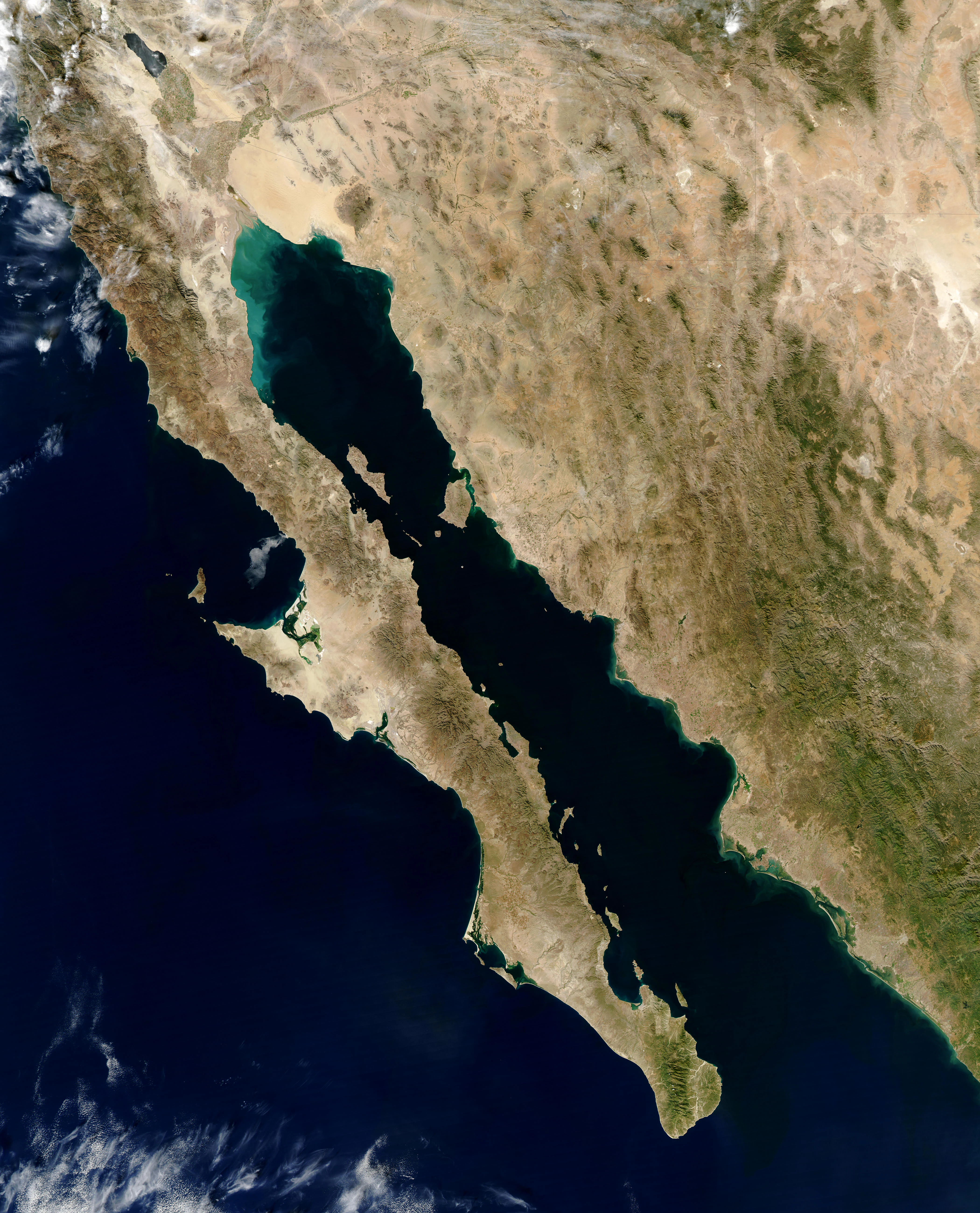
A high-altitude satellite image of the Gulf of California, showing the narrow strip of the Baja California Peninsula to the west and the mainland of Mexico to the east.
A satellite view showing the Gulf of California separating the Baja California Peninsula from mainland Mexico.

Gulf of California history and protected-area timeline

The Gulf of California began forming around 5 to 6 million years ago as tectonic forces rifted the Baja California peninsula away from the North American plate, propagating seafloor spreading along what is now the East Pacific Rise. Over millions of years, this rifting has continued, with the peninsula gradually drifting northwest and the gulf widening. The Colorado River Delta, one of the most important geological features of the northern gulf, has long served as a natural barrier preventing the sea from flooding inland valleys.

The gulf was first documented by European explorers in the sixteenth century. Spanish expeditions led by Francisco de Ulloa in 1539 gave the gulf its early names, including Mar de Cortés in honor of Hernán Cortés and Mar Bermejo for the reddish plankton blooms that colored its waters. Early explorers such as Fortún Ximénez, Hernando de Alarcón, Melchior Díaz, Juan de Oñate, and Sebastián Vizcaíno mapped its coasts and islands. Over subsequent centuries, the gulf became a center of pearling, commercial fisheries, and eventually sport fishing.

In the modern era, the gulf's conservation profile rose sharply. Federal reserves for islands and migratory birds were established in 1978, broader flora and fauna protections followed in 2000, and the islands and protected areas of the gulf were inscribed as a UNESCO World Heritage Site in 2005. In 2019, the property was added to the List of World Heritage in Danger, largely due to the crisis facing the vaquita, along with broader concerns about overfishing and habitat loss.

Gulf of California landscape and geographic character

The Gulf of California occupies a long, narrow basin between the Baja California peninsula and the Mexican mainland, reaching roughly 1,100 kilometers in length and varying from about 50 to 240 kilometers in width. Its seafloor is unusually rugged, with deep submarine valleys and canyons descending more than three kilometers below the surface, particularly along continental and peninsular margins.

The gulf hosts more than 37 major islands and over 900 islets, most concentrated along the western side closer to the Baja California peninsula. The two largest islands, Isla Ángel de la Guarda and Isla Tiburón, lie in the northern gulf, while volcanic islands such as Isla Coronados, Isla Partida, and Isla Tortuga reflect the region's tectonic activity. Shores around the gulf vary between rocky headlands, sandy beaches, and tidal flats, and the rocks on those shores influence local habitat richness through their porosity, stability, and thermal properties.

The northern gulf experiences some of the most extreme tidal ranges in the world, with fluctuations that can exceed five meters locally and in some places approach or exceed nine meters. The arid desert landscape of Sonora and Baja California meets the gulf along much of its shore, giving the region a striking visual character of bare mountains, dunes, and turquoise waters that contrasts with the lush tropical coastlines found further south.

Gulf of California ecosystems, habitats, and plant life

The Gulf of California supports one of the most diverse marine ecosystems in the world. Its waters host an unusually wide spectrum of habitats, ranging from nutrient-rich upwelling zones and cool northern waters to warm tropical environments in the south. This ecological gradient allows both temperate and tropical species to coexist and has produced a high degree of endemism, especially among reef fishes, mollusks, and micro-invertebrates.

Shores, islands, and submerged environments all contribute to this diversity. Rocky shores built of porous rocks such as coquina, rhyolite, and granite tend to support richer communities than harder, smoother substrates, because the cracks and crevices provide microhabitats for marine life. Tidal flats, estuarine inlets, and the remnant deltaic ecosystem of the Colorado River in the north further add to the variety of environments.

The gulf's island ecosystems are ecologically significant in their own right. Together totaling several hundred hectares, the islands harbor endemic plants and reptiles, important seabird rookeries, and resting sites for migratory species. Protection regimes established in 1978 and reinforced in 2000 treat the islands as a unified ecological reserve, with subregions managed through Mexican federal directorates tied to each bordering state.

Gulf of California wildlife and species highlights

The Gulf of California is globally important for marine wildlife. It supports endangered and endemic species such as the vaquita, a small porpoise restricted to the northern gulf near the Colorado River Delta, and the totoaba, a large fish whose remnant population sits in the same waters. The gulf's islands are nesting grounds for thousands of seabirds, and its waters serve as breeding, feeding, and nursery habitat for a wide range of migratory and resident species.

Among the larger marine animals, the gulf hosts migratory humpback whales, gray whales, killer whales, manta rays, Humboldt squid, and leatherback sea turtles, along with the world's largest animal, the blue whale. Unusual resident populations of fin whales and sperm whales also live in the gulf year-round, rather than following typical migratory patterns. The region's fish fauna includes hundreds of species with high endemism, supporting both small-scale fisheries and historically record-setting sport fishing.

Conservation concerns are central to the gulf's wildlife profile. Overfishing, bottom trawling that damages eelgrass beds and shellfish habitat, and the long-term reduction of freshwater flow into the northern gulf from the Colorado River have all placed pressure on marine ecosystems. The vaquita's situation has become emblematic of these challenges and was a major factor in the gulf's 2019 placement on the List of World Heritage in Danger.

Gulf of California conservation status and protection priorities

The Gulf of California holds exceptional conservation significance because of its ecological richness, high endemism, and globally important populations of marine mammals and seabirds. Its islands and protected areas were inscribed as a UNESCO World Heritage Site in 2005, recognizing the gulf as a natural laboratory for marine and coastal processes and as a repository of biodiversity comparable in importance to the Galápagos Islands and Australia's Great Barrier Reef.

Efforts to protect the gulf have been layered across decades. Mexican federal authorities established islands as a Migratory Bird Refuge and Wildlife Reserve in 1978, and in 2000 designated them as a flora and fauna protection area under the national system of protected natural areas. All of the gulf's islands also participate in UNESCO's Man and the Biosphere programme as part of the World Network of Biosphere Reserves.

Despite this formal recognition, conservation has faced serious challenges. Limited enforcement capacity, politically powerful commercial fishing interests, and the difficulty of patrolling a vast, remote coastline have made compliance difficult. Overfishing, bycatch, and habitat destruction have pushed several species toward collapse, most notably the vaquita, whose dwindling numbers triggered the gulf's addition to the List of World Heritage in Danger in 2019. The gulf therefore stands as both a celebrated natural heritage site and a site of acute ongoing conservation concern.

Gulf of California cultural meaning and human context

The Gulf of California has deep human and cultural roots. Indigenous peoples including the Pericú, Guaycura, Cochimí, and Cucapá inhabited its coasts and islands for thousands of years, leaving behind cave paintings and rock art in ranges such as the sierras of San Borja, San Juan, San Francisco, and Guadalupe. These communities were sustained by the marine resources of the gulf, the same resources that continue to shape regional economies today.

Naming traditions reflect this layered history. Native languages preserve older references to the sea, including the Kiliwa term for the eastern sea and the Seri word for the gulf as a whole. Spanish explorers named it in the sixteenth century, first as Mar Bermejo for the reddish plankton blooms and later as Mar de Cortés in honor of Hernán Cortés. The modern name, Gulf of California, reflects the same contested cartographic history that once led European sailors to believe Baja California was an island.

The gulf has also shaped regional identity through its fisheries and coastal communities. Places such as La Paz, Guaymas, Puerto Peñasco, San Felipe, Loreto, Santa Rosalía, and Cabo San Lucas have grown alongside the sea, with small-scale fishing, commercial sardine and anchovy fleets, and sport fishing forming long-standing cultural and economic traditions. Pearl diving off the coast of what is now La Paz was historically important enough to attract international attention during the colonial period.

Top sights and standout views in Gulf of California

The Gulf of California combines dramatic geological youth with extraordinary biological richness. Sea-floor rifting along the Gulf of California Rift Zone produces volcanic islands, hydrothermal vents, and some of the deepest, most sharply contoured seabed in any marginal sea, while its extreme tidal ranges add to the sense of a dynamic, alive landscape.

A second highlight is the gulf's biodiversity density. Tens of thousands of square kilometers of water host more than 900 fish species, hundreds of bird species, vital populations of migratory and resident marine mammals, and a remarkable roster of endemic invertebrates. The convergence of desert coasts, subtropical seas, and tropical southern waters within a single basin makes the gulf a natural reference point for marine science, comparable in status to the world's most iconic ocean reserves.

Best time to visit Gulf of California

The Gulf of California has a subtropical climate with strong regional and seasonal contrasts, which shape how it can be experienced. Winters bring cooler water temperatures in the northern gulf, occasionally dropping low enough to cause die-offs of algae and plankton, while summers bring warmer, calmer conditions in the south, with peak water temperatures near La Paz and around the southern tip of the peninsula.

The best time to experience the gulf's wildlife often coincides with the cooler months, when gray whales, humpback whales, and other migratory marine mammals are most active along its shores. Northern areas such as the upper gulf and Colorado River Delta region tend to be most rewarding for wildlife observation during winter and early spring, while southern areas around La Paz and Cabo San Lucas offer warmer waters, clearer conditions, and reef experiences during the warmer half of the year. Tropical storms and chubascos can affect coastal conditions during late summer and early autumn, so visitors planning sea-based activities often prefer the more stable months outside of hurricane season.
Monthly climate preview

Track long-term average temperature ranges and monthly precipitation patterns across representative coordinates.

Gulf of California Climate Normals: Annual Temperature and Precipitation Rhythm

Recorded baseline data outlines monthly average temperature fluctuations and precipitation measurements for the Gulf of California based on historical climatology records. Reviewing the complete twelve-month sequence provides deeper analytical insight into long-term environmental trends across the protected region.
Annual mean23 °C
17 °C30 °C
Jan17°
Feb17°
Mar18°
Apr20°
May23°
Jun26°
Jul29°
Aug30°
Sep29°
Oct26°
Nov22°
Dec18°
Warmest month
August

30 °C

Coolest month
January

17.1 °C

Wettest month
September

2.1 mm/day

Driest month
May

0 mm/day

Park location guide

Geography guide, regional context, and park location map for Gulf of California

Gulf of California park geography, regions, and map view in Mexico

Understand where Gulf of California sits in Mexico through a broader geographic reading of the surrounding landscape, nearby location context, and its mapped position within the national park landscape.

How Gulf of California fits into Mexico

Mexico, officially the United Mexican States, is a country in North America spanning the Sierra Madre mountain ranges, coastal plains, and tropical regions. It borders the United States to the north, Guatemala and Belize to the southeast, and has coastlines along the Pacific Ocean, Gulf of Mexico, and Caribbean Sea. With a population exceeding 130 million, Mexico is home to one of the world's most significant concentrations of Indigenous languages alongside Spanish.

Wider geography shaping Gulf of California in Mexico

Mexico occupies a land area of 1,972,550 km2, making it the thirteenth-largest country in the world. The terrain is highly diverse, featuring the Sierra Madre Occidental and Sierra Madre Oriental mountain ranges, the Mexican Plateau, coastal lowlands along the Pacific and Gulf/Caribbean margins, and the Yucatan Peninsula. The country spans multiple climate zones from desert in the north to tropical rainforest in the south.

Map view of Gulf of California

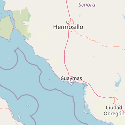
Use this park location map to pinpoint Gulf of California in Mexico, understand its exact geographic position, and read its mapped placement within the surrounding landscape more clearly.

Pigeon | © OpenStreetMap contributors

Location context for Gulf of California

Baja California SurSonora

Visual archive of desert shores, volcanic islands, and marine habitats

Gulf of California Photos, Landscapes, and Protected Marine Scenery

Visual documentation reveals the dramatic contrast between arid desert mountains and turquoise marine waters across the Gulf of California. Examining these protected area photographs provides direct insight into the rugged coastal terrain, volcanic islands, and diverse marine habitats.

A high-altitude satellite image of the Gulf of California, showing the narrow strip of the Baja California Peninsula to the west and the mainland of Mexico to the east.

A scuba diver swimming in deep blue water next to a large manta ray, seen from below against the sunlit surface.

Park atlas

Compare adjacent marine reserves, desert shores, and regional conservation areas.

Explore Parks Near Gulf of California and Surrounding Protected Landscapes

Browse nearby national parks and protected areas sharing the geological and marine characteristics of the surrounding region. Expanding beyond Gulf of California connects visitors to broader regional geography and diverse coastal habitats.
Nature reserveSonora
About 52 km away#1 closest

Northwest

Isla San Pedro Mártir Nature Reserve: Mapping the Geography of the Gulf of California

Isolated rocky terrain and productive marine sanctuary

Isla San Pedro Mártir serves as a distinct protected area marked by its extreme isolation and dramatic vertical cliffs. The reserve acts as a core seabird nesting site supported by nutrient-rich cold-water upwellings in the Gulf of California, providing a vital example of arid island and marine geography.

Area
2.729 km²
Scope
Mixed
National parkBaja California
About 130 km away#2 closest

Northwest

San Lorenzo Marine Archipelago National Park: Protected Area and Mapped Landscape Geography

Explore its national park status and regional context in Baja California.

Delve into San Lorenzo Marine Archipelago National Park, a key protected area contributing to Baja California's diverse geography. As a national park, its mapped boundaries and unique landscape characteristics provide essential data for atlas exploration and understanding regional conservation efforts. This entry focuses on the park's identity as a mapped protected entity, ideal for researchers and explorers seeking structured geographic insights into natural reserves.

Area
504.42 km²
Established
2005
IUCN
II
Relief
Upland
Protected areaBaja California Sur
About 171 km away#3 closest

Southwest

San Ignacio Lagoon: Protected Coastal Desert Geography in Baja California Sur

Coastal lagoons, tidal channels, and desert ecosystems.

Examine the geographic boundaries and landscape features of San Ignacio Lagoon. This protected coastal nursery provides a rare desert-to-sea interface, characterized by shallow tidal flats, narrow channels, and expansive arid terrain within the Baja California Peninsula.

Area
175 km²
Established
2004
Relief
Lowland
Climate
Arid
A watercolor painting showing a coastal landscape with pale pink foreground, green vegetation, a light-colored bay, and soft-hued mountains in the background.
Biosphere reserveBaja California
About 186 km away#4 closest

Northwest

Bahía de los Ángeles Biosphere Reserve: Geography and Protected Area Atlas

Coastal desert, volcanic islands, and Sea of Cortez marine channels

Spanning 1,500 square miles, this biosphere reserve preserves the dramatic transition from the arid Baja California desert to the deep, productive waters of the Gulf of California. The protected area encompasses a diverse chain of volcanic islands, including Isla Ángel de la Guarda, and supports high biological productivity driven by deep submarine canyons and marine currents.

Area
3,879.56 km²
Established
2007
Relief
Mixed relief
Climate
Arid
National parkBaja California Sur
About 252 km away#5 closest

South

Bahía de Loreto National Park: National Park Protected Landscape and Geographic Identity

Explore its mapped boundaries and regional context.

Bahía de Loreto National Park offers a distinct focus on its protected natural landscape and geographic features within Baja California Sur. This destination provides detailed mapping and regional context, enabling a focused exploration of its boundaries and natural environment. It is ideal for users seeking to understand the specific protected area identity and its geographical placement as part of a broader atlas of conservation landscapes.

Area
2,065.81 km²
Established
1996
IUCN
II
Relief
Mixed relief
Nature reserveSonora
About 321 km away#6 closest

Northeast

Northern Jaguar Reserve: Geography and Protected Landscape Atlas of Sonora

Foothill bushland between the Aros and Bavispe River valleys

Northern Jaguar Reserve represents a key protected block of dry tropical bushland in the Sierra Madre foothills of Sonora. This map-focused profile examines the topography, drainage systems, and structural habitat corridors that support one of the northernmost wild jaguar populations within a transition zone of mountain slopes and river-fed canyons.

Area
222 km²
Relief
Mountain
Climate
Subtropical
Access
Remote access
Wildlife reserveSonora
About 356 km away#7 closest

Northeast

Bavispe Flora and Fauna Protection Area: Sierra Madre Occidental Mountain Geography

Mapped protected forest tracts across Sonora ranges

Spanning five distinct mountain tracts in Sonora, this wildlife reserve preserves rare pine-oak forest communities within the Sierra Madre Occidental. Learn how these ridges and basins act as a vital hydrological anchor for the Yaqui River and provide critical corridors for wildlife through the diverse, transition-heavy terrain of northern Mexico.

Area
2,009 km²
Established
1936
IUCN
VI
Relief
Mountain
Protected areaSonora
About 368 km away#8 closest

East

Área de protección de flora y fauna Sierra de Álamos-Río Cuchujaqui: Geography and Park Boundaries

Detailed atlas view of the Sonora biodiversity enclave and canyon systems.

Spanning over 92,000 hectares in Sonora, this protected area is defined by its dramatic transition from coastal plains to the Sierra Madre range. The geography centers on the deep, moisture-trapping barrancas of the Cuchujaqui River, which sustain a rare mixture of Neotropical and temperate species. Examine the structural complexity of these forested slopes and river-carved valleys that function as a essential habitat for large predators and diverse flora alike.

Area
928.9 km²
Established
1996

Common questions about visiting, size, designation, and location context for Gulf of California

Gulf of California FAQs for park facts, access, geography, and protected area context

Find quick answers about Gulf of California, including protected-area facts, park geography, trail and visitor context, and how the park fits into its surrounding country and regional landscape.
MoriAtlas Explorer

Continue Your Protected Areas Search Across the Global Atlas

Deepen your exploration by continuing the structured search for national parks and protected areas worldwide. Utilize the comprehensive filtering capabilities to compare different conservation landscapes and refine your understanding of global park geography. Discover more about the distribution and characteristics of protected natural areas.

Global natural geography