
Mori Atlas logo
Nature reserveHetter-Millinger Bruch

A cross-border landscape of historic drainage channels and floodplain pastures near the Dutch border

Hetter-Millinger Bruch Nature Reserve: Mapping the Protected Wet Grasslands of the Lower Rhine

(Naturschutzgebiet Hetter-Millinger Bruch)

Hetter-Millinger Bruch spans roughly 660 hectares of managed wet-grassland within the Lower Rhine region of North Rhine-Westphalia, Germany. This protected mosaic of meadows and pastures is defined by a dense network of historical water-management structures, including the Millinger Landwehr and Netterdensch Kanal. Positioned alongside the Rhine and reaching the border with the Netherlands, the reserve serves as a critical habitat for native flora and fauna across its four distinct protected parcels.

wetlandsmeadowsfloodplainnature reserveLower Rhinebird habitat
A flat-style digital illustration depicting a wide mountain valley with a central waterfall, green pastures, grazing cattle, and trees framing the foreground.

Hetter-Millinger Bruch

Nature reserve

Park overview

Structured park overview, official facts, and landscape profile for Hetter-Millinger Bruch

Hetter-Millinger Bruch park facts, protected area profile, and essential visitor context

Review the core facts for Hetter-Millinger Bruch, including designation, size, terrain, visitor scale, habitats, and operating context in one park-focused overview.

About Hetter-Millinger Bruch

Hetter-Millinger Bruch is a nature reserve in the Lower Rhine (Niederrhein) region of western North Rhine-Westphalia, Germany. It occupies part of the territories of the towns of Emmerich am Rhein and Rees within the Kreis Kleve district, sitting in the wide, flat agricultural landscape that borders the Netherlands to the north.

The reserve is made up of four separate land parcels, rather than a single contiguous block. Together they extend northeast from the outskirts of central Emmerich, parallel to the German-Dutch state border. The Rhine lies to the southwest, shaping the region's hydrology and ecological character, while the A3 motorway runs largely along the southern edge of the reserve and crosses through it near the village of Millingen.

The defining physical feature of Hetter-Millinger Bruch is its system of drainage channels. Several historic Landwehr ditches and canals run through the area, including the Millinger Landwehr, the Tote Landwehr, the Netterdensch Kanal, and the Löwenberger Landwehr. These channels break the landscape into a pattern of meadows, pastures, field tracks, and ditches that remain ecologically productive despite their long history of agricultural management. The combination of open grassland, ditch networks, and proximity to the Rhine floodplain places the reserve firmly within the traditional Lower Rhine wet-meadow landscape type.

The reserve is administered under German nature protection law as a Naturschutzgebiet, with the official identifier KLE-013, and is recognized at the international level through its entry in the World Database on Protected Areas (WDPA ID 163664). Its designation as an IUCN Category IV Habitat/Species Management Area reflects an active management approach aimed at preserving specific habitats and the wild plant and animal communities they support, rather than a strictly hands-off preservation model.

Quick facts and research context for Hetter-Millinger Bruch

The Hetter-Millinger Bruch nature reserve covers around 660 hectares and is registered under the designation KLE-013 in the Kreis Kleve district of North Rhine-Westphalia. It was originally designated as a protected area in 1989 and received renewed protection status in 2012. The reserve is classified under IUCN Category IV as a Habitat/Species Management Area and is recorded in the World Database on Protected Areas under WDPA ID 163664.

Geographically, the reserve stretches from the area around Millingen northeastward along the border with the Netherlands. The A3 motorway crosses through part of the area near Millingen, while the Rhine flows along its southwestern edge. The site forms part of the broader Lower Rhine wetland landscape associated with the EU Bird Directive protection zone Unterer Niederrhein.

Protection and recognition

Examine official protected area records and international database tracking metrics.

Hetter-Millinger Bruch Protection Status and Designated Area Records

Consolidated protection records provide structured insight into the management framework governing Hetter-Millinger Bruch. Global conservation databases supply verified administrative details for comprehensive park analysis.

Protection details

WDPA ID
163664
Park context

Deeper park guide and search-rich context for Hetter-Millinger Bruch

Hetter-Millinger Bruch history, landscape, wildlife, and travel context

Explore Hetter-Millinger Bruch through its history, landscape character, ecosystems, wildlife, conservation priorities, cultural context, and seasonal travel timing in a structured park guide built for atlas discovery and search intent.

Why Hetter-Millinger Bruch stands out

Hetter-Millinger Bruch is best known as a flat, lowland reserve of former Rhine floodplain meadows patterned with historic drainage ditches and grazing pastures. The site's defining character comes from its network of Landwehr channels and associated wet grasslands, which create a managed but ecologically valuable mosaic typical of the traditional Lower Rhine countryside. The four-part structure of the reserve, set right beside the international border and the Rhine, gives it a distinctive cross-border ecological role within the regional nature protection system.
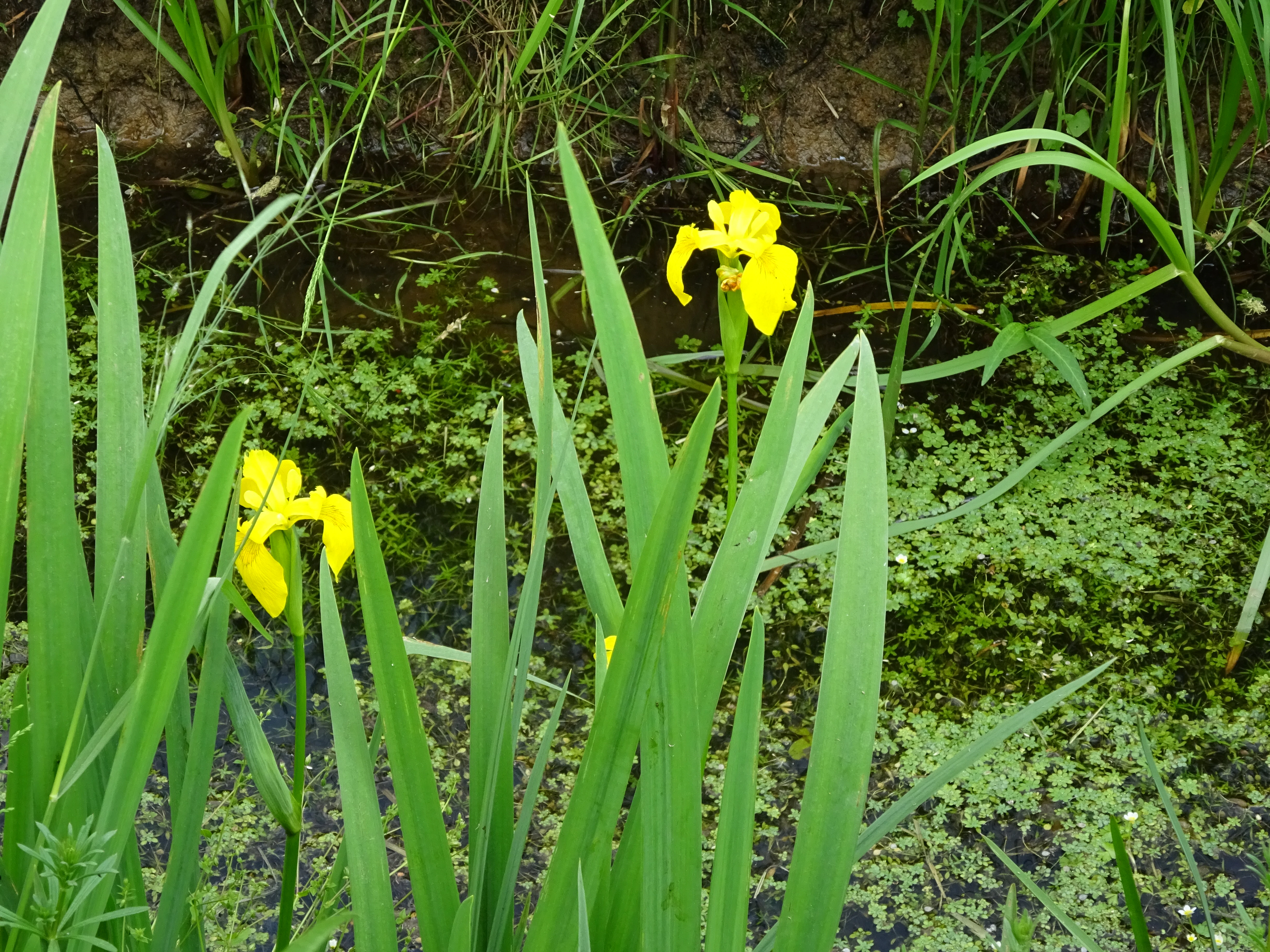
Two bright yellow iris flowers rising above tall, slender green leaves and water covered in floating vegetation.
Yellow iris flowers blooming along a water-filled ditch in Hetter-Millinger Bruch.

Hetter-Millinger Bruch history and protected-area timeline

The area that now makes up Hetter-Millinger Bruch was first formally designated as a nature reserve in 1989, when a 660-hectare area across the municipal lands of Emmerich and Rees was placed under protection under the identifier KLE-013. The designation was established to conserve, promote, and restore wild plant and animal communities that depend on the Lower Rhine's traditional meadow and wetland habitats.

In 2012, the reserve's protection status was renewed or reaffirmed, consolidating its legal standing and ensuring the continuation of habitat management across its four separate parcels. Today the reserve is documented both in the regional Fachinformationssystem of the North Rhine-Westphalian state environment agency and through international databases such as the World Database on Protected Areas, reflecting its ongoing role in the broader Lower Rhine nature conservation network.

Hetter-Millinger Bruch landscape and geographic character

The landscape of Hetter-Millinger Bruch is defined by flatness, openness, and water management. It lies in the classic Lower Rhine floodplain terrain of North Rhine-Westphalia, where the continent's long gradient toward the North Sea produces broad, level terrain rather than dramatic relief. Elevations are consistently low, and the horizon is formed by distant tree lines, the Dutch border landscape, and the embankments of the Rhine rather than by hills or ridges.

The most conspicuous landscape features are the drainage channels. The Millinger Landwehr, the Tote Landwehr, the Netterdensch Kanal, and the Löwenberger Landwehr cut through the reserve, dividing the land into elongated parcels of meadow and pasture. These channels are accompanied by field tracks, low embankments, and small infrastructure such as the border bridge near Megchelen that connect the German side with the Dutch countryside.

The reserve is crossed by the A3 motorway near Millingen, which acts as a notable anthropogenic feature along the southern margin, while the Rhine flows southwest of the protected area. Photographs of the site show a patchwork of hay meadows, grazed pastures with cattle, ditch-side vegetation, and quiet country lanes, all of which together give the reserve the character of a traditional, working wet-meadow landscape rather than a wild, unmanaged wilderness.
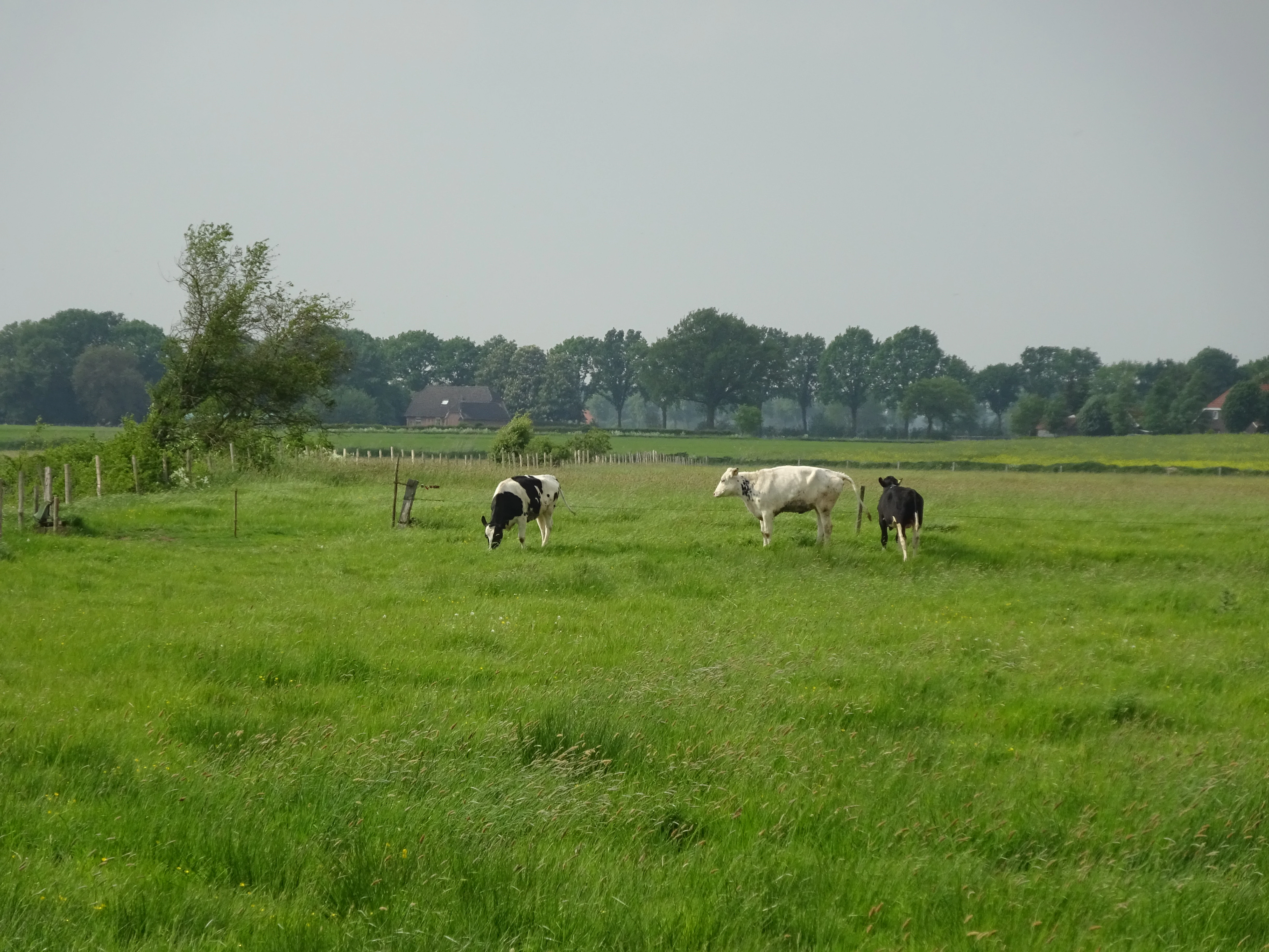
A wide, flat green pasture with three cows grazing in the foreground, and a line of distant trees under a hazy sky.
Cattle grazing in the fields of the Hetter-Millinger Bruch nature reserve.

Hetter-Millinger Bruch ecosystems, habitats, and plant life

Ecologically, Hetter-Millinger Bruch represents the managed wet grassland habitats typical of the Lower Rhine. The reserve's vegetation is shaped by centuries of agricultural use and by ongoing water management through its Landwehr ditch network. Open meadows, grazed pastures, and ditch margins form the dominant habitat mosaic, with the wetter ditch corridors and the influence of the nearby Rhine contributing to moisture-loving plant communities.

Because the reserve lies adjacent to the Rhine and within the Unterer Niederrhein EU Bird Directive protection zone, it forms part of a larger ecological continuum that extends across the German-Dutch border into the Dutch riverine landscape. The combination of open meadows, drainage channels, and proximity to floodplain habitats gives the reserve ecological relevance that extends well beyond its individual boundaries.

The site is classified under IUCN Category IV as a Habitat/Species Management Area, indicating that active management of vegetation and water levels is central to maintaining its ecological values, rather than purely passive protection of untouched nature.
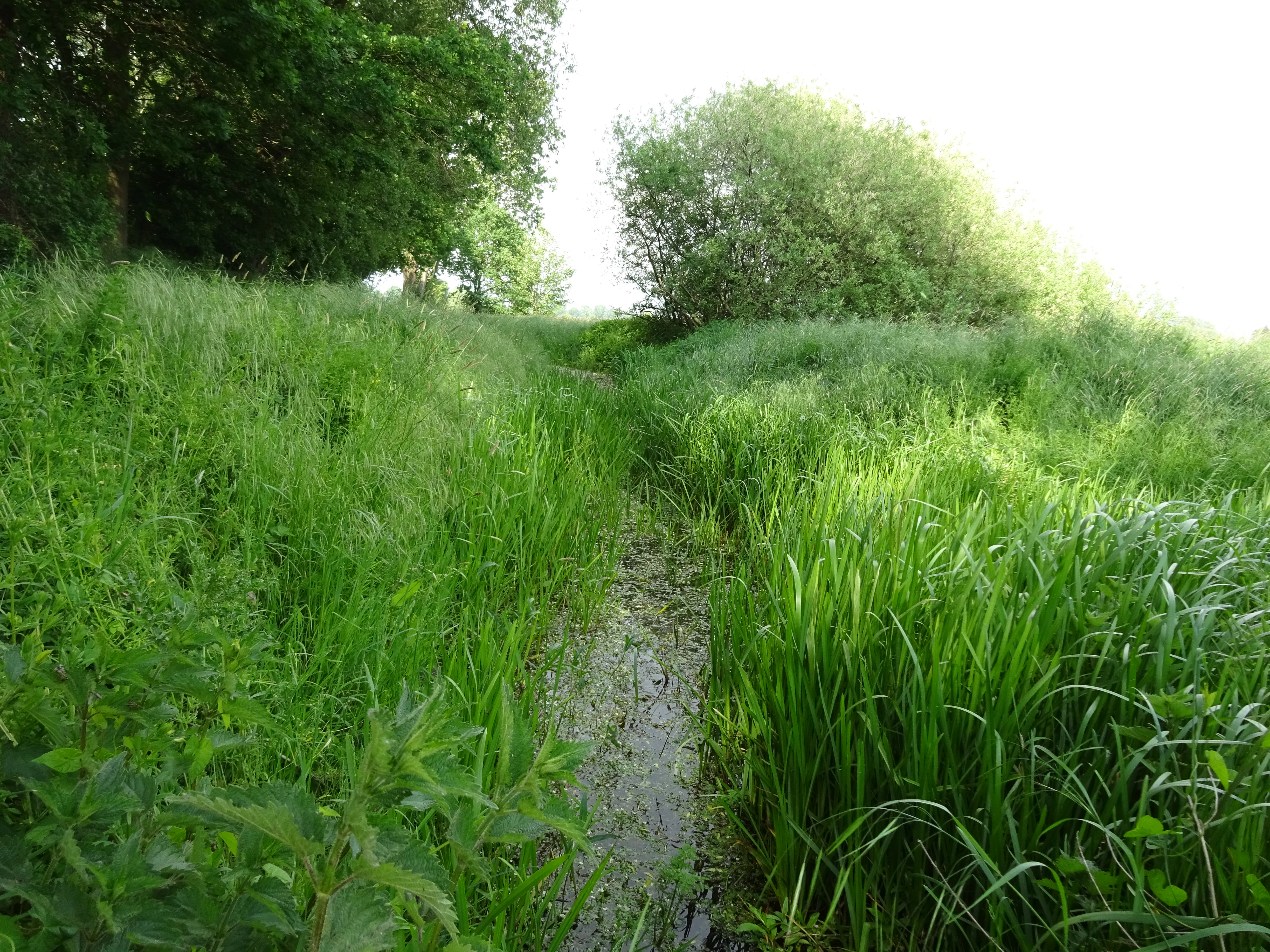
A narrow, muddy path or small stream bed flanked by tall, vibrant green grasses and reeds, with dense trees in the background under bright, diffuse light.
A narrow, grassy waterway winding through the lush vegetation of the Hetter-Millinger Bruch nature reserve.

Hetter-Millinger Bruch wildlife and species highlights

Wildlife in Hetter-Millinger Bruch is associated with the open meadow and wet-ditch habitats of the Lower Rhine. The grazed pastures with cattle visible in the reserve's photographic record indicate that livestock-based habitat management is part of the conservation approach, helping maintain the open character of the meadows that support meadow-dependent species.

Because the reserve overlaps with the broader Unterer Niederrhein EU Bird Directive protection area, its meadows, ditches, and field margins are considered part of a wider landscape context relevant to breeding and migratory bird species typical of the Lower Rhine floodplain. The site's position along the international border and near the Rhine further connects it to regional wildlife corridors that extend into the Netherlands.

A small wooden bridge crosses a narrow, grassy-banked canal in a lush green landscape with pollard willow trees in the background.
A wooden bicycle bridge crossing a small canal in the Hetter-Millinger Bruch nature reserve.

Hetter-Millinger Bruch conservation status and protection priorities

Hetter-Millinger Bruch has been a designated Naturschutzgebiet since 1989, with its protection renewed in 2012. Its primary conservation objective is the preservation, support, and restoration of specific communities of wild plants and animals that depend on the Lower Rhine's traditional meadow and ditch habitats.

The reserve operates within Germany's standard nature protection framework and carries the official identifier KLE-013. At the international level, it is classified as an IUCN Category IV Habitat/Species Management Area and is listed in the World Database on Protected Areas under WDPA ID 163664. Its placement beside the Dutch border and within the Unterer Niederrhein EU Bird Directive protection zone gives the site additional cross-border and European-level conservation significance, linking it to broader efforts to protect the Lower Rhine as one of the major floodplain ecosystems of northwestern Europe.

Hetter-Millinger Bruch cultural meaning and human context

The Hetter-Millinger Bruch sits in a centuries-old agricultural landscape of the Lower Rhine, where drainage channels such as the Landwehr ditches have shaped the land for generations and continue to define the local countryside. The presence of cattle grazing, hay meadows, and rural field tracks reflects traditional regional land use that remains compatible with modern nature protection goals. The reserve's location directly on the German-Dutch border, including the border bridge near Megchelen, also gives it a quiet but distinctive cross-border cultural dimension, linking the protected area to neighboring communities in the Netherlands.
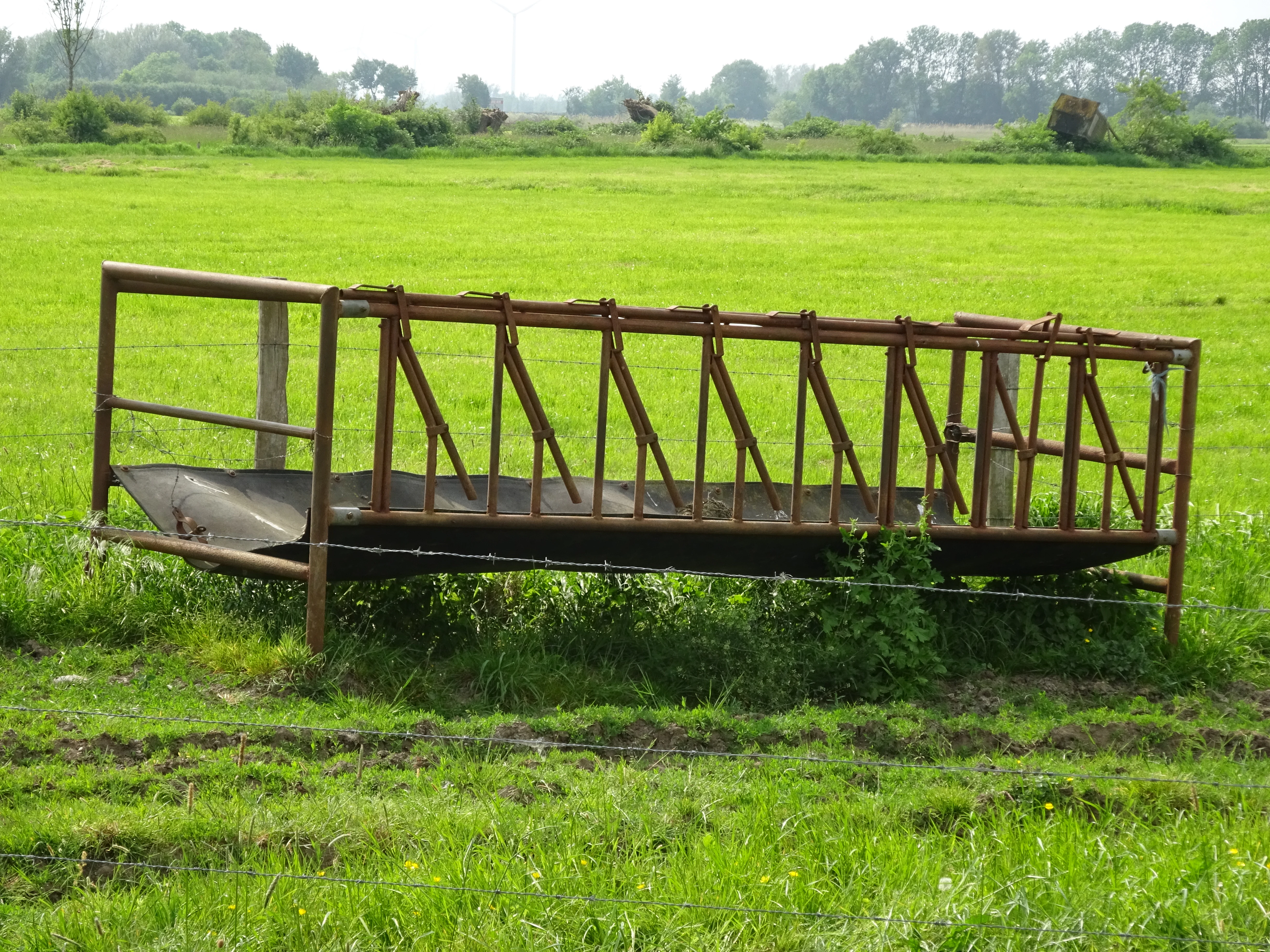
A rusty metal cattle feeding trough standing in a bright green grassy field at Hetter-Millinger Bruch.
A metal livestock feeding trough located within the Hetter-Millinger Bruch nature reserve.

Top sights and standout views in Hetter-Millinger Bruch

Hetter-Millinger Bruch stands out for its four-part protected structure strung along the German-Dutch border, its 660-hectare extent, and its dense network of historic Landwehr drainage channels. The reserve is officially classified as an IUCN Category IV Habitat/Species Management Area and lies within the Unterer Niederrhein EU Bird Directive protection zone, giving it both national and European-level ecological relevance. Its identity rests on the combination of open meadows, ditch systems, and Rhine floodplain proximity that makes it a representative example of the managed wet-grassland landscape of the Lower Rhine.

Best time to visit Hetter-Millinger Bruch

Hetter-Millinger Bruch can be appreciated year-round as a working agricultural and ecological landscape, but late spring and early summer are typically the most rewarding periods for visitors interested in meadow flora and full ditchside vegetation. Spring tends to bring fresh growth across the meadows and visible water in the channels, while summer shows the meadows at their most expressive and grazed pastures at their most active. Autumn and winter bring quieter conditions, with migratory and wintering bird activity in the surrounding Lower Rhine landscape adding a different seasonal interest for those interested in regional birdlife.


Monthly climate preview

Long-term monthly temperature and precipitation data recorded at a representative coordinate

Hetter-Millinger Bruch Climate Normals, Temperature and Precipitation Rhythms

Representative coordinates in Hetter-Millinger Bruch record recorded monthly temperature variations spanning from sub-zero winter minimums to warm summer maximums alongside steady precipitation rates. Reviewing the complete twelve-month climate profile reveals long-term average weather patterns across the protected landscape.
Annual mean10 °C
2 °C18 °C
Jan
Feb
Mar
Apr
May13°
Jun16°
Jul18°
Aug18°
Sep15°
Oct10°
Nov
Dec
Warmest month
July

18.3 °C

Coolest month
January

1.9 °C

Wettest month
December

2.5 mm/day

Driest month
April

1.4 mm/day

Park location guide

Geography guide, regional context, and park location map for Hetter-Millinger Bruch

Hetter-Millinger Bruch park geography, regions, and map view in Germany

Understand where Hetter-Millinger Bruch sits in Germany through a broader geographic reading of the surrounding landscape, nearby location context, and its mapped position within the national park landscape.

How Hetter-Millinger Bruch fits into Germany

Germany is a federal republic in Western and Central Europe with a population of over 83 million across sixteen constituent states. It is Europe's largest economy by nominal GDP and a major global exporter and importer. The capital is Berlin, and the country borders Denmark, Poland, Czech Republic, Austria, Switzerland, France, Luxembourg, Belgium, and the Netherlands.

Wider geography shaping Hetter-Millinger Bruch in Germany

Germany is located in Western and Central Europe, spanning 357,022 km². It borders Denmark to the north, Poland and the Czech Republic to the east, Austria and Switzerland to the south, and France, Luxembourg, Belgium, and the Netherlands to the west. The country has coastlines on the Baltic Sea and North Sea to the north, with the Alps located in the southern region.

Map view of Hetter-Millinger Bruch

Use this park location map to pinpoint Hetter-Millinger Bruch in Germany, understand its exact geographic position, and read its mapped placement within the surrounding landscape more clearly.

Pigeon | © OpenStreetMap contributors

Location context for Hetter-Millinger Bruch

North Rhine-Westphalia
Recorded earthquake history

Examine the Recorded Earthquake History for Hetter-Millinger Bruch

Browse a comprehensive database of recorded seismic events associated with the Hetter-Millinger Bruch nature reserve. This collection provides transparent access to historical data for the Lower Rhine region, allowing users to map regional activity and review event metrics without requiring complex geological expertise.

Hetter-Millinger Bruch Earthquake History

Catalogued events

61 events

Strongest magnitude

Magnitude 4.2

Most recent event

Sep 8, 2011

This history includes earthquakes recorded inside the park or within 50 km of its borders

Explore photographic documentation of floodplain meadows, historic drainage ditches, and open lowland terrain.

Hetter-Millinger Bruch Photos and Landscape Scenery: Visualizing the Lower Rhine Protected Wetland

Photographic records reveal the flat terrain, historic drainage channels, and pastoral mosaic defining Hetter-Millinger Bruch. Visual documentation illustrates the low-lying floodplain geography, moist grasslands, and cross-border habitat character of the reserve.

Two bright yellow iris flowers rising above tall, slender green leaves and water covered in floating vegetation.

A wide shot of a flat, green meadow in the Hetter-Millinger Bruch nature reserve, featuring a narrow ditch in the foreground and trees in the distance under a cloudy sky.

A wide, flat green pasture with three cows grazing in the foreground, and a line of distant trees under a hazy sky.

A narrow, muddy path or small stream bed flanked by tall, vibrant green grasses and reeds, with dense trees in the background under bright, diffuse light.

A small wooden bridge crosses a narrow, grassy-banked canal in a lush green landscape with pollard willow trees in the background.

A dirt and gravel path winds through a green meadow with trees in the background under a cloudy sky.

A rusty metal cattle feeding trough standing in a bright green grassy field at Hetter-Millinger Bruch.

Park atlas

Compare adjacent wetland reserves, floodplain habitats, and regional river landscapes.

Explore Parks Near Hetter-Millinger Bruch and Surrounding Protected Areas

Browse other parks near Hetter-Millinger Bruch to discover connected wetland ecosystems and managed lowland reserves across the surrounding region. Comparing adjacent protected landscapes reveals the broader geography of traditional floodplain terrain and riverine conservation networks.
Nature reserveNorth Rhine-Westphalia
Park boundaries overlap#1 closest

South

Unterer Niederrhein Nature Reserve: Geographic Atlas and Floodplain Landscape Mapping

Riverine wetland ecosystems in North Rhine-Westphalia

Uncover the protected landscape of Unterer Niederrhein, an expansive bird protection area along the German Lower Rhine. The region features a mosaic of sand banks, oxbow lakes, and seasonally flooded grasslands, creating a highly interconnected riverine ecosystem that spans across the districts of Kleve and Wesel.

Area
258.094 km²
Established
1983
Relief
Lowland
Climate
Temperate
Nature reserveNorth Rhine-Westphalia
About 8.1 km away#2 closest

Southeast

Sonsfeldsches Bruch, Hagener Meer und Düne: Geography and Protected Area Overview

Nature reserve featuring Rhine oxbows and inland dune landscapes.

Sonsfeldsches Bruch, Hagener Meer und Düne represents a compact but ecologically significant nature reserve in the Lower Rhine region. The area integrates a historic Rhine branch, extensive wetland corridors, and a distinctive inland dune, creating a multifaceted habitat mosaic that contrasts sharply with the surrounding agricultural plains of North Rhine-Westphalia.

Area
0.48 km²
Established
1986
IUCN
IV
Relief
Lowland
Nature reserveNorth Rhine-Westphalia
About 11 km away#3 closest

Southeast

Lange Renne Nature Reserve: Mapping the Geography of a Lower Rhine Floodplain Oxbow

Protected riparian habitat in the North Rhine-Westphalia district of Kleve

Lange Renne functions as a focused conservation zone along a historic Rhine channel. The area features a 1.5-kilometre-long oxbow lake with a marshy shoreline, riparian woodland, and wet meadows. By protecting the southern half of this waterbody, the reserve provides a critical, undisturbed habitat for rare plant communities and aquatic species that define the ecological character of the Lower Rhine landscape.

Area
0.13 km²
Established
2010
Relief
Lowland
Climate
Temperate
A soft, light-toned watercolor painting depicting a marshy wetland with patches of grass and distant low trees against a pale, washed-out sky.
Nature reserveNorth Rhine-Westphalia
About 19 km away#4 closest

West

Kranenburger Bruch Nature Reserve: Geography and Protected Wetland Landscapes in North Rhine-Westphalia

A preserved Niedermoor relic in the Düffel floodplain

Kranenburger Bruch stands as a prominent nature reserve in North Rhine-Westphalia, protecting a distinct lowland peat bog and alder carr forest. The area is defined by a low-lying basin topography, seasonal shallow pools, and hedgerow-lined pastures that characterize the traditional Düffel region. This reserve is recognized for its ecological density, hosting diverse birdlife and rare wetland flora across a network of brooks and open water bodies.

Area
1.18 km²
Established
1981
Relief
Lowland
Climate
Temperate
Nature reserveNetherlands
24 km away#5 closest

East

Wooldse Veen Nature Reserve: Mapped Geography and Protected Bog Landscapes in the Netherlands

A transboundary peatland system in Gelderland.

Wooldse Veen preserves a rare fragment of raised bog and peatland habitat in the Dutch-German borderlands. The reserve features restored bog pools, historic smugglers paths, and a mosaic of heathland and birch woodland that reflects the regional geography of the Winterswijk National Landscape.

Area
1.5 km²
Established
1949
Relief
Lowland
Climate
Temperate
Protected areaNetherlands
25 km away#6 closest

Northwest

Veluwe: A Comprehensive Geographic Atlas of the Central Netherlands Protected Area

Glacial moraines, heathlands, and inland sand systems

Investigate the Veluwe, a premier protected area in the Gelderland province characterized by its historic push moraines and extensive ecological zones. The region encompasses significant sand drift complexes, dense woodlands, and vital spring-fed streams, offering a clear view of the diverse natural terrain found throughout the central Netherlands.

Area
1,000 km²
Relief
Upland
Climate
Temperate
Access
Easy access
Nature reserveGelderland
About 25 km away#7 closest

Northeast

Korenburgerveen Nature Reserve: Geography and Protected Peatland Landscapes in Gelderland

A vital wetland and raised bog complex in the Dutch Achterhoek

Korenburgerveen represents a key protected peatland basin in Gelderland, featuring a diverse mosaic of marsh woodland, blue grassland, and active raised bog. Use this geographic entry to analyze the reserve's position within the wider Nationaal Landschap Winterswijk and observe the hydrological restoration of its rare wetland terrain.

Relief
Lowland
Climate
Temperate
Scope
Terrestrial
Water
Major water bodies
Watercolor illustration of a park landscape with a winding stream, grassy fields, and distant hills
National parkGelderland
25 km away#8 closest

Northwest

Veluwezoom National Park: Protected Landscape Atlas and Gelderland Geography

Explore oldest Dutch national park, heathlands, and glacial terrain.

Veluwezoom National Park is the Netherlands' inaugural national park, located in Gelderland. This page provides an atlas-driven exploration of its protected landscape, characterized by rolling heathlands, ancient forests, and dramatic glacial push moraines. Users can discover the park's geographical features, mapped boundaries, and its significance as a conserved natural area within the Veluwe region.

Area
50 km²
Established
1930
IUCN
II
Relief
Upland

Common questions about visiting, size, designation, and location context for Hetter-Millinger Bruch

Hetter-Millinger Bruch FAQs for park facts, access, geography, and protected area context

Find quick answers about Hetter-Millinger Bruch, including protected-area facts, park geography, trail and visitor context, and how the park fits into its surrounding country and regional landscape.
MoriAtlas Explorer

Continue Your Protected Areas Search Across the Global Atlas

Deepen your exploration by continuing the structured search for national parks and protected areas worldwide. Utilize the comprehensive filtering capabilities to compare different conservation landscapes and refine your understanding of global park geography. Discover more about the distribution and characteristics of protected natural areas.

Global natural geography