
Why Hetter-Millinger Bruch stands out
Hetter-Millinger Bruch is best known as a flat, lowland reserve of former Rhine floodplain meadows patterned with historic drainage ditches and grazing pastures. The site's defining character comes from its network of Landwehr channels and associated wet grasslands, which create a managed but ecologically valuable mosaic typical of the traditional Lower Rhine countryside. The four-part structure of the reserve, set right beside the international border and the Rhine, gives it a distinctive cross-border ecological role within the regional nature protection system.
Hetter-Millinger Bruch history and protected-area timeline
The area that now makes up Hetter-Millinger Bruch was first formally designated as a nature reserve in 1989, when a 660-hectare area across the municipal lands of Emmerich and Rees was placed under protection under the identifier KLE-013. The designation was established to conserve, promote, and restore wild plant and animal communities that depend on the Lower Rhine's traditional meadow and wetland habitats.
In 2012, the reserve's protection status was renewed or reaffirmed, consolidating its legal standing and ensuring the continuation of habitat management across its four separate parcels. Today the reserve is documented both in the regional Fachinformationssystem of the North Rhine-Westphalian state environment agency and through international databases such as the World Database on Protected Areas, reflecting its ongoing role in the broader Lower Rhine nature conservation network.
Hetter-Millinger Bruch landscape and geographic character
The landscape of Hetter-Millinger Bruch is defined by flatness, openness, and water management. It lies in the classic Lower Rhine floodplain terrain of North Rhine-Westphalia, where the continent's long gradient toward the North Sea produces broad, level terrain rather than dramatic relief. Elevations are consistently low, and the horizon is formed by distant tree lines, the Dutch border landscape, and the embankments of the Rhine rather than by hills or ridges.
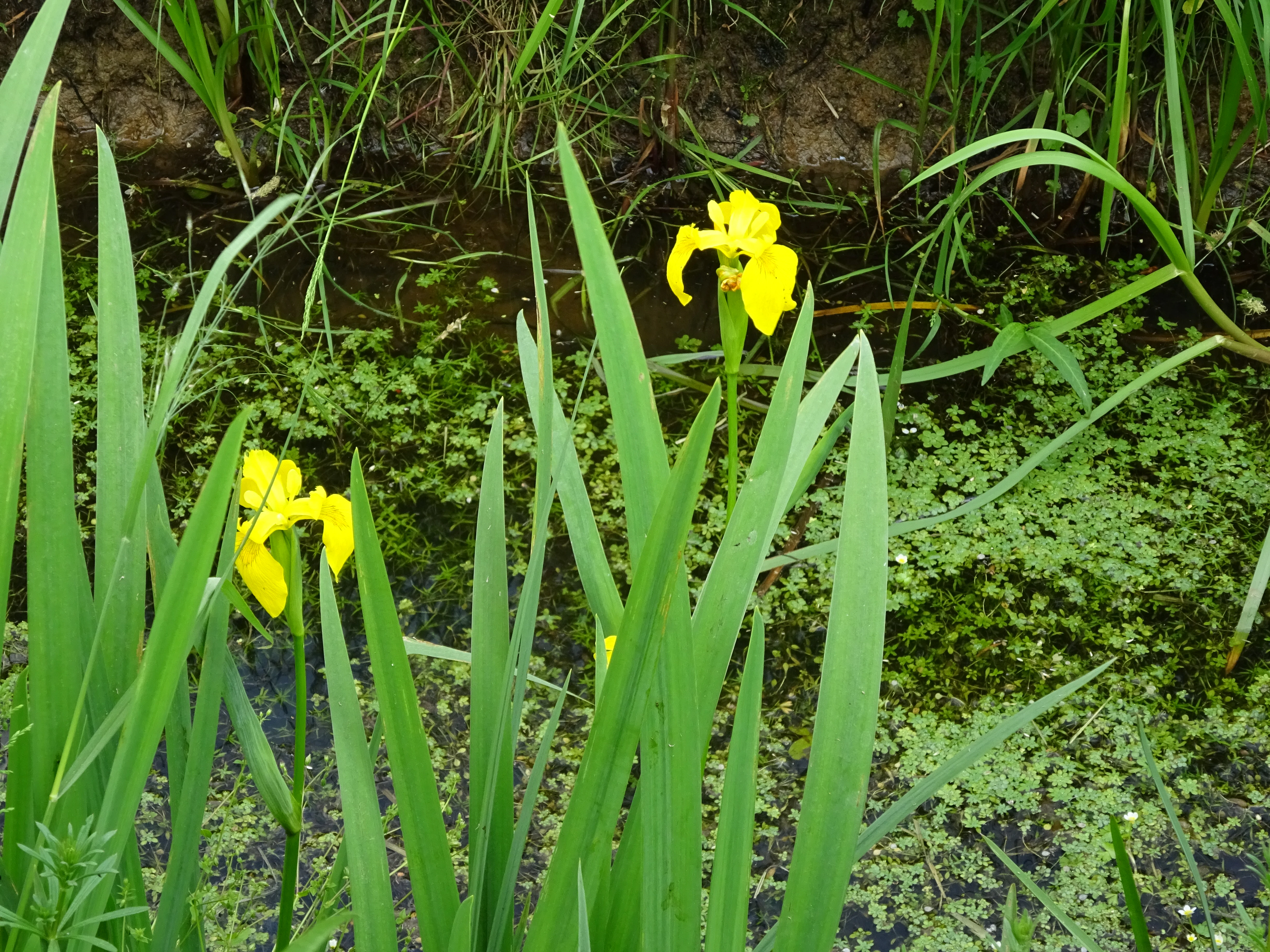
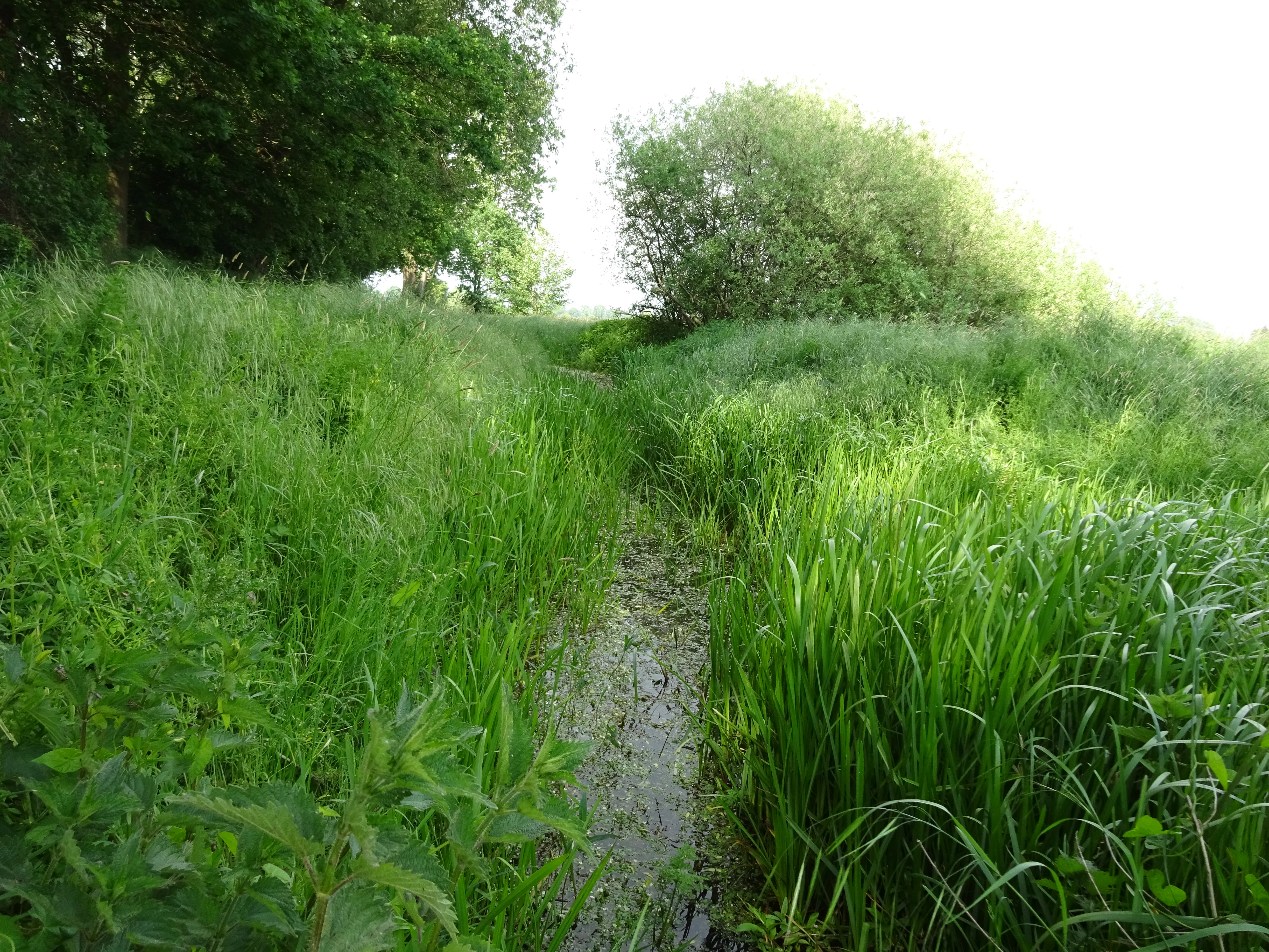
The most conspicuous landscape features are the drainage channels. The Millinger Landwehr, the Tote Landwehr, the Netterdensch Kanal, and the Löwenberger Landwehr cut through the reserve, dividing the land into elongated parcels of meadow and pasture. These channels are accompanied by field tracks, low embankments, and small infrastructure such as the border bridge near Megchelen that connect the German side with the Dutch countryside.
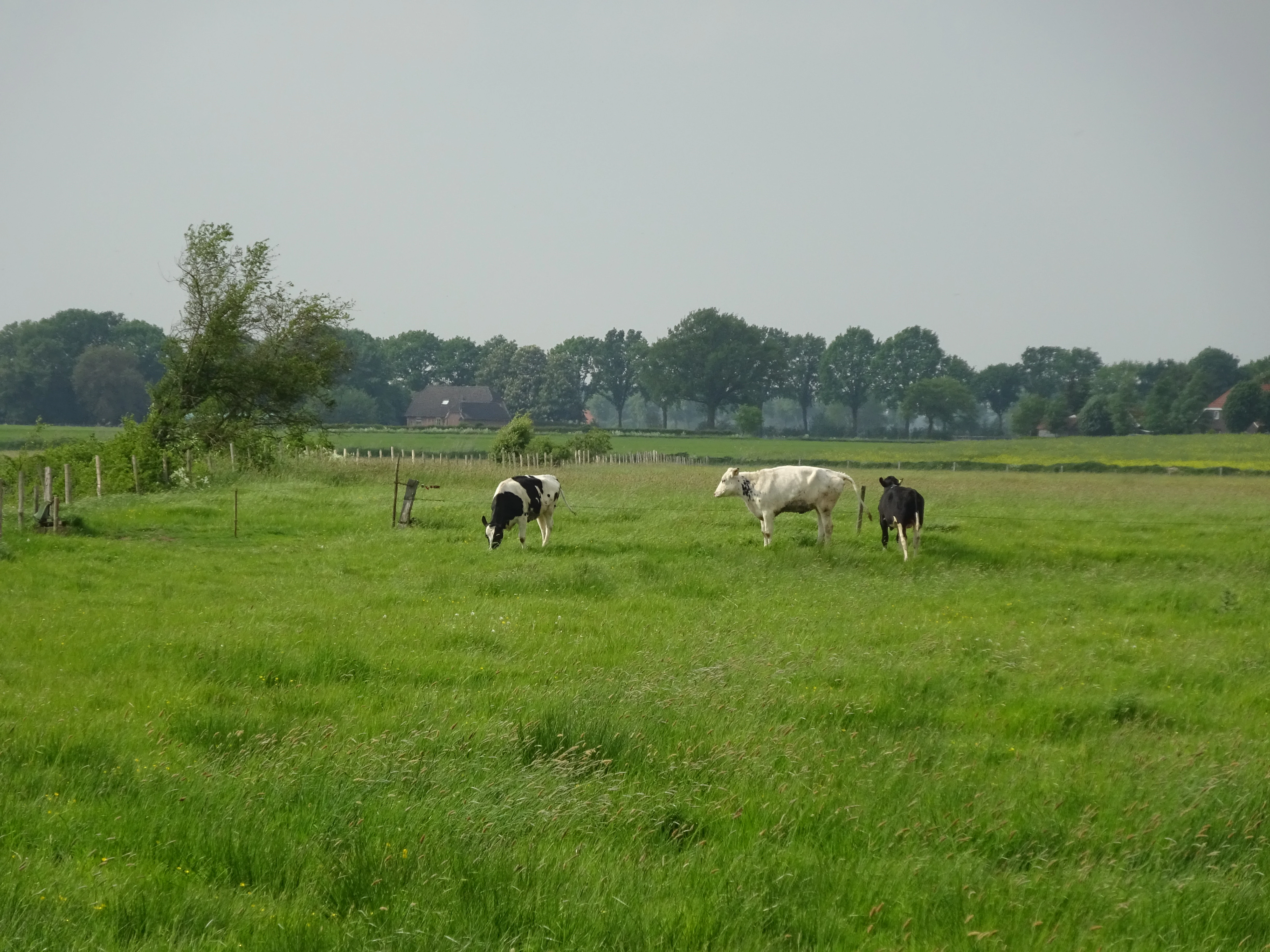
The reserve is crossed by the A3 motorway near Millingen, which acts as a notable anthropogenic feature along the southern margin, while the Rhine flows southwest of the protected area. Photographs of the site show a patchwork of hay meadows, grazed pastures with cattle, ditch-side vegetation, and quiet country lanes, all of which together give the reserve the character of a traditional, working wet-meadow landscape rather than a wild, unmanaged wilderness.
Hetter-Millinger Bruch ecosystems, habitats, and plant life
Ecologically, Hetter-Millinger Bruch represents the managed wet grassland habitats typical of the Lower Rhine. The reserve's vegetation is shaped by centuries of agricultural use and by ongoing water management through its Landwehr ditch network. Open meadows, grazed pastures, and ditch margins form the dominant habitat mosaic, with the wetter ditch corridors and the influence of the nearby Rhine contributing to moisture-loving plant communities.
Because the reserve lies adjacent to the Rhine and within the Unterer Niederrhein EU Bird Directive protection zone, it forms part of a larger ecological continuum that extends across the German-Dutch border into the Dutch riverine landscape. The combination of open meadows, drainage channels, and proximity to floodplain habitats gives the reserve ecological relevance that extends well beyond its individual boundaries.
The site is classified under IUCN Category IV as a Habitat/Species Management Area, indicating that active management of vegetation and water levels is central to maintaining its ecological values, rather than purely passive protection of untouched nature.
Hetter-Millinger Bruch wildlife and species highlights
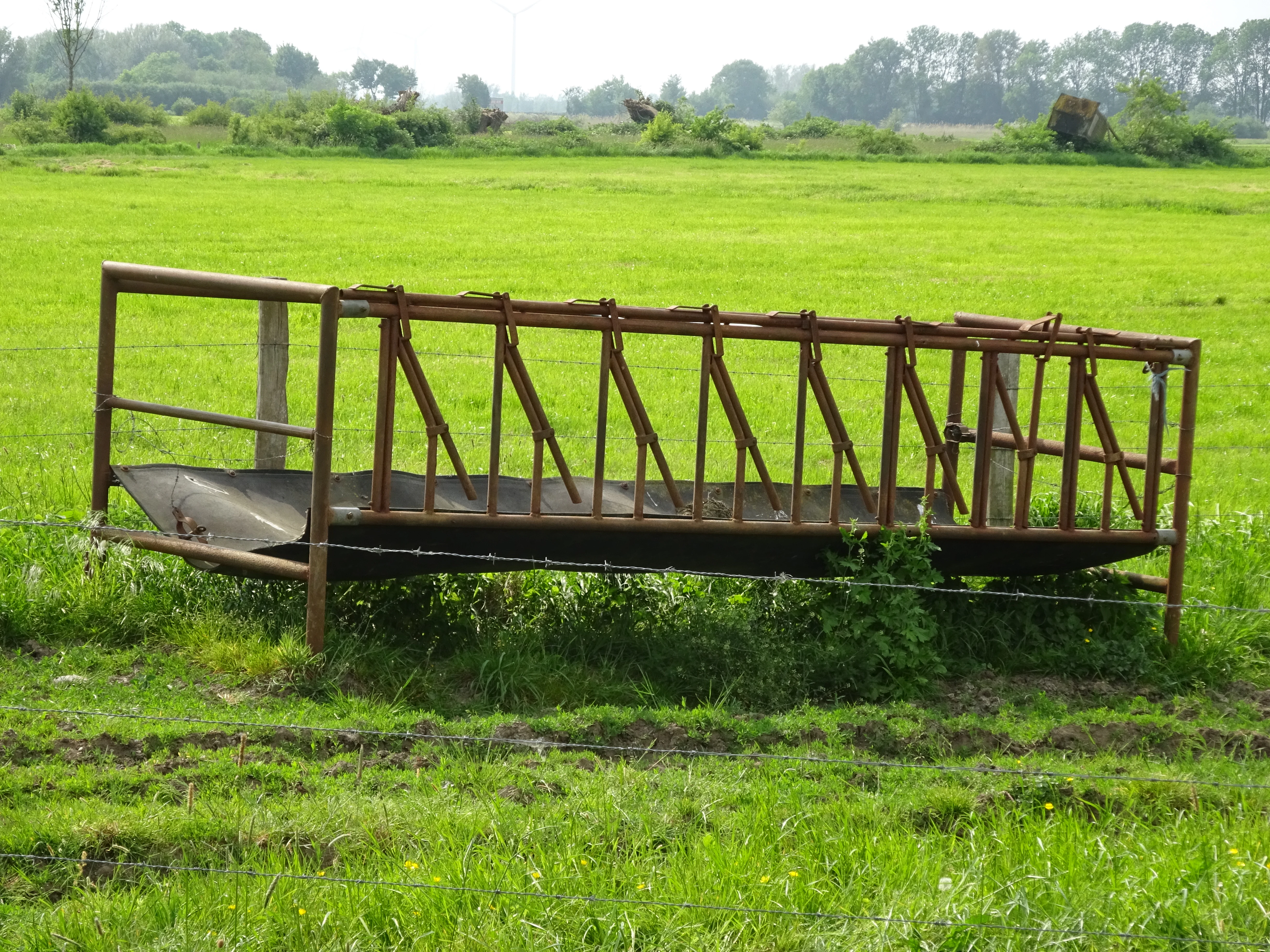
Wildlife in Hetter-Millinger Bruch is associated with the open meadow and wet-ditch habitats of the Lower Rhine. The grazed pastures with cattle visible in the reserve's photographic record indicate that livestock-based habitat management is part of the conservation approach, helping maintain the open character of the meadows that support meadow-dependent species.
Because the reserve overlaps with the broader Unterer Niederrhein EU Bird Directive protection area, its meadows, ditches, and field margins are considered part of a wider landscape context relevant to breeding and migratory bird species typical of the Lower Rhine floodplain. The site's position along the international border and near the Rhine further connects it to regional wildlife corridors that extend into the Netherlands.

Hetter-Millinger Bruch conservation status and protection priorities
Hetter-Millinger Bruch has been a designated Naturschutzgebiet since 1989, with its protection renewed in 2012. Its primary conservation objective is the preservation, support, and restoration of specific communities of wild plants and animals that depend on the Lower Rhine's traditional meadow and ditch habitats.
The reserve operates within Germany's standard nature protection framework and carries the official identifier KLE-013. At the international level, it is classified as an IUCN Category IV Habitat/Species Management Area and is listed in the World Database on Protected Areas under WDPA ID 163664. Its placement beside the Dutch border and within the Unterer Niederrhein EU Bird Directive protection zone gives the site additional cross-border and European-level conservation significance, linking it to broader efforts to protect the Lower Rhine as one of the major floodplain ecosystems of northwestern Europe.
Hetter-Millinger Bruch cultural meaning and human context
The Hetter-Millinger Bruch sits in a centuries-old agricultural landscape of the Lower Rhine, where drainage channels such as the Landwehr ditches have shaped the land for generations and continue to define the local countryside. The presence of cattle grazing, hay meadows, and rural field tracks reflects traditional regional land use that remains compatible with modern nature protection goals. The reserve's location directly on the German-Dutch border, including the border bridge near Megchelen, also gives it a quiet but distinctive cross-border cultural dimension, linking the protected area to neighboring communities in the Netherlands.
Top sights and standout views in Hetter-Millinger Bruch
Hetter-Millinger Bruch stands out for its four-part protected structure strung along the German-Dutch border, its 660-hectare extent, and its dense network of historic Landwehr drainage channels. The reserve is officially classified as an IUCN Category IV Habitat/Species Management Area and lies within the Unterer Niederrhein EU Bird Directive protection zone, giving it both national and European-level ecological relevance. Its identity rests on the combination of open meadows, ditch systems, and Rhine floodplain proximity that makes it a representative example of the managed wet-grassland landscape of the Lower Rhine.
Best time to visit Hetter-Millinger Bruch
Hetter-Millinger Bruch can be appreciated year-round as a working agricultural and ecological landscape, but late spring and early summer are typically the most rewarding periods for visitors interested in meadow flora and full ditchside vegetation. Spring tends to bring fresh growth across the meadows and visible water in the channels, while summer shows the meadows at their most expressive and grazed pastures at their most active. Autumn and winter bring quieter conditions, with migratory and wintering bird activity in the surrounding Lower Rhine landscape adding a different seasonal interest for those interested in regional birdlife.