Mori Atlas logo
Nearby park discovery

Map protected geography around an isolated Danube meander hill within the city

Compare protected landscapes around Honberg across Tuttlingen's Danube valley terrain

Honberg is an elongated Umlaufberg left behind by a former Danube meander, rising above Tuttlingen through Upper Jurassic limestone slopes, wooded flanks, sheep pasture, orchard meadow, a narrow plateau, and castle remains. Explore nearby protected geography on the map while keeping each site's natural terrain, cultural history, and designation distinct.

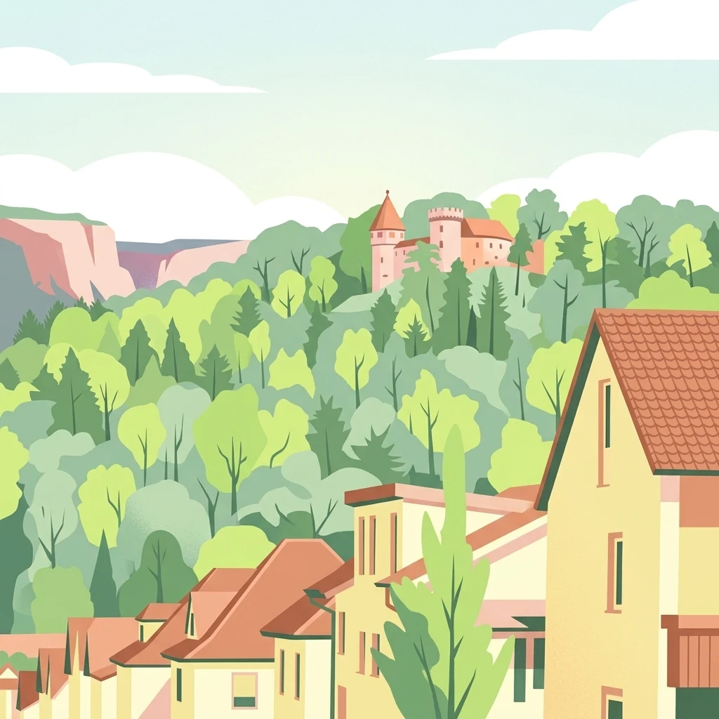
A stylized digital illustration showing yellow houses with red roofs in the foreground, with dense green forest and a stone castle tower in the background under a pale sky.

A small, historic Danube meander hill at the heart of Tuttlingen, protected as a landscape conservation area.

Honberg

The Honberg is a protected landscape (Landschaftsschutzgebiet) centered on a small hill in the heart of Tuttlingen, in the state of Baden-Württemberg in southwestern Germany. Geologically, the hill is a Umlaufberg, an isolated ridge left behind as the Danube carved a new meander around it, leaving the older valley loop cut off as a standalone topographic feature. Today the hill sits entirely within the urban area of Tuttlingen, surrounded on all sides by the town, yet it preserves a recognizable mosaic of woodland, orchard meadow, pasture, and the ruins of the medieval Honberg Castle on its plateau. Although now consumed by the surrounding city, the Honberg functions as a key local recreation area and as a visual and ecological landmark in the Danube valley. It lies within the natural region of Baaralb and Upper Danube Valley and is part of the broader Naturpark Obere Donau (Upper Danube Nature Park). Because of its geological interest, its mix of habitats, and its long history of human use, including medieval fortification, sheep grazing, and small-scale allotment gardening, the area was placed under formal landscape protection in February 1986. Protection is administered by the Landratsamt Tuttlingen (Tuttlingen district office). The protected designation is intended to preserve the hill's combination of natural landscape character and historical cultural features, particularly the castle ruins and their associated park, against further loss to urban development. Although small in size, the Honberg is emblematic of how ancient Danube valley landforms survive, in compressed form, within modern German towns.

Location
Germany
Park type
Protected landscape
Established
1986
Area
0.6 km²
Honberg Protected Landscape in Tuttlingen
Regional park map

See the ranked park cluster in its geographic setting

Nearby parks around Honberg

This regional map shows the same 20 nearby parks ranked below around Honberg. Select a ranked marker to highlight that park’s boundary where boundary data is available.
Reference park: HonbergRanked nearby park20 nearby parks shown
20 nearby parks

Distance-sorted regional park geography and comparative protected landscapes

Ranked Protected Areas and Surrounding Parks Geographically Near Honberg

Geographic proximity measurements rank surrounding protected areas by linear separation from Honberg to establish structural comparison signals. Country context and recorded environmental characteristics reveal diverse regional landforms across neighboring conservation territories without implying shared terrain.
Watercolor painting of a rolling hilly landscape with forests and a winding path, featuring soft pastel green, yellow, and pink tones.
Protected areaBaden-Württemberg
About 10 km away#1 closest

North

Großer Heuberg und Donautal: Protected Landscape Geography and Map Analysis

Natura 2000 territory in the southwestern Swabian Alb

Großer Heuberg und Donautal presents an expansive protected landscape where the elevated plateau of the Swabian Alb meets the deeply carved, winding valley of the Upper Danube. This area displays a diverse geological transition through limestone cliffs, open juniper heaths, and dense deciduous forests, providing essential context for understanding the regional geography and conservation status of this unique portion of Germany.

Area
86.62 km²
Established
2015
Relief
Mountain
Climate
Temperate
Protected landscapeBaden-Württemberg
About 11 km away#2 closest

Southwest

Hegau Protected Landscape in Baden-Württemberg: Atlas and Geographic Regional Map

Plateau landscape and agricultural heritage in Tuttlingen

The Hegau protected landscape in the Landkreis Tuttlingen preserves a characteristic segment of the Hegaualb plateau. Defined by undulating farmland, meadows, and the isolated Franzengrund woodland, this reserve offers a clear look at the rural geography and cultural landscape patterns typical of this part of southwestern Germany.

Area
2.723 km²
Established
1952
IUCN
V
Relief
Upland
Protected landscapeBaden-Württemberg
About 18 km away#3 closest

North

Schafweiden im Unteren Bäratal bei Reichenbach: Regional Landscape and Protected Area Atlas

Baden-Württemberg cultural landscape and valley topography

This protected area captures the traditional sheep-grazed character of the Hohe Schwabenalb. The landscape mosaic consists of contrasting valley slopes that support rare orchid populations, mature forest fringes, and ancient pasture trees, providing deep insight into the regional conservation geography of the lower Bära valley.

Area
0.327 km²
Established
2019
IUCN
V
Nature reserveGermany
About 21 km away#4 closest

North

Hintere Harrasbachtalwiesen Nature Reserve: Swabian Alb Valley and Meadow Geography

A mapped protected landscape in Baden-Wurttemberg, Germany

Hintere Harrasbachtalwiesen is a protected valley landscape in the Tuttlingen district, characterized by its stream network and distinctive forest-encircled wet meadows. This compact reserve provides a clear example of local Swabian Alb topography, linking small-scale riparian corridors to the extensive regional Natura 2000 protected land network.

Area
0.08 km²
Established
1944
Relief
Upland
Climate
Temperate
A watercolor painting showing a soft, panoramic view of green rolling hills and a winding river against a pale background of distant mountains.
Protected landscapeBaden-Württemberg
About 21 km away#5 closest

North

Oberhohenberg Protected Landscape: A Geographical Atlas of the Swabian Alb Zeugenberg

Mapping limestone summits, block forests, and relict meadow habitats.

Oberhohenberg is a designated protected landscape situated on the Swabian Alb. As a striking zeugenberg, the hill supports a complex environment consisting of limestone rock faces, remnant grasslands, and rare blockschuttwald forest types. This compact area offers a precise view into the geological and structural diversity defining the regional landscape of Baden-Württemberg.

Area
0.286 km²
Established
1953
IUCN
V
Relief
Mountain
Protected landscapeBaden-Württemberg
About 23 km away#6 closest

Northwest

Hänge mit Wald und Hecken im Neckartal und Mückenbachtal Protected Landscape and Valley Map

Geographic study of the upper Neckar valley and Mückenbachtal terrain

Investigate the layered landscape of Hänge mit Wald und Hecken im Neckartal und Mückenbachtal, where open grassland plains meet steep, forest-covered valley walls. This protected area provides a clear look at regional river-valley morphology and the integration of natural habitats near the A 81 corridor within the Baden-Württemberg state boundaries.

Area
0.223 km²
Established
1953
IUCN
V
Relief
Upland
A horizontal watercolor painting showing a calm lake shore with green trees, reeds, and soft reflections on the water surface.
Nature reserveBaden-Württemberg
About 23 km away#7 closest

Southeast

Bodanrück und westl. Bodensee: Mapped Geography of an Extensive Nature Reserve

A glacial peninsula protected area in Baden-Württemberg

The Bodanrück und westl. Bodensee nature reserve represents a sprawling mosaic of ground moraines, drumlins, and kettle lakes along the shoreline of Lake Constance. This protected area supports a diverse array of habitats, from tufa-forming springs and alluvial forests to species-rich hay meadows, reflecting the complex ecological history of the German southwest.

Area
143.407 km²
Established
2004
Relief
Mixed relief
Climate
Temperate
Protected landscapeBaden-Württemberg
About 24 km away#8 closest

Northwest

Wacholderheide Dissenhorn: Protected Landscape Mapping and Regional Geography in Baden-Württemberg

A preserved juniper heath mosaic within the Southwestern Alb Foothills

Wacholderheide Dissenhorn represents a vital protected landscape area near Göllsdorf, where the projecting Dissenhorn slope preserves a historic juniper heath mosaic. Defined by Middle Keuper geological formations, this terrain offers a clear look at local habitat management and the transition between open heath and mixed coniferous forest in Germany.

Area
0.101 km²
Established
1953
IUCN
V
Nature reserveBaden-Württemberg
About 25 km away#9 closest

Southwest

Blumberger Pforte und Mittlere Wutach: Protected Landscape and Gorge Geography

Nature reserve terrain and ecological atlas in Baden-Württemberg

This protected area captures the dramatic transition where the Wutach river cuts through limestone strata. Discover a rugged landscape mosaic featuring canyon forests, juniper heaths, and karst cave systems across the Swabian Alb and Black Forest fringe. The site offers significant value for understanding regional ecological gradients and limestone-dependent plant communities within the broader southern German geography.

Area
63.25 km²
Established
2019
Protected landscapeBaden-Württemberg
About 31 km away#10 closest

Northwest

Teufenbachtal Protected Landscape: Mapping the Valleys of Baden-Württemberg

Stream valley geography and forest-meadow mosaic analysis

Discover the geographic layout of Teufenbachtal, a designated protected landscape in Germany. This site analyzes the valley's corridor structure, featuring mixed forest slopes, open meadows, and the distinct Teufensee landmark, situated within the Baden-Württemberg regional geography.

Area
1.292 km²
Established
1989
IUCN
V
Relief
Upland
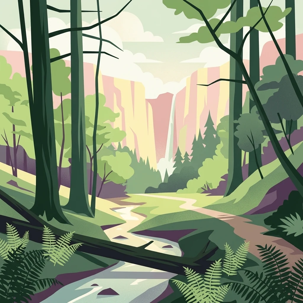
A graphic illustration of a deep forest gorge featuring a winding stream in the foreground, tall trees on both sides, and a cascading waterfall against high cliff walls in the background.
Protected landscapeBaden-Württemberg
About 32 km away#11 closest

North

Waldenbachtal Protected Landscape: A Geographic Profile of a Sandstone Gorge in Baden-Württemberg

Forested Klingen valley and stream-carved terrain mapping

Waldenbachtal serves as an ecologically significant protected landscape within the Rottweil district of Baden-Württemberg. Its map profile highlights a narrow gorge incised into Stubensandstein, defined by a distinct coniferous forest cover and linear stream drainage. This site provides a clear view into the region's Middle Keuper geological history and valley-based conservation patterns.

Area
0.149 km²
Established
1982
IUCN
V
Protected landscapeBaden-Württemberg
About 34 km away#12 closest

Northwest

Heckengelände im Gewand Kaltenberg: Protected Landscape and Farmland Mosaic in Baden-Württemberg

Examining traditional hedgerow patterns and regional Muschelkalk geology

Heckengelände im Gewand Kaltenberg offers a window into the Obere Gäue natural region, preserving a unique structural mosaic of agricultural fields and woody hedgerow bands. Established in 1953, this protected landscape demonstrates the historical land management and geological diversity found where the Black Forest meets the Swabian Alb.

Area
0.202 km²
Established
1953
IUCN
V
Relief
Upland
Protected landscapeSchwarzwald-Baar-Kreis
About 34 km away#13 closest

West

Groppertal Protected Landscape in Schwarzwald-Baar-Kreis: Regional Geography and Atlas

Mapped riparian meadows and Black Forest woodland boundaries

Groppertal is a protected landscape situated within the Schwarzwald-Baar-Kreis, defined by the Brigach river valley. The area exhibits a unique contrast between maintained lowland wet meadows and expansive forest slopes. This geography provides an essential protected corridor connecting the riparian ecosystem of the river floodplain to the wider highland terrain of the South-eastern Black Forest, illustrating a complex rural-natural mosaic.

Area
5.397 km²
Established
1957
IUCN
V
Relief
Upland
Abstract watercolor illustration of rolling green hills with soft yellow and pink washes and a winding path through a valley
Protected landscapeBaden-Württemberg
About 35 km away#14 closest

Northwest

Neckartal mit Seitentälern von Rottweil bis Aistaig Protected Landscape Map and Regional Context

Protected river valleys and plateau topography in Baden-Württemberg

This protected landscape in Baden-Württemberg features a sequence of twenty dramatic meander loops where the Neckar river cuts 140 meters into the bedrock. The protected area offers a complex geography of steep valley slopes, incised tributary notches, and historic castle-crowned ridges that reveal the evolution of the Obere Gäue terrain.

Area
16.05 km²
Established
1953
IUCN
V
Protected landscapeBaden-Württemberg
About 35 km away#15 closest

Northwest

Gaienbühl Protected Landscape: Regional Geography and Map of the Middle Black Forest

Protected mosaic of meadow and forest in Baden-Württemberg

Gaienbühl provides a concentrated example of the Middle Black Forest's rolling terrain, featuring a blend of forest patches and expansive central meadows. The area encompasses critical wetland biotopes and integrates into broader regional bird conservation zones. This record details the protected boundaries and landscape elements that define this specific site within the Schwarzwald-Baar-Kreis district.

Area
0.502 km²
Established
1954
IUCN
V
Protected landscapeBaden-Württemberg
About 37 km away#16 closest

Northwest

Villingen Süd Protected Landscape: Geographic Atlas and Cultural Heritage Map

Agricultural mosaic within the Baar plateau of Baden-Württemberg

Examine the territorial boundaries and ecological features of Villingen Süd. This protected landscape highlights the integration of historical Iron Age burial sites like Magdalenenberg with traditional agricultural practices, including meadows, hedgerows, and small woodland patches located within the broader Naturpark Südschwarzwald.

Area
4.89 km²
Established
1991
IUCN
V
Relief
Upland
Protected landscapeBaden-Württemberg
About 37 km away#17 closest

Northwest

Heckengelände zwischen Dunningen und Seedorf: Protected Landscape and Regional Geography

Hedgerow network and agricultural mosaic of Baden-Württemberg

Defined by its dense system of historical field hedgerows, this protected landscape in the Rottweil district maintains a unique ecological mosaic across an undulating plateau. The area features a complex interaction of loess-loam overlays, sedimentary hollows, and open farmland, representing a preserved traditional agricultural landscape within the broader context of Baden-Württemberg.

Area
7.53 km²
Established
1993
IUCN
V
Relief
Upland
A horizontal watercolor painting depicting a soft-focus valley scene with rolling hills, scattered green trees, and a light sky.
Nature reserveBaden-Württemberg
About 39 km away#18 closest

Southeast

Deggenhauser Tal Nature Reserve: Mapped Geography and Protected Valley Landscapes

Glacial terrain and watershed ridges in Baden-Württemberg

Investigate the protected geography of Deggenhauser Tal, an expansive nature reserve in the Oberschwäbisches Hügelland. This record maps the complex network of stream corridors, steep valley slopes, and ridge heights that define this Natura 2000 protected area. Gain insights into the glacial relief and varied land use patterns that characterize this essential southwestern German valley ecosystem.

Area
8.492 km²
Established
2019
A minimalist watercolor illustration showing a winding river flowing through a soft green landscape with rolling hills in the background and clusters of trees.
Nature reserveBaden-Württemberg
About 41 km away#19 closest

North

Gebiete zwischen Bisingen, Haigerloch und Rosenfeld Nature Reserve and Geographic Context

Fragmented protected terrain in the Swabian Alb foothills

Gain insight into the fifteen separate fragments that constitute this protected nature reserve in Baden-Württemberg. From open limestone meadows to narrow floodplain strips, the area represents a critical mosaic of EU-protected habitat types that demand careful geographic consideration and mapping.

Area
7.53 km²
Established
2019
Watercolor painting of a rolling rural landscape with forested hills and open fields in muted green, yellow, and soft pink tones.
Protected landscapeBaden-Württemberg
About 42 km away#20 closest

North

Oberes Starzeltal und Zollerberg Protected Landscape: Regional Geography and Terrain

Swabian Alb limestone topography and river valley systems.

Oberes Starzeltal und Zollerberg represents a core landscape protection area on the western Swabian Alb, defined by its distinct Middle Jurassic limestone geology. The area connects critical habitats across the Zollernalbkreis district, featuring steep wooded slopes and open sheep-grazed grasslands. Through this atlas entry, visualize the environmental continuity between the Starzel river valley and the surrounding agricultural plateau, which together form a essential component of the regional protected-area network.

Area
79 km²
Established
1972
IUCN
V
Relief
Mountain
Distance methodology

Geographic measurements, not driving distances

How nearby park distances are calculated

Distances use park boundaries whenever the available geometry allows it. When one or both boundaries are missing, the mapped park locations provide a clearly labelled estimate. Every value represents straight-line geographic separation and does not use roads or routing.

Boundary distance

Calculated between the nearest points of both park boundaries.

Location-to-boundary estimate

Estimated from one mapped park location to the nearest boundary of the other park.

Mapped-location estimate

Estimated between the mapped locations of both parks.

MoriAtlas Explorer

Explore the Honberg Protected Landscape and Its Unique Danube Valley Geography

Continue exploring the Honberg through detailed geographic maps and landscape data. Analyze the formation of this unique Umlaufberg ridge and its role within the Naturpark Obere Donau. MoriAtlas provides structured insights into the protected boundaries and natural terrain characterizing this historic site in Landkreis Tuttlingen.