

Mori Atlas logo
Protected landscapeJinshitan National Resort

Mapping the geological heritage and diverse shoreline terrain along the Yellow Sea coast

Jinshitan National Resort: A Detailed Geographic Atlas of Coastal Protected Landscapes in Dalian China

(Jinshitan National Tourist Resort)

Jinshitan National Resort represents a significant coastal protected landscape located on the Liaodong Peninsula in Dalian, China. This area is defined by its unique sedimentary rock formations, often described as a stone forest at sea, which contrast against the expansive golden sand beaches of the Yellow Sea. The site provides a rich study of ancient geological heritage and managed coastal geography, serving as a primary intersection of natural terrain and regional maritime landscape development.

coastal resortnational geoparkmarine parkbeachcoastal cliffssedimentary rocks
A stylized flat illustration of a coastal cliffside featuring a small gazebo on a lookout point, rocky formations jutting into the green sea, and small boats in the distance.

Jinshitan National Resort

Protected landscape

Park overview

Structured park overview, official facts, and landscape profile for Jinshitan National Resort

Jinshitan National Resort park facts, protected area profile, and essential visitor context

Review the core facts for Jinshitan National Resort, including designation, size, terrain, visitor scale, habitats, and operating context in one park-focused overview.

About Jinshitan National Resort

Jinshitan National Resort sits on the Liaodong Peninsula coast in northeastern China, forming part of Dalian's Jinzhou District. Although it functions as a national tourism resort, its visual identity is shaped as much by geology as by recreation. The shoreline combines a long sandy beach, often referred to locally as the Golden Coast, with rocky outcrops, weathered sea cliffs, and unusual sedimentary formations that have been celebrated as a "stone forest at sea."

These formations originated hundreds of millions of years ago, when the area lay under ancient seabeds that accumulated thick layers of sediment. Tectonic activity later lifted and exposed these layers, and ongoing coastal erosion has since sculpted them into strange shapes and textures visible along the shore today. Their visual distinctiveness and scientific value are what earned the area designation as a national geological park, anchored by the Jinshitan core area of the larger Dalian Coastal National Geopark.

Beyond geology, the resort developed through the late twentieth and early twenty-first centuries into a major integrated destination. It carries several layered national designations, including national scenic area, national tourism resort, national AAAAA tourist attraction, national geopark, and a national-level marine park. These overlapping designations illustrate how the area is recognized simultaneously as a place of natural heritage, ecological protection, and large-scale tourism development.

Within the resort, visitors encounter a mix of natural scenery and curated attractions. The golden beach forms the main arena for seaside activity, while the geological park showcases the ancient rocks. Cultural sites such as wax museums, a museum of life sciences, and Discoveryland theme park add recreational variety. Transport links from central Dalian make the resort an accessible day-trip or extended-stay destination within Liaoning's coastal tourism corridor.

Quick facts and research context for Jinshitan National Resort

Jinshitan National Resort is a nationally designated coastal tourism resort on the Yellow Sea coast near Dalian in Liaoning Province, northeastern China. It carries multiple overlapping national designations, including national scenic area, national geological park, national tourism resort, and a high-level national AAAAA tourist attraction rating (the highest tier in China's classification system).

The area covers roughly 62 square kilometers on land and 58 square kilometers of sea area, combining a long beachfront with a fossil-rich coastal rocky landscape. CNN previously listed Jinshitan among China's 40 most beautiful scenic spots. It also hosts one of China's first national tourism resorts, established by the State Council in 1992.

Protection and recognition

Explore the documented mixed protection scope and designation timeline for Jinshitan National Resort.

Jinshitan National Resort Protection Status and Designation History

Jinshitan National Resort maintains a documented mixed protection status established in 1988 through official administrative records. Detailed designation history and international recognition frameworks provide structured context for conservation management scope.

Protection details

Protection scope
Mixed
Designated year
1988
Transboundary protection
No
Park context

Deeper park guide and search-rich context for Jinshitan National Resort

Jinshitan National Resort history, landscape, wildlife, and travel context

Explore Jinshitan National Resort through its history, landscape character, ecosystems, wildlife, conservation priorities, cultural context, and seasonal travel timing in a structured park guide built for atlas discovery and search intent.

Why Jinshitan National Resort stands out

Jinshitan is best known for its unusual coastal rock formations, often described as a "stone forest at sea," formed from ancient sedimentary deposits along the shore. These formations give the resort its defining geological character and inspired its name, since the rocks were considered "more precious than gold." Equally important is the resort's role as one of China's earliest and largest national tourism resorts, combining a golden sand beach with cultural institutions such as wax museums and theme parks. The mix of natural geological heritage and curated coastal tourism has shaped the area's identity as both a sightseeing destination and an outdoor recreation area.
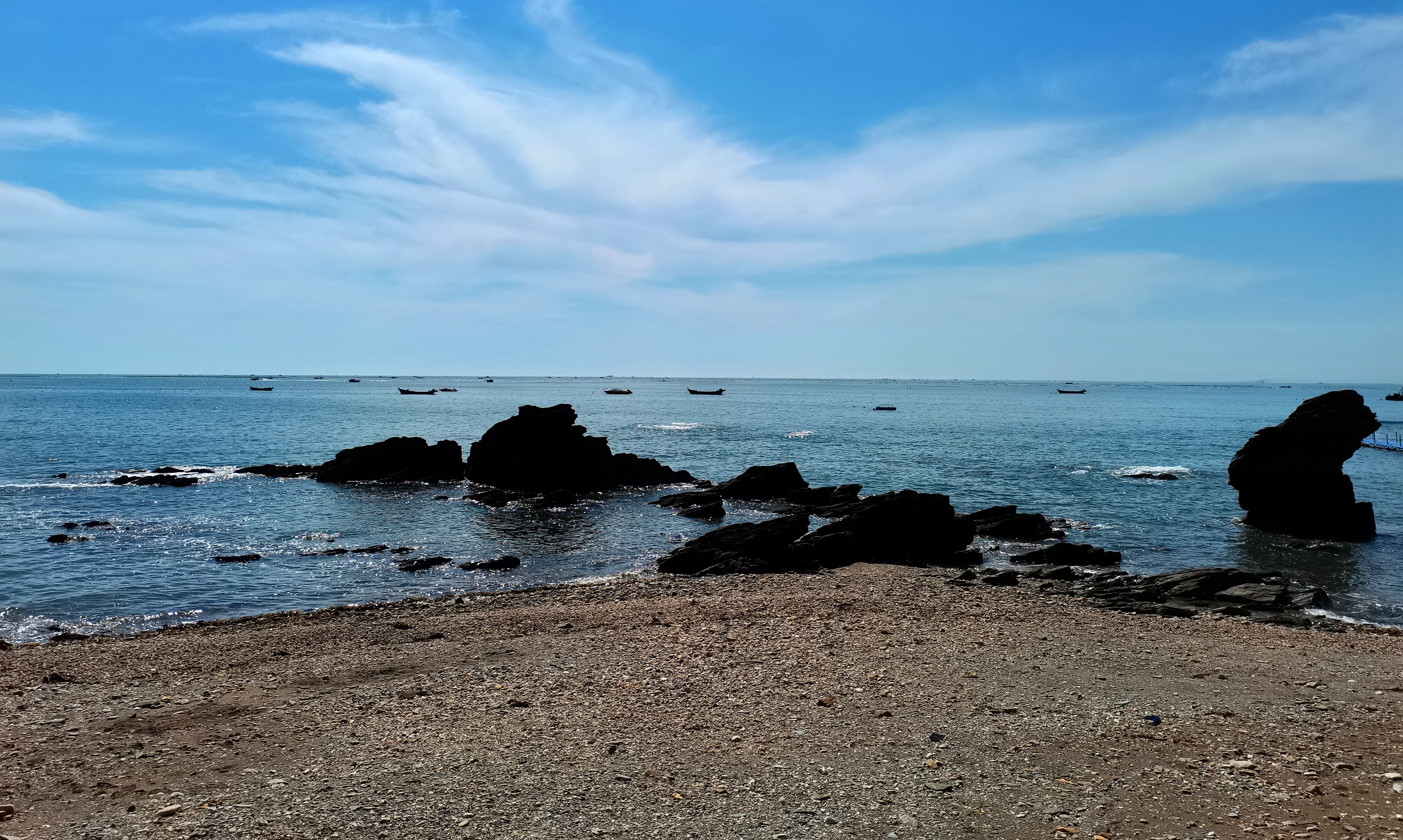
A rocky beach shoreline leading to the ocean under a clear blue sky with thin clouds; small boats are visible in the distant water.
Coastal view of the rocky shores at Jinshitan National Resort.

Jinshitan National Resort history and protected-area timeline

The area now known as Jinshitan was historically called Manjiatan, and was locally known for its seafood-rich shoreline, with a saying referencing abundant sea cucumbers and crabs. The coastal formations formed over hundreds of millions of years from ancient marine sediments, and the region was recognized for these striking rock exposures long before modern tourism development.

The modern development of Jinshitan began in 1984, when the then Party Secretary of Jin County, Bo Xilai, initiated large-scale development of the coastal area. In 1986, the area was designated a county-level nature reserve, and by late 1987 it had been elevated to a municipal nature reserve under the Dalian municipal government. In August 1988, by approval of the State Council, Jinshitan became part of the second batch of national key scenic areas in China, reflecting its growing recognition at the national level.

In November 1992, the State Council approved the establishment of China's first and, at that time, largest national tourism resort at Jinshitan, marking a pivotal moment that anchored Jinshitan's identity as a flagship coastal resort destination. In 2005, the Ministry of Land and Resources approved the creation of the Dalian Coastal National Geopark with Jinshitan as its core area, and the following year the site became a national science education base focused on resource protection.

The resort was listed among the first batch of national AAAA tourist attractions in 2000, then upgraded to the highest national AAAAA level in January 2010. In March 2014, the State Oceanic Administration approved the establishment of the Dalian Jinshitan National Marine Park, adding a marine-protected layer to the site's already extensive set of designations.

Jinshitan National Resort landscape and geographic character

Jinshitan's landscape is defined by its coastal setting on the Yellow Sea, where the land meets the water through a combination of long sandy stretches and ancient rocky headlands. The most distinctive visual feature is the set of exposed sedimentary rocks, shaped by hundreds of millions of years of geological history and then eroded by waves into unusual cliff and platform formations. This collection of weathered coastal rocks is widely described as a "stone forest at sea," because the varied shapes, textures, and stratification patterns resemble a forest of stone columns and ridges rising along the shore.

The resort's golden sand beach, often called the Golden Coast, forms the other half of the landscape contrast. The long, gently sloping shoreline provides open space for seaside recreation and visual relief against the more rugged rocky sections of the coast. Together, the sandy beach and the rocky formations give the resort a layered coastal landscape that shifts between soft, open terrain and dramatic, sharply textured geology within a relatively compact area.

The sea area itself plays a role in the landscape identity, both visually and ecologically, by framing the rocky formations and supporting the marine park designation. The interplay of land, sea, and ancient stone is what gives Jinshitan its distinct coastal character compared with smoother, sand-only beaches elsewhere along the Bohai-Yellow Sea coast.
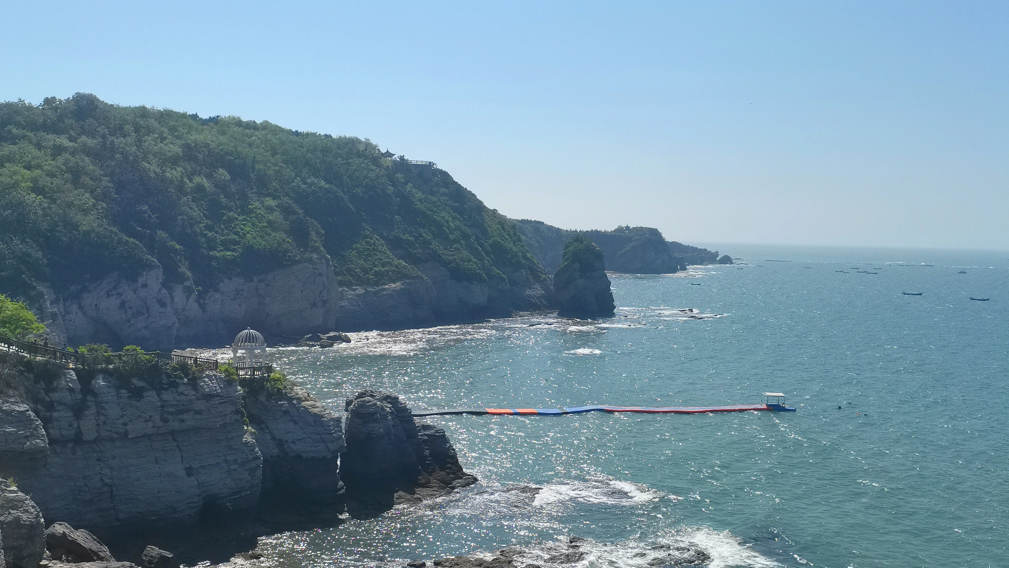
A wide coastal view of Jinshitan National Resort, featuring steep rocky cliffs topped with green vegetation overlooking the ocean, with a long floating walkway extending into the water.
Coastal cliffs and a floating walkway at Jinshitan National Resort.

Jinshitan National Resort ecosystems, habitats, and plant life

The natural environment of Jinshitan is shaped primarily by its coastal geology and the interaction between ancient seabed rocks and the modern marine environment. The exposed sedimentary rocks, dating back hundreds of millions of years, contain fossil-bearing layers and represent a significant record of the region's deep geological past. Their weathering along the active coastline continues to shape the present-day scenery, making the site a place where ancient geological processes remain visible at the surface.

The marine component of the environment is recognized through the area's national marine park designation. This marine designation protects a portion of coastal sea area along the resort, framing the boundary between land-based geopark features and the marine ecosystem that surrounds them. The combination of rocky intertidal zones, sandy beach environments, and adjacent shallow sea creates a transition zone between terrestrial and marine habitats.

The broader vegetation and habitat patterns follow the typical Liaodong Peninsula coastal pattern, with the sandy beach supporting limited salt-tolerant vegetation and the rocky headlands hosting sparse but adapted maritime plant communities. While the area is more famous for geology than for dense terrestrial habitat, the diversity of substrates along a short coastal stretch supports a recognizable range of coastal ecological micro-environments.

Jinshitan National Resort wildlife and species highlights

Wildlife at Jinshitan is shaped primarily by its coastal and marine setting. The rocky intertidal zones and shallow marine waters support typical Bohai Sea invertebrate life, including crabs and other shellfish that historically gave the surrounding waters a reputation for abundant seafood. The traditional local saying about the area's seafood resources reflects this long-standing ecological character of the shoreline.

The sandy and rocky shoreline habitats also attract coastal birds characteristic of the Yellow Sea and Bohai Sea flyway, while the marine environment under protection through the national marine park designation supports broader marine biodiversity in the resort's coastal waters. Wildlife here is best understood in the context of a working coastal landscape where geological heritage, beach environments, and marine habitats coexist within a compact resort area.

Jinshitan National Resort conservation status and protection priorities

Conservation at Jinshitan operates through a layered set of national designations that recognize both the area's natural heritage and its environmental sensitivity. The coastal rock formations are protected as part of the Dalian Coastal National Geopark, anchored by the Jinshitan core area, preserving the region's ancient sedimentary record and distinctive erosion-shaped landforms.

The sea area is independently protected under the Dalian Jinshitan National Marine Park, established in 2014 by the State Oceanic Administration, giving the resort an explicit marine conservation framework. Earlier conservation recognition came through the area's designation as a county-level nature reserve in 1986 and a municipal nature reserve in 1987, before it was elevated to national scenic area status in 1988.

Together, these designations make Jinshitan a place where geological heritage, coastal scenery, and marine environment are managed under overlapping national protection frameworks. The presence of a national science education base focused on resource protection further underlines the area's role in conservation awareness, not only as a tourism destination but also as a site of recognized natural and scientific value.

Jinshitan National Resort cultural meaning and human context

Jinshitan's cultural context is shaped by its origins as a coastal fishing and gathering area known locally as Manjiatan. Before its modern development, the shoreline was associated with local livelihoods tied to the sea, and the abundance of seafood along the coast became part of the area's regional identity, expressed through popular local sayings.

Modern cultural layers include curated visitor attractions such as the Dalian Jinshitan Wax Museum, a museum focused on the mysteries of life, and the Discoveryland theme park, which is among the earliest theme parks developed in Dalian. Together with its scenic and geological identity, these attractions have positioned Jinshitan as both a natural heritage site and a center for cultural and recreational tourism in northeastern China.

Top sights and standout views in Jinshitan National Resort

Jinshitan's strongest highlights include its ancient coastal rock formations, the "stone forest at sea" that gives the resort its name, and a long golden sand beach that combines natural beauty with recreation. Layered national designations, covering scenic, geological, marine, and tourism protection, mark the area as one of the most institutionally recognized coastal destinations in northeastern China.

Anchored by the Dalian Coastal National Geopark, China's first national tourism resort, and a national marine park, Jinshitan stands out as a destination where deep geological history and modern resort development sit side by side along the Yellow Sea.

Best time to visit Jinshitan National Resort

The character of a visit to Jinshitan shifts noticeably with the seasons. Summer brings the warmest sea conditions and the most active beach atmosphere, while spring and autumn typically offer milder temperatures and clearer views of the coastal rock formations, which remain the resort's defining visual feature year-round.

Winter visits are quieter and colder, and the contrast between empty beaches and weathered rocky headlands can make the geological landscape especially visible. Since the resort's appeal is split between beach recreation and geological sightseeing, the most rewarding visits tend to favor shoulder seasons that balance outdoor comfort with strong visibility of the ancient rocks.

Monthly climate preview

Long term meteorological records and weather by month for a representative coordinate

Jinshitan National Resort Climate Normals: Annual Temperature and Precipitation Rhythm

Representative coordinate measurements reveal the multiyear thermal range and precipitation distribution across Jinshitan National Resort. Examining the complete monthly climate record provides deeper context for long term atmospheric patterns.
Annual mean11 °C
-2 °C25 °C
Jan-2°
Feb-1°
Mar
Apr
May15°
Jun20°
Jul24°
Aug25°
Sep21°
Oct15°
Nov
Dec
Warmest month
August

24.8 °C

Coolest month
January

-2.1 °C

Wettest month
August

5.2 mm/day

Driest month
January

0.2 mm/day

Park location guide

Geography guide, regional context, and park location map for Jinshitan National Resort

Jinshitan National Resort park geography, regions, and map view in China

Understand where Jinshitan National Resort sits in China through a broader geographic reading of the surrounding landscape, nearby location context, and its mapped position within the national park landscape.

How Jinshitan National Resort fits into China

China is a unitary communist state in East Asia, governed by the Chinese Communist Party. The country's capital is Beijing, while Shanghai is the largest city by urban population. China has 33 province-level divisions including provinces, autonomous regions, municipalities, and special administrative regions. The nation has a long history spanning thousands of years, with achievements including the invention of gunpowder, paper, printing, and the compass.

Wider geography shaping Jinshitan National Resort in China

China is located in East Asia, bordering fourteen countries: Russia, North Korea, Vietnam, Laos, Myanmar, India, Bhutan, Nepal, Pakistan, Afghanistan, Tajikistan, Kyrgyzstan, Kazakhstan, and Mongolia. The country spans diverse terrain including deserts, mountains, plateaus, and river valleys. Major river systems include the Yellow River and Yangtze River. The coastline stretches along the East China Sea, South China Sea, and Yellow Sea.

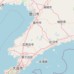
Map view of Jinshitan National Resort

Use this park location map to pinpoint Jinshitan National Resort in China, understand its exact geographic position, and read its mapped placement within the surrounding landscape more clearly.

Pigeon | © OpenStreetMap contributors

Location context for Jinshitan National Resort

Dalian

Visual reference guide to ancient sedimentary rock formations and marine park terrain

Jinshitan National Resort Photos and Coastal Landscape Scenery

Visual documentation captures the coastal landscape character and ancient rock formations of Jinshitan National Resort. Photographic records help researchers examine the geological terrain and protected shoreline environments along the Yellow Sea.

A rocky beach shoreline leading to the ocean under a clear blue sky with thin clouds; small boats are visible in the distant water.

A view across a calm, dark pond toward a forested hill with a white resort building on top and a suspension bridge crossing the water.

A wide coastal view of Jinshitan National Resort, featuring steep rocky cliffs topped with green vegetation overlooking the ocean, with a long floating walkway extending into the water.

Park atlas

Compare regional park geography and adjacent protected landscapes across the coast

Exploring Parks Near Jinshitan National Resort and Surrounding Coastal Protected Areas

Browse nearby national parks and protected areas connected to the coastal geography surrounding Jinshitan National Resort. Continuing into adjacent regional reserves reveals broader patterns in coastal terrain and geological heritage.
National parkSouth Korea
About 435 km away#1 closest

Southeast

Taean Seaside National Park: National Park Geography and Mapped Landscape Discovery

South Korea's protected coastal terrain.

Explore the precise geographic identity of Taean Seaside National Park, a key protected area within South Korea. This page offers an atlas-style perspective on its landscape context, mapped boundaries, and regional distribution across the Korean Peninsula. Understand its role as a national park and its contribution to the mapped natural terrain of East Asia.

Area
840 km²
Established
1978
IUCN
II
Relief
Lowland
National parkGyeonggi Province
About 462 km away#2 closest

East

Bukhansan National Park: Protected Area Geography and Mapped Boundaries in Gyeonggi Province

Explore the landscape context of this national park.

Bukhansan National Park stands as a distinct protected area within Gyeonggi Province, offering a rich landscape for geographic exploration. This entry focuses on its identity as a national park, detailing its mapped boundaries and its contribution to the regional geography. Users can explore its protected landscape features and understand its significance through a structured, map-centric approach, enriching their atlas understanding of protected natural areas.

Area
79.92 km²
Established
1983
IUCN
II
Visitors
5M annual
National parkSouth Hamgyong Province
About 500 km away#3 closest

East

Lake Pujŏn National Park: National Park Atlas Exploration and Protected Landscape Geography

View the mapped boundaries and regional natural landscape of this protected area.

Lake Pujŏn National Park offers a distinct opportunity for geographic discovery focused on protected natural landscapes. As a national park located in South Hamgyong Province, its mapped outlines and surrounding terrain provide valuable context for atlas exploration. Understand the unique protected-area identity of Lake Pujŏn National Park and its role within the broader regional geography through detailed, map-driven insights designed for structured exploration.

Area
26 km²
Relief
Mountain
Climate
Boreal
Scope
Mixed
State or regional parkBeijing
About 520 km away#4 closest

West

Beijing Xishan National Forest Park: Atlas and Geographic Landscape Overview

Mapping the Western Hills forest and cultural landscape

Beijing Xishan National Forest Park offers a unique study of peri-urban conservation, featuring planted woodlands and rocky ridge terrain at the doorstep of the Chinese capital. This protected area bridges the metropolitan edge of Beijing with the eastern reaches of the Taihang Mountains, integrating historical sites with diverse seasonal forest flora. The park remains a primary example of how regional geography and cultural memory converge within a state-designated national forest zone.

Area
53.33 km²
Established
1992
Visitors
1.5M annual
Relief
Mountain
National parkChungcheongnam-do
About 549 km away#5 closest

Southeast

Gyeryongsan National Park: Mapped Protected Landscape in Chungcheongnam-do

Explore its national park designation and regional geography.

Gyeryongsan National Park is a formally protected national park in Chungcheongnam-do, South Korea. This page offers critical atlas context for understanding the park's geographic scope, mapped protected boundaries, and its significance as a natural landscape within the region. Examine the terrain and explore its regional context for a deeper appreciation of its protected status.

Area
64.71 km²
Established
1968
IUCN
II
Relief
Mountain
National parkJeollabuk-do
About 557 km away#6 closest

Southeast

Byeonsan-bando National Park: Protected Landscape and Geographic Context in Jeollabuk-do

Explore mapped terrain and regional park geography.

This detail page provides an in-depth look at Byeonsan-bando National Park, a protected area located in South Korea's Jeollabuk-do region. Users can discover the park's specific geographic identity, understand its mapped boundaries, and explore its role within the broader regional landscape. The content is structured for atlas exploration, offering detailed insights into the park's natural terrain and its significance as a national park.

Area
154.71 km²
Established
1988
IUCN
II
Relief
Mixed relief
National parkSouth Korea
About 561 km away#7 closest

Southeast

Dadohaehaesang National Park: Exploring South Korea's Coastal Protected Area Boundaries

Mapped landscape context and regional geography.

Delve into the protected landscape of Dadohaehaesang National Park, a significant national park located in South Korea. This entry provides critical geographic information, detailing the park's mapped boundaries and its place within the broader regional terrain. It serves as an essential resource for understanding the park's protected status and its unique natural features for those exploring national parks and protected areas within an atlas framework.

Area
2,321.5 km²
Established
1981
IUCN
II
Visitors
560K annual
National parkGangwon-do
About 564 km away#8 closest

East

Chiaksan National Park: National Park Protected Landscape and Geographic Context in Gangwon-do

Explore mapped boundaries and regional terrain.

Chiaksan National Park is a designated national park within South Korea's Gangwon-do region, offering a focused entry point for geographic discovery. This resource details the park's protected landscape, its mapped boundaries, and its relation to the surrounding natural terrain. Delve into the atlas-style context of Chiaksan National Park to understand its significance as a protected natural area within its regional geography.

Area
181.57 km²
Established
1984
IUCN
II
Relief
Mountain

Common questions about visiting, size, designation, and location context for Jinshitan National Resort

Jinshitan National Resort FAQs for park facts, access, geography, and protected area context

Find quick answers about Jinshitan National Resort, including protected-area facts, park geography, trail and visitor context, and how the park fits into its surrounding country and regional landscape.
MoriAtlas Explorer

Continue Your Protected Areas Search Across the Global Atlas

Deepen your exploration by continuing the structured search for national parks and protected areas worldwide. Utilize the comprehensive filtering capabilities to compare different conservation landscapes and refine your understanding of global park geography. Discover more about the distribution and characteristics of protected natural areas.

Global natural geography