Mori Atlas logo
Marine protected areaKahurangi Marine Reserve

Tracing the shoreline boundaries, reef structures, and underwater topography of the West Coast

Kahurangi Marine Reserve: Mapped Protected Coastal Landscapes and Marine Geography

Kahurangi Marine Reserve spans over 8,000 hectares of rugged territorial waters along New Zealand's northwestern South Island coast. This protected area connects sandy beaches and nīkau forests with diverse subtidal habitats including rocky reefs, seastacks, and soft sediment seabeds that reach depths of 50 metres. Discover the complex geography of this marine environment as it borders Kahurangi National Park, providing a continuous protected corridor across the shoreline and into the Tasman Sea.

marine reserveWest Coast South IslandBuller Districttemperate coastlinerocky reefseastacks

Kahurangi Marine Reserve

Marine protected area

Park overview

Structured park overview, official facts, and landscape profile for Kahurangi Marine Reserve

Kahurangi Marine Reserve park facts, protected area profile, and essential visitor context

Review the core facts for Kahurangi Marine Reserve, including designation, size, terrain, visitor scale, habitats, and operating context in one park-focused overview.

About Kahurangi Marine Reserve

Kahurangi Marine Reserve lies on the northwestern edge of New Zealand's South Island, offshore from one of the country's most extensive national parks and in a region known for wild weather, dense forest, and a sparsely populated coastline. Its waters and shoreline stretch along the Buller District side of the West Coast, where the Tasman Sea meets a rugged landscape of cliffs, boulder beaches, nikau-studded coastal forest, and shifting sands.

As a marine reserve, its purpose is to protect the integrity of the coastal and inshore marine environment from extraction and disturbance, allowing physical and biological processes to continue with minimal direct human pressure. The reserve brings together three main habitat zones: the high-energy sandy and boulder shoreline with its driftwood communities, the rocky reef and seastack systems of the nearshore zone, and the softer mud-and-sand seabed deeper out where burrowing animals dominate. Each contributes a different piece of the wider marine ecosystem.

The reserve is meaningful not only for what lives within its boundaries, but also for its relationship to the adjacent Kahurangi National Park. Together the park on land and the reserve at sea form an unusually large, connected protected landscape on the West Coast, one that spans temperate rainforest, coastal cliffs, intertidal boulder fields, and subtidal habitats within a relatively short horizontal distance. This connectedness, combined with the reserve's setting in one of New Zealand's more remote coastal regions, gives Kahurangi Marine Reserve a strong identity as both a marine conservation area and a coastal landscape feature.

Quick facts and research context for Kahurangi Marine Reserve

Kahurangi Marine Reserve is located in the West Coast Region of New Zealand's South Island, within the Buller District and offshore of Kahurangi National Park. It was formally established in 2014 after a proposal process that began in September 2011.

The reserve covers 8,419 hectares and extends 16 kilometres along the coast between Wekakura Point and Crayfish Point, with a five-kilometre seaward extent and depths of roughly 50 metres. It is administered by the New Zealand Department of Conservation and ranks among the larger marine reserves in the New Zealand system.

Protection and recognition

Examine the documented marine conservation scope and recognition history

Kahurangi Marine Reserve Protection Status and Designated Area Records

Marine protection status records for Kahurangi Marine Reserve detail the established conservation scope and boundary framework. Verified data sources provide structured insight into the protected area designation without external recognition assignments.

Protection details

Protection scope
Marine
Transboundary protection
No
Park context

Deeper park guide and search-rich context for Kahurangi Marine Reserve

Kahurangi Marine Reserve history, landscape, wildlife, and travel context

Explore Kahurangi Marine Reserve through its history, landscape character, ecosystems, wildlife, conservation priorities, cultural context, and seasonal travel timing in a structured park guide built for atlas discovery and search intent.

Why Kahurangi Marine Reserve stands out

Kahurangi Marine Reserve is best known for its combination of an undisturbed West Coast shoreline and a contiguous offshore marine environment directly adjacent to Kahurangi National Park. The reserve pairs sandy beaches backed by nīkau forest with rocky reefs, seastacks, and a subtidal seabed of mud and sand, creating a layered coastal-to-ocean habitat profile within a single protected area. It is also recognised for the wildlife that the broader coastline supports as part of the reserve, including fur seal colonies and Hector's dolphins along the northern section, and the unusual driftwood-beach invertebrate communities of earwigs, sandhoppers, and spiders. The reserve's scale and its connection to one of New Zealand's largest national parks give it a distinctive identity among the country's marine reserves.

Kahurangi Marine Reserve history and protected-area timeline

The idea for Kahurangi Marine Reserve was first raised in September 2011. The proposal went through review and revision, and the area that was finally approved was substantially smaller than the original concept. Conservation Minister Nick Smith formally approved the reduced marine reserve in March 2013.

The regulation that created the marine reserve was passed by Prime Minister John Key on 11 August 2014 and came into effect on 7 September 2014. Once established, the reserve was recognised as one of the larger marine reserves in New Zealand, both in total area and in the length of coastline it encompassed. Since then, enforcement activity has confirmed the practical significance of the protected zone, with several documented cases of illegal fishing within the reserve boundaries, including a 2016 trawling incident spotted by rangers and a 2020 prosecution of a commercial fisher from Nelson who had been trawling in the area without realising it was a marine reserve. These cases have helped define the reserve as a serious, actively managed conservation area rather than a purely notional designation.

Kahurangi Marine Reserve landscape and geographic character

The landscape of Kahurangi Marine Reserve is shaped by the meeting of the Tasman Sea with the northwestern South Island coastline. The reserve's shoreline runs for about 16 kilometres between Wekakura Point and Crayfish Point, characterised by long stretches of sandy beach interspersed with boulder fields, small rocky promontories, and the kind of driftwood-strewn high-tide zone typical of exposed West Coast beaches. Inland, the coastal margin rises quickly into nīkau forest, the dense subtropical palm-dominated vegetation that lines much of this stretch of coast and gives it a distinctive lush, almost tropical feel despite its southern latitude.

Below the tideline, the landscape continues through rocky reef platforms and isolated seastacks that rise from the nearshore seabed. These hard substrates are gradually replaced by softer ground as the seafloor slopes outward: a mix of mud and sand dominates within the reserve's five-kilometre seaward extent, reaching depths of around 50 metres. The result is a compact gradation from high-energy shoreline through structured reef to soft-sediment seabed, all within one protected area. Rocky reef and seastack zones tend to support encrusting marine life in the clearer water, while the sandier seabed hosts burrowing shellfish and other soft-bottom fauna, with inshore fish like flounder, gurnard, snapper, and sharks moving across these habitats.

Kahurangi Marine Reserve ecosystems, habitats, and plant life

Ecologically, Kahurangi Marine Reserve is built around the transition from terrestrial coastal vegetation into marine habitat, with minimal human intervention. The shoreline border is shaped by nīkau palm forest pressing right up against the beach, while the rocky reef and seastack zones add biological complexity through their encrusting communities of invertebrates and small fish. The inshore water column is characteristically murky in places, a condition that itself is part of the ecological setting the reserve protects, since it influences which species thrive there.

The soft-sediment seabed within the reserve forms another distinct ecological layer. Mud and sand substrates of the subtidal zone support burrowing shellfish and coastal fish species that depend on this kind of bottom for shelter and feeding. Because the reserve extends continuously from the surf zone out to roughly five kilometres offshore and down to about 50 metres depth, these habitats are not isolated patches but elements of an interconnected coastal ecosystem, where beach, reef, and seabed communities are linked through water movement and the movement of species between them.

Kahurangi Marine Reserve wildlife and species highlights

Kahurangi Marine Reserve supports wildlife across both the shoreline and the marine zones. The northern end of the reserve's coast is a recognised habitat for New Zealand fur seals (Kekeno) and for Hector's dolphins, both of which are protected species of high conservation interest and part of the reserve's wider ecological significance. These marine mammal populations link the reserve to broader West Coast conservation efforts for these vulnerable species.

The intertidal and supratidal zones support a distinctive invertebrate community associated with the driftwood that accumulates along the high-tide line. Earwigs, sandhoppers, and spiders are characteristic members of this assemblage, occupying a habitat that is easy to overlook but ecologically meaningful. Within the water column, rocky reefs and seastacks host encrusting animals and invertebrates alongside inshore fish, while the mud-and-sand seabed supports burrowing shellfish and fish species such as flounder, gurnard, snapper, and sharks. The result is a wildlife profile that combines charismatic marine mammals with less conspicuous but ecologically important invertebrate and fish communities.

Kahurangi Marine Reserve conservation status and protection priorities

Kahurangi Marine Reserve was established with the aim of protecting the coastal and marine environment offshore of Kahurangi National Park from extractive and disruptive activities, allowing ecological processes to function with limited direct human pressure. Its scale, encompassing 8,419 hectares across 16 kilometres of coastline and out to five kilometres at sea, gives it significance as one of the larger marine reserves in New Zealand and as an important component of the network of marine protected areas along the South Island's West Coast.

The reserve is part of a broader conservation picture that includes Kahurangi National Park on land, and together they protect a continuous gradient of habitat from forest and cliff through beach and reef to soft-sediment seabed. Enforcement activity since 2014, including documented prosecutions for illegal commercial fishing, has reinforced the reserve's role as a real working conservation area rather than a paper designation. The reserve's ecological value is reinforced by the presence of protected species such as Hector's dolphins and New Zealand fur seals on its coastal fringe, making it meaningful both for habitat protection and for the species that depend on that habitat.

Kahurangi Marine Reserve cultural meaning and human context

Kahurangi Marine Reserve sits along a stretch of coastline strongly associated with Ngāi Tahu, the iwi whose cultural and traditional ties to the West Coast are reflected in the management arrangements of nearby protected areas. Pounamu, the culturally significant greenstone found in parts of the region, can be collected within the reserve by Ngāi Tahu or with iwi permission, recognising the enduring customary relationship between the iwi and the resources of the coast.

This cultural dimension connects the reserve to broader patterns of indigenous guardianship along the South Island's West Coast, where marine, coastal, and hinterland resources have long held significance for local Māori. The reserve's overlap with Kahurangi National Park also means that the cultural connections of the broader park landscape extend seaward into the reserve, linking terrestrial and marine customary interests within a single regional identity.

Top sights and standout views in Kahurangi Marine Reserve

Among the reserve's most notable features is its sheer physical scale along the West Coast: nearly 16 kilometres of continuous shoreline combined with a five-kilometre seaward extent, placing it among the largest marine reserves in New Zealand. The reserve's direct adjacency to Kahurangi National Park means it functions as the marine counterpart to one of the country's largest national parks, an unusually complete pairing of terrestrial and marine protection.

Equally distinctive is the layering of habitats within the reserve: sandy and boulder beaches bordered by nīkau forest, rocky reefs with seastacks, and a subtidal seabed of mud and sand reaching about 50 metres depth. This variety is matched by an unusual wildlife profile that brings together fur seals and Hector's dolphins on the coast with the small-scale but ecologically meaningful driftwood invertebrate communities of the high-tide line.

Best time to visit Kahurangi Marine Reserve

The character of a visit to Kahurangi Marine Reserve is shaped by the typical West Coast climate, where conditions vary through the year and weather can shift quickly. The reserve's shoreline and inshore marine environment are most accessible and most inviting during the warmer months of late spring through autumn, when sea conditions tend to be calmer and longer daylight hours allow more time along the beaches, reefs, and forest margins. Summer is generally the most comfortable period for exploring the coastal interface of the reserve.

At the same time, the marine environment itself is a year-round feature rather than a seasonal one, and cooler-season visits can offer their own qualities: quieter shorelines, different light over the driftwood beaches, and distinct wildlife activity along the coast. Visitors should plan around the realities of a remote West Coast setting, including the need for warm clothing, wet weather gear, food, and water regardless of season, since conditions can turn quickly even in the warmer months.
Monthly climate preview

Long-term representative temperature and precipitation averages by month

Kahurangi Marine Reserve Climate Normals and Annual Weather Patterns

Historical climate records for Kahurangi Marine Reserve show measured monthly temperatures ranging from 10.95 degrees Celsius to 21.03 degrees Celsius alongside consistent precipitation patterns. Examining the complete twelve-month dataset provides a detailed statistical breakdown of long-term temperature ranges and precipitation normals across the protected area.
Annual mean14 °C
11 °C17 °C
Jan17°
Feb17°
Mar16°
Apr15°
May14°
Jun12°
Jul11°
Aug11°
Sep11°
Oct12°
Nov13°
Dec15°
Warmest month
February

17.2 °C

Coolest month
August

11 °C

Wettest month
June

5 mm/day

Driest month
February

3.1 mm/day

Park location guide

Geography guide, regional context, and park location map for Kahurangi Marine Reserve

Kahurangi Marine Reserve park geography, regions, and map view in New Zealand

Understand where Kahurangi Marine Reserve sits in New Zealand through a broader geographic reading of the surrounding landscape, nearby location context, and its mapped position within the national park landscape.

How Kahurangi Marine Reserve fits into New Zealand

New Zealand is an island nation in the southwestern Pacific Ocean comprising two main islands and numerous smaller islands. Located east of Australia across the Tasman Sea, it features varied topography with the Southern Alps running along the South Island and volcanic terrain on the North Island. The country was settled by Maori people between 1280 and 1350, followed by European exploration beginning in 1642, and became a Dominion in 1907 before gaining full independence in 1947.

Wider geography shaping Kahurangi Marine Reserve in New Zealand

New Zealand lies in the southwestern Pacific Ocean, east of Australia across the Tasman Sea. The country consists of two main islands, the North Island and South Island, plus over 600 smaller islands. The North Island features volcanic plateaus and hills while the South Island is dominated by the Southern Alps mountain range. The country has a long coastline and is surrounded by the Pacific Ocean.

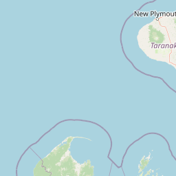
Map view of Kahurangi Marine Reserve

Use this park location map to pinpoint Kahurangi Marine Reserve in New Zealand, understand its exact geographic position, and read its mapped placement within the surrounding landscape more clearly.

Pigeon | © OpenStreetMap contributors

Location context for Kahurangi Marine Reserve

Buller DistrictWest Coast Region
Recorded earthquake history

Explore the Documented Earthquake History of Kahurangi Marine Reserve

Access a structured collection of seismic events recorded near Kahurangi Marine Reserve. This MoriAtlas archive offers a clear view of regional earthquake history, allowing for the review of event magnitudes and epicentre distances without speculating on future hazards or geological causes.

Kahurangi Marine Reserve Earthquake History

Catalogued events

52 events

Strongest magnitude

Magnitude 5.2

Most recent event

Sep 8, 2025

This history includes earthquakes recorded inside the park or within 50 km of its borders

Park atlas

Compare adjacent marine environments, terrestrial reserves, and wild regional geography

Explore Other Parks Near Kahurangi Marine Reserve and Surrounding Protected Coastal Landscapes

Continuing beyond Kahurangi Marine Reserve allows travelers to evaluate nearby national parks and protected coastal landscapes across the rugged South Island shoreline. Examining these adjacent conservation areas reveals broader patterns in marine ecology, rugged coastal geography, and regional habitat connectivity.
Watercolor painting of mountains, green valleys, and a winding river under a soft sky
National parkWest Coast Region
Park boundaries overlap#1 closest

Southeast

Kahurangi National Park: A National Park of Ancient Geology and Diverse Protected Landscapes in New Zealand

Explore the mapped natural terrain and regional geographic context.

Kahurangi National Park is distinguished by its extraordinary geological diversity, representing New Zealand's finest Paleozoic rock sequence and expansive karst features. Covering a vast area in the West Coast Region, it protects a remarkable array of natural landscapes, from coastal cliffs and nikau palm forests to alpine tussock basins and deep gorges. This national park is crucial for understanding New Zealand's natural heritage, offering a rich tapestry of mapped terrain and protected biodiversity for dedicated geographic exploration.

Area
5,193 km²
Established
1996
IUCN
II
Relief
Mixed relief
Protected landscapeNew Zealand
About 32 km away#2 closest

Northeast

North-west Nelson Forest Park: Exploring the Tasman Region Protected Landscape Boundaries

A mapped overview of scattered conservation blocks in South Island, New Zealand.

North-west Nelson Forest Park provides an atlas-style perspective on the evolution of public conservation land in the Tasman region. Once a continuous wilderness, the remaining forest park is characterized by a series of excluded parcels that now border the Kahurangi National Park. This site documents the terrain and geographic distribution of these disparate forest blocks, offering insight into the legacy of land management and protected area formation within the northern South Island.

Established
1970
National parkTasman District
61 km away#3 closest

East

Abel Tasman National Park: Coastal Protected Landscape and Mapped Geography in Tasman District

New Zealand's smallest national park offering iconic coastal hiking and wildlife.

Delve into the mapped boundaries and unique geography of Abel Tasman National Park, New Zealand's smallest national park located in the Tasman District. This protected landscape features renowned golden beaches, forested hills, and vital island ecosystems. Explore its coastal trails, understand its ecological restoration context, and appreciate its historical significance as a site of early European and Māori interaction, making it a key destination for atlas-driven geographic discovery.

Area
237.1 km²
Established
1942
IUCN
II
Relief
Upland
Protected landscapeMarlborough Region
88 km away#4 closest

Southeast

Mount Richmond Forest Park: Geography and Protected Landscapes in the Marlborough Region

Expansive native bush and mountain peak terrain

Mount Richmond Forest Park stands as one of the largest protected forest areas on the South Island of New Zealand. Dominated by dense native bush and rugged subalpine ridges, the park offers a complex topography of river valleys and high-altitude peaks, including its namesake Mount Richmond. It serves as a vital conservation landscape and a core segment of the regional geography between Nelson and the Marlborough district.

Area
1,659 km²
Established
1977
Relief
Mountain
Scope
Terrestrial
National parkWest Coast Region
89 km away#5 closest

South

Paparoa National Park: Detailed Geographic Atlas of Karst Formations and Coastal Terrain

Discover protected landscape boundaries and unique New Zealand geology.

Paparoa National Park, located in the West Coast Region of New Zealand, offers a unique window into complex karst geology and dynamic coastal landscapes. This national park is characterized by extensive limestone cave systems, underground rivers, and the famous Pancake Rocks and Blowholes. The park's geography includes dramatic mountain terrain within the Paparoa Range and a striking coastline, providing a rich dataset for mapping protected area context and understanding regional natural features. It stands apart for its subterranean wonders and eroded limestone formations.

Area
429.7 km²
Established
1987
IUCN
II
Relief
Mountain
National parkNew Zealand
91 km away#6 closest

Southeast

Nelson Lakes National Park: Alpine Geography and Glacial Lakes Atlas

Explore New Zealand's protected mountain terrain and natural landscapes.

Nelson Lakes National Park provides a deep dive into a dramatic alpine environment situated at the northern edge of New Zealand's Southern Alps. This national park is characterized by its striking glacial lakes, Rotoiti and Rotoroa, and the extensive mountain ranges that surround them, offering a rich context for understanding protected land distribution. Explore the park's mapped geography, its distinct beech forest ecosystems, and the rugged natural terrain that makes it a significant feature within the broader South Island landscape.

Area
1,018.8 km²
Established
1956
IUCN
II
Relief
Mountain
Protected landscapeSouth Island
About 127 km away#7 closest

South

Victoria Forest Park: A Deep Dive Into New Zealand's Largest Protected Forest Landscape

Inland West Coast mountain ranges and beech forest ecosystems

Spanning over 200,000 hectares, Victoria Forest Park stands as a defining geographic feature of the South Island. It acts as a critical refuge for endemic species and preserves all five native beech tree types within a massive, continuous protected area. The landscape integrates rugged mountain ranges with deep river valleys and historical industrial artifacts, providing a comprehensive look at the intersection of conservation and regional history.

Area
2,069 km²
Established
1981
Relief
Mountain
Climate
Temperate
A watercolor painting showing a panoramic view of lush green hills leading to a water feature, with soft-colored mountains in the background under a pale sky.
Marine protected areaWest Coast
About 132 km away#8 closest

Southwest

Punakaiki Marine Reserve: Mapped Protected Waters and West Coast Geographic Context

Exploring marine habitats and coastal land-sea corridors

Punakaiki Marine Reserve provides a critical look at marine conservation geography in New Zealand. Located along the West Coast, the reserve encompasses a variety of seafloor substrates and coastal formations that define the boundary between the Tasman Sea and the rugged limestone landscapes of the region. This atlas entry provides essential context for understanding the reserve's role in linking terrestrial and marine ecosystems.

Area
35.2 km²
Established
2014
Relief
Lowland
Climate
Temperate

Common questions about visiting, size, designation, and location context for Kahurangi Marine Reserve

Kahurangi Marine Reserve FAQs for park facts, access, geography, and protected area context

Find quick answers about Kahurangi Marine Reserve, including protected-area facts, park geography, trail and visitor context, and how the park fits into its surrounding country and regional landscape.
MoriAtlas Explorer

Continue Your Protected Areas Search Across the Global Atlas

Deepen your exploration by continuing the structured search for national parks and protected areas worldwide. Utilize the comprehensive filtering capabilities to compare different conservation landscapes and refine your understanding of global park geography. Discover more about the distribution and characteristics of protected natural areas.

Global natural geography