Why North-west Nelson Forest Park stands out
North-west Nelson Forest Park is known first and foremost as the original extensive forest reserve that gave way to Kahurangi National Park, the second largest national park in New Zealand. Its creation in 1970 by merging eight earlier forest parks made it one of the defining early examples of large-scale forest park conservation in the country. The forest park is also known for the long-running dispute over mineral exploration that ultimately pushed conservation groups to seek national park status for the area. Proposals to bulldoze access tracks into the Mount Arthur Tablelands, in particular, became a focal point of the campaign that reshaped the region.
North-west Nelson Forest Park history and protected-area timeline
The history of North-west Nelson Forest Park begins in 1920, when the first forest parks were gazetted in the country north of the Buller River. Over the following decades a total of thirteen separate forest parks were established in this part of the South Island, eight of which were merged in 1970 into the new North-west Nelson Forest Park.
That forest park covered approximately 360,000 hectares on its creation and was managed by the New Zealand Forest Service. In the early years after 1970 much of the tramping track network within the park was reported to be overgrown, and the Forest Service responded with a programme to rebuild tracks and huts for recreational users.
In 1987 the New Zealand Forest Service was amalgamated with other organisations into the newly formed Department of Conservation, which inherited responsibility for the forest park. By the 1990s the exploration activity of mining companies inside the park, including the application by Coronado Global Resources to bulldoze a track to the Mount Arthur Tablelands, had generated widespread public demand for stronger protection.
The result was the 1996 establishment of Kahurangi National Park, which absorbed the majority of North-west Nelson Forest Park together with parts of the Mt Owen and Matiri State Forests. Around sixty parcels were deliberately excluded from that new national park for reasons including hydro-electric generation, grazing leases, sphagnum moss gathering, and mining interests or rights. The largest of these, the Taitapu Block south of the Mangarakau Wetland, was also tied to a Treaty of Waitangi claim.
North-west Nelson Forest Park landscape and geographic character
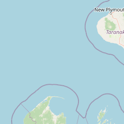
The landscape of North-west Nelson Forest Park in its original form was a vast and largely forested expanse in the north of the South Island, running north of the Buller River and stretching across what is now considered the wider Kahurangi region. The terrain of the surrounding country includes the elevated interior that contains the Mount Arthur Tablelands and the lower-lying valleys and coastal margins of the Tasman region.
Where the old forest park boundary once marked a continuous interior wilderness, today's forest park exists only as scattered excluded blocks around the perimeter of Kahurangi National Park. These include rugged forest parcels near the Buller Gorge, areas adjoining hydro-electric infrastructure, and outlying blocks such as the Taitapu Block south of the Mangarakau Wetland that border coastal lowlands and wetland margins.
North-west Nelson Forest Park ecosystems, habitats, and plant life
Although the source materials describe the park in administrative rather than ecological terms, North-west Nelson Forest Park in its original extent encompassed a substantial slice of the temperate rain forest and rugged upland terrain for which the northwestern South Island is well known. Within that wider setting, the forest park's natural character reflected the same mix of dense indigenous forest, alpine and subalpine plateaus, river valleys, and wetland margins that define the surrounding region.
The remaining forest park fragments, including the Taitapu Block south of the Mangarakau Wetland, retain ecological links to these broader habitats, even though the forest park no longer holds the deep interior forests that were reclassified as national park in 1996.
North-west Nelson Forest Park conservation status and protection priorities
North-west Nelson Forest Park is historically significant in New Zealand conservation because it was the platform from which Kahurangi National Park, the country's second largest national park, was created. The campaign to upgrade the forest park to national park status was driven in part by concerns about mineral exploration, and particularly by the Coronado Global Resources proposal to bulldoze a vehicle route toward the Mount Arthur Tablelands.
The fragmentation of the residual forest park, with around sixty excluded parcels retained under forest park status for hydroelectric, grazing, sphagnum moss, and mining reasons, illustrates how competing land uses shaped the final boundaries of the new national park. The largest excluded block, the Taitapu Block, was retained separately because it was subject to a Treaty of Waitangi claim.
North-west Nelson Forest Park cultural meaning and human context
The cultural context of North-west Nelson Forest Park is closely tied to Treaty of Waitangi settlement processes, most visibly through the exclusion of the Taitapu Block from the 1996 national park creation because it was subject to a Waitangi claim. The forest park's history also reflects the broader New Zealand conversation between conservation interests, recreational users, and extractive industries such as mining, which played a central role in shaping modern protection arrangements in the region.
Top sights and standout views in North-west Nelson Forest Park
North-west Nelson Forest Park is the conservation landscape that effectively birthed Kahurangi National Park, since the great majority of its original 1970 area was reclassified into that national park in 1996. The fact that around sixty parcels were excluded for hydro-electric, grazing, sphagnum moss, and mining reasons left the modern forest park as a distinctive ring of smaller conservation lands around the perimeter of Kahurangi.
The Taitapu Block, surrounding Lake Otuhie south of the Mangarakau Wetland, stands out as the largest remaining forest park parcel and connects the forest park's modern identity to both ecological values and Treaty of Waitangi processes.