
Streams
Park geography
Detailed assessment of regional location, terrain elevation, and natural landscapes
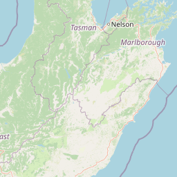
Comprehensive Geographic Profile and Mapped Boundaries of Kahurangi National Park
Review the geographic specifications for Kahurangi National Park, including its 5193 square kilometer extent across the West Coast and Tasman regions of New Zealand. This profile provides data on its northern and southern latitude bounds, peak elevation, and diverse environmental features ranging from coastal cliffs to alpine plateaus.
New Zealand's second-largest national park, protecting geological complexity and alpine biodiversity
Kahurangi National Park
Kahurangi National Park is a vast protected area in the northwest of New Zealand's South Island, established in 1996 as the country's thirteenth national park. Covering 5,193 square kilometres, it is the second largest of New Zealand's thirteen national parks, stretching from the Buller River near Murchison in the south to the base of Farewell Spit in Golden Bay in the north. The park is distinguished by extraordinary geological diversity, representing the most complex and complete sequence of Paleozoic rocks found anywhere in New Zealand. Unlike many iconic New Zealand parks defined by a single dramatic landform, Kahurangi encompasses an exceptional variety of landscapes including mountain ranges, river valleys, deep gorges, elevated peneplains, and one of the country's most extensive karst systems with caves, arches, and natural bridges. The park's ecological significance is equally remarkable, containing approximately eighty percent of all New Zealand's alpine species and around eighteen endemic bird species, earning it description as a 'tectonic ark' that保留了古老的生物多样性。
- Location
- New Zealand
- Park type
- National park
- Established
- 1996
- Area
- 5,193 km²
- Highest point
- 1,795 m
Location overview
Regional positioning and coastal status within the New Zealand atlas
Kahurangi National Park Regional Geography and Location Atlas
Kahurangi National Park sits in New Zealand, spanning the Tasman Region and West Coast Region. The reserve maintains a distinct coastal designation while serving as a key regional conservation zone.
- Countries
- New Zealand
- Regions
- Tasman Region, West Coast Region
- Primary location
- West Coast Region
- Geographic setting
- Coastal
Boundary and coordinates
Spatial dimensions and coordinate limits of a 5,193 square kilometer reserve
Kahurangi National Park Boundary Mapping and Spatial Limits
Geographic boundary outlines trace the spatial layout and land coverage of the protected region. Structured regional measurements detail the estimated area of 5,193 square kilometers alongside coordinate spans and center point metrics.
- Boundary area
- 5,195.2 km²
- Boundary perimeter
- 984.9 km
- Northernmost point
- 40.5077° S
- Southernmost point
- 41.7885° S
- Easternmost point
- 172.9214° E
- Westernmost point
- 171.9928° E
- Geographic centre
- 41.2207° S, 172.4266° E
- North–south span
- 142.2 km
- East–west span
- 78 km
Elevation and terrain
Mixed relief profiles and recorded peaks, saddles, and caves
Kahurangi National Park Terrain and Elevation Geography
Recorded elevation data shows a highest point of 1795 meters across mixed park relief. Linked feature cards supply names, types, and spatial relationships for interior saddles, peaks, and caves.
- Highest point
- 1,795 m
Selected named natural features
Valleys
Limestone Gully
Ridges
Harris Ridge
Streams
Deception Creek
Peaks
Marris Peak
1,313 m
Ridges
Lockett Range
Environmental setting
Temperate climate zones, forest cover, and diverse relief features across the park
Kahurangi National Park Environmental Classifications and Physical Settings
Recorded landscape features and habitat types outline the physical setting of Kahurangi National Park as complementary interpretive categories. Stored environmental classifications link directly to relevant atlas destinations for regional comparison.
- Relief
- Mixed relief
- Climate
- Temperate
- Water
- Major water bodies
- Forest cover
- Mostly forested
- Seasonality
- Seasonal
Landscape features
Mountains · Valleys · Plateau · Cliffs · Canyon · Forest · Woodland · Grassland · Karst · Rivers · Coast · Beach · Cave
Habitat types
Temperate broadleaf forest · Temperate coniferous forest · Boreal forest · Montane forest · Alpine meadow · Grassland · Wetland · Riverine habitat · Lacustrine habitat · Coastal habitat · Karst habitat
Park atlas
Explore the regional geography and connected protected landscapes surrounding Kahurangi National Park in New Zealand's South Island.
Discover Nearby National Parks and Protected Areas Beyond Kahurangi National Park
Browse other national parks and protected areas within New Zealand's South Island, focusing on diverse landscapes adjacent to Kahurangi National Park, including alpine, coastal, and karst environments. Compare the unique geological features, ecological significance, and extensive trail networks across these conservation landscapes for deeper atlas-style park discovery.
Marine protected areaWest Coast Region
Park boundaries overlap#1 closest
Northwest

Kahurangi Marine Reserve: Protected Marine Landscapes and West Coast Geography
Mapped coastal reefs, nīkau forest margins, and subtidal habitats
Located in New Zealand's West Coast Region, Kahurangi Marine Reserve protects 16 kilometres of coastline and extends five kilometres offshore. The reserve is defined by its layered marine profile, ranging from boulder-strewn beaches to complex rocky reefs and expansive mud and sand seabeds. It serves as a vital protected counterpart to Kahurangi National Park, fostering habitats for Hector's dolphins and diverse reef communities within its remote and rugged geography.
- Area
- 84.19 km²
- Established
- 2014
- Relief
- Lowland
- Climate
- Temperate
Protected landscapeNew Zealand
About 2 km away#2 closest
North
North-west Nelson Forest Park: Exploring the Tasman Region Protected Landscape Boundaries
A mapped overview of scattered conservation blocks in South Island, New Zealand.
North-west Nelson Forest Park provides an atlas-style perspective on the evolution of public conservation land in the Tasman region. Once a continuous wilderness, the remaining forest park is characterized by a series of excluded parcels that now border the Kahurangi National Park. This site documents the terrain and geographic distribution of these disparate forest blocks, offering insight into the legacy of land management and protected area formation within the northern South Island.
- Established
- 1970
National parkTasman District
2.9 km away#3 closest
Northeast
Abel Tasman National Park: Coastal Protected Landscape and Mapped Geography in Tasman District
New Zealand's smallest national park offering iconic coastal hiking and wildlife.
Delve into the mapped boundaries and unique geography of Abel Tasman National Park, New Zealand's smallest national park located in the Tasman District. This protected landscape features renowned golden beaches, forested hills, and vital island ecosystems. Explore its coastal trails, understand its ecological restoration context, and appreciate its historical significance as a site of early European and Māori interaction, making it a key destination for atlas-driven geographic discovery.
- Area
- 237.1 km²
- Established
- 1942
- IUCN
- II
- Relief
- Upland
National parkNew Zealand
8.3 km away#4 closest
South
Nelson Lakes National Park: Alpine Geography and Glacial Lakes Atlas
Explore New Zealand's protected mountain terrain and natural landscapes.
Nelson Lakes National Park provides a deep dive into a dramatic alpine environment situated at the northern edge of New Zealand's Southern Alps. This national park is characterized by its striking glacial lakes, Rotoiti and Rotoroa, and the extensive mountain ranges that surround them, offering a rich context for understanding protected land distribution. Explore the park's mapped geography, its distinct beech forest ecosystems, and the rugged natural terrain that makes it a significant feature within the broader South Island landscape.
- Area
- 1,018.8 km²
- Established
- 1956
- IUCN
- II
- Relief
- Mountain
Protected landscapeMarlborough Region
20 km away#5 closest
Southeast
Mount Richmond Forest Park: Geography and Protected Landscapes in the Marlborough Region
Expansive native bush and mountain peak terrain
Mount Richmond Forest Park stands as one of the largest protected forest areas on the South Island of New Zealand. Dominated by dense native bush and rugged subalpine ridges, the park offers a complex topography of river valleys and high-altitude peaks, including its namesake Mount Richmond. It serves as a vital conservation landscape and a core segment of the regional geography between Nelson and the Marlborough district.
- Area
- 1,659 km²
- Established
- 1977
- Relief
- Mountain
- Scope
- Terrestrial
National parkWest Coast Region
23 km away#6 closest
Southwest
Paparoa National Park: Detailed Geographic Atlas of Karst Formations and Coastal Terrain
Discover protected landscape boundaries and unique New Zealand geology.
Paparoa National Park, located in the West Coast Region of New Zealand, offers a unique window into complex karst geology and dynamic coastal landscapes. This national park is characterized by extensive limestone cave systems, underground rivers, and the famous Pancake Rocks and Blowholes. The park's geography includes dramatic mountain terrain within the Paparoa Range and a striking coastline, providing a rich dataset for mapping protected area context and understanding regional natural features. It stands apart for its subterranean wonders and eroded limestone formations.
- Area
- 429.7 km²
- Established
- 1987
- IUCN
- II
- Relief
- Mountain
Protected landscapeSouth Island
About 56 km away#7 closest
Southwest
Victoria Forest Park: A Deep Dive Into New Zealand's Largest Protected Forest Landscape
Inland West Coast mountain ranges and beech forest ecosystems
Spanning over 200,000 hectares, Victoria Forest Park stands as a defining geographic feature of the South Island. It acts as a critical refuge for endemic species and preserves all five native beech tree types within a massive, continuous protected area. The landscape integrates rugged mountain ranges with deep river valleys and historical industrial artifacts, providing a comprehensive look at the intersection of conservation and regional history.
- Area
- 2,069 km²
- Established
- 1981
- Relief
- Mountain
- Climate
- Temperate
Marine protected areaWest Coast
About 79 km away#8 closest
Southwest
Punakaiki Marine Reserve: Mapped Protected Waters and West Coast Geographic Context
Exploring marine habitats and coastal land-sea corridors
Punakaiki Marine Reserve provides a critical look at marine conservation geography in New Zealand. Located along the West Coast, the reserve encompasses a variety of seafloor substrates and coastal formations that define the boundary between the Tasman Sea and the rugged limestone landscapes of the region. This atlas entry provides essential context for understanding the reserve's role in linking terrestrial and marine ecosystems.
- Area
- 35.2 km²
- Established
- 2014
- Relief
- Lowland
- Climate
- Temperate
MoriAtlas Explorer
Continue Your Atlas Exploration of Kahurangi National Park's Mapped Geography and Protected Landscapes
Venture deeper into the structured geographic context of Kahurangi National Park. Understand its position within the West Coast Region and the unique protected landscape features that define this significant national park. Continue to explore its mapped terrain and geological wonders to build a comprehensive understanding of New Zealand's protected areas.
Browse next
Global natural geography
Explore related park routes
Explore MoriAtlas Global ParksBrowse All MoriAtlas ParksGlobal Park Map DiscoveryMoriAtlas: Browse All CountriesBrowse All MoriAtlas ContinentsNational Park Environment AtlasGrand Canyon National Park AtlasYellowstone National Park AtlasYosemite National Park Atlas and GeographySerengeti National Park AtlasGalápagos National Park Protected LandscapeBanff National Park Geography and AtlasKruger National Park Atlas EntryUluṟu-Kata Tjuṯa National Park AtlasExplore Uluru-Kata Tjuta National Park GeographyPlitvice Lakes National Park AtlasFiordland National Park Protected LandscapeGreat Smoky Mountains National Park AtlasAfghanistan National Parks and Protected AreasAlbania National Parks and Protected AreasAlgeria National Parks and Protected AreasAmerican Samoa National Parks and Protected AreasAndorra National Parks and Protected AreasAngola National Parks and Protected AreasAntarctica National Parks and Protected AreasAntigua and Barbuda Park List