
Waterfalls
Park geography
Analyzing Mountainous Terrain, Regional Extents, and Natural Landscape Features
Detailed Geographic Profile and Boundary Mapping of Katon-Karagay National Park
Review the comprehensive geographic framework of Katon-Karagay National Park located within the East Kazakhstan Region. This profile details the 6435 square kilometer protected area, mapping its expansive mountain terrain, diverse habitat zones, and specific peak clusters throughout the region.
Kazakhstan's largest protected area spanning the Southern Altai Mountains at the crossroads of four nations
Katon-Karagay National Park
Katon-Karagay National Park is the largest national park in Kazakhstan, occupying a spectacular stretch of the Southern Altai Mountains on the country's eastern edge. The park sits at a remarkable geographic crossroads where the borders of Kazakhstan, Russia, China, and Mongolia converge, creating a mountainous landscape of exceptional ecological diversity. Established in 2001, this protected area encompasses over 643,000 hectares of glaciated peaks, alpine meadows, and forested valleys that represent some of the most pristine terrain in Central Asia. The park protects the western slopes of the Altai range, including portions of the Katun Range that hold Belukha Mountain, the highest summit in the South Siberian Mountains at 4,506 meters. This location at the biogeographic divide between Siberian coniferous forests and the cold deserts of Central Asia has produced an extraordinary mosaic of habitats and species.
- Location
- Kazakhstan
- Park type
- National park
- Established
- 2001
- Area
- 6,435 km²
Location overview
Administrative boundaries and regional placement in East Kazakhstan
Geographic Location of Katon-Karagay National Park in Kazakhstan
Katon-Karagay National Park is situated entirely within the East Kazakhstan Region of Kazakhstan. Regional records outline the administrative positioning and single country status of the protected area.
- Countries
- Kazakhstan
- Regions
- East Kazakhstan Region
- Primary location
- East Kazakhstan Region
- Geographic setting
- Inland
Boundary and coordinates
Mapping over 6,435 square kilometers of protected regional terrain
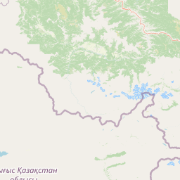
Katon-Karagay National Park Geographic Boundary Map Explorer
Interactive boundary mapping outlines the precise spatial footprint of the reserve. Geographic profiles detail the total area of 6435 square kilometers alongside calculated coordinate centers and regional spans.
- Boundary area
- 6,709.7 km²
- Boundary perimeter
- 1,131.2 km
- Northernmost point
- 49.8127° N
- Southernmost point
- 48.9042° N
- Easternmost point
- 87.3156° E
- Westernmost point
- 84.9154° E
- Geographic centre
- 49.3237° N, 86.2262° E
- North–south span
- 101 km
- East–west span
- 174.4 km
Terrain and natural features
Mountain classification and recorded natural features across protected geography
Katon-Karagay National Park Terrain And Named Natural Features
Mountain terrain classifications govern the protected landscape alongside recorded named natural features located within the park boundary. Linked feature cards supply verified names, structural types, and spatial relationships for each entry.
Selected named natural features
Rivers
Фомина
Ridges
Қынжал жотасы
Rivers
Курту
Peaks
Теснинский Белок
2,574 m
Peaks
Көкқошқар
Environmental setting
Temperate mountain relief, forest cover, and seasonal habitat categories
Katon-Karagay National Park Environmental Classifications and Terrain Settings
Recorded landscape features and habitat types provide complementary perspectives on the physical setting of Katon-Karagay National Park. Stored classifications link directly to related environmental records and regional atlas destinations.
- Relief
- Mountain
- Climate
- Temperate
- Water
- Minor water
- Forest cover
- Partial forest
- Seasonality
- Seasonal
Landscape features
Mountains · Glacier · Rivers · Waterfalls · Forest · Valleys
Habitat types
Temperate broadleaf forest · Temperate coniferous forest · Boreal forest · Alpine meadow · Grassland · Steppe · Riverine habitat
Park atlas
Explore Protected Landscapes, Mountainous Terrain, and Regional Context Beyond Katon-Karagay National Park
Explore Nearby Protected Areas Around Katon-Karagay National Park and the Altai Mountains
After exploring Katon-Karagay National Park, continue your geographic discovery by browsing other protected areas within Kazakhstan and across the broader Altai Mountain region. This contextual view helps compare diverse mountain landscapes, glaciated peaks, and alpine ecosystems, tracing connected conservation efforts around this Central Asian crossroads.
Nature reserveEast Kazakhstan Region
About 33 km away#1 closest
Southwest

Markakol Nature Reserve: Mapping the Protected Mountain Landscapes of East Kazakhstan
High-altitude glacial lake and alpine tundra ecosystems
Markakol Nature Reserve protects a remote tectonic depression within the Southern Altai. The area features a complex vertical zonation of fir and spruce forests, subalpine meadows, and alpine tundra, centered around the pristine and ecologically significant Lake Markakol. This protected site serves as a vital study of the intersection between Siberian boreal influences and high-mountain steppe biodiversity.
- Area
- 1,029.71 km²
- Established
- 1976
- IUCN
- Ia
- Relief
- Mountain
National parkBayan-Ölgii Province
37 km away#2 closest
Southeast

Altai Tavan Bogd National Park: Protected Mountainous Landscape in Bayan-Ölgii
Explore mapped geography and protected terrain.
Altai Tavan Bogd National Park, situated in Mongolia's Bayan-Ölgii Province, offers a detailed view of a significant protected natural area. This park is defined by its mountainous geography, forming a key part of the Altai range. Users can explore its mapped boundaries and understand its role as a protected landscape within the western Mongolian atlas.
- Area
- 6,362 km²
- Established
- 1996
- IUCN
- II
- Relief
- Mountain
National parkAltai Republic
About 82 km away#3 closest
East

Saylyugemsky National Park: Discover its Protected Landscape and Geographic Significance in Altai Republic
Mapped boundaries and regional landscape context within the Altai Republic.
Delve into Saylyugemsky National Park, a designated national park situated within the vast geographic expanse of Russia's Altai Republic. This canonical page provides detailed insights into its protected landscape, meticulously mapped boundaries, and its contribution to the regional geography. MoriAtlas focuses on structured geographic discovery, enabling a deeper understanding of Saylyugemsky National Park's place within the atlas of protected areas and natural landscapes.
- Area
- 1,183.8 km²
- Established
- 2012
- IUCN
- II
- Relief
- Mountain
Nature reserveKazakhstan
About 101 km away#4 closest
Northwest
West Altai State Nature Reserve: Protected Mountain Taiga and Alpine Geography in Kazakhstan
An ecological atlas of the Western Altai mountain system
Spanning the Ivanovsky and Uba ranges, this nature reserve protects a diverse terrain of mountain taiga, glacial cirques, and high-mountain bogs. It remains a key conservation landscape for Central Asian biodiversity, anchoring the headwaters of the Uba River within a striking environment of granite pillars and alpine meadows.
- Area
- 861.22 km²
- Established
- 1992
- Relief
- Mountain
- Climate
- Boreal
Nature reserveXinjiang
About 149 km away#5 closest
South

Altay Kokesu Wetland National Nature Reserve: Protected Landscape and Regional Map
A diverse wetland corridor in the Xinjiang region
Spanning over 300 square kilometers, the Altay Kokesu Wetland National Nature Reserve represents a key protected entity within the Altai grasslands. This area supports a unique hydrological convergence of the Irtysh and Kran rivers, resulting in a rare ecological mosaic of meadows, marshes, and desert-steppe transition zones. Users can explore the reserve's topography and its critical role in maintaining water-fed habitats for regional bird populations.
- Area
- 306.67 km²
- Established
- 2001
- Relief
- Lowland
- Climate
- Arid
National parkBayan-Ölgii Province
About 273 km away#6 closest
East
Tsambagarav Uul National Park: Mapped Protected Landscape in Bayan-Ölgii
Explore its geographic context and park boundaries.
Tsambagarav Uul National Park offers a detailed look at a significant protected landscape situated in Mongolia's western Bayan-Ölgii Province. This national park's boundaries are mapped to provide context within the broader Altai Mountains region. Users can explore the park's geographic setting, understanding its contribution to the protected natural areas of western Mongolia and its significance for regional landscape studies.
- Area
- 1,110 km²
- Established
- 2000
- IUCN
- II
- Relief
- Mountain
National parkEast Kazakhstan Region
283 km away#7 closest
Southwest
Tarbagatai National Park: Protected Landscape and Wild Fruit Tree Forests in East Kazakhstan Region
Explore the mapped boundaries and ecosystem of this national park.
Tarbagatai National Park is a protected area in East Kazakhstan recognized for its unique role in conserving wild fruit tree forests that have maintained genetic isolation. This national park provides a detailed view of a mountain-steppe ecosystem across the Tarbagatai mountain range, Karabas Mountains, and Arkaly Mountains, along with the Urzhar and Emel river valleys. Its establishment in 2018 highlights its importance for biodiversity and the study of natural forest genetics, offering significant geographic context for regional protected land exploration.
- Area
- 1,364 km²
- Established
- 2018
- IUCN
- II
- Relief
- Mountain
National parkTashtagolsky District
About 329 km away#8 closest
North
Shorsky National Park: Protected Taiga and Karst Landscapes in Tashtagolsky District
Mapping the mountainous wilderness of southern Siberia
Shorsky National Park protects vast swathes of dark taiga forest and dramatic karst features across 4,180 square kilometers of rugged mountain terrain. Explore the geography of this Siberian region, featuring over 60 named caves, deep river valleys, and significant rock formations that define the natural character of the Tashtagolsky District.
- Area
- 4,180 km²
- Established
- 1989
- IUCN
- II
- Relief
- Mountain
MoriAtlas Explorer
Continue Exploring Katon-Karagay National Park's Geographic and Protected Landscape Context
Delve deeper into the specific atlas-driven details of Katon-Karagay National Park. Understanding its protected boundaries, distinct mountain terrain, and placement within East Kazakhstan Region offers crucial insights for geographic exploration. Discover the mapped context that defines this significant protected area and its relation to the broader Central Asian landscape, providing a structured approach to understanding natural park territories.
Browse next
Global natural geography
Explore related park routes
Explore MoriAtlas Global ParksBrowse All MoriAtlas ParksGlobal Park Map DiscoveryMoriAtlas: Browse All CountriesBrowse All MoriAtlas ContinentsNational Park Environment AtlasGrand Canyon National Park AtlasYellowstone National Park AtlasYosemite National Park Atlas and GeographySerengeti National Park AtlasGalápagos National Park Protected LandscapeBanff National Park Geography and AtlasKruger National Park Atlas EntryUluṟu-Kata Tjuṯa National Park AtlasExplore Uluru-Kata Tjuta National Park GeographyPlitvice Lakes National Park AtlasFiordland National Park Protected LandscapeGreat Smoky Mountains National Park AtlasAfghanistan National Parks and Protected AreasAlbania National Parks and Protected AreasAlgeria National Parks and Protected AreasAmerican Samoa National Parks and Protected AreasAndorra National Parks and Protected AreasAngola National Parks and Protected AreasAntarctica National Parks and Protected AreasAntigua and Barbuda Park List