
Mori Atlas logo
Nature reserveWest Altai State Nature Reserve

Mapping the ridges, alpine wetlands, and granite formations of Eastern Kazakhstan

West Altai State Nature Reserve: A Detailed Geographic Atlas of Mountain Taiga Landscapes

(West Altai State Nature Reserve (Kazakh: Батыс Алтай мемлекеттiк табиғи қорығы))

The West Altai State Nature Reserve spans over 86,000 hectares in the western Altai mountain system, preserving a vital ecological mosaic of dark-conifer forests, high-altitude bogs, and crystalline river headwaters. From the rugged peaks of the Kholzun and Ivanovsky ranges to the striking granite pillars of the Lineyskiye Stolby, this protected area serves as a critical reference site for Central Asian mountain taiga ecosystems and glacial landforms.

mountainsmountain taigadark conifer forestSiberian pinealpine meadowsglacial lakes
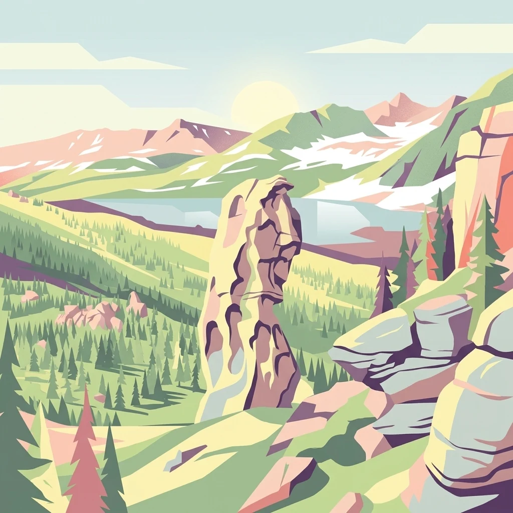
A digital illustration of a mountain valley with a tall rock formation in the center, surrounded by green pine trees, a blue lake, and snow-capped mountains in the distance under a pale sky.

West Altai State Nature Reserve

Nature reserve

Park overview

Structured park overview, official facts, and landscape profile for West Altai State Nature Reserve

West Altai State Nature Reserve park facts, protected area profile, and essential visitor context

Review the core facts for West Altai State Nature Reserve, including designation, size, terrain, visitor scale, habitats, and operating context in one park-focused overview.

About West Altai State Nature Reserve

The West Altai State Nature Reserve is a comparatively young but ecologically significant protected area in eastern Kazakhstan. It was established by decree of the Supreme Soviet of Kazakhstan on 3 July 1992 with the goal of preserving the biogeocenoses of the Altai mountain system in the western, Kazakh portion of the range. The reserve covers more than 86,000 hectares, spanning two administrative districts near the city of Ridder, and includes several distinct mountain ridges that shape its terrain and ecological character.

The protected area lies squarely within the South Siberian mountain province and its landscape reflects a strong vertical zonation. Lower slopes are cloaked in dark conifer forests of fir, Siberian pine, spruce, and larch, while higher elevations give way to subalpine meadows, alpine tundra vegetation, rocky outcrops, glacial cirques, and moraines. The granite pillars of Lineysky Belok, on the crest of the Kholzun range, form a distinctive landmark shaped by geological processes and weather into dramatic rock formations, sometimes referred to as the Lineyskiye Stolby. Water systems across the reserve are equally varied, with snowmelt-fed mountain rivers, dozens of small streams, high-mountain bogs, and glacial lakes such as Kedrovoye and Shcherbakovoye.

Beyond its natural value, the reserve carries a strong conservation remit. Its IUCN classification as a strict nature reserve reflects the highest level of protection within the national system of protected areas. In 2020, the West Altai Reserve was inscribed into the UNESCO World Network of Biosphere Reserves, formalizing its role as a reference site for monitoring and safeguarding Central Asian mountain taiga. Today it functions not only as a sanctuary for wildlife and habitat but also as a platform for scientific observation, ecological recovery research, and environmental education in the region.

Quick facts and research context for West Altai State Nature Reserve

The West Altai State Nature Reserve lies in the East Kazakhstan Region, near the city of Ridder, close to Kazakhstan's border with the Russian Altai Republic. It was established in 1992 to protect the biogeocenoses of the Altai mountain system. The area is classified as a strict nature reserve on the IUCN scale and is administered under the country's forestry and wildlife committee.

Roughly two-thirds of the territory is forested, dominated by fir, Siberian pine, larch, and spruce. The remainder consists of alpine meadows, subalpine vegetation, rocky outcrops, glacial lakes, and high-mountain wetlands. In 2020 the reserve was included in the UNESCO World Network of Biosphere Reserves.

Protection and recognition

Terrestrial protected area records and official designation history for West Altai State Nature Reserve.

West Altai State Nature Reserve Protection Status and Designation Records

West Altai State Nature Reserve holds a documented terrestrial protection status established in the year 2020. Official records compile the designation history and management scope associated with this protected natural area.

Protection details

Protection scope
Terrestrial
Designated year
2020
Transboundary protection
No
Park context

Deeper park guide and search-rich context for West Altai State Nature Reserve

West Altai State Nature Reserve history, landscape, wildlife, and travel context

Explore West Altai State Nature Reserve through its history, landscape character, ecosystems, wildlife, conservation priorities, cultural context, and seasonal travel timing in a structured park guide built for atlas discovery and search intent.

Why West Altai State Nature Reserve stands out

The West Altai Reserve is best known for protecting a representative tract of Central Asian mountain taiga in the western reaches of the Altai range. Its landscapes combine dense dark-conifer forests, snowmelt-fed rivers, glacial lakes, and high-mountain bogs with striking granite formations such as the Lineyskiye Stolby pillars on Mount Lineysky Belok. It is also recognized for preserving complete populations of taiga wildlife, including brown bear, lynx, sable, maral deer, and a rich bird community that includes rare raptors and the black stork. The reserve's inclusion in the UNESCO World Network of Biosphere Reserves gives it international recognition as a model site for mountain taiga conservation.
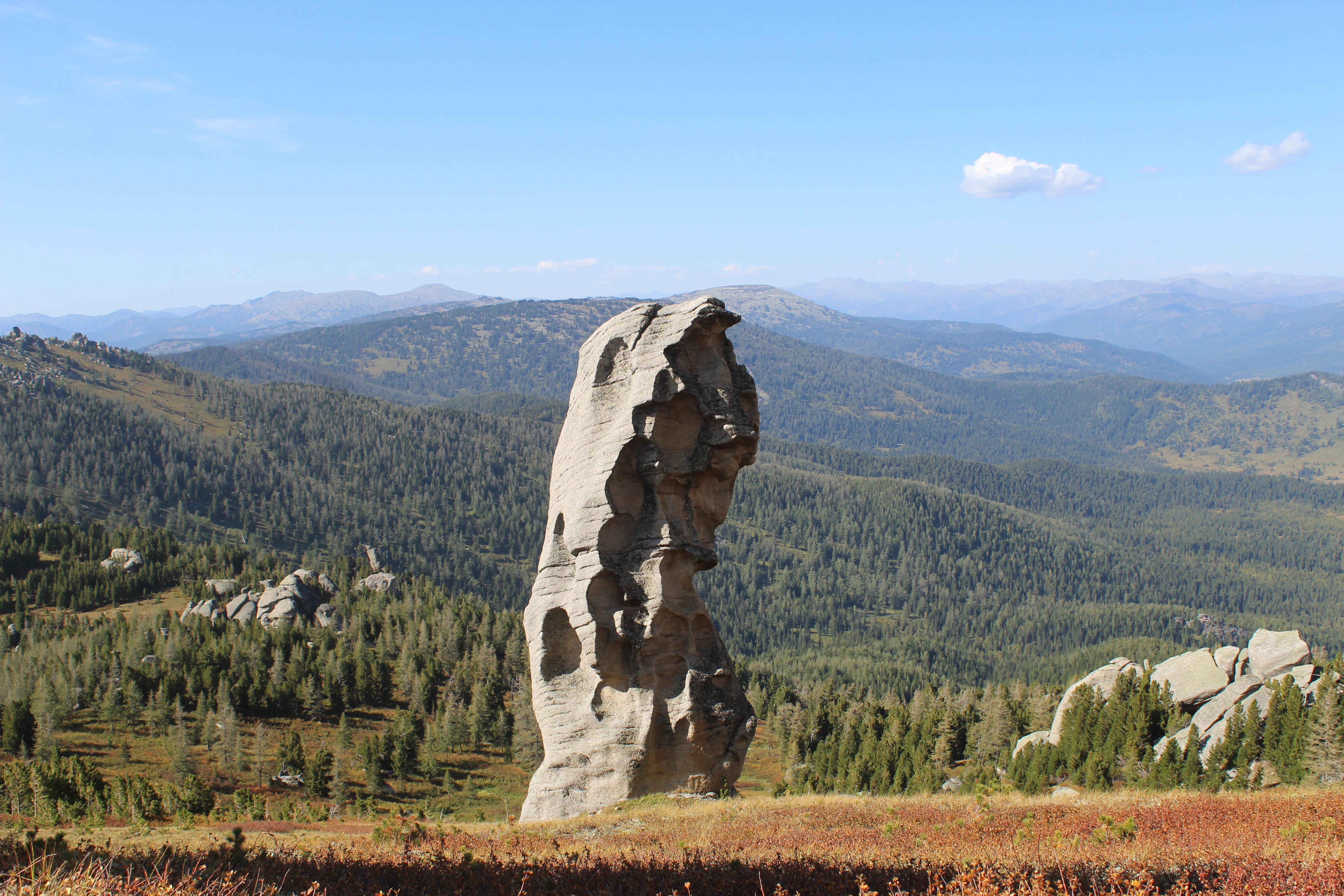
A tall, weathered granite rock pillar stands centrally in a mountainous landscape covered in green coniferous forest under a blue sky with scattered clouds.
The Lineyskie Pillars, a prominent granite rock formation rising above the taiga forest in the West Altai State Nature Reserve.

West Altai State Nature Reserve history and protected-area timeline

The West Altai State Nature Reserve was established on 3 July 1992 by decree of the Supreme Soviet of Kazakhstan, becoming one of the country's early post-independence nature reserves. Its creation responded to a long history of pressure on the western Altai forests, where timber cutting and hunting had degraded ecosystems before protection was imposed.

During the Soviet era, parts of the territory had been subject to commercial logging and fur-trapping, leaving some slopes heavily depleted. The 1992 reserve designation formally withdrew these lands from exploitation and placed them under state protection. Over subsequent decades, the reserve worked to restore damaged forest cover, with natural regeneration supported along steep and inaccessible slopes where timber extraction had been difficult.

A significant milestone came in 2020, when the reserve was added to the UNESCO World Network of Biosphere Reserves. The recognition underscored the area's importance as a model region for the conservation of South Siberian mountain taiga and reflected growing scientific interest in the reserve's flora, fauna, and recovery dynamics. The reserve's central office remains based in the city of Ridder in East Kazakhstan Region.

West Altai State Nature Reserve landscape and geographic character

The reserve lies within the northwestern part of the Altai mountain system and follows the rugged relief of several parallel ranges. The principal ridges within or bordering its territory are Ivanovsky, Uba, Ulbi, and Kholzun, with peaks reaching roughly 2,200 to 2,800 meters depending on how ridges are delineated. The highest point within the reserve is reported as the summit of Lineysky Belok on the Kholzun range at about 2,598 meters.

Geologically, the mountains are products of long tectonic evolution, with foundations laid in the Precambrian and early Paleozoic and finalized during Hercynian folding. Permian intrusions, Devonian sedimentary layers, and Quaternary deposits together form the visible structure of the area. The present-day relief combines tectonic shaping, glacial features, and widespread water erosion. The mid-mountain zone especially shows deeply cut river valleys, while high-mountain zones retain cirques, kars, and moraines from former glaciation.

A particularly distinctive feature is the granite outcrops of Lineysky Belok, whose erosion has produced striking columnar landforms known as the Lineyskiye Stolby. These weathering remnants rise along the ridge crest and are often compared to similar granite pillars elsewhere in Central Asia. The reserve is also notable for its dense network of rivers and streams; key watercourses include the Belaya Uba and Chernaya Uba, which join to form the Uba River, an important tributary of the Irtysh. Small glacial lakes and high-mountain bogs, including the large Gulbishche bog, add ecological and scenic depth to the terrain.
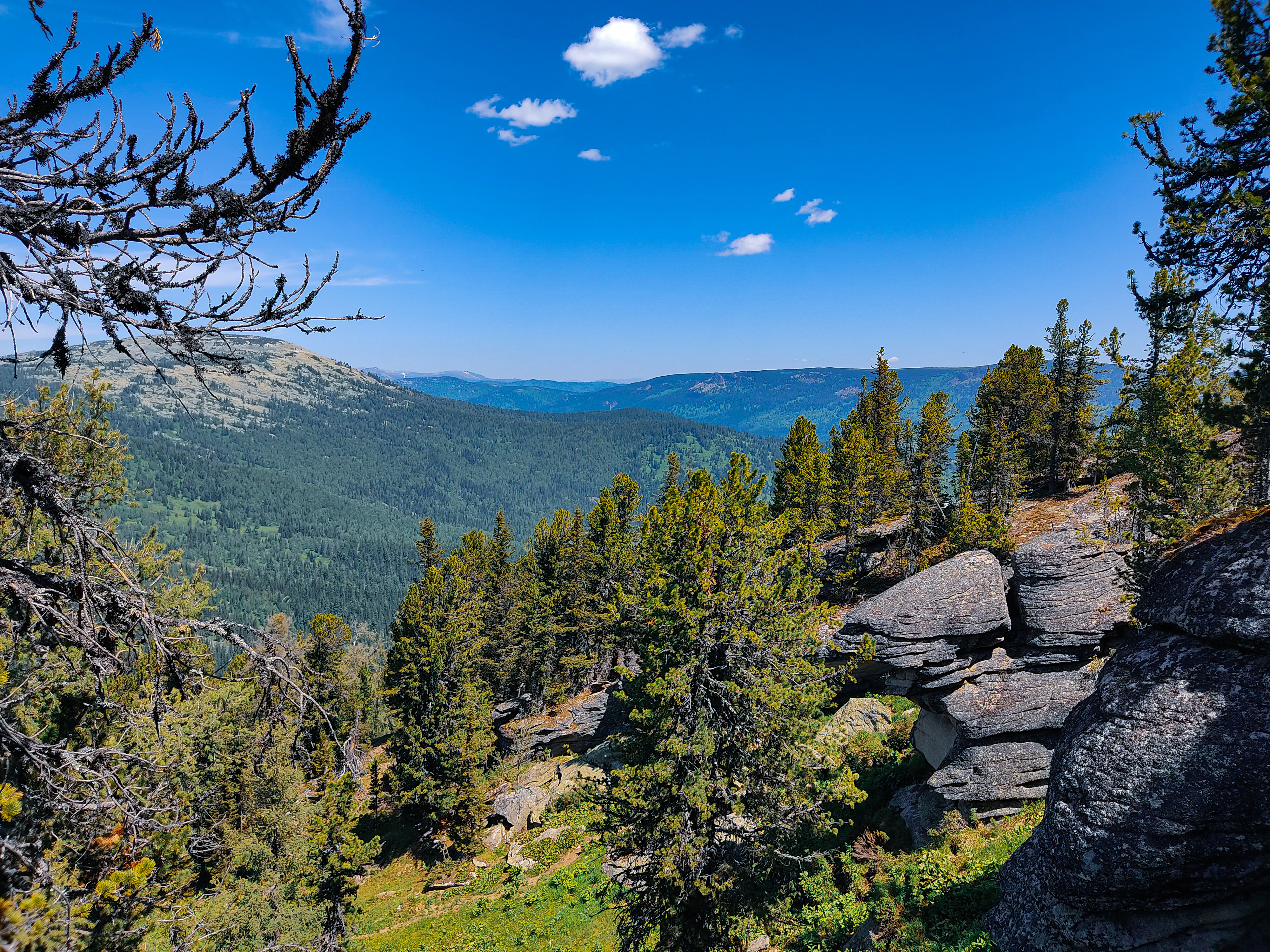
A scenic view from a rocky ridge featuring layered grey rocks in the foreground, dense green coniferous forests covering rolling mountains in the midground, and a bright blue sky with scattered clouds.
The Bastion rock ridge overlooking a forested mountain valley under a blue sky.

West Altai State Nature Reserve ecosystems, habitats, and plant life

The vegetation of the West Altai Reserve reflects a strong elevation gradient. Dark coniferous taiga dominates the forested belt, with fir, Siberian pine, larch, and spruce forming dense stands across the slopes. The Russian source lists fir as the most common species, followed closely by Siberian pine, with larch and spruce also prominent, while small areas of birch and aspen occupy disturbed sites and clearings.

Above the forest line, the landscape shifts to subalpine and alpine vegetation. Subalpine meadows, alpine tundra-like communities, and rocky plant cover occupy the upper elevations. The reserve is reported to host more than 800 vascular plant species, with a subset listed in Kazakhstan's Red Data Book, including rare relicts such as Siberian pine stands that survive as fragments of older plant communities.

Non-forested habitats make up roughly one-third of the reserve area and include alpine meadows, rocky slopes, glacial lakes, mountain streams, and extensive upper wetlands. The Gulbishche bog in the headwaters of the Chernaya Uba is the largest high-mountain bog in the western Altai. Together, these habitats form a representative cross-section of South Siberian mountain ecosystems and a refuge for plant species that have disappeared from more disturbed areas elsewhere in the region.
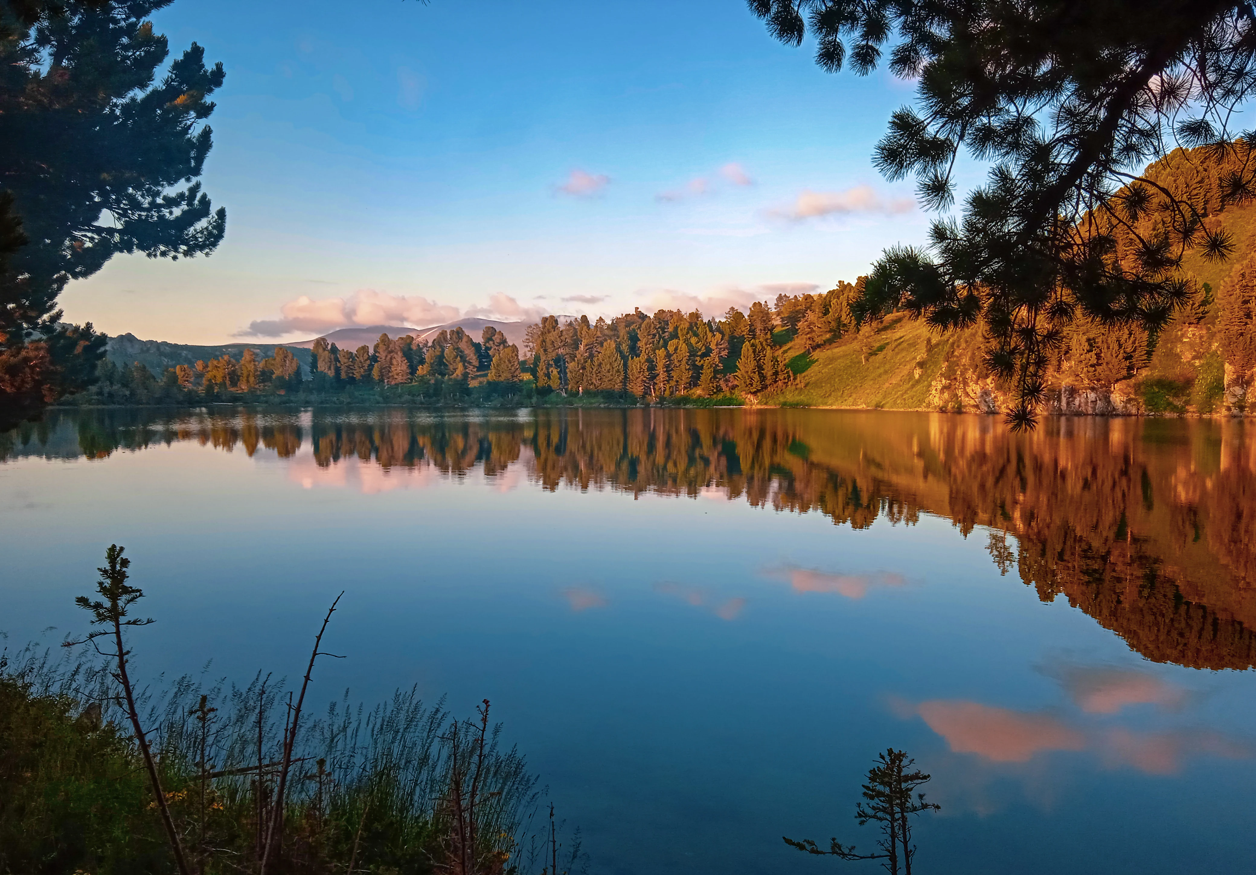
A calm lake reflecting a blue sky with pink clouds and a forested hillside, framed by pine trees in the foreground.
Kedrovoye Lake reflecting the surrounding forested hills and sky during golden hour.

West Altai State Nature Reserve wildlife and species highlights

The reserve supports a typical mountain-taiga fauna of the Central Asian portion of the Altai. Its mammal community includes brown bear, lynx, sable, ermine, weasel, Altai pika, Siberian chipmunk, squirrel, and mountain hare. Three ungulates are present: elk, maral (a local subspecies of red deer), and roe deer. Moose reappeared in the reserve in the 1970s after a long absence, and maral expanded into the area in later decades. Beaver were first recorded in 2008, while American mink appears as an acclimatized species. Wild boar is rare and only occasionally enters the reserve, and wolves and foxes are also part of the predator community.

The bird fauna is reported at roughly 160 species, with around 120 known to breed in the reserve. Several rare species listed in Kazakhstan's Red Data Book are confirmed, including black stork, golden eagle, saker falcon, common crane, and eagle owl, while the saker-related hierofalcon is documented during migration. Additional species, such as the corncrake and the yellow-breasted bunting, appear on international lists as globally threatened.

Herpetofauna is limited but includes two amphibian and four reptile species. The ichthyofauna of the reserve's rivers and lakes remains incompletely studied, but early data lists about five fish species, including the taimen, which is itself a Red Data Book species.
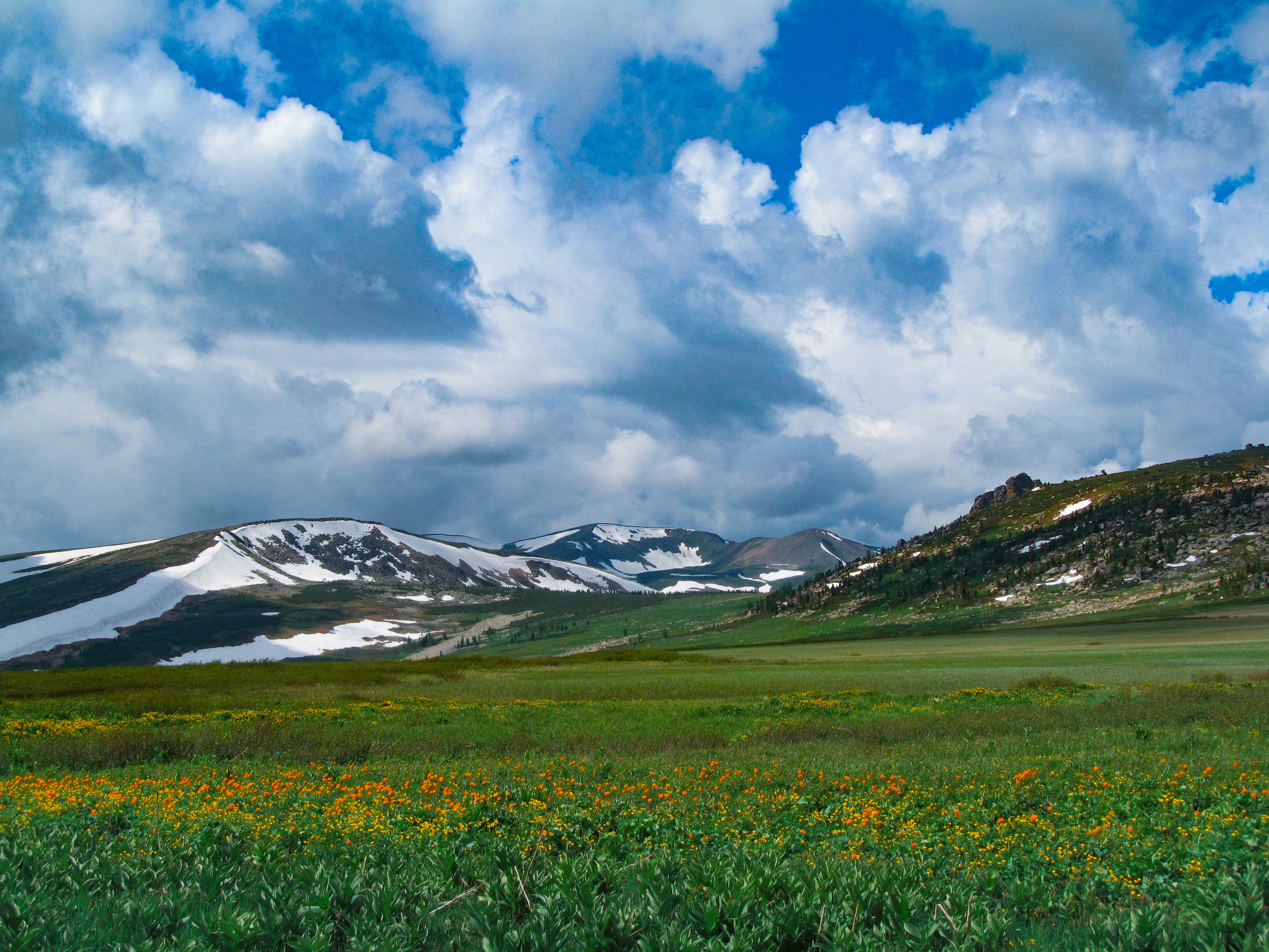
A wide landscape showing a green meadow dotted with yellow wildflowers in the foreground, leading to snow-capped mountains under a bright blue sky with large white clouds.
Gulbishe alpine bog meadow with yellow wildflowers and snow-patched mountains under a dramatic cloudy sky.

West Altai State Nature Reserve conservation status and protection priorities

The West Altai Reserve operates under the highest level of national protection in Kazakhstan, classified as an IUCN Category Ia strict nature reserve. Its core mission is to maintain the natural biogeocenoses of the western Altai in an undisturbed state for scientific study, ecological monitoring, and biodiversity preservation. The reserve falls under the Committee for Forestry and Fauna of the Ministry of Agriculture.

The conservation significance of the reserve lies in several factors. Its forests preserve a representative profile of dark coniferous taiga, including Siberian pine stands of considerable scientific value. Its upper watersheds anchor the hydrological regime for the Belaya Uba and Chernaya Uba, rivers that join to form a major Irtysh tributary, making the reserve important for downstream water quality and flow stability. Its upper wetlands, such as the Gulbishche bog, serve as reservoirs for mountain runoff.

The reserve's inscription in the UNESCO World Network of Biosphere Reserves in 2020 marked international recognition of these functions. Earlier in its history, the territory had sustained significant pressure from logging and fur-trapping, and active recovery of damaged forest stands remains an ongoing focus of management. Long-term natural-process monitoring, the so-called Chronicle of Nature, has been conducted to track forest recovery, wildlife recolonization, and climatic variation across the area.

West Altai State Nature Reserve cultural meaning and human context

The reserve lies in the Kazakh sector of the Altai, a region long inhabited by Altaian and Kazakh communities who engaged in mountain taiga hunting, seasonal grazing, and forest-resource use. Place names such as the Russian-style Lineysky Belok and the Rusty Altai references in the sources reflect a layering of Russian and Kazakh cultural heritage that shaped the area before it was formally protected.

Prior to the reserve's establishment in 1992, the territory experienced logging and commercial furbearer hunting as part of wider forestry activity across the western Altai. The 1992 designation effectively ended large-scale extractive use and reshaped the human relationship with the landscape, shifting it toward conservation, scientific study, and limited nature-based activity. The reserve's headquarters in Ridder reflects the integration of conservation administration with the surrounding region's industrial and residential center.
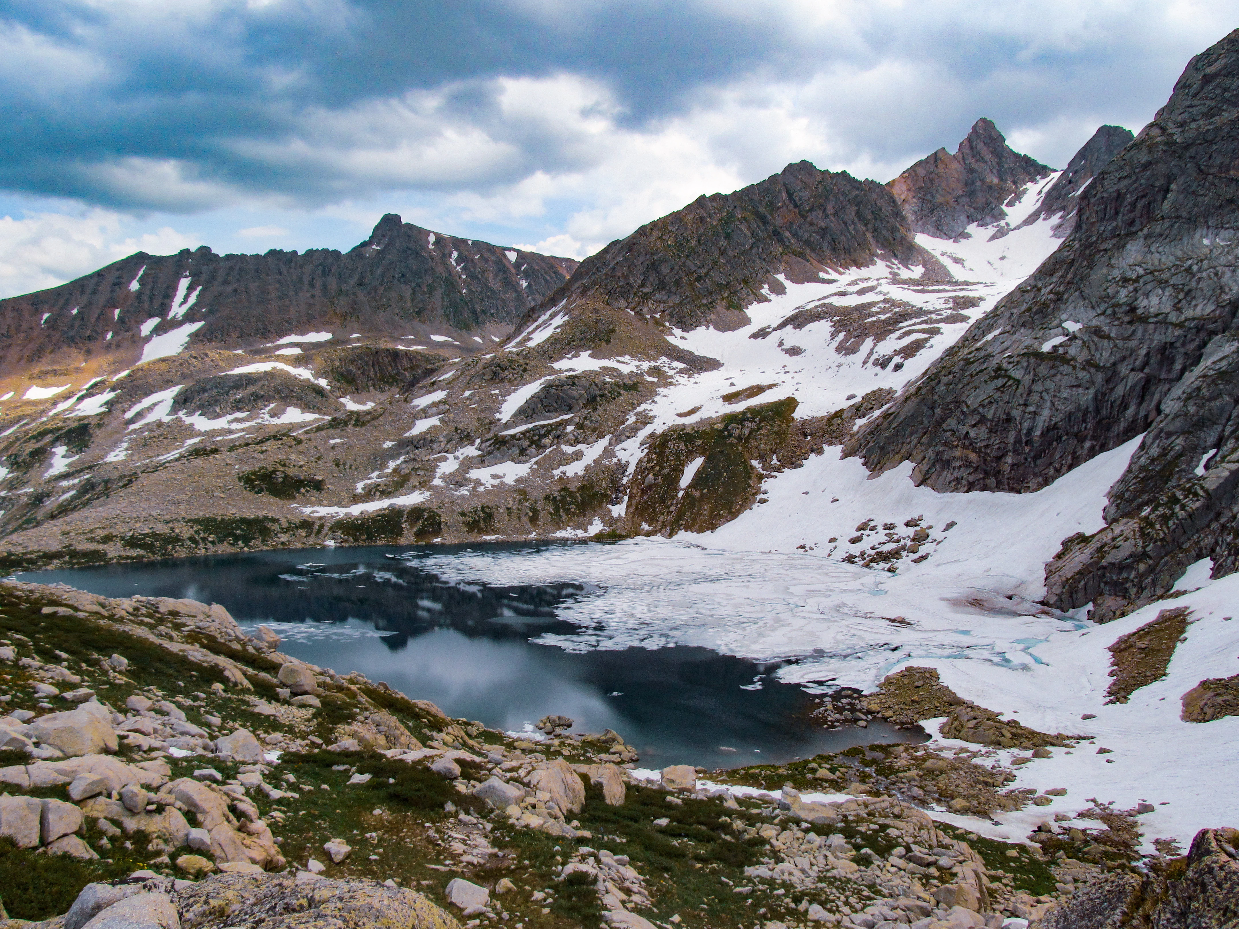
A partially frozen alpine lake surrounded by rocky mountains with snow patches under a cloudy sky.
Second Turgusun Lake, a partially frozen alpine lake surrounded by rocky peaks in the West Altai State Nature Reserve.

Top sights and standout views in West Altai State Nature Reserve

The West Altai Reserve stands out for combining a substantial block of dark coniferous mountain taiga with high-elevation alpine terrain, glacial lakes, granite pillar formations, and the headwaters of a major Irtysh tributary. Its forest cover, dominated by fir, Siberian pine, larch, and spruce, gives it a strong identity as a representative South Siberian mountain forest reserve.

The reserve also provides a complete example of mountain taiga fauna, with characteristic species such as brown bear, lynx, sable, maral deer, and a rich breeding bird community that includes rare raptors and black stork. Its inscription in the UNESCO World Network of Biosphere Reserves in 2020 elevates its profile beyond the regional level, positioning it as an internationally recognized reference site for the study and conservation of Central Asian mountain ecosystems.
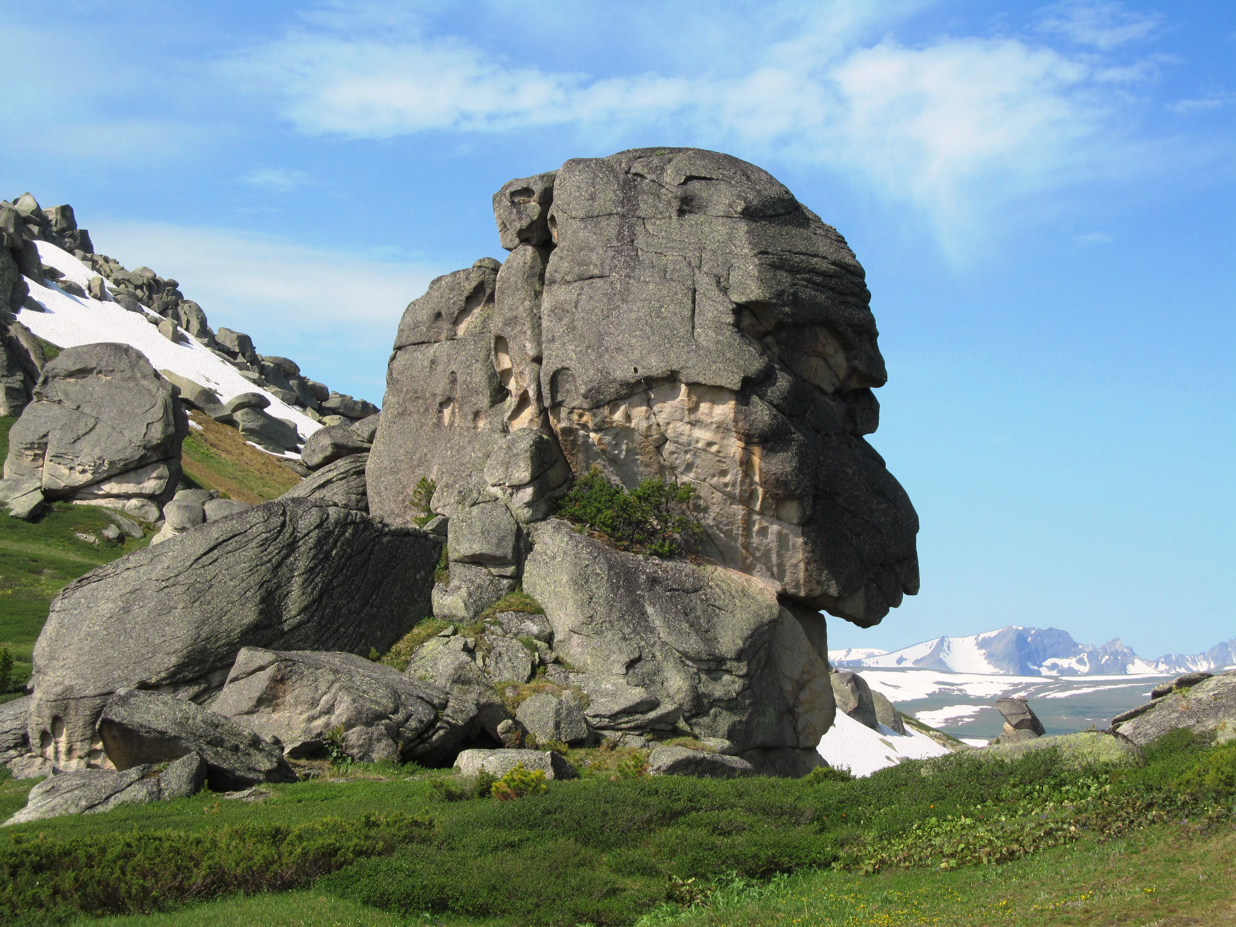
Large weathered rock formations rising from a green alpine meadow with patches of snow and a blue sky in the background.
Rock formations on the Stone Tale trail in the West Altai State Nature Reserve.

Best time to visit West Altai State Nature Reserve

The climate of the West Altai Reserve is strongly continental, with long snowy winters and short mild summers. Snow cover can linger deep into spring at higher elevations, while summer temperatures typically climb into a comfortable range during the day. Spring brings rapid snowmelt, peak river flow in the Belaya Uba and Chernaya Uba systems, and the greening of subalpine meadows.

Late spring through early autumn is generally the most accessible window for understanding the reserve's ecological character. Summer offers the broadest visibility of alpine meadows, glacial lakes, and ridge scenery, while early autumn tends to bring stable weather and the first signs of seasonal wildlife movement. Winter conditions, with deep and prolonged snow cover, define the reserve's character but make most high-mountain terrain difficult to traverse. Visitors should recognize that as a strict nature reserve, access is regulated, and most appreciation of the area occurs from its surroundings rather than its interior.

Monthly climate preview

Long-term representative monthly temperature and precipitation data for Kazakhstan

West Altai State Nature Reserve Climate Normals and Annual Temperature Rhythm

Representative coordinate records show average monthly temperatures ranging from severe winter lows to warm summer highs alongside recorded daily precipitation rates. Analyzing the complete twelve-month climatology profile provides deeper context for the environmental patterns shaping West Altai State Nature Reserve.
Annual mean-3 °C
-19 °C13 °C
Jan-19°
Feb-16°
Mar-11°
Apr-2°
May
Jun11°
Jul13°
Aug11°
Sep
Oct-3°
Nov-12°
Dec-17°
Warmest month
July

12.7 °C

Coolest month
January

-18.7 °C

Wettest month
July

2.7 mm/day

Driest month
January

0.9 mm/day

Park location guide

Geography guide, regional context, and park location map for West Altai State Nature Reserve

West Altai State Nature Reserve park geography, regions, and map view in Kazakhstan

Understand where West Altai State Nature Reserve sits in Kazakhstan through a broader geographic reading of the surrounding landscape, nearby location context, and its mapped position within the national park landscape.

How West Altai State Nature Reserve fits into Kazakhstan

Kazakhstan is a Central Asian country spanning vast steppes and plains, bordered by Russia, China, Kyrgyzstan, Uzbekistan, and Turkmenistan, with a coastline along the Caspian Sea. It gained independence from the Soviet Union in 1991 and has a population of approximately 20.5 million people. The country is officially secular but predominantly Muslim, with Kazakh and Russian as official languages.

Wider geography shaping West Altai State Nature Reserve in Kazakhstan

Kazakhstan occupies a vast territory in Central Asia, extending into Eastern Europe. Its terrain consists largely of hilly plateaus and plains, with lowlands covering about a third of the area. The southern and eastern regions are mountainous. The country borders Russia to the north and west, China to the east, Kyrgyzstan to the southeast, Uzbekistan to the south, and Turkmenistan to the southwest. It has a coastline along the Caspian Sea.

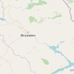
Map view of West Altai State Nature Reserve

Use this park location map to pinpoint West Altai State Nature Reserve in Kazakhstan, understand its exact geographic position, and read its mapped placement within the surrounding landscape more clearly.

Pigeon | © OpenStreetMap contributors

Visual exploration of protected forest ridges, granite pillars, and alpine terrain

West Altai State Nature Reserve Photos and Mountain Taiga Landscapes

Visual records illustrate the rugged mountain taiga, glacial lakes, and dense dark-conifer forests protected within the reserve. Examining these landscape photographs helps researchers and visitors understand the remote terrain and protected habitat character of Central Asia.

A tall, weathered granite rock pillar stands centrally in a mountainous landscape covered in green coniferous forest under a blue sky with scattered clouds.

A river flows through a green valley with a forested hill in the background under a blue sky with white clouds. Leafy branches frame the right side.

A scenic view from a rocky ridge featuring layered grey rocks in the foreground, dense green coniferous forests covering rolling mountains in the midground, and a bright blue sky with scattered clouds.

A calm lake reflecting a blue sky with pink clouds and a forested hillside, framed by pine trees in the foreground.

A wide landscape showing a green meadow dotted with yellow wildflowers in the foreground, leading to snow-capped mountains under a bright blue sky with large white clouds.

A rocky foreground with a large boulder, overlooking a vast valley of green coniferous forest and distant mountains with patches of snow under a dark, cloudy sky.

A partially frozen alpine lake surrounded by rocky mountains with snow patches under a cloudy sky.

Large weathered rock formations rising from a green alpine meadow with patches of snow and a blue sky in the background.

Wide landscape view of green meadows with patches of orange wildflowers, scattered pine trees, and forested hills leading to distant mountains under a dark, cloudy sky.

A weathered granite rock formation shaped like a shoe or boot stands in a grassy meadow with scattered coniferous trees, with rolling green hills and another large rock formation visible to the right.

A cluster of tall vertical grey granite rock formations standing on a green grassy hill against a clear blue sky.

A landscape view of distinctive granite rock pillar formations rising from a green grassy hillside, with a large dark rock formation in the left foreground and rolling mountains visible in the background under a pale sky.

A small dark lake surrounded by dense green coniferous forest, with rocky boulders along the shoreline and fallen logs near the water's edge.

A wide mountain landscape showing rocky alpine peaks with snow patches, a green vegetated slope in the foreground, and a small lake nestled in the valley below under an overcast sky.

A mountain range with snow patches and green forested valleys, viewed from a rocky outcrop under a hazy sky.

Park atlas

Compare regional mountain ranges, forested taiga reserves, and connected protected landscapes

Explore Parks Near West Altai State Nature Reserve And Surrounding Protected Areas

Browse other parks near West Altai State Nature Reserve to examine connected mountain taiga ecosystems across the surrounding region. Comparing adjacent protected landscapes helps reveal broader ecological patterns and regional terrain variations.
Watercolor painting of a river flowing through forested hills with mountains in the background under a sunset sky
National parkEast Kazakhstan Region
About 101 km away#1 closest

Southeast

Katon-Karagay National Park: Discover Kazakhstan's Largest Protected Mountain Landscape

Explore the geography and park boundaries of East Kazakhstan's premier national park.

Katon-Karagay National Park, the largest national park in Kazakhstan, offers a deep dive into the protected landscapes of the Southern Altai Mountains. This page provides essential geographic context, detailing the park's terrain, its significance as a protected area within East Kazakhstan Region, and its role in mapping the natural contours of this ecologically diverse mountain system. Understand the park's boundaries and its contribution to regional conservation.

Area
6,435 km²
Established
2001
IUCN
II
Relief
Mountain
A soft watercolor painting of a serene river winding through a grassy valley toward distant hazy mountains, with evergreen trees dotting the landscape.
Nature reserveEast Kazakhstan Region
About 214 km away#2 closest

Southeast

Markakol Nature Reserve: Mapping the Protected Mountain Landscapes of East Kazakhstan

High-altitude glacial lake and alpine tundra ecosystems

Markakol Nature Reserve protects a remote tectonic depression within the Southern Altai. The area features a complex vertical zonation of fir and spruce forests, subalpine meadows, and alpine tundra, centered around the pristine and ecologically significant Lake Markakol. This protected site serves as a vital study of the intersection between Siberian boreal influences and high-mountain steppe biodiversity.

Area
1,029.71 km²
Established
1976
IUCN
Ia
Relief
Mountain
National parkBayan-Ölgii Province
About 297 km away#3 closest

Southeast

Altai Tavan Bogd National Park: Protected Mountainous Landscape in Bayan-Ölgii

Explore mapped geography and protected terrain.

Altai Tavan Bogd National Park, situated in Mongolia's Bayan-Ölgii Province, offers a detailed view of a significant protected natural area. This park is defined by its mountainous geography, forming a key part of the Altai range. Users can explore its mapped boundaries and understand its role as a protected landscape within the western Mongolian atlas.

Area
6,362 km²
Established
1996
IUCN
II
Relief
Mountain
A pale, soft-toned watercolor illustration of a winding stream moving through a grassy meadow with scattered trees and distant hills.
Nature reserveAbai Region
About 297 km away#4 closest

West

Semey Ormany Nature Reserve: Protected Ribbon Pine Forests in Abai Region

Mapped forest corridors and steppe ecological boundaries.

Semey Ormany protects extensive ribbon pine forests that stretch through the sandy plains of the Abai Region. This reserve serves as a vital ecological buffer, bridging the gap between desert-like semi-steppes and dense woodland strips, home to diverse wildlife and rare plant communities across the Irtysh river basin.

Area
6,541.8 km²
Established
2003
IUCN
VI
Relief
Mixed relief
Watercolor painting showing green mountains, valleys, and a winding river under a light sky
National parkAltai Republic
About 313 km away#5 closest

East

Saylyugemsky National Park: Discover its Protected Landscape and Geographic Significance in Altai Republic

Mapped boundaries and regional landscape context within the Altai Republic.

Delve into Saylyugemsky National Park, a designated national park situated within the vast geographic expanse of Russia's Altai Republic. This canonical page provides detailed insights into its protected landscape, meticulously mapped boundaries, and its contribution to the regional geography. MoriAtlas focuses on structured geographic discovery, enabling a deeper understanding of Saylyugemsky National Park's place within the atlas of protected areas and natural landscapes.

Area
1,183.8 km²
Established
2012
IUCN
II
Relief
Mountain
National parkEast Kazakhstan Region
About 365 km away#6 closest

Southwest

Tarbagatai National Park: Protected Landscape and Wild Fruit Tree Forests in East Kazakhstan Region

Explore the mapped boundaries and ecosystem of this national park.

Tarbagatai National Park is a protected area in East Kazakhstan recognized for its unique role in conserving wild fruit tree forests that have maintained genetic isolation. This national park provides a detailed view of a mountain-steppe ecosystem across the Tarbagatai mountain range, Karabas Mountains, and Arkaly Mountains, along with the Urzhar and Emel river valleys. Its establishment in 2018 highlights its importance for biodiversity and the study of natural forest genetics, offering significant geographic context for regional protected land exploration.

Area
1,364 km²
Established
2018
IUCN
II
Relief
Mountain
Watercolor painting showing a river flowing through a forested area with distant hills, using soft green, blue, and yellow tones
National parkAltai Krai
About 383 km away#7 closest

Northeast

Salair National Park: Mapped Protected Landscape and Geographic Features in Altai Krai

Discover the unique dark taiga terrain and relict flora.

Salair National Park is a significant protected area in Altai Krai, Russia, renowned for its exceptionally biodiverse dark taiga forests, often called the "rainforest of Siberia." Established in 2020, the park spans the western slopes of the Salair Ridge, covering about 161,000 hectares of gentle low mountain terrain. Its landscape is characterized by rounded mountains, a network of ravines, and the preservation of pre-glacial relict plant species. This national park offers a vital contrast to the surrounding agricultural areas, highlighting its role in conserving unique Siberian forest ecosystems and their historic flora.

Area
1,612 km²
Established
2020
IUCN
II
Relief
Upland
Watercolor painting of a river flowing through a valley with forested hills and distant mountains
National parkTashtagolsky District
About 383 km away#8 closest

Northeast

Shorsky National Park: Protected Taiga and Karst Landscapes in Tashtagolsky District

Mapping the mountainous wilderness of southern Siberia

Shorsky National Park protects vast swathes of dark taiga forest and dramatic karst features across 4,180 square kilometers of rugged mountain terrain. Explore the geography of this Siberian region, featuring over 60 named caves, deep river valleys, and significant rock formations that define the natural character of the Tashtagolsky District.

Area
4,180 km²
Established
1989
IUCN
II
Relief
Mountain

Common questions about visiting, size, designation, and location context for West Altai State Nature Reserve

West Altai State Nature Reserve FAQs for park facts, access, geography, and protected area context

Find quick answers about West Altai State Nature Reserve, including protected-area facts, park geography, trail and visitor context, and how the park fits into its surrounding country and regional landscape.
MoriAtlas Explorer

Continue Your Protected Areas Search Across the Global Atlas

Deepen your exploration by continuing the structured search for national parks and protected areas worldwide. Utilize the comprehensive filtering capabilities to compare different conservation landscapes and refine your understanding of global park geography. Discover more about the distribution and characteristics of protected natural areas.

Global natural geography