
Mori Atlas logo
Natural monumentLesvos Petrified Forest

A preserved subtropical fossil ecosystem embedded within ancient Aegean volcanic terrain and rock formations.

Lesvos Petrified Forest Protected Natural Monument: Mapping Miocene Volcanic Landscapes in Greece

(Petrified Forest of Lesbos (Απολιθωμένο Δάσος της Λέσβου))

The Lesvos Petrified Forest represents a significant geological record on the western coast of Lesvos, Greece. This protected natural monument encompasses layers of volcanic ash and pyroclastic material that fossilized a subtropical forest approximately 17 to 20 million years ago. Visitors encounter rare upright trunks, including giant conifers, set against a backdrop of caldera domes and coastal tafoni weathering patterns that define the region geological heritage.

petrified forestfossil treesvolcanic landscapeearly Miocenegeological heritageUNESCO Global Geopark
An illustration showing a large brown fossilized tree stump in the center of a grassy, rolling valley with a footbridge in the foreground and a setting sun in the background.

Lesvos Petrified Forest

Natural monument

Park overview

Structured park overview, official facts, and landscape profile for Lesvos Petrified Forest

Lesvos Petrified Forest park facts, protected area profile, and essential visitor context

Review the core facts for Lesvos Petrified Forest, including designation, size, terrain, visitor scale, habitats, and operating context in one park-focused overview.

About Lesvos Petrified Forest

The Lesvos Petrified Forest occupies a distinctive place among the world's geological heritage sites because it preserves an entire ancient forest, not just scattered fossils. Located on the western side of Lesbos in the eastern Aegean, the forest falls within a landscape dominated by pyroclastic volcanic rocks that blanket much of the island. These rocks are the direct product of intense volcanic activity associated with the tectonic convergence of the African and Eurasian plates, which produced a chain of Miocene-age volcanoes in the north Aegean and covered roughly two-thirds of Lesbos in lava, ash, and other eruptive material.

What makes the site exceptional is the combination of rapid burial and ideal diagenetic conditions. When the eruptions occurred, a rich subtropical forest of conifers, palms, and broadleaf trees was almost instantly entombed. Volcanic ash isolated the organic material, and silica-rich hydrothermal fluids then replaced the wood gradually, preserving growth rings, bark patterns, internal wood structure, and even root systems. The resulting petrified forest includes conifers belonging to the Taxodiaceae, the ancestors of modern sequoias, as well as pines, cypresses, and yews. The presence of fossilized roots between trunks shows that new forests repeatedly regenerated in the intervals between eruptive phases, producing stacked fossil levels.

Today the forest is spread over a very large area, with its core concentrated between the villages of Sigri, Eressos, and Antissa. Several protected parks have been established within this area, including the main Petrified Forest Park at Bali Alonia and the Plaka Park near Sigri, which contains the largest known fossil trunk, with a circumference of 13.7 meters. A maritime park on the small island of Nisiopi also preserves upright and fallen trunks scattered above and below sea level. The site is managed by the Natural History Museum of the Lesvos Petrified Forest, founded in 1994 in Sigri, which conducts ongoing excavations, conservation, and research.

Quick facts and research context for Lesvos Petrified Forest

The Lesvos Petrified Forest is a protected natural monument on the island of Lesbos, Greece, managed by the Natural History Museum of the Lesvos Petrified Forest. It lies on the western part of the island, with the main concentration of trunks stretching across roughly 150 square kilometers between the villages of Sigri, Eressos, and Antissa. Isolated plant fossils are also found in many other parts of Lesbos, including Molyvos, Polichnitos, Plomari, and Akrasi. The site is officially listed as an IUCN Category III Natural Monument or Feature, has been on UNESCO's Tentative List of World Heritage Sites since 2014, and was recognized as an IUGS Geological Heritage Site in 2022 for representing one of the most complete early Miocene forest ecosystem records in the world.

Protection and recognition

Documented conservation status and official establishment records for Lesvos Petrified Forest

Lesvos Petrified Forest Protection Status And Designation History

Lesvos Petrified Forest features a mixed protection scope established in 1985 through official designation records. Structured preservation data details the legal framework and management boundaries governing the protected area.

Protection details

Protection scope
Mixed
Designated year
1985
Transboundary protection
No
Park context

Deeper park guide and search-rich context for Lesvos Petrified Forest

Lesvos Petrified Forest history, landscape, wildlife, and travel context

Explore Lesvos Petrified Forest through its history, landscape character, ecosystems, wildlife, conservation priorities, cultural context, and seasonal travel timing in a structured park guide built for atlas discovery and search intent.

Why Lesvos Petrified Forest stands out

The Lesvos Petrified Forest is renowned for preserving one of the most complete early Miocene forest ecosystems ever documented, with petrified trunks showing extraordinary morphological detail. It is particularly celebrated for its ancestral sequoia-like conifers of the Taxodiaceae family, including upright specimens that can exceed 20 meters in length, and for the unusual discovery of a large deinothere, an ancestral proboscidean, that lived on the margins of the ancient forest. The site is also distinguished by its geological setting, shaped by successive volcanic eruptions between roughly 17 and 20 million years ago that produced thick pyroclastic sequences, silicified tree preservation, and distinctive landscape features such as large honeycomb weathering cavities known as tafoni in coastal andesite outcrops. As part of the broader Lesvos UNESCO Global Geopark, it serves as a major reference point for understanding the volcanic origin of the north Aegean and the ancient flora that once covered it.
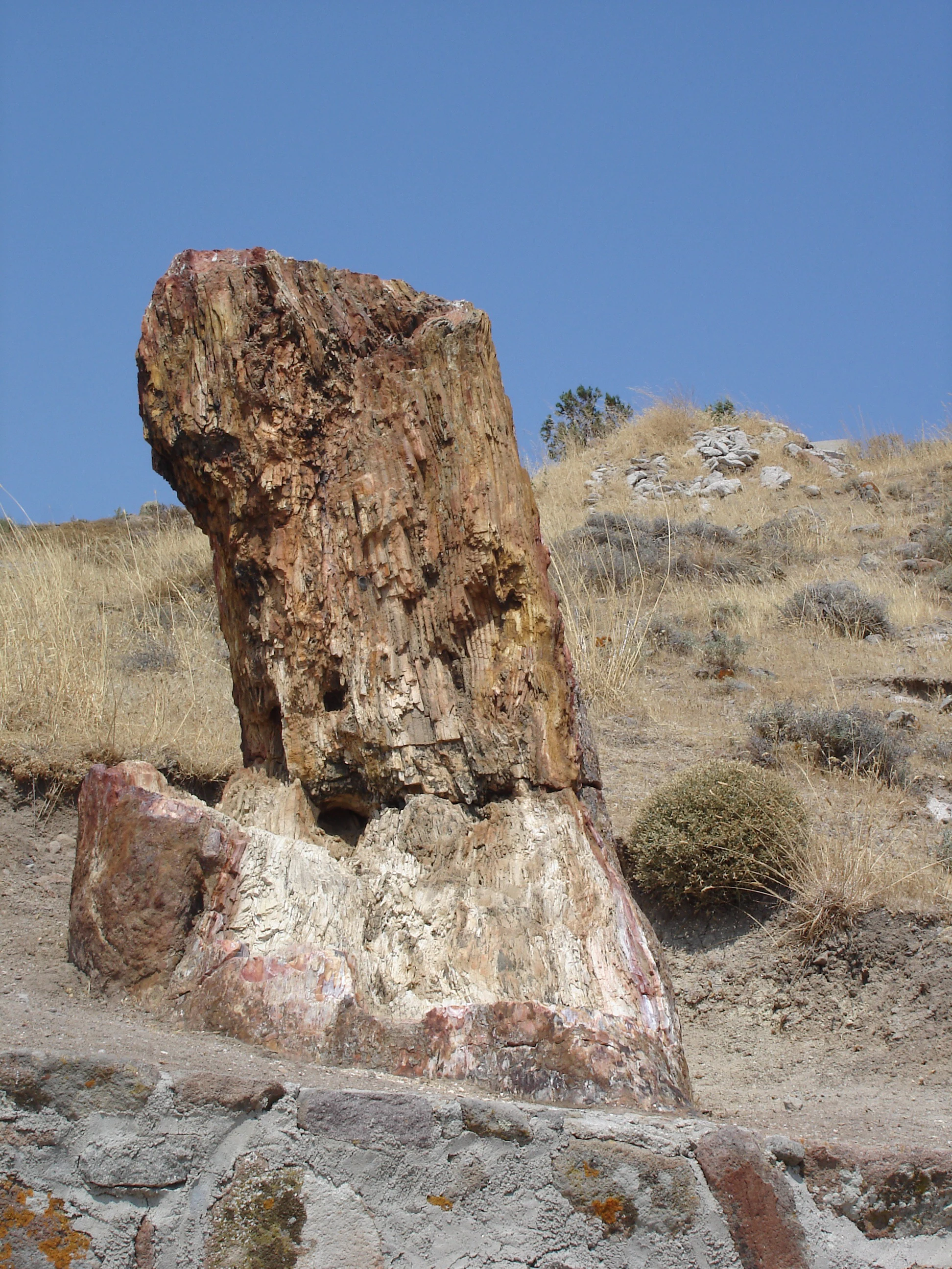
A close-up view of a large, fossilized, and petrified tree trunk standing in a dry, grassy landscape under a clear blue sky.
A preserved petrified tree trunk in the Lesvos Petrified Forest, Greece.

Lesvos Petrified Forest history and protected-area timeline

Scientific interest in the Lesvos petrified plants dates back to antiquity: Theophrastus, who was born on Lesbos, is believed to have described the island's fossilized plants in his now-lost work on stones. Samples from Lesbos were displayed at a fossil exhibition in Graz, Austria, in 1842, having been collected by Archduke Johann, and the Austrian botanist Franz Unger described several species from the island around the same period.

Modern protection of the site began when the Greek state expropriated two key fossil-bearing areas, including the Bali Alonia site near the modern Petrified Forest Park and the Chamandroula site near Eressos, starting in 1966. These areas were formally designated as protected natural monuments by presidential decree in 1985, which also established five parks across the island and described the petrified forest as a natural heritage asset of rare paleontological and geomorphological value. The first excavation inside the Petrified Forest Park took place in 1987 during construction of walking trails, and systematic excavation and conservation have been carried out since 1997 by the Natural History Museum of the Lesvos Petrified Forest.

The museum itself was established by law in 1994 and inaugurated in Sigri, where it now hosts the most complete collection of petrified plants in Greece. In 2000 the museum became a founding member of the European Geoparks Network, and in 2004 the area entered UNESCO's Global Geoparks Network. The whole island of Lesbos was added to the Global Geopark Network in 2012, and in 2014 the petrified forest was placed on UNESCO's Tentative List of World Heritage Sites. In 2022 the International Union of Geological Sciences recognized the Lesvos Early Miocene Petrified Forest as one of the first 100 IUGS Geological Heritage Sites worldwide.

Lesvos Petrified Forest landscape and geographic character

The landscape of the Lesvos Petrified Forest is shaped almost entirely by its volcanic past. The western part of Lesbos is composed of pyroclastic rocks laid down over older Permian to Triassic metamorphic formations such as schists, phyllites, quartzites, and crystalline limestones, and these volcanic deposits cover roughly two-thirds of the island. A series of Miocene volcanic caldera structures, many more than 10 kilometers across, have been identified in northern and western Lesbos through satellite imagery, including calderas at Vatoussa, Lepetymnos, Agra, Anemotia, Skalochori, Sigri, and Mesotopos, whose characteristic dome forms still mark the terrain.

On a finer scale, the petrified forest landscape is defined by layered sequences of volcanic ash, pumice horizons, mudflows, and volcanic conglomerates. Trees that once stood in this terrain were snapped or knocked over by pyroclastic flows, and many now lie as horizontal trunks up to roughly two meters tall, projecting from the surrounding volcanic rock. Coastal exposures around Sigri and the Plaka area feature andesite outcrops shaped by wind and salt weathering into large honeycomb cavities known locally as tafoni, some more than half a meter across, creating an unusual coastal rock texture.

Today the protected fossil-bearing terrain is a mosaic of fenced park zones connected by walking trails, with panoramic viewpoints over fossil-rich hillsides. Outside the parks, the surrounding modern landscape is dry and Mediterranean, covered in phrygana shrubland and oak woodland that contrasts strongly with the subtropical flora preserved in the fossil record.
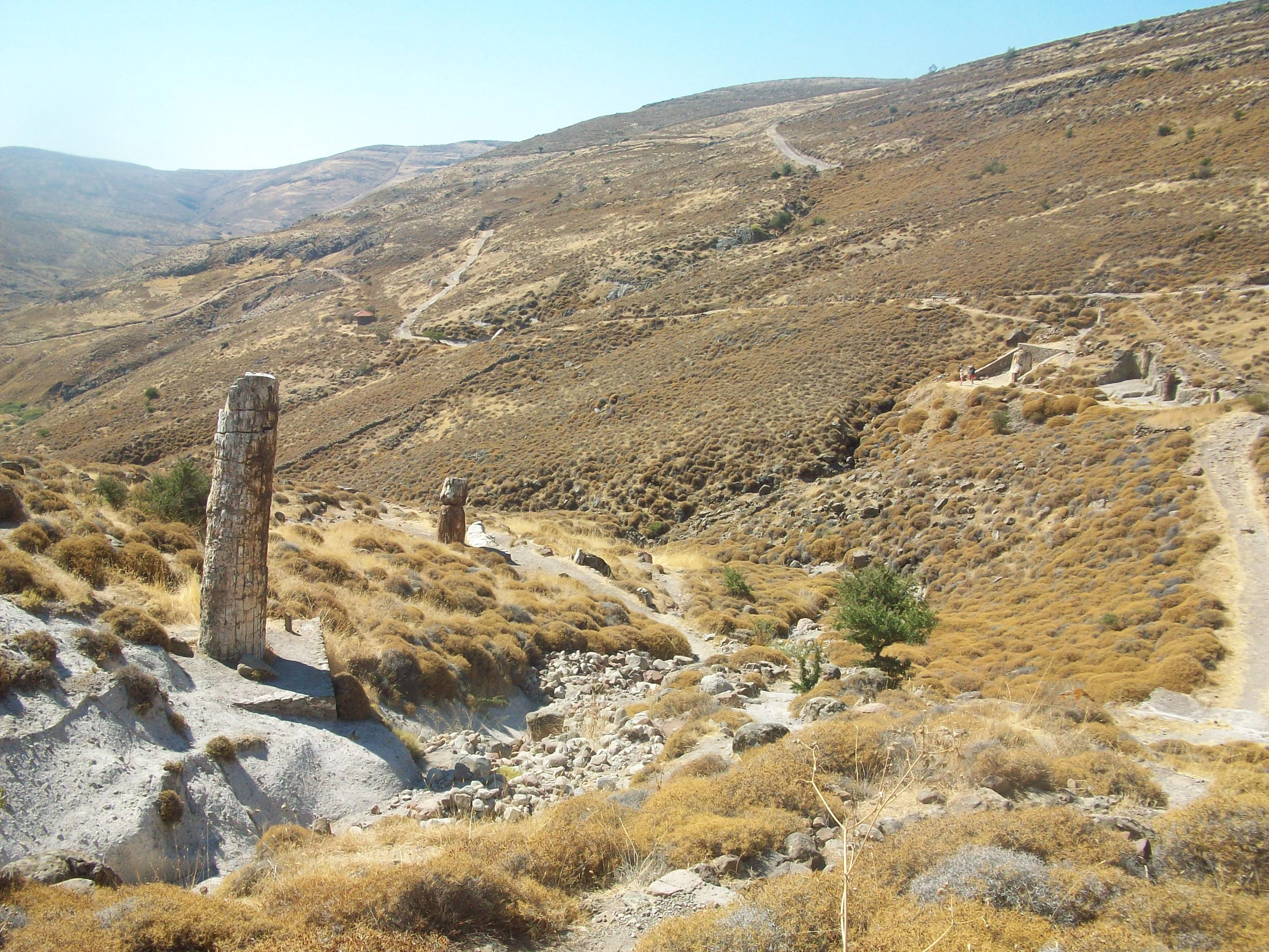
A large vertical petrified tree trunk stands in the foreground of a dry, hilly landscape with sparse vegetation on Lesvos island.
A fossilized tree trunk standing in the arid landscape of the Lesvos Petrified Forest.

Lesvos Petrified Forest ecosystems, habitats, and plant life

Ecology at the Lesvos Petrified Forest operates on two very different timescales. The paleoflora preserved in the fossils reflects a subtropical to warm-temperate climate in the north Aegean around 20 million years ago, when the climate was transitioning from the Oligocene to the early Miocene. Research by the Natural History Museum has revealed distinct vegetation zones in the fossil record: a mixed coniferous forest on higher ground dominated by Taxodioxylon species and other Taxodiaceae, with palm-dominated and broadleaf vegetation at lower elevations. The paleoflora shows affinities with modern forests of subtropical Asia and the Americas, particularly the coastal redwood forests of the western United States.

The living vegetation is far more modest but ecologically distinct. Western Lesbos, where the petrified forest lies, is dominated by dry Mediterranean phrygana, with characteristic species such as oregano, galastovivi, thyme-like plants, and spiny broom. Oak woodlands and small pine forests occur in slightly wetter zones, while stream margins and seasonal watercourses support oleander. Within the fenced parks, grazing and fire have been excluded, allowing a more protected shrub layer to develop that is used to contrast the modern flora with the ancient forest. The natural history museum has also planted pines and other species within the parks specifically to help visitors visually compare the modern vegetation with the species that inhabited the same area 20 million years ago.
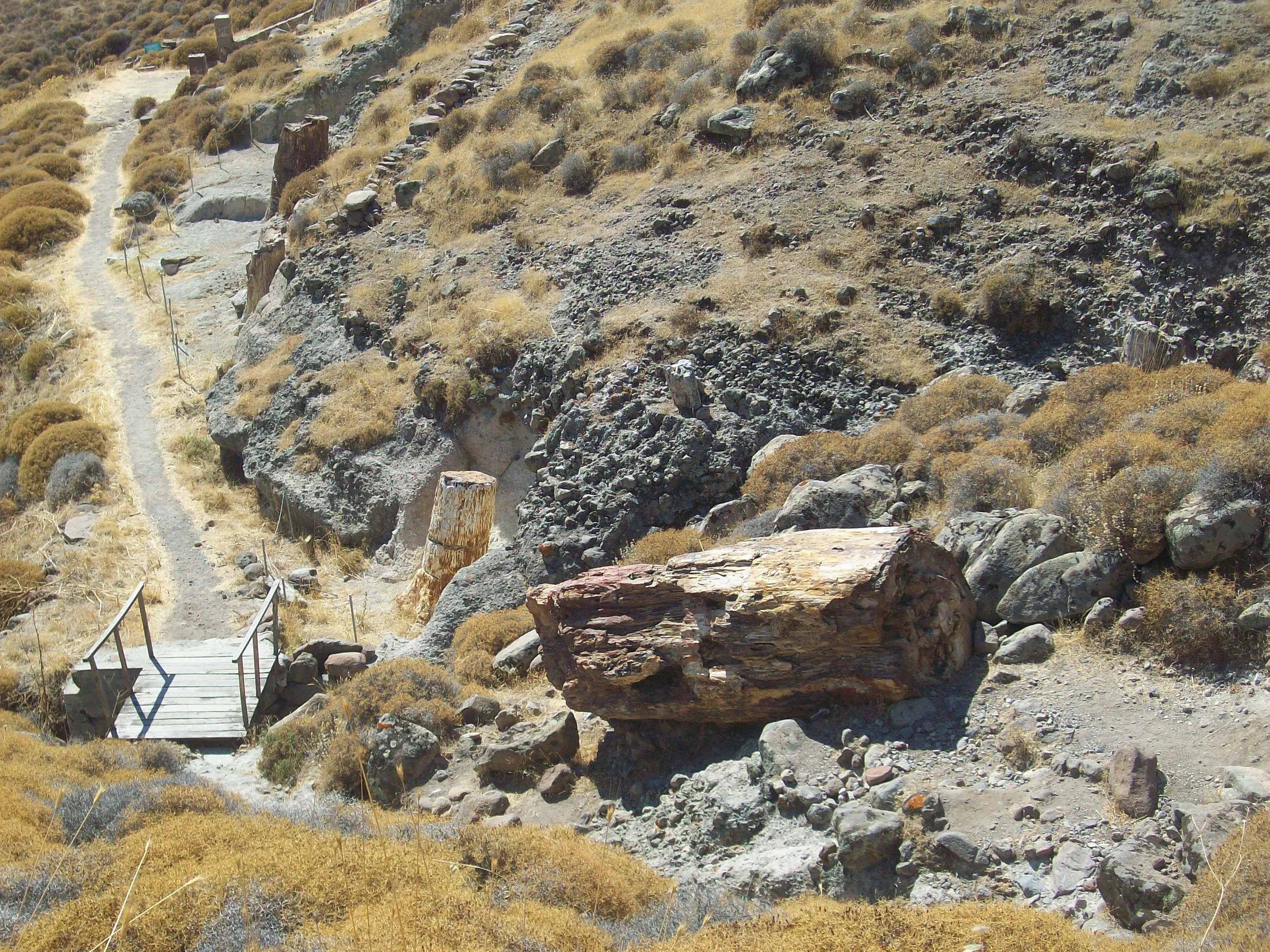
A large horizontal petrified tree trunk rests on a dry, rocky hillside in the Lesvos Petrified Forest, with a small wooden footbridge and dirt walking path visible nearby.
A fossilized tree trunk in the Lesvos Petrified Forest, situated near a hiking trail and wooden bridge.

Lesvos Petrified Forest wildlife and species highlights

While the flora of the petrified forest has been extensively documented, the faunal record is far sparser. The most significant fossil animal discovery to date came in 1999, when excavation work at Gavatha Antissa uncovered the bones of a large proboscidean from the Deinotheriidae family, an ancestral side-branch of modern elephants. Identified as Prodeinotherium bavaricum and dated to at least 18.4 million years old, this is the oldest known deinothere specimen from Greece and, given Lesbos's position, probably one of the oldest in Europe. Its presence demonstrates that ancestral large mammals were moving from Africa into Europe via Asia Minor and Greece at the time when the forest was alive, and studies suggest the animal lived near a large lake at the forest's edge, feeding on the rich subtropical vegetation.

The modern fauna of the area includes a wide range of small mammals such as hares, mice, and rock mice, alongside reptiles like tortoises, lizards (including the Greek-endemic krokodilaki and ophisops), and various snakes. Birdlife around the petrified forest area is especially significant for conservation: the region overlaps with one of Lesbos's three Natura 2000 sites and supports threatened species such as the Aegean swallow and the dark shag, both of which are among the few Mediterranean endemic birds.
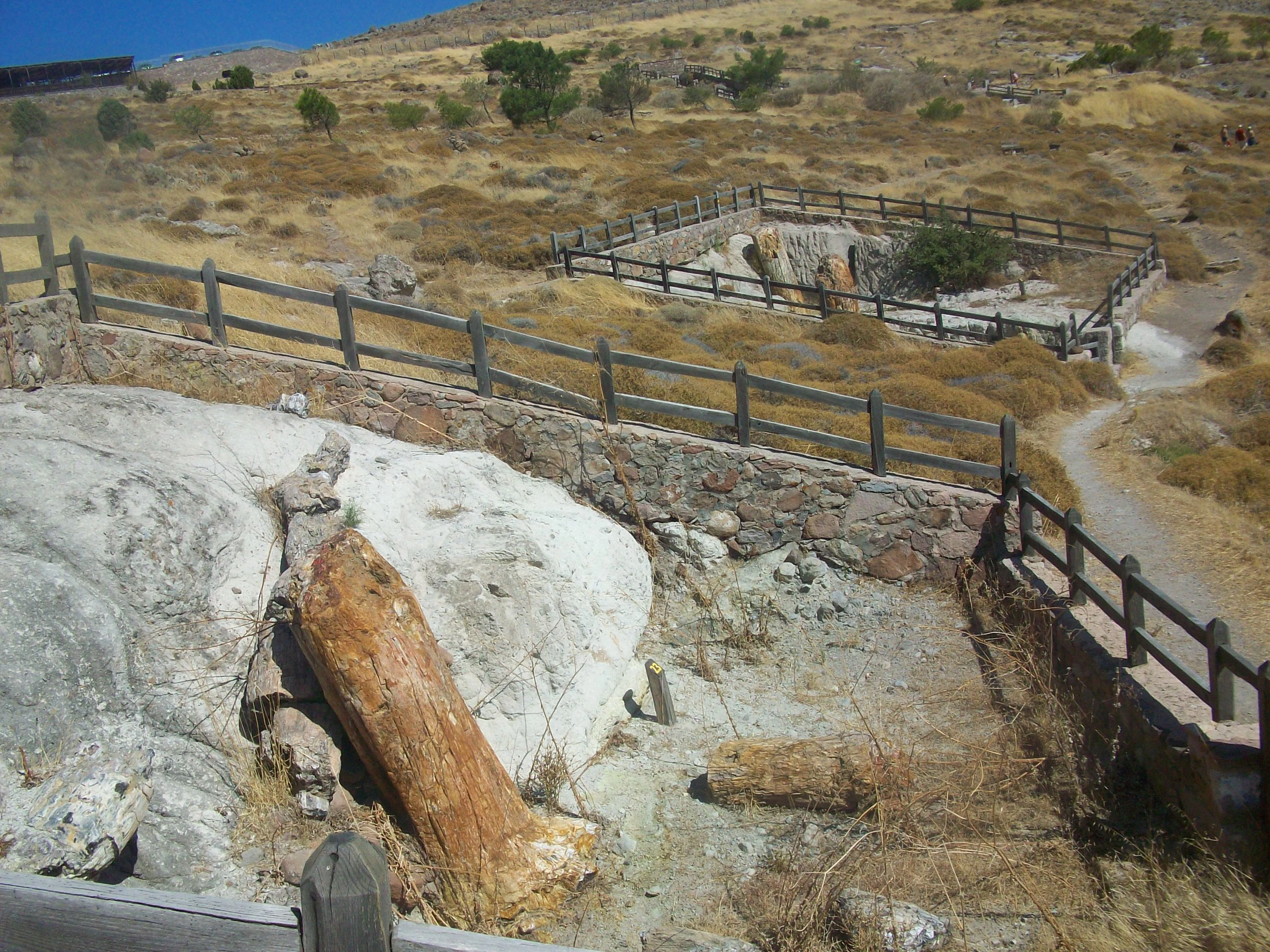
A high-angle view of two large fossilized tree trunks set into light-colored volcanic rock in a fenced-off outdoor area at the Lesvos Petrified Forest.
Petrified tree trunks in the Lesvos Petrified Forest, surrounded by volcanic soil and protective fencing.

Lesvos Petrified Forest conservation status and protection priorities

The Lesvos Petrified Forest matters for conservation primarily because it preserves an almost continuous geological and ecological record of an early Miocene forest ecosystem, making it a globally significant reference site for understanding ancient climates, volcanic processes, and the evolution of Mediterranean flora. Its conservation significance has been recognized at multiple international levels. The fossil-bearing area of approximately 150 square kilometers was declared a protected natural monument in 1985, and in 2012 the broader geopark designation was extended to cover the entire island. In 2014 the forest was added to UNESCO's Tentative List of World Heritage Sites, and in 2022 the International Union of Geological Sciences included it among the first 100 IUGS Geological Heritage Sites worldwide as one of the most complete early Miocene forest ecosystem records in existence.

Active management is carried out by the Natural History Museum of the Lesvos Petrified Forest, which undertakes systematic excavation, consolidation, and conservation of fossil trunks, including specialized consolidants injected into surface cracks to prevent dust accumulation, vegetation growth, and fragmentation. The museum also performs geophysical surveys to locate buried trunks and collaborates internationally on geopark management, an effort that earned European recognition in 2001 from the European network of protected areas Eurocité for its management approach. The Lesvos Petrified Forest is now a central component of the Lesvos UNESCO Global Geopark within the broader Lesvos Geopark system.

Lesvos Petrified Forest cultural meaning and human context

Although the Lesvos Petrified Forest is primarily a natural and geological site, it has long cultural resonance. It is traditionally linked with Theophrastus, the ancient Greek philosopher and native of Lesbos, whose botanical writings and his now-lost treatise on stones are believed to contain some of the earliest descriptions of the island's fossilized plants. The traditional local name of the main fossil-bearing site, Bali Alonia, reflects a remembered association with large concentrations of stones, and by the 18th century the same area was already documented under the local name Kyria apolithomeni in reference to its remarkable fossil density.

In the modern era, the forest has become an important part of regional identity for western Lesbos, reinforcing the cultural identity of villages such as Sigri, Eressos, and Antissa and supporting cultural programs held in the open-air amphitheater of the Natural History Museum. Its integration into the Lesvos UNESCO Global Geopark in 2012 also tied the site into broader educational and cultural heritage programming that links geological heritage with the island's natural and human history.
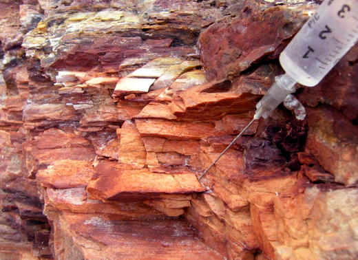
A close-up view of a medical-style syringe injecting a clear liquid into a crevice of a layered, reddish-brown fossilized rock.
A conservation specialist injects a chemical fixative into cracks within a piece of silicified fossil wood to stabilize the specimen.

Top sights and standout views in Lesvos Petrified Forest

The Lesvos Petrified Forest offers a rare combination of scientific depth and visual scale: more than twenty-million-year-old trunks preserved in extraordinary morphological detail, including upright specimens and the largest known coniferous petrified trunk in the world, displayed within an active volcanic landscape. The site spans five protected parks, a maritime fossil park on the island of Nisiopi, and a network of themed walking trails, all coordinated through the Natural History Museum in Sigri. Beyond the fossils themselves, the surrounding area features distinctive volcanic landforms, from caldera domes to coastal tafoni weathering patterns, and supports modern Mediterranean wildlife of genuine conservation interest, including endemic reptile species and threatened Mediterranean birds.
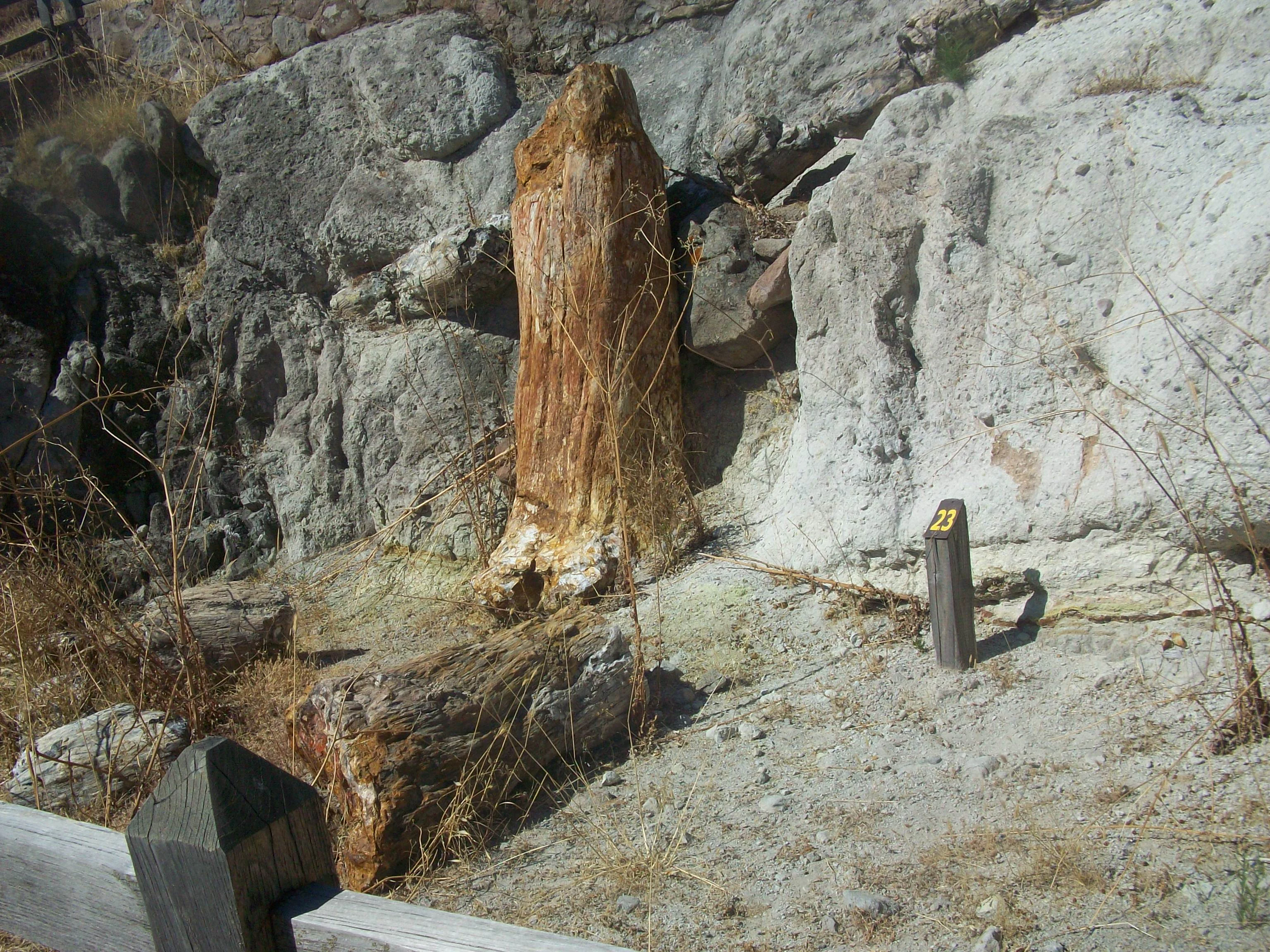
A vertical, fossilized tree trunk standing in a rocky, arid landscape with a numbered marker nearby.
A fossilized tree trunk specimen displayed in the Lesvos Petrified Forest.

Best time to visit Lesvos Petrified Forest

Lesbos has a typical eastern Mediterranean climate, with mild, wetter winters and hot, dry summers. Spring and early summer are well suited for visiting the petrified forest because temperatures are moderate for walking the open-air park trails, and the surrounding phrygana vegetation is at its most characteristic. Summer visits are common and align with the museum's active program of temporary exhibitions and cultural events, but visitors should expect strong sun and very dry ground conditions. Autumn remains mild and offers a quieter atmosphere for hiking the cross-island trails that connect Sigri, Eressos, and the Petrified Forest Park. Winter visits are possible but cooler and occasionally wet, with reduced activity at outdoor sites.

Monthly climate preview

Long-term representative averages tracking annual temperature curves and precipitation totals

Lesvos Petrified Forest Climate Normals, Temperature Ranges, and Monthly Precipitation

Historical data records monthly temperature ranges from lows near 4.88 degrees to highs reaching 27.94 degrees alongside varying daily precipitation rates. Reviewing the complete twelve-month climatology profile provides deeper context on long-term weather patterns across the protected landscape.
Annual mean18 °C
12 °C24 °C
Jan12°
Feb12°
Mar13°
Apr15°
May18°
Jun22°
Jul24°
Aug24°
Sep22°
Oct19°
Nov16°
Dec13°
Warmest month
August

24.4 °C

Coolest month
January

11.6 °C

Wettest month
December

3.7 mm/day

Driest month
August

0.2 mm/day

Park location guide

Geography guide, regional context, and park location map for Lesvos Petrified Forest

Lesvos Petrified Forest park geography, regions, and map view in Greece

Understand where Lesvos Petrified Forest sits in Greece through a broader geographic reading of the surrounding landscape, nearby location context, and its mapped position within the national park landscape.

How Lesvos Petrified Forest fits into Greece

Greece, officially the Hellenic Republic, is a country in Southeast Europe occupying the southern Balkans. It borders Albania, North Macedonia, Bulgaria, and Turkey, with coastlines on the Aegean, Ionian, and Mediterranean seas. The country has over 10 million people and is renowned for its ancient Greek heritage, philosophy, democracy, and the Olympic Games.

Wider geography shaping Lesvos Petrified Forest in Greece

Greece occupies the southern tip of the Balkan peninsula in Southeast Europe. It shares land borders with Albania to the northwest, North Macedonia and Bulgaria to the north, and Turkey to the east. The Aegean Sea lies to the east of the mainland, the Ionian Sea to the west, and the Sea of Crete and Mediterranean Sea to the south. The country spans thousands of islands across nine traditional geographic regions and has the longest coastline in the Mediterranean basin.

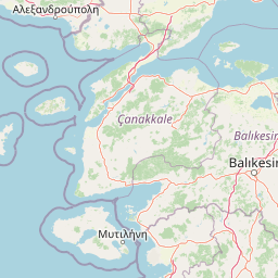
Map view of Lesvos Petrified Forest

Use this park location map to pinpoint Lesvos Petrified Forest in Greece, understand its exact geographic position, and read its mapped placement within the surrounding landscape more clearly.

Pigeon | © OpenStreetMap contributors

Location context for Lesvos Petrified Forest

Lesvos

Visual reference guide to volcanic terrain, fossilized trunks, and protected habitats

Lesvos Petrified Forest Photos and Landscape Scenery

Visual records capture ancient volcanic terrain, exposed pyroclastic layers, and fossilized tree trunks embedded within the protected landscape of western Lesbos. Examining these photographs helps observers understand the geological scale, structural detail, and natural habitat character preserved across the park.

A close-up view of a large, fossilized, and petrified tree trunk standing in a dry, grassy landscape under a clear blue sky.

A large, upright fossilized tree trunk standing in a dry, sun-drenched landscape with a small wooden marker post labeled with the number 26 in the foreground.

A large vertical petrified tree trunk stands in the foreground of a dry, hilly landscape with sparse vegetation on Lesvos island.

A large horizontal petrified tree trunk rests on a dry, rocky hillside in the Lesvos Petrified Forest, with a small wooden footbridge and dirt walking path visible nearby.

A high-angle view of two large fossilized tree trunks set into light-colored volcanic rock in a fenced-off outdoor area at the Lesvos Petrified Forest.

A rocky, arid volcanic lava dome rises above a sparse landscape of green trees under a clear blue sky on the island of Lesvos.

A close-up view of a medical-style syringe injecting a clear liquid into a crevice of a layered, reddish-brown fossilized rock.

A vertical, fossilized tree trunk standing in a rocky, arid landscape with a numbered marker nearby.

A large, upright fossilized tree stump with varied earth tones and mineral textures, surrounded by a low stone wall and dry grass in an outdoor setting.

A high angle view of petrified tree trunks resting in a dry, volcanic, scrub-covered landscape with wooden fences delineating the area.

Three fossilized prehistoric animal specimens displayed in a museum case on a gray surface, including two elongated jaw fragments with teeth and a large ridged molar.

Park atlas

Compare surrounding regional geography and connected protected natural areas

Parks Near Lesvos Petrified Forest and Related Protected Landscapes

Browsing parks near Lesvos Petrified Forest reveals diverse volcanic terrain and protected natural monuments across the Aegean region. Extending the geographic comparison helps connect ancient geological heritage sites with broader regional conservation landscapes.
Watercolor illustration of a landscape featuring rolling hills, trees, and a small body of water
Protected areaTurkey
About 89 km away#1 closest

North

Ancient Troya National Park: A Mapped Protected Landscape with Deep Historical Significance

Explore the terrain and protected boundaries of this key Turkish heritage site.

Ancient Troya National Park offers a unique window into history, preserving the layers of the ancient city of Troy within its protected boundaries. Situated in Turkey, this park encompasses a significant archaeological site on a commanding hilltop, overlooking rolling Mediterranean terrain and coastal plains. Its landscape, characterized by fortified walls, gates, and the remnants of ancient structures, provides a rich context for understanding its mythological and historical importance. MoriAtlas provides detailed mapping and geographic context for this vital protected area, enhancing its atlas exploration value.

Established
1996
IUCN
II
Relief
Lowland
Climate
Mediterranean
Watercolor painting showing green and pink mountain ranges with a body of water in the middle
National parkTurkey
About 103 km away#2 closest

Northeast

Kazdağı National Park: Explore Turkey's Protected Mountainous Terrain and Forest Ecosystem

Mapped geography and protected landscape context within Turkey's Aegean region.

Kazdağı National Park is a significant protected area in Turkey, renowned for its dramatic mountain landscape encompassing Mount Ida. This park safeguards a critical subalpine forest ecosystem, characterized by diverse tree species that transition into rocky summits and alpine meadows. Understanding Kazdağı National Park's mapped boundaries provides essential insight into the regional geography, watershed protection, and the unique natural terrain found in western Turkey's Mediterranean mountain ranges, offering a solid foundation for geographic discovery.

IUCN
II
Scope
Terrestrial
Watercolor illustration of a coastal landscape with hills, trees, and a body of water
Marine protected areaGreece
About 124 km away#3 closest

West

National Marine Park of Alonnisos Northern Sporades: Protected Marine Landscape and Aegean Geography

Explore Greece's largest marine protected area and its vital ecosystems.

Investigate the National Marine Park of Alonnisos Northern Sporades, an extensive marine protected area situated in the northern Aegean Sea. This protected landscape is internationally significant for its role in conserving the Mediterranean monk seal and for its healthy Posidonia oceanica seagrass meadows. Understanding this park's geographic scope and its protected marine terrain offers crucial insights into Mediterranean island ecosystems and conservation efforts within the region.

Area
2,260 km²
Established
1992
IUCN
II
Relief
Mixed relief
Watercolor illustration of layered mountain ranges with green, yellow, and pink hues
National parkTurkey
About 155 km away#4 closest

Southeast

Mount Spil National Park: Turkey's National Park and Protected Landscape Atlas Entry

Explore its mapped boundaries and regional geographic context.

Mount Spil National Park is presented here as a key protected area within Turkey's atlas of natural landscapes. This detail page focuses on its identity as a national park, providing a structured overview of its mapped boundaries and geographic setting. Understand its landscape context and its significance within Turkey's network of protected lands for detailed atlas exploration and geographic discovery.

IUCN
II
Scope
Mixed
Water
Minor water
National parkTurkey
About 176 km away#5 closest

North

Lake Gala National Park: A Key Protected Wetland Landscape in Turkey's Maritsa Delta

Discover its bird habitats and mapped geographic context.

Lake Gala National Park is a nationally significant protected area, designated in 2005 to conserve the unique wetland ecosystem of the Maritsa Delta. Encompassing the shallow lakes Pamuklu and Küçük Gala, this park spans approximately 6,090 hectares of diverse wetland and forest habitats. It is internationally recognized as a Ramsar site and serves as a critical sanctuary for over 160 bird species, making it a premier birdwatching destination in Turkey and an important locus for understanding protected landscapes within a regional geographic framework.

Area
60.9 km²
Established
2005
IUCN
II
Relief
Lowland
National parkAydın Province
About 195 km away#6 closest

Southeast

Dilek Peninsula-Büyük Menderes Delta National Park: Protected Landscape and Geographic Context

Aydın Province's unique national park with diverse ecosystems.

Investigate Dilek Peninsula-Büyük Menderes Delta National Park, a key protected area in Turkey's Aydın Province. This page provides detailed geographic context, highlighting the park's remarkable coexistence of mountainous terrain and essential wetland habitats. Understand the mapped boundaries and landscape characteristics that define this significant national park.

Area
275.98 km²
Established
1966
IUCN
II
Visitors
700K annual
Watercolor illustration of a river, green fields, trees, and distant hills
National parkBalıkesir Province
About 199 km away#7 closest

Northeast

Kuşcenneti National Park: Mapping Turkey's Premier Bird Sanctuary and Wetland Ecosystem

Explore the protected boundaries and avian geography of this key national park.

Kuşcenneti National Park stands as Turkey's foundational protected area for bird conservation, celebrated for its critical role as an avian migration crossroads and nesting ground. Situated in Balıkesir Province, this national park encompasses a diverse wetland ecosystem including shallow lakes, flooded willow forests, and extensive marshlands. MoriAtlas provides a detailed geographic context for Kuşcenneti National Park, highlighting its mapped protected area, unique landscape features, and profound significance for regional avian biodiversity.

Area
240.47 km²
Established
1959
IUCN
II
Visitors
2.5M annual
Watercolor painting depicting a wide, soft-focus view of marshland, low-lying green vegetation, and distant purple mountains under a clear sky.
National parkEastern Macedonia and Thrace
About 211 km away#8 closest

North

Parc national de Macédoine-Orientale-et-Thrace: Wetland Atlas and Geographic Boundaries

Coastal lagoons and river delta protected landscapes

Gain insight into the ecological and geographic structure of Parc national de Macédoine-Orientale-et-Thrace. This protected area encompasses a complex mosaic of river deltas, shifting saline lagoons, and remnant riparian forests that anchor the natural landscape of Eastern Macedonia and Thrace.

Area
929.47 km²
Established
2008
IUCN
V
Relief
Lowland

Common questions about visiting, size, designation, and location context for Lesvos Petrified Forest

Lesvos Petrified Forest FAQs for park facts, access, geography, and protected area context

Find quick answers about Lesvos Petrified Forest, including protected-area facts, park geography, trail and visitor context, and how the park fits into its surrounding country and regional landscape.
MoriAtlas Explorer

Continue Your Protected Areas Search Across the Global Atlas

Deepen your exploration by continuing the structured search for national parks and protected areas worldwide. Utilize the comprehensive filtering capabilities to compare different conservation landscapes and refine your understanding of global park geography. Discover more about the distribution and characteristics of protected natural areas.

Global natural geography