Mori Atlas logo
Marine protected areaNational Marine Park of Alonnisos Northern Sporades

Explore the mapped boundaries and ecosystems of Greece's premier marine protected area.

National Marine Park of Alonnisos Northern Sporades: A Vast Protected Marine Landscape in the Aegean Sea

The National Marine Park of Alonnisos Northern Sporades represents a significant protected marine landscape within the Aegean Sea, encompassing a vast expanse of the Northern Sporades island group. Established as Greece's first and Europe's largest marine protected area, it safeguards critical ecosystems, including extensive Posidonia oceanica seagrass meadows and vital habitats for the endangered Mediterranean monk seal. This park provides essential context for understanding marine conservation geography and the protected natural terrain of the Greek islands.

Marine Protected AreaMediterranean IslandsMonk Seal HabitatIUCN Category IINatura 2000Aegean Sea
Illustrated coastal cave with green water, rocky cliffs, forested trees, and pine branches in the foreground

National Marine Park of Alonnisos Northern Sporades

Marine protected area

Park overview

Structured park overview, official facts, and landscape profile for National Marine Park of Alonnisos Northern Sporades

National Marine Park of Alonnisos Northern Sporades park facts, protected area profile, and essential visitor context
Review the core facts for National Marine Park of Alonnisos Northern Sporades, including designation, size, terrain, visitor scale, habitats, and operating context in one park-focused overview.

About National Marine Park of Alonnisos Northern Sporades

The National Marine Park of Alonnisos Northern Sporades stands as a landmark in Mediterranean conservation. Its creation marked a pioneering step in Greek environmental protection, establishing a model for marine conservation that encompasses both sea and land ecosystems. The park's vast expanse of 2,260 square kilometers makes it the largest marine protected area in Europe, providing refuge for species that have vanished from much of their historical range. The isolation of these islands, combined with limited human interference and the excellent condition of the natural environment, has allowed ecosystems to thrive in a relatively pristine state. The park is divided into two primary protection zones: Zone A covers 1,587 square kilometers with strict protection measures, including the critical habitat around Piperi Island and Psathoura, while Zone B encompasses 678 square kilometers and permits controlled visitor access and sustainable activities.

Quick facts and research context for National Marine Park of Alonnisos Northern Sporades

The park is classified as IUCN Category II (national park) and forms part of the European Natura 2000 network under site code GR1430004. It is governed through a joint venture between Greek ministries and represents a unique protected area combining strict preservation zones with areas supporting sustainable human activities. The park features Mediterranean climate with average annual temperature of 17°C and 515mm rainfall, characterized by dry summers and the strong northerly meltemia winds that refresh the region during August.

Park context

Deeper park guide and search-rich context for National Marine Park of Alonnisos Northern Sporades

National Marine Park of Alonnisos Northern Sporades history, landscape, wildlife, and travel context
Explore National Marine Park of Alonnisos Northern Sporades through its history, landscape character, ecosystems, wildlife, conservation priorities, cultural context, and seasonal travel timing in a structured park guide built for atlas discovery and search intent.

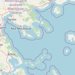
Why National Marine Park of Alonnisos Northern Sporades stands out

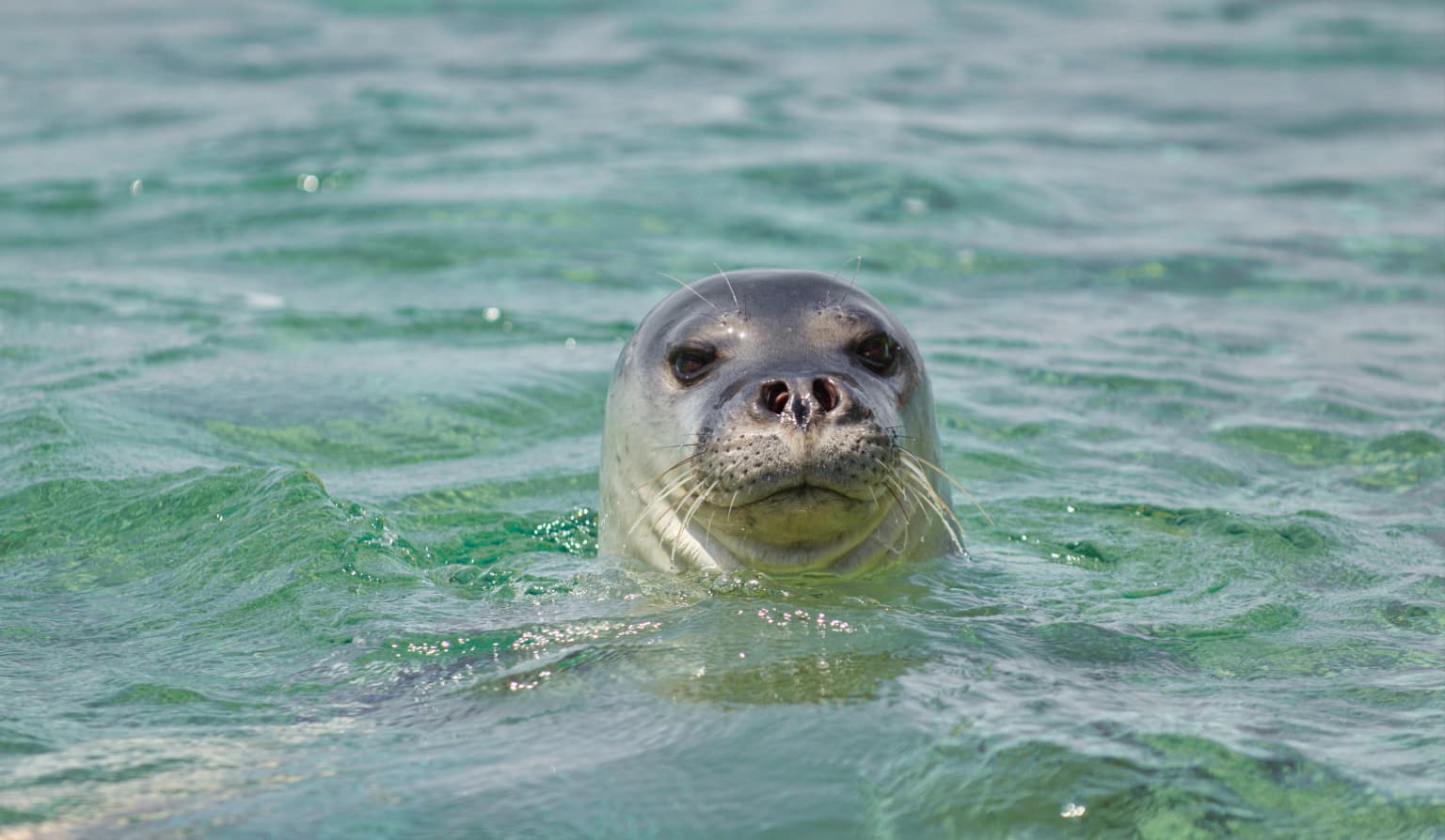
The park is internationally recognized as one of the most important habitats for the Mediterranean monk seal (Monachus monachus), one of the world's rarest marine mammals. It protects extensive underwater seagrass meadows of Posidonia oceanica, which are ecologically vital for marine life and water quality. The park also serves as a crucial migration corridor and breeding ground for numerous seabird species and supports populations of dolphins and whales. Its geological features include dramatic limestone cliffs, sea caves, and isolated islands that create diverse microhabitats.

Dolphin swimming in deep blue ocean water with visible breath trail above its body
Dolphin swimming in the Alonnisos Marine Park waters

National Marine Park of Alonnisos Northern Sporades history and protected-area timeline

The establishment of the marine park emerged from decades of scientific advocacy and local engagement. German zoologist Thomas Schultze-Westrum first recognized the extraordinary ecological value of the region during exploratory missions in 1976, proposing the creation of a protected area. Local fishermen from Alonnisos Island embraced the concept in 1982, committing to support protection efforts. In 1986, the Magnesia Prefecture issued the first formal protection order, followed by decisions from the Ministries of Environmental Affairs, Agriculture, and Merchant Navy. The Hellenic Society for the Study and Protection of the Monk seal (MOm), formed by young marine biologists, established a permanent research presence in 1990 and acquired the research vessel IFAW-ODYSSEAS to monitor monk seal populations. The organization also founded the first Mediterranean seal health centre in Alonnisos. Presidential Decree in 1992 formally established the park, though initial management faced challenges including funding limitations and delayed establishment of a formal management agency.

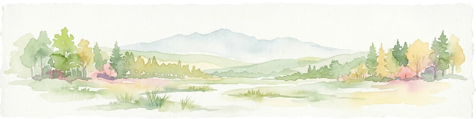
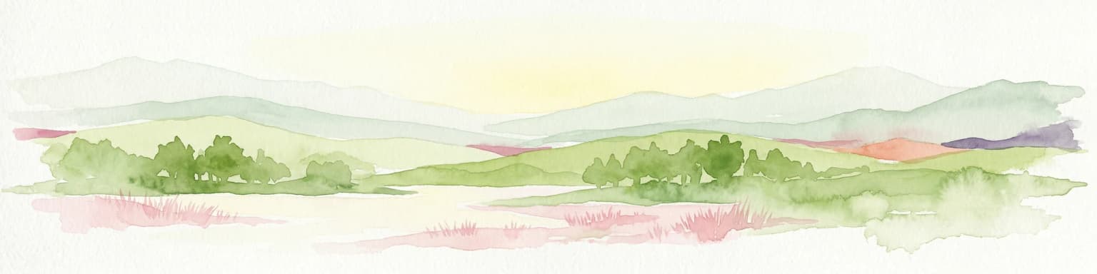
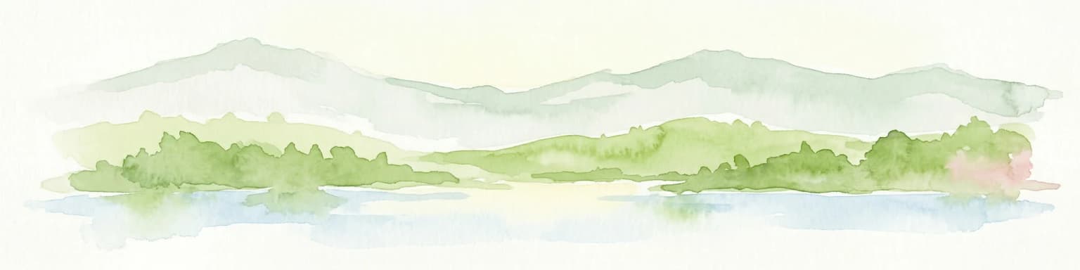
National Marine Park of Alonnisos Northern Sporades landscape and geographic character

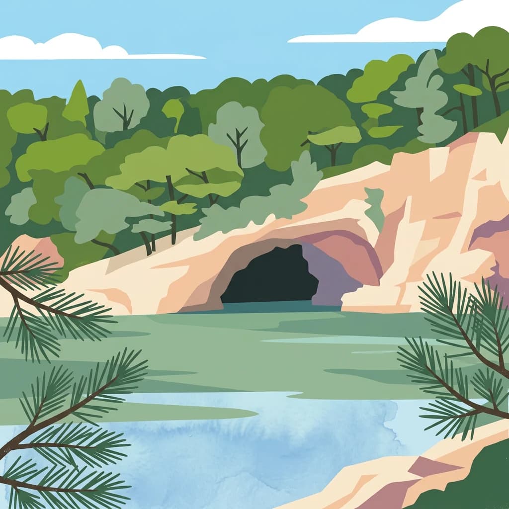
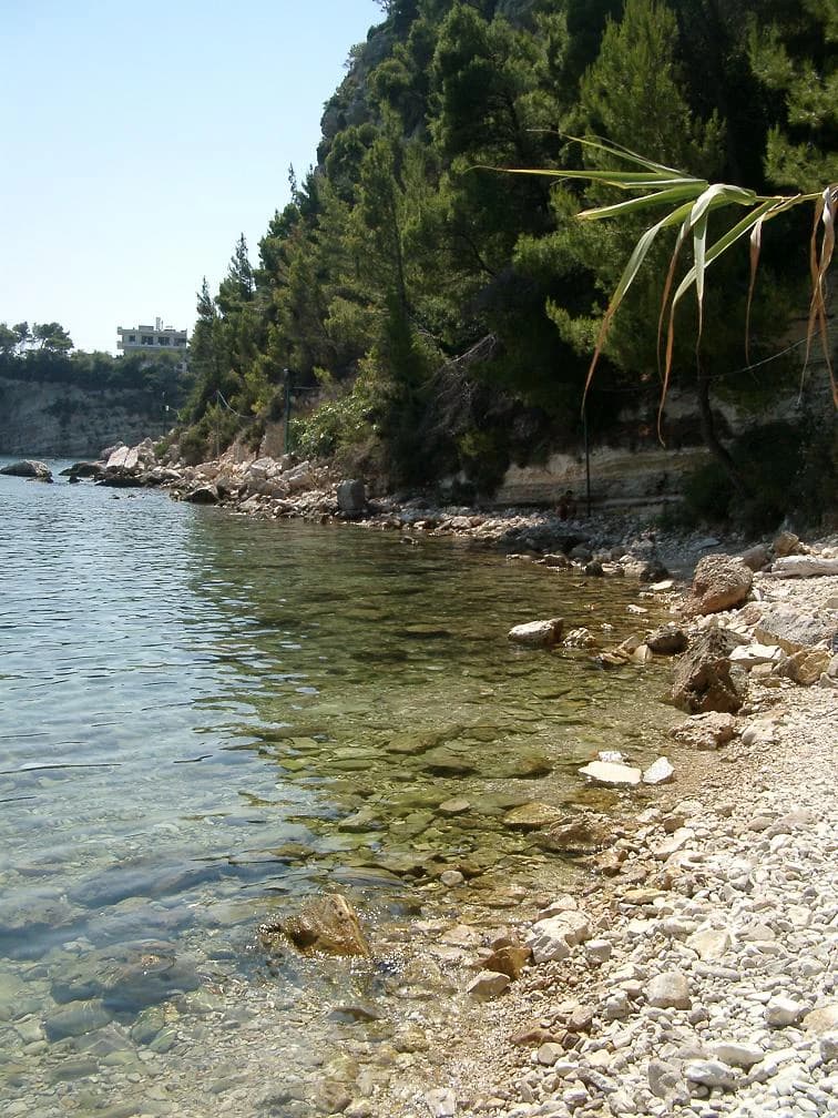
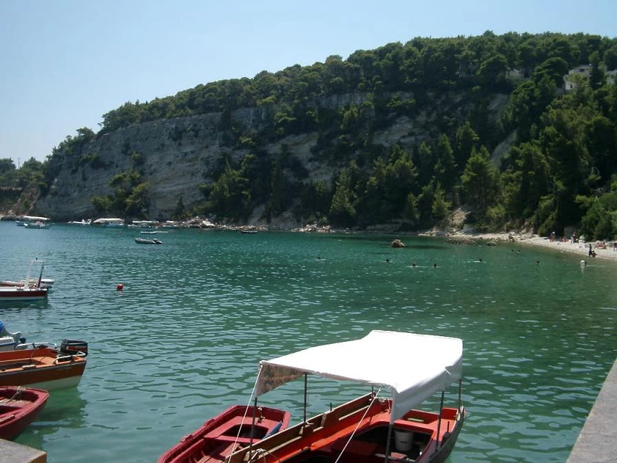
The terrestrial landscapes of the park are dominated by limestone formations characterized by steep rocky slopes descending to the sea and numerous sea caves that provide critical habitat for monk seals. Fresh water sources are scarce across the islands, and the terrain supports distinctive Mediterranean vegetation. The marine environment features extensive Posidonia oceanica seagrass meadows in good condition, which play a vital role in marine ecosystem function, providing habitat for numerous organisms and contributing to water quality through particle retention and cycling. The varied underwater topography supports diverse benthic communities and fish populations.

Clear blue water along a rocky shore with forested hills in the background under a sunny sky
Rocky shoreline with clear waters and forested hills in the National Marine Park of Alonnisos Northern Sporades

National Marine Park of Alonnisos Northern Sporades ecosystems, habitats, and plant life

The park encompasses remarkable ecosystem diversity, supporting both nationally and internationally significant habitats. The underwater seagrass beds of Posidonia oceanica are particularly important, forming the foundation of the marine food web and providing spawning and nursery grounds for many species. Each island within the park possesses its own geomorphology, resulting in distinct flora and fauna assemblages despite their relatively close proximity. The terrestrial vegetation consists primarily of Mediterranean macchia with kermes oak, strawberry tree, phillyrea, and evergreen trees including maple, wild olive, Phoenician juniper, and the rare Amelanchier chelmea. Phrygana vegetation is widespread, and the rock clefts support endemic plant species such as Campanula reiseri, Linum gyaricum, and Arenaria phitosiana.

Mediterranean monk seal swimming in clear blue-green water
Mediterranean monk seal swimming in the sea

National Marine Park of Alonnisos Northern Sporades wildlife and species highlights

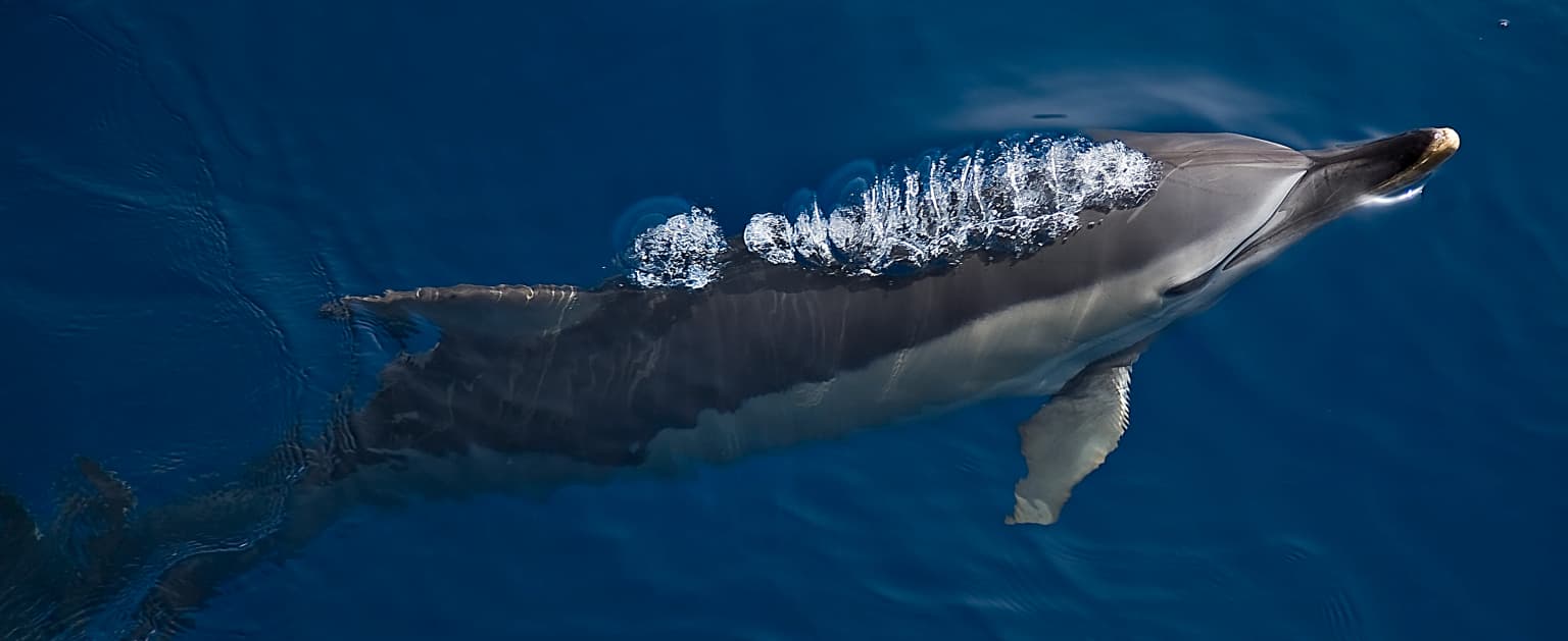
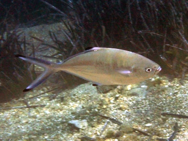
The park supports extraordinary biodiversity across multiple taxa. The marine environment hosts approximately 300 fish species and provides critical habitat for the endangered Mediterranean monk seal, one of the rarest seal species in the world. Six cetacean species are regularly observed: common dolphin, striped dolphin, bottlenose dolphin, long-finned pilot whale, sperm whale, and Cuvier's beaked whale. The avifauna includes up to 80 bird species, with particularly significant populations of Eleonora's falcon, Audouin's gull, shag, Bonelli's eagle, cormorant, and Mediterranean gull. The islands support breeding populations of the wild goat on Gioura, and the red coral (Corallium rubrum) is among the notable marine invertebrates.

Several boats docked at a waterfront with a rocky cliffside and forested hillside in the background
Boats docked at a waterfront in the National Marine Park of Alonnisos Northern Sporades

National Marine Park of Alonnisos Northern Sporades conservation status and protection priorities

The park represents a cornerstone of Mediterranean conservation, protecting species and habitats of European importance. It forms part of the Natura 2000 network, ensuring coordination with broader European conservation objectives. The strict protection zone around Piperi Island and surrounding waters to three nautical miles prohibits all commercial and amateur fishing, vessel approach, and most human activities to safeguard critical monk seal breeding habitat. The park's designation as IUCN Category II reflects its role in protecting outstanding natural ecosystems while allowing for sustainable use in designated zones. Despite its formal protection status, ongoing challenges remain in funding, management effectiveness, and balancing conservation with sustainable development pressures.

National Marine Park of Alonnisos Northern Sporades cultural meaning and human context

The park includes several inhabited communities within its boundaries, with Patitiri being the largest settlement on Alonnisos. Other communities include Palia Alonnisos, Votsi, and Steni Vala. These communities have traditionally relied on fishing and small-scale agriculture, and the park's management framework acknowledges the need to balance protection with sustainable livelihoods. The long history of human interaction with these islands has shaped the cultural landscape while the establishment of the park has created new dynamics around resource use and conservation.

Silver fish with a black spot near the dorsal fin swimming over sandy seabed with sparse aquatic plants
Trachinotus ovatus fish swimming in the marine environment of Alonnisos National Marine Park

Top sights and standout views in National Marine Park of Alonnisos Northern Sporades

As Europe's largest marine protected area, the park offers exceptional opportunities for experiencing Mediterranean marine ecosystems in a relatively pristine state. The critical protection of Mediterranean monk seal populations, combined with thriving Posidonia seagrass meadows and diverse cetacean populations, makes this area globally significant for marine conservation. The combination of strict protection zones with accessible areas allows for sustainable wildlife observation and environmental education.

Best time to visit National Marine Park of Alonnisos Northern Sporades

The park can be visited year-round, though the Mediterranean climate shapes optimal experiences. Summer months bring warm temperatures and excellent conditions for swimming and marine activities, though the strong meltemia winds characteristic of August can affect sea conditions. Spring and autumn offer milder temperatures and excellent conditions for wildlife observation, with spring bringing wildflower displays across the islands. Winter sees reduced visitor numbers and the opportunity to experience the islands' quieter character, though some services may be limited.

Park location guide

Geography guide, regional context, and park location map for National Marine Park of Alonnisos Northern Sporades

National Marine Park of Alonnisos Northern Sporades park geography, regions, and map view in Greece
Understand where National Marine Park of Alonnisos Northern Sporades sits in Greece through a broader geographic reading of the surrounding landscape, nearby location context, and its mapped position within the national park landscape.

How National Marine Park of Alonnisos Northern Sporades fits into Greece

Greece, officially the Hellenic Republic, is a country in Southeast Europe occupying the southern Balkans. It borders Albania, North Macedonia, Bulgaria, and Turkey, with coastlines on the Aegean, Ionian, and Mediterranean seas. The country has over 10 million people and is renowned for its ancient Greek heritage, philosophy, democracy, and the Olympic Games.

Wider geography shaping National Marine Park of Alonnisos Northern Sporades in Greece

Greece occupies the southern tip of the Balkan peninsula in Southeast Europe. It shares land borders with Albania to the northwest, North Macedonia and Bulgaria to the north, and Turkey to the east. The Aegean Sea lies to the east of the mainland, the Ionian Sea to the west, and the Sea of Crete and Mediterranean Sea to the south. The country spans thousands of islands across nine traditional geographic regions and has the longest coastline in the Mediterranean basin.

Map view of National Marine Park of Alonnisos Northern Sporades

Use this park location map to pinpoint National Marine Park of Alonnisos Northern Sporades in Greece, understand its exact geographic position, and read its mapped placement within the surrounding landscape more clearly.

Pigeon | © OpenStreetMap contributors

Location context for National Marine Park of Alonnisos Northern Sporades

Northern Sporades

Visual Reference for the Island Ecosystems, Limestone Cliffs, and Diverse Marine Environments

National Marine Park of Alonnisos Northern Sporades: Visual Landscapes and Marine Habitats
Browse compelling imagery to understand the diverse terrestrial landscapes and vital marine habitats within the National Marine Park of Alonnisos Northern Sporades. These visual insights offer crucial context for its unique island ecosystems, dramatic limestone cliffs, and the protected environment of the endangered Mediterranean monk seal, enhancing atlas-style park discovery.

Dolphin swimming in deep blue ocean water with visible breath trail above its body

Blue sea in foreground, rocky cliffs with cave opening, green trees in background.

Clear blue water along a rocky shore with forested hills in the background under a sunny sky

Mediterranean monk seal swimming in clear blue-green water

Several boats docked at a waterfront with a rocky cliffside and forested hillside in the background

Underwater scene showing a Hermodice carunculata marine worm feeding on a sea urchin among pebbles on the seabed

Silver fish with a black spot near the dorsal fin swimming over sandy seabed with sparse aquatic plants

Park atlas

Map the regional protected landscapes, tracing similar marine and island conservation areas across the Aegean Sea.

Explore Other National Parks and Protected Areas Near National Marine Park of Alonnisos Northern Sporades
Continue your atlas exploration beyond National Marine Park of Alonnisos Northern Sporades by browsing other national parks and protected marine areas across the Aegean Sea. Compare these geographically connected conservation landscapes to understand regional protected area spread and diverse island ecosystems.
Watercolor depiction of a river delta with green fields, a winding river, wildflowers, and distant hills
National parkCentral Macedonia

Axios Delta National Park: Central Macedonia's Premier Protected Wetlands and Bird Sanctuary

Mapping the unique geography of this vital European bird migration corridor.

Axios Delta National Park is a significant protected wetland located in Central Macedonia, Greece, renowned for its role as a critical stopover and breeding ground for countless bird species along the East Atlantic Flyway. The park's landscape is shaped by the Axios, Haliacmon, Loudias, and Gallikos river deltas, creating a dynamic mosaic of lagoons, reedbeds, and coastal dunes. As a Ramsar site and Natura 2000 network area, it highlights the importance of understanding mapped protected landscapes and their regional geographic context for conservation efforts. Explore the distinct natural features and ecological significance of this unique delta.

Area
338 km²
Established
2009
IUCN
VI
Relief
Lowland
Protected areaTurkey

Ancient Troya National Park: A Mapped Protected Landscape with Deep Historical Significance

Explore the terrain and protected boundaries of this key Turkish heritage site.

Ancient Troya National Park offers a unique window into history, preserving the layers of the ancient city of Troy within its protected boundaries. Situated in Turkey, this park encompasses a significant archaeological site on a commanding hilltop, overlooking rolling Mediterranean terrain and coastal plains. Its landscape, characterized by fortified walls, gates, and the remnants of ancient structures, provides a rich context for understanding its mythological and historical importance. MoriAtlas provides detailed mapping and geographic context for this vital protected area, enhancing its atlas exploration value.

Established
1996
Relief
Lowland
Climate
Mediterranean
Access
Moderate access
National parkTurkey

Lake Gala National Park: A Key Protected Wetland Landscape in Turkey's Maritsa Delta

Discover its bird habitats and mapped geographic context.

Lake Gala National Park is a nationally significant protected area, designated in 2005 to conserve the unique wetland ecosystem of the Maritsa Delta. Encompassing the shallow lakes Pamuklu and Küçük Gala, this park spans approximately 6,090 hectares of diverse wetland and forest habitats. It is internationally recognized as a Ramsar site and serves as a critical sanctuary for over 160 bird species, making it a premier birdwatching destination in Turkey and an important locus for understanding protected landscapes within a regional geographic framework.

Area
60.9 km²
Established
2005
Relief
Lowland
Climate
Temperate
Watercolor illustration showing mountains, river, and forested area
National park

Rodopi Mountain Range National Park: Greece's Largest Protected Forest Landscape Explorer

Mapped boundaries, old-growth ecosystems, and Balkan geography.

Rodopi Mountain Range National Park is a critical protected forest area in Greece, safeguarding one of Europe's last primeval forests, the Frakto Virgin Forest. As the nation's largest woodland conservation site, it showcases remarkable biodiversity and complex mountain terrain, from low-lying forests to subalpine meadows. This page provides detailed mapping context and geographic specifics for understanding this unique protected landscape and its ecological significance within the Rhodope Mountains.

Area
1,731.5 km²
Established
2009
IUCN
VI
Relief
Mountain
Watercolor illustration of a mountainous landscape with a river, forests, and distant hills
National park

Pindus National Park: A Protected Greek Mountain Wilderness with Ancient Forests

Explore its rugged terrain, biodiversity, and alpine landscape.

MoriAtlas presents Pindus National Park, a significant protected area in Greece known for its dramatic mountainous terrain, deep valleys, and ancient old-growth forests. This page details its geographic context, featuring rugged highland landscapes, serpentine soils, and vital habitats for species like the Eurasian brown bear. Understand its place within the Pindus mountain range and its importance as a mapped wilderness area for conservation.

Area
69.27 km²
Established
1966
Relief
Mountain
Climate
Temperate
National parkEastern Macedonia and Thrace

Dadia-Lefkimi-Soufli Forest National Park: Protected Landscape Atlas and Raptor Habitat

Mapped terrain and protected area context in Eastern Macedonia and Thrace.

This canonical entry for Dadia-Lefkimi-Soufli Forest National Park provides a structured atlas view of its protected landscape. Understand the park's geographic setting within Eastern Macedonia and Thrace, its mapped boundaries, and its significance as a critical sanctuary for raptors across Europe. Explore the diverse natural terrain that defines this protected area and its ecological importance.

Area
428 km²
Established
2006
IUCN
VI
Visitors
50K annual
Watercolor illustration of green mountains and a lake with trees
National parkBlagoevgrad Province

Pirin National Park: Protected Area and Regional Geographic Context in Bulgaria

Explore Pirin National Park's mapped boundaries and landscape.

Pirin National Park serves as a vital national park entity within the atlas of Blagoevgrad Province, Bulgaria. This page details its protected landscape, offering a structured view of its geographic setting and mapped terrain. Users can investigate the park's specific identity and its relation to the surrounding regional geography, providing essential context for understanding protected areas and natural landscapes within a comprehensive map-driven framework.

Area
403.56 km²
Established
1962
IUCN
II
Relief
Mountain
National park

Vikos-Aoös National Park: Deepest Gorge and Protected Mountain Landscape Atlas

Discover protected area boundaries and regional geography in Epirus.

Vikos-Aoös National Park in Greece's Pindus mountains is a premier destination for exploring dramatic natural geography. Best known for the Vikos Gorge, considered the world's deepest canyon relative to its width, the park also features towering alpine peaks like Mount Tymphe, glacial lakes such as Drakolimni, and rich botanical diversity. As a UNESCO Geopark and part of the Natura 2000 network, it safeguards critical habitats, including significant brown bear populations. This park offers a profound look into protected landscapes, offering detailed geographic context and mapped terrain for atlas-based discovery.

Area
126 km²
Established
1973
IUCN
II
Visitors
100K annual

Common questions about visiting, size, designation, and location context for National Marine Park of Alonnisos Northern Sporades

National Marine Park of Alonnisos Northern Sporades FAQs for park facts, access, geography, and protected area context
Find quick answers about National Marine Park of Alonnisos Northern Sporades, including protected-area facts, park geography, trail and visitor context, and how the park fits into its surrounding country and regional landscape.
MoriAtlas Explorer

Continue Your Protected Areas Search Across the Global Atlas

Deepen your exploration by continuing the structured search for national parks and protected areas worldwide. Utilize the comprehensive filtering capabilities to compare different conservation landscapes and refine your understanding of global park geography. Discover more about the distribution and characteristics of protected natural areas.

Global natural geography