Mori Atlas logo
National parkPirin National Park

Understanding the mapped boundaries and protected landscape of Pirin National Park.

Pirin National Park: A National Park within Blagoevgrad Province's Geographic Atlas

Pirin National Park stands as a key protected area within the geographic atlas of Blagoevgrad Province, Bulgaria. This page provides a structured exploration of its mapped boundaries and natural landscape context, offering a distinct view of its identity as a national park. Delve into the regional geography to understand Pirin National Park's unique place, facilitating a deeper comprehension of protected lands and mapped terrain for atlas-based discovery.

glacial lakesalpine landscapeUNESCO World Heritage Siteendemic speciesancient forestsmountain peaks
Stylized illustration showing mountains, waterfall, lake, and forest landscape

Pirin National Park

National park

Park overview

Structured park overview, official facts, and landscape profile for Pirin National Park

Pirin National Park park facts, protected area profile, and essential visitor context
Review the core facts for Pirin National Park, including designation, size, terrain, visitor scale, habitats, and operating context in one park-focused overview.

About Pirin National Park

Pirin National Park represents one of Bulgaria's three national parks and constitutes a cornerstone of the country's protected area network. The park occupies the northern section of the Pirin Mountains, which form part of the larger Rila-Rhodope Massif in southwestern Bulgaria. The terrain is distinctly alpine, characterized by steep slopes, high ridges, and deep river valleys carved by ancient glacial activity. Nearly 60% of the park's area sits above 2,000 meters elevation, creating conditions for subalpine and alpine ecosystems rarely found at this latitude in Europe. The park is administered from Bansko, with visitor information centers in both Bansko and Sandanski, and is divided into six management sectors covering the mountain's diverse terrain. The entire territory forms part of the European Union's Natura 2000 network, reflecting its significance for continental biodiversity conservation.

Quick facts and research context for Pirin National Park

Located in Blagoevgrad Province in southwestern Bulgaria, Pirin National Park covers 403.56 km² across seven municipalities. The park features 118 glacial lakes grouped into 17 clusters, with Popovo Lake being the largest and deepest at 29.5 meters. The elevation range spans nearly 2,000 meters, with nearly 60% of the territory above 2,000 meters. Forests cover 57.3% of the park, predominantly coniferous species including Macedonian pine and Bosnian pine. Baikushev's Pine, a 1,300-year-old Bosnian pine, is Bulgaria's oldest tree and a living contemporary of the founding of the Bulgarian state in 681 CE.

Park context

Deeper park guide and search-rich context for Pirin National Park

Pirin National Park history, landscape, wildlife, and travel context
Explore Pirin National Park through its history, landscape character, ecosystems, wildlife, conservation priorities, cultural context, and seasonal travel timing in a structured park guide built for atlas discovery and search intent.

Why Pirin National Park stands out

Pirin National Park is best known for its spectacular alpine landscape dominated by marble peaks, including the towering Vihren summit, and its network of 118 glacial lakes scattered throughout dramatic cirques. The park harbors Europe's southernmost glaciers, Snezhnika and Banski Suhodol, which are relict features from the last Ice Age. It is equally renowned for its extraordinary plant endemism, with 18 species found nowhere else on Earth, including the Pirin poppy and Pirin thyme, alongside 35 Bulgarian endemics and 86 Balkan endemics. The ancient Baikushev's Pine, estimated at 1,300 years old, stands as a living monument within the park's coniferous forests.

A lake surrounded by mountains at sunset with pink and purple clouds in the sky
Tevno Lake at sunset

Pirin National Park history and protected-area timeline

Pirin National Park was established on November 8, 1962, initially covering 67.36 km² under the name Vihren National Park with the purpose of preserving the forest stands in the highest parts of the mountain. The protected area was significantly expanded several times over the following decades, reaching its current extent of 403.56 km² in 1999. In 1974, the park was renamed Pirin National Park by decree of the Ministry of Forests, and its territory was considerably enlarged. A dedicated directorate responsible for the park's protection and development was created in 1979, based in the town of Bansko. The park achieved national park status in 1998 following the adoption of Bulgaria's Protected Areas Act. In 1983, Pirin was inscribed on the UNESCO World Heritage List, recognizing its outstanding universal value, and was extended in 2010 to include additional territory.

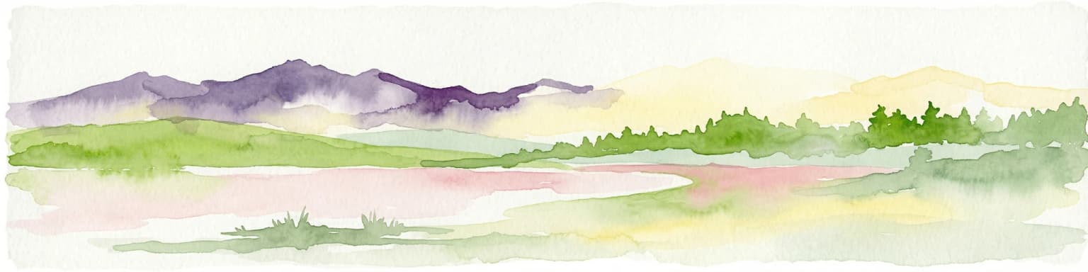
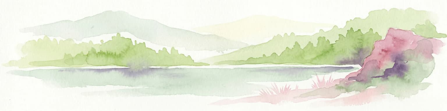
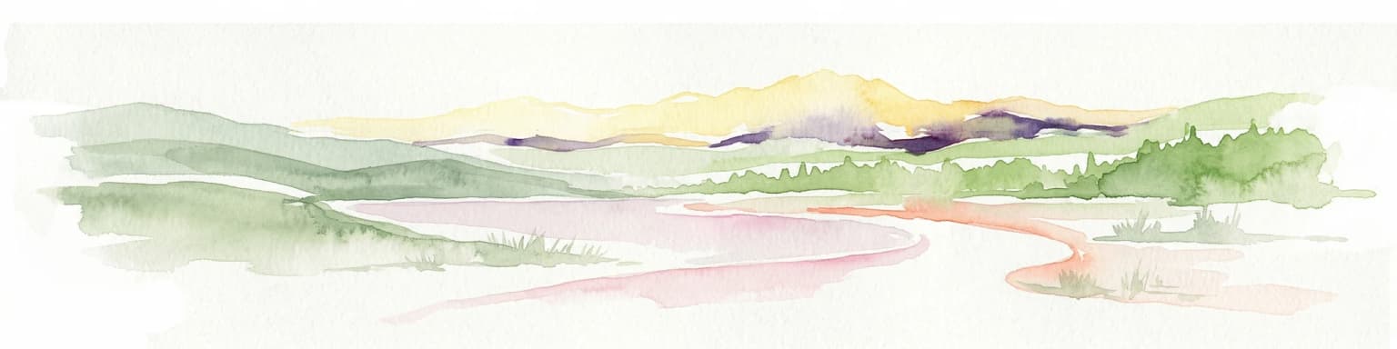
Pirin National Park landscape and geographic character

The Pirin Mountains present a dramatic alpine landscape shaped during the Pleistocene epoch by glacial processes that paralleled those of the Alps. The northern section of the range, entirely contained within the park, features two distinct geological zones. The northern zone comprises the steep marble Vihren ridge with three prominent summits: Vihren at 2,914 meters, Kutelo at 2,908 meters, and Banski Suhodol at 2,884 meters, along with the spectacular Koncheto ridge at 2,810 meters. The southern zone consists of granite ridges, including Polezhan, the fourth-highest summit at 2,851 meters. The relief is highly fragmented with steep slopes exceeding 30 degrees on more than 90% of the territory. The park contains 118 permanent glacial lakes conventionally divided into 17 groups, such as the Popovo Lakes, Kremenski Lakes, and Vasilashki Lakes, many situated in dramatic cirques carved by ancient glaciers.

Mountain landscape with turquoise lakes nestled among rocky peaks and patches of snow under a blue sky with scattered clouds
Gergiyski lakes surrounded by mountain peaks under a partly cloudy sky

Pirin National Park ecosystems, habitats, and plant life

Pirin National Park falls within the Rodope montane mixed forests ecoregion of the Palearctic temperate broadleaf and mixed forest biome. The park supports three distinct vegetation zones: forest, subalpine, and alpine, reflecting its substantial elevation range. Forests cover 231.10 km² or 57.3% of the park, with approximately 95% being coniferous and 5% deciduous. The vegetation includes 16 tree species, of which three are Balkan endemics with limited distributions: Bulgarian fir, Macedonian pine, and Bosnian pine. The Macedonian and Bosnian pines in Pirin constitute respectively 42% and 52 of their total area in Bulgaria, making the park critically important for their conservation. The park's flora comprises 1,315 vascular plant species from 94 families, representing approximately one-third of Bulgaria's total flora, with particularly high endemism due to the combination of southern latitude and significant elevation variation.

Snow-covered mountain peaks with dark forested slopes beneath a clear blue sky
Snow-capped mountain peaks in Pirin National Park under a clear blue sky

Pirin National Park wildlife and species highlights

The vertebrate fauna of Pirin National Park includes 229 species across multiple taxa. Mammal populations comprise 45 species, including notable conservation species such as brown bear, gray wolf, wildcat, European pine marten, wild boar, red deer, roe deer, and the Balkan chamois. The European snow vole represents a relict species in the park. Bird diversity is particularly significant, with 159 species recorded, including three relict species: the boreal owl, white-backed woodpecker, and Eurasian three-toed woodpecker. Raptor species include lesser spotted eagle, booted eagle, golden eagle with 2 to 5 breeding pairs, short-toed snake eagle, saker falcon, and peregrine falcon. The park supports 11 reptile species and 8 amphibian species representing diverse biogeographic origins, and 6 fish species inhabit the glacial lakes and streams.

Rocky mountain peak with mist, illuminated by orange dawn light against a cloudy sky
Vihren peak in Pirin National Park illuminated by dawn light with mist

Pirin National Park conservation status and protection priorities

Pirin National Park holds international recognition as a UNESCO World Heritage Site and is integrated into the European Union's Natura 2000 network of protected areas. The Bayuvi Dupki-Dzhindzhiritsa reserve within the park is among the oldest in Bulgaria, established in 1934, and is included in the World Network of Biosphere Reserves under UNESCO's Man and the Biosphere Programme. The park is classified as IUCN Category II, with the primary objective of protecting functioning ecosystems while allowing sustainable human visitation. However, the park faces significant conservation challenges including ski resort development at Bansko, illegal logging, poaching, and industrial pressures. In 2017, legislative changes sparked protests when commercial logging and construction within 50% of the park were legalized, prompting international concern and legal action by environmental organizations.

Pirin National Park cultural meaning and human context

The Pirin Mountains hold deep cultural significance for the Bulgarian people. According to tradition, when the Slavs settled in the region in ancient times, they named the mountain after their god Perun, from which the contemporary name derives. The surrounding region preserves rich cultural heritage, including the historic towns of Bansko, with its notable churches and museums dedicated to national renaissance figures, and Melnik, declared a historical and cultural monument. The nearby Rozhen Monastery and the archaeological remains beneath modern Sandanski, linked to the Thracian tribe the Medes and the legendary Spartacus, further illustrate the region's layered history spanning Thracian, Greek, Roman, Byzantine, Slavic, and Bulgarian epochs.

Tall coniferous tree with dense green needles and branches, set against a mountainous landscape with distant peaks under a clear blue sky
Abies borisii-regis tree in Pirin National Park with mountain landscape in background

Top sights and standout views in Pirin National Park

Pirin National Park offers exceptional diversity within a relatively compact alpine landscape. The Koncheto ridge trail, reaching approximately 2,810 meters between the peaks of Banski Suhodol and Kutelo, ranks among Bulgaria's most challenging and spectacular hiking routes, with near-vertical cliffs dropping 300-400 meters on one side. Popovo Lake, Bulgaria's fourth-largest glacial lake at 123,600 m², and the deepest at 29.5 meters, anchors a network of 118 mountain lakes. The park contains Bulgaria's oldest tree, the 1,300-year-old Baikushev's Pine, a living landmark of extraordinary age. The two small glaciers, Snezhnika and Banski Suhodol, represent the southernmost glacial formations in Europe, making the park uniquely significant for understanding glacial dynamics at the continent's southern limit.

A calm lake reflecting mountain peaks under a partly cloudy sky, with rocky shoreline, green grassy terrain, and a tent visible on the right side
Muratovo Lake reflecting mountains in Pirin National Park

Best time to visit Pirin National Park

The optimal visiting season for Pirin National Park depends on interests, with summer months from June through September offering the most accessible conditions for hiking and wildlife viewing, though afternoon thunderstorms are common in the high country. Autumn provides spectacular autumn color in the forests and clearer skies, while winter transforms the landscape into a premier destination for skiing and winter sports, particularly around Bansko. Spring brings abundant water from snowmelt, making the waterfalls and lakes particularly impressive, though trail conditions may be uncertain as snow recedes. The alpine climate means temperatures vary dramatically with elevation, with the higher areas experiencing alpine conditions even in summer, while the lower valleys enjoy warmer, more Mediterranean-influenced weather.

Park location guide

Geography guide, regional context, and park location map for Pirin National Park

Pirin National Park park geography, regions, and map view in Bulgaria
Understand where Pirin National Park sits in Bulgaria through a broader geographic reading of the surrounding landscape, nearby location context, and its mapped position within the national park landscape.

How Pirin National Park fits into Bulgaria

Bulgaria is a unitary parliamentary republic in Southeast Europe, bordered by Romania to the north, Serbia and North Macedonia to the west, Greece and Turkey to the south, and the Black Sea to the east. With a population of about 6.4 million and an area of roughly 111,000 km², it is the tenth-largest EU member by area. The country has a rich historical legacy spanning the First and Second Bulgarian Empires and nearly five centuries of Ottoman rule before becoming a modern republic.

Wider geography shaping Pirin National Park in Bulgaria

Bulgaria is situated on the eastern Balkans peninsula, occupying the region directly south of the Danube river which forms its northern border with Romania. The country borders Greece and Turkey to the south, Serbia and North Macedonia to the west, and fronts the Black Sea to the east. The terrain is varied, featuring mountain ranges such as the Rila, Pirin, and Rhodope mountains in the south and southwest, fertile plains in the north and northeast, and a coastal plain along the Black Sea.

Map view of Pirin National Park

Use this park location map to pinpoint Pirin National Park in Bulgaria, understand its exact geographic position, and read its mapped placement within the surrounding landscape more clearly.

Pigeon | © OpenStreetMap contributors

Location context for Pirin National Park

Blagoevgrad Province

Mapped Imagery of Pirin National Park: Discover its dramatic alpine terrain, glacial lakes, and unique protected habitats.

Visual Exploration of Pirin National Park: UNESCO World Heritage Landscapes and Alpine Scenery
Explore a curated collection of imagery capturing the breathtaking alpine landscapes and diverse ecosystems within Pirin National Park. Visuals illuminate the park's towering marble peaks, deep glacial cirques, ancient forests, and distinct protected-area characteristics, offering a comprehensive understanding of its natural identity.

A lake surrounded by mountains at sunset with pink and purple clouds in the sky

Mountain peak with snow patches and forested slopes under clear blue sky

Mountain landscape with turquoise lakes nestled among rocky peaks and patches of snow under a blue sky with scattered clouds

Snow-covered mountain peaks with dark forested slopes beneath a clear blue sky

Rocky mountain peak with mist, illuminated by orange dawn light against a cloudy sky

A mountain peak with a reddish hue reflecting in a calm lake, surrounded by grassy terrain

Tall coniferous tree with dense green needles and branches, set against a mountainous landscape with distant peaks under a clear blue sky

A calm lake reflecting mountain peaks under a partly cloudy sky, with rocky shoreline, green grassy terrain, and a tent visible on the right side

Fallen dead tree in foreground, mountain peaks and clear blue sky in background, Pirin National Park

A lake with rocky shore in the foreground, mountains with snow patches in the background under a cloudy sky

Yellow poppy flowers growing among gray and brown rocks

A male bullfinch with black head, orange body, and blue wings perched on a tall plant with green leaves and seed heads in a grassy field

Park atlas

Compare mapped geography, alpine landscapes, and protected areas across the Pirin Mountains and neighboring regions.

Discover Other National Parks and Protected Areas Near Pirin National Park
Browse additional national parks and protected areas geographically connected to Pirin National Park, highlighting diverse alpine terrain, glacial features, and unique conservation landscapes. Continue your atlas-style exploration by tracing their regional spread, comparing different ecosystems, and understanding the broader protected-area context across the Balkan Peninsula.
National park

Rila National Park: Bulgaria's Largest National Park with Alpine Terrain and Glacial Lakes

Explore mapped boundaries and protected landscape features.

Rila National Park, situated in Bulgaria's Rila mountain range, stands as the country's largest national park and a vital protected landscape. Its territory is characterized by dramatic glacial topography, including the iconic Seven Rila Lakes, and ascends to Musala Peak, the highest summit in the Balkan Peninsula. This atlas entry details the park's extensive mapped boundaries and unique ecosystems, emphasizing its importance for understanding regional geography and protected area networks.

Area
810.46 km²
Established
1992
IUCN
II
Relief
Mountain
Watercolor illustration showing mountains, river, and forested area
National park

Rodopi Mountain Range National Park: Greece's Largest Protected Forest Landscape Explorer

Mapped boundaries, old-growth ecosystems, and Balkan geography.

Rodopi Mountain Range National Park is a critical protected forest area in Greece, safeguarding one of Europe's last primeval forests, the Frakto Virgin Forest. As the nation's largest woodland conservation site, it showcases remarkable biodiversity and complex mountain terrain, from low-lying forests to subalpine meadows. This page provides detailed mapping context and geographic specifics for understanding this unique protected landscape and its ecological significance within the Rhodope Mountains.

Area
1,731.5 km²
Established
2009
IUCN
VI
Relief
Mountain
Watercolor depiction of a river delta with green fields, a winding river, wildflowers, and distant hills
National parkCentral Macedonia

Axios Delta National Park: Central Macedonia's Premier Protected Wetlands and Bird Sanctuary

Mapping the unique geography of this vital European bird migration corridor.

Axios Delta National Park is a significant protected wetland located in Central Macedonia, Greece, renowned for its role as a critical stopover and breeding ground for countless bird species along the East Atlantic Flyway. The park's landscape is shaped by the Axios, Haliacmon, Loudias, and Gallikos river deltas, creating a dynamic mosaic of lagoons, reedbeds, and coastal dunes. As a Ramsar site and Natura 2000 network area, it highlights the importance of understanding mapped protected landscapes and their regional geographic context for conservation efforts. Explore the distinct natural features and ecological significance of this unique delta.

Area
338 km²
Established
2009
IUCN
VI
Relief
Lowland
National parkLovech Province

Central Balkan National Park: Bulgaria's Majestic National Park and Protected Landscape

Explore mapped alpine terrain and ancient forests in Lovech Province.

Central Balkan National Park is a significant protected area in Bulgaria, renowned for its stunning mountain geography and exceptionally well-preserved ancient beech forests. Located within Lovech Province, the park's landscape is defined by dramatic peaks, including Botev Peak, deep canyons, and alpine meadows, offering a rich context for geographical exploration and understanding its protected status. Its ecosystem health and ecological value are underscored by multiple nature reserves and its recognition as part of a UNESCO World Heritage Site.

Area
716.69 km²
Established
1991
IUCN
II
Relief
Mountain
Watercolor painting of a landscape with green trees, rolling hills, and distant mountains under a light sky
National parkMunicipality of Bitola

Pelister National Park: North Macedonia's Oldest National Park and Alpine Protected Landscape

Explore unique glacial features and endemic forests within Municipality of Bitola.

Pelister National Park, a pioneering protected area in North Macedonia, offers a rich tapestry of alpine geography and unique geological formations. This page provides detailed information on the park's landscape, including its dramatic mountain massif within Municipality of Bitola, the rare Macedonian pine forests, the striking 'stone rivers' formed by ancient glacial processes, and the serene Pelister Eyes glacial lakes. Discover the park's mapped boundaries and its significance as a conservation heritage site within the Balkan Peninsula.

Area
171.5 km²
Established
1948
IUCN
II
Visitors
30K annual
Protected landscape

Sićevo Gorge Protected Landscape: Explore Serbia's Dramatic Karst Geography

Mapping the unique limestone cliffs and river valley terrain.

Delve into the atlas details of Sićevo Gorge, a protected landscape in Serbia defined by its spectacular limestone cliffs and the Nišava River canyon. This page provides a structured overview of its dramatic topography, intricate karst formations, and the regional geographic context. Understand the mapped boundaries and the unique geological character that makes this gorge a standout feature in Serbia's natural landscape.

Scope
Terrestrial
Water
Minor water
National parkKosovo

Sharr Mountains National Park: Kosovo's Alpine Protected Landscape and Geographic Atlas

Explore its dramatic peaks and glacial terrain.

Sharr Mountains National Park in Kosovo is a prime example of dramatic alpine topography, featuring jagged peaks, steep glacial valleys, and clear evidence of ancient glacial shaping. This protected area safeguards critical ecosystems, including extensive old-growth forests and diverse alpine meadows, supporting notable wildlife conservation efforts. Its scenic ridgelines, glacial lakes, and mountain streams define the park's natural landscape, offering rich context for atlas-based geographic discovery within the Balkans.

Relief
Mountain
Scope
Terrestrial
National park

Mavrovo National Park: North Macedonia's Extensive Protected Alpine Terrain and Wildlife

Mapped geography of Alpine peaks, gorges, and unique endemic species.

Mavrovo National Park, North Macedonia's largest protected area, offers a deep dive into a complex Alpine geography. Dominated by the Šar, Korab, and Bistra mountain systems, the park features towering peaks and the dramatic Radika River gorge. This protected landscape is globally significant for its role in conserving the rare Balkan lynx and harbors endemic tertiary relic plant species like Macedonian pine. Explore the mapped boundaries, glacial lakes, and distinct terrain that define this vital conservation area.

Area
730.88 km²
Established
1949
IUCN
II
Relief
Mountain

Common questions about visiting, size, designation, and location context for Pirin National Park

Pirin National Park FAQs for park facts, access, geography, and protected area context
Find quick answers about Pirin National Park, including protected-area facts, park geography, trail and visitor context, and how the park fits into its surrounding country and regional landscape.
MoriAtlas Explorer

Continue Your Protected Areas Search Across the Global Atlas

Deepen your exploration by continuing the structured search for national parks and protected areas worldwide. Utilize the comprehensive filtering capabilities to compare different conservation landscapes and refine your understanding of global park geography. Discover more about the distribution and characteristics of protected natural areas.

Global natural geography