Mori Atlas logo
National parkRila National Park

Explore the vast glacial terrain, alpine peaks, and endemic ecosystems of Bulgaria's largest national park.

Rila National Park: Bulgaria's Premier Protected Landscape and National Park Atlas Entry

Rila National Park represents Bulgaria's largest protected natural area, encompassing over 810 square kilometers within the majestic Rila mountain range. As a national park, it safeguards critical ecosystems, rare species habitats, and landscapes of significant scientific and cultural value. This atlas entry provides detailed geographic context for its mapped boundaries, from the 800-meter foothills to Musala Peak, the Balkan Peninsula's highest summit at 2,925 meters, highlighting its role as a key element of regional protected lands.

National ParkGlacial LakesAlpine EnvironmentOld-Growth ForestEndemic SpeciesMountain Peaks

Rila National Park

National park

Park overview

Structured park overview, official facts, and landscape profile for Rila National Park

Rila National Park park facts, protected area profile, and essential visitor context
Review the core facts for Rila National Park, including designation, size, terrain, visitor scale, habitats, and operating context in one park-focused overview.

About Rila National Park

Rila National Park represents one of the most significant protected areas in Europe, both for its ecological diversity and its cultural landscape value. The park sits within the Rodope montane mixed forests ecoregion of the Palearctic realm, encompassing a remarkable vertical gradient that supports distinct ecological zones from broadleaf forests through coniferous stands to alpine meadows and bare rock terrain. The Rila mountains themselves are among the highest and most impressive in Bulgaria, with their granite peaks, steep cirques, and glacial valleys creating a landscape of outstanding natural beauty. The park's establishment in 1992 marked a commitment to preserving these ecosystems in their natural state, recognizing that the Rila contains some of the last remaining relatively untouched montane forests in Europe. The park's boundaries encompass territory used by local communities for centuries, creating a landscape where natural and cultural values intertwine, with numerous Bulgarian national monuments and the nearby Rila Monastery adding cultural depth to the ecological significance.

Quick facts and research context for Rila National Park

Rila National Park covers 810.46 km² in southwestern Bulgaria, making it the largest protected area in the country. The park was established in 1992 and is classified as IUCN Category II. Its elevation gradient from 800m to 2,925m at Musala Peak creates remarkable ecological diversity across montane, subalpine, and alpine zones. The park contains 120 glacial lakes and serves as the source of rivers that collectively account for nearly 4% of all Bulgarian rivers by volume. Within its borders lie four nature reserves, two of which are included in the UNESCO World Network of Biosphere Reserves. Forests cover approximately 66% of the park's territory, while the remaining area includes alpine meadows, rocky terrain, and aquatic systems.

Park context

Deeper park guide and search-rich context for Rila National Park

Rila National Park history, landscape, wildlife, and travel context
Explore Rila National Park through its history, landscape character, ecosystems, wildlife, conservation priorities, cultural context, and seasonal travel timing in a structured park guide built for atlas discovery and search intent.

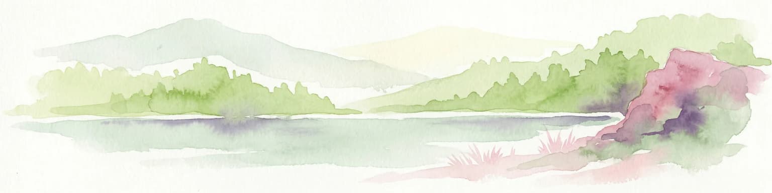
Why Rila National Park stands out

Rila National Park is best known for Musala Peak, the highest point in the Balkan Peninsula, and the spectacular Seven Rila Lakes, a chain of glacial lakes sitting in a dramatic cirque. The park's ancient spruce, silver fir, and white pine forests are among the most significant in Europe, with some stands exceeding 90 years in average age. The park protects exceptional biodiversity including 57 endemic species found nowhere else on Earth, with three local endemics unique to the Rila mountains: Rila primrose, Pavlovo shapchiche, and Rila rhubarb. The presence of 105 glacial relic species, survivors from the Ice Age, adds to the park's scientific importance.

Rila National Park history and protected-area timeline

Rila National Park was established on 24 February 1992 through legislation aimed at protecting several ecosystems of national importance within Bulgaria. The creation of the park represented the culmination of decades of conservation efforts in the Rila mountains, an area that had long been recognized for its ecological significance but lacked comprehensive protected area status. The park was designated with the explicit purpose of preserving in perpetuity self-regulating ecosystems and their inherent species diversity, habitats of rare and endangered species and communities, and characteristic landscapes and geological features of outstanding value for science and culture. Prior to national park status, portions of the territory had been protected as nature reserves, with Parangalitsa, Central Rila Reserve, Ibar, and Skakavitsa already established as strict reserves preserving old-growth forests and unique habitats. The park's establishment also built upon Bulgaria's broader commitment to European conservation, with two of the four reserves subsequently included in the UNESCO Man and Biosphere Programme as biosphere reserves.

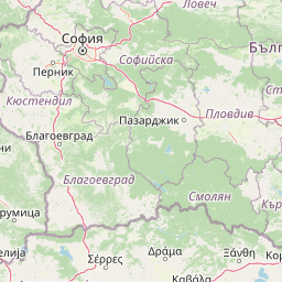
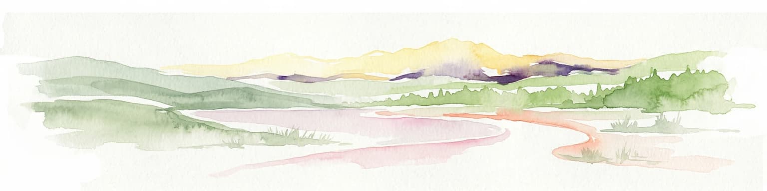
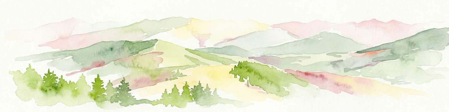
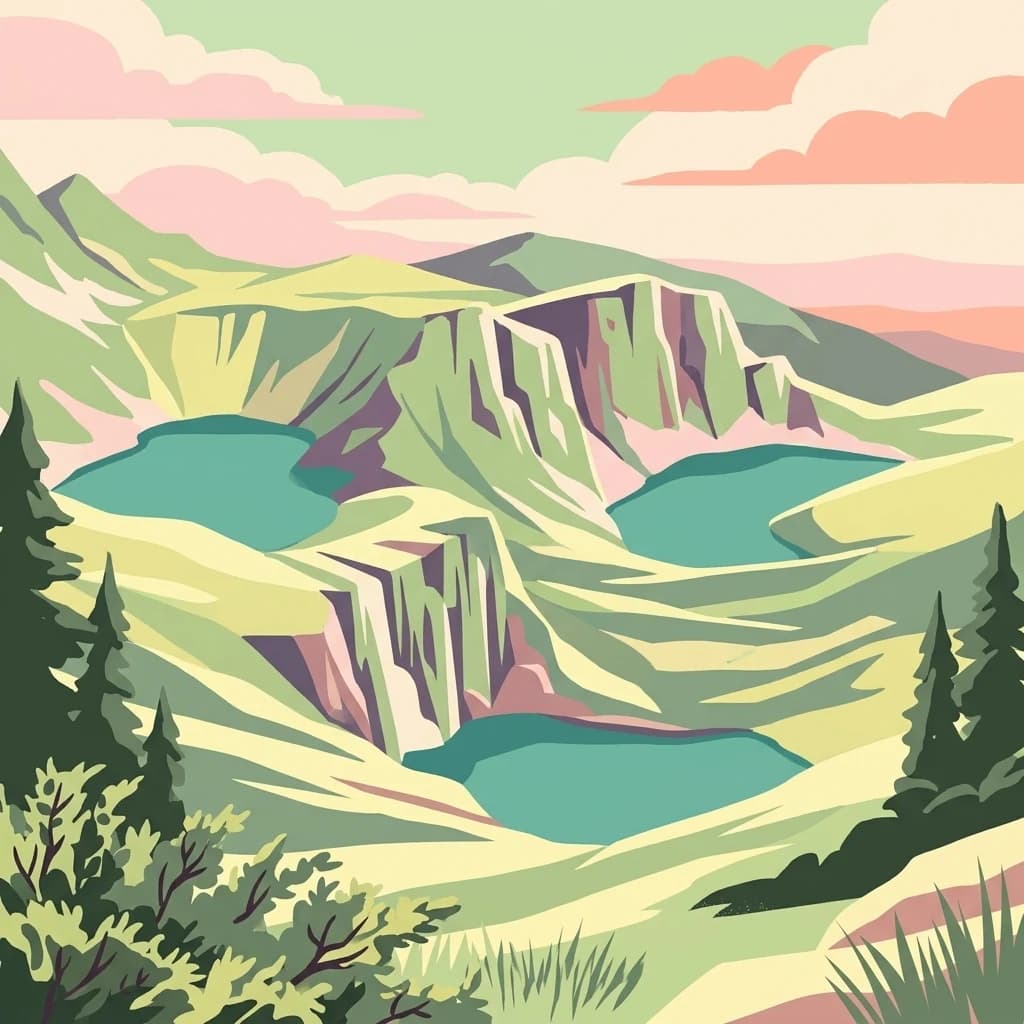
Rila National Park landscape and geographic character

The landscape of Rila National Park is defined by its high mountain terrain, dramatic glacial topography, and extensive forest cover. The Rila mountains rise as a massive granite mountain system in southwestern Bulgaria, with their highest elevations forming sharp peaks, steep cirques, and U-shaped glacial valleys. Musala Peak at 2,925 meters dominates the landscape as the highest summit in the Balkan Peninsula. The park contains 120 natural lakes, most of glacial origin, formed in cirques and hanging valleys carved by Pleistocene glaciers. The Seven Rila Lakes represent the most famous example, a chain of lakes descending in elevation from the Smradlivo Lake at 2,185 meters down to the Lower Lake at 1,785 meters. Rivers originating within the park include the Maritsa, which flows to the Aegean Sea, and the Iskar, which flows northward to the Danube. The terrain shows the marks of glacial processes throughout, with moraines, cirques, and glacial valleys creating the characteristic high mountain scenery. Forests dominate the lower and middle elevations, while the highest zones feature alpine meadows, rocky outcro, and permanent snow patches.

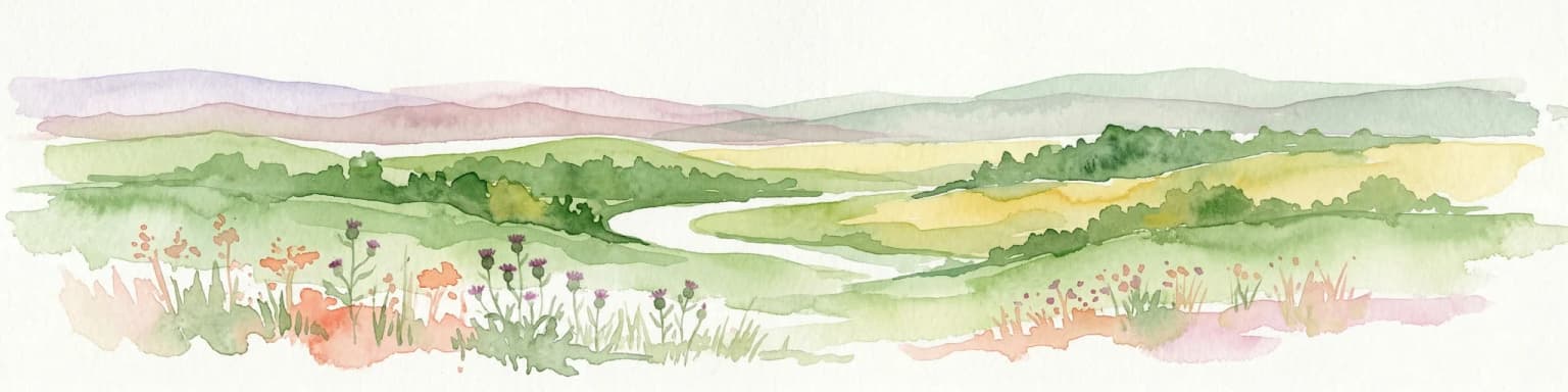
Rila National Park ecosystems, habitats, and plant life

The ecological character of Rila National Park reflects its position within the Rodope montane mixed forests ecoregion, combined with the significant elevation range that creates diverse habitat zones. Forests occupy approximately 66% of the park, covering 534.81 km² and dominated by coniferous species including Norway spruce, silver fir, and white pine. These forests, especially those within the four strict reserves, represent some of the most significant old-growth forest areas remaining in Europe, with average tree ages exceeding 90 years in the reserves. Broadleaf forests occur at lower elevations, featuring beech, oak, and aspen in mixed stands. The park sits at a relatively high average forest elevation of 1,800 meters, with more than three-quarters of forest area falling between 1,500 and 2,300 meters, reflecting the dominance of coniferous species adapted to cooler conditions. Alpine meadows occupy areas above the tree line, while the numerous lakes and rivers support aquatic and wetland ecosystems. The diversity of habitats supports remarkable plant diversity, with approximately 1,400 species of vascular plants representing 38.35% of Bulgaria's total flora, along with 282 moss species and 130 freshwater algae species.

Rila National Park wildlife and species highlights

The wildlife of Rila National Park demonstrates exceptional diversity despite the relatively limited geographic area. vertebrate fauna includes 48 mammal species, 99 bird species, approximately 20 reptile and amphibian species, and 18 fish species. Among the mammals, the brown bear holds particular significance as a flagship species, along with the chamois and wolf, both of which have restricted distributions in Bulgaria. The park supports important populations of birds associated with forest and alpine habitats, with 99 nesting species representing nearly one-third of all breeding bird species in Bulgaria. Notable bird species include the capercaillie, black grouse, rock partridge, three-toed woodpecker, and white-backed woodpecker, as well as predatory species such as the golden eagle, short-toed snake eagle, and peregrine falcon. The reptile and amphibian fauna benefits from the significant elevation range and climatic diversity, with species including the alpine newt, mountain water frog, and viviparous lizard. The invertebrate fauna is extraordinarily diverse, with approximately 2,934 species recorded, including 282 endemic species and numerous globally threatened species.

Rila National Park conservation status and protection priorities

Rila National Park holds exceptional conservation significance as one of the largest and most valuable protected areas in Europe. The International Union for Conservation of Nature has classified the park under Category II, recognizing its primary purpose of protecting natural ecosystems. Two of the park's four nature reserves, Parangalitsa and Central Rila Reserve, are included in the United Nations list of Representative Protected Areas, while four reserves participate in the UNESCO Man and Biosphere Programme. The park protects 57 endemic species with limited global distributions, including three local endemics found nowhere else on Earth. Additionally, 105 relic species representing survivors from past geological epochs persist in the park, including 74 species from the glacial period and 31 from the Tertiary. Ninety-eight species of vascular plants found in the park appear in Bulgaria's Red Book of endangered species, representing 13% of all species in that national registry. The park also serves as a critical water source, with rivers originating within its boundaries contributing nearly 4% of all river flow in Bulgaria, underscoring its importance beyond biodiversity conservation to broader ecosystem services.

Rila National Park cultural meaning and human context

The landscape of Rila National Park has been shaped by centuries of human activity, creating a rich cultural context that complements its ecological values. The territory contains 326 Bulgarian national monuments, with two sites of world significance, reflecting the long history of human presence in these mountains. The nearby Rila Monastery, Bulgaria's most famous religious monument and a UNESCO World Heritage Site, lies adjacent to the park boundaries and represents the cultural heart of the region. This 10th-century monastery complex has drawn pilgrims and visitors for centuries and remains one of the primary tourist destinations in the area. The park's mountain huts and trails have been maintained by the Bulgarian Tourist Union since the early 20th century, creating infrastructure that supports both conservation and sustainable use of the area. The two European long-distance hiking routes E4 and E8 pass through the park, connecting it to broader international trail networks.

Top sights and standout views in Rila National Park

Rila National Park offers visitors a combination of outstanding natural beauty, scientific significance, and cultural heritage. The Seven Rila Lakes, accessible via hiking trails from the Panichishte resort area, represent the park's most iconic landscape, with their dramatic setting in a glacial cirque and vivid blue-green waters. Musala Peak provides the opportunity to reach the highest point in the Balkans, with well-maintained trails and mountain huts facilitating access. The old-growth forests within the strict reserves, particularly in Central Rila Reserve and Parangalitsa, showcase forest ecosystems in a near-natural state with trees exceeding 100 years in age. The remarkable biodiversity, including endemic species found nowhere else on Earth, makes the park significant for scientific research and nature study. The combination of natural and cultural attractions, from the glacial lakes and alpine peaks to the historic Rila Monastery and numerous mountain monuments, creates a destination of enduring appeal.

Best time to visit Rila National Park

The best time to visit Rila National Park depends on the desired experience, with each season offering distinct advantages. Summer months from June through September bring the most stable weather and easiest access to high-elevation trails, with temperatures comfortable for hiking and the alpine meadows in full flower. This period sees the longest days and most reliable hut access, though it also coincides with the peak tourist season. Autumn in September and October offers colorful forest scenery as the deciduous species change color, with fewer visitors and crisp mountain air. Winter transforms the park into a skiing destination, with Borovets resort providing alpine ski facilities, though access to the high country becomes limited and hut operations close. Spring arrival in May and June brings the snowmelt that feeds the rivers and lakes, though trails may still be snow-covered at higher elevations. The park's high-elevation climate means that temperatures remain cool even during summer months, and visitors should be prepared for rapid weather changes regardless of season.

Park location guide

Geography guide, regional context, and park location map for Rila National Park

Rila National Park park geography, regions, and map view in Bulgaria
Understand where Rila National Park sits in Bulgaria through a broader geographic reading of the surrounding landscape, nearby location context, and its mapped position within the national park landscape.

How Rila National Park fits into Bulgaria

Bulgaria is a unitary parliamentary republic in Southeast Europe, bordered by Romania to the north, Serbia and North Macedonia to the west, Greece and Turkey to the south, and the Black Sea to the east. With a population of about 6.4 million and an area of roughly 111,000 km², it is the tenth-largest EU member by area. The country has a rich historical legacy spanning the First and Second Bulgarian Empires and nearly five centuries of Ottoman rule before becoming a modern republic.

Wider geography shaping Rila National Park in Bulgaria

Bulgaria is situated on the eastern Balkans peninsula, occupying the region directly south of the Danube river which forms its northern border with Romania. The country borders Greece and Turkey to the south, Serbia and North Macedonia to the west, and fronts the Black Sea to the east. The terrain is varied, featuring mountain ranges such as the Rila, Pirin, and Rhodope mountains in the south and southwest, fertile plains in the north and northeast, and a coastal plain along the Black Sea.

Map view of Rila National Park

Use this park location map to pinpoint Rila National Park in Bulgaria, understand its exact geographic position, and read its mapped placement within the surrounding landscape more clearly.

Pigeon | © OpenStreetMap contributors

Location context for Rila National Park

Blagoevgrad ProvinceKyustendil ProvincePazardzhik ProvinceSofia Province
Park atlas

Compare other national parks and protected landscapes across the Balkan Peninsula, tracing regional spread and adjacent mountain geography.

Explore Nearby Protected Areas, National Parks, and Landscapes Around Rila National Park
After exploring Rila National Park's alpine environment, old-growth forests, and glacial lakes, browse a curated selection of nearby national parks and protected areas within the broader Balkan region. This geographical context allows for comparison of diverse mountain peaks, river headwaters, and unique biodiversity across connected conservation landscapes.
Watercolor illustration of green mountains and a lake with trees
National parkBlagoevgrad Province

Pirin National Park: Protected Area and Regional Geographic Context in Bulgaria

Explore Pirin National Park's mapped boundaries and landscape.

Pirin National Park serves as a vital national park entity within the atlas of Blagoevgrad Province, Bulgaria. This page details its protected landscape, offering a structured view of its geographic setting and mapped terrain. Users can investigate the park's specific identity and its relation to the surrounding regional geography, providing essential context for understanding protected areas and natural landscapes within a comprehensive map-driven framework.

Area
403.56 km²
Established
1962
IUCN
II
Relief
Mountain
National parkLovech Province

Central Balkan National Park: Bulgaria's Majestic National Park and Protected Landscape

Explore mapped alpine terrain and ancient forests in Lovech Province.

Central Balkan National Park is a significant protected area in Bulgaria, renowned for its stunning mountain geography and exceptionally well-preserved ancient beech forests. Located within Lovech Province, the park's landscape is defined by dramatic peaks, including Botev Peak, deep canyons, and alpine meadows, offering a rich context for geographical exploration and understanding its protected status. Its ecosystem health and ecological value are underscored by multiple nature reserves and its recognition as part of a UNESCO World Heritage Site.

Area
716.69 km²
Established
1991
IUCN
II
Relief
Mountain
Watercolor illustration showing mountains, river, and forested area
National park

Rodopi Mountain Range National Park: Greece's Largest Protected Forest Landscape Explorer

Mapped boundaries, old-growth ecosystems, and Balkan geography.

Rodopi Mountain Range National Park is a critical protected forest area in Greece, safeguarding one of Europe's last primeval forests, the Frakto Virgin Forest. As the nation's largest woodland conservation site, it showcases remarkable biodiversity and complex mountain terrain, from low-lying forests to subalpine meadows. This page provides detailed mapping context and geographic specifics for understanding this unique protected landscape and its ecological significance within the Rhodope Mountains.

Area
1,731.5 km²
Established
2009
IUCN
VI
Relief
Mountain
Protected landscape

Sićevo Gorge Protected Landscape: Explore Serbia's Dramatic Karst Geography

Mapping the unique limestone cliffs and river valley terrain.

Delve into the atlas details of Sićevo Gorge, a protected landscape in Serbia defined by its spectacular limestone cliffs and the Nišava River canyon. This page provides a structured overview of its dramatic topography, intricate karst formations, and the regional geographic context. Understand the mapped boundaries and the unique geological character that makes this gorge a standout feature in Serbia's natural landscape.

Scope
Terrestrial
Water
Minor water
Watercolor depiction of a river delta with green fields, a winding river, wildflowers, and distant hills
National parkCentral Macedonia

Axios Delta National Park: Central Macedonia's Premier Protected Wetlands and Bird Sanctuary

Mapping the unique geography of this vital European bird migration corridor.

Axios Delta National Park is a significant protected wetland located in Central Macedonia, Greece, renowned for its role as a critical stopover and breeding ground for countless bird species along the East Atlantic Flyway. The park's landscape is shaped by the Axios, Haliacmon, Loudias, and Gallikos river deltas, creating a dynamic mosaic of lagoons, reedbeds, and coastal dunes. As a Ramsar site and Natura 2000 network area, it highlights the importance of understanding mapped protected landscapes and their regional geographic context for conservation efforts. Explore the distinct natural features and ecological significance of this unique delta.

Area
338 km²
Established
2009
IUCN
VI
Relief
Lowland
National parkKosovo

Sharr Mountains National Park: Kosovo's Alpine Protected Landscape and Geographic Atlas

Explore its dramatic peaks and glacial terrain.

Sharr Mountains National Park in Kosovo is a prime example of dramatic alpine topography, featuring jagged peaks, steep glacial valleys, and clear evidence of ancient glacial shaping. This protected area safeguards critical ecosystems, including extensive old-growth forests and diverse alpine meadows, supporting notable wildlife conservation efforts. Its scenic ridgelines, glacial lakes, and mountain streams define the park's natural landscape, offering rich context for atlas-based geographic discovery within the Balkans.

Relief
Mountain
Scope
Terrestrial
Watercolor painting of a landscape with green trees, rolling hills, and distant mountains under a light sky
National parkMunicipality of Bitola

Pelister National Park: North Macedonia's Oldest National Park and Alpine Protected Landscape

Explore unique glacial features and endemic forests within Municipality of Bitola.

Pelister National Park, a pioneering protected area in North Macedonia, offers a rich tapestry of alpine geography and unique geological formations. This page provides detailed information on the park's landscape, including its dramatic mountain massif within Municipality of Bitola, the rare Macedonian pine forests, the striking 'stone rivers' formed by ancient glacial processes, and the serene Pelister Eyes glacial lakes. Discover the park's mapped boundaries and its significance as a conservation heritage site within the Balkan Peninsula.

Area
171.5 km²
Established
1948
IUCN
II
Visitors
30K annual
National park

Mavrovo National Park: North Macedonia's Extensive Protected Alpine Terrain and Wildlife

Mapped geography of Alpine peaks, gorges, and unique endemic species.

Mavrovo National Park, North Macedonia's largest protected area, offers a deep dive into a complex Alpine geography. Dominated by the Šar, Korab, and Bistra mountain systems, the park features towering peaks and the dramatic Radika River gorge. This protected landscape is globally significant for its role in conserving the rare Balkan lynx and harbors endemic tertiary relic plant species like Macedonian pine. Explore the mapped boundaries, glacial lakes, and distinct terrain that define this vital conservation area.

Area
730.88 km²
Established
1949
IUCN
II
Relief
Mountain

Common questions about visiting, size, designation, and location context for Rila National Park

Rila National Park FAQs for park facts, access, geography, and protected area context
Find quick answers about Rila National Park, including protected-area facts, park geography, trail and visitor context, and how the park fits into its surrounding country and regional landscape.
MoriAtlas Explorer

Continue Your Protected Areas Search Across the Global Atlas

Deepen your exploration by continuing the structured search for national parks and protected areas worldwide. Utilize the comprehensive filtering capabilities to compare different conservation landscapes and refine your understanding of global park geography. Discover more about the distribution and characteristics of protected natural areas.

Global natural geography