

Mori Atlas logo
Natural monumentLonar Lake

Tracing the mapped boundaries and unique saline basin of a hypervelocity impact site

Lonar Lake Natural Monument: A Geological Impact Crater Landmark within Maharashtra, India

Lonar Lake represents a remarkable geological anomaly as the only known hypervelocity meteorite impact crater formed within basaltic rock in India. Located on the Deccan Plateau of Maharashtra, this protected natural monument features a near-perfect circular basin with steep, forest-covered walls that isolate the saline soda water from the surrounding plains. The site serves as a vital geographic landmark, offering profound insights into crater morphology, alkaline lake chemistry, and centuries of regional cultural history preserved within its sheltered terrain.

impact cratersaline lakesoda lakeRamsar wetlandNational Geological MonumentDeccan Plateau
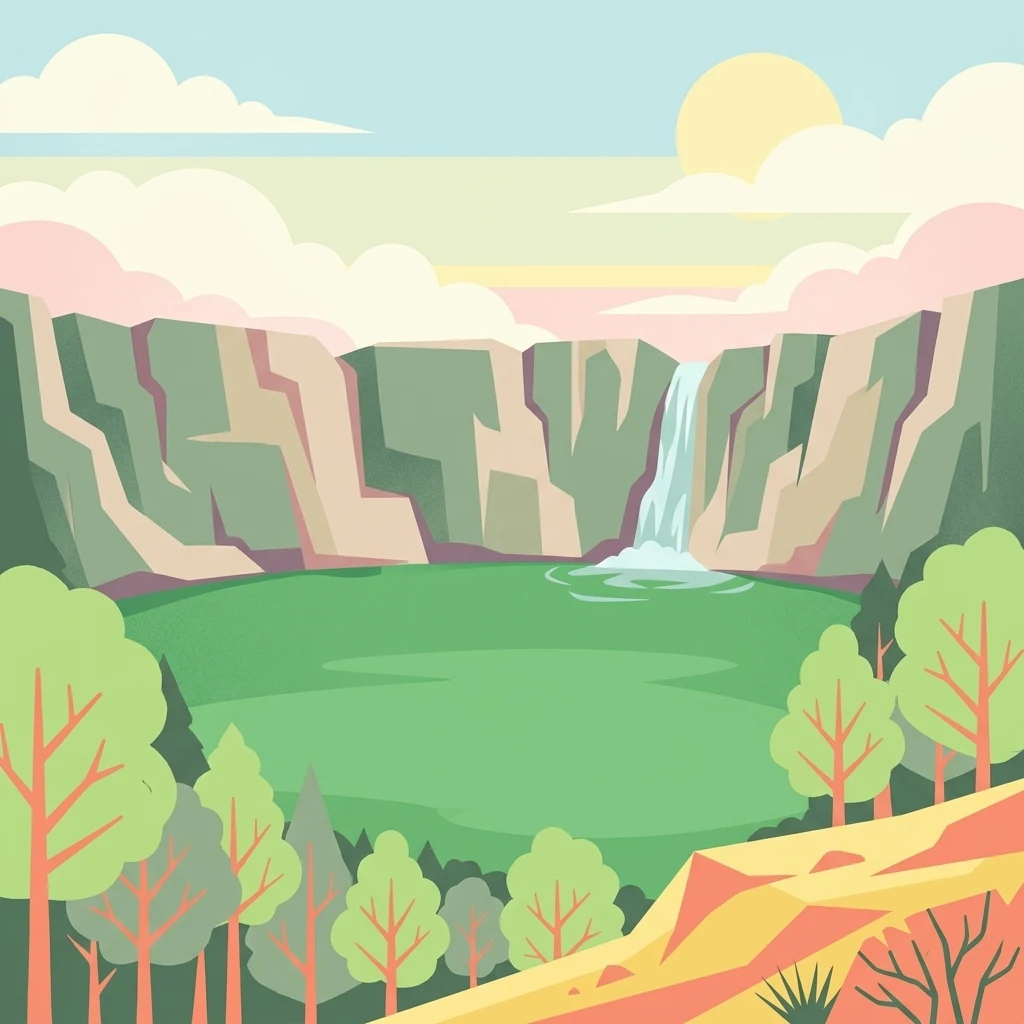
A flat vector-style illustration of a green circular lake surrounded by steep crater walls, with a waterfall cascading into the water, surrounded by trees and a soft sunset sky.

Lonar Lake

Natural monument

Park overview

Structured park overview, official facts, and landscape profile for Lonar Lake

Lonar Lake park facts, protected area profile, and essential visitor context

Review the core facts for Lonar Lake, including designation, size, terrain, visitor scale, habitats, and operating context in one park-focused overview.

About Lonar Lake

Lonar Lake occupies a singular position in India's natural heritage. Set within the Buldhana district of Maharashtra, the lake fills a near-circular crater that scientists now understand to be the product of a meteorite impact rather than volcanic activity, despite sitting squarely on the basalt-rich Deccan Plateau. The crater walls rise sharply around the basin, enclosing an isolated environment where rainwater and runoff accumulate without any significant outflow, allowing salts and alkalis to concentrate naturally over time.

This enclosed, evaporative system has shaped the lake's chemistry to an unusual degree. The water separates into distinct zones: a relatively neutral outer ring and a caustic alkaline interior, creating two overlapping ecological worlds within the same small body of water. Dense populations of salt-tolerant cyanobacteria give the lake a characteristic green hue most of the year, while specialized bacteria and archaea thrive in waters hostile to most life. The biological novelty of the system has drawn the attention of Indian scientific institutions, and even minerals in the surrounding soils have been compared to lunar samples.

Beyond its geology and chemistry, Lonar is framed by a striking natural environment. Slopes surrounding the basin are clothed in teak and mixed dry tropical woodland, supporting peafowls, gazelles, and other species that occupy the corridor between the rim and the water. The area has attracted hunters of birdlife for generations due to its combination of resident and migratory waterbirds. Cultural heritage also defines the lake's identity. Temples around the rim, such as the dedicated Vishnu shrine at Daitya Sudan, are entwined with local legend about the lake's formation, giving the place a sense of myth layered over measurable geological truth. The combination of impact origin, dual-water chemistry, woodland ecology, and ancient religious presence makes Lonar Lake a destination site of unusual depth.

Quick facts and research context for Lonar Lake

Lonar Lake lies in the Buldhana district of Maharashtra, on the Deccan Plateau, a vast basaltic plain formed by ancient volcanic eruptions. The basin is roughly circular, approximately 1.8 kilometres across, and the lake surface rests well below the surrounding crater rim.

The waterbody is saline and strongly alkaline, lacking any outflow stream, which leads to progressive mineral concentration through evaporation. Lonar is the only meteorite-impact crater lake in India and one of only four known hypervelocity impact structures formed in basaltic rock globally. It was declared a National Geological Monument and has been recognized internationally as a Ramsar wetland, placing it among India's designated ecologically significant waterbodies.

Protection and recognition

Documented terrestrial designation history and Ramsar site recognition

Lonar Lake Protection Status and International Recognition Data

Terrestrial protection status for Lonar Lake includes official Ramsar site recognition established in 2020. Documented designation records outline the international recognition framework and management scope associated with this protected landscape.

International recognition

Protection details

Protection scope
Terrestrial
Designated year
2020
Transboundary protection
No
Park context

Deeper park guide and search-rich context for Lonar Lake

Lonar Lake history, landscape, wildlife, and travel context

Explore Lonar Lake through its history, landscape character, ecosystems, wildlife, conservation priorities, cultural context, and seasonal travel timing in a structured park guide built for atlas discovery and search intent.

Why Lonar Lake stands out

Lonar Lake is best known as one of the world's rare meteorite-impact crater lakes formed in basaltic rock, and the only such feature in India. The near-perfect circular basin, with its steep enclosing walls and saline soda water, stands out dramatically against the surrounding Deccan Plateau landscape. The lake is also recognized for its unusual chemistry, which produces two distinct water environments, neutral near the edges and strongly alkaline in the center, that interact but do not fully mix. This unusual setting supports dense blooms of salt-tolerant cyanobacteria and a specialized community of bacteria and archaea unmatched by most other Indian lakes. Around the rim, ancient temples and a dense forest ecosystem add cultural and ecological layers that complete the site's distinctive profile.
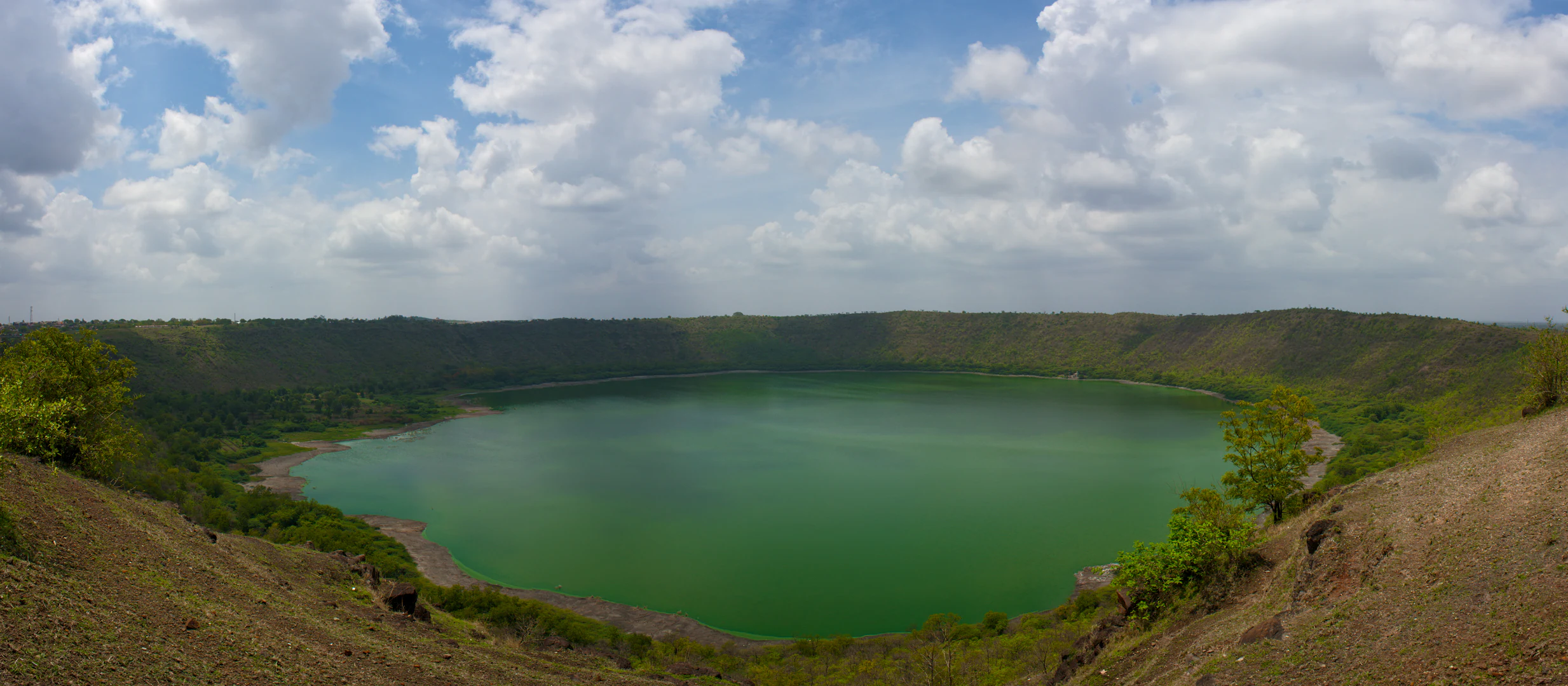
A wide, panoramic view looking down into the Lonar meteor impact crater, which contains a large, vibrant green circular lake surrounded by steep, vegetated crater walls under a cloudy sky.
Panoramic view of Lonar Lake, a saline soda lake formed within a meteoritic impact crater in Maharashtra, India.

Lonar Lake history and protected-area timeline

The geological history of Lonar Lake reaches back several hundred thousand years. Earlier studies estimated the impact at roughly 52,000 years, but more recent argon-argon dating has placed the event close to 570,000 years ago, an age consistent with the visible erosion of the crater rim. Long before modern science interpreted the basin, however, people were already aware of the unusual depression. References to the lake and its environs appear in ancient Sanskrit texts such as the Skanda Purana and the Padma Purana, suggesting that the feature captured human attention for many centuries.

Politically, the region around Lonar changed hands repeatedly, passing through the Maurya, Satavahana, Rashtrakuta, and Chalukya periods before coming under Mughal influence and, later, the rule of the Nizam of Hyderabad and the British. A sixteenth-century Mughal document, the Ain-i-Akbari, mentions the lake and notes the mineral resources found in its surroundings. Religious structures built around the rim, including the Daitya Sudan Temple dedicated to Vishnu and several smaller shrines, reflect this layered history of regional powers and devotional traditions.

In the modern era, the lake has gained formal recognition for its natural importance. It was declared a National Geological Monument, the surrounding area was designated the Lonar Wildlife Sanctuary in 2000, and an Eco-sensitive Zone was established around the site in 2017. Most significantly, the lake was added to the Ramsar list of internationally important wetlands in 2020, confirming its global conservation value. These protections have begun to address the pressures from local agriculture, construction, and tourism, though stewardship of the lake continues to be an ongoing challenge.

Lonar Lake landscape and geographic character

Lonar Lake sits within a roughly circular crater that is among the most clearly defined impact features visible on the Indian land surface. The walls of the basin rise steeply above the water, enclosing the lake within a natural bowl that is clearly visible from the rim and, thanks to NASA imagery, from orbit itself. The crater rim is intact enough for the geological origin of the lake to remain visually legible, even though the original ejecta blanket has long since weathered into the surrounding terrain.

The broader setting is the Deccan Plateau, an extensive plain composed of layered basalt flows laid down by massive volcanic eruptions millions of years ago. Despite this volcanic substrate, the crater itself is not volcanic in origin; it is incised into the basalt by the force of an extraterrestrial impact. The contrast between the plateau's flat surroundings and the abrupt descent into the crater gives Lonar a striking topographical profile. Within the basin, low-lying flats slope gently toward the saline water, while the steep interior crater walls are cloaked in dry tropical forest. Smaller secondary features, such as the nearby Ambar depression believed to be associated with debris from the impact, add further texture to the local landscape.

Satellite top down view of Lonar Lake circular crater filled with dark green water, surrounded by crater rims.
Satellite imagery showing Lonar Lake in May 2020 before its notable color change.

Lonar Lake ecosystems, habitats, and plant life

The ecological character of Lonar Lake is defined by its unusual basin and chemistry. Because the crater has no significant outflow, evaporation progressively concentrates dissolved salts and alkalis in the water, producing a habitat hostile to most large aquatic organisms but ideal for specialized microbes. The lake is famously split into two coexisting environments: a neutral outer zone where pH levels are close to those of ordinary freshwater, and a strongly alkaline inner zone whose pH approaches extreme values. The boundary between these two zones is gradual rather than abrupt, yet the communities they support remain distinct.

These extreme conditions support an unusual microbial ecosystem. Blooms of salt-tolerant cyanobacteria from genera such as Arthrospira give the water its characteristic green colour and dominate photosynthetic activity in the lake. Beyond cyanobacteria, surveys have identified methanogens, methanotrophs, phototrophs, denitrifying bacteria, sulfur oxidizers, sulfate reducers, and heterotrophs, alongside diverse fungi, alveolates, stramenopiles, and amoeboid lineages. Even novel micro-eukaryotes unique to this kind of habitat have been catalogued here, and a distinct fungal species, Curvularia lonarensis, has been described from the lake's sediments.

Outside the water, the crater slopes support a dry deciduous woodland dominated by teak, interspersed with flowering trees, thorny acacias, and Ziziphus shrubs that thrive on the well-drained volcanic soils. Cultivated plots of millet, maize, okra, banana, and papaya edge the lake, reflecting the long coexistence of farming and forest around the crater. This blend of agricultural land, dry tropical forest, and saline lake creates a distinctive patchwork landscape within a very small radius.

Lonar Lake wildlife and species highlights

Lonar Lake is recognized for its rich birdlife, which combines resident woodland species with migratory waterbirds drawn to the open water in the crater. Visitors regularly observe black-winged stilts, brahminy ducks, grebes, shelducks, shovelers, and teals patrolling the shallows, while herons, lapwings, parakeets, hoopoes, and larks move between the water and the surrounding forest. The presence of species such as the Asian woolly-necked stork and seasonal flocks of common pochards reflects the lake's value as a wetland refuge on a broader flyway.

The forested slopes and rim of the crater support a different set of species. Peafowls are a familiar sight along the woodland edges, where their calls frequently echo across the basin. Monitor lizards, chinkaras, gazelles, and wolves, although shy and less commonly observed, form part of the wider sanctuary fauna. Together, the mix of wetland and forest wildlife gives the area a layered ecological identity unusual for such a small geographic footprint.

Lonar Lake conservation status and protection priorities

Lonar Lake's conservation significance is rooted in its status as an impact crater lake of global scientific importance. The site has been formally protected at multiple levels: as a National Geological Monument, as part of the Lonar Wildlife Sanctuary established in 2000, and through the declaration of an Eco-sensitive Zone around the lake in 2017. The lake's inclusion among Ramsar wetlands in 2020 affirmed its international standing as a hydrological and ecological site requiring special protection.

The lake's scientific importance extends beyond geology. Researchers have used Lonar as a natural laboratory for studying extremophile microbes, and a 2019 study from IIT Bombay found notable mineralogical similarities between the lake's soils and lunar rocks retrieved during the Apollo missions, giving the site additional astrobiological relevance. The presence of biological nitrogen fixation first documented here in 2007 underscores the role of the lake in biogeochemical research.

Despite these recognitions, the site faces ongoing pressures. The use of fertilizers and pesticides in surrounding agricultural land, sewage inflow from nearby settlements, littering, illegal logging, and unregulated construction threaten the integrity of the water and the surrounding rim. Conservation efforts increasingly focus on managing tourism and local land use while preserving the crater's characteristic chemistry and unusual microbial communities.

Lonar Lake cultural meaning and human context

The cultural landscape around Lonar Lake reflects centuries of regional history and religious tradition. The most prominent temple on the rim, the Daitya Sudan Temple, is dedicated to Vishnu in his form as the slayer of a demon named Lonasura or Lavanasura, and the legend itself may encode an early, mythical explanation for the lake's striking crater form. Smaller shrines, including the Kamalaja Devi Temple, the Gomukha Temple, and the partially submerged Shankara Ganesha Temple, give the rim a layered devotional character.

The wider region has been home to successive political powers, from ancient dynasties such as the Mauryas, Satavahanas, Rashtrakutas, and Chalukyas, through the Mughals, the Nizam of Hyderabad, and the British. Each of these transitions has left traces in the architecture and inscriptions that remain visible around the basin. Even today, the annual rhythms of pilgrimages, agricultural work, and local festivals infuse the lake with human presence. The combination of geological drama, ecological novelty, and centuries of cultural memory is central to the site's enduring identity.

Top sights and standout views in Lonar Lake

The defining highlight of Lonar Lake is its origin: a hypervelocity meteorite impact that produced a circular depression in the Deccan Plateau's basalt, creating India's only impact crater lake and one of the few such structures worldwide. The crater's sharp walls, visible both from the rim and from satellite imagery, frame a saline soda lake famous for two coexisting water chemistries and an unusually diverse microbial community.

Around this geological core, the highlights continue: the Daitya Sudan Temple and other historic shrines scattered along the rim, the protected status that places Lonar among international Ramsar wetlands, the dry deciduous teak forest that supports peafowls, gazelles, and seasonal migratory waterbirds, and the broader scientific value of the site as a natural laboratory for studying extreme environments and even lunar-analogue mineralogy.

Best time to visit Lonar Lake

The character of Lonar Lake shifts with the seasons in ways shaped by the regional monsoon climate of Maharashtra. Following the rains, water levels rise and the lake takes on a fuller, more reflective appearance, while bird activity peaks as migratory waterbirds take advantage of the expanded habitat. The surrounding woodland is also at its greenest during and immediately after the wet season, making this period particularly rewarding for visitors interested in both scenery and birdwatching.

During the drier months, evaporation intensifies and the lake's chemistry becomes more extreme, occasionally producing striking colour changes as microbial populations respond to shifting salinity. The cooler, drier season offers clearer skies and easier walking around the crater rim, though vegetation is more sparse. Each season brings a different facet of the lake to the foreground, contributing to its appeal across the year.
Monthly climate preview

Analysis of long-term temperature ranges and monthly precipitation variations across the representative coordinate.

Lonar Lake Climate Normals and Measured Annual Temperature Patterns

Representative coordinate records show measured shifts in average monthly temperatures and precipitation rates from twelve-year baseline data. Reviewing the complete twelve-month climate profile provides detailed metrics for long-term meteorological comparisons.
Annual mean26 °C
20 °C34 °C
Jan21°
Feb24°
Mar28°
Apr32°
May34°
Jun29°
Jul26°
Aug25°
Sep25°
Oct24°
Nov22°
Dec20°
Warmest month
May

33.7 °C

Coolest month
December

20.3 °C

Wettest month
July

6.4 mm/day

Driest month
February

0.2 mm/day

Park location guide

Geography guide, regional context, and park location map for Lonar Lake

Lonar Lake park geography, regions, and map view in India

Understand where Lonar Lake sits in India through a broader geographic reading of the surrounding landscape, nearby location context, and its mapped position within the national park landscape.

How Lonar Lake fits into India

India is a South Asian country bordered by the Indian Ocean, Arabian Sea, and Bay of Bengal. It shares land borders with Pakistan, China, Nepal, Bhutan, Bangladesh, and Myanmar. The country has a population of over 1.4 billion people and operates as a federal parliamentary republic with its capital in New Delhi.

Wider geography shaping Lonar Lake in India

India occupies the Indian subcontinent in South Asia, bordered by the Arabian Sea to the southwest, the Bay of Bengal to the southeast, and the Indian Ocean to the south. It shares land borders with Pakistan to the west, China, Nepal, and Bhutan to the north, and Bangladesh and Myanmar to the east. The territory also includes the Andaman and Nicobar Islands in the Indian Ocean.

Map view of Lonar Lake

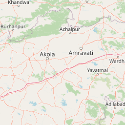
Use this park location map to pinpoint Lonar Lake in India, understand its exact geographic position, and read its mapped placement within the surrounding landscape more clearly.

Pigeon | © OpenStreetMap contributors

Location context for Lonar Lake

Buldhana districtMaharashtra

Examine the steep crater walls, saline soda waters, and surrounding teak forest habitats.

Lonar Lake Photos and Landscape Scenery: Visualizing the Impact Crater Basin

Visual records capture the dramatic topography and unique saline ecosystem enclosed within the Deccan Plateau impact basin. Photographic views reveal the steep forested crater walls and distinct shoreline environments that define this rare geological landmark.

A wide, panoramic view looking down into the Lonar meteor impact crater, which contains a large, vibrant green circular lake surrounded by steep, vegetated crater walls under a cloudy sky.

Top-down satellite view of the circular Lonar Lake crater surrounded by agricultural and rural landscape.

Satellite top down view of Lonar Lake circular crater filled with dark green water, surrounded by crater rims.

Park atlas

Compare regional protected areas and surrounding Deccan Plateau geography

Explore Other Parks Near Lonar Lake and Related Protected Landscapes

Browse nearby national parks and related protected landscapes to examine the broader geographic context surrounding Lonar Lake. Comparing adjacent terrain helps trace regional ecosystems and conservation networks across the surrounding plateau.
National parkMaharashtra
About 170 km away#1 closest

Northeast

Gugamal National Park: A National Park Within Maharashtra's Geographic Atlas

Explore its mapped boundaries and regional landscape context.

Gugamal National Park represents a critical protected natural landscape within the state of Maharashtra, India. As a designated national park, it provides essential context for understanding the region's geography and the spread of conservation efforts. Users can explore the park's mapped boundaries and its role within the broader atlas of protected areas, contributing to a detailed geographic understanding.

Area
361.28 km²
Established
1974
IUCN
II
Relief
Upland
Wildlife reserveMaharashtra
About 260 km away#2 closest

West

Nandur Madhameshwar Bird Sanctuary: Maharashtra Wetland Geography and Protected Lands

Exploring the Godavari River floodplain and riparian bird habitats

Nandur Madhameshwar Bird Sanctuary sits as a pivotal protected wetland in Maharashtra, characterized by a shifting mosaic of marshes, scrub, and seasonal waterbodies. This wildlife reserve offers essential insights into the riparian ecology of the Godavari River basin, providing a mapped look at one of India's most significant inland bird habitats.

Area
100.12 km²
Established
1986
IUCN
IV
Relief
Lowland
National parkChandrapur district
About 303 km away#3 closest

East

Tadoba Andhari Tiger Reserve National Park: Mapped Protected Landscape Discovery

Geographic context within Chandrapur district, India.

Investigate Tadoba Andhari Tiger Reserve as a national park, focusing on its distinct protected landscape characteristics. This detail page provides structured insights into its mapped boundaries and its position within the regional geography of Chandrapur district, essential for a comprehensive understanding of India's protected natural areas.

Area
1,727.59 km²
Established
1955
IUCN
II
Relief
Highland
National parkMadhya Pradesh
About 316 km away#4 closest

Northwest

Dinosaur Fossils National Park: Protected Area and National Park in Madhya Pradesh

Explore mapped boundaries and regional geography.

Dinosaur Fossils National Park stands as a distinct national park within Madhya Pradesh, offering a unique focus for geographic exploration. This entry provides essential details about its protected status, mapped landscape features, and its place within India's network of conservation areas. Engage with structured data that details the park's regional context and natural terrain for comprehensive atlas-based understanding.

Area
0.894 km²
Established
2011
IUCN
II
Relief
Lowland
National parkNavsari District
About 327 km away#5 closest

West

Vansda National Park: Protected Deciduous Forest Landscape within the Western Ghats

Explore the mapped geography and biodiversity of this Navsari District national park.

Vansda National Park stands as a crucial protected area in Navsari District, Gujarat, preserving the characteristic dense deciduous forests and extensive bamboo groves of the Western Ghats. The park's geography is shaped by its location along the Ambika River, presenting a landscape of rolling hills and forested valleys within this significant biodiversity hotspot. Users can delve into its protected land status, mapped terrain, and the unique ecological attributes that make it a noteworthy national park for geographic and conservation exploration.

Area
23.99 km²
Established
1979
IUCN
II
Relief
Highland
National parkIndia
About 330 km away#6 closest

Northeast

Satpura National Park: India's National Park for Protected Landscape Discovery

Explore mapped boundaries and regional geographic context.

Satpura National Park represents a significant protected area within India, offering valuable insights for geographic and atlas exploration. As a designated national park, its mapped boundaries and landscape character are central to understanding its protected status. This entry provides a focused view on Satpura National Park, highlighting its contribution to the atlas of protected lands in India and its distinct geographic identity for researchers and explorers.

Area
524 km²
Established
1981
Relief
Mountain
Climate
Subtropical
National parkMadhya Pradesh
About 345 km away#7 closest

Northeast

Pench National Park: Madhya Pradesh National Park Protected Landscape Overview

Mapped geographic context and protected area boundaries

Pench National Park is a designated national park situated in Madhya Pradesh, India, offering a distinct protected landscape for geographic study. This entry provides detailed insights into its mapped terrain, allowing for an atlas-style exploration of its protected boundaries and its significance within the regional geography. Understand the park's place in the landscape and its value for conservation-focused map exploration.

Area
292.85 km²
Established
1983
IUCN
II
Relief
Upland
National parkTelangana
About 346 km away#8 closest

Southeast

Kasu Brahmananda Reddy National Park: Telangana National Park Geographic Atlas

Mapped protected landscapes and regional context in India.

This detail entry for Kasu Brahmananda Reddy National Park provides essential context for understanding its protected landscape identity within Telangana. Explore its mapped boundaries, regional geographic setting on the Deccan Plateau, and discover how this national park contributes to the atlas of protected areas in South India, offering a grounded perspective for geographic exploration.

Area
1.6 km²
Established
1998
Climate
Tropical
Access
Easy access

Common questions about visiting, size, designation, and location context for Lonar Lake

Lonar Lake FAQs for park facts, access, geography, and protected area context

Find quick answers about Lonar Lake, including protected-area facts, park geography, trail and visitor context, and how the park fits into its surrounding country and regional landscape.
MoriAtlas Explorer

Continue Your Protected Areas Search Across the Global Atlas

Deepen your exploration by continuing the structured search for national parks and protected areas worldwide. Utilize the comprehensive filtering capabilities to compare different conservation landscapes and refine your understanding of global park geography. Discover more about the distribution and characteristics of protected natural areas.

Global natural geography