
Capes
Park geography
Analyzing the regional boundaries, elevation data, and physical features of this Galicia reserve.
Geography and Landscape Profile of Reserva de la biosfera de las Mariñas Coruñesas y Tierras del Mandeo
This geographic profile covers the 1139.7 square kilometer area of Reserva de la biosfera de las Mariñas Coruñesas y Tierras del Mandeo in Galicia, Spain. The site includes diverse terrain ranging from sea level to 841 meters, featuring a mix of mountains, river valleys, coastal cliffs, and wetlands that support a temperate climate. Users can trace recorded stream networks and evaluate the regional landscape distribution within the designated area.
A coastal and inland Galician biosphere reserve protecting Atlantic forests, river valleys, and the rías of Betanzos and A Coruña.
Mariñas Coruñesas and Tierras del Mandeo Biosphere Reserve
The Mariñas Coruñesas and Tierras del Mandeo Biosphere Reserve is a UNESCO-designated protected area in northwestern Spain, declared on 28 May 2013 by the UNESCO Man and the Biosphere Programme. It covers roughly 113,970 hectares across seventeen municipalities in the province of A Coruña, in the autonomous community of Galicia, blending coastal rías, river valleys, and inland sierras. The reserve extends inland from the Atlantic coast along the basins of two principal rivers, the Mero and the Mandeo, and includes the estuarine margins of the Ría de Betanzos and the Ría do Burgo. Its geography ranges from sea-level beaches and estuaries to forested hills and the Sierra de la Cova da Serpe, whose highest peak reaches 841 meters. The territory is unusually diverse for a relatively compact area, encompassing suburban, rururban, and rural zones tied to the influence of the city of A Coruña. The reserve is especially recognized for its surviving fragments of coastal Atlantic forest, which act as refuges for relict flora and fauna that persisted through the last glaciation. It hosts dozens of habitats and hundreds of protected species, making it one of the most ecologically significant UNESCO biosphere reserves along the Cantabrian-Atlantic coast of the Iberian Peninsula.
- Location
- Spain
- Park type
- Biosphere reserve
- Established
- 2013
- Area
- 1,139.7 km²
- Highest point
- 841 m
Location overview
National park location memberships and regional status across Spain and Galicia
Geographic Overview of Reserva de la biosfera de las Mariñas Coruñesas y Tierras del Mandeo
Reserva de la biosfera de las Mariñas Coruñesas y Tierras del Mandeo is situated in Spain within the region of Galicia. Recorded facts document coastal and marine attributes for the protected area without transboundary or island designations.
- Countries
- Spain
- Regions
- Galicia
- Primary location
- Galicia
- Geographic setting
- Coastal · Marine
Boundary and coordinates
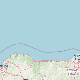
Interactive protected area mapping covering 1139.7 square kilometers
Reserva de la biosfera de las Mariñas Corunesas y Tierras del Mandeo Boundary Map and Extent
Mapped boundary geometry provides spatial context for the protected area footprint. Accompanying measurements detail the total geographic extent, coordinate limits, and regional span.
- Boundary area
- 1,139.8 km²
- Boundary perimeter
- 309.9 km
- Northernmost point
- 43.4054° N
- Southernmost point
- 42.9852° N
- Easternmost point
- 7.9166° W
- Westernmost point
- 8.6038° W
- Geographic centre
- 43.2229° N, 8.194° W
- North–south span
- 46.7 km
- East–west span
- 55.9 km
Elevation and terrain
Mixed relief profiles spanning from sea level to high points across protected terrain.
Reserva de la biosfera de las Mariñas Coruñesas y Tierras del Mandeo Terrain and Elevation Profile
Recorded elevation metrics span from zero meters up to eight hundred forty-one meters across mixed terrain classifications. Accompanying cards detail individual streams located within protected boundaries along with their spatial relationships.
- Minimum elevation
- 0 m
- Maximum elevation
- 841 m
- Highest point
- 841 m
Selected named natural features
Rivers
Rego das Lobeiras
Forests
Bosque do Perendenge
Peaks
Baralla
144 m
Streams
Rego das Moas
Forests
As Uceiras
Environmental setting
Temperate climate zones, mixed relief, and major water presence profiles
Reserva de la biosfera de las Mariñas Coruñesas y Tierras del Mandeo Environmental Classifications
Stored landscape features, habitat types, and seasonal profiles serve as interpretive categories for the physical setting. Recorded classifications link directly to connected atlas destinations across the protected area.
- Relief
- Mixed relief
- Climate
- Temperate
- Water
- Major water bodies
- Forest cover
- Partial forest
- Seasonality
- Year-round
Landscape features
Mountains · Valleys · Cliffs · Forest · Wetland · Lakes · Rivers · Coast · Beach
Habitat types
Temperate broadleaf forest · Wetland · Riverine habitat · Coastal habitat · Marine habitat
Park atlas
Compare nearby protected areas and connected regional landscapes in northwestern Iberia
Parks Near Reserva de la biosfera de las Mariñas Coruñesas y Tierras del Mandeo
Visitors exploring Reserva de la biosfera de las Mariñas Coruñesas y Tierras del Mandeo can browse adjacent protected areas, river valleys, and coastal reserves. Reviewing these surrounding natural habitats provides valuable geographic context for northern Spanish conservation zones.
Biosphere reserveGalicia
Park boundaries overlap#1 closest
East

Reserva de la biosfera de las Tierras del Miño: Mapped Landscapes and Geographic Overview
Extensive riverine forests and wetland networks in northwestern Spain
Explore the expansive territory of Reserva de la biosfera de las Tierras del Miño, spanning a large portion of the Galician interior. This protected area features a mosaic of wetlands, riparian corridors, and mountainous terrain, offering a deep look into the ecological and cultural geography of the upper Miño river basin.
- Area
- 3,636.69 km²
- Established
- 2002
- Relief
- Lowland
- Scope
- Terrestrial
Biosphere reserveLugo
64 km away#2 closest
East
Reserva de la Biosfera de Los Ancares Lucenses y Montes de Cervantes, Navia y Becerreá Protected Area Map
Mountainous terrain and river valley geography in Lugo, Spain
This protected area covers the dramatic Sierra de Ancares, featuring steep mountain slopes and deep river valleys that define the geography of Galicia. The reserve spans a significant vertical relief, providing essential habitats for brown bears and capercaillie while preserving traditional rural mountain land use systems and ancient forest ecosystems.
- Area
- 536.64 km²
- Established
- 2006
- Relief
- Mountain
- Climate
- Temperate
National parkGalicia
67 km away#3 closest
Southwest
Atlantic Islands of Galicia National Park: Protected Archipelagos & Galician Coastline Geography
Explore mapped island ecosystems and protected marine areas.
Uncover the protected landscape of the Atlantic Islands of Galicia National Park, Spain's only national park in Pontevedra province. This atlas entry details the four distinct archipelagos, Cíes, Ons, Sálvora, and Cortegada, across the Rías Baixas. Discover the unique sea-land protected area, its rare bay laurel forests, significant seabird colonies, and the broader regional geography of Galicia.
- Area
- 84.8 km²
- Established
- 2002
- IUCN
- II
- Visitors
- 472.3K annual
Biosphere reserveGalicia
82 km away#4 closest
South
Área de Allariz Biosphere Reserve: Mapping the Protected Landscapes of Inland Galicia
Exploring the river basins, granitic massifs, and ecological frontiers
The Área de Allariz biosphere reserve serves as a vital transition zone in northwestern Spain, characterized by its flat-floored tectonic basin, the River Limia, and varied highland terrain. This protected area offers an instructive look at the integration of traditional rural land management with large-scale ecological recovery and conservation across its core, buffer, and transition zones.
- Area
- 214.82 km²
- Established
- 2005
- Relief
- Mixed relief
- Scope
- Terrestrial
Biosphere reserveProvincia de León
88 km away#5 closest
East
Reserva de la biosfera de los Ancares Leoneses: Protected Mountain Terrain and Atlas
Mapping the Sierra de Ancares river valleys in Provincia de León
Examine the geographic layout and protected boundaries of the Reserva de la biosfera de los Ancares Leoneses. This biosphere reserve serves as a critical mountain corridor, featuring complex river basins and diverse forest cover that highlight the region's environmental and cultural history across the Spanish highlands.
- Area
- 567.86 km²
- Established
- 2006
- Relief
- Mountain
- Scope
- Terrestrial
National parkPortugal
101 km away#6 closest
South

Peneda-Gerês National Park: A Distinct Protected Landscape in Northern Portugal
Granite peaks, glacial valleys, and cultural heritage mapped.
Peneda-Gerês National Park represents a cornerstone of protected landscapes in Portugal, celebrated for its rugged granite mountains and deep glacial valleys sculpted over millennia. This national park showcases a rare ecological transition zone with unique endemic species and features dramatic waterfalls and pristine river systems. The park's rich cultural tapestry, interwoven with its natural environment, offers a compelling subject for atlas-based geographic discovery and landscape exploration.
- Area
- 695.93 km²
- Established
- 1971
- IUCN
- II
- Visitors
- 92.8K annual

Protected landscapeBragança District
131 km away#7 closest
Southeast
Montesinho Natural Park: Protected Landscape in Bragança District, Portugal
Explore mapped boundaries and regional landscape context.
Montesinho Natural Park is designated as a protected landscape in northeastern Portugal, located within the administrative region of Bragança District. This page serves as an entry point to understanding the park's protected area characteristics, its mapped geographic footprint, and its role in the broader natural landscape of the Trás-os-Montes region. Discover the atlas value of this significant protected territory and its relation to surrounding geography.
- Area
- 742.25 km²
- Established
- 1979
- IUCN
- V
- Relief
- Mountain
Protected landscapeEsposende
165 km away#8 closest
South
Northern Littoral Natural Park Protected Landscape: Geographic Discovery and Atlas Context
Mapped protected areas and regional landscape discovery near Esposende.
Uncover the geographic identity of Northern Littoral Natural Park, a key protected landscape situated near Esposende. This MoriAtlas entry focuses on its mapped boundaries and regional significance, providing a factual basis for understanding its role within Portugal's network of protected areas. Explore the park's natural terrain and its context within the broader geography of the Norte region for comprehensive atlas-based discovery.
- Area
- 87.62 km²
- Established
- 1987
- IUCN
- V
- Relief
- Lowland
MoriAtlas Explorer
Continue exploring the geographic profile of Reserva de la biosfera de las Mariñas Coruñesas y Tierras del Mandeo
Gain insight into the layered natural environment of this biosphere reserve through its detailed mapping of river valleys, coastal forest refuges, and upland sierras. MoriAtlas provides a structured look at the terrain and boundaries that define this significant conservation area within the Galicia region of Spain.
Browse next
Global natural geography
Explore related park routes
Explore MoriAtlas Global ParksBrowse All MoriAtlas ParksGlobal Park Map DiscoveryMoriAtlas: Browse All CountriesBrowse All MoriAtlas ContinentsNational Park Environment AtlasGrand Canyon National Park AtlasYellowstone National Park AtlasYosemite National Park Atlas and GeographySerengeti National Park AtlasGalápagos National Park Protected LandscapeBanff National Park Geography and AtlasKruger National Park Atlas EntryUluṟu-Kata Tjuṯa National Park AtlasExplore Uluru-Kata Tjuta National Park GeographyPlitvice Lakes National Park AtlasFiordland National Park Protected LandscapeGreat Smoky Mountains National Park AtlasAfghanistan National Parks and Protected AreasAlbania National Parks and Protected AreasAlgeria National Parks and Protected AreasAmerican Samoa National Parks and Protected AreasAndorra National Parks and Protected AreasAngola National Parks and Protected AreasAntarctica National Parks and Protected AreasAntigua and Barbuda Park List