
Mori Atlas logo
Biosphere reserveReserva de la biosfera de las Mariñas Coruñesas y Tierras del Mandeo

Tracing the geographic transition from Galician coastal estuaries to inland mountain sierras

Reserva de la biosfera de las Mariñas Coruñesas y Tierras del Mandeo: A Protected Atlantic Landscape

(Reserva de la Biosfera Mariñas Coruñesas y Tierras del Mandeo)

The Reserva de la biosfera de las Mariñas Coruñesas y Tierras del Mandeo encompasses a diverse protected territory in northwestern Spain. Spanning from the Atlantic shoreline of the Ría de Betanzos and Ría do Burgo through the river basins of the Mero and Mandeo, this biosphere reserve captures a complex transition of coastal forests, rural valleys, and the elevated terrain of the Sierra de la Cova da Serpe.

biosphere reserveUNESCO biosphere reserveAtlantic forestcoastal ecosystemsestuarine landscaperiver valleys
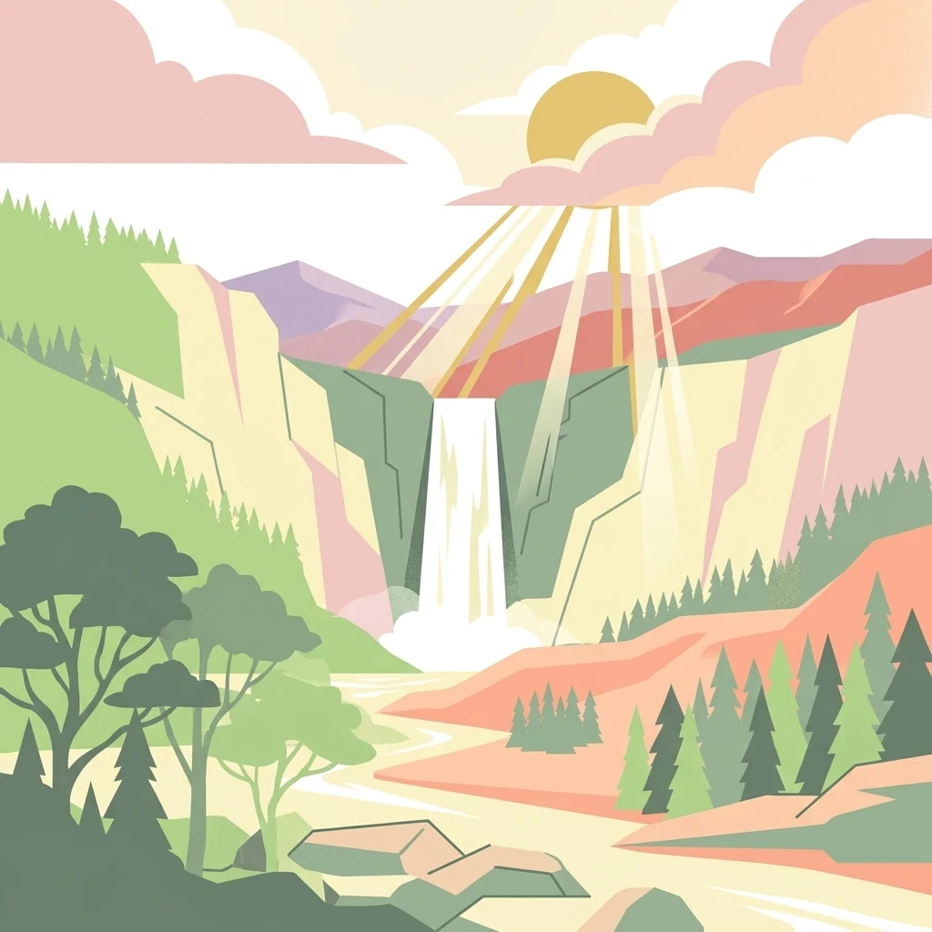
A flat, stylized digital illustration of a mountainous landscape with a river flowing from a cascading waterfall, surrounded by forest and under a sunlit sky with soft clouds.

Reserva de la biosfera de las Mariñas Coruñesas y Tierras del Mandeo

Biosphere reserve

Park overview

Structured park overview, official facts, and landscape profile for Mariñas Coruñesas and Tierras del Mandeo Biosphere Reserve

Mariñas Coruñesas and Tierras del Mandeo Biosphere Reserve park facts, protected area profile, and essential visitor context

Review the core facts for Mariñas Coruñesas and Tierras del Mandeo Biosphere Reserve, including designation, size, terrain, visitor scale, habitats, and operating context in one park-focused overview.

About Mariñas Coruñesas and Tierras del Mandeo Biosphere Reserve

The Mariñas Coruñesas and Tierras del Mandeo Biosphere Reserve is a UNESCO-designated protected area in northwestern Spain, situated along the Cantabrian-Atlantic coast of Galicia in the province of A Coruña. It was officially declared on 28 May 2013 and represents one of the newer additions to the Spanish network of biosphere reserves, forming part of the broader framework of the UNESCO Man and the Biosphere Programme.

Geographically, the reserve is defined by two main river basins, those of the Mero and the Mandeo, plus the coastal sectors of the Ría de Betanzos and the Ría do Burgo. The landscape ranges from sandy beaches, rocky headlands, and estuarine environments along the Atlantic coast, through extensive river valleys and rural inland areas, to forested foothills and the highest elevations of the Sierra de la Cova da Serpe, which reaches 841 meters. Although the reserve covers roughly 113,970 hectares, around 3.85 percent of the total area of Galicia, it integrates suburban, rururban, and rural zones owing to the influence of the nearby metropolitan area of A Coruña.

Administratively, the reserve spans seventeen municipalities distributed across the comarcas of A Coruña, Betanzos, and Tierra de Mellid, including Arteixo, Oleiros, Sada, Bergondo, Cambre, Culleredo, Carral, and Abegondo in the coastal and suburban band, and Betanzos, Miño, Paderne, Aranga, Coirós, Curtis, Irijoa, Oza-Cesuras, and Sobrado in the more rural interior. Several Sites of Community Importance from the European Natura 2000 network are nested within the reserve, including Betanzos-Mandeo, the Abegondo-Cecebre reservoir, the Cova da Serpe range, the Costa de Dexo-Serantes coast, and the relevant stretch of the Costa da Morte within Arteixo.

Ecologically, the reserve is recognized for maintaining important fragments of coastal Atlantic forest, increasingly rare elsewhere on this coast, which serve as refuges for numerous relict species of flora and fauna. About 49 habitats of community interest, 12 of them priority habitats, and more than 300 protected species have been documented, reinforcing the reserve's role as one of the most ecologically significant areas along the northwestern Iberian coast.

Quick facts and research context for Mariñas Coruñesas and Tierras del Mandeo Biosphere Reserve

Designated a UNESCO Biosphere Reserve on 28 May 2013, the area lies in the province of A Coruña in Galicia, northwestern Spain, and covers approximately 113,970 hectares across seventeen municipalities. It is structurally defined by the river basins of the Mero and the Mandeo, together with the coastal sectors of the Ría de Betanzos and the Ría do Burgo.

The reserve contains multiple Sites of Community Importance within the European Natura 2000 network, including Betanzos-Mandeo, the Abegondo-Cecebre reservoir, the Cova da Serpe range, and the Costa de Dexo-Serantes coast, which is also declared a natural monument. Approximately 49 habitats of community interest, including 12 considered priority, and more than 300 protected species have been recorded within the reserve's boundaries.

Protection and recognition

Examine documented protection scope, management frameworks, and official conservation designations

Reserva de la biosfera de las Mariñas Coruñesas y Tierras del Mandeo Protection Status

Reserva de la biosfera de las Mariñas Coruñesas y Tierras del Mandeo maintains a documented mixed protection scope outlining regional conservation frameworks. Review official management parameters and recorded designation metrics for this protected landscape.

Protection details

Protection scope
Mixed
Transboundary protection
No
Park context

Deeper park guide and search-rich context for Mariñas Coruñesas and Tierras del Mandeo Biosphere Reserve

Mariñas Coruñesas and Tierras del Mandeo Biosphere Reserve history, landscape, wildlife, and travel context

Explore Mariñas Coruñesas and Tierras del Mandeo Biosphere Reserve through its history, landscape character, ecosystems, wildlife, conservation priorities, cultural context, and seasonal travel timing in a structured park guide built for atlas discovery and search intent.

Why Mariñas Coruñesas and Tierras del Mandeo Biosphere Reserve stands out

The reserve is best known as a refuge for relict coastal Atlantic forests along the Cantabrian-Atlantic coast of Galicia. These increasingly fragmented woodlands sheltered climatic relict species of flora and fauna during the last glaciations and remain a defining ecological feature of the protected area. It is also recognized for the diverse mosaic of marine and inland landscapes compressed into a relatively small territory, from the estuaries of the Ría de Betanzos and the Ría do Burgo through broad river valleys to the inland Sierra de la Cova da Serpe. Together with its network of Natura 2000 sites, this combination of coast, valley, and upland forest gives the biosphere reserve one of the most ecologically layered profiles in northwestern Iberia.
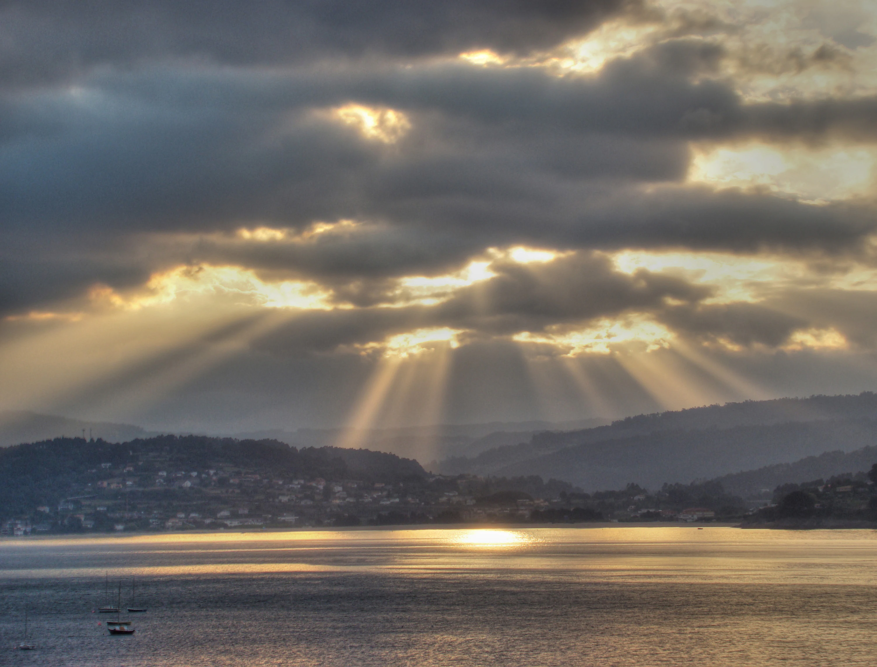
Sunbeams break through heavy clouds at sunrise over a calm coastal bay with distant hills and a small town.
Sunrise over the coastal landscape of Sada within the Mariñas Coruñesas e Terras do Mandeo Biosphere Reserve.

Mariñas Coruñesas and Tierras del Mandeo Biosphere Reserve history and protected-area timeline

The Mariñas Coruñesas and Tierras del Mandeo Biosphere Reserve was officially declared on 28 May 2013 under the UNESCO Man and the Biosphere Programme, becoming part of the Spanish network of biosphere reserves. Its creation was supported through the rural development association Mariñas-Betanzos, which continues to act as a coordinating body and runs the official communication channels for the reserve.

The designation brought together seventeen municipalities in the province of A Coruña into a single coordinated framework for conservation and sustainable development. Several of the protected areas that were already part of the European Natura 2000 network, such as the Betanzos-Mandeo Site of Community Importance and the Abegondo-Cecebre reservoir area, were incorporated into the broader biosphere reserve structure as core and buffer zones.

Following its declaration, the reserve has been promoted through educational initiatives, including the resource guide for teachers published by the Centro de Extensión Universitaria y Divulgación Ambiental de Galicia (CEIDA) in 2014, and through a dedicated quality mark for local products. These efforts have helped to reinforce the reserve's profile both within Galicia and in the wider Spanish biosphere reserve network.

Mariñas Coruñesas and Tierras del Mandeo Biosphere Reserve landscape and geographic character

The landscape of the biosphere reserve unfolds in a layered transition from the Atlantic coast to the inland sierras of Galicia. Along the coast, the reserve includes the estuarine systems of the Ría de Betanzos and the Ría do Burgo, with sandy beaches such as those of Barrañán in Arteixo and Santa Cristina in Oleiros, as well as rocky stretches like the Costa de Dexo-Serantes, which is also a declared natural monument.

Moving inland, the river valleys of the Mero and the Mandeo carve broad, gently sloping agricultural lowlands framed by forested hills. These basins form the structural backbone of the reserve, linking the coastal rías with the more mountainous interior. The valley floors combine traditional rural farmland, small villages, and patches of woodland, while the surrounding hills support denser forest cover.

Further inland, the Sierra de la Cova da Serpe provides the highest elevation within the reserve, reaching 841 meters at its peak. The transition from coast to mountain occurs over relatively short distances, producing the compressed diversity of habitats, estuarine wetlands, riverine corridors, valley landscapes, and upland forests, which characterizes the reserve's physical setting.
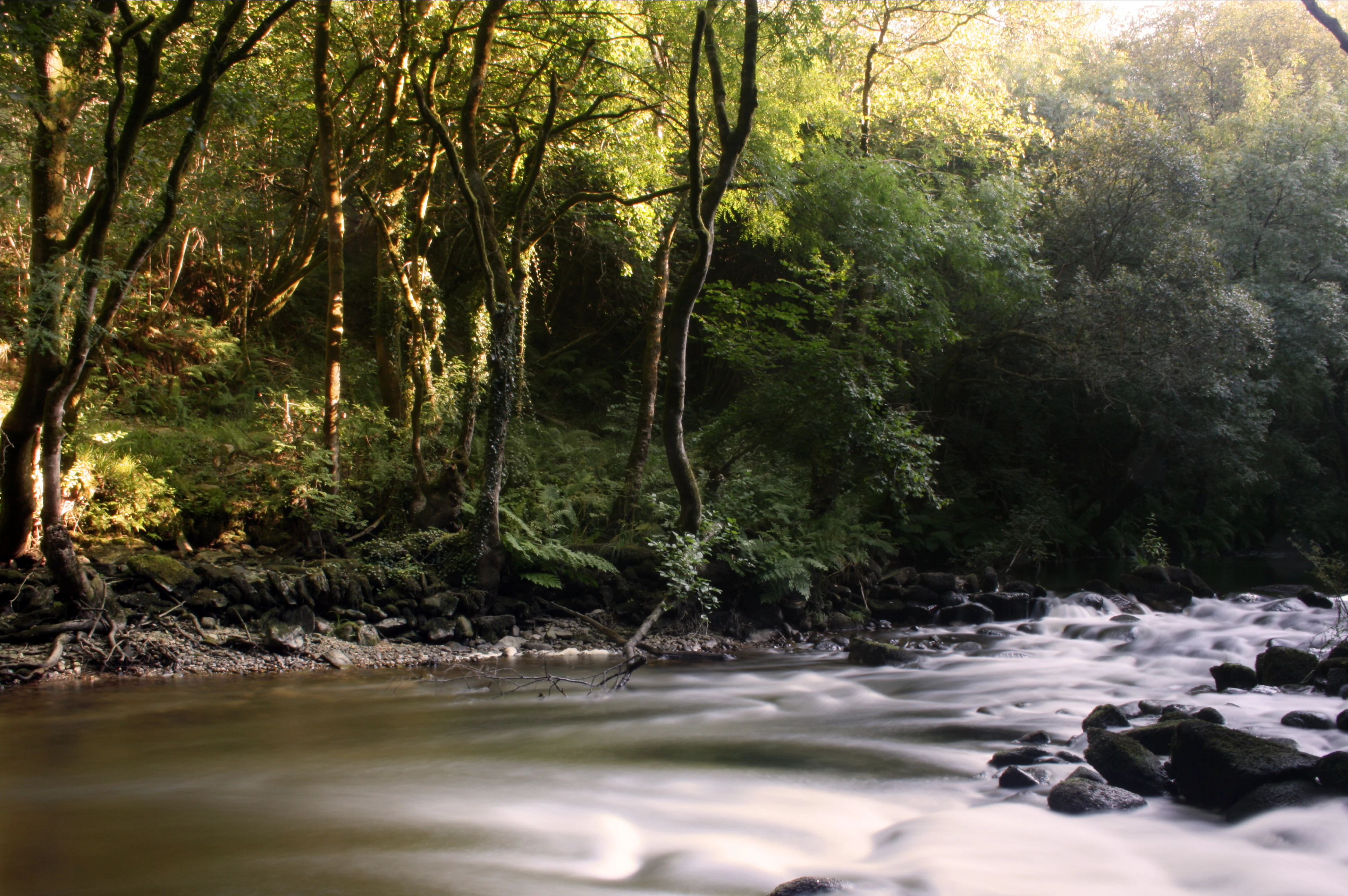
A long exposure photograph of the Mandeo River flowing over a rocky bed with a dense green forest lining the riverbank in the late afternoon light.
The Mandeo River flowing through the lush riparian forest at Chelo.

Mariñas Coruñesas and Tierras del Mandeo Biosphere Reserve ecosystems, habitats, and plant life

Ecologically, the reserve belongs to the Cantabrian-Atlantic biogeographical context of northwestern Iberia and is characterized by a strong mosaic of marine, freshwater, and terrestrial habitats. The estuaries of the Ría de Betanzos and the Ría do Burgo support brackish wetlands and coastal habitats, while the river basins of the Mero and the Mandeo, together with the Abegondo-Cecebre reservoir, contribute extensive freshwater and riparian environments.

Within the reserve, around 49 habitats of community interest have been identified, including 12 considered priority habitats under European classifications. The coastal and riverine areas contribute saltmarshes, reedbeds, dune systems, and Atlantic salt meadows, while the inland hills support oak forests, mixed broadleaf woodland, and humid scrub. Traditional agricultural mosaics in the inland parishes add further ecological value through their combination of seminatural grasslands, hedgerows, and small woodland patches.

These varied habitats support more than 300 species benefitting from some form of international, European, Spanish, or Galician protection. The reserve's zoning into core, buffer, and transition areas helps safeguard the most ecologically sensitive landscapes while allowing continued human activity in zones designed for sustainable use.
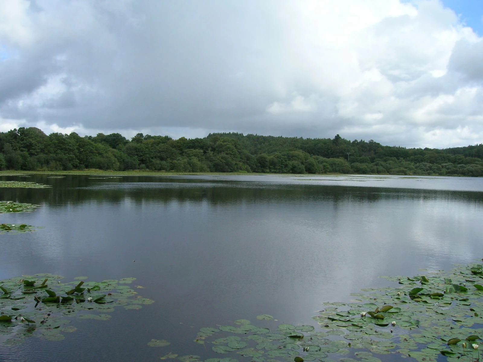
A wide view of a calm lake with lily pads near the foreground and a dense green forested shoreline under a cloudy sky.
The tranquil waters of the Lago de Sobrado dos Monxes within the Mariñas Coruñesas e Terras do Mandeo Biosphere Reserve.

Mariñas Coruñesas and Tierras del Mandeo Biosphere Reserve wildlife and species highlights

The biosphere reserve shelters a wide range of fauna typical of the Cantabrian-Atlantic coast of Galicia, including birdlife associated with its estuaries, coastal cliffs, reservoirs, and inland forests. The estuarine margins of the Ría de Betanzos and the Ría do Burgo provide feeding and resting areas for waterbirds and seabirds, while the inland wetlands around the Abegondo-Cecebre reservoir attract freshwater species and migratory birds at different times of the year.

The surviving fragments of coastal Atlantic forest are particularly important for forest-dependent species, offering refuges to invertebrates, amphibians, and small mammals that depend on humid, shaded conditions. These relict forests are highlighted as the last refuge for several species of flora and fauna that survived the last glaciation in the temperate forests along this stretch of the Iberian coast.

The combination of marine, freshwater, and forest habitats across the reserve's territory supports more than 300 protected species at international, European, Spanish, or Galician levels. This diversity reflects the compressed ecological transition from coast to inland sierra within the reserve.
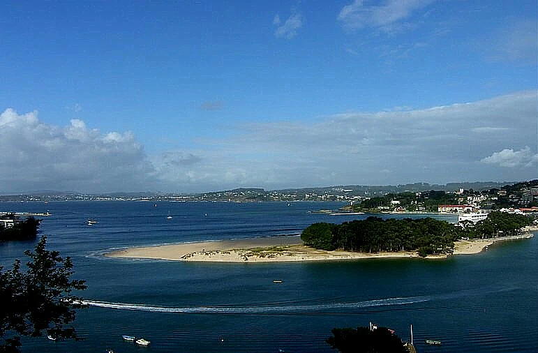
A wide view of Santa Cristina Beach, featuring a sandy spit of land surrounded by calm blue water, with coastal vegetation and buildings visible in the distance under a sunny, partly cloudy sky.
Santa Cristina Beach situated on the Ria do Burgo, within the Mariñas Coruñesas biosphere reserve.

Mariñas Coruñesas and Tierras del Mandeo Biosphere Reserve conservation status and protection priorities

Conservation is central to the identity of the Mariñas Coruñesas and Tierras del Mandeo Biosphere Reserve. The reserve is structured into three distinct functional zones, core, buffer, and transition, with the core zones receiving the highest level of environmental protection to safeguard their landscapes, habitats, and species.

The reserve incorporates multiple Sites of Community Importance from the Natura 2000 network, including Betanzos-Mandeo, the estuary of the Río Baxoi, the Abegondo-Cecebre reservoir, the Brañas do Deo, the Sierra de la Cova da Serpe, the Costa de Dexo-Serantes, and the relevant section of the Costa da Morte within Arteixo. The Costa de Dexo-Serantes is also recognized as a natural monument, adding an additional layer of legal protection.

From a broader perspective, the reserve is notable for protecting one of the remaining strongholds of coastal Atlantic forest in northwestern Iberia, a habitat type that has become increasingly rare and fragmented elsewhere along the Cantabrian-Atlantic coast. By integrating conservation with the daily life of a population of around 195,000 people distributed across seventeen municipalities, the reserve also serves as a model for balancing ecological protection with sustainable socioeconomic development in the metropolitan influence area of A Coruña.

Mariñas Coruñesas and Tierras del Mandeo Biosphere Reserve cultural meaning and human context

The territory of the biosphere reserve carries a strong rural and coastal Galician cultural identity rooted in the comarcas of A Coruña, Betanzos, and Tierra de Mellid. Across the seventeen municipalities, the landscape is shaped by centuries of small-scale agriculture, forestry, fishing, and inland river trade, with traditional parishes and villages forming the administrative and social fabric of the interior.

Towns such as Betanzos, with its historical significance as a regional center, and Sobrado, associated with the Monastery of Sobrado dos Monxes, contribute to the deep-rooted cultural heritage of the inland area, while coastal municipalities such as Sada, Oleiros, and Arteixo reflect longstanding links with the sea, including fishing communities and beach-oriented local traditions. The reserve's territory also lies within the broader linguistic and cultural context of Galicia, where the Galician language remains a defining element of local identity alongside Spanish.
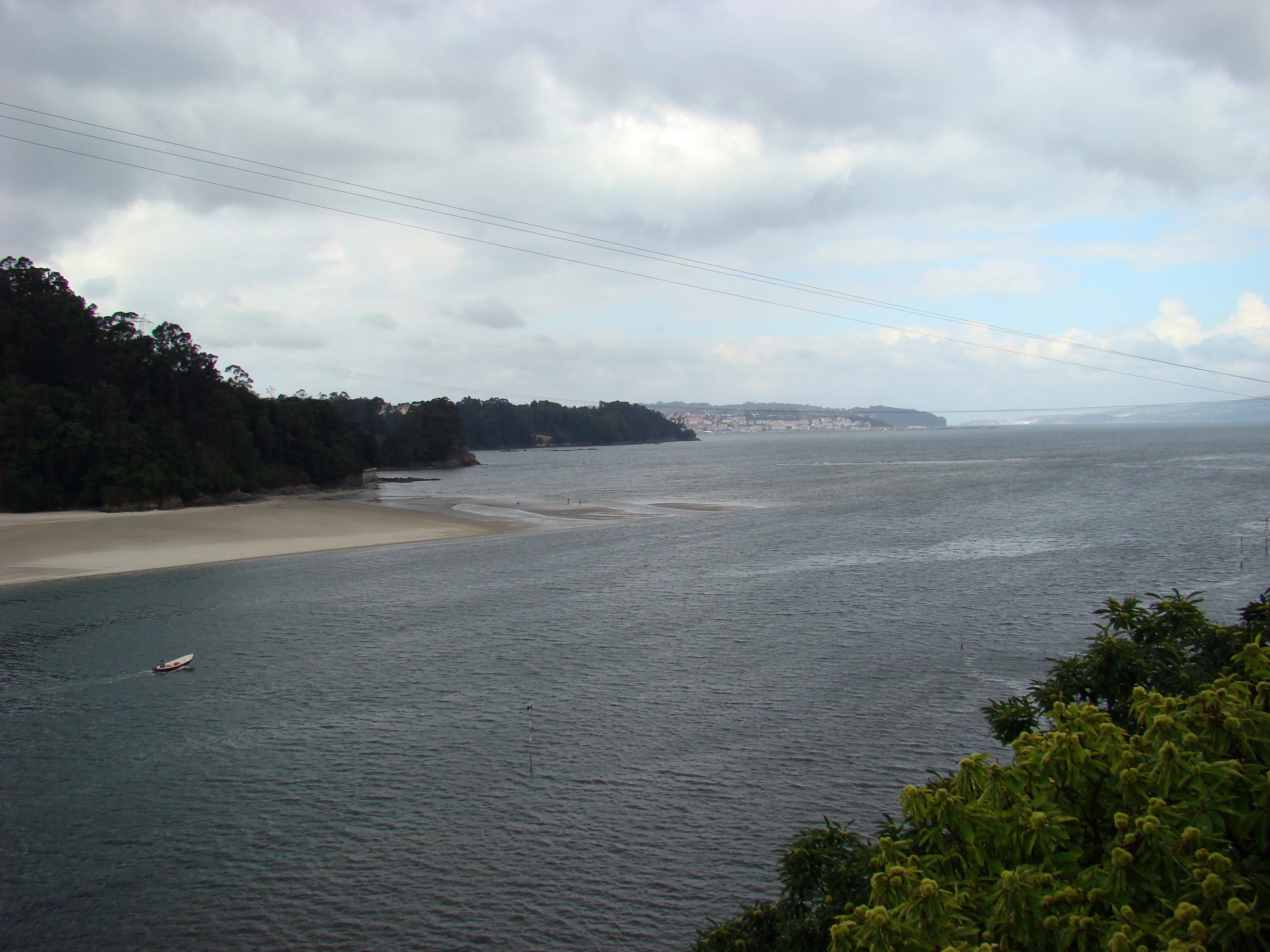
A wide view of a river estuary under a cloudy sky, showing a sandy beach on the left, calm dark water, and dense green shoreline vegetation.
A view of the coastal landscape at the Pedrido Bridge in the Mariñas Coruñesas y Tierras del Mandeo Biosphere Reserve.

Top sights and standout views in Mariñas Coruñesas and Tierras del Mandeo Biosphere Reserve

Among the standout features of the Mariñas Coruñesas and Tierras del Mandeo Biosphere Reserve are its surviving fragments of relict coastal Atlantic forest, which represent one of the best-preserved examples of this habitat type along the Cantabrian-Atlantic coast. These forests are home to a remarkable concentration of protected flora and fauna and have shaped the reserve's identity as an ecological refuge.

The reserve's geography is equally noteworthy, encompassing the estuaries of the Ría de Betanzos and the Ría do Burgo, the broad valleys of the Mero and the Mandeo, the Abegondo-Cecebre reservoir, and the Sierra de la Cova da Serpe. The inclusion of multiple Natura 2000 sites and the natural monument of Costa de Dexo-Serantes underlines the layered conservation significance of the territory, while its proximity to the metropolitan area of A Coruña offers an unusual example of a biosphere reserve that integrates densely populated suburban space with extensive rural landscapes.

Best time to visit Mariñas Coruñesas and Tierras del Mandeo Biosphere Reserve

The climate of the reserve is typical of the northwestern Iberian coast, with mild temperatures, frequent rainfall, and a strongly Atlantic character throughout the year. Spring and early summer tend to bring lush vegetation, active birdlife in estuarine and reservoir areas, and pleasant conditions for exploring both coastal and inland paths, while autumn offers quieter conditions, mature forest colors, and continued wildlife activity in the river valleys and upland forests.

Winter is generally mild compared to inland Spain, though rain is more frequent and daylight hours for outdoor exploration are reduced. For visitors interested in combining coastal scenery with the inland forested landscapes of the reserve, late spring and early autumn generally offer the most balanced conditions for seeing the full ecological range of the area, from estuarine wetlands to the highest elevations of the Sierra de la Cova da Serpe.
Monthly climate preview

Long-term temperature and precipitation records across twelve months

Reserva de la biosfera de las Mariñas Coruñesas y Tierras del Mandeo Climate Normals

Representative coordinate measurements track the annual temperature range from cool winter minimums to warm summer maximums alongside measured precipitation rhythms. Reviewing the complete monthly climate profile provides deeper context for long-term environmental patterns across the protected landscape.
Annual mean12 °C
6 °C19 °C
Jan
Feb
Mar
Apr10°
May13°
Jun16°
Jul19°
Aug19°
Sep17°
Oct13°
Nov
Dec
Warmest month
August

19.4 °C

Coolest month
January

6.5 °C

Wettest month
November

5.2 mm/day

Driest month
July

1 mm/day

Park location guide

Geography guide, regional context, and park location map for Mariñas Coruñesas and Tierras del Mandeo Biosphere Reserve

Mariñas Coruñesas and Tierras del Mandeo Biosphere Reserve park geography, regions, and map view in Spain

Understand where Mariñas Coruñesas and Tierras del Mandeo Biosphere Reserve sits in Spain through a broader geographic reading of the surrounding landscape, nearby location context, and its mapped position within the national park landscape.

How Mariñas Coruñesas and Tierras del Mandeo Biosphere Reserve fits into Spain

Spain, officially the Kingdom of Spain, is a unitary parliamentary constitutional monarchy located in Southern and Western Europe. The country occupies most of the Iberian Peninsula and includes territories in the Mediterranean and Atlantic. With a population of approximately 49.6 million and an area of 506,030 km², Spain is a major European economy and cultural force. Its capital is Madrid, and the country is known for its diverse landscapes ranging from mountainous regions to coastal areas.

Wider geography shaping Mariñas Coruñesas and Tierras del Mandeo Biosphere Reserve in Spain

Spain occupies the Iberian Peninsula in Southern and Western Europe. Peninsular Spain is bordered to the north by France, Andorra, and the Bay of Biscay; to the east and south by the Mediterranean Sea and Gibraltar; and to the west by Portugal and the Atlantic Ocean. The territory includes the Canary Islands in the Atlantic Ocean, the Balearic Islands in the Mediterranean Sea, and the autonomous cities of Ceuta and Melilla in mainland Africa. Spain features diverse terrain including the Pyrenees in the northeast, the Sierra Nevada in the south, and the Meseta Central plateau.

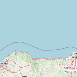
Map view of Mariñas Coruñesas and Tierras del Mandeo Biosphere Reserve

Use this park location map to pinpoint Mariñas Coruñesas and Tierras del Mandeo Biosphere Reserve in Spain, understand its exact geographic position, and read its mapped placement within the surrounding landscape more clearly.

Pigeon | © OpenStreetMap contributors

Location context for Mariñas Coruñesas and Tierras del Mandeo Biosphere Reserve

Galicia
Natural feature types

Examine the Natural Topography of Reserva de la biosfera de las Mariñas Coruñesas y Tierras del Mandeo

Deepen your understanding of the landscape by browsing the inventory of named natural features found within the Reserva de la biosfera de las Mariñas Coruñesas y Tierras del Mandeo. MoriAtlas organizes these landmarks to illustrate the unique transition from coastal estuaries to inland mountain corridors in northwestern Spain.
Recorded earthquake history

Explore Historical Earthquake Records for the Reserva de la biosfera de las Mariñas Coruñesas y Tierras del Mandeo

Review the chronological list of seismic events associated with the Reserva de la biosfera de las Mariñas Coruñesas y Tierras del Mandeo. This database provides accessible historical records to help users understand recorded seismic activity within this protected landscape as indexed by MoriAtlas.

Reserva de la biosfera de las Mariñas Coruñesas y Tierras del Mandeo Seismic Records

Catalogued events

28 events

Strongest magnitude

Magnitude 4

Most recent event

Apr 23, 2006

This history includes earthquakes recorded inside the park or within 50 km of its borders

Visualizing coastal rías, river valleys, and relict Atlantic forests across the protected reserve

Reserva de la biosfera de las Mariñas Coruñesas y Tierras del Mandeo Photos and Landscapes

Visual documentation captures the complex terrain of Reserva de la biosfera de las Mariñas Coruñesas y Tierras del Mandeo, ranging from Atlantic estuarine margins to inland forested sierras. Examining these protected habitats clarifies how coastal geography and river basins shape the ecological character of the Galician reserve.

Sunbeams break through heavy clouds at sunrise over a calm coastal bay with distant hills and a small town.

A backlit coastal landscape in Galicia at sunset, showing dark rolling hills in the background, a sandy beach, and shimmering dark water in the foreground.

A long exposure photograph of the Mandeo River flowing over a rocky bed with a dense green forest lining the riverbank in the late afternoon light.

A wide view of a calm lake with lily pads near the foreground and a dense green forested shoreline under a cloudy sky.

A wide view of Santa Cristina Beach, featuring a sandy spit of land surrounded by calm blue water, with coastal vegetation and buildings visible in the distance under a sunny, partly cloudy sky.

A wide panoramic view of a sandy beach in a cove with calm water, grassy cliffs on the right, and a hazy city visible on the far horizon.

A wide view of a river estuary under a cloudy sky, showing a sandy beach on the left, calm dark water, and dense green shoreline vegetation.

Park atlas

Compare nearby protected areas and connected regional landscapes in northwestern Iberia

Parks Near Reserva de la biosfera de las Mariñas Coruñesas y Tierras del Mandeo

Visitors exploring Reserva de la biosfera de las Mariñas Coruñesas y Tierras del Mandeo can browse adjacent protected areas, river valleys, and coastal reserves. Reviewing these surrounding natural habitats provides valuable geographic context for northern Spanish conservation zones.
Watercolor illustration of a gentle river winding through green hills and forests with soft, hazy mountain silhouettes in the background.
Biosphere reserveGalicia
Park boundaries overlap#1 closest

East

Reserva de la biosfera de las Tierras del Miño: Mapped Landscapes and Geographic Overview

Extensive riverine forests and wetland networks in northwestern Spain

Explore the expansive territory of Reserva de la biosfera de las Tierras del Miño, spanning a large portion of the Galician interior. This protected area features a mosaic of wetlands, riparian corridors, and mountainous terrain, offering a deep look into the ecological and cultural geography of the upper Miño river basin.

Area
3,636.69 km²
Established
2002
Relief
Lowland
Scope
Terrestrial
Watercolor painting of a wide, rolling mountain landscape with green and muted red hills under a soft, light background.
Biosphere reserveLugo
64 km away#2 closest

East

Reserva de la Biosfera de Los Ancares Lucenses y Montes de Cervantes, Navia y Becerreá Protected Area Map

Mountainous terrain and river valley geography in Lugo, Spain

This protected area covers the dramatic Sierra de Ancares, featuring steep mountain slopes and deep river valleys that define the geography of Galicia. The reserve spans a significant vertical relief, providing essential habitats for brown bears and capercaillie while preserving traditional rural mountain land use systems and ancient forest ecosystems.

Area
536.64 km²
Established
2006
Relief
Mountain
Climate
Temperate
Watercolor illustration of rolling green hills and distant purple mountains under a light sky
National parkGalicia
67 km away#3 closest

Southwest

Atlantic Islands of Galicia National Park: Protected Archipelagos & Galician Coastline Geography

Explore mapped island ecosystems and protected marine areas.

Uncover the protected landscape of the Atlantic Islands of Galicia National Park, Spain's only national park in Pontevedra province. This atlas entry details the four distinct archipelagos, Cíes, Ons, Sálvora, and Cortegada, across the Rías Baixas. Discover the unique sea-land protected area, its rare bay laurel forests, significant seabird colonies, and the broader regional geography of Galicia.

Area
84.8 km²
Established
2002
IUCN
II
Visitors
472.3K annual
A watercolor painting showing a soft-toned landscape with a stone arch bridge spanning a river, framed by trees and gentle hills.
Biosphere reserveGalicia
82 km away#4 closest

South

Área de Allariz Biosphere Reserve: Mapping the Protected Landscapes of Inland Galicia

Exploring the river basins, granitic massifs, and ecological frontiers

The Área de Allariz biosphere reserve serves as a vital transition zone in northwestern Spain, characterized by its flat-floored tectonic basin, the River Limia, and varied highland terrain. This protected area offers an instructive look at the integration of traditional rural land management with large-scale ecological recovery and conservation across its core, buffer, and transition zones.

Area
214.82 km²
Established
2005
Relief
Mixed relief
Scope
Terrestrial
A soft watercolor painting depicting rolling green hills, distant mountains, a river, and stylized pink trees against a plain background.
Biosphere reserveProvincia de León
88 km away#5 closest

East

Reserva de la biosfera de los Ancares Leoneses: Protected Mountain Terrain and Atlas

Mapping the Sierra de Ancares river valleys in Provincia de León

Examine the geographic layout and protected boundaries of the Reserva de la biosfera de los Ancares Leoneses. This biosphere reserve serves as a critical mountain corridor, featuring complex river basins and diverse forest cover that highlight the region's environmental and cultural history across the Spanish highlands.

Area
567.86 km²
Established
2006
Relief
Mountain
Scope
Terrestrial
Watercolor illustration of a river winding through a valley with mountains, forests, and pink flowering trees.
National parkPortugal
101 km away#6 closest

South

Peneda-Gerês National Park: A Distinct Protected Landscape in Northern Portugal

Granite peaks, glacial valleys, and cultural heritage mapped.

Peneda-Gerês National Park represents a cornerstone of protected landscapes in Portugal, celebrated for its rugged granite mountains and deep glacial valleys sculpted over millennia. This national park showcases a rare ecological transition zone with unique endemic species and features dramatic waterfalls and pristine river systems. The park's rich cultural tapestry, interwoven with its natural environment, offers a compelling subject for atlas-based geographic discovery and landscape exploration.

Area
695.93 km²
Established
1971
IUCN
II
Visitors
92.8K annual
Watercolor depiction of green hills, a small pond, and distant mountains under a soft sky.
Protected landscapeBragança District
131 km away#7 closest

Southeast

Montesinho Natural Park: Protected Landscape in Bragança District, Portugal

Explore mapped boundaries and regional landscape context.

Montesinho Natural Park is designated as a protected landscape in northeastern Portugal, located within the administrative region of Bragança District. This page serves as an entry point to understanding the park's protected area characteristics, its mapped geographic footprint, and its role in the broader natural landscape of the Trás-os-Montes region. Discover the atlas value of this significant protected territory and its relation to surrounding geography.

Area
742.25 km²
Established
1979
IUCN
V
Relief
Mountain
Watercolor painting of sandy dunes with patches of grass, distant mountains, and a body of water under a light sky
Protected landscapeEsposende
165 km away#8 closest

South

Northern Littoral Natural Park Protected Landscape: Geographic Discovery and Atlas Context

Mapped protected areas and regional landscape discovery near Esposende.

Uncover the geographic identity of Northern Littoral Natural Park, a key protected landscape situated near Esposende. This MoriAtlas entry focuses on its mapped boundaries and regional significance, providing a factual basis for understanding its role within Portugal's network of protected areas. Explore the park's natural terrain and its context within the broader geography of the Norte region for comprehensive atlas-based discovery.

Area
87.62 km²
Established
1987
IUCN
V
Relief
Lowland

Common questions about visiting, size, designation, and location context for Mariñas Coruñesas and Tierras del Mandeo Biosphere Reserve

Mariñas Coruñesas and Tierras del Mandeo Biosphere Reserve FAQs for park facts, access, geography, and protected area context

Find quick answers about Mariñas Coruñesas and Tierras del Mandeo Biosphere Reserve, including protected-area facts, park geography, trail and visitor context, and how the park fits into its surrounding country and regional landscape.
MoriAtlas Explorer

Continue Your Protected Areas Search Across the Global Atlas

Deepen your exploration by continuing the structured search for national parks and protected areas worldwide. Utilize the comprehensive filtering capabilities to compare different conservation landscapes and refine your understanding of global park geography. Discover more about the distribution and characteristics of protected natural areas.

Global natural geography