
Mori Atlas logo
National parkMelimoyu National Park

Detailed view of Melimoyu National Park's mapped boundaries and regional natural terrain.

Melimoyu National Park: Protected Landscape and Geographic Atlas Context in Aysén Region

(Parque Nacional Melimoyu)

Melimoyu National Park represents a significant protected natural area within the Aysén Region of Chile. This canonical page offers detailed geographic context, focusing on the park's mapped boundaries and its place within the broader regional landscape. Users can delve into the park's identity as a national park, understanding its terrestrial features and how it contributes to the protected lands atlas.

National ParkPatagoniaVolcanic LandscapeSouthern Beech ForestRemote WildernessMarine Protected Area
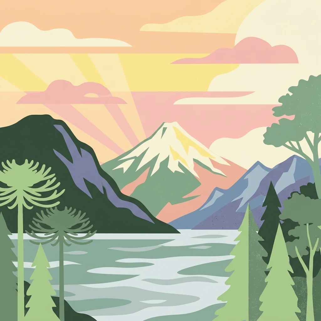
Stylized illustration of Melimoyu National Park showing a snow-capped volcano, lake, forested hills, and sunset sky with clouds

Melimoyu National Park

National park

Park overview

Structured park overview, official facts, and landscape profile for Melimoyu National Park

Melimoyu National Park park facts, protected area profile, and essential visitor context
Review the core facts for Melimoyu National Park, including designation, size, terrain, visitor scale, habitats, and operating context in one park-focused overview.

About Melimoyu National Park

Melimoyu National Park occupies a remarkable position within Chile's system of protected areas, established in 2018 to safeguard a distinctive combination of volcanic, terrestrial, and marine environments in the remote Aysén Region. The park's creation emerged from a collaborative conservation initiative involving the Chilean government and Tompkins Conservation, an organization founded by American conservationists Kristine and Douglas Tompkins, as part of a broader effort to establish a connected network of national parks across Patagonia. The land base was assembled from public holdings combined with estates donated through the Tompkins Foundation, representing a significant example of private-public partnership in Chilean conservation history. The park forms part of a constellation of protected areas in the region, bordered by Corcovado National Park to the north, Queulat National Park to the west, and Isla Magdalena National Park to the east, while the marine protected area Pitipalena Añihué protects coastal waters near the Palena River estuary. The park's inaccessibility has largely preserved its wilderness character, with much of the territory reachable only by boat through the complex network of channels that define the Patagonian coast.

Quick facts and research context for Melimoyu National Park

Melimoyu National Park lies in the Patagonian fjord region of Aysén Region, Chile, established in 2018 as a Category II protected area managed by CONAF. The park covers 1,055 square kilometers of mountainous terrain centered on Melimoyu volcano, a prominent volcanic peak rising 2,440 meters above sea level. The region has been explored since the late 18th century, with the volcano serving as an important navigation reference point along the Moraleda Channel. The park's vegetation consists primarily of southern beech forests, with lenga, coihue, mañío, and Magellan's beech dominating the coastal interior zones. Access is primarily by sea, as no road connections exist to the Carretera Austral except for two segments intersected by Route X-12.

Park context

Deeper park guide and search-rich context for Melimoyu National Park

Melimoyu National Park history, landscape, wildlife, and travel context
Explore Melimoyu National Park through its history, landscape character, ecosystems, wildlife, conservation priorities, cultural context, and seasonal travel timing in a structured park guide built for atlas discovery and search intent.

Why Melimoyu National Park stands out

Melimoyu National Park is best known for its dramatic volcanic centerpiece, the symmetrical Melimoyu volcano that rises from the Patagonian landscape and serves as both a geographic landmark and the park's namesake. The park protects extensive tracts of pristine southern beech forest in one of Chile's most remote coastal regions, where the labyrinth of islands, channels, and fjords creates a singular landscape. It also serves as a conservation corridor for marine mammals, particularly whales and dolphins that inhabit the coastal waters adjacent to the park. The protection of endangered species and the preservation of the volcano's ecological and cultural significance represent key motivations for the park's establishment.
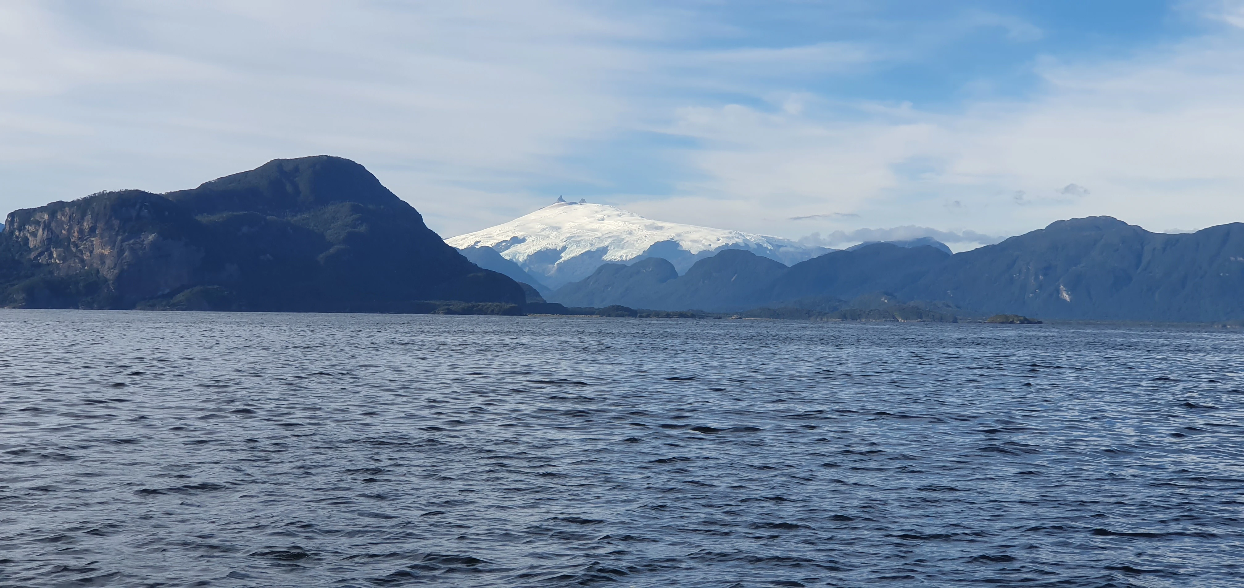
Calm water with a snow-capped mountain in the background under a partly cloudy sky
Panoramic view of Melimoyu volcano from the water in Melimoyu National Park

Melimoyu National Park history and protected-area timeline

The territory now protected as Melimoyu National Park has been documented by European explorers since the late 18th century, when the Spanish navigator José de Moraleda conducted surveys of the region beginning around 1752. The distinctive Melimoyu volcano, standing prominently above the maze of islands and channels, has long served as an important navigation aid for vessels transiting the Moraleda Channel. This maritime significance was recognized as early as the 19th century, when Captain Robert FitzRoy of the HMS Beagle described the volcano in his narrative of the surveying voyages. For centuries, the region's indigenous peoples and later European explorers traversed these waters, yet the area remained largely undeveloped due to its extreme remoteness. The establishment of the national park in 2018 marked a new chapter in the region's history, formalizing protections that had long been needed as development pressures increased elsewhere in Chilean Patagonia. The creation of the park represented the culmination of years of effort by conservation organizations working to expand Chile's national park system through the addition of ecologically significant lands.

Melimoyu National Park landscape and geographic character

The landscape of Melimoyu National Park is defined by the intersection of volcanic highlands and the intricate coastal geography of the Patagonian fjord system. At its heart stands Melimoyu volcano, a conical peak reaching 2,440 meters elevation with glacial coverage around its crater, creating a striking visual feature visible from the surrounding waters of the Gulf of Corcovado and the channels. The terrain descends from the volcanic heights through forested slopes to the shoreline, where the landscape fragments into a complex arrangement of islands, inlets, and channels. The park encompasses Refugio Island and numerous smaller islands scattered along the coast, each with its own complement of vegetation and topography. The absence of road access throughout most of the park has preserved the landscape in a relatively unmodified state, with the only overland routes limited to two brief segments where Route X-12 crosses the territory, connecting La Junta with Puerto Raúl Marín Balmaceda.

Melimoyu National Park ecosystems, habitats, and plant life

The park's vegetation consists primarily of southern beech forests characteristic of the Andean-Patagonian ecosystem, with four dominant species forming the primary forest cover. Lenga beech dominates many areas, particularly in higher elevations and on drier sites, while Chiloé's coigue thrives in moister sections. The conifer mañío adds diversity to the forest structure, and Magellan's beech occupies the most exposed coastal positions. These forests extend inland from the coastline, clothing the lower slopes and valleys except where bare rock or alpine conditions prevail at the highest elevations near the volcano's summit. The forest composition reflects the cool, humid climate of the Patagonian fjord region, where precipitation is abundant and temperatures remain moderate throughout the year. The transition from coastal grasslands and shrublands to dense forest creates distinct ecological zones within the park.

Melimoyu National Park wildlife and species highlights

Melimoyu National Park provides habitat for several species of conservation concern, though the Wikipedia sources provide limited specific information about wildlife. The park was established partly to facilitate protection of whales and dolphins that inhabit the coastal marine areas adjacent to the protected boundaries. The surrounding waters of the Gulf of Corcovado, Moraleda Channel, and Jacaf Channel support cetacean populations, with the marine environment complementing the terrestrial protected area. The forests undoubtedly harbor typical Patagonian fauna including various bird species and small mammals, though precise species inventories are not detailed in the available sources. The presence of endangered species was cited as a motivation for the park's creation, indicating that the region supports species of particular conservation concern.

Melimoyu National Park conservation status and protection priorities

The establishment of Melimoyu National Park represents a significant addition to Chile's protected area network, contributing to the goal of creating a connected system of wild spaces across Patagonia. The park was created with multiple purposes: protecting the Melimoyu volcano and its surrounding landscape, preserving endangered species, and providing protection for marine mammals in adjacent coastal waters. The collaborative model involving government agencies and private conservation organizations through Tompkins Conservation demonstrates a modern approach to expanding protected area coverage. The park forms part of a cluster of national parks in the Aysén Region, creating a conservation corridor that allows for ecological connectivity across the landscape. The absence of infrastructure and rangers within the park presents management challenges, yet the remote location provides a degree of natural protection from development pressures.

Melimoyu National Park cultural meaning and human context

The region surrounding Melimoyu has a history of human presence spanning centuries, beginning with indigenous peoples who inhabited the coastal areas before European contact. The subsequent period of European exploration brought navigators like José de Moraleda to the region in the late 18th century, establishing patterns of maritime use that continue today. The landscape holds significance beyond its ecological value, as the Melimoyu volcano has served as a navigational landmark for generations of sailors traversing the complex channel system. Local communities in nearby settlements including Puerto Raúl Marín Balmaceda, the village of Melimoyu, and Puerto Cisnes maintain connections to the area and provide local transportation services for visitors. The park's creation through the Tompkins Conservation initiative reflects contemporary international conservation partnerships that have become increasingly important in establishing large-scale protected areas.

Top sights and standout views in Melimoyu National Park

Melimoyu National Park offers visitors an encounter with one of Chile's most remote and sparsely visited protected areas, where the dramatic volcanic cone of Melimoyu provides an unforgettable centerpiece rising above the forested islands and channels. The park's inclusion within the National Parks of Patagonia Network connects it to a broader vision of wilderness preservation spanning the southern Andes. The absence of developed infrastructure means the park retains a frontier character, accessible primarily to those willing to arrive by boat through the scenic fjord landscape. The protection of both terrestrial forests and adjacent marine areas creates an integrated conservation approach uncommon in older protected area designations.

Best time to visit Melimoyu National Park

The optimal time to explore Melimoyu National Park aligns with the Patagonian summer months from November through March, when weather conditions are most favorable and daylight hours are longest. During this period, temperatures remain moderate and precipitation is somewhat reduced compared to the wet winter months. However, visitors should anticipate the unpredictable weather typical of the region, where rapid changes in conditions can occur throughout any season. The winter months bring increased rainfall and shorter days, making access and exploration more challenging. Given the park's remote nature and limited infrastructure, planning requires careful attention to logistics, including arrangements for boat transportation and accommodation in nearby communities.
Park location guide

Geography guide, regional context, and park location map for Melimoyu National Park

Melimoyu National Park park geography, regions, and map view in Chile
Understand where Melimoyu National Park sits in Chile through a broader geographic reading of the surrounding landscape, nearby location context, and its mapped position within the national park landscape.

How Melimoyu National Park fits into Chile

Chile is a presidential republic in western South America, extending as a narrow strip along the western edge of the continent between the Andes Mountains and the Pacific Ocean. It is the southernmost country in the world and the closest to Antarctica. The country is bordered by Peru, Bolivia, and Argentina, and administers several Pacific islands including Easter Island. Chile is a major copper producer and has a population of approximately 19.6 million.

Wider geography shaping Melimoyu National Park in Chile

Chile occupies a narrow strip of land along the western edge of South America, extending approximately 4,300 km north to south but only about 350 km east to west at its widest point. The country is sandwiched between the Andes Mountains to the east and the Pacific Ocean to the west. It shares borders with Peru to the north, Bolivia to the northeast, and Argentina to the east. Southern Chile borders the Drake Passage. Chile also administers several Pacific islands including Juan Fernández Islands, Isla Salas y Gómez, Desventuradas Islands, and Easter Island, plus the Chilean Antarctic Territory.

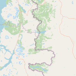
Map view of Melimoyu National Park

Use this park location map to pinpoint Melimoyu National Park in Chile, understand its exact geographic position, and read its mapped placement within the surrounding landscape more clearly.

Pigeon | © OpenStreetMap contributors

Location context for Melimoyu National Park

Aysén Region

Visual insights into Melimoyu's diverse terrain, from volcanic peaks to fjord ecosystems, showcasing its protected natural environments.

Melimoyu National Park Photos: Explore Volcanic Landscapes and Patagonian Fjord Scenery
Discover the dramatic landscapes of Melimoyu National Park through captivating imagery, revealing its iconic volcano, dense southern beech forests, and intricate Patagonian fjords. These visual references provide essential context for understanding the park's unique protected-area character, diverse habitats, and remote Aysén Region environment.

Calm water with a snow-capped mountain in the background under a partly cloudy sky

Park atlas

Compare diverse protected landscapes, fjord systems, and volcanic terrain in the surrounding Patagonian Aysén region.

Discover Nearby National Parks and Protected Areas Beyond Melimoyu National Park
Explore additional national parks and protected areas geographically adjacent to Melimoyu National Park, extending discovery across Chile's remote Patagonian fjords and volcanic highlands. This regional park-by-park view offers valuable geographic context, allowing comparison of diverse conservation landscapes and the distinct natural features of southern Chile.
Watercolor illustration of rolling hills, a river flowing through a valley, and forested areas
National parkAysén del General Carlos Ibáñez del Campo Region

Queulat National Park: Patagonian Andes Glacier and Rainforest Discovery

Mapped protected area in Aysén del General Carlos Ibáñez del Campo Region.

Queulat National Park is a vast protected wilderness in southern Chile, renowned for its dramatic glacial alpine terrain and lush temperate rainforests. The park's geography is defined by steep glacial valleys, ice fields, and the iconic Queulat Hanging Glacier cascading from sheer cliffs. Discover the mapped boundaries of this significant Patagonian national park, offering unparalleled insight into its unique ecosystems and dramatic landscapes shaped by ice and forest.

Area
1,541 km²
Established
1983
IUCN
II
Relief
Mountain
National parkAysén del General Carlos Ibáñez del Campo Region

Isla Magdalena National Park: Protected Area and Regional Geography Context

Discover the mapped landscape of this national park.

Delve into the protected landscape of Isla Magdalena National Park, a key national park situated in the Aysén del General Carlos Ibáñez del Campo Region of Chile. This entry provides essential geographic context, focusing on the park's mapped boundaries and its role within the Patagonian environment. Understand its distinct identity as a protected area for structured atlas exploration.

Area
1,576 km²
Established
1983
IUCN
II
Relief
Mountain
Watercolor painting depicting mountains, a lake, and grassy shoreline
National parkArgentina

Los Alerces National Park: Ancient Alerce Forests and Glacial Terrain in Argentina

Discover the park's protected landscape and regional geography.

Los Alerces National Park in Argentina is a globally significant protected area, celebrated for its ancient alerce forests, some of the longest-living trees on Earth. This national park showcases a dramatic landscape shaped by glaciers, featuring a series of interconnected lakes and rugged Andean terrain. Explore the unique ecosystem and mapped geography of this UNESCO World Heritage site to understand its profound natural and conservation value.

Area
2,599 km²
Established
1937
IUCN
II
Relief
Mountain
National parkAysén del General Carlos Ibáñez del Campo Region

Cerro Castillo National Park: Dramatic Granite Peaks and Patagonian Protected Landscape

Mapped geography and huemul conservation in Chile's Aysén Region.

Cerro Castillo National Park is a premier protected area in southern Chile, celebrated for its iconic Cerro Castillo granite mountain that dominates the landscape. This national park, spanning over 1,700 square kilometers in the Aysén del General Carlos Ibáñez del Campo Region, showcases a dynamic Patagonian terrain shaped by glaciers and rivers. Its significance extends to being a vital corridor for endangered huemul, offering critical habitat within a broader regional conservation strategy and the famous Route of Parks.

Area
1,795.5 km²
Established
1970
IUCN
II
Relief
Mountain
Watercolor illustration showing a lake surrounded by forested hills and mountains
National parkChubut Province

Lago Puelo National Park: A Unique Protected Landscape at the Intersection of Biomes

Explore its glacial terrain and Andean-Patagonian geographic context.

Lago Puelo National Park, located in Argentina's Chubut Province, stands out as a significant protected area due to its remarkable ecological diversity. This park is distinguished by its rare transition zone where the Patagonian forest converges with the Andean steppe, incorporating flora typically found in the Valdivian temperate rainforest. The mountainous landscape, carved by glaciers, features the striking turquoise waters of Puelo Lake and surrounding river systems. Understanding Lago Puelo National Park's geography provides insight into the complex natural systems of Patagonia and its unique protected biomes.

Area
276.74 km²
Established
1971
IUCN
II
Relief
Mountain
National parkLos Lagos Region

Chiloé National Park: National Park Discovery and Mapped Boundaries in Los Lagos Region

Explore its unique protected landscape and regional geography.

Chiloé National Park represents a significant protected natural area within the Los Lagos Region of Chile. This detailed page offers an atlas-centric view, focusing on the park's mapped boundaries, its place in the regional geography, and the overall protected landscape character. Gain structured insight into this important component of southern Chile's conservation lands, ideal for geographic exploration and atlas context.

Area
430.57 km²
Established
1983
IUCN
II
Visitors
33.6K annual
National parkLos Lagos Region

Hornopirén National Park: Mapped Protected Landscape and Geographic Identity

Explore the national park's mapped boundaries and regional context.

Hornopirén National Park serves as a crucial protected landscape within Chile's Los Lagos Region. This dedicated park page offers detailed insight into its geographic setting, emphasizing mapped boundaries and its identity as a national park. Users can explore how Hornopirén National Park contributes to the regional geography and protected-area framework, providing a grounded point for landscape discovery.

Area
482 km²
Established
1988
IUCN
II
Relief
Mountain
National parkLos Lagos Region

Alerce Andino National Park: Protected Landscape Within Los Lagos Region Geography

Explore the national park's mapped boundaries and regional context.

Delve into the protected landscape of Alerce Andino National Park, a distinct national park entity situated in Chile's Los Lagos Region. This focus provides a clear understanding of its geographic setting, highlighting its importance within regional conservation efforts and offering a detailed view of its mapped terrain. Understand the park's place in the southern Chile geography through this detailed exploration.

Area
393 km²
Established
1982
IUCN
II
Visitors
12.2K annual

Common questions about visiting, size, designation, and location context for Melimoyu National Park

Melimoyu National Park FAQs for park facts, access, geography, and protected area context
Find quick answers about Melimoyu National Park, including protected-area facts, park geography, trail and visitor context, and how the park fits into its surrounding country and regional landscape.
MoriAtlas Explorer

Continue Your Protected Areas Search Across the Global Atlas

Deepen your exploration by continuing the structured search for national parks and protected areas worldwide. Utilize the comprehensive filtering capabilities to compare different conservation landscapes and refine your understanding of global park geography. Discover more about the distribution and characteristics of protected natural areas.

Global natural geography