Mori Atlas logo
National parkMohéli National Park

Discover the mapped geography and protected area context of this Indian Ocean national park.

Mohéli National Park: A Protected National Park Landscape in the Comoros

Mohéli National Park represents a significant protected landscape within the Comoros, an island nation located in the northern Mozambique Channel. As a designated national park, it offers a unique focus for atlas exploration, allowing users to understand its specific geographic boundaries and its role as a protected area. This detailed entry serves as a gateway to exploring the park's natural terrain and regional context within the Comoros archipelago.

Marine protected areaCoral reef ecosystemIsland conservationEndemic speciesRamsar siteVolcanic island

Mohéli National Park

National park

Park overview

Structured park overview, official facts, and landscape profile for Mohéli National Park

Mohéli National Park park facts, protected area profile, and essential visitor context
Review the core facts for Mohéli National Park, including designation, size, terrain, visitor scale, habitats, and operating context in one park-focused overview.

About Mohéli National Park

Mohéli National Park represents the flagship protected area of the Comoros, a small island nation positioned in the Mozambique Channel between Madagascar and the African mainland. The park's establishment in 2001 marked a milestone as the first protected area in Comoros history, born from recognition that the island's unique ecosystems required formal conservation status. The 2010 redesignation from marine park to national park reflected growing understanding that effective conservation required integrated management of coastal and inland environments. The 2015 expansion dramatically increased terrestrial protection, bringing three-quarters of Mohéli island under park management. The park's marine zone extends from the southern and eastern shores, encompassing a lagoon system, fringing reef, and deep ocean habitat. This comprehensive approach addresses the interconnected nature of island ecosystems, where marine and terrestrial environments influence each other through coastal processes, nutrient flows, and species migration patterns.

Quick facts and research context for Mohéli National Park

Mohéli National Park covers 643.62 square kilometers across marine, coastal, and terrestrial zones on Mohéli island in the Comoros archipelago. The marine component features a fringing reef enclosing a lagoon 10 to 60 meters deep, eight islets, and open ocean habitat to 100 meters depth, along with 91 hectares of mangrove forest. The terrestrial portion reaches 790 meters at Mont Mlédjélé and retains a significant forest enclave on the mountain's western and southern slopes. The park was designated a Ramsar site in 1995 for Lake Dziani-Boudouni, a 30-hectare freshwater crater lake. The park is operated by the Comoros National Parks Agency.

Park context

Deeper park guide and search-rich context for Mohéli National Park

Mohéli National Park history, landscape, wildlife, and travel context
Explore Mohéli National Park through its history, landscape character, ecosystems, wildlife, conservation priorities, cultural context, and seasonal travel timing in a structured park guide built for atlas discovery and search intent.

Why Mohéli National Park stands out

Mohéli National Park is distinguished by its remarkable marine biodiversity and the presence of coelacanths, an ancient fish species once thought extinct that survives in the deep waters surrounding the island. The park also provides critical habitat for endangered marine species including dugongs, green sea turtles, and hawksbill turtles. On land, the park protects populations of Livingstone's fruit bat, one of the rarest bats in the world, along with two endemic bird species: the Moheli scops owl and the Moheli brush warbler. The combination of marine protection with terrestrial conservation makes this park exceptional among Indian Ocean protected areas.

Mohéli National Park history and protected-area timeline

Mohéli National Park traces its institutional origins to 19 April 2001, when it was established as Mohéli Marine Park, becoming the first protected area in Comoros history. The initial designation reflected international recognition of the marine biodiversity significance in Mohéli's surrounding waters, particularly the presence of coelacanths and important marine turtle populations. In 2010, the park was redesignated as a national park, expanding its mandate to include full terrestrial ecosystem management. A major expansion occurred in 2015 when the park boundaries were extended to encompass approximately three-quarters of Mohéli's terrestrial area. This expansion brought the total area to 643.62 square kilometers, making it the largest protected area in Comoros. The Lake Dziani-Boundouni area had already received international recognition as a Ramsar Wetland site in 1995, reflecting its importance as a freshwater habitat. The Comoros National Parks Agency serves as the operational authority for the park.

Mohéli National Park landscape and geographic character

The landscape of Mohéli National Park encompasses remarkable diversity within a relatively small island territory. The marine portion features a prominent fringing reef that runs parallel to the southern and eastern coasts, enclosing a lagoon ranging from 10 to 60 meters in depth. Beyond the reef, the ocean floor drops to 100 meters, creating a diving and research zone of significant interest. Eight small mountainous islets rise from the ocean near the coast, providing rugged volcanic terrain that contrasts with the surrounding marine environment. On land, the terrain is characterized by rugged topography with deep stream valleys separated by steep ridges. The highest point, Mont Mlédjélé, reaches 790 meters and forms the volcanic backbone of the island. The western and southern facing slopes of this mountain retain the island's most significant forest cover, where deep valleys and ridges create a complex micro-topography supporting diverse habitats. The park also includes Lake Dziani-Boudouni, a freshwater crater lake covering 30 hectares in the southern lowlands, possibly fed by subterranean volcanic vents.

Mohéli National Park ecosystems, habitats, and plant life

The ecological character of Mohéli National Park reflects its position at the crossroads of African and Malagasy biogeographic influences. The marine environment supports extensive coral reef communities within the lagoon and along the fringing reef, while seagrass beds provide additional habitat complexity. The 91 hectares of mangrove forest along the shoreline serve as critical nursery areas for fish and crustacean species. On land, the remaining forest on Mount Mlédjélé's slopes represents what remains of the island's original forest cover, most of which was cleared for agriculture and livestock. This forest remnant provides habitat for numerous endemic species, including the native trees Pterophylla comorensis and Khaya madagascariensis, valued for their timber. The plant community includes many additional tree species, shrubs, ferns, and orchids, with significant representation of Comorian endemics. The freshwater lake supports a distinct ecological community adapted to crater lake conditions.

Mohéli National Park wildlife and species highlights

The wildlife of Mohéli National Park includes species of exceptional conservation significance. The marine environment hosts coelacanths, the ancient deep-sea fish that represents a evolutionary lineage dating back millions of years. Shark species patrol the reef and open ocean areas, while humpback whales migrate through the waters surrounding the island. The park provides crucial habitat for marine mammals including eight dolphin species and two bottlenose whale species. Endangered marine reptiles include the dugong, green sea turtle, and hawksbill turtle, all of which depend on the park's coastal and marine habitats. The terrestrial fauna features Livingstone's fruit bat, one of the world's rarest bats, found only on Mohéli and Anjouan islands. Two bird species are endemic to Mohéli within the park: the Moheli scops owl and the Moheli brush warbler. The islets serve as seabird breeding colonies for masked booby, brown noddy, white-tailed tropicbird, lesser frigatebird, and great frigatebird. The broader terrestrial fauna includes additional bird species, reptiles, and insects endemic to the Comoro Islands.

Mohéli National Park conservation status and protection priorities

Mohéli National Park represents Comoros' primary contribution to global conservation efforts and exemplifies integrated ecosystem protection in a small island context. The park's significance extends beyond national boundaries, providing critical habitat for species of international conservation concern including coelacanths, dugongs, and multiple marine turtle species. The Ramsar designation of Lake Dziani-Boundouni reflects international recognition of freshwater wetland importance. The presence of three endemic vertebrate species on such a small land area demonstrates the island's extraordinary biological significance. The park faces ongoing challenges from historical forest clearing and ongoing agricultural pressures, making active management essential for conservation success. The 2015 expansion to include three-quarters of the island's terrestrial area represents a commitment to comprehensive landscape-level conservation that acknowledges the interconnected nature of marine, coastal, and inland ecosystems.

Mohéli National Park cultural meaning and human context

Mohéli island and its national park exist within the cultural context of the Comoros, an Islamic nation with strong connections to Arab, African, and Malagasy cultural traditions. As the southernmost territory of the southernmost Arabic-speaking country, Mohéli occupies a distinctive position within the regional cultural geography. The local communities on Mohéli have traditional relationships with the marine environment that include fishing and coastal resource use. The park management must balance conservation objectives with the livelihoods of these communities, a common challenge in small island developing states. The freshwater lake, Lake Dziani-Boundouni, holds local cultural significance beyond its ecological value. The park's establishment reflected both national pride in the island's natural heritage and recognition of international conservation responsibilities.

Top sights and standout views in Mohéli National Park

The highlights of Mohéli National Park center on its exceptional biodiversity and comprehensive ecosystem protection. The coelacanth population makes this one of the world's most significant locations for this ancient fish species. The marine turtle populations, particularly green and hawksbill turtles, represent important nesting and foraging populations in the western Indian Ocean. The bat and bird endemics, including Livingstone's fruit bat and the two Mohéli-specific bird species, make the park globally significant for island biodiversity. The integration of marine, coastal, mangrove, forest, and freshwater crater lake habitats within a single protected area provides a model for island ecosystem conservation.

Best time to visit Mohéli National Park

The best time to experience Mohéli National Park aligns with the region's dry season, typically from May through October, when conditions are most favorable for outdoor exploration and marine activities. During this period, sea conditions are calmer and visibility for snorkeling and diving improves, making optimal conditions for observing coral reefs, marine turtles, and potentially coelacanths in deeper waters. The cooler, drier weather also makes terrestrial exploration more comfortable, particularly for hiking in the island's interior. The wet season from November to April brings higher temperatures and increased rainfall, which can affect trail conditions and marine visibility. Humpback whale migrations typically occur during the austral winter months, offering opportunities for whale watching. Visitors should consult current conditions and park access regulations before planning trips, as infrastructure and access may be limited on this remote island.
Park location guide

Geography guide, regional context, and park location map for Mohéli National Park

Mohéli National Park park geography, regions, and map view in Comoros
Understand where Mohéli National Park sits in Comoros through a broader geographic reading of the surrounding landscape, nearby location context, and its mapped position within the national park landscape.

How Mohéli National Park fits into Comoros

Comoros is an island nation in the Indian Ocean located at the northern end of the Mozambique Channel. It consists of three main islands: Grande Comore, Anjouan, and Mohéli. The country gained independence from France in 1975 and is a member of the Arab League, African Union, and Organisation of Islamic Co-operation. It has three official languages: Comorian, French, and Arabic.

Wider geography shaping Mohéli National Park in Comoros

Comoros is situated in the Indian Ocean at the northern end of the Mozambique Channel, between Madagascar and the African mainland. The country consists of three main volcanic islands: Grande Comore, Anjouan, and Mohéli. The islands are part of the Comoro Islands archipelago.

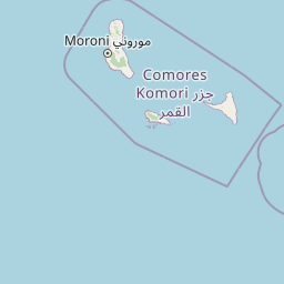
Map view of Mohéli National Park

Use this park location map to pinpoint Mohéli National Park in Comoros, understand its exact geographic position, and read its mapped placement within the surrounding landscape more clearly.

Pigeon | © OpenStreetMap contributors

Location context for Mohéli National Park

Mohéli
Park atlas

Explore the Indian Ocean's Island Conservation Landscapes and Compare Nearby Protected Geography

Discover Other National Parks and Protected Areas Near Mohéli National Park
Continue your exploration from Mohéli National Park by browsing other protected areas and national parks across the Comoros archipelago and surrounding Indian Ocean region. Compare diverse marine, coastal, and terrestrial conservation landscapes to understand the broader regional park geography and unique island ecosystems.
National parkAnjouan

Shisiwani National Park: Anjouan's Protected Marine and Island Landscape Atlas

Coastal and terrestrial protected area mapping in Comoros.

Delve into the protected landscape of Shisiwani National Park, a critical national park situated on Anjouan's Sima Peninsula in Comoros. This atlas entry details the park's combined marine and terrestrial boundaries, highlighting its vital coral reefs, mangrove forests, and unique island geography. Understand the park's role in conservation through its mapped extent and diverse natural environments, offering a clear geographic context for protected area exploration.

Area
64.97 km²
Established
2016
IUCN
II
Climate
Tropical
Watercolor illustration of a mountainous landscape with a lake and grassy fields.
National parkAnjouan

Mount Ntringui National Park: Protected Volcanic Landscape and Highland Geography on Anjouan

Explore its dramatic peaks, crater lake, and remnant montane forests.

Mount Ntringui National Park is a significant protected area situated in the rugged volcanic highlands of Anjouan. This national park preserves the island's highest peaks, Mount Ntringui and Mount Trindrini, alongside the unique Dzialandzé crater lake and the crucial Moya Forest. It stands as a vital refuge for endemic species and represents the last substantial tract of montane forest on Anjouan, offering deep insights into the region's unique ecology and mapped natural terrain.

Area
79.14 km²
Established
2010
IUCN
II
Relief
Mountain
National parkCabo Delgado Province

Quirimbas National Park: Coastal Protected Landscape and Island Archipelago Atlas

Discover marine conservation and inselberg terrain in Cabo Delgado.

Quirimbas National Park, located in Cabo Delgado Province, Mozambique, is a key protected area defined by its exceptional combination of marine and terrestrial environments. The park's geography includes eleven islands, extensive mangrove forests, and vibrant coral reefs, alongside a mainland characterized by striking inselberg formations. This national park is a vital site for understanding coastal landscape diversity, marine ecosystems, and protected-area geography within East Africa.

Area
1,430 km²
Established
1971
IUCN
II
Relief
Mixed relief
National parkBoeny

Baie de Baly National Park: Mapped Boundaries and Protected Landscape Context

Explore the geography and natural terrain of this national park.

Baie de Baly National Park presents a critical focal point for understanding protected areas within the Boeny region. As a national park, it showcases specific mapped boundaries that contribute to the broader geographic understanding of Madagascar's conservation landscapes. This detailed view allows for an atlas-driven exploration of the park's natural terrain and its significance as a distinct protected landmass within its regional context.

Area
571.42 km²
Established
1997
IUCN
II
Climate
Tropical
National parkMadagascar

Lokobe National Park: Madagascar's Protected Natural Landscape and Geographic Context

Explore mapped boundaries and regional park geography.

Lokobe National Park is a protected national park situated within Madagascar, an island country recognized globally for its exceptional biodiversity and unique ecosystems. This page offers a detailed, atlas-oriented perspective on Lokobe National Park, focusing on its designation as a protected area, its specific geographic location, and the natural landscape features that define its territory. Users can explore the park's mapped boundaries and understand its contribution to Madagascar's remarkable natural heritage.

Area
15.23 km²
Established
1927
IUCN
II
Climate
Tropical
National parkBoeny Region

Ankarafantsika National Park: Protected Area Atlas and Regional Geography Discovery

Explore mapped boundaries and natural landscape context.

Ankarafantsika National Park serves as a key protected area for understanding the geography of Madagascar's Boeny Region. This canonical page offers a detailed atlas-style view, highlighting the park's mapped boundaries and its role as a distinct natural landscape. Engage with structured geographic data to comprehend the park's protected status and its contribution to the regional terrain, facilitating a deeper appreciation of protected lands.

Area
1,365.13 km²
Established
2002
IUCN
II
Relief
Lowland
National parkDiana Region

Nosy Hara National Park: Mapped Protected Landscape and Regional Geographic Context

Atlas exploration of national park boundaries and natural terrain.

Nosy Hara National Park is a designated national park situated within the Diana Region of Madagascar. This entry provides detailed geographic information, focusing on the park's mapped boundaries and its role as a protected landscape. Explore the unique regional geography and understand how this protected area contributes to the broader atlas of natural landscapes.

Area
2.7 km²
Relief
Lowland
Climate
Tropical
Access
Access unknown
Watercolor illustration showing a lake surrounded by grassy areas with trees and mountains in the background
Nature reserveMozambique

Niassa Reserve Nature Reserve: Mozambique's Expansive Protected Wilderness

Mapping the vast miombo woodlands and endemic species.

Niassa Reserve, a sprawling nature reserve in northern Mozambique, represents one of the largest miombo woodland ecosystems on Earth. Its diverse terrain encompasses dense forests, open savannahs, and riparian zones, making it a vital habitat for unique wildlife and a significant landmark in regional geography. The reserve's protected status and immense scale offer unparalleled opportunities for atlas-style exploration of its landscape and conservation importance.

Area
42,000 km²
Established
1954
IUCN
IV
Relief
Mixed relief

Common questions about visiting, size, designation, and location context for Mohéli National Park

Mohéli National Park FAQs for park facts, access, geography, and protected area context
Find quick answers about Mohéli National Park, including protected-area facts, park geography, trail and visitor context, and how the park fits into its surrounding country and regional landscape.
MoriAtlas Explorer

Continue Your Protected Areas Search Across the Global Atlas

Deepen your exploration by continuing the structured search for national parks and protected areas worldwide. Utilize the comprehensive filtering capabilities to compare different conservation landscapes and refine your understanding of global park geography. Discover more about the distribution and characteristics of protected natural areas.

Global natural geography