
Mori Atlas logo
Natural monumentNa kneipě

Explore the geography of a rare summit peat bog and subalpine granite plateau in northern Bohemia.

Na kneipě Natural Monument: Analyzing the Protected Mountain Mire Landscape in the Czech Jizera Mountains

(Přírodní památka Na kneipě)

Na kneipě represents a critical protected area within the Jizera Mountains of Czechia, safeguarding a significant upland mire ecosystem. This natural monument preserves a summit plateau where granite geology intersects with waterlogged terrain and mountain pine stands. The site functions as a vital hydrological watershed, offering a rare view into the high-elevation wetland habitats that define the upper ridges of the region.

peat bogsummit miremountain pinegranite uplandsJizera Mountainsprotected landscape area
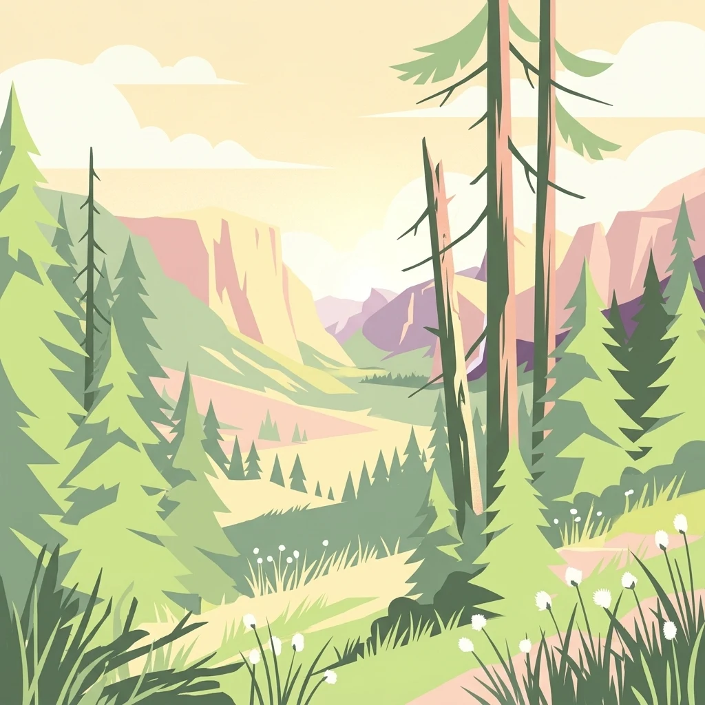
A stylized vector illustration of a forested mountain valley with evergreen trees in the foreground and distant peaks in the background under a soft light.

Na kneipě

Natural monument

Park overview

Structured park overview, official facts, and landscape profile for Na kneipě

Na kneipě park facts, protected area profile, and essential visitor context

Review the core facts for Na kneipě, including designation, size, terrain, visitor scale, habitats, and operating context in one park-focused overview.

About Na kneipě

Na kneipě, sometimes recorded in older German sources as Kneipe, is a small natural monument situated in the northwestern part of the Czech Republic, in the Jizera Mountains (Jizerské hory). The protected zone surrounds an unnamed and easily overlooked summit in the cadastral territory of Hejnice, in the Liberec district. Although the peak rises only modestly above surrounding terrain, the site has attracted ecological attention because it lies on a rounded summit plateau that supports one of the few remaining upland peat bogs of the Czech side of the Jizera Mountains.

The geological character of the mountain is typical of the Jizera range: the bedrock is granite, and this is reflected in the surface of the bog, where several granite boulders rise from the mire. The summit is surrounded by mountain pine (Pinus mugo, known locally as kleč), a low shrubby conifer that thrives in cool, wet, exposed conditions and contributes significantly to the visual character of the site. Although the summit is small, its ecological footprint is disproportionate: together with the Quarre mire nearby, it represents the only remaining summit mire complex still preserved on the highest ground of the Czech Jizera Mountains.

The site's name reflects the cultural history of the summits of the Jizera Mountains. The label Kneipe, which in German means roughly a pub or tavern, derives from a former woodcutter's cabin that once stood here. This small human reference point on the landscape was enough to give the otherwise anonymous peak a lasting name. The same name has occasionally been misapplied on maps to the adjacent Velká klečová louka, an area of large mountain pine stands of its own, but the natural monument itself refers strictly to the protected bog and summit.

Na kneipě sits within a constellation of broader conservation designations that reinforce its importance. It lies inside the Jizera Mountains Protected Landscape Area, contributes to the Jizerské smrčiny site of community importance under the European Natura 2000 network, and is included in the Jizera Mountains bird protection area. Together, these designations place this small summit mire within a wider framework for the protection of upland habitats, montane spruce forests, and birdlife across the range.

Quick facts and research context for Na kneipě

Na kneipě is a Czech přírodní památka located in the Jizera Mountains above the town of Hejnice, in the Liberec district of the Liberec Region. The protected site covers an unnamed summit near 1010 m, the rounded plateau of which hosts one of the only remaining summit peat bogs of the Czech Jizera Mountains. The reserve was first protected in 1960 as part of an earlier broader reserve and became a standalone site in 1965; under a 1992 reclassification of Czech small protected areas, it became a natural monument. The area is part of the Jizera Mountains Protected Landscape Area and lies within the Jizerské smrčiny European site of community importance.

Park context

Deeper park guide and search-rich context for Na kneipě

Na kneipě history, landscape, wildlife, and travel context

Explore Na kneipě through its history, landscape character, ecosystems, wildlife, conservation priorities, cultural context, and seasonal travel timing in a structured park guide built for atlas discovery and search intent.

Why Na kneipě stands out

Na kneipě is best known for hosting one of the only summit peat bogs (vrcholové rašeliniště) of the Czech Jizera Mountains, alongside the nearby mire on Quarre. The site is recognized for its compact combination of upland mire vegetation, a distinctive cover of mountain pine (kleč), and scattered granite boulders typical of the granite geology of the range. Together with its small size and unusual position on a tepid summit plateau, it represents a classic example of the high-elevation mire habitats that once characterized the upper parts of the Jizera Mountains.
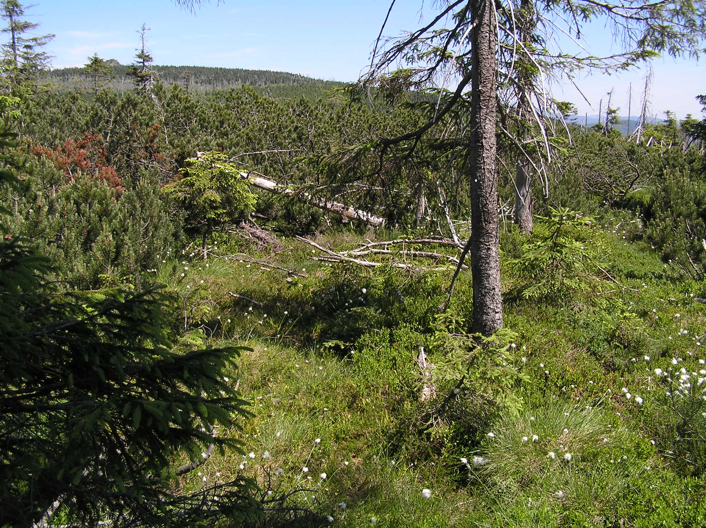
A sunny scene in a peat bog with low-lying green shrubs, scattered spruce trees, and small white flowers on the forest floor, with a hilly landscape in the background.
A view of the peat bog habitat within the Na kneipe natural monument.

Na kneipě history and protected-area timeline

The conservation history of Na kneipě is closely tied to the broader wave of nature protection that swept through the Jizera Mountains in the second half of the 20th century. In 1960, the first nineteen nature reserves of the Jizera Mountains were declared. At that point, the bog at Na kneipě had no separate name and was incorporated into the larger Klečové louky reserve, which originally covered 0.44 hectares.

In 1965, the Klečové louky reserve was reduced in extent, and the bog at the summit was separated as an independent reserve known as Na kneipě. The change reflected a growing recognition of the summit mire as a distinctive ecological unit rather than merely a marginal element of the surrounding mountain pine stands.

A further change came in 1992, when the Czech Republic reorganized its categories of small protected areas. As part of this reform, the state nature reserve at Na kneipě was reclassified as a přírodní památka (natural monument), a designation that better suits its small size and its function as a specific habitat-protection site. Today the monument is administered by the Czech Agency for Nature Conservation and Landscape Protection (AOPK ČR), through its regional office for the Liberec area.

Na kneipě landscape and geographic character

The landscape of Na kneipě is that of a quiet, rounded mountain summit rather than a dramatic peak. The summit itself is barely prominent, rising only modestly from the southern flank of Smědavská hora (1084 m). The bedrock is granite, and the position of the summit on the watershed gives the area particular hydrological importance: water from the upper bogs of Smědavská hora drains outward in four different directions, eventually reaching both the North Sea through the Lusatian Neisse basin and the Baltic Sea through the Smědá basin.

The defining physical feature of the protected area is its summit plateau, a flat, waterlogged surface that supports peat-forming processes on a granite mountain top. Several granite boulders rise from this mire, breaking the otherwise low and uniform surface. Vegetation around the summit is dominated by dense stands of mountain pine, which clothe the slopes and the plateau edge in a continuous low canopy. Although the elevation is only modest by alpine standards, the combination of boggy ground, exposed granite, and mountain pine gives the summit a distinctly subalpine character.

Na kneipě ecosystems, habitats, and plant life

Ecologically, Na kneipě is defined by the presence of an upper montane peat bog, a habitat type that is extremely rare in the Czech part of the Jizera Mountains. The bog, although very small in extent, functions much like larger upland mires: it accumulates peat, holds water at the surface, and supports plant communities adapted to acidic, nutrient-poor, permanently wet conditions.

Mountain pine (Pinus mugo, in Czech kleč) is the dominant woody species around the bog and on the surrounding slopes, forming dense, low-growing thickets that stabilize the surface and contribute to the cold microclimate of the site. Within and around the mire, the vegetation layers combine sphagnum and other peat-forming mosses, scattered granite boulder habitats, and pockets of specialized mire flora. The protection aim for the site is specifically the preservation of these plant communities and their associated landforms.

Na kneipě wildlife and species highlights

The wildlife significance of Na kneipě is closely linked to its inclusion in the Jizera Mountains bird protection area and in the Jizerské smrčiny European site. Its summit mire and adjoining mountain pine habitats provide nesting and feeding habitat for bird species associated with the upper elevations of the Jizera Mountains. Although the reserve itself is extremely small, its ecological contribution to the larger bird protection area is real: even tiny remnants of upland bog and mountain pine can support bird species that depend on these specific habitats.

Beyond birds, the bog and surrounding vegetation provide habitat for invertebrates and other organisms adapted to cool, wet, acidic environments. The site functions less as a large wildlife stronghold than as a small but ecologically representative micro-refuge for the high-mountain communities that once occupied much more of the Jizera summits.

Na kneipě conservation status and protection priorities

Na kneipě holds a specific and important place in conservation of the Jizera Mountains precisely because of its small size and its habitat type. Its defining value is the protection of an upland peat bog and the associated vegetation cover on the summit. The area is protected as a přírodní památka, a designation used for small Czech sites of particular botanical, geological, or landscape importance. The official reason for protection is the preservation of characteristic plant communities, flora, and landforms.

The site is part of a layered system of conservation designations. Locally, it lies within the Jizera Mountains Protected Landscape Area, which sets the broader framework for landscape management in the region. At the European level, the site is included in the Jizerské smrčiny site of community importance under the Natura 2000 network, and it is part of the Jizera Mountains bird protection area. Together, these designations mean that Na kneipě contributes, despite its tiny size, to the conservation of upland mire habitats, montane spruce forest ecosystems, and bird species across a much larger landscape.

Na kneipě cultural meaning and human context

The cultural dimension of Na kneipě is small but distinctive. The name itself is a historical remnant from a period when woodcutters working the high forests of the Jizera Mountains built simple cabins on remote peaks. The German name Kneipe, meaning a pub or tavern, refers to one such woodcutter's hut that once stood on this summit, and the Czech form Na kneipě preserves that memory.

A second cultural reference on the eastern slope of the surrounding terrain is the Gackův pomník (Gacka's memorial), located southeast of the Čihadla tourist junction. The memorial commemorates the 1927 murder of engineer Viktor Gacka from Králův Dvůr near Beroun, a historical event that has become a small local landmark along the blue-marked hiking trail below the summit.

Top sights and standout views in Na kneipě

Na kneipě offers a compact but distinctive mountain experience: an inconspicuous summit, a rare summit peat bog, dense mountain pine stands, and a few granite boulders in a single small protected package. It is one of just two surviving summit mires of the Czech Jizera Mountains, sits along the historic Kristiánov blue trail between Nová Louka and Josefův Důl, and lies within both the Jizera Mountains Protected Landscape Area and European Natura 2000 designations.

Best time to visit Na kneipě

Na kneipě is most appealing when the boggy summit plateau and the surrounding mountain pine can be appreciated under cool, damp conditions. Late spring through early autumn generally offers the most accessible ground for hiking, though the peat surface remains soft and wet for much of the year. In winter, the area can take on a stark subalpine character under snow, though visitors should expect severe conditions on exposed summits and only limited trail access directly to the peak. The site is part of the broader Jizera Mountains hiking network, and visiting alongside the longer range of marked trails such as the Kristiánov route or the Hřebenovka long-distance trail makes the summit most rewarding as part of a wider mountain walk.

Monthly climate preview

Long-term temperature and precipitation trends across twelve recorded monthly cycles

Na kneipě climate normals and average temperature patterns

Representative baseline coordinates for Na kneipě record a measured annual rhythm of shifting mean temperatures and daily precipitation rates. Examining the full monthly climate profile reveals precise long-term normals across temperature thresholds and moisture levels.
Annual mean8 °C
-2 °C19 °C
Jan-2°
Feb-1°
Mar
Apr
May13°
Jun17°
Jul19°
Aug19°
Sep14°
Oct
Nov
Dec-1°
Warmest month
July

18.8 °C

Coolest month
January

-2.5 °C

Wettest month
July

3 mm/day

Driest month
April

1.4 mm/day

Park location guide

Geography guide, regional context, and park location map for Na kneipě

Na kneipě park geography, regions, and map view in Czechia

Understand where Na kneipě sits in Czechia through a broader geographic reading of the surrounding landscape, nearby location context, and its mapped position within the national park landscape.

How Na kneipě fits into Czechia

Czech Republic is a landlocked Central European country with a population of approximately 10.9 million people. The nation was established as an independent state on January 1, 1993, following the dissolution of Czechoslovakia. Its capital and largest city is Prague, with other major urban centers including Brno, Ostrava, Plzeň, and Liberec.

Wider geography shaping Na kneipě in Czechia

The Czech Republic is a landlocked country in Central Europe. It is bordered by Germany to the west, Austria to the south, Poland to the northeast, and Slovakia to the southeast. The landscape is predominantly hilly, with the territory covering 78,871 square kilometers.

Map view of Na kneipě

Use this park location map to pinpoint Na kneipě in Czechia, understand its exact geographic position, and read its mapped placement within the surrounding landscape more clearly.

Pigeon | © OpenStreetMap contributors

Explore detailed visual references of summit peat bogs, mountain pine stands, and protected terrain.

Na kneipě Photos and Scenery: Visualizing Mountain Mires and Granite Uplands

Browse curated photographic records documenting the upland habitats, granite boulder fields, and distinctive subalpine scenery defining Na kneipě. Visual documentation provides essential context for understanding the rare mire ecosystems and protected landscape character preserved across the upper Jizera range.

A sunny scene in a peat bog with low-lying green shrubs, scattered spruce trees, and small white flowers on the forest floor, with a hilly landscape in the background.

A view of the summit area at Na kneipě showing tall grasses, small conifers, and a wooden fence running across the middle ground.

Park atlas

Compare surrounding granite uplands and protected landscapes in northern Bohemia

Other Parks and Protected Areas Near Na kneipě in the Jizera Mountains

Browse protected areas and natural monuments located near Na kneipě across the surrounding mountain region. Comparing adjacent upland habitats and granite terrain helps reveal broader ecological patterns across the range.
Natural monumentLiberecký kraj
About 1.5 km away#1 closest

North

Vlčí louka Natural Monument: Protected Bog Landscape in the Liberecký kraj Region

High-elevation peatland and mountain habitat geography

Vlčí louka serves as a prime example of a high-altitude raised bog located along the Smědavská hora ridge. This protected area supports a diverse suite of peatland plants and serves as a vital refuge for mountain birds. By studying its unique terrain, mapped boundaries, and position within the Jizera Mountains, users gain a deeper understanding of this specialized, elevated ecosystem in the Czech Republic.

Area
0.08 km²
Established
1965
IUCN
IV
Relief
Highland
Watercolor painting of a mountain range with spruce forest in the foreground on a white background.
Nature reserveLiberec Region
About 1.5 km away#2 closest

East

Prales Jizera Nature Reserve: Protected Mountain Geography and Summit Landscapes

Highland spruce forests and granite outcrops in the Liberec Region

Investigate the summit geomorphology of Prales Jizera, a vital protected area encompassing rare climax spruce forest and granite blockfields. This record provides detailed geographic context on the reserve's unique soil, hydrological watershed position, and its role as a landmark conservation site in the Jizera Mountains.

Area
0.936 km²
Established
1960
IUCN
IV
Relief
Mountain
A soft watercolor painting depicting rolling forested mountains in muted green, pink, and yellow tones against a white background.
Nature reserveLiberec Region
About 5 km away#3 closest

West

Ptačí Kupy Nature Reserve: Granite Formations and Montane Forest in Liberec Region

Protected mountain geography and high-elevation beech forest terrain

Ptačí Kupy stands as a notable nature reserve in the Liberec Region, defined by its coarse-grained granite outcrops and preserved acidophilic beech forest ecosystems. This compact area sits within the high-elevation ridge of the Jizera Mountains, offering a window into specialized montane vegetation and complex frost-riven geological structures. As a key segment of the regional conservation network, it illustrates the recovery of mountain woodland landscapes from historical environmental pressures.

Area
0.118 km²
Established
1960
IUCN
IV
Relief
Mountain
Watercolor painting showing green forests, a valley, and distant mountains under a soft sky
National parkLiberec Region
About 11 km away#4 closest

East

Krkonoše National Park: Central European Alpine Protected Area and Map Context

Discover glacial landforms and unique ecosystems in the Giant Mountains.

Krkonoše National Park, situated in the Liberec Region, is a premier example of a protected alpine landscape in Central Europe. This page facilitates exploration of its significant glacial geography, including distinct cirques, rockfields, and valleys, providing vital context for understanding its protected area status. Engage with the mapped terrain and discover the unique ecological features that make this national park a cornerstone of conservation and geographic study within the Czech Republic.

Area
363.52 km²
Established
1963
IUCN
II
Visitors
12.1M annual
Watercolor illustration of a mountain range with green hills, pink and yellow sky, and sparse vegetation
National parkPoland
About 13 km away#5 closest

East

Karkonosze National Park: A Premier National Park in Poland's Giant Mountains

Discover alpine terrain and unique glacial landscapes.

Karkonosze National Park is a significant protected area in Poland, renowned for its dramatic alpine topography carved by ancient glaciers. As the highest range in the Polish Sudetes, it features striking U-shaped valleys, U-shaped glacial cirques, and diverse subalpine to alpine ecosystems. This national park provides a rich context for understanding Central European mountain geography and exploring its mapped protected boundaries.

IUCN
II
Relief
Mountain
Scope
Terrestrial
A minimalist watercolor illustration depicting rolling, layered mountain ridges in soft shades of green, yellow, and light pink against a white background.
National parkDolnośląskie Voivodeship
About 16 km away#6 closest

East

Karkonoski Park Narodowy: Mapping Protected Granite Peaks and Glacial Terrain in Poland

High-mountain landscapes in the Dolnośląskie Voivodeship

Trace the diverse geography of Karkonoski Park Narodowy, where granite blockfields and glacial cirques define the high-altitude terrain. This protected area represents one of Central Europe's most significant upland ecosystems, showcasing a vertical transition from dense forest to alpine tundra.

Area
59.51 km²
Established
1959
Visitors
2M annual
Relief
Mountain
A soft watercolor illustration of a rolling natural landscape with green trees, distant hills, and gentle colors on a white background.
Natural monumentLiberec Region
About 22 km away#7 closest

South

Na Vápenici Natural Monument: Geological Mapping and Protected Landscape Analysis

Calcareous outcrops and rare forest microhabitats in the Liberec Region

Na Vápenici represents a focused example of geological diversity, where a distinct limestone outcrop supports unique vegetation and paleontological richness. This natural monument provides a case study for understanding how isolated calcareous substrates contribute to the broader ecological health and terrain character of the Liberec Region.

Area
0.079 km²
Established
2008
IUCN
IV
Relief
Upland
A soft watercolor painting of a river flowing through a hilly, forested landscape with light green and pastel tones.
Nature reserveLower Silesian Voivodeship
About 28 km away#8 closest

Northeast

Ostoja nad Bobrem Nature Reserve and Bóbr River Valley Geographic Atlas

Protected Sudetes foothills landscape in Poland

Ostoja nad Bobrem represents a significant protected area within the Lower Silesian Voivodeship, characterized by its winding river corridor and hilly topography. The reserve supports a range of habitats including rare orchid-rich grasslands and dense slope forests. This atlas entry provides a detailed look at the geographic distribution and ecological importance of this essential Polish nature reserve.

Area
153.73 km²
Established
2009
Relief
Upland
Climate
Temperate

Common questions about visiting, size, designation, and location context for Na kneipě

Na kneipě FAQs for park facts, access, geography, and protected area context

Find quick answers about Na kneipě, including protected-area facts, park geography, trail and visitor context, and how the park fits into its surrounding country and regional landscape.
MoriAtlas Explorer

Continue Your Protected Areas Search Across the Global Atlas

Deepen your exploration by continuing the structured search for national parks and protected areas worldwide. Utilize the comprehensive filtering capabilities to compare different conservation landscapes and refine your understanding of global park geography. Discover more about the distribution and characteristics of protected natural areas.

Global natural geography