Mori Atlas logo
Nearby park discovery

Geographic context and map-based proximity of protected sites in Jihomoravský kraj

Protected Areas and Natural Landscapes Surrounding the Na Skalách Natural Monument

Browse the surrounding natural landscape near the Na Skalách Natural Monument to identify clusters of protected areas across the Jihomoravský kraj region. Use these geographic data to analyze regional park distribution, terrain connectivity, and the spread of limestone and forest habitats near the Svratka River.

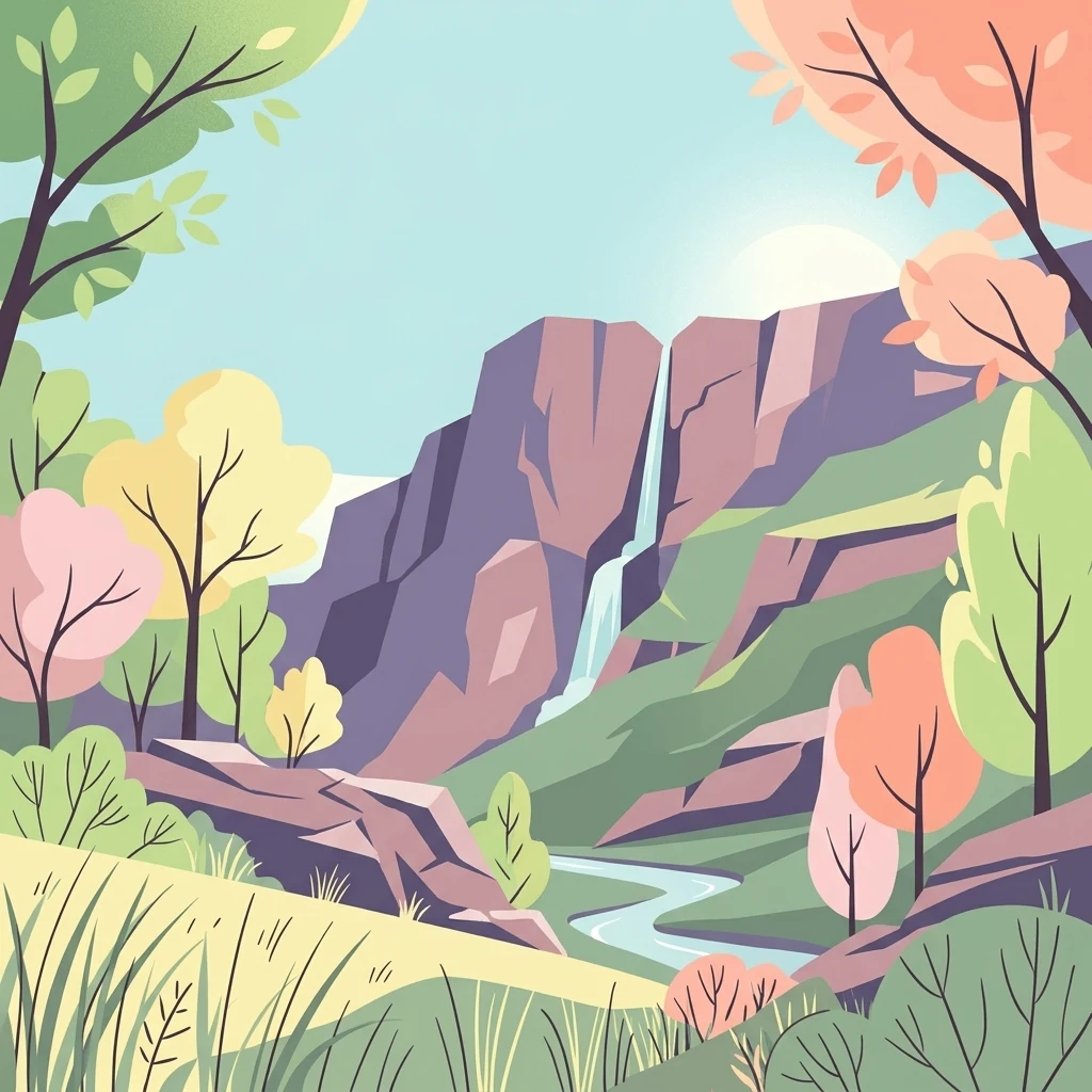
A flat vector-style illustration of a rocky canyon with a waterfall cascading down the face into a river, framed by stylized trees and grassy hills.

A small limestone-cliff natural monument beside the Svratka River valley in Brno.

Na Skalách

Na Skalách is a small protected natural area on the outskirts of Brno, in the Czech Republic, sitting along the left side of the gorge cut by the Svratka River. Part of the slope is now submerged beneath the Brno Reservoir, but the protected site itself occupies a rocky outcrop and a steep south to southwest-facing slope within the landscape of the Bobravská vrchovina highlands. The reserve was created to safeguard a distinctive combination of stunted thermophilic oak woodland and warm-loving herb-grass communities that thrive on calcareous substrate. Despite being less than one hectare in size, it preserves a striking ecological contrast between exposed limestone rocks and forested cliff habitat just a short distance from the urban edge of the city. Na Skalách is recognized as an IUCN Category IV protected area (habitat/species management area), and it is administered by the Regional Authority of the South Moravian Region. Its scientific and conservation value lies in the preservation of relict forest communities and specialist flora that depend on warm, sun-exposed calcareous cliffs in the Moravian landscape.

Location
Czechia
Park type
Natural monument
Established
1991
Area
0 km²
Highest point
270 m
Na Skalách Protected Area Geography
Regional park map

See the ranked park cluster in its geographic setting

Nearby parks around Na Skalách

This regional map shows the same 20 nearby parks ranked below around Na Skalách. Select a ranked marker to highlight that park’s boundary where boundary data is available.
Reference park: Na SkaláchRanked nearby park20 nearby parks shown
20 nearby parks

Distance-ranked protected landscapes and environmental comparison signals around Na Skalách

Parks and Protected Areas Geographically Near Na Skalách in Regional Context

Geographic proximity measurements establish a structured ranking of protected areas surrounding Na Skalách across regional territory. Comparative analysis of recorded terrain metrics and boundary separations reveals broader patterns in surrounding park geography.
Protected landscapeBrno-venkov District
About 5.7 km away#1 closest

West

Přírodní park Údolí Bílého potoka: Protected Landscape in the South Moravian Region

Forested stream valley geography and upland terrain mapping

This protected area centers on the deep, forested valley of the Bílý potok stream. It features a rich mosaic of beech-fir and oak-pine forests on rocky slopes, representing a significant ecological corridor in the agricultural landscape northwest of Brno within the Brno-venkov District.

Area
40.46 km²
Established
1978
Relief
Upland
Climate
Temperate
Natural monumentJihomoravský kraj
About 5.7 km away#2 closest

Southeast

Skalky u Přehrady: Protected Natural Monument and Mapped Landscape in Jihomoravský kraj

Ecologically significant forest steppe and river gorge terrain

Skalky u Přehrady is a protected natural monument characterized by its rugged diorite cliffs and diverse plant communities. The site serves as a compact example of forest steppe mosaic situated along the Svratka River, offering significant insight into the regional geography and conservation status of rocky slopes within the South Moravian territory.

Area
0.013 km²
Established
1989
IUCN
IV
Relief
Upland
A minimalist watercolor illustration showing rolling green hills and a few trees against a pale yellow and pink background.
Protected landscapeCzechia
About 6.3 km away#3 closest

East

Přírodní park Baba: A Detailed Geographic Overview of this Czech Protected Landscape

Forested ridges and centuries-old oak woodland topography

Přírodní park Baba is a protected area in Czechia characterized by a continuous six-kilometer ridge rising above the surrounding urban landscape of Brno. This site is defined by its deep-rooted, century-old sessile oak stands and an intricate mosaic of meadows supporting rare orchid species and diverse avian life. Its geological foundation, composed of Paleozoic diorite, supports a resilient ecosystem that serves as a vital natural corridor between Brno and Kuřim.

Area
8.89 km²
Established
1990
Relief
Mountain
Climate
Temperate
A soft watercolor painting showing a rolling landscape with hills, scattered trees, and rocky outcrops, rendered in pastel greens and pinks.
Natural monumentBrno
About 8.4 km away#4 closest

East

Medlánecká skalka Natural Monument: Mapped Protected Landscapes and Geography in Brno

A rare urban-adjacent steppe and rocky habitat site

Medlánecká skalka is a protected natural monument located in the Medlánky district of Brno, Czech Republic. Spanning a small but significant rocky slope, this site preserves thermophilous dry-grassland communities and essential habitats for rare flora like the Pulsatilla grandis. Its unique topography and skeletal soil composition make it an important geographic reference point for understanding steppe-like ecosystems in the South Moravian region.

Area
0.003 km²
Established
1999
IUCN
IV
Relief
Upland
A horizontal watercolor painting showing rolling green hills with small patches of trees under a soft, pale sky.
Natural monumentJihomoravský kraj
About 8.7 km away#5 closest

East

Medlánecké kopce Natural Monument: Exploring Protected Steppe Habitats in Northern Brno

A rare mosaic of dry grasslands and rocky outcrops in Jihomoravský kraj

Medlánecké kopce preserves a critical landscape of thermophilic flora and insect communities on the edge of the Brno basin. The site is noted for its xerothermic vegetation, including the large-flowered pasqueflower, which thrives on its unique metabasite and loess soil composition. This protected area offers a look at how specialized steppe ecosystems persist within a heavily developed regional environment.

Area
0.118 km²
Established
1988
IUCN
IV
Relief
Upland
Natural monumentJihomoravský kraj
About 11 km away#6 closest

East

Soběšické rybníčky Natural Monument: A Detailed Geographic Atlas of the Jihomoravský kraj Forest Ponds

Mapping the protected wetland terrain and amphibian breeding landscapes of central Moravia.

Explore the geographic and conservation profile of Soběšické rybníčky, a protected forest monument in the Czech Republic. The site represents a vital wetland network that maintains stable amphibian populations within a dense, shaded valley setting of the Soběšice Highlands, offering a focused look at small-scale protected landscape management.

Area
0.012 km²
Established
1987
IUCN
IV
Relief
Upland
A horizontal watercolor illustration showing rolling green hills and meadows against a soft, pale background, with trees and soft light.
Protected landscapeBrno-venkov District
About 13 km away#7 closest

South

Přírodní park Bobrava Protected Landscape: Geography and Regional Mapping

South Moravian forest and river valley terrain

Přírodní park Bobrava represents an unbroken, forest-heavy landscape situated in the Brno-venkov District. Characterized by its deep river valleys and hilly ridges, this protected territory functions as a crucial natural mosaic of woodlands and meadows, providing a quiet highland retreat that remains distinct from the surrounding urban expansion of the city of Brno.

Area
30.9 km²
Established
1982
Relief
Upland
Climate
Temperate
A watercolor painting showing a stylized, panoramic view of green rolling hills and evergreen trees under a soft, light-colored sky.
Nature reserveJihomoravský kraj
About 15 km away#8 closest

Southwest

Rybičková skála Nature Reserve: Paleontological and Geological Landscape in Jihomoravský kraj

A preserved Permian fossil site in the Boskovice Furrow

Rybičková skála acts as a vital reference point for Permian sedimentary studies in central Europe. The site features a 40 meter cliff exposing mudstones and siltstones rich in fish fossils. Framed by mixed oak-hornbeam forests and rural Moravian farmland, this compact reserve represents a convergence of deep geological time and traditional landscape character.

Area
0.001 km²
Established
1980
IUCN
III
Relief
Upland
Natural monumentJihomoravský kraj
About 17 km away#9 closest

North

Veselský chlum Natural Monument: Protected Highland Landscape and Regional Geography

A diverse habitat mosaic in the South Moravian Highlands

Veselský chlum functions as a compact natural monument, preserving an unusual blend of vegetation formations including dry grasslands and shrublands. Located in the South Moravian region, this protected area offers significant value for understanding how historical land use creates rich habitat mosaics on low-elevation summits. The site provides a valuable geographic reference point for highland conservation patterns.

Area
0.124 km²
Established
1991
IUCN
IV
Relief
Mountain
Nature reserveJihomoravský kraj
About 17 km away#10 closest

East

Velká Klajdovka Nature Reserve: Steppe and Forest-Steppe Landscape in Jihomoravský Kraj

Ecologically rich protected limestone slopes and terrain near Brno

Velká Klajdovka is a protected natural monument distinguished by its high-value thermophilic vegetation and complex soil structures. Located on the flank of the Hády massif, the reserve offers a unique study of forest-steppe mosaics, rare entomological diversity, and dry oak woodlands that thrive on the boundary of varied geological substrates.

Area
0.09 km²
Established
1988
IUCN
IV
Relief
Upland
Watercolor illustration of a karst landscape featuring hills, a lake, and cave-like rock formations with green vegetation
Protected landscapeSouth Moravian Region
About 20 km away#11 closest

East

Moravian Karst Protected Landscape: Detailed Geographic and Cave System Atlas

Mapped protected boundaries and karst phenomena in the South Moravian Region.

Moravian Karst, designated a Protected Landscape Area, offers a profound look into complex karst geology within the South Moravian Region. This entry within MoriAtlas facilitates a structured discovery of its approximately 92 square kilometers, featuring an intricate network of over 1,100 caves and gorges. Users can explore the mapped extent of this geological treasure, understand its relationship with the surrounding regional geography, and appreciate the unique formations sculpted by underground water systems, including the iconic Macocha Abyss.

Area
92 km²
IUCN
V
Scope
Terrestrial
Water
Minor water
A pale, minimalist watercolor painting showing a soft horizon line with hints of green, yellow, and pink foliage against a white background.
Natural monumentJihomoravský kraj
About 20 km away#12 closest

East

Rudice, Seč Natural Monument: A Comprehensive Geological and Landscape Atlas Overview

Protected mineral landscapes and pioneer ecosystems in the Moravian Karst

Rudice, Seč provides a concentrated view into the geological history of the Drahanská vrchovina. The site is a former quarry that now protects unique sedimentary layers, abundant geodes, and secondary pond habitats. This protected monument offers a clear case study of how karstic depressions are filled by Cretaceous materials and how human-modified terrain can recover to host specialized biodiversity.

Area
0.07 km²
Established
2022
IUCN
III
Relief
Upland
Natural monumentJihomoravský kraj
About 22 km away#13 closest

Southeast

Velké Družďavy Natural Monument: Steppe Geography and Protected Landscapes in Jihomoravský kraj

Rare xerothermic habitats on Miocene sandy substrates

Velké Družďavy represents a vital, small-scale protected area in the Czech Republic. Defined by its south-facing slope and sandy Miocene substrate, the site supports significant populations of thermophilic plants. This natural monument illustrates the challenges of managing xerothermic steppe vegetation against encroaching forest succession, providing a distinct geographic focal point within the regional protected area network of South Moravia.

Area
0.014 km²
Established
1953
IUCN
IV
Relief
Upland
Natural monumentJihomoravský kraj
About 23 km away#14 closest

East

Velatická slepencová stráň: A Protected Natural Monument in South Moravia, Czech Republic

Mapping the rare steppe vegetation and conglomerate geology of Jihomoravský kraj.

Velatická slepencová stráň serves as a critical refuge for thermophilous steppe communities within the Jihomoravský kraj region. The site features distinctive conglomerate outcrops and a rich assembly of dry-grassland plants. This mapping resource provides a comprehensive geographic overview of the protected landscape and its specific ecological configuration.

Area
0.017 km²
Established
1951
IUCN
IV
Relief
Upland
A soft watercolor illustration depicting a panoramic view of rolling green hills, distant light purple mountain ridges, and a central valley stream.
Protected landscapeCzechia
About 25 km away#15 closest

East

Přírodní park Říčky: Protected Landscape and Highland Geography in Czechia

Deep exploration of stream-carved valleys and karst-influenced terrain.

Přírodní park Říčky preserves a vital transitional environment within the Drahanská vrchovina highlands. This protected area integrates diverse ecosystems, including upland beech enclaves and orchid-rich wet meadows, tied together by a complex network of springs and streams that carve through the sedimentary and limestone geology of the region.

Area
30.05 km²
Established
1984
Relief
Upland
Climate
Temperate
Nature reserveJihomoravský kraj
About 29 km away#16 closest

Southwest

Velký kopec Nature Reserve: A Detailed Map and Geography Overview for South Moravia

Protected dry grasslands and landscape terrain in Jihomoravský kraj

Velký kopec is a protected nature reserve in the Znojmo district, characterized by its rounded hill profile and rich acidophilous dry grassland habitat. This geographic overview highlights the site's role as a biodiversity refuge, its metamorphic geology, and the ongoing conservation efforts that sustain its rare steppe-like flora and butterfly populations within the Jevišovice hills.

Area
0.259 km²
Established
2023
IUCN
IV
Relief
Upland
A watercolor painting showing a wide view of soft, green rolling hills against a pale, warm-toned sky.
Protected landscapeBlansko District
About 29 km away#17 closest

North

Halasovo Kunštátsko Nature Park: Protected Highland Landscapes and Regional Geography

A detailed geographic study of the Blansko District highland interior.

Covering the eastern flank of the Czech-Moravian Highlands, Halasovo Kunštátsko Nature Park provides a diverse inland environment of ridges, valleys, and forest mosaics. From the high summit of Kulíšek to the transitional zones of the Boskovická brázda, this protected landscape integrates geological, botanical, and regional environmental values into a single, cohesive geographic area.

Area
68.3 km²
Established
1980
Relief
Upland
Climate
Temperate
Nature reserveKraj Vysočina
About 32 km away#18 closest

North

Pyšolec Nature Reserve: Protected Forest Geography and Mapped Terrain in Kraj Vysočina

Biodiverse woodland and historic castle ruin protected area

Pyšolec is a significant nature reserve characterized by mature broadleaf forests and steep, rocky terrain in the Czech Vysočina Region. The site provides a critical habitat for specialized invertebrates and rare species within its unique forest-castle mosaic, mapped here for geographic context and ecological study.

Area
0.342 km²
Established
2021
IUCN
IV
Relief
Upland
Nature reserveJihomoravský kraj
About 36 km away#19 closest

East

Volkramy Nature Reserve: Geography and Protected Habitat Mapping in South Moravia

Sub-Pannonian steppe grassland and sandy landscape terrain.

Volkramy serves as a critical nature monument in the Czech Republic, protecting a dense concentration of rare steppe flora and dry-grassland ecosystems on sandy substrates. This protected area within the Jihomoravský kraj region showcases a unique combination of open grassland, orchard heritage, and post-industrial sand quarry habitats that provide nesting sites for specialized bird colonies.

Area
0.072 km²
Established
2023
IUCN
IV
Relief
Upland
A watercolor illustration of a soft, rolling landscape featuring meadows, distant hills, and coniferous forest edges in pale greens and yellow tones.
Protected landscapeBlansko District
About 36 km away#20 closest

Northeast

Řehořkovo Kořenecko Protected Landscape: An Upland Mosaic in the Czech Republic

Geographic analysis of plateau ridges and wetland river corridors

Centered in the Blansko District, the Řehořkovo Kořenecko protected landscape offers a unique study of Czech upland geography. The area highlights the interplay between the Bělá river valley, peatland remnants of the Pavlovské mokřady, and the high-point vistas from the Paprč summit, illustrating a cohesive protected region defined by its geological substrate and forest composition.

Area
23.14 km²
Established
2000
Relief
Upland
Scope
Terrestrial
Distance methodology

Geographic measurements, not driving distances

How nearby park distances are calculated

Distances use park boundaries whenever the available geometry allows it. When one or both boundaries are missing, the mapped park locations provide a clearly labelled estimate. Every value represents straight-line geographic separation and does not use roads or routing.

Boundary distance

Calculated between the nearest points of both park boundaries.

Location-to-boundary estimate

Estimated from one mapped park location to the nearest boundary of the other park.

Mapped-location estimate

Estimated between the mapped locations of both parks.

MoriAtlas Explorer

Continue Exploring the Protected Landscapes of the Na Skalách Natural Monument

Gain a deeper understanding of the geological and botanical composition of Na Skalách through our structured MoriAtlas data. Analyze how this limestone outcrop maintains relict habitats and contributes to the broader ecological context of the South Moravian region.

Global natural geography