Mori Atlas logo
Nearby park discovery

Map and explore the geographic distribution of protected terrain in the surrounding region.

Protected Areas and Regional Landscapes Near Naturschutzgebiet Plästerlegge – Auf’m Kipp

This geographic overview visualizes the protected landscapes and natural sites positioned around Naturschutzgebiet Plästerlegge – Auf’m Kipp. Navigate through the surrounding Hochsauerlandkreis region to examine how ravine forests, moorlands, and valley terrain define the wider geography. Gain context on the local distribution of protected sites relative to the slate-formed topography and stream networks of western Germany.

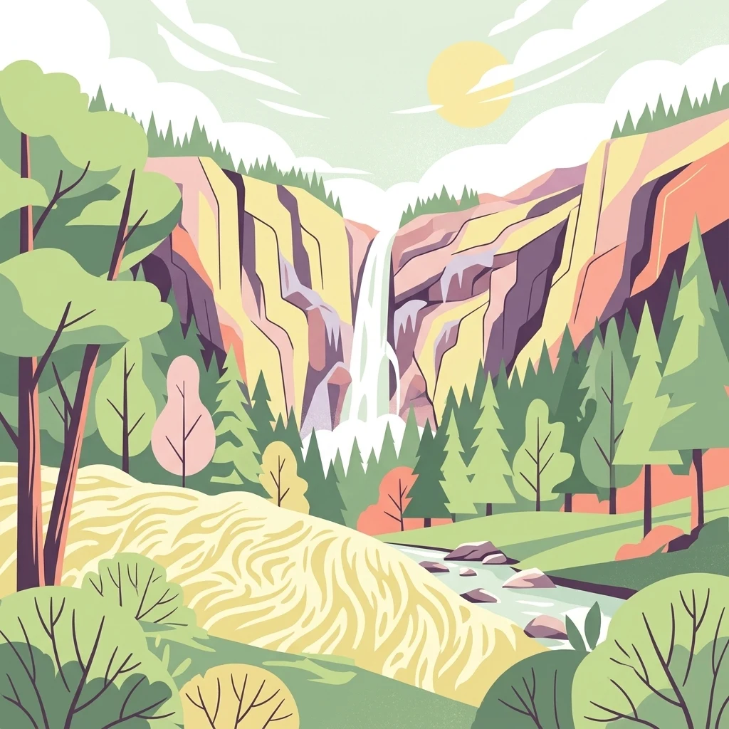
An artistic vector illustration showing a waterfall flowing down a rocky canyon wall into a stream, surrounded by coniferous and deciduous trees under a sunny sky.

A narrow gorge with a 20-metre waterfall, a rare ravine forest, and a small high moor in the Hochsauerland region of North Rhine-Westphalia.

Plästerlegge, Auf'm Kipp Nature Reserve

Plästerlegge – Auf'm Kipp is a small nature reserve in the Sauerland region of North Rhine-Westphalia, in western Germany. The protected area combines a steep, rocky gorge carved by the Plästerlegge stream with the upper slopes of the hill known as Auf'm Kipp, east of the village of Wasserfall near Bestwig. The reserve's defining feature is a roughly 20-metre-high waterfall, which drops through a narrow valley cut into Middle Devonian slate. Around the waterfall, cool and humid microclimates have allowed rare relic plant communities, including ferns, mosses, and lichens, to survive. The upper part of the protected area includes a saddle-form high moor, with pockets of birch bog forest and spruce moor forest set within a mosaic of rushes and purple moor grass. Most of the reserve belongs to the larger EU Habitats Directive site 'Schluchtwälder bei Elpe', recognising its importance for two priority habitat types: ravine and slope mixed forests, and degraded but still restorable raised bogs. The reserve sits across parts of the municipality of Bestwig and the town of Olsberg, and forms one of several protected gorge forests along the upper Ruhr and Elpe valleys.

Location
Germany
Park type
Nature reserve
Established
1952
Area
0.3 km²
Naturschutzgebiet Plästerlegge – Auf’m Kipp Nature Reserve Map
Regional park map

See the ranked park cluster in its geographic setting

Nearby parks around Plästerlegge, Auf'm Kipp Nature Reserve

This regional map shows the same 20 nearby parks ranked below around Plästerlegge, Auf'm Kipp Nature Reserve. Select a ranked marker to highlight that park’s boundary where boundary data is available.
Reference park: Plästerlegge, Auf'm Kipp Nature ReserveRanked nearby park20 nearby parks shown
20 nearby parks

Distance-ranked protected landscapes and regional park geography surrounding the reserve

Parks and Protected Areas Geographically Near Naturschutzgebiet Plästerlegge – Auf’m Kipp

Examine the ranked collection of nearby protected areas surrounding Naturschutzgebiet Plästerlegge – Auf’m Kipp by geographic separation and directional orientation. Compare recorded environmental characteristics and country context to understand broader regional park patterns.
A watercolor illustration depicting a serene river valley landscape with soft rolling hills and clusters of trees in the distance.
Nature reserveNordrhein-Westfalen
About 3.8 km away#1 closest

South

Naturschutzgebiet Oberes Elpetal: Protected Stream Valley and Floodplain Geography

A representative Sauerland nature reserve in Nordrhein-Westfalen.

This nature reserve protects a vital section of the upper Elpe stream, characterized by intact meanders, small-scale fish ponds, and moisture-loving vegetation. The valley floor creates a sheltered micro-habitat of riparian strips and traditional grazing lands, essential for the regional integrity of upland stream systems in the Hochsauerland district.

Area
0.112 km²
Established
2004
IUCN
IV
A watercolor painting of a serene landscape featuring rolling green hills in the distance, a line of trees in the middle ground, and a small winding stream in the foreground.
Protected landscapeHochsauerlandkreis
About 3.9 km away#2 closest

Northwest

Landschaftsschutzgebiet Bestwig: Mapped Protected Landscape in the Hochsauerland District

Geography, forest ridges, and historic mining terrain

Landschaftsschutzgebiet Bestwig covers significant portions of the central Sauerland, integrating forest crests and river valley slopes into a single protected area. The geography reveals a complex interaction between agricultural plantation land, unpopulated northern forest ridges, and historic mining remnants that define this distinct German landscape.

Area
49.12 km²
Established
2008
Relief
Mountain
Water
Minor water
Nature reserveNorth Rhine-Westphalia
About 5.6 km away#3 closest

East

Naturschutzgebiet Olsberger Ruhrtal oberhalb Assinghausen: Protected River Corridor and Valley Geography

Nature reserve featuring floodplain habitats in the Sauerland region

This nature reserve protects the natural flow and riparian ecosystem of the upper Ruhr river. Comprising three distinct sections, it serves as an important ecological link within the Sauerland landscape, preserving floodplain meadows and the river channel corridor. The area represents a focused approach to river-centered conservation in North Rhine-Westphalia, providing a clear example of protected habitat integration within the German landscape.

Area
0.155 km²
Established
2004
Relief
Lowland
Scope
Terrestrial
Nature reserveNordrhein-Westfalen
About 5.8 km away#4 closest

Southwest

Naturschutzgebiet Oegmannsholz: Protected Forest and Geological Landscapes in Nordrhein-Westfalen

A dense nature reserve featuring beech woodland, rock formations, and valley springs.

Naturschutzgebiet Oegmannsholz represents a concentrated protected area within the Sauerland region of Germany. This reserve safeguards diverse forest microhabitats, including mature beech stands and steep drainage lines known as Kerbtalsiepen. Its structural variety, from rocky outcrops to flowing springs, creates a distinct natural terrain within the broader North Rhine-Westphalia conservation network.

Area
0.113 km²
Established
2008
IUCN
IV
Nature reserveHochsauerlandkreis
About 5.8 km away#5 closest

Northwest

Naturschutzgebiet Ostenberg: Protected Nature Reserve and Cave System Geography

Upland forest terrain and karst geology in Hochsauerlandkreis

Naturschutzgebiet Ostenberg is a significant 21-hectare nature reserve that safeguards a complex of steep-slope forests and a multi-level limestone cave system. The site offers a detailed view into the karst processes and mature woodland ecology characteristic of the Sauerland region, providing a protected habitat for forest flora and wintering bat colonies.

Area
0.211 km²
Established
2008
Relief
Upland
Climate
Temperate
Nature reserveNordrhein-Westfalen
About 6.1 km away#6 closest

Southwest

Naturschutzgebiet Palmetal Protected Area Map and Sauerland Highland Landscape Context

Stream corridors and floodplain meadows in Nordrhein-Westfalen

Located in the foothills of the Rothaargebirge, Naturschutzgebiet Palmetal preserves a cohesive upland stream ecosystem. The reserve centers on the Palme and Brabecke brooks, protecting 11.7 hectares of wet meadow and gallery forest habitats. This site provides a representative look at the small-scale valley landscapes found within the Hochsauerlandkreis region, emphasizing the interplay between waterway, floodplain, and local terrain.

Area
0.117 km²
Established
2008
IUCN
IV
Relief
Upland
A watercolor illustration of a soft, rolling landscape with green hills, patches of trees, and grasses, set against a light background.
Nature reserveNorth Rhine-Westphalia
About 6.9 km away#7 closest

Northwest

Naturschutzgebiet Alert: Protected Juniper Heath and Rocky Landscapes of North Rhine-Westphalia

A rare cultural relic within the High Sauerland

Naturschutzgebiet Alert is a compact nature reserve protecting a surviving juniper heath and rocky ridge landscape near Meschede. The site offers a clear look at traditional grazing-dependent ecosystems, combining open grassland with scattered shrubs and woodland edges on a foundation of Devonian slate bedrock. It stands as a significant geographic remnant of the historical land-use patterns that once defined the wider High Sauerland region.

Area
0.021 km²
Established
1994
Relief
Upland
Scope
Terrestrial
Nature reserveNordrhein-Westfalen
About 7.7 km away#8 closest

North

Naturschutzgebiet Ochsenberg: Landscape and Geographic Profile of a German Nature Reserve

Examining forest reclamation on historic slate mine terrain

Located in the Hochsauerlandkreis, Naturschutzgebiet Ochsenberg serves as a case study in ecological succession. The reserve features an intricate mosaic of oak and beech woodland established over old spoil tips, while its abandoned mine tunnels remain essential for regional biodiversity as wintering habitats for protected bat species.

Area
0.124 km²
Established
2004
Relief
Upland
Scope
Terrestrial
Nature reserveHochsauerlandkreis
About 8.4 km away#9 closest

West

Naturschutzgebiet Piepenbruchsiepen: Protected Landscape and Mountain Brook Geography

Mapping nature reserves in the Hochsauerlandkreis region

This nature reserve covers a steep, forested valley in the Hochsauerlandkreis, showcasing a classic Sauerland Siepen. The terrain is defined by a rocky mountain brook, seeping springs, and structurally rich beech forests that preserve native biodiversity within a heavily managed timber landscape.

Area
0.077 km²
Established
2020
Relief
Mountain
Scope
Terrestrial
Nature reserveNordrhein-Westfalen
About 11 km away#10 closest

East

Hoppecke-Quellbäche Nature Reserve: Protected Headwater Landscapes in Nordrhein-Westfalen

Highland spring and mountain brook habitats within the Rothaargebirge

Hoppecke-Quellbäche safeguards essential headwater habitats across the mid-slopes of the Clemensberg and the high ground leading to the Langenberg. This nature reserve, organized into three distinct parcels, maps the hydrological connections that feed the upper Hoppecke stream within the broader protected-area network of the northern Sauerland region.

Area
0.169 km²
Established
2008
IUCN
IV
Relief
Mountain
Nature reserveNorth Rhine-Westphalia
About 11 km away#11 closest

Southeast

Naturschutzgebiet Oberes Ruhrtal: Mapping the Sauerland Headwater Valley Landscape

Protected grassland and river valley geography

Discover the topography and protected boundaries of Naturschutzgebiet Oberes Ruhrtal. This nature reserve in North Rhine-Westphalia preserves a classic headwater valley, where the young Ruhr meanders through nutrient-poor meadows, wet grasslands, and varied riparian terrain, offering a clear example of traditional agricultural landscape conservation.

Area
0.553 km²
Established
2008
IUCN
IV
Relief
Upland
A watercolor landscape illustration showing a winding river flowing through a green meadow with a line of trees in the background.
Nature reserveNorth Rhine-Westphalia
About 11 km away#12 closest

East

Naturschutzgebiet Oberes Hoppecketal: Geography and Protected Valley Landscapes

A vital river floodplain reserve in eastern Sauerland

Naturschutzgebiet Oberes Hoppecketal protects 21.4 hectares of near-natural river channel and valley floor near Brilon. This reserve represents a crucial link in the regional mosaic of floodplain habitats, offering important data on aquatic connectivity and wet meadow ecosystems within the North Rhine-Westphalia conservation landscape.

Area
0.214 km²
Established
2001
Relief
Lowland
Climate
Temperate
A soft, pastel-toned watercolor painting of a rolling rural landscape with low hills, sparse trees, and a winding path.
Nature reserveNorth Rhine-Westphalia
About 11 km away#13 closest

Northwest

Naturschutzgebiet Schnettenberg: Protected Juniper Heath and Ridge Geography in Sauerland

Historic German nature reserve in North Rhine-Westphalia

Covering more than 1,000 metres of ridge terrain, this nature reserve maintains essential dry grassland and juniper communities within the Hochsauerlandkreis. The area provides a vital study of transition zones between open farmland and wooded valley slopes, illustrating the ongoing conservation of light-dependent habitats in modern Germany.

Area
0.045 km²
Established
1938
IUCN
IV
Nature reserveNorth Rhine-Westphalia
About 12 km away#14 closest

Northwest

Naturschutzgebiet Oberes Lörmecketal: Protected Valley Landscapes in North Rhine-Westphalia

Swamp woodland and brook headwater geography

Delve into the landscape composition of Naturschutzgebiet Oberes Lörmecketal, a small yet ecologically significant nature reserve in the Sauerland. This record details the spring-fed valley terrain, alder-dominated wetlands, and the protected brook corridor that serves as a vital connecting point within the regional Natura 2000 network.

Area
0.03 km²
Established
1994
Relief
Upland
Climate
Temperate
A soft watercolor painting of a rolling landscape with green hills, a cluster of trees, and a small water body in the foreground.
Nature reserveNordrhein-Westfalen
About 12 km away#15 closest

Southwest

Naturschutzgebiet Quellgebiet der Henne: Exploring the Sauerland Springhead Landscape

A protected forest area in the Rothaargebirge foothills of Germany.

This protected area captures the headwaters of the Henne river, featuring a dense ash-dominated mixed forest in the Sauerland uplands. The terrain consists of narrow, humid valleys that protect the delicate springhead ecosystem, offering a focused study of central European forest hydrology and regional conservation.

Area
0.107 km²
Established
2008
IUCN
IV
Nature reserveNorth Rhine-Westphalia
About 13 km away#16 closest

Northeast

Naturschutzgebiet Poppenberg: A Detailed Geographic Overview of this Nature Reserve

Exploring Limestone Cliff Habitats and Regional Forest Ecosystems

Naturschutzgebiet Poppenberg represents an essential ecological link within the Brilon limestone hill network. This nature reserve offers a concentrated study in geology and ecology, showcasing exposed rock formations, historical mining traces, and a diverse range of woodland habitats compressed into a compact, protected area within North Rhine-Westphalia.

Area
0.007 km²
Established
2008
Relief
Upland
Climate
Temperate
A watercolor-style digital illustration of a gentle, rolling green landscape with a winding path and distant hills on a white background.
Nature reserveWaldeck-Frankenberg
About 13 km away#17 closest

East

Naturschutzgebiet Grebensteine bei Willingen: Protected Forest and Rock Outcrop Atlas

Ecological mapping of the Itter valley gorge forest in Waldeck-Frankenberg

This nature reserve protects a rare, near-primary gorge forest (Schluchtwald) in northern Hesse. Its steep slopes are characterized by isolated rock outcrops, boulder-rich substrates, and springs that foster high botanical diversity. The site serves as a critical example of upland forest conservation within the larger protected landscape of the Rothaargebirge foothills and the Diemelsee Nature Park.

Area
0.157 km²
Established
1985
IUCN
IV
Relief
Mountain
A soft watercolor painting of a rolling rural landscape with distant hills, scattered trees, and pastoral fields in shades of green, yellow, and red.
Protected landscapeHochsauerlandkreis
About 13 km away#18 closest

Northeast

Landschaftsschutzgebiet Briloner Kalkplateau und Randhöhen: Protected Area Geography

Limestone plateau and mining heritage in Hochsauerlandkreis

Discover the geographic character of Landschaftsschutzgebiet Briloner Kalkplateau und Randhöhen, a significant protected area covering upland forests and limestone terrain. Analyze its role as a buffer zone and the historical influence of regional mining on its mapped surface and natural landscape structure.

Area
16.578 km²
Established
2008
Relief
Upland
Climate
Temperate
A horizontal watercolor painting depicting a soft, pastel-colored landscape with rolling hills in the background, a line of trees in the midground, and a small winding stream or boggy area in the foreground.
Nature reserveHessen
About 13 km away#19 closest

East

Naturschutzgebiet Alter Hagen bei Willingen: Protected Nature Reserve and Wetland Atlas

Landscape and geographic overview in the Hessen region

Naturschutzgebiet Alter Hagen bei Willingen covers a significant floodplain system in the Hessen uplands. This nature reserve serves as a critical habitat for diverse butterfly communities and relict woodland flora, centered on the headwaters of the River Itter. Its mix of swamps, bogs, and beech-dominated forest makes it a key site for understanding the geography of protected mire ecosystems in Central Germany.

Area
1.436 km²
Established
1989
IUCN
IV
Relief
Upland
Nature reserveWaldeck-Frankenberg
About 13 km away#20 closest

East

Naturschutzgebiet Jägers Weinberg: Geographic Profile of a Protected Upland Wetland

A mapped nature reserve in the Waldeck-Frankenberg district of northern Hesse

Naturschutzgebiet Jägers Weinberg is a protected wetland landscape in northern Hesse, Germany. This area preserves a rare combination of raised bog and birch swamp forest, functioning as a vital botanical refuge in the Waldeck-Frankenberg district. Its mapped boundaries highlight a specialized ecological site that offers clear insights into the micro-topography and natural history of the local Upland terrain.

Area
0.254 km²
Established
1979
IUCN
IV
Relief
Upland
Distance methodology

Geographic measurements, not driving distances

How nearby park distances are calculated

Distances use park boundaries whenever the available geometry allows it. When one or both boundaries are missing, the mapped park locations provide a clearly labelled estimate. Every value represents straight-line geographic separation and does not use roads or routing.

Boundary distance

Calculated between the nearest points of both park boundaries.

Location-to-boundary estimate

Estimated from one mapped park location to the nearest boundary of the other park.

Mapped-location estimate

Estimated between the mapped locations of both parks.

MoriAtlas Explorer

Navigate the Protected Landscapes of Naturschutzgebiet Plästerlegge – Auf’m Kipp

Continue your exploration of this unique nature reserve in Hochsauerlandkreis. Learn how the Plästerlegge stream and upland moor define the regional geography. MoriAtlas provides detailed insight into the terrain, forest types, and protected boundaries of this significant site within the larger Sauerland protected area network.