Mori Atlas logo
National parkNoosa National Park

Explore the mapped boundaries and regional park atlas context of Noosa National Park.

Noosa National Park: A Protected Landscape within Queensland's Natural Geography

Noosa National Park stands as a significant protected area within the diverse geographic tapestry of Queensland, Australia. This page offers an atlas-centric view, detailing the park's mapped boundaries and its place within the broader natural landscape. Understanding Noosa National Park through its geographic setting provides essential context for exploring protected lands across the region and continent.

Coastal national parkRainforest habitatWildlife viewingWhale migrationWalking tracksKoala habitat

Noosa National Park

National park

Park overview

Structured park overview, official facts, and landscape profile for Noosa National Park

Noosa National Park park facts, protected area profile, and essential visitor context
Review the core facts for Noosa National Park, including designation, size, terrain, visitor scale, habitats, and operating context in one park-focused overview.

About Noosa National Park

Noosa National Park occupies a striking position along the Queensland coast, sandwiched between the Pacific Ocean and the expanding urban areas of the Sunshine Coast region. The park was formally established in 1939, though the area had been protected as a reserve since 1879 when early settlers recognized the natural significance of the Noosa Heads region. The park's creation and subsequent expansion reflect ongoing community advocacy, particularly from the Noosa Parks Association formed in the 1960s when urban development pressures threatened the area's wilderness character. In 2003, an additional 300 hectares at Coolum were incorporated into the park, demonstrating continued commitment to conservation of the coastal corridor. The park's four sections each present different characteristics: the Headland Section around Noosa Heads features the most developed visitor infrastructure and contains the iconic coastal trails; the Peregian Section preserves important wildflower habitats; the Emu Mountain Section offers elevated terrain with different vegetation communities; and the East Weyba Section encompasses wetland areas around Lake Weyba. Unlike many Australian national parks, Noosa prohibits camping, focusing instead on day-use recreation that allows visitors to experience the coastal landscapes, rainforest trails, and wildlife viewing opportunities without overnight stays.

Quick facts and research context for Noosa National Park

Noosa National Park covers 28.83 square kilometers along the Queensland coast, making it a relatively compact but ecologically diverse protected area. The park is managed by the Queensland Parks and Wildlife Service and is divided into four geographic sections that each offer distinct landscapes and visitor experiences. The Headland Section contains pockets of subtropical rainforest with hoop and kauri pines, while the Peregian Section is celebrated for its spring wildflower displays including the rare swamp orchid and Christmas bells. The park supports populations of koalas and other marsupials, as well as numerous bird species including the endangered red goshawk. Visitors can access five walking tracks totaling various lengths, with the most popular trail leading to Hell's Gate, one of the park's prominent headlands. The park does not permit camping, but offers opportunities for swimming, surfing, fishing, rock climbing, and snorkeling along its coastline.

Park context

Deeper park guide and search-rich context for Noosa National Park

Noosa National Park history, landscape, wildlife, and travel context
Explore Noosa National Park through its history, landscape character, ecosystems, wildlife, conservation priorities, cultural context, and seasonal travel timing in a structured park guide built for atlas discovery and search intent.

Why Noosa National Park stands out

Noosa National Park is best known for its spectacular coastal headland trails that provide sweeping views of the Pacific Ocean and the Sunshine Coast shoreline. The park's most famous feature is the walking track to Hell's Gate, which is reported to be the most traversed trail in Queensland, drawing hikers from across Australia and internationally. The park's unique combination of coastal and subtropical ecosystems distinguishes it from other Australian national parks, with visitors frequently highlighting the contrast between the rainforest-covered headlands and the exposed coastal heaths. The area is particularly renowned for koala sightings within the eucalypt forest sections, and the headlands serve as a popular vantage point for observing migrating humpback whales during the winter months. The Peregian Section's spring wildflower displays, featuring the rare swamp orchid and Christmas bells, draw botanical enthusiasts, while the various beaches offer excellent surfing and swimming opportunities in a more remote setting than the nearby developed coastline.

Noosa National Park history and protected-area timeline

The land that now comprises Noosa National Park has ancient origins, with the parabolic high dunes formed during the Pleistocene era and sandplains continuously developing through the Quaternary period. The area around Hell's Gate represents particularly old geology, with sandstone cliffs forming coves approximately 190 million years ago. Human protection of this landscape began in 1879 when early settlers at Noosa Heads established a reserve to protect the area's natural values. This reserve formally transitioned to national park status in 1939, making it one of Queensland's older protected areas. The mid-twentieth century brought significant development pressure to the Sunshine Coast region, prompting local conservationists to organize in defense of the park. The Noosa Parks Association was formed in the 1960s specifically to advocate for protection of this coastal wilderness area against expanding urban development. This community advocacy proved crucial in preserving the park's integrity. A formal management plan for the park was released in October 1999, providing strategic direction for conservation and visitor management. The park's boundaries were expanded in 2003 with the addition of 300 hectares at Coolum, further securing important coastal habitat in the region.

Noosa National Park landscape and geographic character

Noosa National Park presents a dramatic coastal landscape characterized by headlands, beaches, and vegetated dunes that contrast sharply with the urban development immediately adjacent to its boundaries. The park's terrain rises to 147 meters at Noosa Hill, the highest point, from which visitors can enjoy panoramic views extending along the coastline and inland toward the hinterland. The Headland Section features steep coastal cliffs and rocky headlands that project into the Pacific Ocean, interspersed with accessible beaches suitable for swimming despite the absence of lifeguard patrols. Alexandria Bay at the southern end of the park is known for strong currents, and its southern portion operates as an unofficial clothing-optional beach. The landscape includes pockets of subtropical rainforest in the more sheltered gullies and valleys, where hoop and kauri pines dominate the canopy. Open eucalypt forest covers much of the higher ground, while extensive wallum heaths occupy the sandy areas closer to the coast. Pandanus palms are scattered throughout the wetland margins, particularly around Lake Weyba in the southern section of the park. The Emu Mountain Section provides more elevated terrain with different topographic character, while the East Weyba Section encompasses the shallow waters and surrounding wetlands of Lake Weyba.

Noosa National Park ecosystems, habitats, and plant life

The ecological diversity of Noosa National Park reflects its position at the transition between tropical and subtropical climatic zones along the Queensland coast. The Headland Section contains the most botanically significant areas, with pockets of subtropical rainforest supporting hoop and kauri pines as canopy dominants. These rainforest fragments exist in sharp contrast to the surrounding open eucalypt forest and the coastal wallum heaths that characterize large portions of the park. The Peregian Section is renowned for its spring wildflower displays, with the rare swamp orchid and Christmas bells representing particularly notable botanical treasures. The park's vegetation communities also include grasslands and areas dominated by pandanus palms in wetland settings. This mosaic of habitats supports considerable biodiversity, with the combination of coastal, forest, and wetland environments creating conditions for numerous species to thrive. The park's location along the coast also positions it as an important corridor for migratory species moving along the eastern Australian coastline.

Noosa National Park wildlife and species highlights

Noosa National Park supports diverse wildlife populations across its range of habitats, with particular significance attached to the koala population that inhabits the eucalypt forest areas. The park provides habitat for several marsupial species including the short-nosed bandicoot, common ringtail possum, and brushtail possum, which occupy the forest and heathland environments. Birdlife is particularly diverse, with species such as the eastern ground parrot, glossy black cockatoo, eastern yellow robin, rufous fantail, satin bowerbird, and crimson rosella all found within the park's forests. The endangered red goshawk has been recorded in the park, representing a significant conservation finding for this raptorial species. The coastal headlands serve as a seasonally important location for observing migrating humpback whales as they move along the coast during winter months, providing visitors with wildlife viewing opportunities that extend beyond the terrestrial fauna. The park's beaches and nearshore waters support marine life important to the overall ecological character of the protected area.

Noosa National Park conservation status and protection priorities

Noosa National Park represents an important conservation asset for Queensland and Australia, preserving coastal ecosystems that have faced significant development pressure throughout the Sunshine Coast region. The park protects remnant vegetation communities including subtropical rainforest, eucalypt forest, wallum heaths, and wetlands that would otherwise have been extensively cleared for urban development. The presence of rare plant species such as the swamp orchid within the park's boundaries indicates the conservation significance of the remaining habitat. The endangered red goshawk population demonstrates the park's value as habitat for threatened species, providing protected territory for species that require intact forest environments for breeding and foraging. The park's management focuses on balancing visitor access with conservation objectives, restricting camping to minimize environmental impact while allowing sustainable day-use recreation. The 2003 expansion to include additional land at Coolum reflects ongoing commitment to securing connected habitat corridors and protecting additional coastal ecosystems within the national park framework.

Noosa National Park cultural meaning and human context

While Noosa National Park is primarily valued for its natural landscapes and ecological significance, the area has historical roots in European settlement patterns dating to the late nineteenth century. The establishment of a reserve in 1879 by early settlers demonstrates early recognition of the area's special character and the desire to preserve it from exploitation. The subsequent formation of the Noosa Parks Association in the 1960s reflects the continuing community connection to this landscape and the desire to protect it for future generations. The park sits within the traditional territory of the Gubbi Gubbi people, who are the Aboriginal custodians of the Sunshine Coast region, though the Wikipedia source provides limited detail about indigenous cultural connections to the specific park area. The proximity of the park to the developed town centers of Noosa Heads and Sunshine Beach creates an unusual situation where a national park exists essentially within an urban matrix, making it particularly accessible to residents and visitors while also presenting management challenges related to visitor pressure and boundary interactions with private land.

Top sights and standout views in Noosa National Park

Noosa National Park's most celebrated feature is its coastal headland trail system, particularly the track to Hell's Gate, which is Queensland's most frequently hiked trail. The park offers exceptional diversity within a relatively compact area, with visitors able to experience subtropical rainforest, eucalypt forest, coastal heaths, and wetland environments within a single visit. The opportunity to observe koalas in their natural habitat draws significant visitor interest, as does the seasonal whale watching from the headlands during winter migration. The Peregian Section's spring wildflower displays provide botanical interest, while the various beaches offer traditional coastal recreation including swimming, surfing, and snorkeling. The park's accessibility from Brisbane and the Sunshine Coast, combined with its prohibition of camping, creates a day-visit focus that distinguishes it from more remote wilderness parks. The contrast between the natural landscapes and the immediate urban development creates a striking visual boundary that emphasizes both the value of preservation and the pressures facing coastal environments.

Best time to visit Noosa National Park

The best time to visit Noosa National Park depends on the specific experiences visitors seek, though the cooler winter months from May through September typically offer the most comfortable conditions for hiking and outdoor activity. Winter also coincides with the humpback whale migration along the coast, making this an ideal season for visitors interested in observing these marine mammals from the headland vantage points. Spring from September to November brings the wildflower displays in the Peregian Section, with the rare swamp orchid and Christmas bells in bloom, though this period may coincide with warmer temperatures as summer approaches. Summer months from December through February can be hot and humid, though early morning or late afternoon visits allow visitors to avoid the peak heat while still enjoying the beaches and coastal trails. The park is accessible year-round and remains popular throughout all seasons, though visitors seeking solitude should consider weekdays or early mornings to avoid the crowds that gather especially on the popular headland trails.

Park location guide

Geography guide, regional context, and park location map for Noosa National Park

Noosa National Park park geography, regions, and map view in Australia
Understand where Noosa National Park sits in Australia through a broader geographic reading of the surrounding landscape, nearby location context, and its mapped position within the national park landscape.

How Noosa National Park fits into Australia

Australia is a constitutional monarchy and federal parliamentary democracy comprising six states and ten territories. With a population of nearly 28 million, it is one of the world's most urbanised countries, with most people concentrated on the eastern seaboard. The country has a high Human Development Index and is known for its cultural diversity, ancient Aboriginal heritage, and unique wildlife.

Wider geography shaping Noosa National Park in Australia

Australia occupies the entire Australian continent, the island of Tasmania, and numerous smaller islands. It is the world's flattest and driest inhabited continent, featuring vast deserts in the interior (the Outback), tropical rainforests along the eastern coast, and a coastline bordering the Indian and Pacific Oceans.

Map view of Noosa National Park

Use this park location map to pinpoint Noosa National Park in Australia, understand its exact geographic position, and read its mapped placement within the surrounding landscape more clearly.

Pigeon | © OpenStreetMap contributors

Location context for Noosa National Park

Queensland
Park atlas

Compare adjacent protected landscapes, mapping coastal, forest, and wetland conservation areas across the region.

Explore More National Parks and Protected Areas Near Noosa National Park
After exploring Noosa National Park, continue browsing other national parks and protected areas across Queensland's Sunshine Coast region, tracing their unique coastal, forest, and wetland ecosystems. Compare these diverse conservation landscapes to understand regional geography and discover new areas with similar natural features or distinct protected values for further exploration.
National parkQueensland

Tewantin National Park: Queensland National Park with Volcanic Peaks and Coastal Rainforest

Explore its unique ecosystems and protected landscape boundaries.

Tewantin National Park is a key protected area in Queensland, recognized for its distinct landscape blending coastal rainforest, vibrant Wallum Heath, and the ancient volcanic dome of Mount Tinbeerwah. This national park provides essential conservation for endangered species, particularly amphibians and the swamp stringybark tree, serving as an important natural enclave within the Sunshine Coast region. Its mapped geography offers insight into the ecological significance of this protected landscape, contributing a vital piece to Australia's atlas of natural heritage.

Area
13 km²
IUCN
II
Relief
Mixed relief
Climate
Subtropical
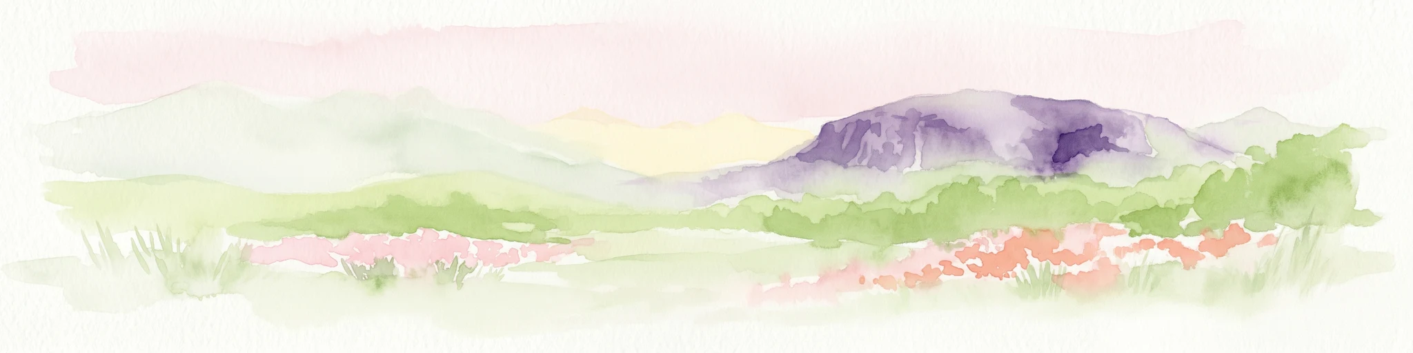
Watercolor depiction of Mount Coolum mountain with flowering fields in the foreground
National parkQueensland

Mount Coolum National Park: Mapped Boundaries and Geological Significance in Queensland

Explore Queensland's unique laccolith national park and its diverse botanical landscapes.

Mount Coolum National Park offers a concentrated study in unique geological formations and botanical richness within Queensland's protected lands. As a prominent laccolith, the park's dome-shaped mountain and rhyolite cliffs provide a striking natural landmark. Explore its mapped terrain, from forested slopes to rare heath communities, and grasp its significance as a protected area contributing to the regional landscape context. Understand the distinct natural character of this Sunshine Coast national park.

Area
0.69 km²
Established
1990
IUCN
II
Relief
Mixed relief
National parkQueensland

Mount Pinbarren National Park: Queensland's Protected Landscape and Mapped Geography

Explore Queensland's National Park terrain and boundaries.

Mount Pinbarren National Park serves as a significant protected area within Queensland, Australia. This resource provides detailed geographic context, emphasizing the park's mapped boundaries and its role within the broader natural landscape of northeastern Australia. Users can engage with the park's terrain and understand its protected status, contributing to a structured understanding of regional geography and conservation landscapes.

Area
0.227 km²
Established
1929
IUCN
V
Relief
Mountain
National parkQueensland

Tuchekoi National Park: A Mapped Protected Area within Queensland's Geographic Atlas

Explore Queensland's designated national park landscape.

Tuchekoi National Park serves as a distinct protected natural area, offering valuable geographic insights for atlas explorers. This entry details the park's identity as a national park within Queensland, focusing on its mapped boundaries and its contribution to the region's overall landscape context. Understand Tuchekoi National Park as a key component of Australia's protected land network, ideal for detailed geographic study and regional park mapping.

Area
3.9 km²
Established
2009
IUCN
II
Relief
Mountain
National parkQueensland

Ferntree Creek National Park: Queensland National Park Protected Landscape and Map Context

Discover mapped boundaries and regional geography within Queensland.

Ferntree Creek National Park, identified as a national park within Queensland, Australia, offers a specific point of reference for protected landscape exploration. This detail page provides geographic context, mapping its protected area boundaries and situating it within the regional atlas. Understand the landscape and its place in Queensland's natural geography through structured data and map-based discovery.

Area
0.72 km²
Established
1947
IUCN
II
Relief
Lowland
National parkQueensland

Triunia National Park: Mapped Protected Landscape within Queensland's Geography

Explore Queensland's natural terrain and park boundaries.

Triunia National Park stands as a protected landscape offering a distinct point for geographic exploration within Queensland, Australia. This page details the park's specific mapped boundaries and its contribution to the state's rich natural terrain, providing essential context for atlas-based discovery. Users can delve into the regional geography surrounding Triunia National Park, enhancing their understanding of Australia's protected areas and diverse ecosystems.

Area
0.18 km²
Established
1994
IUCN
II
Access
Access unknown
National parkQueensland

Mapleton Falls National Park: National Park Geography and Protected Landscape Identity in Queensland

Explore mapped boundaries and regional natural terrain.

Mapleton Falls National Park is a protected natural area within Queensland, Australia, designated as a national park. This entry provides a focused atlas-style exploration of its geographic features, mapped protected boundaries, and its significance as part of Queensland's broader natural landscape. Discover the park's specific terrain and its place within the regional geography for detailed landscape context.

Area
0.26 km²
Established
1973
IUCN
II
Scope
Terrestrial
National parkQueensland

Eudlo Creek National Park: Queensland National Park Protected Landscape

Mapped geography and protected area context.

Eudlo Creek National Park is a designated national park situated within the vast geographical expanse of Queensland, Australia. This entry facilitates an atlas-style understanding of the park, highlighting its mapped boundaries and its significance as a protected natural landscape. Delve into the regional geography and landscape context to appreciate Eudlo Creek National Park's role within Australia's network of conservation areas.

Area
0.43 km²
Established
1951
IUCN
II
Climate
Subtropical

Common questions about visiting, size, designation, and location context for Noosa National Park

Noosa National Park FAQs for park facts, access, geography, and protected area context
Find quick answers about Noosa National Park, including protected-area facts, park geography, trail and visitor context, and how the park fits into its surrounding country and regional landscape.
MoriAtlas Explorer

Continue Your Protected Areas Search Across the Global Atlas

Deepen your exploration by continuing the structured search for national parks and protected areas worldwide. Utilize the comprehensive filtering capabilities to compare different conservation landscapes and refine your understanding of global park geography. Discover more about the distribution and characteristics of protected natural areas.

Global natural geography