
Mori Atlas logo
Protected landscapePadre Island National Seashore

A geographic study of Gulf shoreline, hypersaline lagoons, and dynamic dune ecosystems

Padre Island National Seashore: Mapping the Protected Barrier Island Landscapes of South Texas

Padre Island National Seashore preserves one of the longest stretches of undeveloped barrier island environment in the United States. Spanning seventy miles of natural coastline along the western Gulf of Mexico, this protected area features shifting foredunes, vast interior grasslands, and the hypersaline Laguna Madre. The geography reflects constant change driven by wind and tidal forces, creating a vital refuge for migratory birds and sea turtles along the Texas coast.

barrier islandGulf coastTexasnational seashorebeachdunes
A stylized digital illustration of a sandy beach with rolling dunes, coastal grasses, and sunflowers under a soft sun, reflecting the environment of Padre Island National Seashore.

Padre Island National Seashore

Protected landscape

Park overview

Structured park overview, official facts, and landscape profile for Padre Island National Seashore

Padre Island National Seashore park facts, protected area profile, and essential visitor context

Review the core facts for Padre Island National Seashore, including designation, size, terrain, visitor scale, habitats, and operating context in one park-focused overview.

About Padre Island National Seashore

Padre Island National Seashore occupies the northern two-thirds of Padre Island, the largest of the Texas barrier islands and the world's longest barrier island. Stretching about 70 miles along the South Texas Gulf coast, the seashore protects a shoreline where the Gulf of Mexico meets continuous sand beaches, low dunes, grassy flats, and shallow bays, offering visitors an unusually intact barrier island experience.

At its core, the park is about preserving the natural behavior of a barrier island rather than polishing it for tourism. It is one of the few remaining stretches of U.S. Gulf beach where natural processes such as wave action, wind, storm overwash, and dune migration can still shape the landscape. In contrast to developed South Padre Island further south, PINS emphasizes primitive recreation, four-wheel-drive beach access, and a sense of open, untamed coastal space.

Protected areas within the seashore include sandy Gulf beach, a system of active and stabilized dunes, interior grasslands and freshwater ponds, and the landward Laguna Madre. Man-made spoil islands, natural sand ridges, and tidal flats create nesting and feeding habitat for shorebirds and colonial seabirds. Because the park sits in a hot, dry region where freshwater is limited and coastal ecosystems are sensitive, the protected landscape supports a distinctive mix of Texas coastal habitats found in few other places.

Quick facts and research context for Padre Island National Seashore

Geography: Located on Padre Island, off the coast of South Texas, on the western Gulf of Mexico. Spans parts of Kleberg, Kenedy, and Willacy counties, with nearest major city Corpus Christi. Park character: U.S. national seashore administered by the National Park Service; IUCN Category V protected landscape and seascape. Long, largely undeveloped barrier island with about 65.5 miles of Gulf beach. Significance: Sits on the Central Flyway and hosts roughly 380 documented bird species. Site of a major Kemp's ridley sea turtle nesting recovery program. Among the longest undeveloped barrier island stretches on Earth.

Protection and recognition

Examine documented conservation frameworks, management scopes, and official recognition records.

Padre Island National Seashore Protection Status and International Recognition

Padre Island National Seashore maintains a documented mixed protection status within its regional conservation framework. Official records compile management scopes and formal recognition data without assuming broader conservation outcomes.

Protection details

Protection scope
Mixed
Transboundary protection
No
Park context

Deeper park guide and search-rich context for Padre Island National Seashore

Padre Island National Seashore history, landscape, wildlife, and travel context

Explore Padre Island National Seashore through its history, landscape character, ecosystems, wildlife, conservation priorities, cultural context, and seasonal travel timing in a structured park guide built for atlas discovery and search intent.

Why Padre Island National Seashore stands out

Padre Island National Seashore is best known for its exceptionally long, largely undeveloped Gulf beach and its global importance for birdlife. Its position on the Central Flyway, along with the habitat diversity of beach, dune, tidal flat, and Laguna Madre environments, makes it a critical stopover and wintering area for migratory birds and an officially designated Globally Important Bird Area. The seashore is also known for the Kemp's ridley sea turtle recovery program, one of the signature conservation efforts on the Texas coast. Hatchling releases, sea turtle patrols, and the visible increase in nesting activity over decades have made the park a flagship site for marine turtle conservation in the United States.
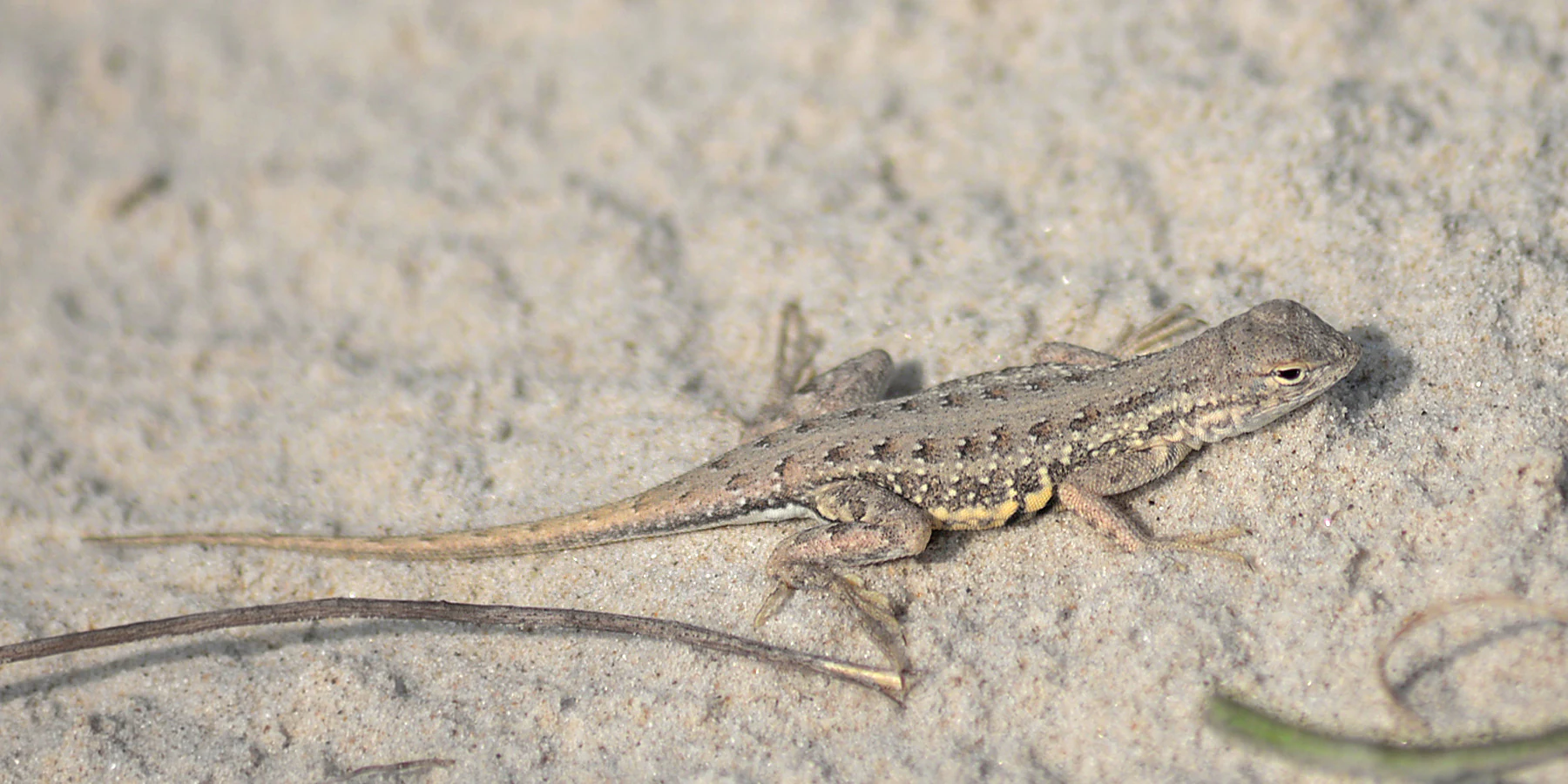
A small lizard with textured, brownish-gray patterned skin sits on light-colored sand.
A male Keeled Earless Lizard (Holbrookia propinqua) rests on the sandy ground at Padre Island National Seashore.

Padre Island National Seashore history and protected-area timeline

The land that became Padre Island National Seashore carries deep human history. It is named in honor of Father José Nicolás Ballí, an 18th and early 19th century missionary priest who owned the island, founded the first mission in what is now Cameron County, and represented the Spanish church across the Rio Grande Valley.

Padre Island itself is a very young geological feature, having developed only over the last several thousand years. Recognition of its natural significance grew throughout the 20th century, and the area was formally protected when Padre Island National Seashore was established in 1962 as the fourth designated national seashore in the United States. The boundary boundaries were surveyed as early as 1957, even though the purchase of mineral rights within the park has never been completed by Congress.

A second era of park history began in 1978, when staff launched a program to re-establish a nesting beach for Kemp's ridley sea turtles. From the first two turtles returning in 1992 to steady growth in nesting numbers, this program evolved into one of the best-known sea turtle recovery efforts in North America. In 1998, the American Bird Conservancy recognized the park as a Globally Important Bird Area, formalizing its importance for migratory and nesting birds.

Padre Island National Seashore landscape and geographic character

The landscape of Padre Island National Seashore is shaped almost entirely by wind, sand, and water. Most of the island sits less than 20 feet above mean sea level, and the terrain transitions from wide Gulf beach and active foredunes inland across grassflats, dune fields, and freshwater ponds. Prevailing southeasterly winds from the Gulf heap sand into shifting foredunes, and over time these dunes can march across the island, smothering vegetation in their path and leaving barren sandflats behind. Storms and hurricanes periodically flatten dunes, cut new channels across the island, and reshape the shoreline.

The western side of the seashore is bordered by Laguna Madre, a long, shallow, hypersaline lagoon that is one of only a few hypersaline lagoons in the world. Because the barrier island restricts water exchange, evaporation under the Texas sun leaves the lagoon far saltier than the Gulf. Its width fluctuates dramatically with wind-driven tides, and it contains grassflats, shallow mudflats, the deeper central area known as the Hole, and regions such as the Land-Cut Area where the Intracoastal Waterway crosses through.

Small natural sand-ridge islands and man-made spoil banks within Laguna Madre create distinctive bird-nesting habitat. Inland from the beach there are interior dunes covering varied vegetation, open grasslands with plants such as the Spanish Dagger yucca, and seasonal freshwater ponds that dot the island interior, offering a broader sense of the rich texture of Texas barrier island scenery.
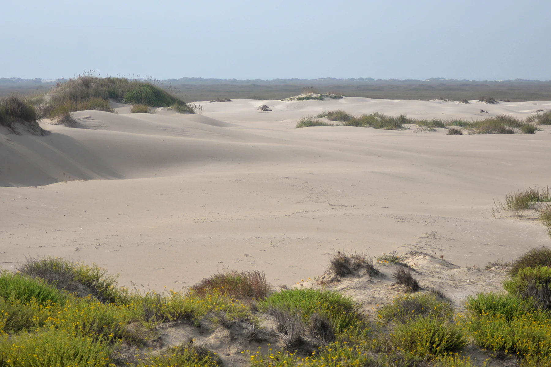
A wide view of rolling sand dunes with patches of low-lying vegetation under a pale sky at Padre Island National Seashore.
Sand dunes within the interior landscape of Padre Island National Seashore.

Padre Island National Seashore ecosystems, habitats, and plant life

Padre Island National Seashore preserves a rare sequence of coastal habitats concentrated in a narrow strip. The Gulf-facing side offers open sandy beach and a dynamic dune system with both mobile and stabilized dunes; the interior holds grasslands, scrubby dune thickets, and scattered freshwater ponds; and the landward side offers the unusual environment of Laguna Madre with its grassflats, algal flats, and shallow open water.

Each habitat supports different components of coastal biodiversity. Beach and dune vegetation struggles against sand burial and salt spray while holding the dunes in place in calmer stretches. The grassflats and tidal flats of Laguna Madre are highly productive biological zones that serve as nurseries for fish, clams, and snails. Periodic rains fill depressions in the interior, creating temporary ponds that attract amphibians and seasonal wildlife pressure.

Vegetation is distinctly coastal Texan, including yucca species, salt-tolerant grasses, and the hardy scrub that stabilizes parts of the dunes. The combination of salinity, isolation, and constant reshaping by wind and water produces an ecosystem that is both fragile and clearly defined, where understanding the environment requires appreciating the way Gulf processes continually reshape the island.
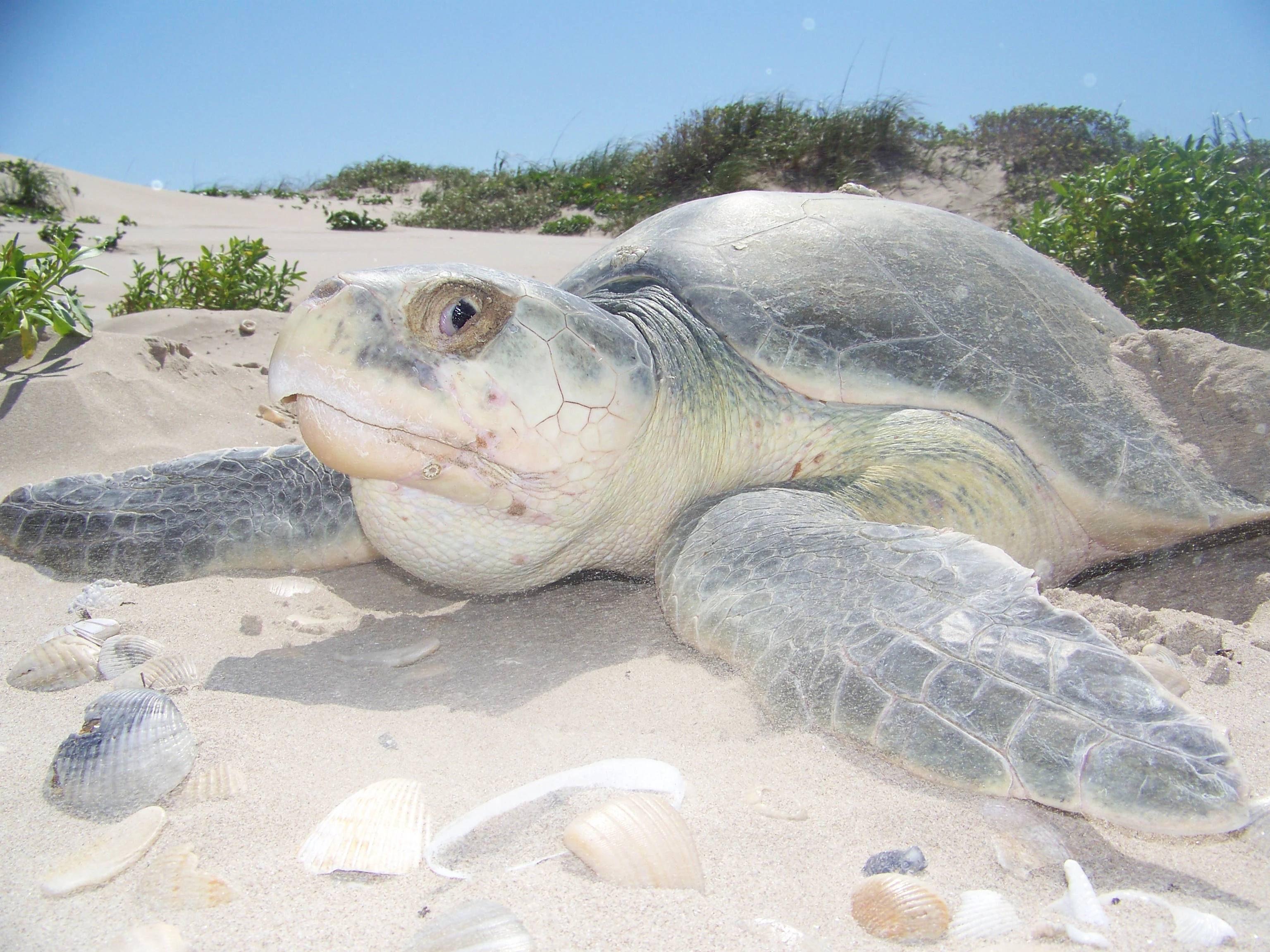
A close-up view of a Kemp's ridley sea turtle resting on white sandy beach dunes with sparse coastal vegetation in the background.
A Kemp's ridley sea turtle on the sandy beaches of Padre Island National Seashore.

Padre Island National Seashore wildlife and species highlights

The seashore is famous for both its birds and its marine turtles. The Kemp's ridley sea turtle is at the heart of the park's wildlife profile. Through decades of work on Padre Island, the park became a critical nesting site for this endangered species, with rising numbers of nests recorded on the beach and seasonal public hatchling releases that have helped redefine public awareness of Gulf coast conservation.

Roughly 380 bird species, about 45 percent of all bird species ever documented in North America, have been observed in the park. Because the seashore lies along the Central Flyway, it provides important habitat for globally significant numbers of brown pelicans, redhead ducks, least terns, piping plovers, reddish egrets, and peregrine falcons. Nesting colonies on North and South Bird Islands and on spoil banks along the Intracoastal Waterway include least terns and piping plovers among the most sensitive species.

On the Gulf beach itself, willets, sanderlings, black skimmers, great blue herons, double-crested cormorants, cattle egrets, grey plovers, laughing gulls, brown pelicans, reddish egrets, and several tern species, including least, Caspian, black, Sandwich, and royal terns, are among the most familiar residents. Bird Island Basin on the Laguna Madre side becomes very productive for waders and shorebirds when water levels are good, supporting black-necked stilts, roseate spoonbills, great egrets, and American white ibis. The island also hosts reptiles such as the keeled earless lizard and mammals such as coyotes, and amphibians such as Hurter's spadefoot toad appear in freshwater ponds.
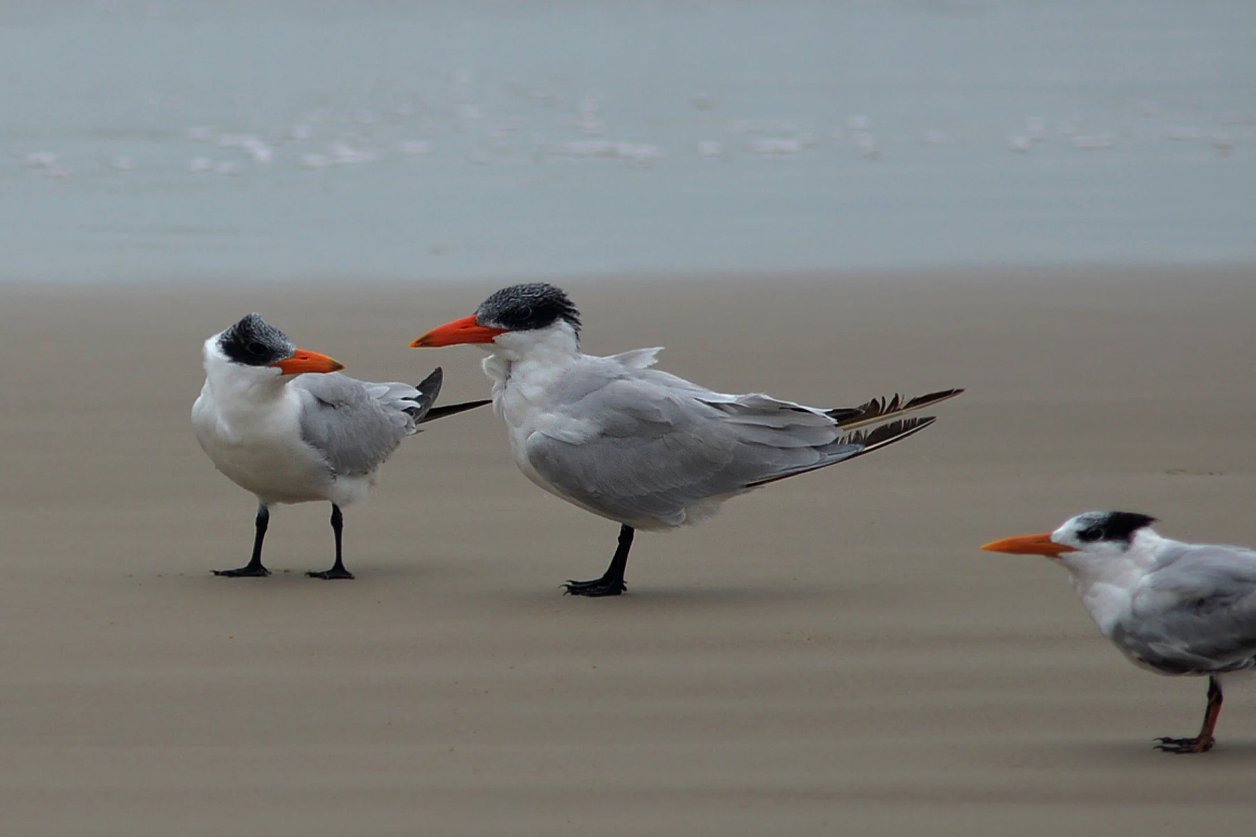
Three terns with white bodies, grey wings, and dark caps stand on a sandy beach.
Three terns resting on the shoreline at Padre Island National Seashore.

Padre Island National Seashore conservation status and protection priorities

Conservation is central to the identity of Padre Island National Seashore. The park's mandate to preserve a largely undeveloped barrier island makes it a reference point for understanding what a functioning Texas Gulf coast seascape looks like, and its Globally Important Bird Area designation underscores its role in continental bird conservation across the hemisphere.

The Kemp's ridley recovery program is among the highest-profile long-term conservation efforts at the park. Through nest monitoring, hatchery management, beach protection, and public engagement, the seashore and its partners have helped rebuild a nesting population on this stretch of the Texas coast. Ongoing bird conservation includes protection for beach-nesting species such as least terns and piping plovers, whose nests are vulnerable to disturbance and to heavy equipment operations.

The seashore also serves as a major monitoring site for marine debris. A long-term debris study begun in the 1990s has cataloged sources of shoreline trash, identified commercial shrimping as the dominant contributor, and supported community-led cleanups such as the Billy Sandifer Big Shell Beach Clean Up. With the help of the nonprofit Friends of Padre, volunteers remove tons of trash each year, and the park's data have influenced national debates on how marine debris reaches U.S. coasts.

Finally, oil and natural gas drilling are still permitted within the park, because Congress has never authorized the purchase of the underlying mineral estate. This ongoing tension between industrial activity and protected status remains one of the most significant conservation issues for the seashore.

Padre Island National Seashore cultural meaning and human context

The cultural identity of Padre Island is tied closely to its Spanish colonial origins. The island's name comes from Father José Nicolás Ballí, a Spanish missionary priest who owned the island and founded early missions in the Rio Grande Valley and Cameron County. His legacy continues to shape how the island is understood as both a natural and a historical place.

Modern cultural context is defined by the contrast between the busy resort town of South Padre Island and the more austere, recreation-focused ethic of PINS. The seashore has its own distinctive community of outdoor enthusiasts, naturalists, and conservation volunteers, including the late fishing guide Billy Sandifer, whose annual Big Shell Beach Clean Up grew into the founding of the nonprofit Friends of Padre in 2007.
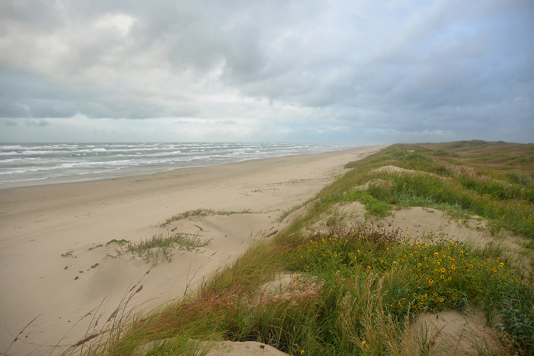
A wide-angle, eye-level view of a sandy beach stretching toward the horizon, bordered on the right by rolling sand dunes covered in grasses and small yellow wildflowers under a cloudy sky.
A view of the sandy coastline and vegetated dunes at Padre Island National Seashore.

Top sights and standout views in Padre Island National Seashore

Seventy miles of largely undeveloped Gulf beach and roughly 65.5 miles of natural shoreline on the world's longest barrier island. Designated Globally Important Bird Area hosting about 380 bird species, including globally significant populations of brown pelicans, redheads, least terns, piping plovers, reddish egrets, and peregrine falcons. A signature Kemp's ridley sea turtle nesting program with seasonal public hatchling releases. Four-wheel-drive beach access, primitive camping, and the rare experience of exploring one of the few intact drive-on beach sections in the United States. Laguna Madre, a hypersaline lagoon and world-class windsurfing destination, with rich tidal flat and shallow-water ecology.
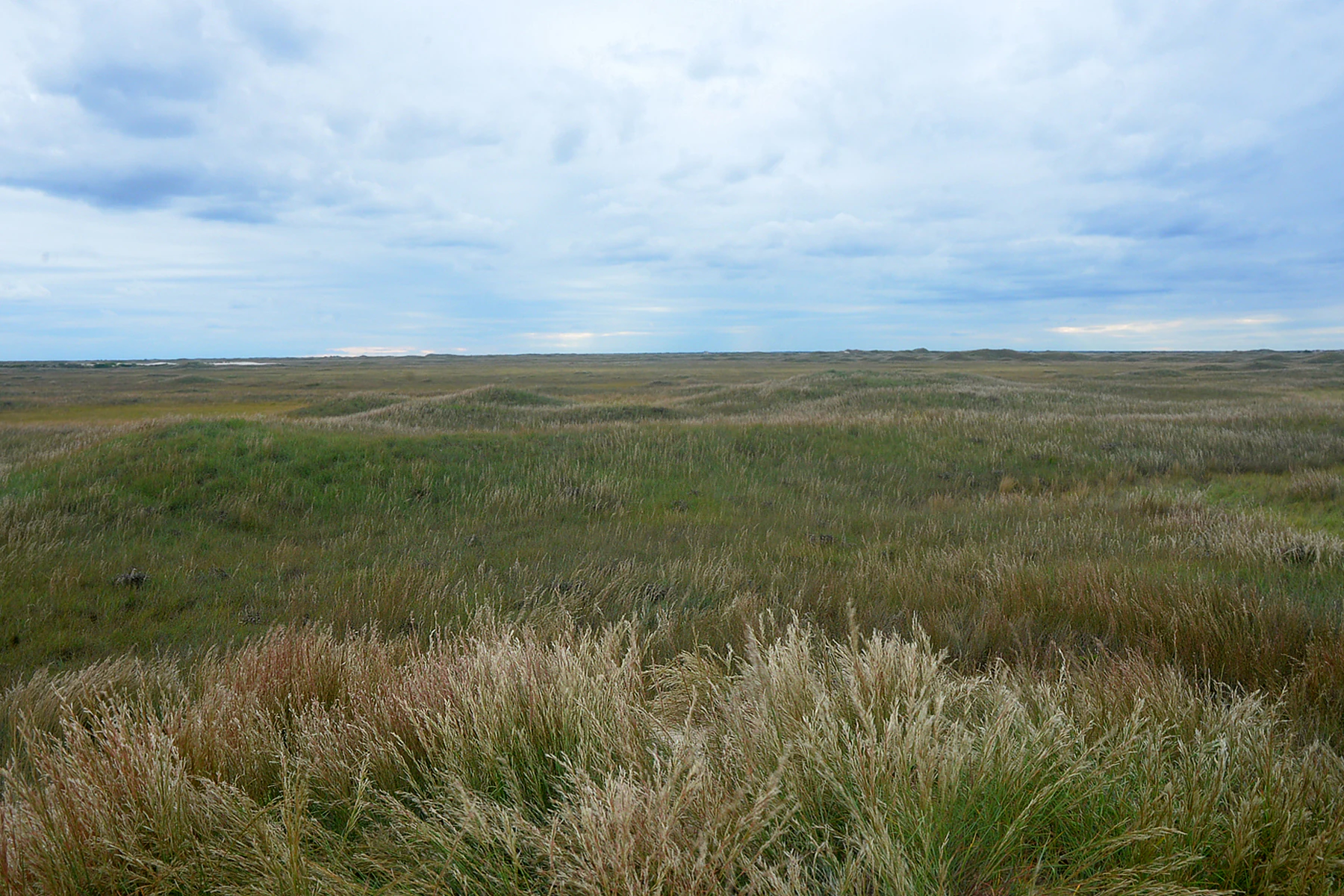
A wide, flat field of tall, wild grasses under a cloudy, overcast sky, showing the interior terrain of a barrier island.
Expansive interior grasslands typical of the barrier island landscape at Padre Island National Seashore.

Best time to visit Padre Island National Seashore

The seashore can be visited throughout the year, but experience shifts significantly with the seasons. Spring and fall bring the most rewarding birdwatching, as thousands of migrants pass through the park on the Central Flyway and wintering bird populations build. Winter is also a strong birdwatching season, with large concentrations of ducks and other wintering species along the bays and marshes.

Summer is the most popular beach season but also the hottest and most humid, when temperatures often climb into the mid-90s F. This is also the primary Kemp's ridley nesting season, when visitors may see patrols and public hatchling releases. The famous Billy Sandifer Big Shell Beach Clean Up takes place the last weekend of February, offering a community-focused window into the seashore's conservation culture. Visitors sensitive to heat will find cooler, more comfortable months outside the peak summer window.

Monthly climate preview

Long-term representative monthly temperature and precipitation data for coastal Texas

Padre Island National Seashore Climate Normals and Annual Weather Patterns

Padre Island National Seashore exhibits a recorded annual climate rhythm spanning measured monthly temperatures from 16.36 degrees Celsius up to 29.21 degrees Celsius alongside varying precipitation levels. Reviewing the complete twelve-month profile provides detailed meteorological context for evaluating regional environmental conditions across the protected landscape.
Annual mean23 °C
16 °C29 °C
Jan16°
Feb18°
Mar20°
Apr23°
May26°
Jun29°
Jul29°
Aug29°
Sep28°
Oct25°
Nov21°
Dec18°
Warmest month
August

29.2 °C

Coolest month
January

16.4 °C

Wettest month
September

4.3 mm/day

Driest month
January

1 mm/day

Park location guide

Geography guide, regional context, and park location map for Padre Island National Seashore

Padre Island National Seashore park geography, regions, and map view in United States of America

Understand where Padre Island National Seashore sits in United States of America through a broader geographic reading of the surrounding landscape, nearby location context, and its mapped position within the national park landscape.

How Padre Island National Seashore fits into United States of America

The United States of America is a federal presidential republic and one of the world's largest countries by area and population. It consists of 50 states across a vast territory spanning multiple time zones, with its capital in Washington, D.C. and largest city in New York City. The nation has a diverse economy, influential political system, and significant cultural and military presence globally.

Wider geography shaping Padre Island National Seashore in United States of America

The United States occupies a vast territory in North America, bordered by Canada to the north and Mexico to the south. The 48 contiguous states stretch from the Atlantic to the Pacific Ocean, while Alaska occupies the northwestern region and Hawaii is an archipelago in the Pacific. The country encompasses diverse terrain including the Rocky Mountains, Appalachian Mountains, Great Plains, and extensive river systems.

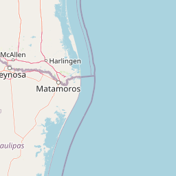
Map view of Padre Island National Seashore

Use this park location map to pinpoint Padre Island National Seashore in United States of America, understand its exact geographic position, and read its mapped placement within the surrounding landscape more clearly.

Pigeon | © OpenStreetMap contributors

Location context for Padre Island National Seashore

Texas

Visual reference for barrier island terrain, wind-shaped dunes, and hypersaline lagoon habitats

Padre Island National Seashore Photos, Landscape Scenery, and Coastal Protected Area Views

Visual documentation captures the shifting foredunes, open Gulf beaches, and tidal flat habitats that define Padre Island National Seashore. Photographic archives reveal the distinct environmental character of the barrier island and its protected coastal ecosystems.

A small lizard with textured, brownish-gray patterned skin sits on light-colored sand.

Two brown pelicans flying in tandem over gray ocean waves under an overcast sky.

A wide view of rolling sand dunes with patches of low-lying vegetation under a pale sky at Padre Island National Seashore.

A close-up view of a Kemp's ridley sea turtle resting on white sandy beach dunes with sparse coastal vegetation in the background.

Three terns with white bodies, grey wings, and dark caps stand on a sandy beach.

A coyote stands in a field of tall, golden-green coastal grass at sunset, looking back over its shoulder.

A wide-angle, eye-level view of a sandy beach stretching toward the horizon, bordered on the right by rolling sand dunes covered in grasses and small yellow wildflowers under a cloudy sky.

A wide, flat field of tall, wild grasses under a cloudy, overcast sky, showing the interior terrain of a barrier island.

A small toad with mottled brown and grey skin, large eyes, and a patterned back sits on sandy soil among dry grass stems.

A sandy beach with dunes covered in green grasses and patches of bright yellow wildflowers in the foreground, leading to ocean waves under a cloudy sky.

A wide, low-angle shot of a coastal prairie landscape under an overcast sky, with a single yucca plant standing out in the midground against a backdrop of rolling dunes.

A group of small, dark hatchling sea turtles crawling across wet, sandy beach toward breaking ocean waves.

A calm, pale green pond sits in a low-lying coastal grassy area under a heavily overcast, grey sky.

Park atlas

Compare adjacent coastal landscapes and regional protected areas after viewing barrier island geography

Exploring Parks Near Padre Island National Seashore and Surrounding Protected Areas

Visitors exploring Padre Island National Seashore can continue browsing other coastal reserves and regional protected areas in the surrounding region. Comparing adjacent park geography provides a wider perspective on barrier island ecosystems and coastal wildlife habitats.
Nature reserveTexas
About 123 km away#1 closest

North

Mission-Aransas National Estuarine Research Reserve: A Texas Coastal Protected Landscape

Mapped estuarine habitats and regional coastal geography

Encompassing a unique mix of terrestrial and marine environments, Mission-Aransas National Estuarine Research Reserve stands as a significant protected corridor on the Texas Coast. The landscape features deep-water bays, sheltered seagrass meadows, and open coastal prairie, offering a clear view of how riverine processes shape the complex shoreline of the western Gulf of Mexico.

Relief
Lowland
Climate
Subtropical
Access
Easy access
Scope
Mixed
Wildlife reserveTamaulipas
About 195 km away#2 closest

South

Laguna Madre Wildlife Reserve: Geography and Protected Coastal Landscapes of Tamaulipas

Mapping the hypersaline lagoons and barrier island chains of Mexico

Laguna Madre represents a singular coastal ecosystem characterized by its extreme salinity, expansive seagrass meadows, and sheltered barrier island configuration. As a vital protected wetland, the area serves as a primary migratory flyway and habitat for diverse shorebirds and sea turtles, revealing a distinct arid coastal landscape along the Tamaulipas shore.

Area
5,728.08 km²
Established
2005
IUCN
VI
Relief
Lowland
Protected areaNuevo León
About 241 km away#3 closest

Southwest

Sierra de Picachos Protected Area: Geographic Boundaries and Regional Landscapes

Mountain geography in northern Nuevo León

Sierra de Picachos represents a vital conservation zone spanning north of Monterrey. The landscape is defined by its dramatic elevation changes, moving from desert-like plains to cool coniferous slopes. This atlas entry focuses on the physical boundaries, ecological zones, and the rugged, peak-studded terrain that distinguish the range from the surrounding Sierra Madre Oriental.

Area
1,405 km²
Established
2000
Relief
Mountain
Climate
Subtropical
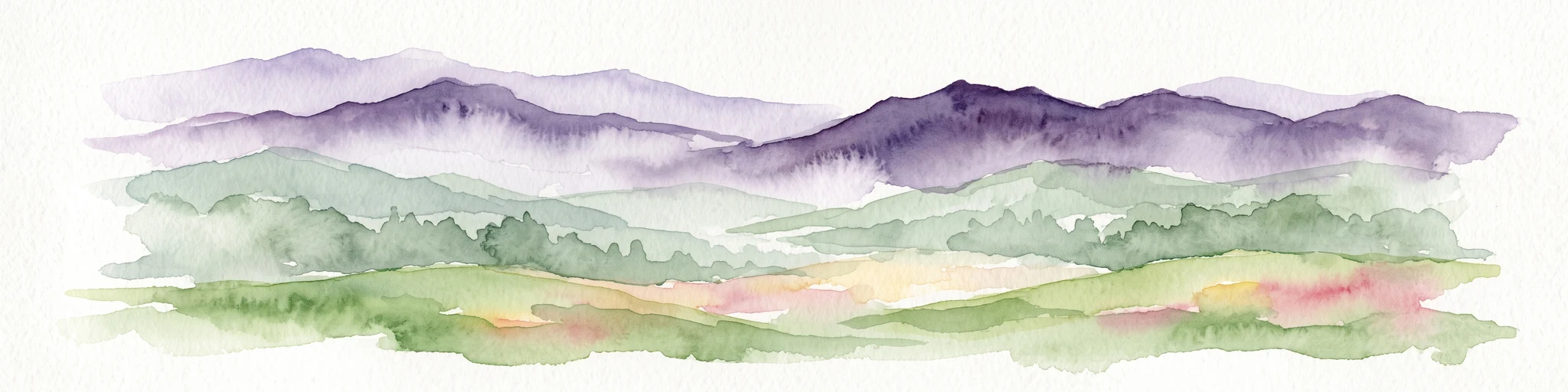
Watercolor illustration of layered mountain ranges with purple peaks fading into a green and yellow foreground.
Natural monumentNuevo León
About 323 km away#4 closest

Southwest

Cerro de la Silla: Protected Natural Monument Geography and Regional Map Context

A rugged mountain landscape in Nuevo León, Mexico

Cerro de la Silla is defined by its unmistakable saddle-shaped silhouette and its status as a vital protected area within the urban matrix of Monterrey. The mountain features complex folded limestone geology and a diverse habitat mosaic that transition from arid scrubland to forested peaks. Use this atlas resource to understand its topographical boundaries, summit formations, and regional environmental significance within the Sierra Madre Oriental fold belt.

Area
60 km²
Established
1991
Relief
Mountain
Climate
Subtropical
Marine protected areaTexas
About 330 km away#5 closest

East

Flower Garden Banks National Marine Sanctuary: Offshore Coral Reefs and Salt Dome Geography

A critical marine protected area landscape in the Gulf of Mexico

Flower Garden Banks National Marine Sanctuary sits roughly 100 nautical miles offshore from the Texas coast, where unique salt dome geology creates elevated ridges that support the northernmost thriving coral reefs in the continental United States. This protected area map highlights the interconnected network of submerged banks and reefs, providing essential habitat for pelagic marine species and rare coral ecosystems in the northwestern Gulf of Mexico.

Area
410 km²
Established
1992
Scope
Marine
Water
Water-dominated
National parkMexico
About 339 km away#6 closest

Southwest

Cumbres de Monterrey National Park: National Park Protected Landscape Discovery

Explore Mexico's Mapped Terrain and Regional Geography

Understand Cumbres de Monterrey National Park as a distinct protected landscape within Mexico. This page provides detailed atlas-oriented information focused on its geographic boundaries, mapped terrain, and its role in regional conservation. It serves as a valuable entry point for exploring the park's natural context and understanding its place in the national geography.

Area
1,773.96 km²
Established
1939
IUCN
II
Relief
Mountain
Protected areaCoahuila
About 356 km away#7 closest

Southwest

Cuenca Alimentadora del Distrito Nacional de Riego 026 Bajo Rio San Juan Protected Landscape

Mountain watershed and forest habitat in Coahuila

An expansive protected area encompassing the upper catchments of the San Juan River. The terrain features a significant altitudinal gradient, ranging from semi-arid matorral shrublands to rare high-altitude conifer groves including Mexican Douglas-fir, defining the regional water supply landscape.

Area
1,971.57 km²
Established
1949
IUCN
VI
Relief
Mountain
Protected areaCoahuila
About 385 km away#8 closest

West

Cuenca Alimentadora del Distrito Nacional de Riego 004 Don Martín Protected Area Geography

A vast watershed and mountain corridor in central Coahuila

This expansive protected area in northern Mexico functions as the primary catchment for the Don Martín irrigation district. The terrain ranges from dry shrubland and grasslands in the Coahuila interior to the rugged, forested heights of the Sierra Madre Oriental. It remains a key case study in river conservation and the complex interplay between arid ecosystems and mountainous watershed systems.

Area
15,193.8 km²
Established
1949
IUCN
VI
Relief
Mountain

Common questions about visiting, size, designation, and location context for Padre Island National Seashore

Padre Island National Seashore FAQs for park facts, access, geography, and protected area context

Find quick answers about Padre Island National Seashore, including protected-area facts, park geography, trail and visitor context, and how the park fits into its surrounding country and regional landscape.
MoriAtlas Explorer

Continue Your Protected Areas Search Across the Global Atlas

Deepen your exploration by continuing the structured search for national parks and protected areas worldwide. Utilize the comprehensive filtering capabilities to compare different conservation landscapes and refine your understanding of global park geography. Discover more about the distribution and characteristics of protected natural areas.

Global natural geography