
Mori Atlas logo
National parkParc national du Parnès

Traversing the rugged karst summits and forest ecosystems rising above the Attica region

Parc national du Parnès: A Comprehensive Mapping of Greece's Alpine Protected Landscape

(Ethnikós Drumós Párnithas (Εθνικός Δρυμός Πάρνηθας))

Parc national du Parnès stands as the most significant mountain range in the Attica peninsula, serving as a vital green lung for the region. This protected area features a dramatic topography of limestone gorges, deep caves, and dense fir forests that reach elevations above 1,400 meters. The mapped landscape showcases a unique Mediterranean ecological gradient, ranging from rocky scrublands to high-altitude woodlands that provide a sanctuary for the only wild red deer population in Greece.

mountain parknearby capitalfir forestAleppo pinekarst landscapegorges and caves
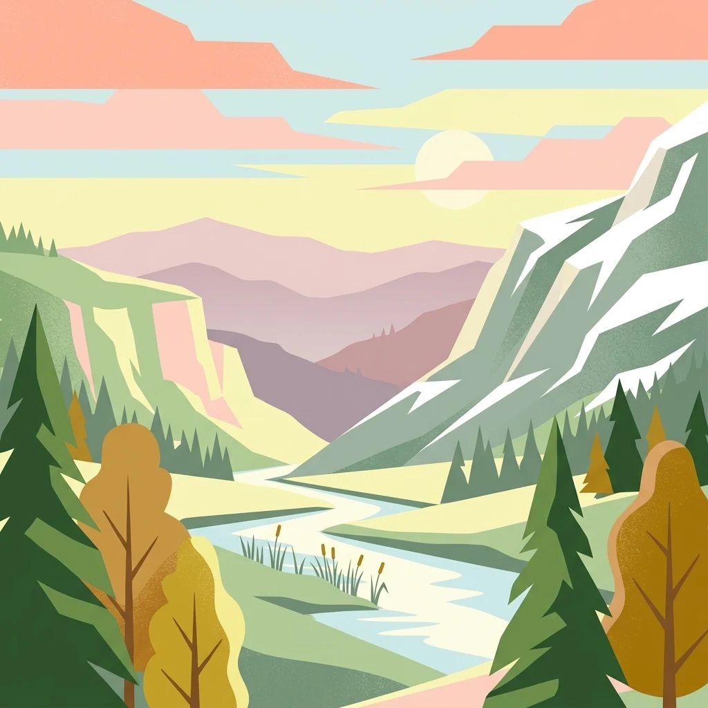
A flat-style digital illustration of a mountain valley at sunset, featuring a winding river, evergreen and deciduous trees, and layered distant mountain peaks.

Parc national du Parnès

National park

Park overview

Structured park overview, official facts, and landscape profile for Parnitha National Park

Parnitha National Park park facts, protected area profile, and essential visitor context

Review the core facts for Parnitha National Park, including designation, size, terrain, visitor scale, habitats, and operating context in one park-focused overview.

About Parnitha National Park

Parnitha National Park is centered on the Parnitha mountain massif, the largest and tallest in the Attica region of Greece, located approximately forty kilometers north of central Athens. The park covers a substantial portion of the mountain and was established in 1961 as one of the foundational Greek national parks protecting a peri-urban forest landscape of significant ecological value.

The terrain is structured in three broad sections: northern, central, and western Parnitha, with a varied topography of smooth slopes, small plateaus, meadows, valleys, dolines, and deep gorges cut by seasonal streams. Limestone dominates the geology, producing a landscape rich in karst features, including caves such as the Cave of Pan in the Keladonas gorge and numerous sinkholes. This porous rock also feeds dozens of springs, some of which historically supplied water to the Athens region through Hadrian's aqueduct.

Forests define the park. Below around 800 m, Aleppo pine, holm oak, and kermes oak cloak the slopes, while Greek fir forests rise above, covering most of the higher elevations. A rich understory of wildflowers, including crocuses, tulips, lilies, peonies, and orchids, grows in clearings and meadows. The combination of forest types, elevation gradients, and proximity to the sea gives Parnitha a particularly high concentration of plant species for an Attic mountain.

The park is the only place in Greece where red deer remain in a wild population, and after the 2007 fire its numbers actually rose, reshaping both forest regeneration and management priorities. Birdlife is likewise rich, supporting the area's Special Protection Area status under the Natura 2000 network. Hiking, mountaineering, and visits to mountain shelters, monasteries, and the historic Mont Parnes cable car and casino hotel round out the visitor experience, making Parnitha a defining natural landmark of greater Athens.

Quick facts and research context for Parnitha National Park

Parnitha National Park covers the largest land area and the highest summits in Attica, anchored by the Karavola peak in the central massif. The protected area was legally established in 1961 by Royal Decree and is now incorporated into the Natura 2000 network as both a Special Protection Area for birds and a designated site of outstanding natural beauty. Vegetation changes with elevation: pines dominate lower slopes, while Greek fir forests blanket higher elevations, accompanied by endemic wildflowers, oaks, and Mediterranean shrubs.

The park lies in a transitional Mediterranean climate with notably higher precipitation than surrounding Attica, supporting rich biodiversity. It functions simultaneously as a protected ecosystem, a recreational landscape for the Athens metropolitan area, and a site of major cultural and mythological significance dating back to antiquity.

Protection and recognition

Documented terrestrial protection scope and conservation designation records

Parc national du Parnès Protection Status and International Recognition

Parc national du Parnès maintains a documented terrestrial protection scope governed by official conservation frameworks and regional management standards. Review recorded designation details, institutional recognition sources, and legal boundaries for this protected area.

Protection details

Protection scope
Terrestrial
Transboundary protection
No
Park context

Deeper park guide and search-rich context for Parnitha National Park

Parnitha National Park history, landscape, wildlife, and travel context

Explore Parnitha National Park through its history, landscape character, ecosystems, wildlife, conservation priorities, cultural context, and seasonal travel timing in a structured park guide built for atlas discovery and search intent.

Why Parnitha National Park stands out

Parnitha is known above all as the green lung of Athens: a vast forested massif rising above the city and offering hiking, mountain monasteries, and dramatic karst gorges within easy reach of the capital. It is the only area in Greece where the European red deer maintains a wild population, and its forest of Greek fir (Abies cephalonica) on the upper slopes is among the most significant in the country. The park is also defined by the deep gorge of Keladonas (Gouras, Giannoulas) and the karst cave of Pan, tying its natural beauty to ancient mythology. The catastrophic 2007 wildfire, which burned the great majority of the forest, has become part of its modern identity, as researchers and conservationists track the slow recovery of the ecosystem.
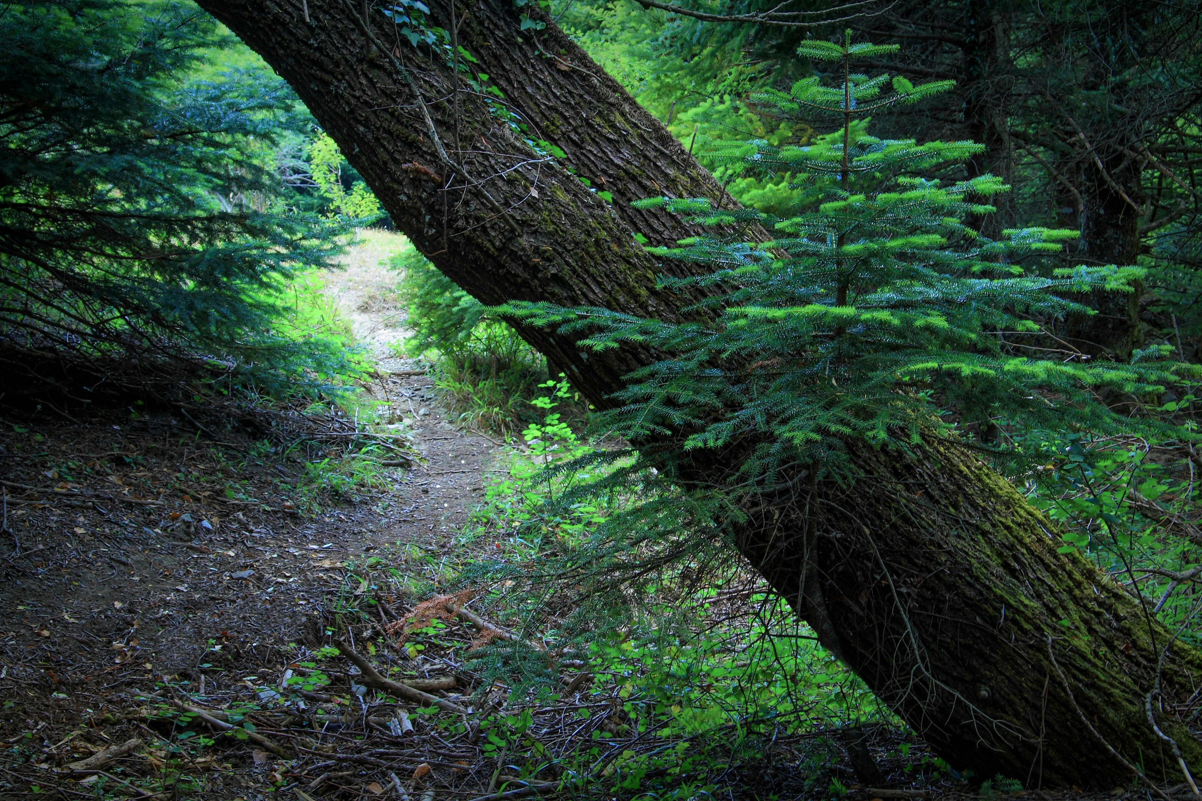
A small green fir sapling growing out from the side of a large, fallen moss-covered tree trunk, with a path visible in the background through the woods.
A young fir sapling emerging from the trunk of a fallen tree in the Parnitha forest.

Parnitha National Park history and protected-area timeline

The Parnitha massif has been present in Greek consciousness since antiquity. The ancient writer Pausanias described it as offering hunting grounds for wild boar and bears, and noted an altar of Zeus Semaleos (the giver of omens) at the summit, along with a statue of Zeus Parnethios. Theophrastus, in his pioneering European meteorological work 'On Weather Signs,' saw the cloud-covered summit of Parnitha with a north wind as a sign of approaching storms. Ancient demes of Acharnes and Deceleia lay at the foot of the mountain, anchoring it deeply in the civic geography of classical Athens.

A sanatorium was opened on the mountain in 1914, reflecting a long-standing recognition of Parnitha's unusually healthy climate. The first mountain refuge, Bafi, was laid in 1937 and built by the Hellenic Alpine Club of Athens. The Flambouri refuge followed in 1981, organized from former military buildings. The cable car from the Athens suburb to the mountain casino at Mont Parnes opened in 1972, formalizing Parnitha's role as an accessible recreational landscape for the capital.

The national park itself was created by Royal Decree in 1961, and was later designated a Site of Outstanding Natural Beauty. After the catastrophic June 2007 wildfire, additional Presidential Decree protections were added to safeguard recovering zones. The mountain has since been incorporated into the Natura 2000 network and recognized as a Special Protection Area for birds.

Parnitha National Park landscape and geographic character

Parnitha dominates northern Attica as a roughly oval massif about 32 km east to west and 17 km north to south, with an outer perimeter of around 160 km. It contains seventeen summits above 1,000 m, with Karavola (1,413 m) at the center as the highest point in the entire Attica peninsula. Major subsidiary peaks include Ornio, Xerovouni, Area, Avgho, Mavrovouni (home to the casino), and Flampouri.

The mountain's limestone geology produces a distinctive karst landscape: deep gorges, caves, sinkholes (dolines), and seasonal springs. The most dramatic of these features is the Keladonas or Gouras–Giannoulas gorge, a 10 km ravine in the western part of the park that contains the notable Cave of Pan. In the north, dolines fill with clay-rich soils and small temporary ponds ('loutsas') after rains, while parallel limestone and schist layers feed a network of historic springs, the most famous being Skipiza and Kithara (the latter forming Lake Beletsi).

The slopes are broken by small plateaus, meadows, oak-studded stands, and forested valleys, giving the park a layered terrain that shifts from rocky Mediterranean scrub at lower elevations through pine woodlands into dense fir forest higher up. Several viewpoints, including from Tatoi to the east, frame the mountain as a self-contained landscape rising abruptly from the densely populated Athens basin.
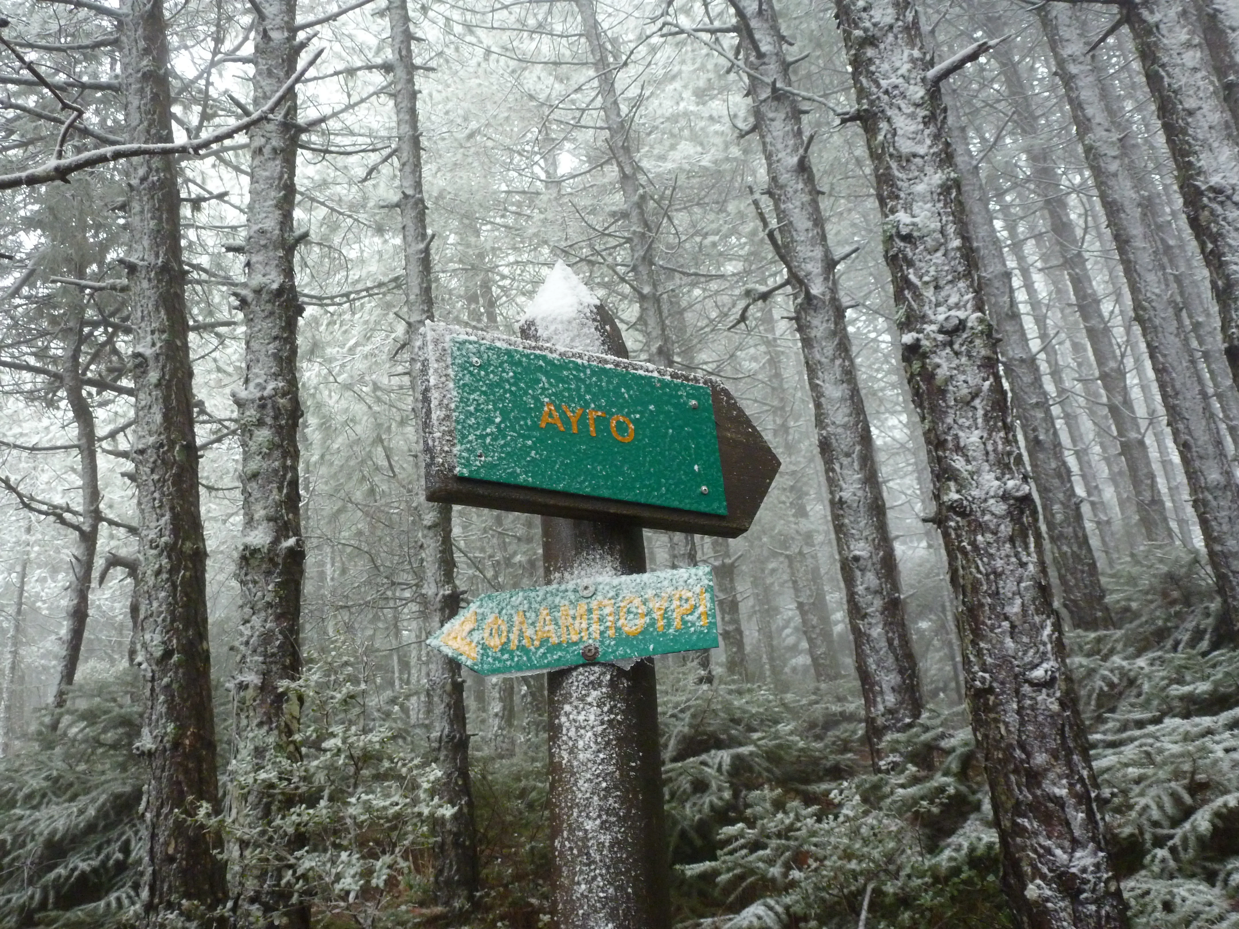
A wooden post with two green directional signs stands in a snow covered pine forest. The signs have text in Greek.
A snow covered trail sign in the forest of Parnitha.

Parnitha National Park ecosystems, habitats, and plant life

Parnitha's vegetation is the heart of its ecological identity. Greek fir (Abies cephalonica) covers the highest elevations, with Aleppo pine taking over on the lower and middle slopes. Holm oak, kermes oak, strawberry tree, carob, hawthorn, and wild rose join a richly textured Mediterranean understory, while plane, willow, and poplar line the streambeds in the ravines.

The flora includes over a thousand recorded plant species, with a particularly high proportion of wildflowers: red tulips, red and white lilies, crocuses, peonies, bellflowers, orchids, anemones, and cyclamen. Several species are rare or endemic, contributing to the mountain's designation as a site of outstanding natural beauty.

The park's climate is notably wetter than the surrounding Attica plains, with annual precipitation exceeding 700 mm, around 110 rainy days, and regular winter snowfall and fog at higher altitudes. This moisture sustains deep soils and dense forests, giving Parnitha a richer and more lush character than most Greek mountains of comparable altitude.
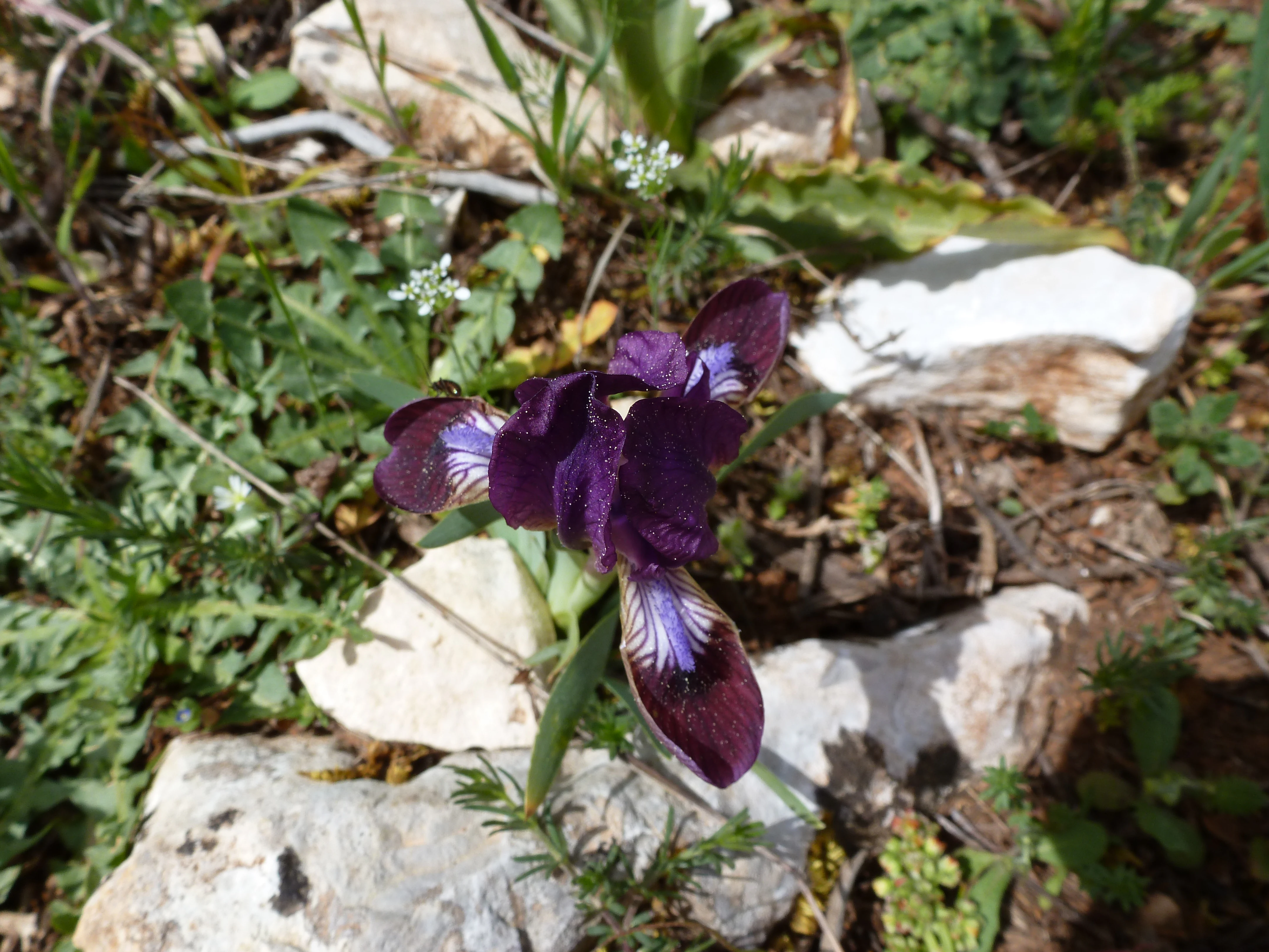
A close-up, high-angle shot of a deep purple and violet iris flower blooming on a rocky, grassy slope.
A purple iris flower blooming among rocks in the Parnitha protected area.

Parnitha National Park wildlife and species highlights

Red deer are Parnitha's most iconic species, and the only wild population of the species in Greece is found here. Their numbers grew after the 2007 fire, and they are now regularly seen approaching the lower slopes and even adjacent towns such as Fyli, Acharnes, and Thrakomakedones.

The park supports a wide range of smaller mammals, including foxes, jackals, hares, badgers, weasels, squirrels, bats, and wild boar. Boar have begun appearing again in recent decades after a long absence, while wolves, recorded by conservation group Callisto from 2014 onward, have returned after disappearing from the area in the 1940s. Bears, last reliably mentioned in the 18th century, have occasionally been reported but not officially confirmed.

Birdlife is exceptionally rich, with about 132 recorded species either resident or seasonal. Raptors include the griffon vulture, short-toed snake eagle, and peregrine falcon, alongside woodpeckers, chaffinches, bramblings, nightingales, and tits. Reptiles and amphibians, around 34 species, range from Greek tortoises and European glass lizards to vipers and water snakes, completing the park's vertebrate inventory.
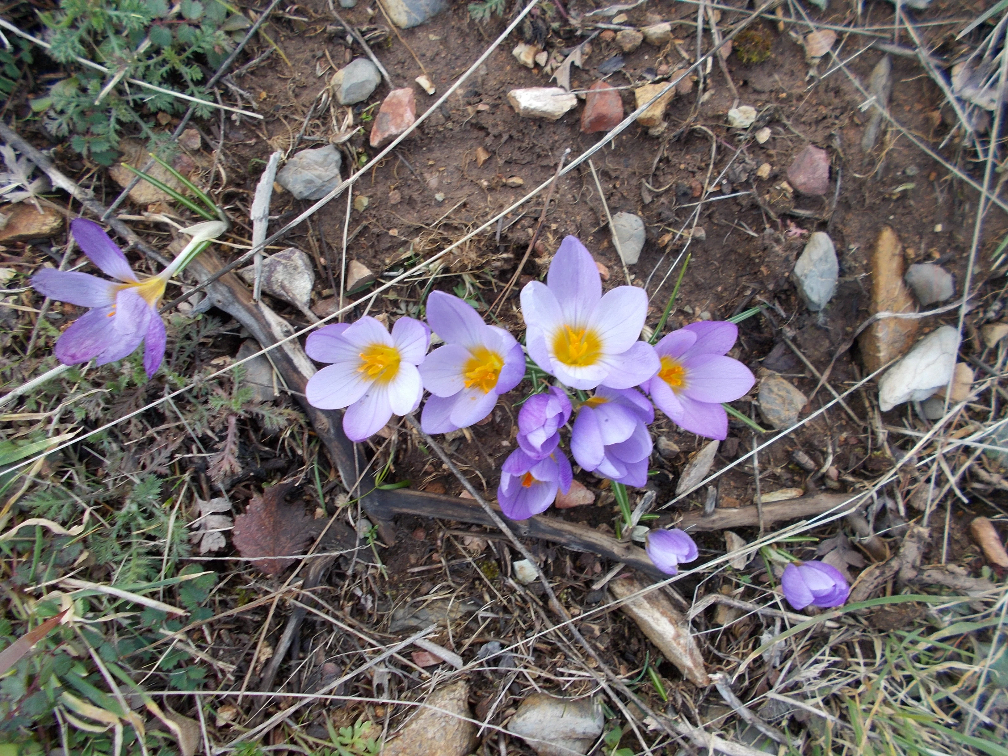
A close-up, top-down view of several light purple crocus flowers with bright yellow centers growing in dry, rocky soil amidst scattered dry twigs and small pebbles.
A small cluster of light purple Crocus sieberi flowers blooming on the rocky ground of Mount Parnitha.

Parnitha National Park conservation status and protection priorities

Parnitha's protected status formally began in 1961 with the establishment of the national park, but its conservation significance has only grown in the decades since. The park is now part of the European Natura 2000 network, recognized as both a Special Protection Area for birds and a Site of Outstanding Natural Beauty. Its forests serve as a critical carbon sink and air-quality buffer for the heavily polluted Athens basin.

The defining moment in the park's modern conservation history was the June 2007 wildfire, which consumed a large share of the forest, most of the fir stands, and many rare plants potentially lost forever. Major reforestation and anti-erosion works followed, attempting to secure the remaining soil and allow natural regeneration. The fire also reshaped the park's wildlife dynamics: deer populations surged, wolves returned after decades of absence, and wild boar reappeared after being absent since the early 20th century, illustrating the resilience of Mediterranean mountain ecosystems and the fragile balance between protection, disturbance, and recovery.

Parnitha National Park cultural meaning and human context

Parnitha has functioned as a cultural and symbolic mountain for Athens throughout recorded history. In antiquity, its summit hosted a sanctuary of Zeus and was noted by travelers and playwrights from Aristophanes to Pausanias. The mountain marked the boundary between Attica and Boeotia, and its forests supplied game, timber, and vines to the city.

In the Byzantine period and through Ottoman rule, the villages around Parnitha were largely settled by Arvanite communities, whose traces remain in local place names such as Avlona, Kapandriti, and Menidi. From the late 14th to mid-15th century, the area was part of the Catalan duchies of Athens before falling to the Ottomans. The early 20th century brought a sanatorium and the Mont Parnes casino hotel to the mountain, establishing Parnitha as a place of retreat and leisure for Athenians.

Monasteries such as the Hagia Triada above the southern slopes, mountain refuges built by alpine clubs, and the iconic Parnitha cable car all reflect the mountain's continuous role as a space for spiritual retreat, scientific interest, and outdoor recreation tied to the identity of the capital.
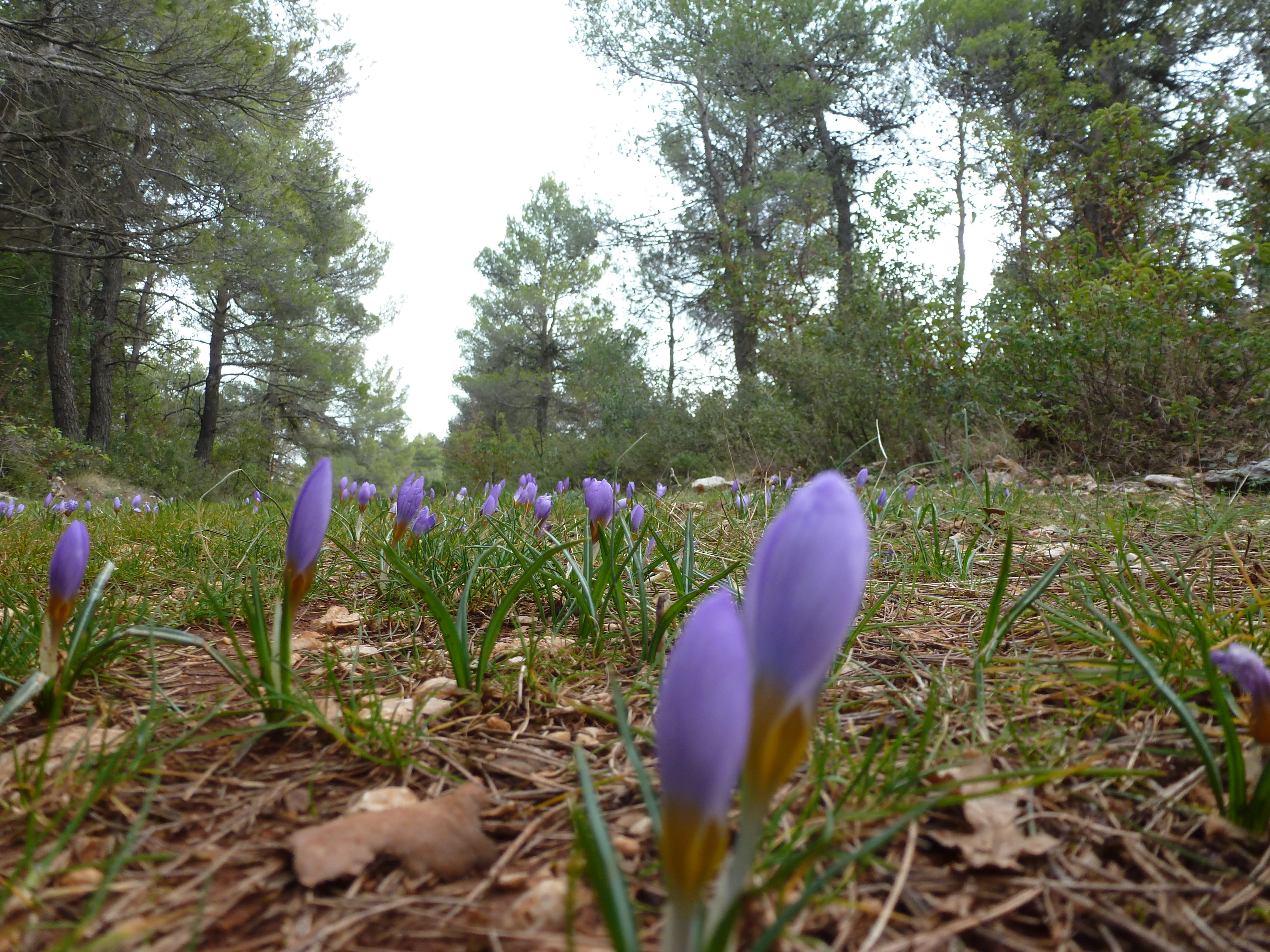
A low angle, close-up shot of small purple crocus flowers growing in a grassy, pine-needle-covered clearing in a forest.
A patch of blooming purple crocus flowers on the forest floor in Parnitha National Park.

Top sights and standout views in Parnitha National Park

Parnitha's defining features include the Karavola summit, the country's only red deer population, and the dramatic Keladonas gorge with the Sanctuary Cave of Pan. Its Greek fir forests above 800 m and dense Aleppo pine stands below form one of the most complete forest gradients around any Mediterranean capital. The summit itself offers a sweep of viewpoints over Attica and a visible connection to the surrounding mountains of Pentelicus and Hymettus.

The park combines accessible recreational infrastructure (refuges, the Mont Parnes cable car, marked trails, and the Hagia Triada monastery road) with remote karst terrain and rich seasonal biodiversity, from spring wildflowers to winter snow. This balance of wilderness and proximity makes Parnitha a rare example of a major European capital with a working national forest behind it.
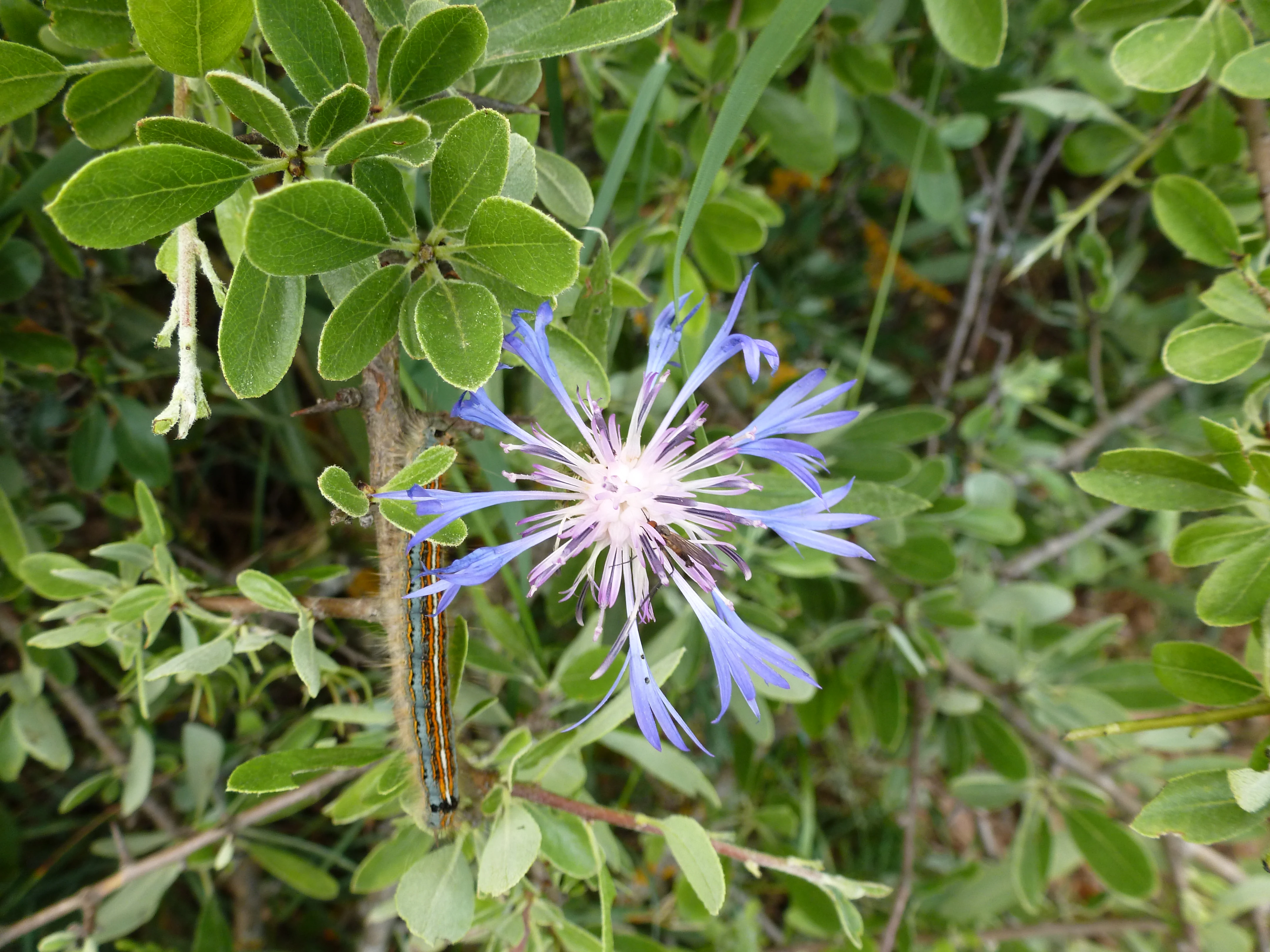
A close up view of a spiky blue wildflower with a white center, set against lush green foliage, with a small caterpillar visible on a stem.
A blue wildflower blooming within the Parnitha landscape.

Best time to visit Parnitha National Park

Spring is widely considered the most rewarding season on Parnitha, when the park's wildflowers including crocuses, tulips, and anemones cover the meadows and the fir and pine forests are at their freshest. Cooler temperatures and clearer skies make this an ideal window for hiking the gorge trails and reaching high summits like Karavola.

Early autumn is the second best period, with milder weather, stable hiking conditions, and the chance to encounter deer and other wildlife as the forest quiets down before winter. Winter brings snow to the higher elevations, transforming the park into a quieter, alpine landscape, though access can be more limited. Summer is hot and dry at lower elevations, and is also the period of greatest fire risk, with major wildfires reshaping the forest in 2007, 2021, and 2023.
Monthly climate preview

Long-term monthly temperature and precipitation rhythms across the coordinate point

Parc national du Parnès Climate Normals and Average Temperature Patterns

Representative coordinate records show measured monthly temperature variation alongside long-term daily precipitation averages for Parc national du Parnès. Detailed monthly climate profiles provide complete twelve-month temperature ranges and precipitation statistics.
Annual mean18 °C
9 °C27 °C
Jan
Feb
Mar11°
Apr15°
May20°
Jun25°
Jul27°
Aug27°
Sep24°
Oct19°
Nov15°
Dec11°
Warmest month
July

27.2 °C

Coolest month
January

9.1 °C

Wettest month
December

2.6 mm/day

Driest month
August

0.3 mm/day

Park location guide

Geography guide, regional context, and park location map for Parnitha National Park

Parnitha National Park park geography, regions, and map view in Greece

Understand where Parnitha National Park sits in Greece through a broader geographic reading of the surrounding landscape, nearby location context, and its mapped position within the national park landscape.

How Parnitha National Park fits into Greece

Greece, officially the Hellenic Republic, is a country in Southeast Europe occupying the southern Balkans. It borders Albania, North Macedonia, Bulgaria, and Turkey, with coastlines on the Aegean, Ionian, and Mediterranean seas. The country has over 10 million people and is renowned for its ancient Greek heritage, philosophy, democracy, and the Olympic Games.

Wider geography shaping Parnitha National Park in Greece

Greece occupies the southern tip of the Balkan peninsula in Southeast Europe. It shares land borders with Albania to the northwest, North Macedonia and Bulgaria to the north, and Turkey to the east. The Aegean Sea lies to the east of the mainland, the Ionian Sea to the west, and the Sea of Crete and Mediterranean Sea to the south. The country spans thousands of islands across nine traditional geographic regions and has the longest coastline in the Mediterranean basin.

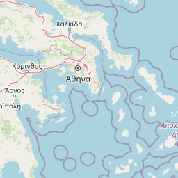
Map view of Parnitha National Park

Use this park location map to pinpoint Parnitha National Park in Greece, understand its exact geographic position, and read its mapped placement within the surrounding landscape more clearly.

Pigeon | © OpenStreetMap contributors

Examine the protected-area character, Greek fir forests, and karst topography of this Mediterranean mountain massif.

Parc national du Parnès Photos and Landscapes: Visualizing Mountain Terrain and Scenery

Visual documentation of Parc national du Parnès reveals the rugged limestone gorges, alpine summits, and recovering forest habitats that define the landscape. Examining these protected-area photographs helps researchers and visitors understand the terrain, elevation gradients, and environmental recovery of the region.

A small green fir sapling growing out from the side of a large, fallen moss-covered tree trunk, with a path visible in the background through the woods.

A red deer stands in the foreground, facing the camera, while other deer graze in the slightly blurred background on a grassy hillside.

A wooden post with two green directional signs stands in a snow covered pine forest. The signs have text in Greek.

A close-up, high-angle shot of a deep purple and violet iris flower blooming on a rocky, grassy slope.

A close-up, top-down view of several light purple crocus flowers with bright yellow centers growing in dry, rocky soil amidst scattered dry twigs and small pebbles.

A close-up of clusters of small, white, bell-shaped flowers hanging from a green-leaved shrub with reddish stems.

A low angle, close-up shot of small purple crocus flowers growing in a grassy, pine-needle-covered clearing in a forest.

A close up view of a spiky blue wildflower with a white center, set against lush green foliage, with a small caterpillar visible on a stem.

A view looking out from a pine forest over mountainous terrain under a blue sky with white clouds.

Close-up view of two light-yellow and purple-streaked irises blooming among scattered brown rocks.

Close up of one yellow and one red strawberry tree fruit hanging from a branch among green leaves.

A small, calm stream winds through a green, forested area with coniferous trees on the left and deciduous trees showing autumn colors on the right.

A small waterfall flows into a clear, shallow stream surrounded by large boulders and overhanging leafy trees, with two hikers resting nearby.

A wide, elevated view of mountainous terrain featuring forested slopes, rocky outcrops, and distant peaks under a blue sky with scattered clouds.

A close up, high angle shot of a vibrant purple flower stalk with several tubular blooms, growing near a dirt path with pine needles.

A single bright orange Turk's cap lily flower in full bloom with recurved petals, set against a blurred green and dark background.

Park atlas

Compare surrounding mountain terrain and connected regional conservation areas

Exploring Parks Near Parc national du Parnès and Regional Protected Landscapes

Discover related national parks and protected areas situated within the surrounding regional geography. Extending your exploration beyond Parc national du Parnès reveals broader ecological patterns and neighboring mountain ecosystems.
National parkGreece
About 64 km away#1 closest

Southeast

Sounio National Park: Protected Coastal Geography and Mediterranean Terrain in Greece

A rugged maritime landscape on the Attica headland

Sounio National Park occupies the dramatic southernmost tip of the Attica peninsula in Greece. The protected area features vertical limestone cliffs, scrub-covered coastal hills, and a strategic headland overlooking the Aegean. This atlas entry provides a detailed look at the park boundaries, surrounding maritime geography, and the unique integration of classical heritage sites within an exposed Mediterranean conservation zone.

Area
0.75 km²
Established
1974
Relief
Upland
Climate
Mediterranean
Watercolor illustration of a coastal landscape with hills, trees, and a body of water
Marine protected areaGreece
About 94 km away#2 closest

North

National Marine Park of Alonnisos Northern Sporades: Protected Marine Landscape and Aegean Geography

Explore Greece's largest marine protected area and its vital ecosystems.

Investigate the National Marine Park of Alonnisos Northern Sporades, an extensive marine protected area situated in the northern Aegean Sea. This protected landscape is internationally significant for its role in conserving the Mediterranean monk seal and for its healthy Posidonia oceanica seagrass meadows. Understanding this park's geographic scope and its protected marine terrain offers crucial insights into Mediterranean island ecosystems and conservation efforts within the region.

Area
2,260 km²
Established
1992
IUCN
II
Relief
Mixed relief
A soft, watercolor painting of a mountain range in the distance, featuring a band of evergreen trees in the midground and a grassy foreground on a plain white background.
National parkGreece
About 104 km away#3 closest

Northwest

Parc national du Mont Parnasse: Mapping the Limestone Massif and Alpine Geography of Greece

A protected national park blending karst geology and mountain ecosystems.

Parc national du Mont Parnasse stands as a prominent protected landscape in Central Greece, defined by its fractured limestone geology and subalpine forests. This national park serves as a vital ecological refuge that preserves karst terrain, sinkholes, and diverse Mediterranean mountain habitats rising toward steep alpine summits.

Relief
Mountain
Climate
Mediterranean
Scope
Terrestrial
Water
Minor water
A watercolor painting showing a wide view of the Foloi plateau with rolling hills, a small grove of deciduous trees, and a winding stream, set against a pale background.
Protected areaElis
About 179 km away#4 closest

West

Foloi Oak Forest Protected Area and Plateau Landscape in Elis, Greece

Deciduous mountain woodland and regional plateau geography

Examine the geographic profile of the Foloi Oak Forest, a rare seed-regenerated deciduous woodland spread across an elevated plateau in the Elis region. This protected landscape forms an essential ecological boundary in the western Peloponnese, featuring a dense canopy of Hungarian oak and deep gorges that define the surrounding mountain terrain and local drainage systems.

Area
42 km²
Relief
Upland
Climate
Mediterranean
Access
Moderate access
A watercolor painting showing a soft, atmospheric landscape with a pink-toned lagoon in the foreground, green hills in the midground, and a hazy purple mountain in the background.
National parkGrèce-Occidentale
About 209 km away#5 closest

West

Parc national de Missolonghi-Etolikó: Coastal Lagoons and Limestone Geography

Protected wetlands and river delta landscapes in Western Greece

Tracing the interface of the Acheloos and Evinos river deltas with the Ionian Sea, this national park protects a mosaic of saltpans, reedbeds, and mountain massifs. Its mapped boundaries encompass the historic Missolonghi lagoon, the vertical limestone cliffs of Mount Varasova, and rare riverine woodlands, providing a detailed look at one of the most vital wetland complexes in the Mediterranean.

Area
360.73 km²
Established
2006
IUCN
VI
Watercolor painting of a wide, rolling landscape with a forested horizon and distant mountains, rendered in soft, muted tones of pink, green, and gold on a white background.
Natural monumentLesvos
About 220 km away#6 closest

Northeast

Lesvos Petrified Forest: Protected Volcanic Fossil Landscapes and Aegean Geological Atlas

Natural monument and ancient Miocene fossil forest zones in western Lesvos, Greece.

This protected natural monument preserves an early Miocene forest transformed into stone by volcanic activity. The landscape features fossilized coniferous trunks, including rare upright specimens, scattered throughout volcanic deposits and coastal andesite outcrops on the island of Lesvos. It serves as a vital reference for the geological history of the North Aegean region.

Area
150 km²
Established
1985
Relief
Upland
Climate
Subtropical
Protected areaAetolia-Acarnania
About 231 km away#7 closest

West

Lake Amvrakia Protected Area: Atlas of a Tectonic Freshwater Basin in Aetolia-Acarnania

Mapped geography of a unique karstic semipolje in western Greece.

Lake Amvrakia is a distinct tectonic basin located in western Greece. This protected area represents a complex karstic landscape formed in Mesozoic limestone, supporting diverse birdlife and endemic species. The geography reveals a stark contrast between agricultural eastern shores and the preserved riparian zones of the west, marking it as a significant case of human-environment interaction in the region.

Area
13.6 km²
Relief
Lowland
Climate
Mediterranean
Access
Access unknown
Watercolor painting of a mountain range, pine trees, and a small stream in the foreground against a light, misty background.
National parkThessaly
About 243 km away#8 closest

Northwest

Olympus National Park: Protected Mountain Landscapes and Geographic Mapping of Northern Greece

High mountain terrain, forest zones, and protected boundaries

Olympus National Park preserves the towering summit of Mount Olympus and its surrounding canyons. This record highlights the park's geologic structure, its diverse vegetation zones ranging from Bosnian pine to alpine grasslands, and its status as a cornerstone of the natural geography spanning the borders of Thessaly and Central Macedonia.

Area
39.88 km²
Established
1938
IUCN
II
Visitors
180K annual

Common questions about visiting, size, designation, and location context for Parnitha National Park

Parnitha National Park FAQs for park facts, access, geography, and protected area context

Find quick answers about Parnitha National Park, including protected-area facts, park geography, trail and visitor context, and how the park fits into its surrounding country and regional landscape.
MoriAtlas Explorer

Continue Your Protected Areas Search Across the Global Atlas

Deepen your exploration by continuing the structured search for national parks and protected areas worldwide. Utilize the comprehensive filtering capabilities to compare different conservation landscapes and refine your understanding of global park geography. Discover more about the distribution and characteristics of protected natural areas.

Global natural geography