
Viewpoints
Park geography
A detailed look at elevation, terrain distribution, and mapped park landscape features
Piatra Craiului National Park Geographic Profile and Mapped Regional Boundaries
This geographic profile details the physical characteristics of Piatra Craiului National Park, spanning across Arges and Brasov counties in Romania. The data includes mapped boundary dimensions, peak elevations reaching 2238 meters, and a comprehensive list of categorized natural features such as karst systems, alpine meadows, and mountain summits.

Romania's majestic karst mountain stronghold in the Southern Carpathians
Piatra Craiului National Park
Piatra Craiului National Park is a protected mountain landscape in south-central Romania, occupying a dramatic karst massif within the Southern Carpathians. The park encompasses the eponymous Piatra Craiului mountain range, a narrow, saw-like ridge approximately 25 kilometers in length that rises sharply above the surrounding valleys and foothills. The highest peak, Vârful La Om, reaches 2,238 meters above sea level, making this one of the most prominent and visually striking mountain landscapes in Romania. The name translates from Romanian as King's Rock or The Rock of the Prince, reflecting the towering, regal appearance of the limestone crests that characterize the range. The park covers an area of nearly 15,000 hectares and represents one of Romania's most important biodiversity refuges, protecting a complex mosaic of alpine meadows, steep forested slopes, deep gorges, and extensive karst cave systems.
- Location
- Romania
- Park type
- National park
- Established
- 2000
- Area
- 147.7 km²
- Highest point
- 2,238 m
Location overview
Regional distribution across Argeș County and Brașov County
Geographic Profile of Piatra Craiului National Park in Romania
Romania contains Piatra Craiului National Park within the borders of Argeș County and Brașov County. National records classify the protected area as a terrestrial, non-transboundary reserve.
- Countries
- Romania
- Regions
- Argeș County, Brașov County
- Primary location
- Romania
- Geographic setting
- Inland
Boundary and coordinates
Interactive protected-area geometry, coordinate limits, and area metrics
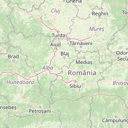
Piatra Craiului National Park Boundary Map and Spatial Extent
Mapped park geometry provides spatial context for the protected landscape and its regional boundaries. Accompanying facts detail calculated area, coordinate spans, and geographic center points.
- Boundary area
- 158.7 km²
- Boundary perimeter
- 151.1 km
- Northernmost point
- 45.5803° N
- Southernmost point
- 45.3647° N
- Easternmost point
- 25.3633° E
- Westernmost point
- 25.1477° E
- Geographic centre
- 45.4841° N, 25.2248° E
- North–south span
- 24 km
- East–west span
- 16.9 km
Elevation and terrain
Explore recorded mountain terrain features and vertical relief data.
Piatra Craiului National Park Terrain and Elevation Summary
Review the recorded elevation summary and highest points spanning the mountain park terrain. Examine linked natural feature cards detailing specific peaks, streams, and caves located within.
- Maximum elevation
- 2,238 m
- Highest point
- 2,238 m
Selected named natural features
Streams
Valea Giuvala
Cave entrances
Peștera Colțul Surpat
Peaks
Dealul Mic
1,238 m
Streams
Valea Mărtoiu
Lakes
Lacul Fără Fund
Environmental setting
Recorded relief, habitat, and landscape feature profiles for regional park geography
Piatra Craiului National Park Environmental Settings and Protected Landscape Classifications
Stored landscape features and habitat types outline the physical relief of Piatra Craiului National Park across designated terrain categories. Recorded classifications connect directly to broader protected area records and comparative geographic profiles.
- Relief
- Mountain
- Water
- Minor water
Landscape features
Mountains · Valleys · Karst · Cliffs · Cave
Habitat types
Montane forest · Alpine meadow · Karst habitat
Park atlas
Explore the Mapped Geography and Connected Protected Landscapes of Romania's Carpathian Mountain Range
Discover Other National Parks and Protected Areas Near Piatra Craiului National Park in the Southern Carpathians
After exploring Piatra Craiului National Park, browse other national parks and protected areas within Romania's Southern Carpathians, comparing diverse mountain, forest, and karst landscapes. Gain broader geographic and ecological context for conservation efforts and unique natural features defining this prominent European mountain range and its surrounding regions.
Protected landscapeRomania
About 11 km away#1 closest
Southeast

Bucegi Natural Park: Protected Landscape Mapping and Regional Geographic Overview
Explore its mapped boundaries and natural terrain.
As a protected landscape in Romania, Bucegi Natural Park offers a distinct focus for geographic study and atlas exploration. This detail page provides access to its mapped protected boundaries, helping users understand its specific location and regional context. Discover how this natural area contributes to the broader understanding of protected lands within the national geography. MoriAtlas enables a clear view of Bucegi Natural Park's landscape characteristics and its place within a mapped system of natural reserves.
- Area
- 0.327 km²
- Established
- 2000
- IUCN
- V
- Relief
- Mountain
National parkVâlcea County
59 km away#2 closest
West
Cozia National Park: Protected Landscape and Regional Geography in Vâlcea County
Discover the mapped protected area in Romania's landscape.
Cozia National Park is a key national park situated within Vâlcea County, Romania. This page facilitates the exploration of its protected landscape, offering detailed insights into its geographic context and mapped features. Understand how Cozia National Park contributes to the regional geography and atlas of Romania's protected areas, providing a foundation for structured landscape discovery.
- Area
- 171 km²
- Established
- 2000
- IUCN
- II
- Relief
- Mountain
National parkVâlcea County
81 km away#3 closest
West
Buila-Vânturarița National Park: Romania's National Park in Vâlcea County Geography
Mapped protected landscape within Vâlcea County.
Delve into the specifics of Buila-Vânturarița National Park, a designated national park in Vâlcea County, Romania. This detailed entry focuses on its protected landscape identity and geographic placement, offering precise mapped boundary information relevant for atlas exploration. Understand how this national park contributes to the regional geography and protected area network, providing a foundational element for structured discovery of Romania's natural environments.
- Area
- 41.86 km²
- Established
- 2005
- IUCN
- II
- Relief
- Mountain
Protected landscapeSibiu County
About 86 km away#4 closest
West
Dumbrava Sibiului Natural Park: Protected Landscape Atlas and Geographic Discovery
Explore the mapped natural terrain and regional context.
Dumbrava Sibiului Natural Park is a designated protected landscape offering a unique lens into Romania's natural geography. This entry provides detailed atlas-level information on the park's protected boundaries and its setting within Sibiu County, part of the historic Transylvania region. Understand the park's landscape character and its role in the regional geography through structured map data.
- Area
- 9.93 km²
- Established
- 2000
- IUCN
- V
- Relief
- Lowland

Protected landscapeVrancea County
About 99 km away#5 closest
Northeast
Putna-Vrancea Natural Park: A Protected Landscape in Vrancea County's Carpathian Mountains
Explore mapped terrain, natural park boundaries, and regional geography.
Putna-Vrancea Natural Park, designated as a protected landscape, offers detailed geographic insights into the Vrancea Mountains in Romania. Users can explore the park's mapped terrain, understand its protected boundaries, and contextualize its natural park status within Vrancea County and the broader Eastern Carpathians region. This atlas-focused view highlights the unique landscape features and regional geographic significance of this Romanian protected area.
- Area
- 302.04 km²
- Established
- 2005
- IUCN
- V
- Relief
- Mountain

Protected landscapeSibiu County
About 107 km away#6 closest
West
Cindrel Natural Park: Protected Landscape within Sibiu County's Regional Geography
Mapped natural landscapes and protected area context.
Delve into the protected landscape of Cindrel Natural Park, situated in Sibiu County, Romania. This page offers a detailed geographic perspective, highlighting the park's mapped boundaries and its role within the broader natural terrain of the Southern Carpathians. Understand the structured atlas data that defines Cindrel Natural Park and its regional significance for protected land discovery.
- Area
- 98.73 km²
- Established
- 2000
- IUCN
- V
- Relief
- Mountain
National parkRomania
127 km away#7 closest
North
Cheile Bicazului-Hășmaș National Park: Protected Area Geography and Mapped Landscape Identity
Discover Romania's National Park mapped boundaries and regional context.
Cheile Bicazului-Hășmaș National Park represents a vital component of Romania's protected natural areas, offering rich geographic detail for atlas enthusiasts. This national park's mapped landscape and defined protected boundaries provide essential context for understanding regional geography and conservation efforts. Explore the specific identity of this protected terrain and its significance within the broader Romanian atlas.
- Area
- 65.75 km²
- IUCN
- II
- Relief
- Mountain
- Scope
- Mixed
National parkGorj County
135 km away#8 closest
West
Defileul Jiului National Park: Romania's Protected National Park Landscape in Gorj County
Explore maps, geography, and protected area context.
Defileul Jiului National Park is a vital protected natural area situated in Gorj County, Romania. This MoriAtlas page serves as a detailed entry point for understanding the park's specific geography, its mapped perimeters, and its significance within the regional landscape atlas. Discover the park's topographic features and its relationship to the surrounding terrain of the Southern Carpathians, providing essential context for geographic exploration.
- Area
- 111.27 km²
- Established
- 2005
- IUCN
- II
- Relief
- Mountain
MoriAtlas Explorer
Continue Mapping Piatra Craiului National Park's Geography and Landscape
Deepen your geographic understanding by exploring Piatra Craiului National Park further through its specific atlas data. Discover how its protected boundaries integrate with the surrounding Romanian geography and landscape context. MoriAtlas facilitates structured exploration, allowing you to trace the park's placement and compare its features within the broader regional map.
Browse next
Global natural geography
Explore related park routes
Explore MoriAtlas Global ParksBrowse All MoriAtlas ParksGlobal Park Map DiscoveryMoriAtlas: Browse All CountriesBrowse All MoriAtlas ContinentsNational Park Environment AtlasGrand Canyon National Park AtlasYellowstone National Park AtlasYosemite National Park Atlas and GeographySerengeti National Park AtlasGalápagos National Park Protected LandscapeBanff National Park Geography and AtlasKruger National Park Atlas EntryUluṟu-Kata Tjuṯa National Park AtlasExplore Uluru-Kata Tjuta National Park GeographyPlitvice Lakes National Park AtlasFiordland National Park Protected LandscapeGreat Smoky Mountains National Park AtlasAfghanistan National Parks and Protected AreasAlbania National Parks and Protected AreasAlgeria National Parks and Protected AreasAmerican Samoa National Parks and Protected AreasAndorra National Parks and Protected AreasAngola National Parks and Protected AreasAntarctica National Parks and Protected AreasAntigua and Barbuda Park List