Mori Atlas logo
Protected landscapeBucegi Natural Park

Discover the mapped boundaries and regional geography of this protected natural area.

Bucegi Natural Park: Romania's Protected Landscape and Geographic Atlas Context

(Parcul Natural Bucegi)

Bucegi Natural Park stands as a key protected landscape within Romania, offering a unique geographic anchor for atlas-based exploration. This page provides detailed insights into the park's mapped extent and its contextual placement within the surrounding natural terrain. Users can navigate its protected boundaries and understand its significance as a distinct natural area for geographic discovery and landscape analysis. MoriAtlas facilitates a structured view of Bucegi Natural Park, highlighting its role in understanding regional protected lands and their mapped configurations.

Nature parkIUCN Category VCarpathian mountainsKarst landscapeAlpine environmentRock formations

Bucegi Natural Park

Protected landscape

Park overview

Structured park overview, official facts, and landscape profile for Bucegi Natural Park

Bucegi Natural Park park facts, protected area profile, and essential visitor context
Review the core facts for Bucegi Natural Park, including designation, size, terrain, visitor scale, habitats, and operating context in one park-focused overview.

About Bucegi Natural Park

Bucegi Natural Park represents one of Romania's significant protected landscapes, designated under IUCN Category V as a protected landscape that maintains natural cultural harmony. The park occupies the core of the Bucegi Mountains, a range that forms part of the larger Southern Carpathian mountain system running through central Romania. The protection of this area recognizes both its ecological importance and its cultural significance to the surrounding communities and the nation as a whole. The park's terrain is characterized by dramatic elevation changes, with limestone bedrock creating a landscape of ridges, cliffs, and karst features. The area has long been a destination for hikers, nature enthusiasts, and those seeking to experience the beauty of the Romanian mountains. The declaration of the park in 2000 formalized protections that had existed since 1974, establishing a framework for managing the natural resources while allowing for appropriate recreational use and continued cultural connection to the landscape.

Quick facts and research context for Bucegi Natural Park

Bucegi Natural Park occupies a strategic position in the Southern Carpathians, covering 32,663 hectares across three Romanian counties. The park features a complex terrain of caves, pit caves, canyons, ridges, sinkholes, valleys, and waterfalls. Several natural reserves are included within the park boundaries: Abruptul Mălăiești - Bucșoiu - Gaura, Locul fosilifer Vama Strunga, Cocora Cave and Cheile Urșilor, Abruptul Prahovean Bucegi, and Colții lui Barbeș Mountains. The nearest population center is the mountain resort town of Sinaia, which provides access to the park.

Park context

Deeper park guide and search-rich context for Bucegi Natural Park

Bucegi Natural Park history, landscape, wildlife, and travel context
Explore Bucegi Natural Park through its history, landscape character, ecosystems, wildlife, conservation priorities, cultural context, and seasonal travel timing in a structured park guide built for atlas discovery and search intent.

Why Bucegi Natural Park stands out

Bucegi Natural Park is best known for its extraordinary rock formations, particularly the Babele and Sphinx, which are iconic landmarks of the Romanian Carpathians. These unusual limestone sculptures, shaped by centuries of weathering, have become the park's most recognizable features and a symbol of the Bucegi Mountains. Beyond these famous formations, the park is distinguished by its Karst landscape featuring extensive cave systems, pit caves, and dramatic limestone cliffs. The alpine limestone grasslands and the contrast between forested slopes and open meadows create a landscape of exceptional visual diversity within easy reach of Romania's capital region.

Bucegi Natural Park history and protected-area timeline

The Bucegi Natural Park was originally established as a protected area in 1974, reflecting the growing recognition of the Bucegi Mountains' natural and cultural significance during Romania's communist period. The formal legal declaration came more recently through Law Number 5 of March 6, 2000, published in Monitorul Oficial Number 152 of April 12, 2000. This legislative act provided the modern legal framework for the park's protection and management, categorizing it as a Nature Park under Romanian law and assigning it IUCN Category V status. The park's history as a protected area coincides with broader Carpathian conservation efforts in Romania, which recognized the unique alpine ecosystems and cultural landscapes of these mountains. The establishment also reflects the importance of the Bucegi Mountains in Romanian cultural identity, with the area long associated with mountain tourism, spiritual retreats, and national heritage.

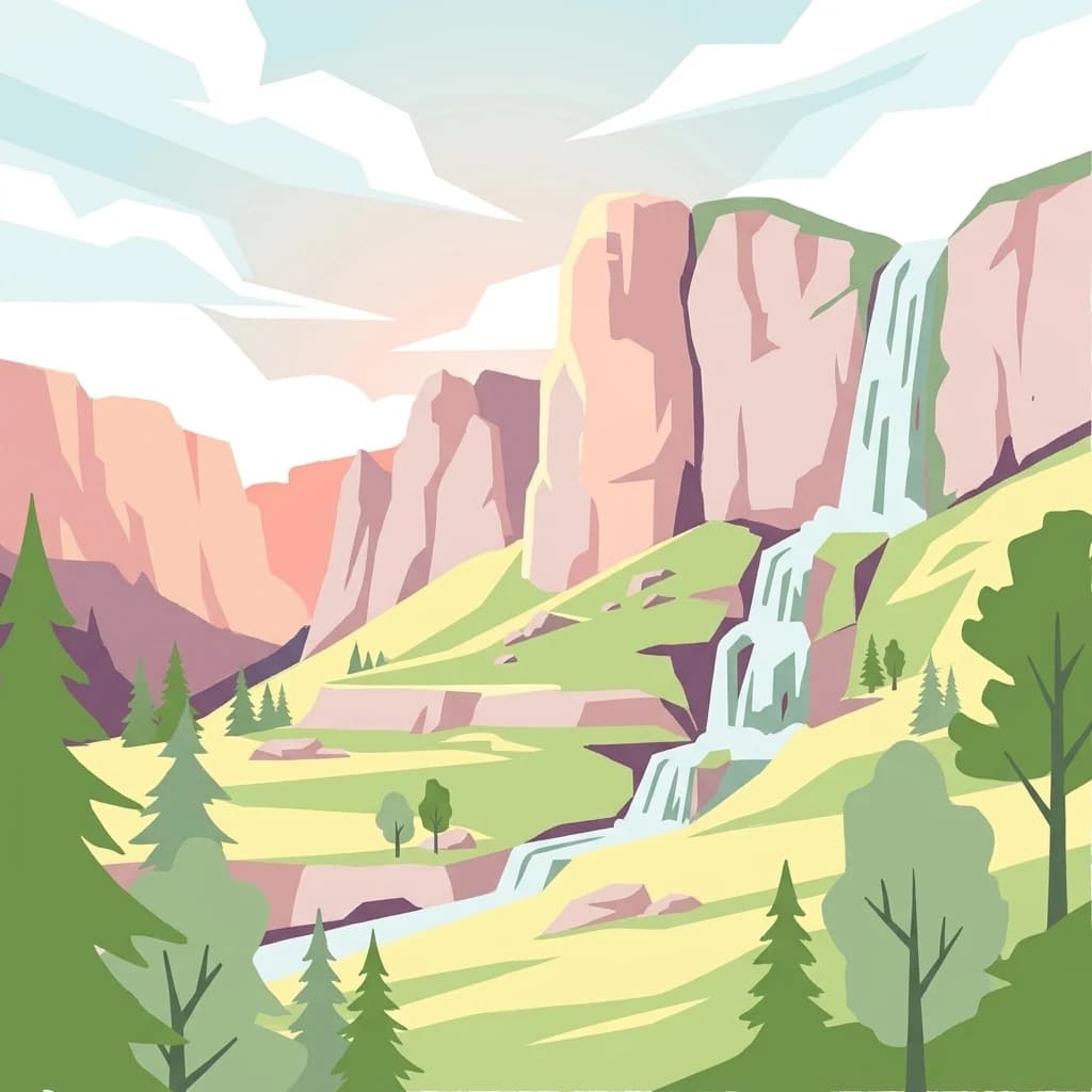
Bucegi Natural Park landscape and geographic character

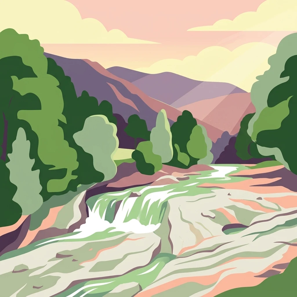
The Bucegi Natural Park encompasses a dramatic mountainous landscape characterized by its limestone-dominated terrain. The park features an array of karst landforms including caves, pit caves, canyons, and sinkholes that have developed in the soluble limestone bedrock over geological time. Dramatic ridges and cliffs rise above deep valleys, creating the dramatic scenery for which the Bucegi Mountains are known. The landscape includes numerous waterfalls where streams cascade over limestone ledges into the valleys below. At lower elevations, the terrain transitions through forested slopes of beech and mixed woodland before opening into alpine meadows and pastures at higher elevations. The distinctive rock formations of Babele and the Sphinx represent exceptional examples of weathering-created landmarks that stand as natural monuments within the park. The combination of vertical cliffs, rolling alpine grasslands, and the intricate karst topography creates a landscape of remarkable diversity and visual impact.

Bucegi Natural Park ecosystems, habitats, and plant life

The ecological character of Bucegi Natural Park reflects its position in the Carpathian alpine zone. The park contains a mosaic of habitats that support diverse plant and animal communities. Beech forests dominate the lower slopes, transitioning through areas of shrubs and bushes into the alpine limestone grasslands at higher elevations. The alpine meadows include mountain hay meadows that support distinctive herbaceous vegetation adapted to the high-altitude conditions. Springs and alpine rivers add to the habitat diversity, creating riparian corridors through the mountain terrain. Limestone rocky slopes and seminatural dry grasslands provide additional habitat variation across the park. This variety of habitats within a relatively compact protected area supports ecological communities representative of the Southern Carpathian mountain ecosystems.

Bucegi Natural Park wildlife and species highlights

The Bucegi Natural Park provides habitat for species adapted to the Carpathian alpine and forest environments. The beech forests shelter forest-dwelling species, while the alpine grasslands and rocky areas support species adapted to higher elevations. The diverse habitats within the park create conditions for a variety of bird species and smaller mammals that characterize Carpathian mountain ecosystems. The protected area status helps maintain corridors and habitats essential for wildlife conservation in this portion of the Southern Carpathians.

Bucegi Natural Park conservation status and protection priorities

Bucegi Natural Park holds IUCN Category V status as a protected landscape, recognizing its value in maintaining traditional mountain ecosystems and cultural landscapes. The park protects representative Carpathian habitats including beech forests, alpine grasslands, and karst systems within a single protected area. The inclusion of specific natural reserves within the park boundaries, such as Abruptul Prahovean Bucegi with its dramatic limestone cliffs and Colții lui Barbeș Mountains, provides additional protection for particularly significant features. The protection framework balances conservation of natural values with sustainable recreational use, reflecting the park's role in Romanian environmental stewardship and sustainable mountain development.

Bucegi Natural Park cultural meaning and human context

The Bucegi Mountains have held cultural significance in Romanian tradition and identity long before their formal protection as a natural park. The distinctive rock formations, particularly the Sphinx, have inspired legends and cultural references throughout Romanian history. The area has been a destination for spiritual retreats and mountain pilgrimage, with monasteries and hermitages established in the surrounding valleys. The traditional pastoral use of the alpine meadows, with seasonal grazing by local communities, has shaped the cultural landscape and contributed to the maintenance of open grassland habitats. The park remains culturally important as a place where Romanians connect with their mountain heritage and natural landscape.

Top sights and standout views in Bucegi Natural Park

The defining highlights of Bucegi Natural Park are its iconic rock formations Babele and the Sphinx, exceptional karst landscapes with caves and dramatic limestone cliffs, and the visual drama of the Carpathian alpine environment. The park offers accessible mountain recreation with trails that traverse forests, meadows, and rocky terrain, providing views of waterfalls and panoramic mountain scenery. The combination of geological wonders, ecological diversity, and cultural heritage makes this one of Romania's most visited protected mountain areas.

Best time to visit Bucegi Natural Park

The summer months from June through September offer the most accessible conditions for exploring Bucegi Natural Park, with clear weather and full trail access through the alpine zones. Autumn brings colorful forest displays and fewer visitors, though conditions can change quickly in the mountains. Winter transforms the park into a skiing and winter recreation destination, though some trails become inaccessible. Spring allows observation of the mountain meadows coming into flower, though snow may persist at higher elevations. The park can be visited year-round, with each season offering a different perspective on the Carpathian landscape.

Park location guide

Geography guide, regional context, and park location map for Bucegi Natural Park

Bucegi Natural Park park geography, regions, and map view in Romania
Understand where Bucegi Natural Park sits in Romania through a broader geographic reading of the surrounding landscape, nearby location context, and its mapped position within the national park landscape.

How Bucegi Natural Park fits into Romania

Romania is a unitary semi-presidential republic located in Southeast and Central Europe. It borders Ukraine, Hungary, Serbia, Bulgaria, Moldova, and the Black Sea. The country has a population of approximately 19 million and covers an area of 238,397 km². Bucharest is the capital and largest city. Romania joined the European Union in 2007.

Wider geography shaping Bucegi Natural Park in Romania

Romania lies on the lower course of the Danube River, north of the Balkan Peninsula, and on the northwestern shore of the Black Sea. The terrain is varied, featuring the Carpathian Mountains in the center, the Transylvanian Plateau, the Moldavian Plateau, and plains along the Danube and in the south. The country has a diverse landscape that includes forests, meadows, and wetland areas.

Map view of Bucegi Natural Park

Use this park location map to pinpoint Bucegi Natural Park in Romania, understand its exact geographic position, and read its mapped placement within the surrounding landscape more clearly.

Pigeon | © OpenStreetMap contributors

Location context for Bucegi Natural Park

Brașov CountyDâmbovița CountyPrahova County
Park atlas

Browse the diverse protected landscapes, mountain terrain, and regional conservation efforts surrounding Bucegi Natural Park for deeper atlas discovery.

Explore Related Protected Areas and Parks Near Bucegi Natural Park, Tracing Carpathian Geography
Discover other protected areas in the Southern Carpathian Mountains, expanding your view beyond Bucegi Natural Park into the broader regional park geography of Romania. Compare their varied landscapes, from karst formations to alpine meadows, and understand the interconnected conservation efforts across this distinct European mountain range.
National park

Piatra Craiului National Park: Protected Landscape Atlas and Geographic Context

Explore Romania's unique national park and its mapped terrain.

Navigate the protected geography of Piatra Craiului National Park, a key national park entity. This page details its mapped boundaries and situates its natural landscape within Romania's regional geography, offering a structured point of discovery for geographic atlas enthusiasts. Understand the park's identity as a protected natural area and its contribution to the mapped terrain of the region.

Area
147.66 km²
Established
2000
IUCN
II
Relief
Mountain
Watercolor painting showing green hills, trees, and a river
National parkVâlcea County

Cozia National Park: Protected Landscape and Regional Geography in Vâlcea County

Discover the mapped protected area in Romania's landscape.

Cozia National Park is a key national park situated within Vâlcea County, Romania. This page facilitates the exploration of its protected landscape, offering detailed insights into its geographic context and mapped features. Understand how Cozia National Park contributes to the regional geography and atlas of Romania's protected areas, providing a foundation for structured landscape discovery.

Area
171 km²
Established
2000
IUCN
II
Relief
Mountain
Protected landscapeVrancea County

Putna-Vrancea Natural Park: A Protected Landscape in Vrancea County's Carpathian Mountains

Explore mapped terrain, natural park boundaries, and regional geography.

Putna-Vrancea Natural Park, designated as a protected landscape, offers detailed geographic insights into the Vrancea Mountains in Romania. Users can explore the park's mapped terrain, understand its protected boundaries, and contextualize its natural park status within Vrancea County and the broader Eastern Carpathians region. This atlas-focused view highlights the unique landscape features and regional geographic significance of this Romanian protected area.

Area
302.04 km²
Established
2005
IUCN
V
Relief
Mountain
National parkVâlcea County

Buila-Vânturarița National Park: Romania's National Park in Vâlcea County Geography

Mapped protected landscape within Vâlcea County.

Delve into the specifics of Buila-Vânturarița National Park, a designated national park in Vâlcea County, Romania. This detailed entry focuses on its protected landscape identity and geographic placement, offering precise mapped boundary information relevant for atlas exploration. Understand how this national park contributes to the regional geography and protected area network, providing a foundational element for structured discovery of Romania's natural environments.

Area
41.86 km²
Established
2005
IUCN
II
Relief
Mountain
Protected landscapeSibiu County

Dumbrava Sibiului Natural Park: Protected Landscape Atlas and Geographic Discovery

Explore the mapped natural terrain and regional context.

Dumbrava Sibiului Natural Park is a designated protected landscape offering a unique lens into Romania's natural geography. This entry provides detailed atlas-level information on the park's protected boundaries and its setting within Sibiu County, part of the historic Transylvania region. Understand the park's landscape character and its role in the regional geography through structured map data.

Area
9.93 km²
Established
2000
IUCN
V
Relief
Lowland
Watercolor illustration of a landscape with mountains, trees, and a river
Protected landscapeSibiu County

Cindrel Natural Park: Protected Landscape within Sibiu County's Regional Geography

Mapped natural landscapes and protected area context.

Delve into the protected landscape of Cindrel Natural Park, situated in Sibiu County, Romania. This page offers a detailed geographic perspective, highlighting the park's mapped boundaries and its role within the broader natural terrain of the Southern Carpathians. Understand the structured atlas data that defines Cindrel Natural Park and its regional significance for protected land discovery.

Area
98.73 km²
Established
2000
IUCN
V
Relief
Mountain
Protected landscapeGiurgiu County

Comana Natural Park: Protected Landscape Atlas and Regional Geography

Giurgiu County, Romania: Mapped protected area context.

Navigate the geographic features and protected landscape boundaries of Comana Natural Park, situated within Giurgiu County. This dedicated atlas entry provides a clear view of the park's mapped territory and its significance as a protected area, offering essential context for understanding its regional setting and natural terrain within Romania.

Area
249.63 km²
Established
2005
IUCN
V
Relief
Lowland
National park

Cheile Bicazului-Hășmaș National Park: Protected Area Geography and Mapped Landscape Identity

Discover Romania's National Park mapped boundaries and regional context.

Cheile Bicazului-Hășmaș National Park represents a vital component of Romania's protected natural areas, offering rich geographic detail for atlas enthusiasts. This national park's mapped landscape and defined protected boundaries provide essential context for understanding regional geography and conservation efforts. Explore the specific identity of this protected terrain and its significance within the broader Romanian atlas.

Area
65.75 km²
Relief
Mountain
Scope
Mixed
Water
Minor water

Common questions about visiting, size, designation, and location context for Bucegi Natural Park

Bucegi Natural Park FAQs for park facts, access, geography, and protected area context
Find quick answers about Bucegi Natural Park, including protected-area facts, park geography, trail and visitor context, and how the park fits into its surrounding country and regional landscape.
MoriAtlas Explorer

Continue Your Protected Areas Search Across the Global Atlas

Deepen your exploration by continuing the structured search for national parks and protected areas worldwide. Utilize the comprehensive filtering capabilities to compare different conservation landscapes and refine your understanding of global park geography. Discover more about the distribution and characteristics of protected natural areas.

Global natural geography