
Mori Atlas logo
Marine protected areaPoor Knights Islands Marine Reserve

Analyzing the underwater topography, arches, and protected island landscape of Northland

Poor Knights Islands Marine Reserve: Mapped Marine Protected Area and Coastal Geography

The Poor Knights Islands Marine Reserve protects an extraordinary marine landscape off the coast of the New Zealand North Island. This protected area features dramatic underwater topography, including natural arches, volcanic caves, and steep drop offs that transition rapidly from coastal shallows into deep oceanic waters. Our geographic data provides insight into the marine boundaries and structural features that define this significant no take zone.

marine reservescuba divingislandscoastal cliffsnatural archescaves
A stylized flat vector illustration of an island surrounded by water with pine trees in the foreground.

Poor Knights Islands Marine Reserve

Marine protected area

Park overview

Structured park overview, official facts, and landscape profile for Poor Knights Islands Marine Reserve

Poor Knights Islands Marine Reserve park facts, protected area profile, and essential visitor context

Review the core facts for Poor Knights Islands Marine Reserve, including designation, size, terrain, visitor scale, habitats, and operating context in one park-focused overview.

About Poor Knights Islands Marine Reserve

The Poor Knights Islands Marine Reserve is one of New Zealand's most distinctive coastal protected areas, defined as much by the spectacular character of the surrounding sea as by the islands it encompasses. It lies offshore from the Northland coast, east of Tutukaka, and surrounds two main islands along with smaller rock formations such as Sugarloaf Rock and High Peak Rocks. Since its establishment in 1981, the reserve has been managed by the Department of Conservation as a no-take marine sanctuary, with all fishing and removal of marine life prohibited within its boundaries.

What sets the Poor Knights apart from many other New Zealand marine reserves is the dramatic underwater landscape. The islands rise sharply from deep water, producing near-vertical walls, narrow channels, natural arches, and extensive cave systems that begin just below the surface and extend into deeper water. Some of the most recognisable features, such as the Northern Arch, have become almost iconic among divers worldwide. The combination of rugged topography and clear oceanic water creates conditions that support a remarkable variety of marine life, including species drawn from both warmer northern currents and cooler southern waters.

The reserve sits at the intersection of marine science, conservation policy, and outdoor recreation. It has been the focus of long-term studies that helped demonstrate the effects of removing fishing pressure on reef fish populations, and it remains a key reference site in New Zealand discussions about marine protection. At the same time, its accessibility from Tutukaka has made it a day-trip and liveaboard diving destination, attracting both local divers and international visitors drawn by its reputation as one of the world's most rewarding dive sites.

Quick facts and research context for Poor Knights Islands Marine Reserve

The Poor Knights Islands Marine Reserve lies off the eastern coast of Northland, New Zealand, offshore from the town of Tutukaka, which serves as the main launching point for dive trips. Covering 1,890 hectares, the reserve surrounds the Poor Knights Islands together with Sugarloaf Rock and High Peak Rocks. It has been administered by the New Zealand Department of Conservation since its establishment in 1981, and full no-take fishing restrictions came into force in 1998.

Protection and recognition

Explore the documented marine protection scope and official designation records.

Poor Knights Islands Marine Reserve Protection Status and Governance Data

Poor Knights Islands Marine Reserve maintains a documented marine protection scope with verified conservation designations. Records outline the established management framework and official protection parameters without external recognition sources.

Protection details

Protection scope
Marine
Transboundary protection
No
Park context

Deeper park guide and search-rich context for Poor Knights Islands Marine Reserve

Poor Knights Islands Marine Reserve history, landscape, wildlife, and travel context

Explore Poor Knights Islands Marine Reserve through its history, landscape character, ecosystems, wildlife, conservation priorities, cultural context, and seasonal travel timing in a structured park guide built for atlas discovery and search intent.

Why Poor Knights Islands Marine Reserve stands out

The Poor Knights Islands Marine Reserve is best known for being one of the world's top-rated scuba diving locations, with unusual clarity, dramatic underwater arches and caves, and an extraordinarily rich mix of subtropical and temperate marine species. The reserve is also recognised for the way snapper populations responded to full protection, providing one of New Zealand's clearest demonstrations of the marine benefits of no-take reserves. Onshore, the islands themselves have become synonymous with the pioneering marine research and advocacy of New Zealand diver and writer Wade Doak.
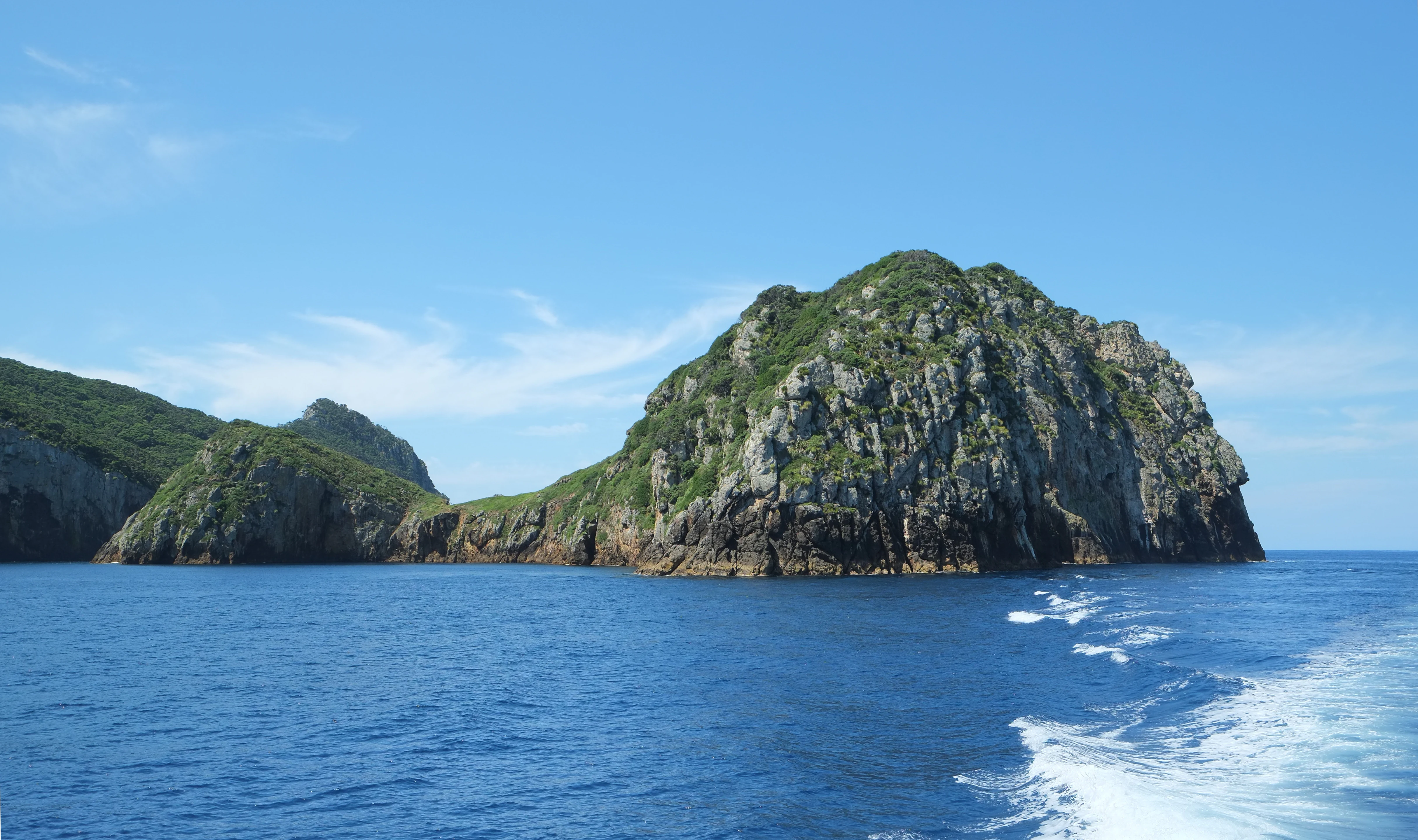
Rugged, vegetation-covered rocky islands rise from the deep blue ocean, viewed from a passing boat with a wake visible in the foreground.
Archway Island and Aorangi Island in the Poor Knights Islands Marine Reserve.

Poor Knights Islands Marine Reserve history and protected-area timeline

The Poor Knights Islands Marine Reserve was established in 1981 following pressure that included public advocacy through editorials in the New Zealand Herald. According to marine biologist Bill Ballantine, the government was pushed toward creating a marine reserve around the Poor Knights after these editorial campaigns raised public awareness about the islands' marine values.

When the reserve was first created, commercial fishing inside its boundaries was banned, but recreational fishing was still permitted. It was only in October 1998, seventeen years later, that a full no-take regime was implemented, prohibiting any disturbance of marine life or removal of rocks and shells inside the reserve. The islands became an increasingly important reference site for marine conservation science in New Zealand, and long-term studies of snapper populations there became widely cited examples of how marine life responds to comprehensive protection.

Parallel to the reserve's formal protection history, the islands became closely associated with the work of diver and marine researcher Wade Doak, whose decades of advocacy, diving, and documentation helped bring the Poor Knights to national and international attention. The reserve's subsequent reputation as a global diving destination grew out of this combination of scientific documentation and grassroots marine advocacy.

Poor Knights Islands Marine Reserve landscape and geographic character

The marine reserve is shaped by the dramatic geomorphology of the Poor Knights Islands and the seafloor around them. The islands themselves are steep and rugged, with sheer cliffs that meet the sea, and their associated rock stacks, Sugarloaf Rock and High Peak Rocks, extend the same rugged character seaward. The surrounding seafloor drops quickly into deep water, producing underwater terrain strikingly different from the gently sloping coasts more typical of mainland New Zealand.

Beneath the surface, this steep terrain gives rise to a series of natural arches, caves, tunnels, and overhangs that define the diving landscape of the reserve. Features such as the Northern Arch are formed by wave action along the volcanic rock of the islands, creating openings that divers can swim through and explore. The interplay of light, depth, and structure in these formations is a central part of what makes the Poor Knights visually distinctive underwater.

Above the surface, the islands present exposed cliffs, sparse coastal vegetation, and offshore rock stacks that are characteristic of remote Northland island environments. Together, these onshore landforms and the underwater arch and cave systems form an integrated landscape that has become the visual signature of the reserve.
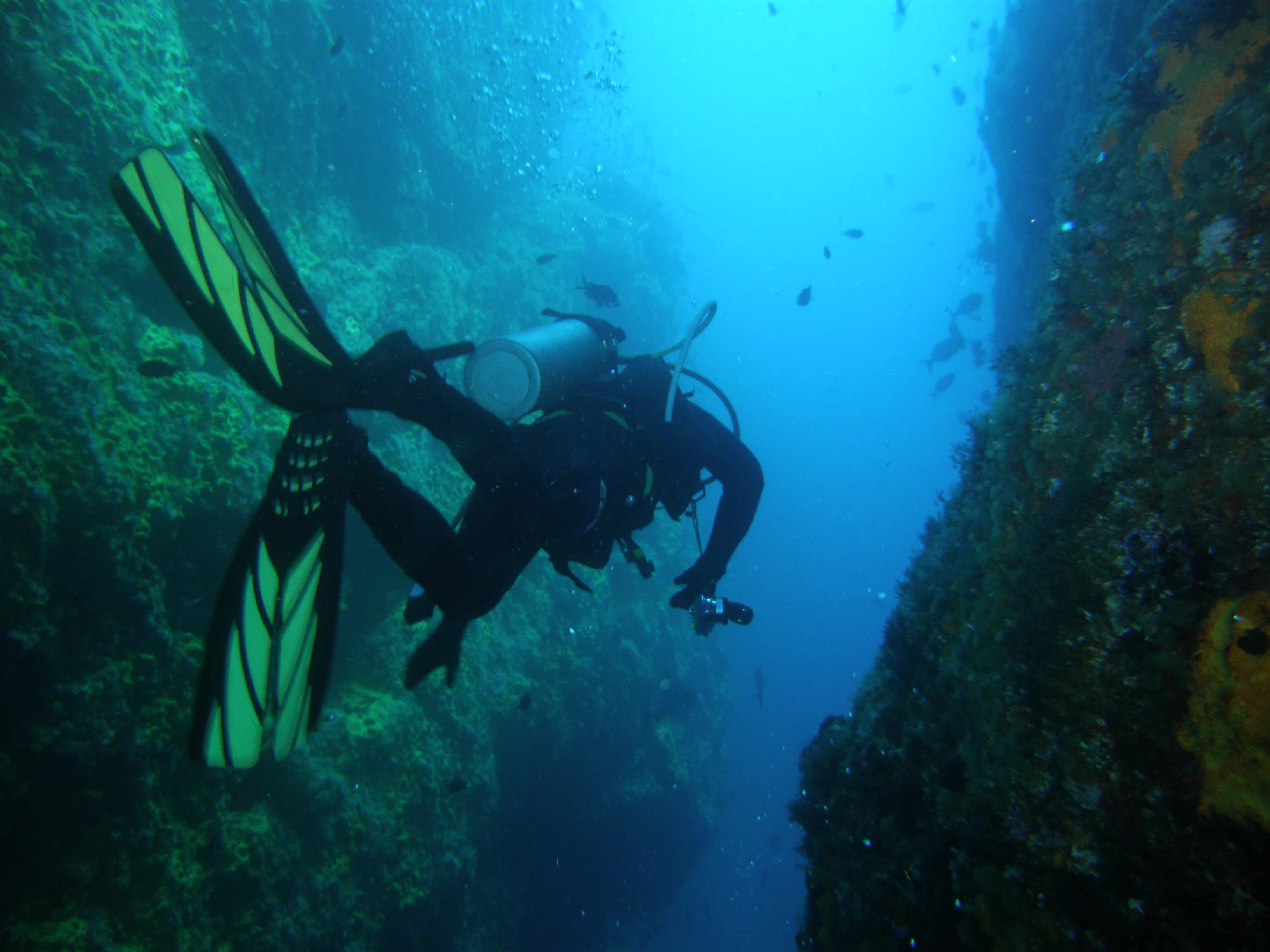
A scuba diver wearing black gear and yellow fins swimming between two dark underwater rock walls in a marine reserve.
A scuba diver exploring the underwater Northern Arch at the Poor Knights Islands Marine Reserve.

Poor Knights Islands Marine Reserve ecosystems, habitats, and plant life

The Poor Knights Islands Marine Reserve lies in a transitional zone between subtropical and temperate marine environments. Warm currents reaching southward along the Northland coast meet cooler waters typical of the wider New Zealand shelf, creating conditions that support an unusually broad range of marine species. This mixing effect contributes strongly to the ecological character of the reserve.

The steep underwater walls and arches of the reserve support dense communities of marine invertebrates, algae, and reef fish. The availability of varied habitat on vertical surfaces, in caves, and along ledges allows different species to occupy distinct niches within a relatively compact area. The combination of clear water and structurally complex habitat also supports a rich diversity of pelagic and semi-pelagic species that move through the reserve rather than living directly on the reef.

The islands themselves are also part of the reserve's natural character, with terrestrial coastal vegetation adapted to exposed conditions and seabird nesting habitat on the cliff faces. Although the marine environment is the main focus of conservation attention, the islands' role in supporting birdlife and coastal plant communities adds an additional layer to the reserve's ecological profile.

Poor Knights Islands Marine Reserve wildlife and species highlights

The Poor Knights Islands Marine Reserve is widely noted for the abundance and diversity of fish life in its waters. Snapper, in particular, has become closely associated with the reserve after studies showed dramatic increases in abundance, biomass, and average size once full no-take protection took effect. Large snapper are now a familiar sight to divers, often behaving confidently in the absence of fishing pressure.

Beyond snapper, the reserve supports a broad community of reef fish typical of northern New Zealand waters, including species associated with both warmer and cooler water influences. Divers regularly report encounters with a wide variety of reef species using the walls, arches, and caves for shelter and feeding. The reserve's structural complexity, combined with its clear water, makes it a productive hunting ground for larger predatory species as well.

Above the surface, the cliffs of the Poor Knights Islands and their surrounding rock stacks provide habitat for seabirds, contributing a wildlife dimension that complements the marine fauna below. While the marine life dominates the reserve's identity, the islands' position as a relatively undisturbed refuge for coastal and pelagic birdlife reinforces its broader ecological importance.

Poor Knights Islands Marine Reserve conservation status and protection priorities

The Poor Knights Islands Marine Reserve plays a significant role in New Zealand marine conservation as both a protected area and a long-term ecological reference site. Its shift from partial to full no-take protection in 1998 marked an important step in the country's marine reserve policy, and the recovery of species such as snapper inside its boundaries has been widely cited as evidence that comprehensive restrictions deliver stronger conservation outcomes than partial measures.

Research conducted in and around the reserve has helped clarify how reef fish populations respond to the removal of fishing pressure. Comparisons with fished reference sites such as Cape Brett and the Mokohinau Islands showed that gains in snapper abundance, biomass, and size inside the Poor Knights occurred alongside little to no change in comparable unprotected locations. This made the reserve one of the clearest New Zealand examples of the conservation benefits of fully protected marine zones.

At a broader scale, the reserve has also contributed to New Zealand's growing network of marine protected areas and to international discussions about no-take marine reserves. Its profile as both a research site and a recreational diving destination has helped reinforce public understanding of why marine protection matters.

Poor Knights Islands Marine Reserve cultural meaning and human context

The Poor Knights Islands Marine Reserve sits within the coastal country of Northland, a region with deep Maori and European maritime heritage. The Poor Knights Islands themselves are part of the cultural and navigational landscape of eastern Northland, where the sea has long supported coastal communities through fishing, travel, and seasonal gathering.

In more recent decades, the reserve has developed a distinct cultural identity linked to diving and marine advocacy. The work of Wade Doak and other prominent divers helped shape a grassroots marine conservation culture that treated the Poor Knights as a place worth knowing intimately and protecting carefully. Dive operators operating out of Tutukaka have also become part of the reserve's modern cultural fabric, connecting local communities to the marine environment through recreation, education, and tourism.

Top sights and standout views in Poor Knights Islands Marine Reserve

Among the most distinctive features of the Poor Knights Islands Marine Reserve is its concentration of natural arches and caves, including the well-known Northern Arch, which together form one of the most rewarding underwater landscapes in the Southern Hemisphere for divers. The reserve is also notable for the unusually rapid recovery of large snapper after full fishing protections came into effect, making it a textbook example in New Zealand marine conservation debates.

The reserve's accessibility from Tutukaka, combined with its clear subtropical-temperate water and dramatic walls, has placed it among the world's most highly regarded dive sites. Less visible but equally important is the reserve's role as a long-term monitoring site, where ongoing study continues to deepen understanding of how marine ecosystems respond to sustained protection.

Best time to visit Poor Knights Islands Marine Reserve

The Poor Knights Islands Marine Reserve can be visited throughout much of the year, but conditions tend to be most favourable for diving when the sea is calmest and underwater visibility is at its highest. Late spring through autumn generally offers warmer water temperatures and the best combination of calm conditions and good clarity, while winter can bring rougher seas and reduced visibility even though the marine life remains abundant.

Seasonal differences are more about conditions than the underlying character of the reserve, since the islands' underwater topography and fish populations stay much the same year-round. Divers and visitors often choose timing based on their tolerance for swell and cooler water, with summer months typically drawing the highest number of trips from Tutukaka. Wildlife experiences, particularly encounters with larger snapper and pelagic visitors, are possible across the year inside the fully protected waters.
Monthly climate preview

Long-term representative temperature and precipitation rhythms across twelve monthly intervals

Poor Knights Islands Marine Reserve Climate Normals and Annual Weather Patterns

Representative coordinate records show measured monthly temperature variations ranging from 14.23 to 23.18 degrees Celsius alongside recorded daily precipitation rates between 2.17 and 4.33 millimeters. Analyzing the complete twelve-month climate profile reveals comprehensive statistical breakdowns for long-term averages.
Annual mean17 °C
14 °C21 °C
Jan20°
Feb21°
Mar20°
Apr19°
May17°
Jun16°
Jul15°
Aug14°
Sep15°
Oct15°
Nov17°
Dec18°
Warmest month
February

20.6 °C

Coolest month
August

14.2 °C

Wettest month
July

4.3 mm/day

Driest month
January

2.2 mm/day

Park location guide

Geography guide, regional context, and park location map for Poor Knights Islands Marine Reserve

Poor Knights Islands Marine Reserve park geography, regions, and map view in New Zealand

Understand where Poor Knights Islands Marine Reserve sits in New Zealand through a broader geographic reading of the surrounding landscape, nearby location context, and its mapped position within the national park landscape.

How Poor Knights Islands Marine Reserve fits into New Zealand

New Zealand is an island nation in the southwestern Pacific Ocean comprising two main islands and numerous smaller islands. Located east of Australia across the Tasman Sea, it features varied topography with the Southern Alps running along the South Island and volcanic terrain on the North Island. The country was settled by Maori people between 1280 and 1350, followed by European exploration beginning in 1642, and became a Dominion in 1907 before gaining full independence in 1947.

Wider geography shaping Poor Knights Islands Marine Reserve in New Zealand

New Zealand lies in the southwestern Pacific Ocean, east of Australia across the Tasman Sea. The country consists of two main islands, the North Island and South Island, plus over 600 smaller islands. The North Island features volcanic plateaus and hills while the South Island is dominated by the Southern Alps mountain range. The country has a long coastline and is surrounded by the Pacific Ocean.

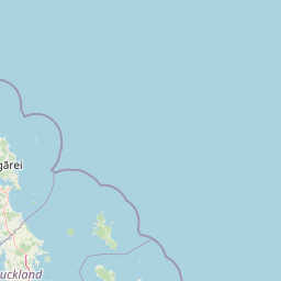
Map view of Poor Knights Islands Marine Reserve

Use this park location map to pinpoint Poor Knights Islands Marine Reserve in New Zealand, understand its exact geographic position, and read its mapped placement within the surrounding landscape more clearly.

Pigeon | © OpenStreetMap contributors

Visual reference of volcanic rock arches, coastal cliffs, and marine habitats

Poor Knights Islands Marine Reserve Photos and Subsurface Landscape Scenery

Visual documentation reveals the dramatic underwater topography and rugged coastal landforms defining Poor Knights Islands Marine Reserve. Examining field photography illuminates the unique geological structures and rich marine habitats protected within New Zealand coastal waters.

Rugged, vegetation-covered rocky islands rise from the deep blue ocean, viewed from a passing boat with a wake visible in the foreground.

A close up underwater view of a snapper fish with visible blue spots, swimming against a dark rocky reef background.

A scuba diver wearing black gear and yellow fins swimming between two dark underwater rock walls in a marine reserve.

Park atlas

Compare adjacent coastal marine reserves and regional conservation landscapes

Parks Near Poor Knights Islands Marine Reserve and Protected Areas

Browse protected areas and marine habitats situated near Poor Knights Islands Marine Reserve to compare coastal geography across the region. Regional park exploration reveals connected marine ecosystems and protected coastal landforms throughout surrounding waters.
Nature reserveNorthland Region
About 0.4 km away#1 closest

Poor Knights Islands Nature Reserve: Mapped Volcanic Geography and Protected Coastal Landscapes

A rugged island chain offshore from New Zealand's Northland Region.

The Poor Knights Islands serve as an essential protected landscape characterized by sheer volcanic cliffs, natural arches, and extensive sea cave systems. Rising sharply from the sea, these uninhabited islands function as a vital sanctuary for seabirds and native flora, providing a unique look into the deeply eroded remnants of ancient rhyolitic volcanic activity within New Zealand.

Area
2.714 km²
Established
1975
IUCN
Ia
Relief
Upland
Nature reserveNew Zealand
About 37 km away#2 closest

West

Waro Limestone Scenic Reserve: Karst Landscapes and Cultural Heritage in Northland, New Zealand

A study in geological formations and industrial history.

Waro Limestone Scenic Reserve offers a concentrated look at Northland geography, featuring vertical limestone outcrops and a flooded quarry set within rural farmland. As a protected nature reserve, it serves as a site of significant Māori cultural heritage while also preserving remnants of early New Zealand industrial activity, such as coal mining and lime extraction, which shaped the surrounding terrain.

Relief
Upland
Climate
Subtropical
Scope
Terrestrial
Water
Minor water
A watercolor illustration of a soft green hilly landscape with distant peaks against a white background.
Nature reserveNew Zealand
About 40 km away#3 closest

South

Hen and Chicken Islands Nature Reserve: Mapped Geography and Protected Island Terrain

Archipelago sanctuary and volcanic landscape offshore of New Zealand

Explore the geographic structure of the Hen and Chicken Islands, an uninhabited nature reserve that serves as a vital predator-free sanctuary. The archipelago displays varied volcanic terrain, from the dramatic central ridge of Hen Island to the rugged rocky reefs of the Marotiri islets, offering a clear window into the ecological conservation landscapes of the Northland region.

Area
8.44 km²
Established
1908
Relief
Highland
Climate
Subtropical
Regional parkAuckland Region
61 km away#4 closest

South

Te Ārai Regional Park: Mapping Coastal Dune Systems and Protected Geography in Auckland

A protected coastal landscape featuring expansive dune systems and northern headlands.

Te Ārai Regional Park sits as a major protected coastal area on the northern edge of the Auckland Region. Its primary defining feature is an expansive system of sand dunes that anchor a diverse coastal environment. Extending southward toward Poutawa Stream and bordered by the Mangawhai Forest, the park represents a critical geography for endangered species breeding and provides a distinct topographic profile along the North Island coast.

Established
2008
Relief
Lowland
Climate
Subtropical
Access
Easy access
A watercolor painting showing a soft, bright landscape with green grasses and wildflowers on both sides of a calm, pale blue body of water, with a green coastline in the distance.
Marine protected areaNew Zealand
76 km away#5 closest

South

Cape Rodney-Okakari Point Marine Reserve: New Zealand Marine Protected Area Geography

Mapped coastal boundaries and marine ecosystem terrain

Delve into the geography of Cape Rodney-Okakari Point Marine Reserve, where protected waters meet a complex interface of greywacke bedrock and sandy substrates. This assessment highlights the ecological transition from exposed rocky headlands to sheltered Whangateau Harbour, illustrating the structural depth of New Zealand's foundational marine site through its diverse invertebrate and fish habitats.

Area
5.5 km²
Established
1975
IUCN
Ia
Visitors
200K annual
A watercolor painting showing soft green hills rising above a light blue body of water, with a small patch of reddish-brown land visible in the foreground.
Protected areaAuckland Region
About 94 km away#6 closest

Southeast

Rakitu Island Protected Area: Volcanic Geography and Coastal Landscapes in the Hauraki Gulf

A protected offshore sanctuary near Great Barrier Island

Rakitu Island is an uninhabited 253-hectare protected area that represents a distinct volcanic landscape off the northeast coast of New Zealand. Formed from eroded rhyolite domes, the island features high coastal cliffs and a central valley that now supports native forest regrowth. This predator-free sanctuary offers an essential map perspective on small-scale island conservation and rugged maritime terrain.

Area
2.5 km²
Established
1994
Relief
Upland
Scope
Terrestrial
Nature reserveNorthland Region
About 98 km away#7 closest

West

Kai Iwi Lakes Reserve: A Detailed Look at Northland's Freshwater Dune Lake Geography

Nature reserve featuring dune-formed lake basins and native scrub

Kai Iwi Lakes Reserve is a notable nature reserve in the Northland region, centered on the freshwater lakes of Taharoa, Kaiiwi, and Waikare. This protected area offers insight into sand-sculpted geomorphology, with lake basins formed by windblown dunes and surrounded by a diverse mix of native forest, pine stands, and pastoral land, providing a clear window into Northland's unique inland water geography.

Area
5.38 km²
Relief
Lowland
Climate
Temperate
Access
Moderate access
A soft watercolor illustration showing the low-lying shape of Motuora Island surrounded by calm water, with a distant hilly coastline in the background.
Nature reserveNorth Island
About 104 km away#8 closest

South

Motuora Nature Reserve: Protected Coastal Island Geography and Restoration Map

Predator-free ecological sanctuary in the Hauraki Gulf

Motuora occupies a key position in the Hauraki Gulf, offering a well-mapped look at coastal island restoration in New Zealand. This protected area features a regenerated forest interior and cliff-edged terrain, serving as an important mainland-island site for avian conservation, including kiwi and petrel colonies.

Area
0.8 km²
Established
1965
Relief
Lowland
Climate
Subtropical

Common questions about visiting, size, designation, and location context for Poor Knights Islands Marine Reserve

Poor Knights Islands Marine Reserve FAQs for park facts, access, geography, and protected area context

Find quick answers about Poor Knights Islands Marine Reserve, including protected-area facts, park geography, trail and visitor context, and how the park fits into its surrounding country and regional landscape.
MoriAtlas Explorer

Continue Your Protected Areas Search Across the Global Atlas

Deepen your exploration by continuing the structured search for national parks and protected areas worldwide. Utilize the comprehensive filtering capabilities to compare different conservation landscapes and refine your understanding of global park geography. Discover more about the distribution and characteristics of protected natural areas.

Global natural geography