Mori Atlas logo
National parkPryazovia National Nature Park

An atlas exploration of Pryazovia National Nature Park's boundaries and landscape context.

Pryazovia National Nature Park: Mapped Protected Area and Regional Geography

(Pryazovskyi National Nature Park)

Pryazovia National Nature Park is a designated National Park within the Zaporizhzhia Oblast of Ukraine. This page offers a structured atlas view, focusing on the park's protected area boundaries and its placement within the broader regional geography. Users can explore the park's landscape context, situated near the Sea of Azov coastline, and understand its role as a significant protected natural area within southeastern Ukraine's mapped terrain.

wetlandscoastal landscapesbirdwatchingsteppe ecosystemsRamsar sitesestuaries

Pryazovia National Nature Park

National park

Park overview

Structured park overview, official facts, and landscape profile for Pryazovia National Nature Park

Pryazovia National Nature Park park facts, protected area profile, and essential visitor context
Review the core facts for Pryazovia National Nature Park, including designation, size, terrain, visitor scale, habitats, and operating context in one park-focused overview.

About Pryazovia National Nature Park

Pryazovia National Nature Park occupies a distinctive coastal position in southeastern Ukraine, where the shallow, brackish waters of the Sea of Azov meet the rolling grasslands of the Pontic-Caspian steppe. Established in 2010, the park was created to protect one of Ukraine's most ecologically significant transition zones, where terrestrial and aquatic ecosystems intermingle to create remarkable biodiversity. The park's territory is organized into distinct management zones: a protected zone covering approximately 10% of the area, stationary recreation zones, regulated recreation areas, and an economic zone. This zoning reflects the park's dual purpose of environmental protection and sustainable use of natural resources. The coastal location near Melitopol and Berdiansk has made this area a traditional destination for recreation and wellness, with the region's mineral waters, therapeutic muds, and favorable climate attracting visitors seeking health benefits. The park's establishment recognized that these wetlands and steppe landscapes required formal protection to preserve their ecological integrity and the services they provide to both wildlife and local communities.

Quick facts and research context for Pryazovia National Nature Park

Pryazovia National Nature Park covers 78,126.92 hectares along the Azov Sea coast in southeastern Ukraine, making it the second-largest national park in the country. The park spans across Melitopol Raion and Berdiansk Raion in Zaporizhzhia Oblast, with the nearest city being Berdiansk. The landscape is dominated by estuarine systems that are approximately 80% land and 20% water, featuring a diverse mix of steppe, floodplain swamps, spits, peninsulas, sandy-shell islands, dunes, and saline lakes. The park contains two Ramsar-designated wetlands of international importance: the Molochnyi Lyman (Milky River Delta) and the Berda River Mouth area with its associated spit and bay.

Park context

Deeper park guide and search-rich context for Pryazovia National Nature Park

Pryazovia National Nature Park history, landscape, wildlife, and travel context
Explore Pryazovia National Nature Park through its history, landscape character, ecosystems, wildlife, conservation priorities, cultural context, and seasonal travel timing in a structured park guide built for atlas discovery and search intent.

Why Pryazovia National Nature Park stands out

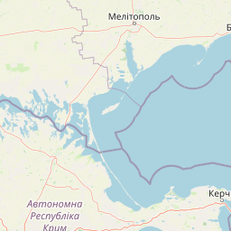
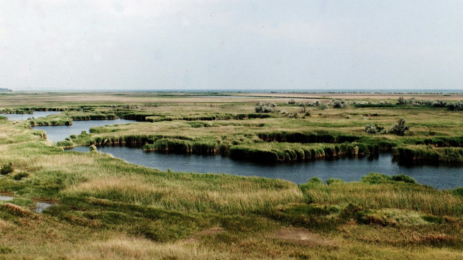
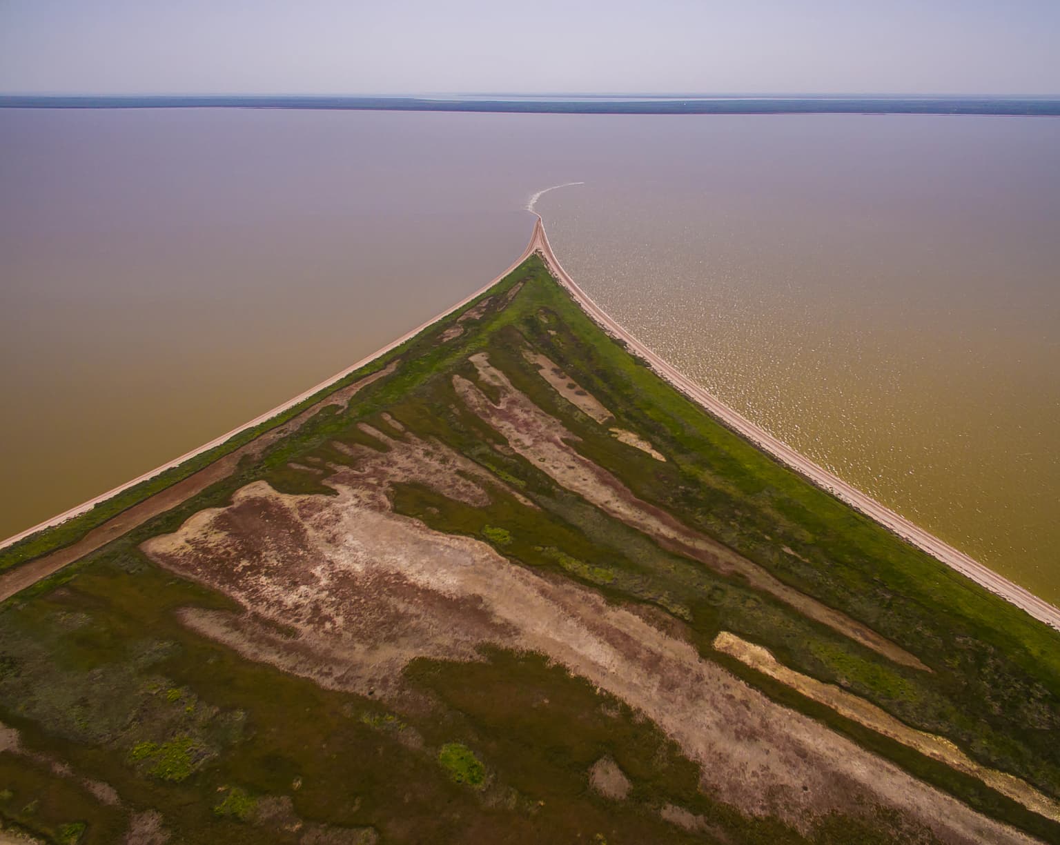
Pryazovia National Nature Park is best known for its exceptional wetland complexes that serve as major nesting and migratory staging grounds for waterfowl. The park protects the transitional ecosystems between the Pontic-Caspian steppe and the Azov Sea, creating unique habitats where steppe vegetation meets brackish estuarine environments. The Molochnyi Lyman and Berda River estuary are recognized as wetlands of international importance under the Ramsar Convention, supporting very large populations of nesting and migratory birds. The coastal landscape features distinctive spits, including the Fedotova Spit, which connects to Biryuchyi Island and forms part of a broader chain of coastal landforms along the Azov Sea.

Pryazovia National Nature Park history and protected-area timeline

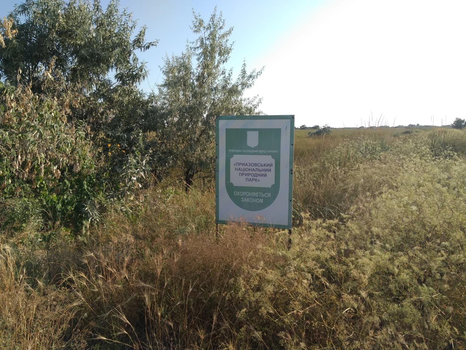
Pryazovia National Nature Park was established in 2010 as part of Ukraine's expanding network of protected areas. The creation of the park reflected growing recognition of the ecological significance of the Azov Sea coastal zone and the need to preserve the transition ecosystems between steppe and wetland habitats. The park was designated under Ukraine's protected areas legislation and is managed by the Ministry of Ecology and Natural Resources. Its establishment followed detailed scientific surveys documenting the area's biodiversity, particularly the importance of the Molochnyi Lyman and Berda River estuary as bird habitats. The park's classification as IUCN Category II reflects its status as a national park with the primary objectives of protecting ecological processes and native species while also allowing for compatible visitor use and environmental education.

Pryazovia National Nature Park landscape and geographic character

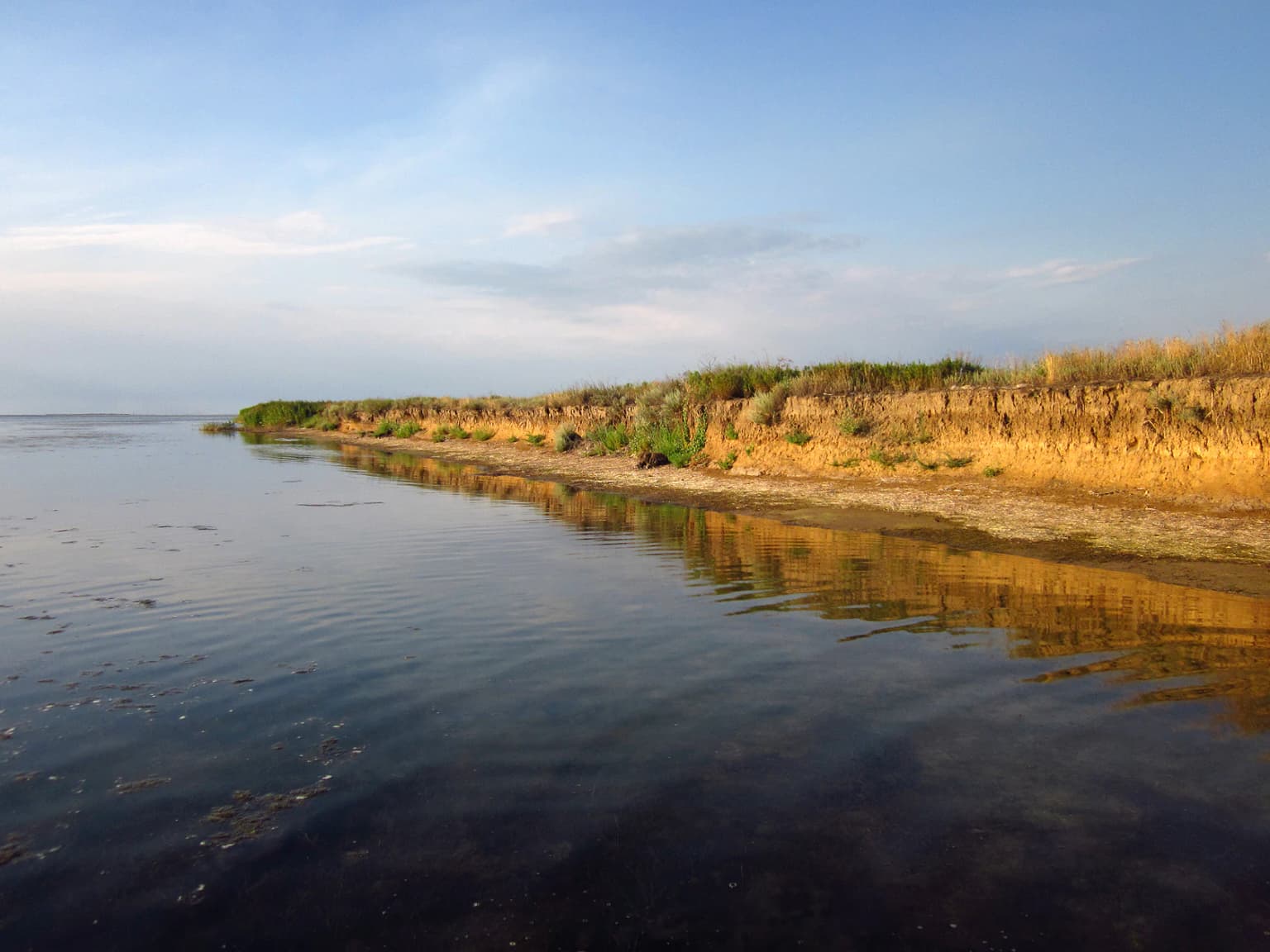
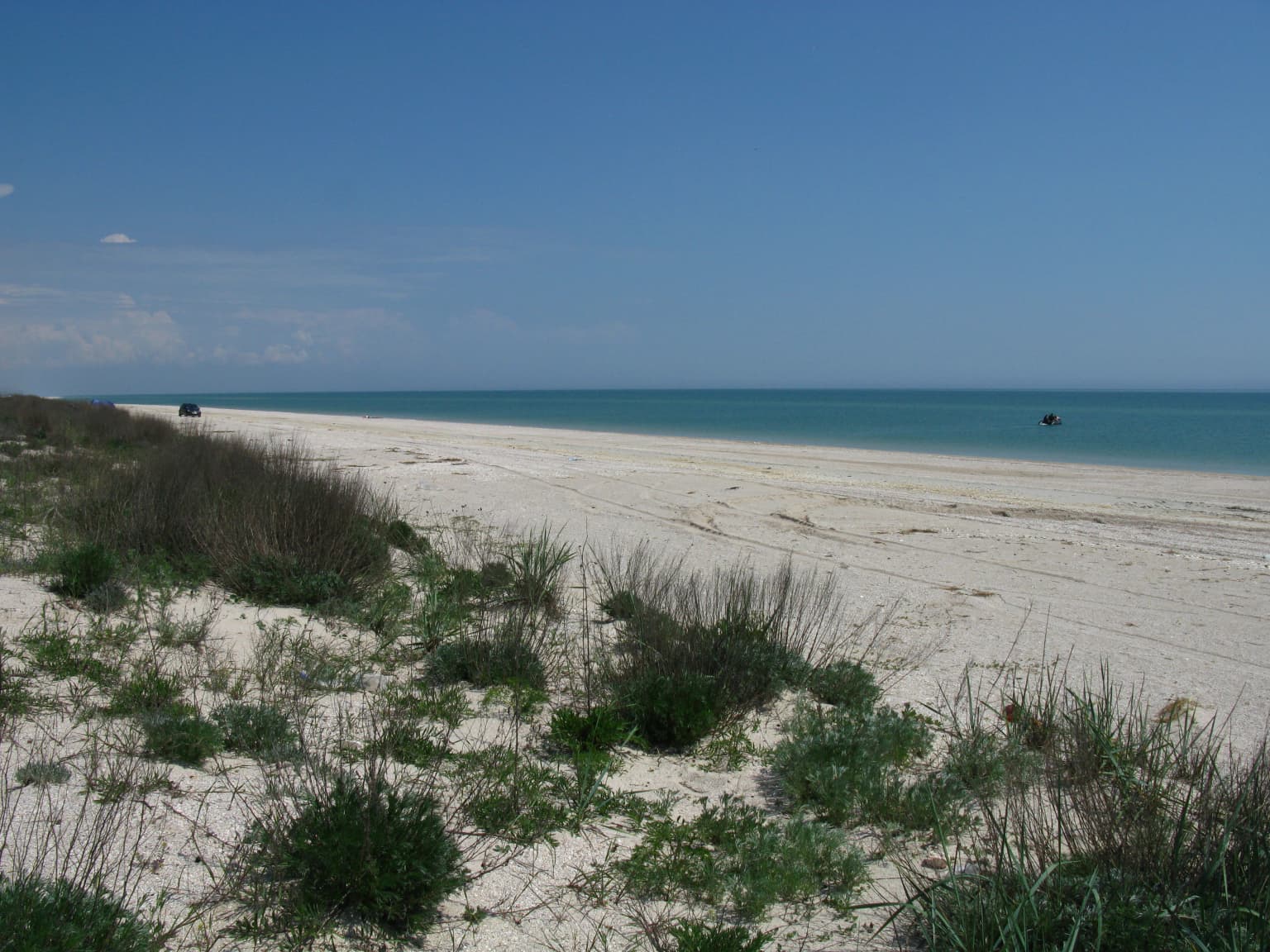
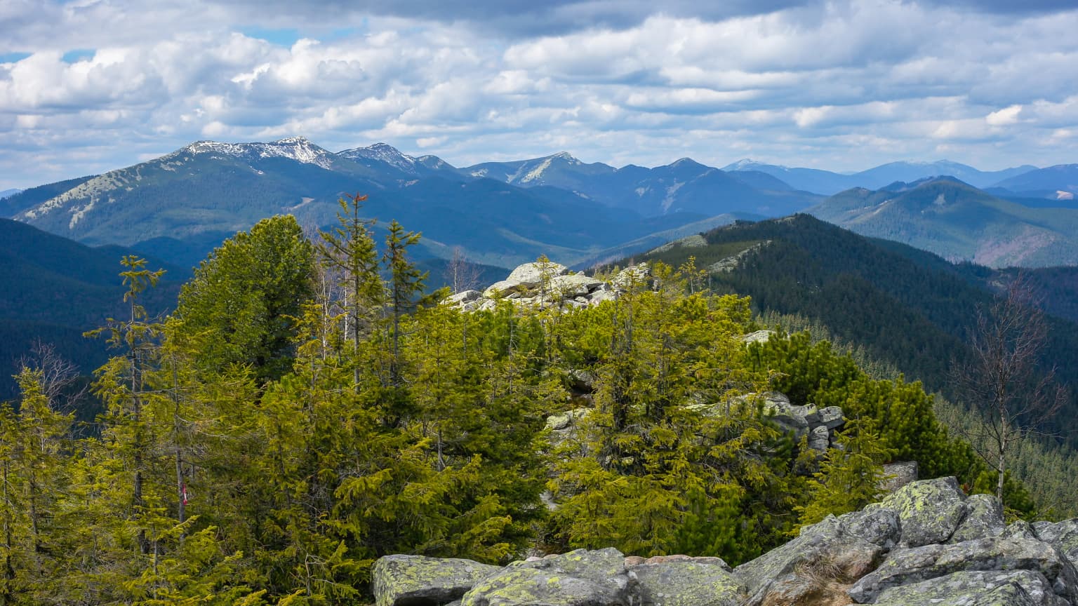
The physical landscape of Pryazovia National Nature Park is defined by its coastal position on the northwest shore of the Sea of Azov. The terrain is predominantly flat to gently rolling coastal plain, punctuated by the distinctive estuarine systems known as limans, which are partially enclosed lagoons where rivers meet the sea. The Molochnyi River, the largest watercourse flowing through the park, creates a broad delta that opens into the Molochnyi Lyman, a saline lagoon separated from the open sea by a narrow barrier. The park's topography includes extensive floodplain areas, sand spits such as the Fedotova Spit, peninsulas, and chains of sandy and shell-rich islands. The coastline features a mix of beach zones, dunes, and areas of saline marsh. Inland from the coast, the landscape transitions into the open steppe that characterizes much of the Pontic-Caspian region. The combination of flat terrain, rich soils, and proximity to water has historically made this region important for agriculture, though significant natural habitat remains within the park's boundaries.

Pryazovia National Nature Park ecosystems, habitats, and plant life

The ecological character of Pryazovia National Nature Park centers on the intersection of two major biomes: the Pontic-Caspian steppe and the wetland ecosystems of the Azov Sea coast. This creates a mosaic of habitats that supports both steppe-adapted species and water-dependent wildlife. The park's wetlands are among the most productive in the region, with the estuarine waters supporting diverse communities of fish, invertebrates, and waterfowl. The variable salinity of the limans creates unique conditions that support both freshwater and marine species. Steppe areas within the park preserve fragments of the once-vast grasslands that covered this region, though much of the original steppe outside protected areas has been converted to agricultural use. The climate classification as humid continental with hot summers (Köppen Dfa) supports a growing season that sustains both agricultural use and natural vegetation. Precipitation averages 300-400mm annually, with evaporation rates of 800-900mm creating semi-arid conditions in some areas that influence vegetation patterns.

Pryazovia National Nature Park wildlife and species highlights

Pryazovia National Nature Park supports exceptionally large populations of nesting and migratory waterfowl, making it one of the most important bird areas in Eastern Europe. The wetlands provide critical habitat for colonial nesting birds, including various species of ducks, geese, swans, and waders that use the area during their annual migrations between northern breeding grounds and southern wintering areas. The diverse habitats support both breeding populations and vast numbers of birds that pause to rest and feed during their journeys. The fish populations in the estuaries and limans support predatory birds and provide important ecological connections between aquatic and terrestrial food webs. While specific species lists vary seasonally, the park's international importance for waterbird conservation is well established, particularly for species that depend on coastal wetlands throughout their annual cycle.

Pryazovia National Nature Park conservation status and protection priorities

The park's conservation significance is underscored by the designation of two wetland complexes as Ramsar sites of international importance. The Molochnyi Lyman (Milky River Delta) and the Berda River Mouth together with the Berdianska Spit and Bay represent some of the most significant coastal wetlands in the Black Sea and Azov Sea region. These designations recognize the critical role these areas play in supporting biodiversity, particularly for migratory waterfowl. As a national park with IUCN Category II status, Pryazovia is managed to maintain ecological integrity while allowing for sustainable recreational use. The zoning system within the park allocates approximately 10% to strict protection, with additional areas designated for regulated use. The conservation framework also addresses the challenge of balancing human use with habitat preservation in a region where coastal development and agricultural expansion have historically put pressure on natural ecosystems.

Pryazovia National Nature Park cultural meaning and human context

The region surrounding Pryazovia National Nature Park has a long history of human settlement and use of the coastal environment. The area near Berdiansk and Melitopol has been important for agriculture, fishing, and more recently, tourism and recreation. The coastal zone has developed as a destination for beach holidays, with resort villages such as Kyrylivka providing visitor infrastructure. The region's reputation for mineral waters and therapeutic muds has attracted visitors seeking wellness benefits, contributing to a tradition of spa and recreational use that predates the park's establishment. Scientists associated with the park engage in educational programs for local communities and schools, helping to build awareness of the park's ecological values. The human landscape around the park includes both agricultural land and the traditional coastal settlements that have shaped the cultural identity of the Pryazovia region.

Top sights and standout views in Pryazovia National Nature Park

Pryazovia National Nature Park stands out as a premier destination for experiencing the unique ecosystems where the Pontic-Caspian steppe meets the Azov Sea. The park offers visitors the opportunity to explore extensive wetland complexes, observe large concentrations of migratory waterfowl, and traverse distinctive coastal landforms including spits, islands, and estuarine lagoons. The Fedotova Spit provides scenic beach access and connections to the broader chain of coastal islands. The park's position as the second-largest national park in Ukraine reflects both its ecological significance and the substantial area it encompasses. The presence of two Ramsar-designated wetlands demonstrates the international recognition of the park's importance for waterbird conservation and wetland ecosystem preservation.

Best time to visit Pryazovia National Nature Park

The optimal time to experience Pryazovia National Nature Park depends on the type of activities and observations visitors wish to pursue. The summer months bring warm water temperatures reaching 30°C in June, making this the peak season for beach recreation along the coast and spit areas. However, the park's true ecological significance becomes most apparent during the spring and autumn migration periods when vast numbers of waterfowl pass through the wetlands. Birdwatchers and nature enthusiasts may find the migration seasons particularly rewarding, as the estuaries serve as crucial staging areas where birds rest and feed during their journeys. The shoulder seasons of spring and autumn also offer pleasant temperatures for exploring the park's landscapes, though visitors should be aware that some facilities may have seasonal availability.

Park location guide

Geography guide, regional context, and park location map for Pryazovia National Nature Park

Pryazovia National Nature Park park geography, regions, and map view in Ukraine
Understand where Pryazovia National Nature Park sits in Ukraine through a broader geographic reading of the surrounding landscape, nearby location context, and its mapped position within the national park landscape.

How Pryazovia National Nature Park fits into Ukraine

Ukraine is a sovereign nation in Eastern Europe, bordered by Russia, Belarus, Poland, Slovakia, Hungary, Romania, Moldova, and the Black Sea. It is the second-largest country in Europe by area. Kyiv is the capital and largest city, followed by Kharkiv, Odesa, and Dnipro. The official language is Ukrainian. Ukraine has a population of approximately 32.9 million and operates as a unitary semi-presidential republic.

Wider geography shaping Pryazovia National Nature Park in Ukraine

Ukraine occupies 603,628 km² in Eastern Europe, making it the second-largest country in Europe. It shares borders with Russia, Belarus, Poland, Slovakia, Hungary, Romania, and Moldova. The country has a southern coastline along the Black Sea and Sea of Azov. The terrain includes plains, steppes, and the Carpathian Mountains in the west.

Map view of Pryazovia National Nature Park

Use this park location map to pinpoint Pryazovia National Nature Park in Ukraine, understand its exact geographic position, and read its mapped placement within the surrounding landscape more clearly.

Pigeon | © OpenStreetMap contributors

Location context for Pryazovia National Nature Park

Berdiansk RaionMelitopol RaionZaporizhzhia Oblast
Park atlas

Map regional protected landscapes, coastal wetlands, and steppe habitats surrounding Pryazovia National Nature Park.

Discover Other National Parks and Protected Areas Near Pryazovia National Nature Park
After exploring Pryazovia National Nature Park, discover other national parks and protected areas in its surrounding geographic region. Expand your atlas view to compare diverse coastal wetlands, steppe habitats, and significant conservation landscapes along the Azov Sea coastline.
Watercolor illustration of a landscape with rolling hills, a body of water, and greenery
National parkZaporizhzhia Oblast

Grand Meadow National Nature Park: National Park Protected Landscape and Regional Geography

Explore the mapped boundaries and natural terrain.

Grand Meadow National Nature Park represents a distinct protected landscape within Zaporizhzhia Oblast, Ukraine. As a national park, its designation signifies an area managed for conservation and geographic study. This entry on MoriAtlas details the park's physical presence, offering users the opportunity to explore its mapped terrain, understand its role in regional geography, and place it within the broader atlas of Ukrainian protected areas. It is ideal for users seeking concrete landscape context and precise geographic data.

Area
168 km²
Established
2006
IUCN
II
Relief
Lowland
National park

Azov, Syvash National Nature Park: National Park Protected Landscape and Geography

Explore mapped boundaries and regional landscape context.

Azov, Syvash National Nature Park stands as a notable protected area, offering a distinct geographic identity within Ukraine's atlas of natural landscapes. This national park's mapped boundaries provide a foundation for understanding its landscape context and regional significance. MoriAtlas enables detailed exploration of its protected terrain and its place within the country's conservation geography, serving as a gateway to structured geographic information and detailed park data for researchers and explorers.

Area
525.8 km²
Established
1993
IUCN
II
Relief
Lowland
Watercolor illustration of a landscape with grassy fields, trees, a river, and distant hills.
National parkKherson Oblast

Oleshky Sands National Nature Park: Mapping Ukraine's Distinctive Semi-Arid Dune Landscape

Explore protected sandy steppe, dunes, and conservation areas in Kherson Oblast.

Oleshky Sands National Nature Park is a critical protected landscape in Kherson Oblast, Ukraine, renowned for its unusual semi-arid terrain dominated by expansive sand dunes and sandy steppe. This page provides detailed geographic context for the park, highlighting its unique mapped boundaries, the contrast between its Radensk and Burkut zones, and its ecological importance as part of the Pontic-Caspian steppe. Understand the specific landscape features and regional geography that make this national park a significant natural asset within Ukraine's protected area network.

Area
80.2 km²
Established
2010
IUCN
II
Relief
Mixed relief
Watercolor illustration of rolling hills, a winding river, and patches of vegetation
National parkKherson Oblast

Dzharylhach National Nature Park: Protected Landscape Atlas & Regional Geography

Explore the mapped protected area in Kherson Oblast, Ukraine.

Delve into the geographic details and protected landscape characteristics of Dzharylhach National Nature Park. As a designated national park within Kherson Oblast, this entry provides vital information for understanding its mapped boundaries and its place in the regional geography. MoriAtlas enables a structured approach to discovering and contextualizing protected areas like Dzharylhach, offering a unique perspective for atlas exploration.

Area
100 km²
Established
2009
IUCN
II
Relief
Lowland
Watercolor painting of a coastal scene with green hills, trees, and a body of water
National parkDonetsk Oblast

Meotyda National Nature Park: Coastal Wetlands and Bird Migration Hub in Donetsk Oblast

Explore protected park boundaries and unique Azov Sea ecosystems.

Meotyda National Nature Park protects a critical stretch of the Sea of Azov coastline, featuring diverse habitats such as coastal wetlands, estuaries, and steppe. Located in Donetsk Oblast, this national park is internationally recognized for its importance to migratory birds, supporting millions of waterfowl and over 100 nesting bird species annually. MoriAtlas offers an in-depth view of its geographic setting, mapped protected area, and its role within regional ecological corridors, providing essential context for understanding this significant Ukrainian natural landscape.

Area
207.21 km²
Established
2009
IUCN
II
Relief
Lowland
National parkAutonomous Republic of Crimea

Charming Harbor National Nature Park: National Park Map and Protected Landscape Identity

Explore its mapped boundaries and regional geography.

Charming Harbor National Nature Park is a key protected area contributing to the natural landscape of the Autonomous Republic of Crimea. This page details its specific geographic scope and mapped boundaries, functioning as an atlas entry to understand its role within regional conservation efforts. Discover the park's distinct protected land context and its contribution to the mapped terrain of Ukraine.

Area
109 km²
Established
2009
IUCN
II
Relief
Lowland
Nature reserve

Crimean Nature Reserve: Nature Reserve with Mountain Forests and Karst Geography

Explore protected area landscapes and terrain.

The Crimean Nature Reserve is a key protected area within the Crimean Mountains, recognized for its significant mountain forests and unique karst landscapes. This nature reserve encompasses a critical span of the peninsula's rugged terrain, from high mountain ridges to dramatic southern slopes. Its designation as a protected area highlights its ecological importance and its role in preserving diverse natural habitats and geological features within a regional geographic context, making it a notable destination for landscape exploration.

Area
442 km²
Established
1991
IUCN
Ia
Relief
Mountain
National parkMykolaiv Oblast

Ivory Coast of Sviatoslav National Nature Park: National Park Identity and Regional Geography

Mapped protected area in Mykolaiv Oblast, Ukraine.

Gain a structured understanding of Ivory Coast of Sviatoslav National Nature Park, a designated national park in the Mykolaiv Oblast region of Ukraine. This entry focuses on its protected landscape identity and its position within the broader regional geography. Explore the mapped outlines and discover its significance as a key protected territory for atlas-based research and geographic context.

Area
352 km²
Established
2009
IUCN
II
Relief
Lowland

Common questions about visiting, size, designation, and location context for Pryazovia National Nature Park

Pryazovia National Nature Park FAQs for park facts, access, geography, and protected area context
Find quick answers about Pryazovia National Nature Park, including protected-area facts, park geography, trail and visitor context, and how the park fits into its surrounding country and regional landscape.
MoriAtlas Explorer

Continue Your Protected Areas Search Across the Global Atlas

Deepen your exploration by continuing the structured search for national parks and protected areas worldwide. Utilize the comprehensive filtering capabilities to compare different conservation landscapes and refine your understanding of global park geography. Discover more about the distribution and characteristics of protected natural areas.

Global natural geography