Mori Atlas logo
National parkAzov–Syvash National Nature Park

Discover the mapped boundaries and regional atlas position of this Ukrainian National Park.

Azov–Syvash National Nature Park: Protected Landscape Identity and Geographic Context

The Azov–Syvash National Nature Park represents a significant protected landscape within Ukraine, offering a unique entry point for geographic discovery. As a designated National Park, its protected boundaries define a specific natural area, contributing to the broader atlas of conservation lands. This page serves as the canonical resource for understanding the park's geographic setting, its landscape character, and its role within the regional context, facilitating exploration through mapped terrain and protected area data.

wetlandsmigratory birdscoastal ecosystemssteppe landscapeRamsar siteislands

Azov–Syvash National Nature Park

National park

Park overview

Structured park overview, official facts, and landscape profile for Azov, Syvash National Nature Park

Azov, Syvash National Nature Park park facts, protected area profile, and essential visitor context
Review the core facts for Azov, Syvash National Nature Park, including designation, size, terrain, visitor scale, habitats, and operating context in one park-focused overview.

About Azov, Syvash National Nature Park

Azov–Syvash National Nature Park represents one of Ukraine's most ecologically significant coastal protected areas, established in 1993 to preserve the unique coastal environment of the northwestern Sea of Azov. The park's territory encompasses a complex mosaic of marine, lagoon, island, and steppe habitats that together support extraordinary biodiversity despite the region's relatively harsh climatic conditions. The Syvash system, from which the park takes its name, is a series of elongated lagoon-like bays that stretch inland along the Ukrainian coast, with extremely shallow, highly saline waters that create a distinctive ecological character. Byriuchyi Island, the other major component of the park, is a sandy island connected to the mainland by the Fedotova Spit, supporting steppe vegetation communities that have been largely lost from the surrounding agricultural landscape. The park is administered by the State Management of Affairs and is organized into distinct management zones, including a strict protected area covering the Central Syvash wetlands, regulated recreation zones, and areas permitting more limited economic activity. The combination of international protection designations, including Ramsar wetland status and Important Bird and Biodiversity Area recognition, reflects the global significance of this coastal steppe and lagoon ecosystem.

Quick facts and research context for Azov, Syvash National Nature Park

The park is located in Henichesk Raion of Kherson Oblast, Ukraine, with Byriuchyi Island connected to the mainland by the narrow Fedotova Spit. It is divided into two main sectors: the Azov Site covering Byriuchyi Island and surrounding waters (about 7,700 hectares), and the larger Syvash Site encompassing the lagoon-like Syvash Bay and its islands (approximately 37,785 hectares). The climate is humid continental with hot summers (Dfa Köppen classification), featuring January averages of -3°C and July averages of 24°C, with annual precipitation among the lowest in Ukraine at around 260mm. The Central Syvash portion of the park holds Ramsar wetland designation of international importance and is recognized as an Important Bird and Biodiversity Area by Birdlife International.

Park context

Deeper park guide and search-rich context for Azov, Syvash National Nature Park

Azov, Syvash National Nature Park history, landscape, wildlife, and travel context
Explore Azov, Syvash National Nature Park through its history, landscape character, ecosystems, wildlife, conservation priorities, cultural context, and seasonal travel timing in a structured park guide built for atlas discovery and search intent.

Why Azov, Syvash National Nature Park stands out

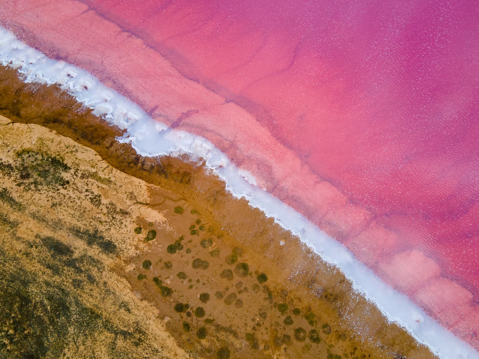
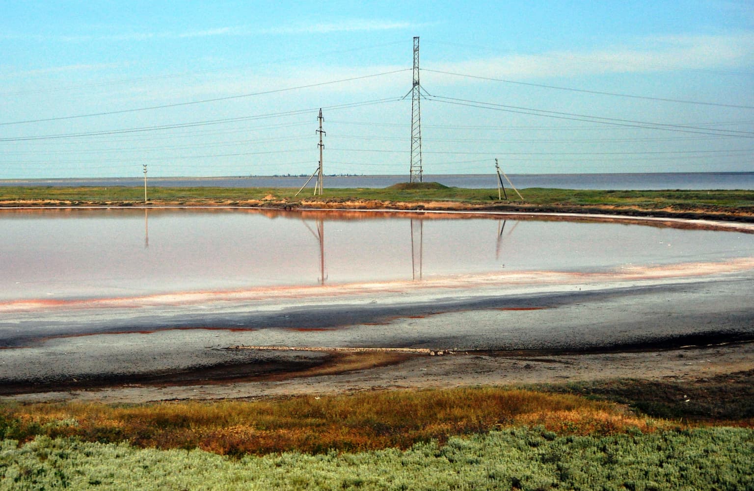
Azov, Syvash is best known as one of the most important migratory bird hotspots in Eastern Europe, with over a million birds passing through the park's wetlands each year. The park serves as a critical rest and feeding stop along the East Atlantic Flyway, supporting enormous concentrations of waterfowl, waders, terns, and swans during spring and autumn migrations. The Syvash lagoons, with their extremely high salinity and distinctive pink coloration caused by Dunaliella salina microalgae, create a unique aquatic environment unlike anywhere else in Ukraine. The park also protects some of the last remaining fragments of southern steppe habitat on coastal islands, with the Central Syvash islands of Churyuk and Kuyuk-Tuk preserving relatively undisturbed steppe phytocenoses. The presence of 30 Red Book bird species, including the white-tailed eagle, little bustard, and red-breasted goose, underscores the park's exceptional conservation value.

Azov, Syvash National Nature Park history and protected-area timeline

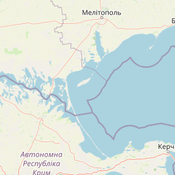
Azov–Syvash National Nature Park was established on February 25, 1993, with the primary purpose of protecting the unique coastal and wetland ecosystems of the northwestern Sea of Azov. The creation of the park came during a period of increased environmental awareness in newly independent Ukraine, when the government began systematically establishing protected areas to preserve the country's natural heritage. The park was designed to encompass both the Azov coastal areas around Byriuchyi Island and the extensive Syvash lagoon system, recognizing that these interconnected ecosystems required unified protection. Prior to formal protection, the region had been subject to various land use pressures, including drainage for agriculture and development of coastal infrastructure. The park's establishment also built upon earlier conservation traditions in the region, including the designation of the Syvash as a Ramsar wetland site. Since its creation, the park has served as a critical anchor for biodiversity conservation in southern Ukraine, providing protected habitat for migratory birds and maintaining ecological connections between the steppe and marine environments.

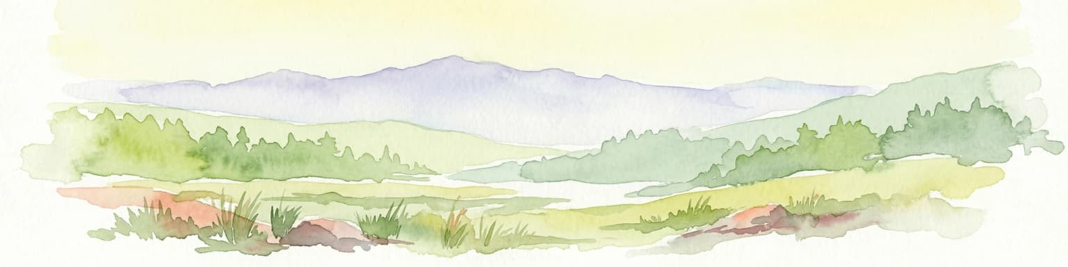
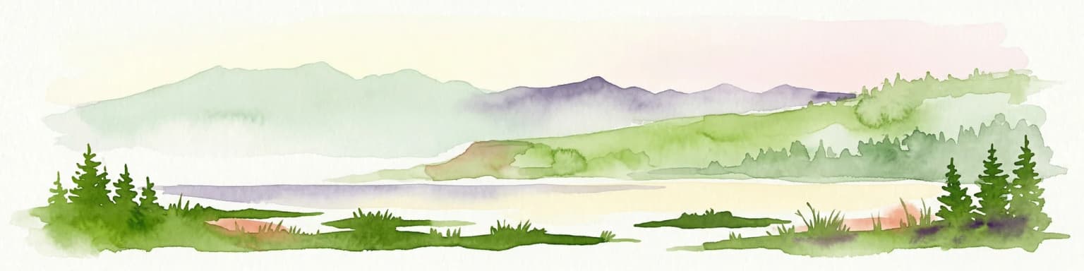
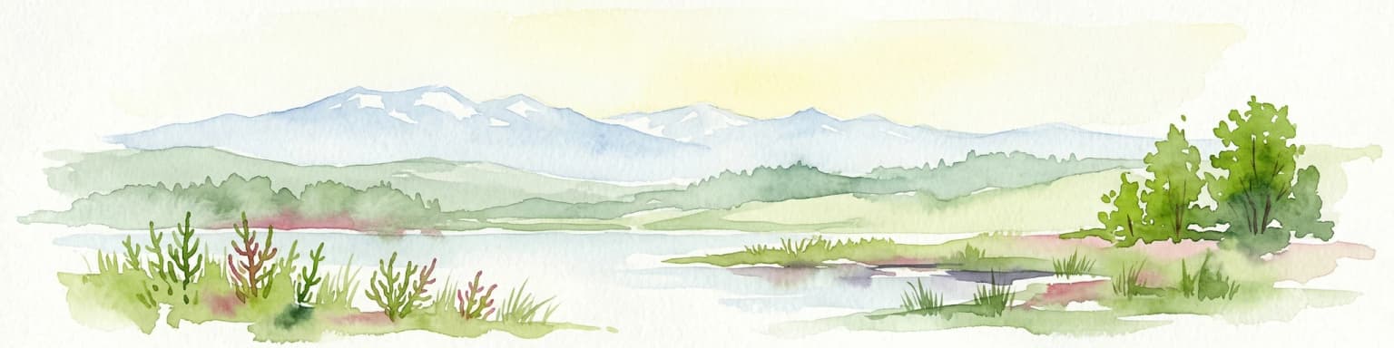
Azov, Syvash National Nature Park landscape and geographic character

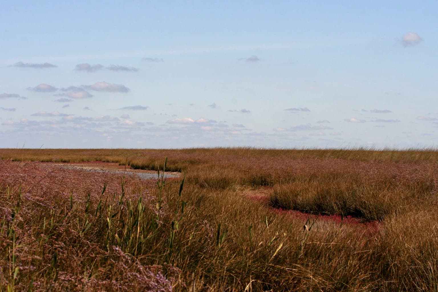
The park's landscape is defined by the interplay between the shallow Sea of Azov, the complex Syvash lagoon system, and remnant steppe terrain. The Syvash consists of a series of narrow, elongated lagoon-like inlets that extend far inland from the main sea, with extremely shallow depths and very high salinity levels that increase toward the interior of the lagoon system. The water of the Syvash can appear distinctly pink or reddish due to the presence of Dunaliella salina, a salt-tolerant microalga that thrives in these hypersaline conditions. Byriuchyi Island, the park's other major component, is a low-lying sand and shell island with terrain consisting mostly of sand-end-shell estuary plains. The island is connected to the mainland by the narrow Fedotova Spit, creating a peninsula-like extension into the Sea of Azov. Within the Syvash sector, numerous islands rise from the lagoon waters, and portions are lined with reed beds that create important wetland habitat. The overall terrain is flat and coastal in character, with minimal topographic relief but significant ecological variation between the wet lagoon environments and the drier steppe islands.

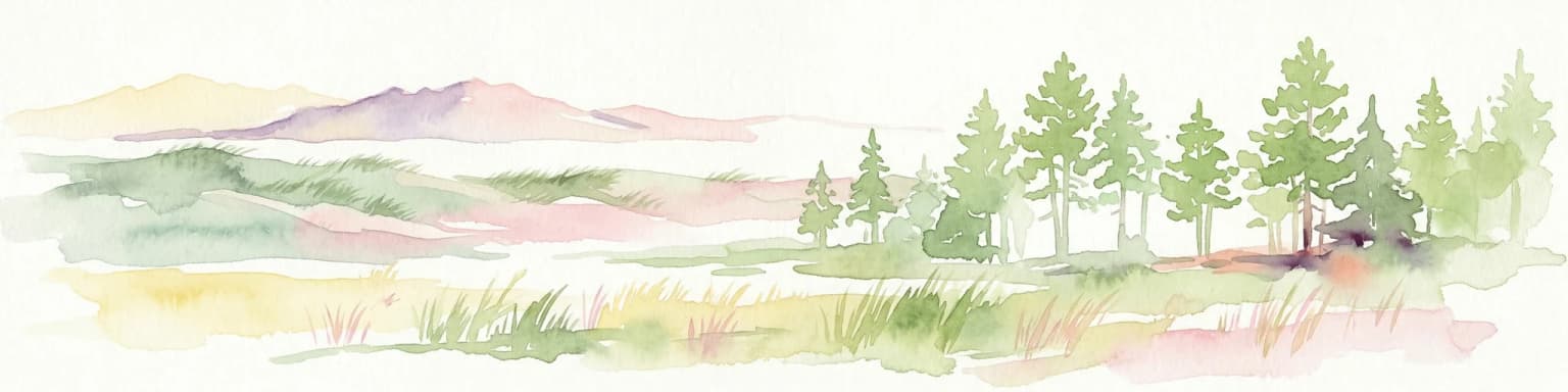
Azov, Syvash National Nature Park ecosystems, habitats, and plant life

The park's ecological character is shaped by the convergence of marine, lagoon, and steppe environments within the Pontic–Caspian steppe ecoregion. The Syvash sector features dry-steppe conditions with poor soils and brackish vegetation adapted to the high salinity. Reed thickets line portions of the Syvash, particularly along the Utlyutsky estuary, providing important habitat for nesting and refuge. The islands within the Central Syvash, particularly Churyuk and Kuyuk-Tuk, have remained relatively isolated from human impact and preserve true steppe phytocenoses representing more complete ecological communities than those found in more disturbed areas. These islands exhibit southern steppe habitats that have become increasingly rare across the region. The juxtaposition of hypersaline lagoon waters, coastal sand dunes, and intact steppe communities creates a complex ecological mosaic that supports diverse plant communities adapted to varying salinity, moisture, and exposure conditions.

Azov, Syvash National Nature Park wildlife and species highlights

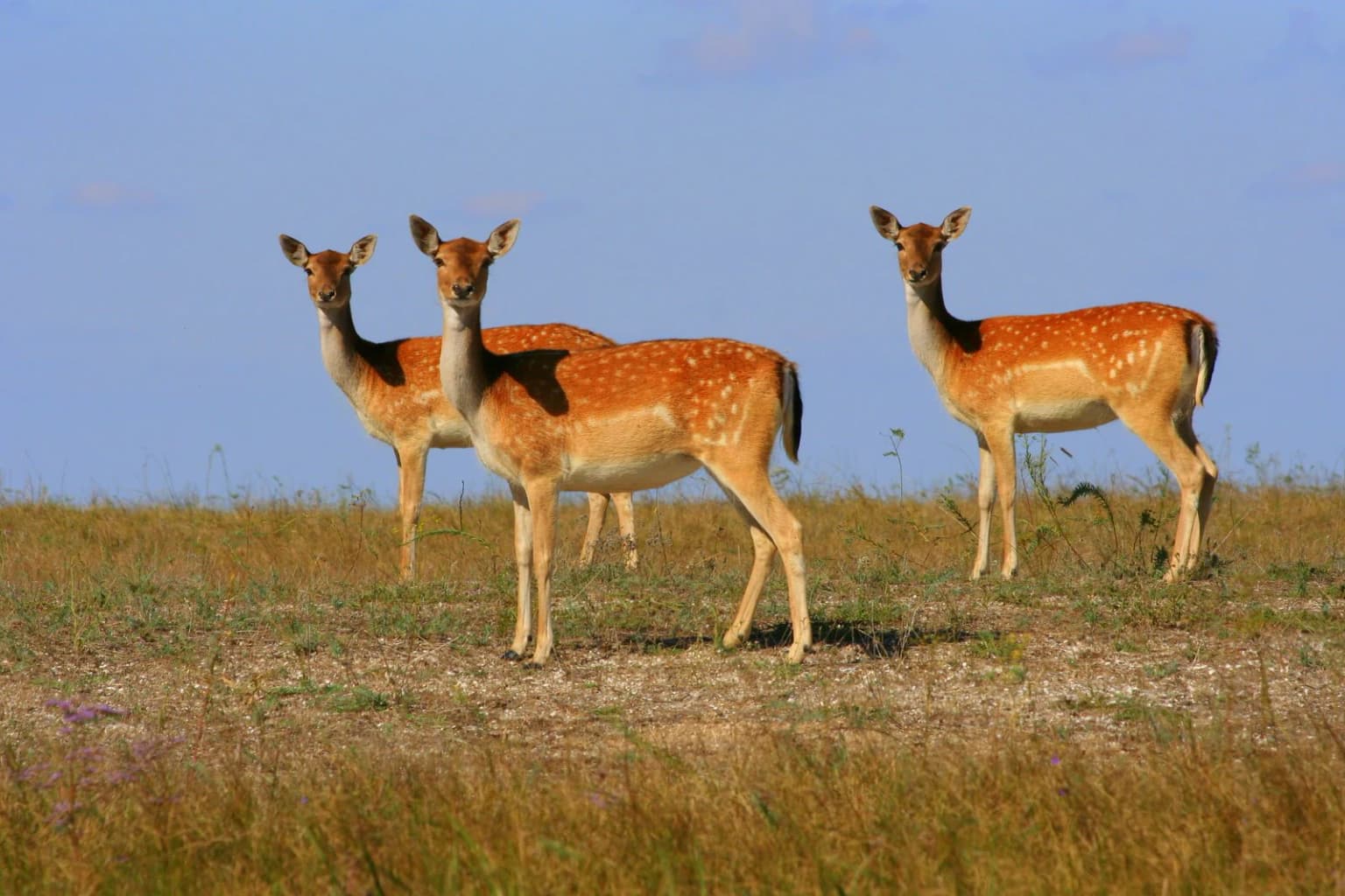
Azov–Syvash supports extraordinary wildlife populations, particularly as a migratory bird destination of international importance. More than one million birds pass through the park seasonally, including swallows, ducks, marsh terns, waders, mute swans, shelducks, and herons. The park records 197 bird species in total, with 30 species listed in the Red Book of Ukraine including kentish plover, black-winged stilt, eurasian oystercatcher, white-headed duck, Pallas's gull, and white-tailed eagle. The park holds significant populations of red-breasted goose and greylag goose, with more than 1% of these species' global populations overwintering in the area. The steppe areas surrounding the Syvash support great bustard, little bustard, Demoiselle crane, common crane, and various birds of prey including hen harrier, pallid harrier, golden eagle, greater spotted eagle, saker falcon, peregrine falcon, and lesser kestrel. The mammal populations include acclimatized species such as red deer, fallow deer, mouflon, and onager, alongside native species including grey hare and fox. Over 5,000 species of animals occur within the park, including 250 vertebrate species.

Azov, Syvash National Nature Park conservation status and protection priorities

Azov–Syvash holds multiple layers of international protection recognition that underscore its exceptional conservation significance. The Central Syvash is designated as a Ramsar wetland of international importance, providing formal recognition of its outstanding universal value as a wetland ecosystem. Birdlife International has listed the park as an Important Bird and Biodiversity Area, acknowledging its critical role for globally significant bird populations. The park protects 30 bird species listed in the Red Book of Ukraine, with the white-tailed eagle and little bustard also appearing on the European Red List. The presence of more than 1% of the global populations of red-breasted goose and greylag goose during winter meets international thresholds for significance. The park's zoning system includes a strict protected area covering 38,970 hectares in Central Syvash, ensuring that the most sensitive wetland areas receive the highest level of protection. Conservation challenges include managing the tension between protecting biodiversity and maintaining ecological balance with species that require population regulation due to epidemiological concerns.

Azov, Syvash National Nature Park cultural meaning and human context

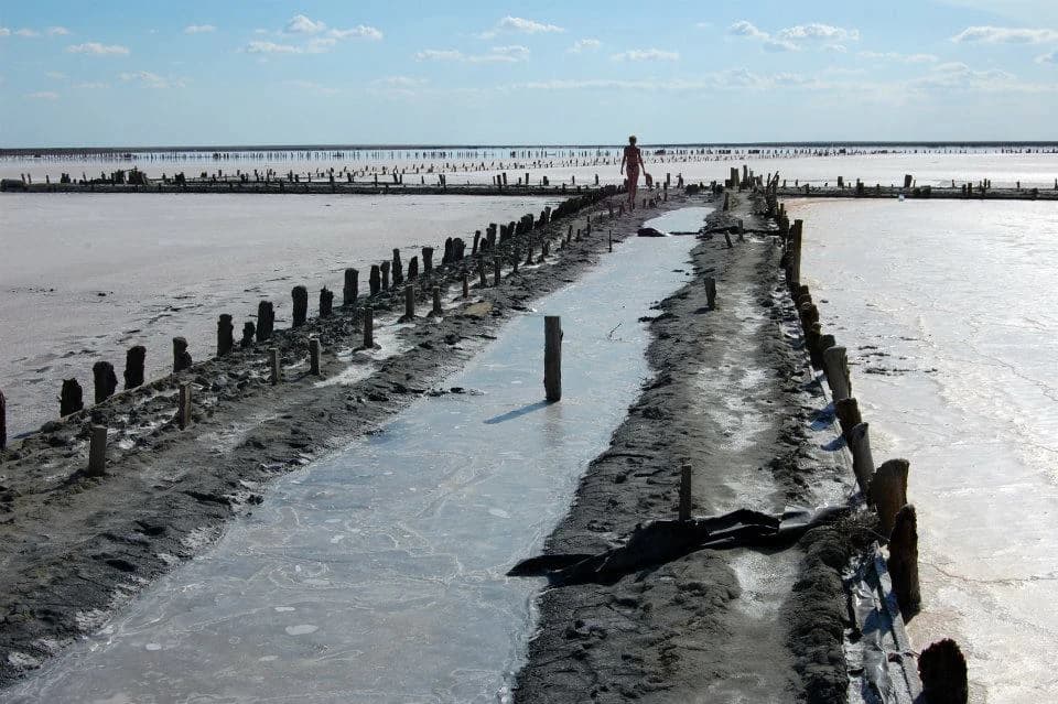
The Azov–Syvash region has a long history of human interaction with its coastal and steppe environments. The Syvash lagoon system has been integral to the local economy and culture, with fishing and salt production historically important activities in the region. The area lies within the broader Prysyvashshya steppe region, which has been historically used for extensive livestock grazing and agriculture. Henichesk, the nearest town to the park, has served as a regional center for the coastal area of Kherson Oblast. The park's establishment in 1993 reflected a new approach to conservation in independent Ukraine, seeking to balance traditional land uses with the need to protect outstanding natural areas. The cultural context also includes the region's strategic location near the Sea of Azov, which has influenced settlement patterns and economic activities throughout history.

Top sights and standout views in Azov, Syvash National Nature Park

The park's standout features include its role as one of Europe's premier migratory bird stopovers, with over one million birds passing through annually. The Syvash lagoons present a unique visual phenomenon, with hypersaline waters appearing pink due to Dunaliella salina algae. The park protects some of the last intact southern steppe habitats on coastal islands in the Central Syvash. The Central Syvash holds Ramsar designation as a wetland of international importance. The park records 197 bird species, including 30 Red Book species and populations of global significance for red-breasted goose and greylag goose. The combination of marine, lagoon, island, and steppe environments creates a biodiversity hotspot in a region with relatively low precipitation and harsh seasonal temperature extremes.

Best time to visit Azov, Syvash National Nature Park

The park offers distinct seasonal experiences tied to the rhythms of bird migration and climate. Spring and autumn migration periods bring the highest concentrations of birds, with hundreds of thousands of waterfowl and waders using the wetlands as staging areas. Spring migration typically peaks in March through May, while autumn migration occurs from August through November. The summer months offer warmer conditions for exploring the coastal landscapes, though temperatures can be high and the steppe vegetation becomes more subdued. Winter provides a different character, with the lagoons hosting significant overwintering populations of geese and swans, though conditions can be harsh with cold temperatures. The low annual precipitation (around 260mm) means that rainfall is rarely a significant factor for planning visits, though the dry continental climate means water availability in the landscape is limited throughout the year.

Park location guide

Geography guide, regional context, and park location map for Azov, Syvash National Nature Park

Azov, Syvash National Nature Park park geography, regions, and map view in Ukraine
Understand where Azov, Syvash National Nature Park sits in Ukraine through a broader geographic reading of the surrounding landscape, nearby location context, and its mapped position within the national park landscape.

How Azov, Syvash National Nature Park fits into Ukraine

Ukraine is a sovereign nation in Eastern Europe, bordered by Russia, Belarus, Poland, Slovakia, Hungary, Romania, Moldova, and the Black Sea. It is the second-largest country in Europe by area. Kyiv is the capital and largest city, followed by Kharkiv, Odesa, and Dnipro. The official language is Ukrainian. Ukraine has a population of approximately 32.9 million and operates as a unitary semi-presidential republic.

Wider geography shaping Azov, Syvash National Nature Park in Ukraine

Ukraine occupies 603,628 km² in Eastern Europe, making it the second-largest country in Europe. It shares borders with Russia, Belarus, Poland, Slovakia, Hungary, Romania, and Moldova. The country has a southern coastline along the Black Sea and Sea of Azov. The terrain includes plains, steppes, and the Carpathian Mountains in the west.

Map view of Azov, Syvash National Nature Park

Use this park location map to pinpoint Azov, Syvash National Nature Park in Ukraine, understand its exact geographic position, and read its mapped placement within the surrounding landscape more clearly.

Pigeon | © OpenStreetMap contributors

Location context for Azov, Syvash National Nature Park

Henichesk RaionKherson Oblast
Park atlas

Compare the unique wetlands and steppe landscapes surrounding this critical East Atlantic Flyway stopover.

Explore Nearby National Parks and Coastal Protected Areas: A Geographic Comparison to Azov–Syvash National Nature Park
Explore other national parks and protected areas located near Azov–Syvash National Nature Park, including comparable coastal ecosystems, steppe fragments, and vital migratory bird habitats. Compare these conservation landscapes to understand regional ecological patterns, protected-area distribution, and unique natural features beyond the Syvash lagoon system.
National parkZaporizhzhia Oblast

Pryazovia National Nature Park: National Park Protected Landscape Atlas

Explore the mapped boundaries and regional geography of Pryazovia National Nature Park.

Pryazovia National Nature Park represents a key protected area within Zaporizhzhia Oblast, Ukraine. This MoriAtlas entry provides detailed atlas-style information, emphasizing the park's mapped boundaries and its integration into the regional geography. Understand the park's character as a protected natural landscape situated in the southeastern Ukrainian coastal zone near the Sea of Azov, offering valuable context for geographic exploration.

Area
781 km²
Established
2010
IUCN
II
Relief
Lowland
Watercolor illustration of a landscape with rolling hills, a body of water, and greenery
National parkZaporizhzhia Oblast

Grand Meadow National Nature Park: National Park Protected Landscape and Regional Geography

Explore the mapped boundaries and natural terrain.

Grand Meadow National Nature Park represents a distinct protected landscape within Zaporizhzhia Oblast, Ukraine. As a national park, its designation signifies an area managed for conservation and geographic study. This entry on MoriAtlas details the park's physical presence, offering users the opportunity to explore its mapped terrain, understand its role in regional geography, and place it within the broader atlas of Ukrainian protected areas. It is ideal for users seeking concrete landscape context and precise geographic data.

Area
168 km²
Established
2006
IUCN
II
Relief
Lowland
Watercolor illustration of rolling hills, a winding river, and patches of vegetation
National parkKherson Oblast

Dzharylhach National Nature Park: Protected Landscape Atlas & Regional Geography

Explore the mapped protected area in Kherson Oblast, Ukraine.

Delve into the geographic details and protected landscape characteristics of Dzharylhach National Nature Park. As a designated national park within Kherson Oblast, this entry provides vital information for understanding its mapped boundaries and its place in the regional geography. MoriAtlas enables a structured approach to discovering and contextualizing protected areas like Dzharylhach, offering a unique perspective for atlas exploration.

Area
100 km²
Established
2009
IUCN
II
Relief
Lowland
Nature reserve

Crimean Nature Reserve: Nature Reserve with Mountain Forests and Karst Geography

Explore protected area landscapes and terrain.

The Crimean Nature Reserve is a key protected area within the Crimean Mountains, recognized for its significant mountain forests and unique karst landscapes. This nature reserve encompasses a critical span of the peninsula's rugged terrain, from high mountain ridges to dramatic southern slopes. Its designation as a protected area highlights its ecological importance and its role in preserving diverse natural habitats and geological features within a regional geographic context, making it a notable destination for landscape exploration.

Area
442 km²
Established
1991
IUCN
Ia
Relief
Mountain
Watercolor illustration of a landscape with grassy fields, trees, a river, and distant hills.
National parkKherson Oblast

Oleshky Sands National Nature Park: Mapping Ukraine's Distinctive Semi-Arid Dune Landscape

Explore protected sandy steppe, dunes, and conservation areas in Kherson Oblast.

Oleshky Sands National Nature Park is a critical protected landscape in Kherson Oblast, Ukraine, renowned for its unusual semi-arid terrain dominated by expansive sand dunes and sandy steppe. This page provides detailed geographic context for the park, highlighting its unique mapped boundaries, the contrast between its Radensk and Burkut zones, and its ecological importance as part of the Pontic-Caspian steppe. Understand the specific landscape features and regional geography that make this national park a significant natural asset within Ukraine's protected area network.

Area
80.2 km²
Established
2010
IUCN
II
Relief
Mixed relief
National parkAutonomous Republic of Crimea

Charming Harbor National Nature Park: National Park Map and Protected Landscape Identity

Explore its mapped boundaries and regional geography.

Charming Harbor National Nature Park is a key protected area contributing to the natural landscape of the Autonomous Republic of Crimea. This page details its specific geographic scope and mapped boundaries, functioning as an atlas entry to understand its role within regional conservation efforts. Discover the park's distinct protected land context and its contribution to the mapped terrain of Ukraine.

Area
109 km²
Established
2009
IUCN
II
Relief
Lowland
Watercolor painting of a coastal scene with green hills, trees, and a body of water
National parkDonetsk Oblast

Meotyda National Nature Park: Coastal Wetlands and Bird Migration Hub in Donetsk Oblast

Explore protected park boundaries and unique Azov Sea ecosystems.

Meotyda National Nature Park protects a critical stretch of the Sea of Azov coastline, featuring diverse habitats such as coastal wetlands, estuaries, and steppe. Located in Donetsk Oblast, this national park is internationally recognized for its importance to migratory birds, supporting millions of waterfowl and over 100 nesting bird species annually. MoriAtlas offers an in-depth view of its geographic setting, mapped protected area, and its role within regional ecological corridors, providing essential context for understanding this significant Ukrainian natural landscape.

Area
207.21 km²
Established
2009
IUCN
II
Relief
Lowland
National parkMykolaiv Oblast

Ivory Coast of Sviatoslav National Nature Park: National Park Identity and Regional Geography

Mapped protected area in Mykolaiv Oblast, Ukraine.

Gain a structured understanding of Ivory Coast of Sviatoslav National Nature Park, a designated national park in the Mykolaiv Oblast region of Ukraine. This entry focuses on its protected landscape identity and its position within the broader regional geography. Explore the mapped outlines and discover its significance as a key protected territory for atlas-based research and geographic context.

Area
352 km²
Established
2009
IUCN
II
Relief
Lowland

Common questions about visiting, size, designation, and location context for Azov, Syvash National Nature Park

Azov, Syvash National Nature Park FAQs for park facts, access, geography, and protected area context
Find quick answers about Azov, Syvash National Nature Park, including protected-area facts, park geography, trail and visitor context, and how the park fits into its surrounding country and regional landscape.
MoriAtlas Explorer

Continue Your Protected Areas Search Across the Global Atlas

Deepen your exploration by continuing the structured search for national parks and protected areas worldwide. Utilize the comprehensive filtering capabilities to compare different conservation landscapes and refine your understanding of global park geography. Discover more about the distribution and characteristics of protected natural areas.

Global natural geography