Mori Atlas logo
National parkIvory Coast of Sviatoslav National Nature Park

Discover the mapped boundaries and regional atlas of this unique national park.

Ivory Coast of Sviatoslav National Nature Park: Protected Landscape and Geographic Context in Mykolaiv Oblast

(National Nature Park Biloberezhzhia Sviatoslava)

Ivory Coast of Sviatoslav National Nature Park stands as a protected natural area within Ukraine's Mykolaiv Oblast. This page serves as a detailed atlas entry, providing insight into the park's designated boundaries, its role as a national park, and its geographical setting. Understand the landscape context and regional significance of this protected territory for enriched map-based exploration and discovery.

Coastal Protected AreaSteppe EcosystemsWetland ConservationBlack SeaRamsar SitePine-Oak Forest

Ivory Coast of Sviatoslav National Nature Park

National park

Park overview

Structured park overview, official facts, and landscape profile for Ivory Coast of Sviatoslav National Nature Park

Ivory Coast of Sviatoslav National Nature Park park facts, protected area profile, and essential visitor context
Review the core facts for Ivory Coast of Sviatoslav National Nature Park, including designation, size, terrain, visitor scale, habitats, and operating context in one park-focused overview.

About Ivory Coast of Sviatoslav National Nature Park

Ivory Coast of Sviatoslav National Nature Park occupies a strategically important position on Ukraine's Black Sea coast, protecting a complex landscape where the Dnieper and Southern Bug rivers meet the sea. Established in 2009, the park spans approximately 35,223 hectares across the Dnieper-Bug estuary, the Kinburn Peninsula, and Yahorlyk Bay. This protected area represents the farthest north extent of the western Black Sea region, situated about 150 kilometers west of the land bridge to the Crimean Peninsula. The park's location within the Black Sea Lowland places it at the interface between continental steppe ecosystems and marine coastal environments, creating a unique ecological transition zone. Adjacent to the Black Sea Biosphere Reserve, the park forms part of a larger coastal conservation network protecting the steppe ecology of southern Ukraine and its adjacent waters.

Quick facts and research context for Ivory Coast of Sviatoslav National Nature Park

The park covers 35,223 hectares along the Black Sea coast in Mykolaiv Oblast, established in 2009 under the management of Ukraine's Ministry of Ecology and Natural Resources. It occupies the Black Sea Lowland at the convergence of the Dnieper River and Southern Bug, protecting both terrestrial steppe environments and adjacent marine wetlands. Yahorlyk Bay within the park is designated as a Ramsar wetland site of international importance. The ecosystem transitions from freshwater estuary in the north to saltwater bay and open sea in the south, supporting a rich diversity of habitats including sandy steppe, pine-oak forests, meadows, and extensive marshlands.

Park context

Deeper park guide and search-rich context for Ivory Coast of Sviatoslav National Nature Park

Ivory Coast of Sviatoslav National Nature Park history, landscape, wildlife, and travel context
Explore Ivory Coast of Sviatoslav National Nature Park through its history, landscape character, ecosystems, wildlife, conservation priorities, cultural context, and seasonal travel timing in a structured park guide built for atlas discovery and search intent.

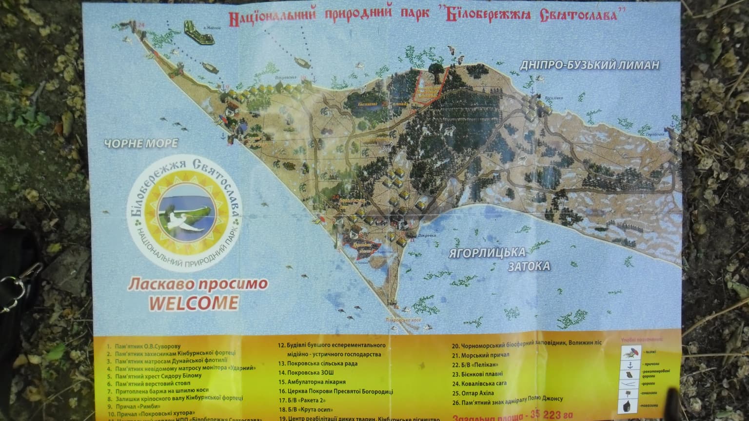
Why Ivory Coast of Sviatoslav National Nature Park stands out

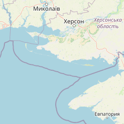
The park is best known for preserving the northernmost examples of Pontic-Caspian steppe ecology and protecting a critical coastal wetland complex at the mouth of the Dnieper River. The Kinburn Spit features distinctive pine-oak forest stands amid sandy steppe terrain, while Yahorlyk Bay serves as a Ramsar-designated wetland of international significance. The area provides crucial habitat for migratory bird species traveling along the Black Sea corridor and supports halophytic plant communities adapted to the mix of fresh and saltwater environments. The park represents one of Ukraine's most important coastal steppe and wetland conservation areas.

Ivory Coast of Sviatoslav National Nature Park history and protected-area timeline

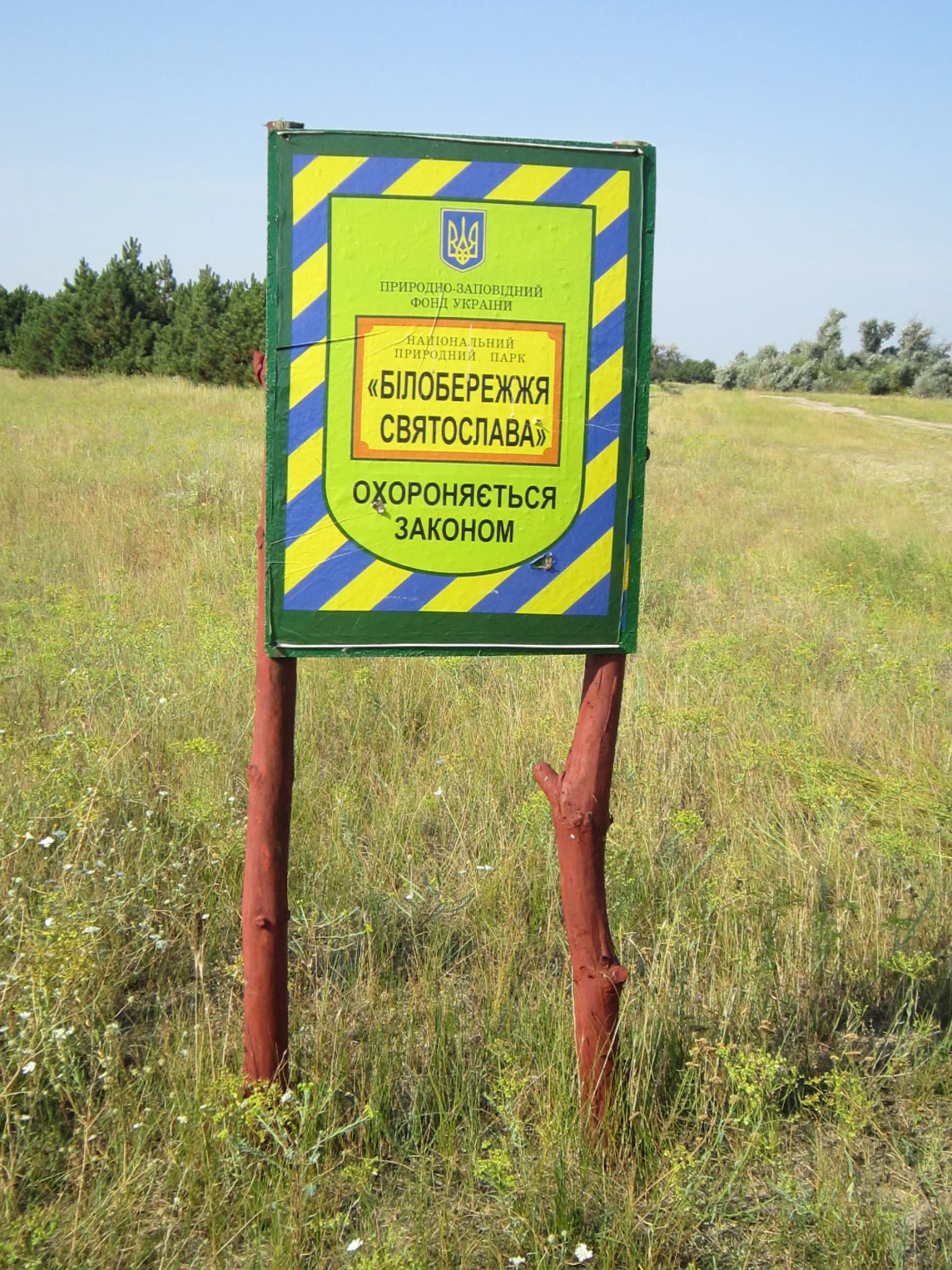
The Ivory Coast of Sviatoslav National Nature Park was established in 2009 as part of Ukraine's expanding network of protected areas. The park was created to preserve the distinctive steppe and wetland ecosystems of the Black Sea coast in Mykolaiv Oblast, an area that had long been recognized for its ecological significance but lacked formal national protection. The establishment reflected growing Ukrainian conservation priorities in the post-Soviet period, particularly regarding coastal and wetland habitats. The park is governed by the Ministry of Ecology and Natural Resources of Ukraine and operates from the administrative center at belosvyat.com.ua. Management of the protected areas continues to be refined, with ongoing efforts to strengthen control and enforcement within park boundaries.

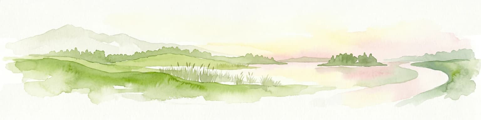
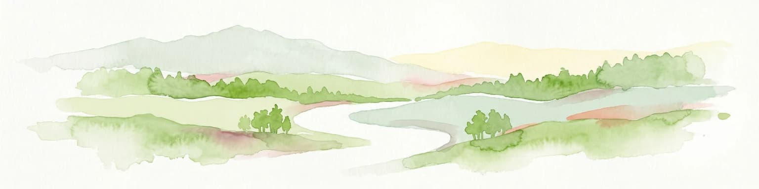
Ivory Coast of Sviatoslav National Nature Park landscape and geographic character

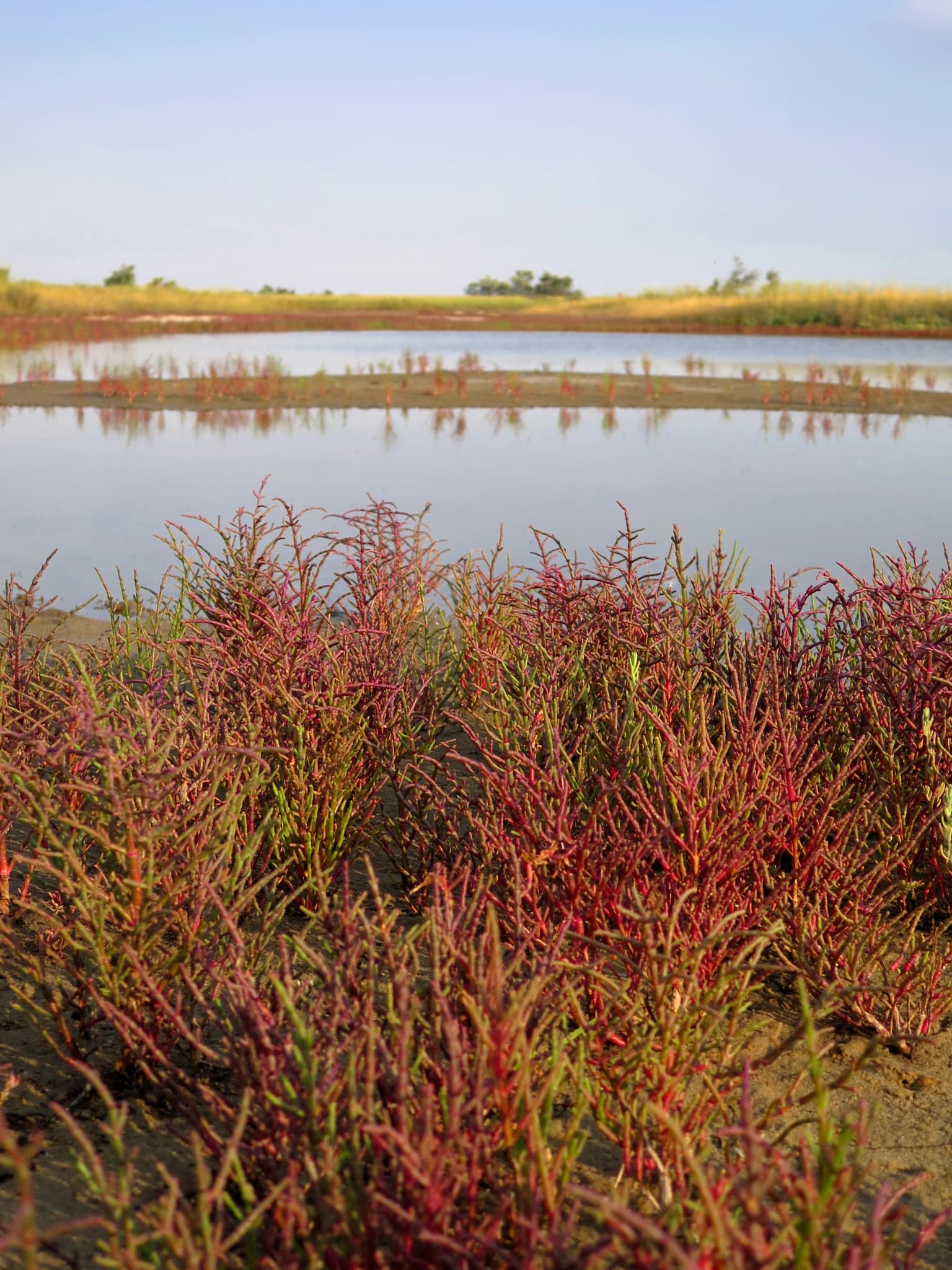
The park's landscape encompasses a diverse array of physical features across its coastal and wetland settings. The terrain lies within the Black Sea Lowland, a relatively flat region that marks the northern extent of the western Black Sea basin. The Kinburn Peninsula extends southward as a sandy spit dividing the Dnieper-Bug estuary from Yahorlyk Bay and the open Black Sea. The park contains numerous lakes that occur in two varieties: freshwater lakes fed by rainfall and saltwater lakes formed through seepage from the sea. The northern sections around the estuary feature freshwater environments, while the southern bay and coastal areas are saltwater. The landscape transitions from representative steppe and forest-steppe habitats in the north to a patchwork of dry steppe, wetlands, and coastal salt water habitats in the south.

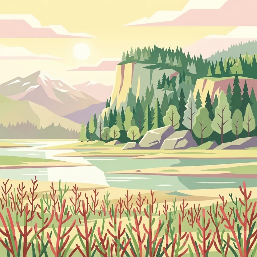
Ivory Coast of Sviatoslav National Nature Park ecosystems, habitats, and plant life

The park protects representative examples of the Pontic-Caspian steppe ecoregion, one of Europe's most historically significant grassland ecosystems. The dominant vegetation on the Kinburn Spit consists of sandy steppe communities, interspersed with forest, meadow, hygrophytic, and halophytic plant groups. Stands of pine-oak forest occur amid the grassy steppe areas, creating a distinctive woodland-grassland mosaic. Marshes and wetland areas are particularly concentrated around Yahorlyk Bay, which has been designated as a Ramsar wetland site recognizing its international significance for waterbird habitat. The combination of fresh and saltwater environments supports specialized plant communities adapted to varying salinity levels, while the steppe zones preserve native grassland species that have been heavily modified across most of their historic range in Europe.

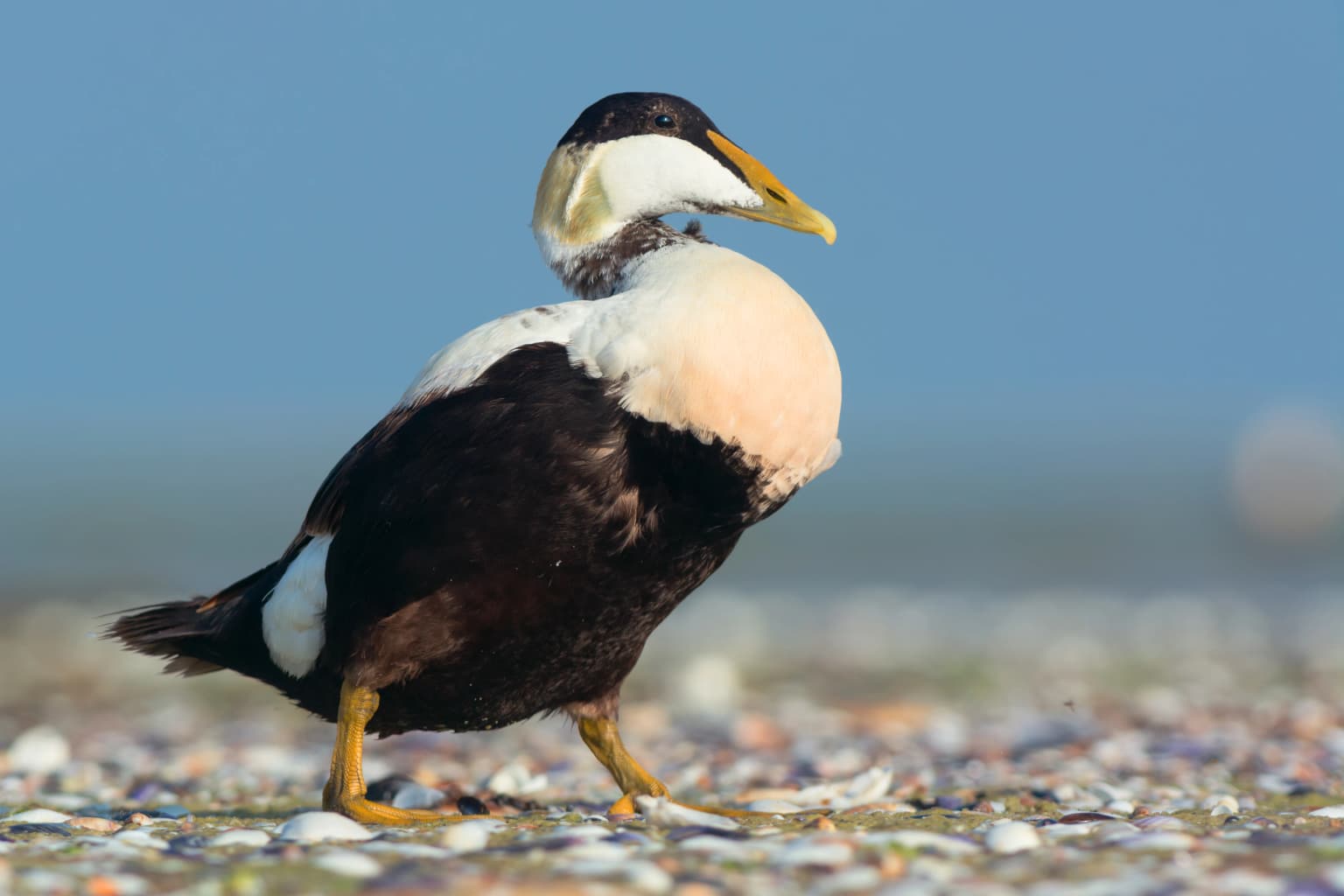
Ivory Coast of Sviatoslav National Nature Park wildlife and species highlights

The park's location along the Black Sea coast and within a major river delta makes it an important area for wildlife, particularly migratory bird species. The wetland habitats around Yahorlyk Bay and the Dnieper-Bug estuary provide critical staging and breeding areas for waterbirds moving along the Black Sea migration corridor. The diverse habitat mosaic, combining steppe, forest, marsh, and coastal environments, supports a variety of faunal communities. The area has historically faced challenges from illegal poaching and fishing, reflecting the ecological value of its wildlife populations. The park's protected status helps preserve these wildlife communities and the ecological relationships between the steppe terrestrial systems and the coastal wetland environments.

Ivory Coast of Sviatoslav National Nature Park conservation status and protection priorities

The park holds IUCN Category II designation as a national park, reflecting its primary goal of protecting natural ecosystems while allowing for sustainable public use. The protection of the Kinburn Peninsula and Yahorlyk Bay preserves what remains of the Pontic-Caspian steppe in this region, a habitat type that has been extensively converted for agriculture across its historic range. Yahorlyk Bay's Ramsar designation underscores the international recognition of its wetland conservation value. The park operates in conjunction with the adjacent Black Sea Biosphere Reserve, creating a coordinated coastal conservation network. Ongoing conservation challenges include improving management control and addressing illegal poaching and fishing activities that have historically impacted the area.

Ivory Coast of Sviatoslav National Nature Park cultural meaning and human context

The park is situated in Mykolaiv Oblast near Ochakiv, a historic city on the Black Sea coast with maritime heritage. The region has long been characterized by human settlement and interaction with the coastal environment, though the park's protected status now limits development within its boundaries. The Ukrainian name Biloberezhzhia Sviatoslava translates to Ivory Coast of Sviatoslav, reflecting local naming conventions and cultural context. The area's position at the mouth of major river systems and along the Black Sea coast has historically made it an important zone for fishing, maritime activity, and coastal livelihoods.

Top sights and standout views in Ivory Coast of Sviatoslav National Nature Park

The park's defining features include its preservation of the northernmost Pontic-Caspian steppe ecosystems, the distinctive pine-oak forests of the Kinburn Peninsula, and the Ramsar-designated wetlands of Yahorlyk Bay. The transition from freshwater estuary to saltwater bay creates a unique ecological gradient supporting diverse habitats. The coastal location at the edge of the Black Sea Lowland provides dramatic landscape character combining steppe plains with coastal spits and wetland lagoons. The park remains relatively undeveloped, offering opportunities for ecological tourism and nature observation in a wild coastal setting.

Best time to visit Ivory Coast of Sviatoslav National Nature Park

The park can be visited throughout the year, with each season offering different experiences of the steppe and wetland environments. Summer brings the characteristic hot continental climate with temperatures exceeding 22°C, making the wetland areas particularly important for wildlife observation as water bodies provide essential habitat during the warm season. The transition seasons of spring and autumn offer more moderate temperatures and are typically excellent for birdwatching, coinciding with migratory movements along the Black Sea corridor. Visitors should note that the park remains relatively undeveloped, with campers and hikers on ecological routes advised to bring their own food and water supplies.

Park location guide

Geography guide, regional context, and park location map for Ivory Coast of Sviatoslav National Nature Park

Ivory Coast of Sviatoslav National Nature Park park geography, regions, and map view in Ukraine
Understand where Ivory Coast of Sviatoslav National Nature Park sits in Ukraine through a broader geographic reading of the surrounding landscape, nearby location context, and its mapped position within the national park landscape.

How Ivory Coast of Sviatoslav National Nature Park fits into Ukraine

Ukraine is a sovereign nation in Eastern Europe, bordered by Russia, Belarus, Poland, Slovakia, Hungary, Romania, Moldova, and the Black Sea. It is the second-largest country in Europe by area. Kyiv is the capital and largest city, followed by Kharkiv, Odesa, and Dnipro. The official language is Ukrainian. Ukraine has a population of approximately 32.9 million and operates as a unitary semi-presidential republic.

Wider geography shaping Ivory Coast of Sviatoslav National Nature Park in Ukraine

Ukraine occupies 603,628 km² in Eastern Europe, making it the second-largest country in Europe. It shares borders with Russia, Belarus, Poland, Slovakia, Hungary, Romania, and Moldova. The country has a southern coastline along the Black Sea and Sea of Azov. The terrain includes plains, steppes, and the Carpathian Mountains in the west.

Map view of Ivory Coast of Sviatoslav National Nature Park

Use this park location map to pinpoint Ivory Coast of Sviatoslav National Nature Park in Ukraine, understand its exact geographic position, and read its mapped placement within the surrounding landscape more clearly.

Pigeon | © OpenStreetMap contributors

Location context for Ivory Coast of Sviatoslav National Nature Park

Mykolaiv Oblast
Park atlas

Compare connected protected areas and diverse regional landscapes across Ukraine's Mykolaiv Oblast.

Explore Other National Parks and Protected Areas Near Ivory Coast of Sviatoslav National Nature Park, Ukraine
After exploring Ivory Coast of Sviatoslav National Nature Park, browse a curated selection of national parks and protected areas across Mykolaiv Oblast and Ukraine's southern Black Sea coast. Comparing these diverse conservation landscapes provides valuable geographic context, revealing regional ecological patterns and the broader network of protected natural sites.
Watercolor illustration of a landscape with grassy fields, trees, a river, and distant hills.
National parkKherson Oblast

Oleshky Sands National Nature Park: Mapping Ukraine's Distinctive Semi-Arid Dune Landscape

Explore protected sandy steppe, dunes, and conservation areas in Kherson Oblast.

Oleshky Sands National Nature Park is a critical protected landscape in Kherson Oblast, Ukraine, renowned for its unusual semi-arid terrain dominated by expansive sand dunes and sandy steppe. This page provides detailed geographic context for the park, highlighting its unique mapped boundaries, the contrast between its Radensk and Burkut zones, and its ecological importance as part of the Pontic-Caspian steppe. Understand the specific landscape features and regional geography that make this national park a significant natural asset within Ukraine's protected area network.

Area
80.2 km²
Established
2010
IUCN
II
Relief
Mixed relief
Watercolor illustration of a landscape with hills, a river, and green vegetation
National parkOdesa Oblast

Lower Dniester National Nature Park: National Park Map and Protected Landscape Atlas

Explore Odesa Oblast's protected natural geography and park boundaries.

The Lower Dniester National Nature Park is a vital component of Ukraine's protected lands, situated within the expansive Odesa Oblast. This page offers detailed geographic context, focusing on the park's mapped boundaries and its contribution to the regional landscape. Dive into an atlas-style exploration that highlights the park's protected terrain and its significance within the natural geography of southwestern Ukraine, offering structured discovery beyond basic park facts.

Area
213 km²
Established
2008
IUCN
II
Relief
Lowland
Watercolor illustration of rolling hills, a winding river, and patches of vegetation
National parkKherson Oblast

Dzharylhach National Nature Park: Protected Landscape Atlas & Regional Geography

Explore the mapped protected area in Kherson Oblast, Ukraine.

Delve into the geographic details and protected landscape characteristics of Dzharylhach National Nature Park. As a designated national park within Kherson Oblast, this entry provides vital information for understanding its mapped boundaries and its place in the regional geography. MoriAtlas enables a structured approach to discovering and contextualizing protected areas like Dzharylhach, offering a unique perspective for atlas exploration.

Area
100 km²
Established
2009
IUCN
II
Relief
Lowland
National parkAutonomous Republic of Crimea

Charming Harbor National Nature Park: National Park Map and Protected Landscape Identity

Explore its mapped boundaries and regional geography.

Charming Harbor National Nature Park is a key protected area contributing to the natural landscape of the Autonomous Republic of Crimea. This page details its specific geographic scope and mapped boundaries, functioning as an atlas entry to understand its role within regional conservation efforts. Discover the park's distinct protected land context and its contribution to the mapped terrain of Ukraine.

Area
109 km²
Established
2009
IUCN
II
Relief
Lowland
National parkBilhorod-Dnistrovskyi Raion

Tuzly Lagoons National Nature Park: National Park Atlas and Geographic Context

Mapped protected landscape within Bilhorod-Dnistrovskyi Raion, Ukraine.

Navigate the protected landscape of Tuzly Lagoons National Nature Park through a detailed geographic lens. This national park entry within MoriAtlas provides structured information on its mapped boundaries and regional context within Bilhorod-Dnistrovskyi Raion, part of Ukraine's Bessarabia region. Understand its position and significance as a protected natural area, facilitating a deeper exploration of its geographical attributes and its place in the broader atlas of Ukrainian protected lands.

Area
278.65 km²
Established
2010
IUCN
II
Relief
Lowland
National parkMykolaiv Oblast

Bug Gard National Nature Park: Mapped Protected Landscape in Mykolaiv Oblast

Explore National Park Geography and Boundaries

Delve into Bug Gard National Nature Park, a designated national park situated in Mykolaiv Oblast, Ukraine. This detailed view highlights the park's protected landscape, offering insights into its geographic distribution and mapped boundaries. Understand its place within the regional terrain and access structured information for atlas-based exploration of this significant natural area.

Area
61.38 km²
Established
2009
IUCN
II
Relief
Mixed relief
Protected area

Danube Delta Protected Area: Mapping Europe's Largest River Delta Geography and Wetland Landscape

Explore the mapped protected area, its unique terrain, and regional landscape context.

The Danube Delta, a protected area in Romania, presents a remarkable geography defined by its extensive wetland terrain, intricate waterways, and significant biodiversity. As Europe's largest and best-preserved river delta, it offers a unique landscape for atlas-based exploration, focusing on its mapped boundaries, regional geographic context, and its role as a critical ecological zone where the Danube River merges with the Black Sea. Understand the delta's horizontal expanse, its network of channels, and its evolving landforms within a protected landscape of global importance.

Area
4,152 km²
Established
1998
Relief
Lowland
Climate
Temperate
Watercolor illustration of a winding river through a landscape with hills and trees
National parkOrhei District

Orhei National Park: Explore Moldova's Inaugural National Park Landscape

Mapped protected boundaries and regional geography in Orhei District.

As Moldova's first national park, Orhei National Park offers a rich exploration of the Codri region's characteristic hilly terrain and extensive deciduous forests. Situated within Orhei District, this protected area encompasses the meandering Răut River valley and notable landscape reserves. Its designation highlights a crucial commitment to preserving both the natural beauty and the significant cultural heritage, including the UNESCO candidate site of Old Orhei, making it a key destination for understanding Moldova's protected lands and regional geography.

Area
337.92 km²
Established
2013
IUCN
II
Relief
Highland

Common questions about visiting, size, designation, and location context for Ivory Coast of Sviatoslav National Nature Park

Ivory Coast of Sviatoslav National Nature Park FAQs for park facts, access, geography, and protected area context
Find quick answers about Ivory Coast of Sviatoslav National Nature Park, including protected-area facts, park geography, trail and visitor context, and how the park fits into its surrounding country and regional landscape.
MoriAtlas Explorer

Continue Your Protected Areas Search Across the Global Atlas

Deepen your exploration by continuing the structured search for national parks and protected areas worldwide. Utilize the comprehensive filtering capabilities to compare different conservation landscapes and refine your understanding of global park geography. Discover more about the distribution and characteristics of protected natural areas.

Global natural geography