Mori Atlas logo
National parkCharming Harbor National Nature Park

Discover the mapped boundaries and regional landscape of this protected area.

Charming Harbor National Nature Park: National Park Geographic Atlas and Map Context

(National Nature Park "Charming Harbor")

Charming Harbor National Nature Park represents a significant protected natural landscape within the Autonomous Republic of Crimea. As a designated national park, its geographic identity is defined by mapped boundaries that delineate its protected status. This page offers an atlas-driven exploration of the park, highlighting its place within the regional geography and providing essential context for understanding its natural terrain and conservation landscape.

Coastal Protected AreaSteppe EcosystemsBlack SeaCliff LandscapesNature ParksCrimea

Charming Harbor National Nature Park

National park

Park overview

Structured park overview, official facts, and landscape profile for Charming Harbor National Nature Park

Charming Harbor National Nature Park park facts, protected area profile, and essential visitor context
Review the core facts for Charming Harbor National Nature Park, including designation, size, terrain, visitor scale, habitats, and operating context in one park-focused overview.

About Charming Harbor National Nature Park

Charming Harbor National Nature Park occupies a unique position in Crimea as the western coastal guardian of the Tarkhankut Peninsula, where the peninsula's elevated steppe terrain meets the Black Sea in a landscape of striking visual contrast. The park's creation in 2009 reflected Ukraine's commitment to preserving the peninsula's natural heritage, establishing protection for an area that represents one of the few remaining intact coastal steppe environments in the region. The park is organized into four management zones: a strict protected area, a regulated recreation zone, a local recreation area, and an economic zone, reflecting the balance between conservation and sustainable visitor use that defines modern protected area management. The dramatic topography, where steppe grasslands literally drop away to meet the sea, creates ecological gradients that support species adapted to both upland and maritime conditions. This transitional environment, combined with the semi-arid climate, has produced a vegetation community of considerable scientific and conservation interest.

Quick facts and research context for Charming Harbor National Nature Park

Located in the Chornomorske Raion of Crimea on the Black Sea coast, Charming Harbor National Nature Park protects the westernmost tip of the Tarkhankut Peninsula. The park covers 10,900 hectares across three separate sections: Bolshoy Castel, Atlesh, and Canğul. The area experiences a humid continental climate with hot summers, receiving approximately 316mm of annual precipitation and enjoying around 2,350 hours of sunshine annually. The park is governed by Ukraine's Ministry of Ecology and Natural Resources, though the area is under de facto Russian administration.

Park context

Deeper park guide and search-rich context for Charming Harbor National Nature Park

Charming Harbor National Nature Park history, landscape, wildlife, and travel context
Explore Charming Harbor National Nature Park through its history, landscape character, ecosystems, wildlife, conservation priorities, cultural context, and seasonal travel timing in a structured park guide built for atlas discovery and search intent.

Why Charming Harbor National Nature Park stands out

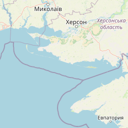
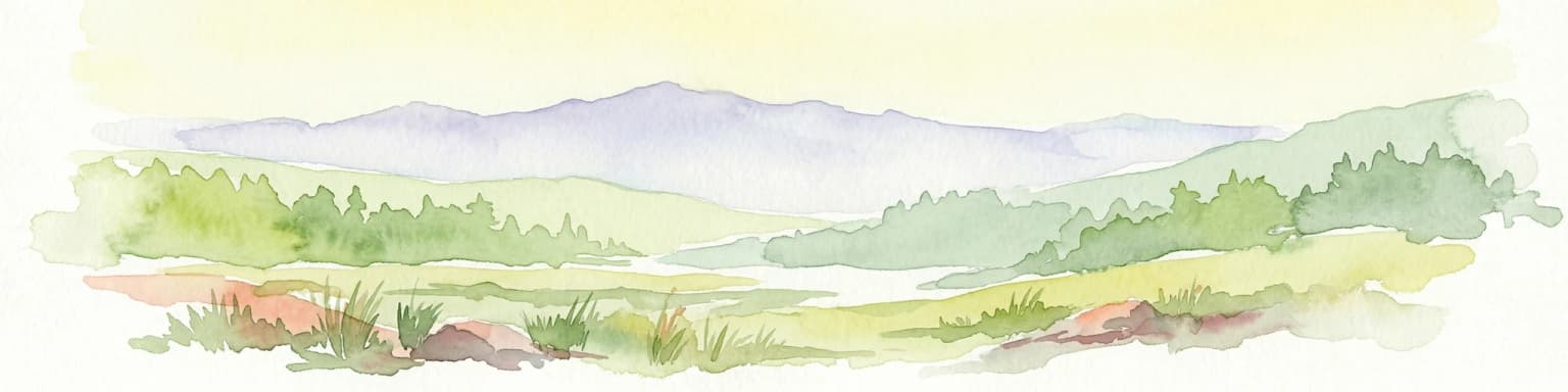
The park preserves some of the last remaining primeval coastal steppe in Crimea, with the Castel gullies containing over 50 plant species found nowhere else in the broader coastal steppe ecosystem. The dramatic transition from dry mountain steppe to sea cliffs creates a distinctive landscape of rugged rock formations, deep arroyos, and exposed coastal scenery. The park's three sections each offer different character: Bolshoy Castel features a gorge descending to a beach with historic settlement ruins; Atlesh showcases significant coastal rock formations; and Canğul displays the characteristic arroyo system of dry gullies that widen into canyons toward the coast.

Charming Harbor National Nature Park history and protected-area timeline

The Charming Harbor National Nature Park was established in 2009 as part of Ukraine's expansion of its national park network during the 2000s. The creation of the park reflected growing recognition of the Tarkhankut Peninsula's ecological significance, particularly its role as a refuge for steppe species in an area that had largely escaped the intensive agricultural conversion that had transformed much of Crimea's interior. The park's establishment also acknowledged the peninsula's cultural heritage, which includes historical settlements and structures within the park boundaries. Following the annexation of Crimea in 2014, the park's administration became the subject of competing jurisdictional claims, with both Ukraine's Ministry of Ecology and Natural Resources and Russia's Ministry of Natural Resources and Environment maintaining formal oversight responsibilities.

Charming Harbor National Nature Park landscape and geographic character

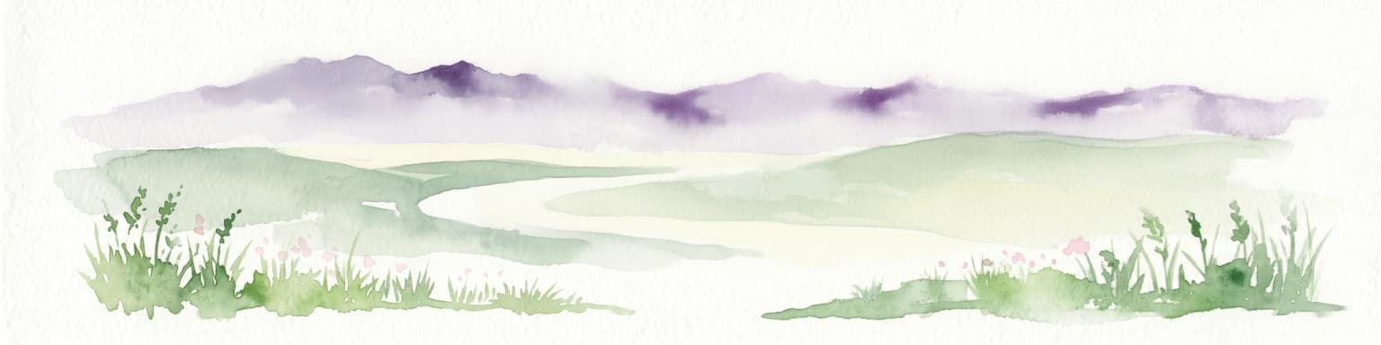
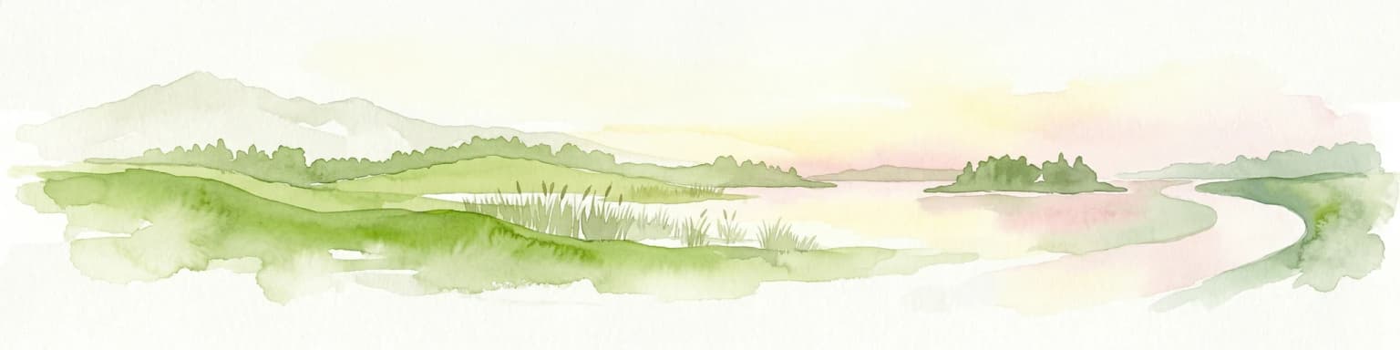
The physical landscape of Charming Harbor National Nature Park is defined by the dramatic intersection of the Crimean steppe plateau with the Black Sea coast. The terrain descends from the elevated interior of the Tarkhankut Peninsula through a series of increasingly steep slopes until it terminates in sheer cliffs and rocky shores along the sea. The park encompasses three distinct landscape sections. Bolshoy Castel features a deep gorge that cuts through the terrain to reach a beach, flanked by the ruins of former settlements that speak to the area's long human presence. Atlesh occupies the southern portion of the park and is distinguished by impressive coastal rock formations that have been sculpted by wind and wave into sculptural shapes. Canğul presents the most distinctive terrain feature: a network of arroyos, or dry gullies, with flat bottoms that are only periodically inundated. These linear erosional features range from 5 to 50 meters in depth and widen into rocky canyons as they approach the coast, creating a labyrinthine landscape unlike typical steppe terrain.

Charming Harbor National Nature Park ecosystems, habitats, and plant life

The ecological character of Charming Harbor National Nature Park centers on its preservation of coastal steppe and shrub-steppe habitats in what represents one of the most intact examples of this ecosystem type in Crimea. The Pontic-Caspian steppe ecoregion, to which the park belongs, once covered vast stretches of Eastern Europe but has been extensively converted to agriculture, making the protected coastal remnants within the park increasingly valuable for biodiversity conservation. The park's vegetation includes coastal steppe, shrub-steppe, and shrub habitats, with the most significant botanical interest concentrated in the deep gullies of the Castel sectors, where approximately 50 plant species occur that are not generally found in the broader coastal steppe environment. Overall, more than 400 species of vascular plants have been recorded within the park boundaries. The semi-arid conditions, combined with the maritime exposure created by the coastline, produce a distinctive ecological community that supports both steppe-adapted species and those with closer affinity to coastal or even Mediterranean conditions.

Charming Harbor National Nature Park wildlife and species highlights

While the Wikipedia source provides limited specific detail on fauna, the park's location within the Pontic-Caspian steppe ecoregion suggests the presence of characteristic steppe-adapted species. The coastal position of the park also creates opportunities for birdlife associated with cliff nesting sites and marine feeding areas. The preserved state of the steppe habitat, particularly in the less-accessible gully systems, likely supports small mammal populations typical of grassland ecosystems. The park's protected status provides a refuge for wildlife in an area where much of the original steppe habitat has been lost to agricultural development.

Charming Harbor National Nature Park conservation status and protection priorities

Charming Harbor National Nature Park represents one of the most important conservation designations in western Crimea, protecting a remnant of the Pontic-Caspian steppe ecosystem that has been heavily impacted by agricultural conversion across its historical range. The park's significance is amplified by its coastal location, which creates unique ecological conditions not found in inland steppe areas and supports plant species with restricted distributions. The designation of the park as an IUCN Category II protected area reflects its management approach centered on ecosystem preservation while accommodating sustainable visitor use through its zoned approach. The park's management framework divides the territory into strict protection, regulated recreation, local recreation, and economic zones, allowing for the preservation of core natural areas while enabling public access and environmental education.

Charming Harbor National Nature Park cultural meaning and human context

The Tarkhankut Peninsula has a long human history, and the park contains evidence of historical settlements within its boundaries. The ruins of former settlements in the Bolshoy Castel section speak to centuries of human presence in this coastal area. The peninsula's strategic position on the Black Sea made it historically significant for maritime activity and trade. The cultural landscape reflects the broader history of Crimea as a region where multiple cultures have interacted over time, though the park's primary designation focuses on natural rather than cultural heritage preservation.

Top sights and standout views in Charming Harbor National Nature Park

The park's most distinctive feature is the dramatic landscape where Crimean steppe meets Black Sea cliffs, a visual transition that defines the Tarkhankut Peninsula's character. The arroyo system at Canğul, with its deep dry gullies and coastal canyons, represents a unique landform not commonly associated with steppe environments. The botanical significance of the Castel gullies, harboring over 50 unique plant species, elevates the park's conservation value beyond typical coastal protected areas. Three distinct sections offer different experiences: dramatic coastal rock formations at Atlesh, historic settlement ruins at Bolshoy Castel, and the intricate gully landscape of Canğul. The park provides a rare opportunity to experience relatively intact coastal steppe in a region where such ecosystems have largely disappeared.

Best time to visit Charming Harbor National Nature Park

The park experiences a humid continental climate with hot summers, making late spring through early autumn the most favorable period for visitation. Summer runs from late May to mid-September, coinciding with the driest and warmest conditions. The hot summer sub-type of the climate classification means daytime temperatures can be quite high, but the coastal location provides some moderation. Visitors seeking to explore the steppe landscape in bloom would find late spring particularly rewarding, while those preferring quieter visits might consider the shoulder seasons of May or September when temperatures remain comfortable and visitor numbers are typically lower.

Park location guide

Geography guide, regional context, and park location map for Charming Harbor National Nature Park

Charming Harbor National Nature Park park geography, regions, and map view in Ukraine
Understand where Charming Harbor National Nature Park sits in Ukraine through a broader geographic reading of the surrounding landscape, nearby location context, and its mapped position within the national park landscape.

How Charming Harbor National Nature Park fits into Ukraine

Ukraine is a sovereign nation in Eastern Europe, bordered by Russia, Belarus, Poland, Slovakia, Hungary, Romania, Moldova, and the Black Sea. It is the second-largest country in Europe by area. Kyiv is the capital and largest city, followed by Kharkiv, Odesa, and Dnipro. The official language is Ukrainian. Ukraine has a population of approximately 32.9 million and operates as a unitary semi-presidential republic.

Wider geography shaping Charming Harbor National Nature Park in Ukraine

Ukraine occupies 603,628 km² in Eastern Europe, making it the second-largest country in Europe. It shares borders with Russia, Belarus, Poland, Slovakia, Hungary, Romania, and Moldova. The country has a southern coastline along the Black Sea and Sea of Azov. The terrain includes plains, steppes, and the Carpathian Mountains in the west.

Map view of Charming Harbor National Nature Park

Use this park location map to pinpoint Charming Harbor National Nature Park in Ukraine, understand its exact geographic position, and read its mapped placement within the surrounding landscape more clearly.

Pigeon | © OpenStreetMap contributors

Location context for Charming Harbor National Nature Park

Autonomous Republic of Crimea
Park atlas

Map the Coastal Steppe and Black Sea Protected Landscapes Surrounding Charming Harbor National Nature Park

Discover Nearby National Parks and Protected Areas Beyond Charming Harbor National Nature Park in Crimea
Browse national parks and protected areas geographically similar to Charming Harbor National Nature Park, covering coastal steppe ecosystems and Black Sea cliff landscapes across the Autonomous Republic of Crimea. Comparing these natural areas provides a richer understanding of the distinct conservation efforts and varied terrain found across the Tarkhankut Peninsula region.
Watercolor illustration of rolling hills, a winding river, and patches of vegetation
National parkKherson Oblast

Dzharylhach National Nature Park: Protected Landscape Atlas & Regional Geography

Explore the mapped protected area in Kherson Oblast, Ukraine.

Delve into the geographic details and protected landscape characteristics of Dzharylhach National Nature Park. As a designated national park within Kherson Oblast, this entry provides vital information for understanding its mapped boundaries and its place in the regional geography. MoriAtlas enables a structured approach to discovering and contextualizing protected areas like Dzharylhach, offering a unique perspective for atlas exploration.

Area
100 km²
Established
2009
IUCN
II
Relief
Lowland
Watercolor illustration of a landscape with grassy fields, trees, a river, and distant hills.
National parkKherson Oblast

Oleshky Sands National Nature Park: Mapping Ukraine's Distinctive Semi-Arid Dune Landscape

Explore protected sandy steppe, dunes, and conservation areas in Kherson Oblast.

Oleshky Sands National Nature Park is a critical protected landscape in Kherson Oblast, Ukraine, renowned for its unusual semi-arid terrain dominated by expansive sand dunes and sandy steppe. This page provides detailed geographic context for the park, highlighting its unique mapped boundaries, the contrast between its Radensk and Burkut zones, and its ecological importance as part of the Pontic-Caspian steppe. Understand the specific landscape features and regional geography that make this national park a significant natural asset within Ukraine's protected area network.

Area
80.2 km²
Established
2010
IUCN
II
Relief
Mixed relief
National parkMykolaiv Oblast

Ivory Coast of Sviatoslav National Nature Park: National Park Identity and Regional Geography

Mapped protected area in Mykolaiv Oblast, Ukraine.

Gain a structured understanding of Ivory Coast of Sviatoslav National Nature Park, a designated national park in the Mykolaiv Oblast region of Ukraine. This entry focuses on its protected landscape identity and its position within the broader regional geography. Explore the mapped outlines and discover its significance as a key protected territory for atlas-based research and geographic context.

Area
352 km²
Established
2009
IUCN
II
Relief
Lowland
Nature reserve

Crimean Nature Reserve: Nature Reserve with Mountain Forests and Karst Geography

Explore protected area landscapes and terrain.

The Crimean Nature Reserve is a key protected area within the Crimean Mountains, recognized for its significant mountain forests and unique karst landscapes. This nature reserve encompasses a critical span of the peninsula's rugged terrain, from high mountain ridges to dramatic southern slopes. Its designation as a protected area highlights its ecological importance and its role in preserving diverse natural habitats and geological features within a regional geographic context, making it a notable destination for landscape exploration.

Area
442 km²
Established
1991
IUCN
Ia
Relief
Mountain
National park

Azov, Syvash National Nature Park: National Park Protected Landscape and Geography

Explore mapped boundaries and regional landscape context.

Azov, Syvash National Nature Park stands as a notable protected area, offering a distinct geographic identity within Ukraine's atlas of natural landscapes. This national park's mapped boundaries provide a foundation for understanding its landscape context and regional significance. MoriAtlas enables detailed exploration of its protected terrain and its place within the country's conservation geography, serving as a gateway to structured geographic information and detailed park data for researchers and explorers.

Area
525.8 km²
Established
1993
IUCN
II
Relief
Lowland
National parkBilhorod-Dnistrovskyi Raion

Tuzly Lagoons National Nature Park: National Park Atlas and Geographic Context

Mapped protected landscape within Bilhorod-Dnistrovskyi Raion, Ukraine.

Navigate the protected landscape of Tuzly Lagoons National Nature Park through a detailed geographic lens. This national park entry within MoriAtlas provides structured information on its mapped boundaries and regional context within Bilhorod-Dnistrovskyi Raion, part of Ukraine's Bessarabia region. Understand its position and significance as a protected natural area, facilitating a deeper exploration of its geographical attributes and its place in the broader atlas of Ukrainian protected lands.

Area
278.65 km²
Established
2010
IUCN
II
Relief
Lowland
Watercolor illustration of a landscape with hills, a river, and green vegetation
National parkOdesa Oblast

Lower Dniester National Nature Park: National Park Map and Protected Landscape Atlas

Explore Odesa Oblast's protected natural geography and park boundaries.

The Lower Dniester National Nature Park is a vital component of Ukraine's protected lands, situated within the expansive Odesa Oblast. This page offers detailed geographic context, focusing on the park's mapped boundaries and its contribution to the regional landscape. Dive into an atlas-style exploration that highlights the park's protected terrain and its significance within the natural geography of southwestern Ukraine, offering structured discovery beyond basic park facts.

Area
213 km²
Established
2008
IUCN
II
Relief
Lowland
Protected area

Danube Delta Protected Area: Mapping Europe's Largest River Delta Geography and Wetland Landscape

Explore the mapped protected area, its unique terrain, and regional landscape context.

The Danube Delta, a protected area in Romania, presents a remarkable geography defined by its extensive wetland terrain, intricate waterways, and significant biodiversity. As Europe's largest and best-preserved river delta, it offers a unique landscape for atlas-based exploration, focusing on its mapped boundaries, regional geographic context, and its role as a critical ecological zone where the Danube River merges with the Black Sea. Understand the delta's horizontal expanse, its network of channels, and its evolving landforms within a protected landscape of global importance.

Area
4,152 km²
Established
1998
Relief
Lowland
Climate
Temperate

Common questions about visiting, size, designation, and location context for Charming Harbor National Nature Park

Charming Harbor National Nature Park FAQs for park facts, access, geography, and protected area context
Find quick answers about Charming Harbor National Nature Park, including protected-area facts, park geography, trail and visitor context, and how the park fits into its surrounding country and regional landscape.
MoriAtlas Explorer

Continue Your Protected Areas Search Across the Global Atlas

Deepen your exploration by continuing the structured search for national parks and protected areas worldwide. Utilize the comprehensive filtering capabilities to compare different conservation landscapes and refine your understanding of global park geography. Discover more about the distribution and characteristics of protected natural areas.

Global natural geography