Mori Atlas logo
National parkLower Dniester National Nature Park

Mapped protected boundaries and regional landscape discovery in Odesa Oblast, Ukraine.

Lower Dniester National Nature Park: National Park Protected Area & Geographic Context

Lower Dniester National Nature Park represents a significant protected area within Ukraine's Odesa Oblast. As a national park, its mapped boundaries define a distinct natural landscape. This page serves as an atlas entry point, facilitating exploration of the park's geographic setting and its role within the broader regional context of southwestern Ukraine. Understand the protected terrain and its place in the natural geography of the Black Sea coast region.

wetlandsbirdwatching Ramsar sitedelta and estuaryfloodplain forestcoastal lagoon
Illustration of a waterfall flowing over rocky cliffs into a river, with forested mountains and a sunlit sky

Lower Dniester National Nature Park

National park

Park overview

Structured park overview, official facts, and landscape profile for Lower Dniester National Nature Park

Lower Dniester National Nature Park park facts, protected area profile, and essential visitor context
Review the core facts for Lower Dniester National Nature Park, including designation, size, terrain, visitor scale, habitats, and operating context in one park-focused overview.

About Lower Dniester National Nature Park

Lower Dniester National Nature Park occupies a strategic position at the mouth of the Dniester River, Ukraine's second-longest watercourse, where it flows into the Black Sea. The protected area encompasses the northern basin of the Dniester Liman, a curved freshwater lagoon separated from the open sea by a narrow sandbar, with the river's main channel and the Turunchuk River from Moldova creating an intricate network of waterways, channels, and floodplain lakes. The park's establishment in 2008 reflected growing recognition that this wetlands complex required formal national protection to preserve its ecological functions and biodiversity. The park sits within the Pontic-Caspian steppe ecoregion, a vast grassland corridor stretching from the Black Sea northern shores to Kazakhstan, but the protected area itself represents the aquatic and riparian counterpart to the surrounding steppe landscapes. The area has long supported traditional floodplain land use, including fishing and hunting, which continues within designated zones while the core areas receive strict protection. Visitors can explore the park through four designated ecotourism routes, including the popular "Dniester Amazon" river journey through forested channels and the "Kingdom of Birds" excursion across the shallow estuary waters.

Quick facts and research context for Lower Dniester National Nature Park

Lower Dniester National Nature Park spans 21,311 hectares along the lower Dniester River in Odesa Oblast, Ukraine. The park was established in 2008 under Presidential Decree and is managed by Ukraine's Ministry of Ecology and Natural Resources. It occupies the northern portion of the Dniester Liman, a coastal lagoon where the river enters the Black Sea, and includes the confluence with the Turunchuk River flowing from Moldova. The park features diverse wetland habitats including peninsulas, reed thickets, scroll ridges, floating bogs, and islands of floodplain forest. It is classified as IUCN Category II and contains two Ramsar wetland sites of international significance.

Park context

Deeper park guide and search-rich context for Lower Dniester National Nature Park

Lower Dniester National Nature Park history, landscape, wildlife, and travel context
Explore Lower Dniester National Nature Park through its history, landscape character, ecosystems, wildlife, conservation priorities, cultural context, and seasonal travel timing in a structured park guide built for atlas discovery and search intent.

Why Lower Dniester National Nature Park stands out

The park is renowned for its extraordinary waterbird colonies and wetland biodiversity. The Dniester Estuary supports one of the largest breeding populations of storks, herons, and pelicans in the Azov-Black Sea region, with some nesting species representing over 1% of their respective geographic populations. The flooded forest channels of the Turunchuk River create a unique "Dniester Amazon" environment, while the shallow lagoon waters provide critical spawning habitat for more than 70 fish species. The park's ichthyological reserve at Karagol Bay protects fish breeding grounds where fishing is prohibited.

Calm river with reed-lined banks under a clear blue sky
Calm river channel through reed beds in Lower Dniester National Nature Park

Lower Dniester National Nature Park history and protected-area timeline

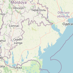
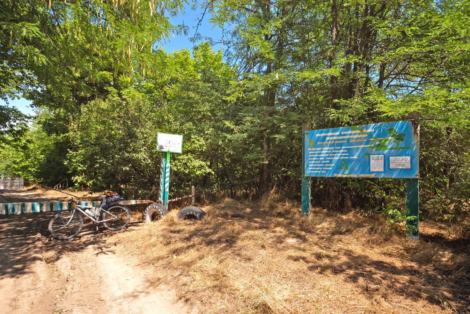
Lower Dniester National Nature Park was established by Presidential Decree No. 1033 on November 13, 2008, creating Ukraine's newest national park at that time. The park was formed partly by incorporating earlier protected area designations, including the "Dnistrovski Plavni" (Dniester Floodplains) reserve and the "Lymansky" landscape reserve, which retained their separate protected status within the larger park framework. The Karagol Bay, an ichthyological reserve since 1965, also became part of the park's protected zone. The park occupies a region with deep historical ties to floodplain utilization, where fishing and hunting traditions have shaped local communities for generations. The administrative structure operates from two locations: an office in Odesa and the main administrative building in the village of Mayaky on the left bank of the Dniester, approximately 40 kilometers from Odesa. The park's management must balance conservation objectives with the ongoing traditional economic activities that characterize the lower Dniester region.

Lower Dniester National Nature Park landscape and geographic character

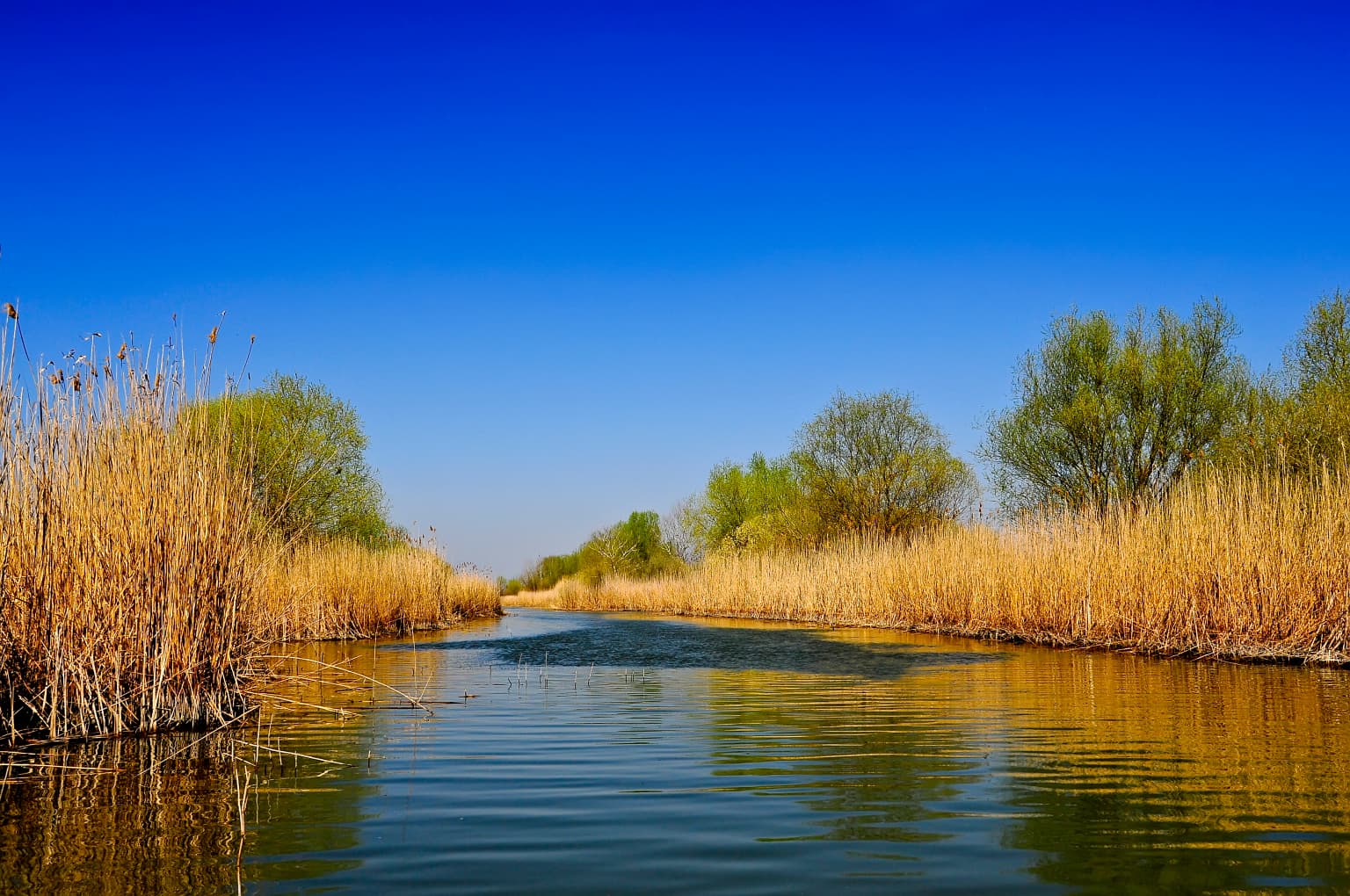
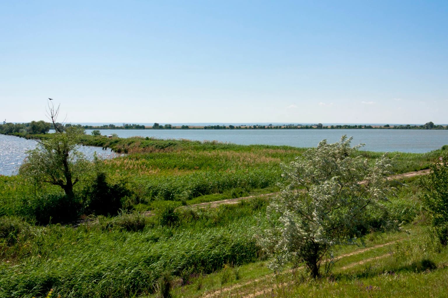
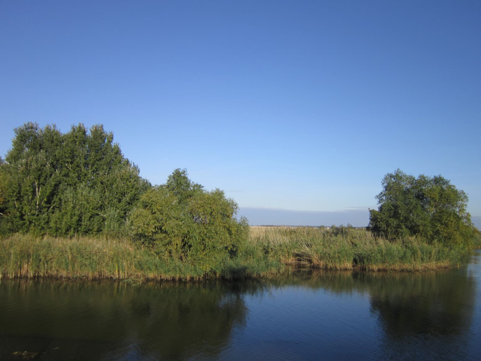
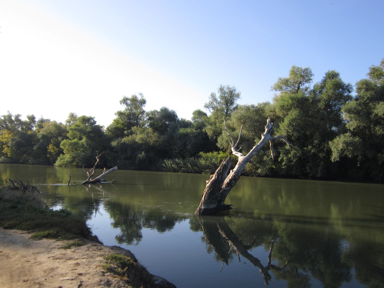
The park's landscape centers on the Dniester Liman, a rectangular freshwater lagoon extending along the Black Sea coast with a width of up to 10 kilometers and a length exceeding 40 kilometers. The lagoon is fed primarily by the Dniester River, with the Turunchuk River entering from Moldova to the west, creating a complex delta system of branching channels, scroll ridges, and accumulative landforms. The coastal area forms a freshwater lagoon separated from the Black Sea by a narrow strip, while inland areas contain permanent inland deltas and intermittent freshwater lakes. The terrain is overwhelmingly flat, characteristic of a large river estuary, with extensive reed beds dominating the shallow margins and floating bog formations occurring in quieter backwater areas. Islands of floodplain forest appear intermittently throughout the wetlands, providing forested cover amidst the otherwise open aquatic landscape. The southern portion of the park, particularly around Karagol Bay, contains shallower waters that support dense aquatic vegetation.

A wide expanse of water covered with lily pads under a clear blue sky
Lake Bile in the Dniester delta, Ukraine

Lower Dniester National Nature Park ecosystems, habitats, and plant life

The park's ecological character is defined by its extensive wetland ecosystems, which support remarkably high biodiversity despite the relatively recent formal protection status. The wetland habitats encompass a gradient from open water through emergent reed beds to forested islands, creating diverse ecological niches. The Dniester Estuary serves as a critical node in the East Atlantic Flyway, the migratory corridor linking Arctic breeding grounds with African wintering areas. Water depths throughout the lagoon average 2-3 meters, with extensive shallows warming quickly in summer and supporting dense populations of aquatic invertebrates and fish. The floodplain forest fragments, though limited in extent, provide important breeding and shelter habitat for species requiring forested cover within the otherwise open wetland matrix. The surrounding steppe landscape, while not part of the protected area, creates a sharp ecological boundary with the aquatic environment.

Wide landscape view of the Lower Dniester River floodplains with grassy vegetation, scattered trees, and a calm river under a clear blue sky
Floodplains of the Lower Dniester River within the national park

Lower Dniester National Nature Park wildlife and species highlights

The park supports extraordinary wildlife populations, particularly among birds and fish. Ornithological surveys have recorded up to 15,000 nesting pairs of waterfowl, with dominant species including Eurasian coot, great crested grebe, mallard, and black-headed gull forming large breeding colonies. The lower Dniester hosts the largest stork and pelican colonies in the Azov-Black Sea region, with populations of spoonbill, glossy ibis, great white heron, and purple heron representing significant proportions of their European or regional populations. The fish community includes more than 70 species across 20 families, providing critical spawning habitat that supports commercial and ecological fisheries downstream. The protected area also supports notable mammal populations, including one of Ukraine's last remaining natural populations of the European mink, a critically endangered mustelid. Jackal populations have expanded into the floodplains, and the area supports diverse amphibian and reptile communities in the wetland margins.

Dirt path leading to blue informational sign and smaller signpost with bicycle parked nearby, surrounded by trees
Informational sign and bicycle near the entrance of Lower Dniester National Nature Park

Lower Dniester National Nature Park conservation status and protection priorities

The park's conservation significance is recognized internationally through its designation as a Ramsar site, with two wetland areas "Northern Part of Dniester Liman" and "Dniester-Turunchuk Interfluve" inscribed under the Convention on Wetlands. The park is categorized as IUCN Category II, reflecting its dual conservation and sustainable use mandate. The inclusion of the Karagol Bay ichthyological reserve, where fishing is prohibited, demonstrates the park's commitment to protecting critical fish spawning habitat. Conservation challenges include managing the interface between protected zones and surrounding agricultural land, where traditional fishing and hunting continue. The park conducts ongoing environmental education programs and works with local communities to promote sustainable practices. Poaching remains a concern, with enforcement efforts addressing illegal fishing practices that can damage fish populations and disturb sensitive bird colonies.

Lower Dniester National Nature Park cultural meaning and human context

The lower Dniester region has been inhabited for millennia, with the floodplain providing rich fishing grounds and the adjacent steppe supporting pastoral communities. The village of Mayaky, serving as the park's administrative center, lies on the left bank of the Dniester approximately 40 kilometers from Odesa and has historically served as a gateway to the estuary fisheries. The region's name in Ukrainian, "Nizhnyodnistrovskyi," directly references the river's lower reaches, and the landscape has been shaped by centuries of traditional floodplain utilization including fishing, reed harvesting, and seasonal grazing. The park's establishment in 2008 required balancing these traditional land uses with conservation objectives, resulting in a zoned approach where some areas allow regulated traditional activities while core zones receive full protection.

River with calm water reflecting trees and reeds, clear blue sky
River landscape with reeds and trees along the Dniester Estuary under clear skies

Top sights and standout views in Lower Dniester National Nature Park

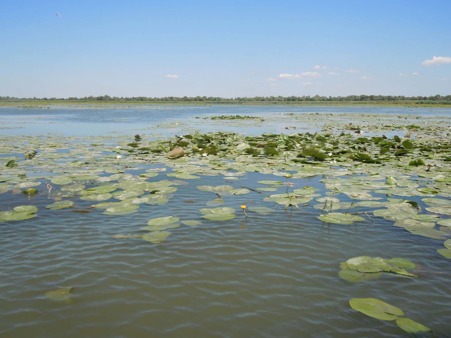
The park offers exceptional birdwatching opportunities, particularly during migration seasons when thousands of waterfowl pass through the estuary. The "Dniester Amazon" route traverses a picturesque channel called the Amazon Strait, winding through floodplain forest where visitors may observe pelicans, swans, cormorants, herons, and terns. The shallow reaches of the estuary support what is described as the largest European plantation of yellow water-lily (Nuphar lutea), creating extensive floating vegetation displays. The park contains the northern part of the Dniester Liman and the Dniester-Turunchuk Interfluve, both Ramsar sites of international wetland importance. The ichthyological reserve at Karagol Bay protects spawning fish populations, while the diverse habitats support species ranging from European mink to 58 bird species listed in Ukraine's Red Book.

A calm river with a dead tree trunk in the water, surrounded by dense green trees and a sandy shore under a clear blue sky
Calm river with a dead tree trunk in the water, surrounded by dense greenery under a clear blue sky

Best time to visit Lower Dniester National Nature Park

The park can be visited year-round, though spring and autumn offer the most dramatic wildlife spectacles. Spring brings massive bird migrations, with thousands of waterfowl arriving to nest in the reed beds and shallow waters, creating exceptional birdwatching opportunities. Autumn migration sees large numbers of birds congregate before heading south, with cranes, swans, and various duck species prominent. Summer months allow exploration of the river channels and swimming in lagoon areas, though midday heat can be intense. Winter access is more limited but offers a different perspective on the frozen wetlands. The climate is humid continental with warm summers and cold, snowy winters, and annual precipitation of 300-400 millimeters.

Park location guide

Geography guide, regional context, and park location map for Lower Dniester National Nature Park

Lower Dniester National Nature Park park geography, regions, and map view in Ukraine
Understand where Lower Dniester National Nature Park sits in Ukraine through a broader geographic reading of the surrounding landscape, nearby location context, and its mapped position within the national park landscape.

How Lower Dniester National Nature Park fits into Ukraine

Ukraine is a sovereign nation in Eastern Europe, bordered by Russia, Belarus, Poland, Slovakia, Hungary, Romania, Moldova, and the Black Sea. It is the second-largest country in Europe by area. Kyiv is the capital and largest city, followed by Kharkiv, Odesa, and Dnipro. The official language is Ukrainian. Ukraine has a population of approximately 32.9 million and operates as a unitary semi-presidential republic.

Wider geography shaping Lower Dniester National Nature Park in Ukraine

Ukraine occupies 603,628 km² in Eastern Europe, making it the second-largest country in Europe. It shares borders with Russia, Belarus, Poland, Slovakia, Hungary, Romania, and Moldova. The country has a southern coastline along the Black Sea and Sea of Azov. The terrain includes plains, steppes, and the Carpathian Mountains in the west.

Map view of Lower Dniester National Nature Park

Use this park location map to pinpoint Lower Dniester National Nature Park in Ukraine, understand its exact geographic position, and read its mapped placement within the surrounding landscape more clearly.

Pigeon | © OpenStreetMap contributors

Location context for Lower Dniester National Nature Park

Odesa Oblast

Explore the Dniester Estuary's unique ecosystems, from sprawling reed beds to vital bird-rich floodplain forests.

Lower Dniester National Nature Park Photos: Wetland Landscapes and Protected Area Scenery
View imagery capturing the distinctive scenery of Lower Dniester National Nature Park, from vast reed beds to intricate floodplain forests and the tranquil Dniester Liman. This visual exploration allows you to grasp the park's wetland environment, key habitats, and conservation significance, enriching your geographic understanding of this vital Ukrainian protected area.

Calm river with reed-lined banks under a clear blue sky

Frosted trees line a calm river at sunrise with a purple and blue sky

A wide expanse of water covered with lily pads under a clear blue sky

Wide landscape view of the Lower Dniester River floodplains with grassy vegetation, scattered trees, and a calm river under a clear blue sky

Dirt path leading to blue informational sign and smaller signpost with bicycle parked nearby, surrounded by trees

Rocky mountain peaks with forested slopes under a partly cloudy sky

River with calm water reflecting trees and reeds, clear blue sky

A calm river with a dead tree trunk in the water, surrounded by dense green trees and a sandy shore under a clear blue sky

A calm river with trees lining both banks under a clear blue sky, with a large willow tree in the foreground

Blue and white boat docked on riverbank with grassy shore, trees, and two people nearby

A large tree with a green and yellow striped sign attached to its trunk, surrounded by dense green foliage

River estuary with marshy wetlands, reeds, grassy fields, and distant hills, with green foliage in the foreground

Park atlas

Compare protected wetland ecosystems, river deltas, and coastal landscapes adjacent to Lower Dniester National Nature Park.

Explore Other National Parks Near Lower Dniester National Nature Park and Surrounding Wetland Regions
Browse other national parks and protected areas found in the vicinity of Lower Dniester National Nature Park, encompassing diverse wetland ecosystems, coastal landscapes, and vital river delta environments. Understanding the regional spread of these conservation landscapes provides valuable geographic context and allows for direct comparison of park features and management objectives.
National parkBilhorod-Dnistrovskyi Raion

Tuzly Lagoons National Nature Park: National Park Atlas and Geographic Context

Mapped protected landscape within Bilhorod-Dnistrovskyi Raion, Ukraine.

Navigate the protected landscape of Tuzly Lagoons National Nature Park through a detailed geographic lens. This national park entry within MoriAtlas provides structured information on its mapped boundaries and regional context within Bilhorod-Dnistrovskyi Raion, part of Ukraine's Bessarabia region. Understand its position and significance as a protected natural area, facilitating a deeper exploration of its geographical attributes and its place in the broader atlas of Ukrainian protected lands.

Area
278.65 km²
Established
2010
IUCN
II
Relief
Lowland
National parkMykolaiv Oblast

Ivory Coast of Sviatoslav National Nature Park: National Park Identity and Regional Geography

Mapped protected area in Mykolaiv Oblast, Ukraine.

Gain a structured understanding of Ivory Coast of Sviatoslav National Nature Park, a designated national park in the Mykolaiv Oblast region of Ukraine. This entry focuses on its protected landscape identity and its position within the broader regional geography. Explore the mapped outlines and discover its significance as a key protected territory for atlas-based research and geographic context.

Area
352 km²
Established
2009
IUCN
II
Relief
Lowland
Protected area

Danube Delta Protected Area: Mapping Europe's Largest River Delta Geography and Wetland Landscape

Explore the mapped protected area, its unique terrain, and regional landscape context.

The Danube Delta, a protected area in Romania, presents a remarkable geography defined by its extensive wetland terrain, intricate waterways, and significant biodiversity. As Europe's largest and best-preserved river delta, it offers a unique landscape for atlas-based exploration, focusing on its mapped boundaries, regional geographic context, and its role as a critical ecological zone where the Danube River merges with the Black Sea. Understand the delta's horizontal expanse, its network of channels, and its evolving landforms within a protected landscape of global importance.

Area
4,152 km²
Established
1998
Relief
Lowland
Climate
Temperate
Watercolor illustration of a winding river through a landscape with hills and trees
National parkOrhei District

Orhei National Park: Explore Moldova's Inaugural National Park Landscape

Mapped protected boundaries and regional geography in Orhei District.

As Moldova's first national park, Orhei National Park offers a rich exploration of the Codri region's characteristic hilly terrain and extensive deciduous forests. Situated within Orhei District, this protected area encompasses the meandering Răut River valley and notable landscape reserves. Its designation highlights a crucial commitment to preserving both the natural beauty and the significant cultural heritage, including the UNESCO candidate site of Old Orhei, making it a key destination for understanding Moldova's protected lands and regional geography.

Area
337.92 km²
Established
2013
IUCN
II
Relief
Highland
Watercolor painting of a river flowing through a wetland with green hills and distant mountains
Protected landscapeGalați County

Lunca Joasă a Prutului Inferior Natural Park: Protected Landscape Atlas and Geographic Context

Explore its wetland terrain and mapped protected area boundaries.

Lunca Joasă a Prutului Inferior Natural Park is a crucial protected landscape within Galați County, Romania, recognized for its extensive wetland ecosystems and role as a vital bird migration hub. This atlas-focused entry details the park's mapped geography, showcasing its complex network of lakes, canals, and floodplains, and its significant habitats that support exceptional biodiversity along major European flyways.

Area
82.47 km²
Established
2005
IUCN
V
Relief
Lowland
National parkMykolaiv Oblast

Bug Gard National Nature Park: Mapped Protected Landscape in Mykolaiv Oblast

Explore National Park Geography and Boundaries

Delve into Bug Gard National Nature Park, a designated national park situated in Mykolaiv Oblast, Ukraine. This detailed view highlights the park's protected landscape, offering insights into its geographic distribution and mapped boundaries. Understand its place within the regional terrain and access structured information for atlas-based exploration of this significant natural area.

Area
61.38 km²
Established
2009
IUCN
II
Relief
Mixed relief
Watercolor illustration of a landscape with grassy fields, trees, a river, and distant hills.
National parkKherson Oblast

Oleshky Sands National Nature Park: Mapping Ukraine's Distinctive Semi-Arid Dune Landscape

Explore protected sandy steppe, dunes, and conservation areas in Kherson Oblast.

Oleshky Sands National Nature Park is a critical protected landscape in Kherson Oblast, Ukraine, renowned for its unusual semi-arid terrain dominated by expansive sand dunes and sandy steppe. This page provides detailed geographic context for the park, highlighting its unique mapped boundaries, the contrast between its Radensk and Burkut zones, and its ecological importance as part of the Pontic-Caspian steppe. Understand the specific landscape features and regional geography that make this national park a significant natural asset within Ukraine's protected area network.

Area
80.2 km²
Established
2010
IUCN
II
Relief
Mixed relief
Watercolor illustration of rolling hills, a winding river, and patches of vegetation
National parkKherson Oblast

Dzharylhach National Nature Park: Protected Landscape Atlas & Regional Geography

Explore the mapped protected area in Kherson Oblast, Ukraine.

Delve into the geographic details and protected landscape characteristics of Dzharylhach National Nature Park. As a designated national park within Kherson Oblast, this entry provides vital information for understanding its mapped boundaries and its place in the regional geography. MoriAtlas enables a structured approach to discovering and contextualizing protected areas like Dzharylhach, offering a unique perspective for atlas exploration.

Area
100 km²
Established
2009
IUCN
II
Relief
Lowland

Common questions about visiting, size, designation, and location context for Lower Dniester National Nature Park

Lower Dniester National Nature Park FAQs for park facts, access, geography, and protected area context
Find quick answers about Lower Dniester National Nature Park, including protected-area facts, park geography, trail and visitor context, and how the park fits into its surrounding country and regional landscape.
MoriAtlas Explorer

Continue Your Protected Areas Search Across the Global Atlas

Deepen your exploration by continuing the structured search for national parks and protected areas worldwide. Utilize the comprehensive filtering capabilities to compare different conservation landscapes and refine your understanding of global park geography. Discover more about the distribution and characteristics of protected natural areas.

Global natural geography