Mori Atlas logo
National parkOrhei National Park

Explore the mapped boundaries and gentle terrain of Orhei District's premier natural area.

Orhei National Park: Moldova's Premier Protected Landscape and First National Park

(Parcul Național Orhei)

Orhei National Park, established in 2013, represents Moldova's inaugural national park, safeguarding the picturesque, rolling forested hills of the Codri region. Spanning 337.92 square kilometers within Orhei District and surrounding areas, this protected landscape offers a unique exploration of Moldovan geography, characterized by dense woodlands, steep river valleys, and the scenic Răut River. It stands as a testament to Moldova's commitment to conservation, integrating significant natural beauty with profound historical and cultural heritage.

National ParkForest Protected AreaUNESCO Candidate SiteMedieval HeritageCave MonasteriesCultural Heritage Site
Illustration of a river valley with a cliffside featuring a church on top, cave-like structures, and surrounding greenery

Orhei National Park

National park

Park overview

Structured park overview, official facts, and landscape profile for Orhei National Park

Orhei National Park park facts, protected area profile, and essential visitor context
Review the core facts for Orhei National Park, including designation, size, terrain, visitor scale, habitats, and operating context in one park-focused overview.

About Orhei National Park

Orhei National Park represents Moldova's most significant protected area initiative, created in 2013 to preserve the country's unique blend of natural landscapes and cultural heritage in central Moldova. The park occupies the Codri region—a distinctive hilly area in the center of the country characterized by gentle but defined elevation changes, dense forest coverage, and deeply incised valleys carved by rivers and streams. The Răut River, one of Moldova's major waterways, flows through the park's territory, creating riparian corridors that support additional biodiversity and add to the scenic character of the landscape. The park's territory spans four administrative districts and includes numerous villages and rural communities whose traditional land use practices have shaped the landscape over centuries. The protected area was established not only to conserve the natural forest ecosystems of the Codri region but also to protect an extraordinary concentration of archaeological and architectural heritage. The Old Orhei cultural and natural reserve forms the park's centerpiece—a complex of cave dwellings, monastery complexes, and archaeological sites representing continuous human occupation from medieval times through the present. Beyond Old Orhei, the park contains the remains of Shehr al-Jedid, a medieval city of the Golden Horde, along with multiple monasteries, noble estates, and other historical monuments. This combination of intact forest ecosystems, significant cultural sites, and ongoing traditional land use makes Orhei National Park essential for both conservation and understanding Moldova's heritage.

Quick facts and research context for Orhei National Park

Orhei National Park occupies 33,792 hectares of central Moldova's hilly Codri region. The park features a gently undulating landscape of forests, valleys, and the Răut River corridor. It was established in 2013 as Moldova's inaugural national park, fulfilling a long-standing gap in the country's protected area network. The park protects both natural ecosystems and cultural heritage, housing medieval monasteries, archaeological sites, and the historic Old Orhei complex. The area is notable for its combination of temperate forest habitats, riverine corridors, and centuries of human settlement history.

Park context

Deeper park guide and search-rich context for Orhei National Park

Orhei National Park history, landscape, wildlife, and travel context
Explore Orhei National Park through its history, landscape character, ecosystems, wildlife, conservation priorities, cultural context, and seasonal travel timing in a structured park guide built for atlas discovery and search intent.

Why Orhei National Park stands out

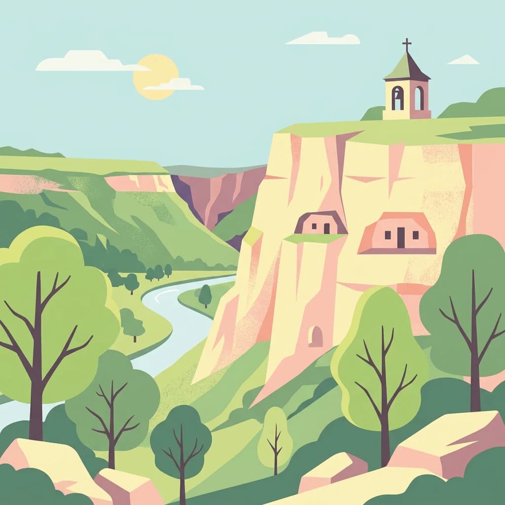
Orhei National Park is best known for its remarkable concentration of cultural and natural heritage within a relatively compact area. The park protects the historic Old Orhei (Orheiul Vechi) complex, a cave monastery system and medieval settlement that has been a UNESCO World Heritage candidate since 2017. The Trebujeni and Țigănești landscape reserves showcase the park's distinctive hilly terrain with forest cover. The Răut River, which flows through the park, creates scenic valleys and supports diverse riparian ecosystems. The presence of five monasteries, including Curchi and Țigănești, plus the archaeological remains of the Golden Horde city Shehr al-Jedid, gives the park exceptional cultural significance while its position in the Codri forests provides important habitat connectivity in Moldova's forest estate.

Tall trees and lush green undergrowth in a forested area
A dense forest scene in Orhei National Park, Moldova

Orhei National Park history and protected-area timeline

Orhei National Park was established in 2013, marking a watershed moment in Moldova's environmental protection history. Prior to this designation, Moldova was unique among European countries in having no national parks—only strict nature reserves and nature reserves of different categories. The creation of Orhei National Park addressed this gap by designating the Codri region's most significant natural and cultural landscapes under IUCN Category II protection. The park's territory has been inhabited and used by humans for centuries, evidenced by the numerous archaeological sites, medieval settlements, and religious monuments throughout the area. The Old Orhei complex represents the most significant cultural heritage element, with its cave monastery system and standing religious structures representing different periods of occupation and construction. The medieval city of Shehr al-Jedid, established during the Golden Horde period, represents an important but lesser-known historical layer. The selection of this particular area for Moldova's first national park reflected both the ecological importance of the Codri forests and the exceptional concentration of cultural heritage sites that would benefit from protected status. The park's establishment was accompanied by infrastructure development including tourist routes designed for motorists, cyclists, pedestrians, and climbers, making the heritage and natural landscapes accessible to visitors while maintaining protection objectives.

Orhei National Park landscape and geographic character

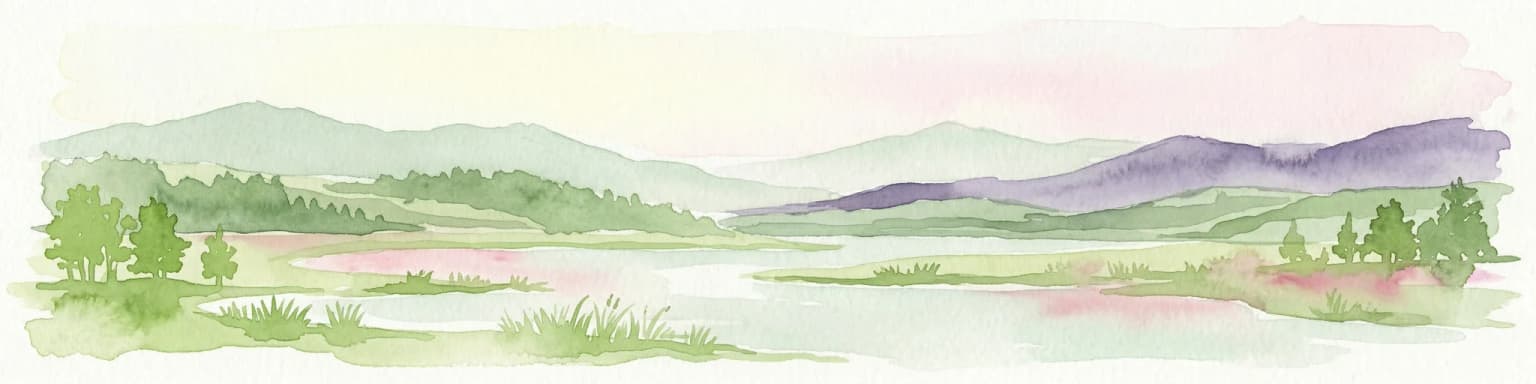
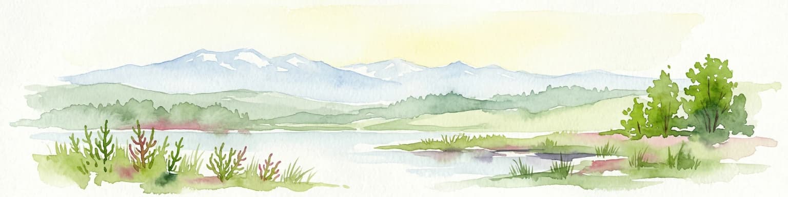
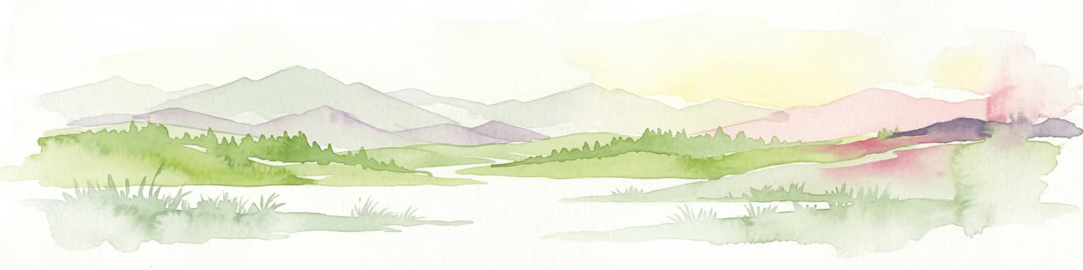
The landscape of Orhei National Park is characteristic of Moldova's central Codri region—a gently hilly terrain that rises above the surrounding plains while remaining far from mountainous. The terrain features smooth ridges and slopes covered with deciduous forest, interspersed with deep valleys carved by streams and the Răut River. The forest cover is a defining visual element, with the Codri forests representing some of Moldova's most extensive and intact woodland areas. The Răut River flows through the park, creating a meandering valley with riparian vegetation and wetland areas along its course. The landscape reserve areas within the park—Trebujeni and Țigănești—represent particularly scenic portions where the hilly terrain, forest coverage, and cultural elements combine into distinctive vistas. The area lacks dramatic rock formations or extreme terrain, instead offering the subtle beauty of rolling hills, graceful valleys, and the interplay of forest and field that characterizes central Moldova's countryside. The landscape supports agricultural use in the valley bottoms and village surroundings while the hillslopes and steeper terrain maintain forest cover.

Rocky cliff face with carved cave entrances and a small chapel on the ridge, surrounded by grassy hills
Rocky cliff with ancient cave dwellings and a small chapel atop a grassy hillside in Orhei National Park

Orhei National Park ecosystems, habitats, and plant life

The natural ecosystems of Orhei National Park center on the temperate deciduous forests that dominate the hilly terrain of the Codri region. These forests represent important habitat for Moldova's woodland biodiversity, providing structure and cover for numerous species of birds, mammals, and invertebrates. The Răut River corridor adds aquatic and riparian habitats to the park's ecological diversity, with riverine forests, wetlands, and the river itself supporting different species assemblages than the surrounding upland forests. The combination of forest cover, water features, and the variety of terrain creates a mosaic of habitats within a relatively compact area. Moldova's position at the crossroads of different biogeographic influences is reflected in the park's flora and fauna, with species from both western and eastern European biomes present. The protected area status provides formal conservation recognition for these ecosystems, while the presence of cultural heritage sites adds an unusual dimension to the park's ecological management considerations.

A winding river flows through a grassy valley with scattered trees and forested hills under a partly cloudy sky
Raut River winding through grassy fields and forested hills in Orhei National Park

Orhei National Park wildlife and species highlights

Orhei National Park provides important habitat for Moldova's forest-dwelling wildlife species. The deciduous forests of the Codri region support populations of typical Central European woodland species, with the forest canopy and understory providing food and cover for various bird and mammal species. The Răut River and its riparian zone attract waterfowl and other aquatic-associated species, while the wetland areas along the river provide additional habitat diversity. The park's landscape of forests, valleys, and open areas creates ecological edges and transitions that benefit species adapted to mosaic habitats. While specific species data would require more detailed surveys, the forest ecosystem supports the general community of woodland birds, small mammals, and insects typical of Moldova's protected forest areas. The protection afforded by national park status helps maintain these wildlife populations and the ecological connections they require.

Orhei National Park conservation status and protection priorities

Orhei National Park serves as a flagship conservation designation for Moldova, representing the country's first and most significant national park establishment. The park protects representative examples of the Codri region's forests and valleys, ensuring that these ecosystems persist despite surrounding agricultural and development pressures. The IUCN Category II designation provides a framework for conservation management that balances protection with sustainable use, acknowledging both the natural and cultural values of the area. The inclusion of Old Orhei as a UNESCO World Heritage candidate since 2017 reflects international recognition of the park's exceptional cultural and natural significance. The park's conservation value is enhanced by its location in one of Moldova's most heavily forested regions, providing connectivity with other protected areas and supporting broader landscape-level conservation objectives. As Moldova's inaugural national park, Orhei also serves an important role in developing conservation capacity and demonstrating best practices for protected area management in the country.

Orhei National Park cultural meaning and human context

Orhei National Park contains an extraordinary density of cultural heritage sites, reflecting centuries of continuous human presence in the Codri region. The Old Orhei (Orheiul Vechi) complex represents the park's most significant cultural element—a multi-period archaeological site featuring cave dwellings carved into the limestone cliffs, a functioning monastery complex, and architectural monuments spanning several centuries. The site has been nominated for UNESCO World Heritage status since 2017. The park also contains the archaeological remains of Shehr al-Jedid, a medieval city established during the Golden Horde period, representing an important but often overlooked chapter in the region's history. Five monasteries are distributed throughout the park, including Old Orhei, Curchi, and Țigănești, representing important centers of religious and cultural life. Four noble estates add to the architectural heritage, while numerous villages within and bordering the park maintain traditional land use patterns and rural character. A small museum of folk crafts operates in Ivancea, providing interpretation of local traditions. This cultural layer is inseparable from the natural landscape—the monasteries are positioned within the scenic valleys, the archaeological sites are carved into the hillsides, and the agricultural patterns of surrounding villages have shaped the landscape over generations.

Top sights and standout views in Orhei National Park

Orhei National Park uniquely combines Moldova's first national park status with an exceptional concentration of cultural heritage, creating a destination where natural landscapes and historical sites are inseparable. The UNESCO候选 site of Old Orhei, with its cave monastery and dramatic cliffside setting, represents the park's most iconic feature. The park protects the forested hills and river valleys of the Codri region—the most extensively wooded area of central Moldova. Five historic monasteries, Golden Horde archaeological sites, and noble estates dot the landscape, providing cultural context to the natural environment. The establishment of this park in 2013 fulfilled Moldova's need for a national park and demonstrates the country's commitment to integrated conservation that protects both natural and cultural heritage.

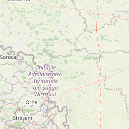
Best time to visit Orhei National Park

Orhei National Park can be visited year-round, with each season offering different character. The late spring and summer months bring full forest canopy and warm conditions ideal for hiking the various tourist routes that traverse the park. Autumn provides colorful forest foliage and typically mild weather, while the winter season reveals the skeletal structure of the deciduous forest against often snowy landscapes. The monastery sites and cultural attractions are accessible throughout the year, though the outdoor exploration of the park's natural features is most comfortable during the warmer months from May through September. The park's accessibility from Chișinău—approximately 46 kilometers—makes it suitable for day trips, though the concentration of sites and the variety of tourist routes encourage longer visits for those interested in exploring both natural and cultural elements.

Park location guide

Geography guide, regional context, and park location map for Orhei National Park

Orhei National Park park geography, regions, and map view in Moldova
Understand where Orhei National Park sits in Moldova through a broader geographic reading of the surrounding landscape, nearby location context, and its mapped position within the national park landscape.

How Orhei National Park fits into Moldova

Moldova is a landlocked Eastern European country with a population of approximately 2.4 million people. Once part of the Principality of Moldavia and later the Soviet Union, it gained independence in 1991. The country is predominantly agricultural with a parliamentary republic government system, and its capital Chișinău serves as the main cultural and commercial center.

Wider geography shaping Orhei National Park in Moldova

Moldova is situated in Eastern Europe, landlocked between Romania to the west and Ukraine to the north, east, and south. The terrain consists mostly of plains and gentle hills, with the Dniester River being the major waterway. The country lies in the Prut and Dniester river basins and has fertile agricultural soils.

Map view of Orhei National Park

Use this park location map to pinpoint Orhei National Park in Moldova, understand its exact geographic position, and read its mapped placement within the surrounding landscape more clearly.

Pigeon | © OpenStreetMap contributors

Location context for Orhei National Park

Călărași DistrictCriuleni DistrictOrhei DistrictStrășeni District

Browse detailed imagery showcasing the distinctive hilly terrain, ancient cultural sites, and diverse riverine habitats within Moldova's first national park.

Orhei National Park Photos: Visualizing Moldova's Codri Forest Landscapes and River Valleys
Explore the diverse landscapes of Orhei National Park through detailed visual imagery, revealing its distinctive hilly terrain, dense Codri forests, and the meandering Răut River valleys. Understanding these protected environments and their cultural heritage is enhanced by seeing the park's unique blend of natural beauty and historical significance.

Tall trees and lush green undergrowth in a forested area

A river flows through a valley with steep cliffs, grassy fields, and scattered trees under a clear blue sky

Rocky cliff face with carved cave entrances and a small chapel on the ridge, surrounded by grassy hills

A winding river flows through a grassy valley with scattered trees and forested hills under a partly cloudy sky

Park atlas

Explore the regional context of protected landscapes and national parks near Orhei National Park.

Explore National Parks and Protected Areas Beyond Orhei National Park, Discovering Adjacent Landscapes
Continue your geographic exploration by browsing other national parks and protected areas situated within the broader region surrounding Orhei National Park. This enables detailed comparison of diverse conservation landscapes, tracing the spread of forested hills, river valleys, and cultural heritage sites across central Moldova.
Watercolor illustration of a landscape with hills, a river, and green vegetation
National parkOdesa Oblast

Lower Dniester National Nature Park: National Park Map and Protected Landscape Atlas

Explore Odesa Oblast's protected natural geography and park boundaries.

The Lower Dniester National Nature Park is a vital component of Ukraine's protected lands, situated within the expansive Odesa Oblast. This page offers detailed geographic context, focusing on the park's mapped boundaries and its contribution to the regional landscape. Dive into an atlas-style exploration that highlights the park's protected terrain and its significance within the natural geography of southwestern Ukraine, offering structured discovery beyond basic park facts.

Area
213 km²
Established
2008
IUCN
II
Relief
Lowland
Watercolor painting of a river flowing through a wetland with green hills and distant mountains
Protected landscapeGalați County

Lunca Joasă a Prutului Inferior Natural Park: Protected Landscape Atlas and Geographic Context

Explore its wetland terrain and mapped protected area boundaries.

Lunca Joasă a Prutului Inferior Natural Park is a crucial protected landscape within Galați County, Romania, recognized for its extensive wetland ecosystems and role as a vital bird migration hub. This atlas-focused entry details the park's mapped geography, showcasing its complex network of lakes, canals, and floodplains, and its significant habitats that support exceptional biodiversity along major European flyways.

Area
82.47 km²
Established
2005
IUCN
V
Relief
Lowland
National parkMykolaiv Oblast

Bug Gard National Nature Park: Mapped Protected Landscape in Mykolaiv Oblast

Explore National Park Geography and Boundaries

Delve into Bug Gard National Nature Park, a designated national park situated in Mykolaiv Oblast, Ukraine. This detailed view highlights the park's protected landscape, offering insights into its geographic distribution and mapped boundaries. Understand its place within the regional terrain and access structured information for atlas-based exploration of this significant natural area.

Area
61.38 km²
Established
2009
IUCN
II
Relief
Mixed relief
National parkBilhorod-Dnistrovskyi Raion

Tuzly Lagoons National Nature Park: National Park Atlas and Geographic Context

Mapped protected landscape within Bilhorod-Dnistrovskyi Raion, Ukraine.

Navigate the protected landscape of Tuzly Lagoons National Nature Park through a detailed geographic lens. This national park entry within MoriAtlas provides structured information on its mapped boundaries and regional context within Bilhorod-Dnistrovskyi Raion, part of Ukraine's Bessarabia region. Understand its position and significance as a protected natural area, facilitating a deeper exploration of its geographical attributes and its place in the broader atlas of Ukrainian protected lands.

Area
278.65 km²
Established
2010
IUCN
II
Relief
Lowland
Protected landscapeNeamț County

Vânători-Neamț Natural Park: Protected Landscape within Neamț County, Romania

Mapped protected area and regional landscape context.

Vânători-Neamț Natural Park is a designated protected landscape located in Romania's Neamț County. This MoriAtlas entry provides detailed geographic information, focusing on the park's mapped boundaries and its role within the regional atlas of protected natural areas. Understand the park's specific landscape context and its place within the wider geography of Western Moldavia, essential for any structured exploration of Romanian protected lands.

Area
306.31 km²
Established
2003
IUCN
V
Scope
Terrestrial
National parkMykolaiv Oblast

Ivory Coast of Sviatoslav National Nature Park: National Park Identity and Regional Geography

Mapped protected area in Mykolaiv Oblast, Ukraine.

Gain a structured understanding of Ivory Coast of Sviatoslav National Nature Park, a designated national park in the Mykolaiv Oblast region of Ukraine. This entry focuses on its protected landscape identity and its position within the broader regional geography. Explore the mapped outlines and discover its significance as a key protected territory for atlas-based research and geographic context.

Area
352 km²
Established
2009
IUCN
II
Relief
Lowland
National park

Cheile Bicazului-Hășmaș National Park: Protected Area Geography and Mapped Landscape Identity

Discover Romania's National Park mapped boundaries and regional context.

Cheile Bicazului-Hășmaș National Park represents a vital component of Romania's protected natural areas, offering rich geographic detail for atlas enthusiasts. This national park's mapped landscape and defined protected boundaries provide essential context for understanding regional geography and conservation efforts. Explore the specific identity of this protected terrain and its significance within the broader Romanian atlas.

Area
65.75 km²
Relief
Mountain
Scope
Mixed
Water
Minor water
Protected landscapeVrancea County

Putna-Vrancea Natural Park: A Protected Landscape in Vrancea County's Carpathian Mountains

Explore mapped terrain, natural park boundaries, and regional geography.

Putna-Vrancea Natural Park, designated as a protected landscape, offers detailed geographic insights into the Vrancea Mountains in Romania. Users can explore the park's mapped terrain, understand its protected boundaries, and contextualize its natural park status within Vrancea County and the broader Eastern Carpathians region. This atlas-focused view highlights the unique landscape features and regional geographic significance of this Romanian protected area.

Area
302.04 km²
Established
2005
IUCN
V
Relief
Mountain

Common questions about visiting, size, designation, and location context for Orhei National Park

Orhei National Park FAQs for park facts, access, geography, and protected area context
Find quick answers about Orhei National Park, including protected-area facts, park geography, trail and visitor context, and how the park fits into its surrounding country and regional landscape.
MoriAtlas Explorer

Continue Your Protected Areas Search Across the Global Atlas

Deepen your exploration by continuing the structured search for national parks and protected areas worldwide. Utilize the comprehensive filtering capabilities to compare different conservation landscapes and refine your understanding of global park geography. Discover more about the distribution and characteristics of protected natural areas.

Global natural geography