Mori Atlas logo
National parkHoly Mountains National Nature Park

Discover the mapped boundaries and geographic setting of this Ukrainian national park.

Holy Mountains National Nature Park: A Protected Landscape in Donetsk Oblast

(National Nature Park "Sviati Hory")

Holy Mountains National Nature Park stands as a significant protected area within Ukraine's Donetsk Oblast, offering a focused point for geographic discovery. This national park provides an essential anchor for understanding the regional landscapes and mapped natural terrain of the Donbas region. Explore its distinct protected boundaries and learn how this area fits into the broader atlas context of eastern Ukraine's varied geography and industrial heritage.

chalk cliffsriverine forestsPontic-Caspian steppeEastern Ukrainewetlandsdeciduous forests
Stylized illustration of a river flowing through a mountainous landscape with trees, a waterfall, and distant peaks under a pink sky

Holy Mountains National Nature Park

National park

Park overview

Structured park overview, official facts, and landscape profile for Holy Mountains National Nature Park

Holy Mountains National Nature Park park facts, protected area profile, and essential visitor context
Review the core facts for Holy Mountains National Nature Park, including designation, size, terrain, visitor scale, habitats, and operating context in one park-focused overview.

About Holy Mountains National Nature Park

Holy Mountains National Nature Park occupies a unique position in eastern Ukraine's protected area network, combining exceptional geological, ecological, and cultural values within a single protected landscape. The park stretches along the Donets River, with its boundaries encompassing parts of Sloviansk, Lyman, and Bakhmut raions in northern Donetsk Oblast. The most distinctive feature of the park is the chain of chalk hills on the right bank of the river, where white limestone outcrops create a dramatic landscape unlike anywhere else in the Ukrainian steppe. These geological formations have created microhabitats that support species more typical of mountainous or boreal regions, allowing forests to thrive in what would otherwise be an open grassland environment. The left bank of the Donets within the park features a series of flood terraces with numerous lakes, wetlands, and spring-fed streams, providing additional habitat diversity. The park was formally established in 1997 through a presidential decree, though the idea of protecting this area was first proposed by botanist V. Taliev in 1913. Today, the park contains numerous sub-protected areas that were absorbed into its boundaries, including botanical preserves, forest reserves, and ornithological sanctuaries.

Quick facts and research context for Holy Mountains National Nature Park

Holy Mountains National Nature Park covers roughly 40,600 hectares along the Donets River in Donetsk Oblast, eastern Ukraine. The park was established in 1997 and is managed by Ukraine's Ministry of Ecology and Natural Resources. The landscape features chalk cliffs on the right bank rising dramatically above the river, while the left bank contains flood terraces with numerous lakes and spring-fed streams. Approximately 91% of the park is forested, with oak, ash, lime, and maple dominating the deciduous stands. The park contains 129 archaeological sites and the historic Sviatohirsk Lavra monastery.

Park context

Deeper park guide and search-rich context for Holy Mountains National Nature Park

Holy Mountains National Nature Park history, landscape, wildlife, and travel context
Explore Holy Mountains National Nature Park through its history, landscape character, ecosystems, wildlife, conservation priorities, cultural context, and seasonal travel timing in a structured park guide built for atlas discovery and search intent.

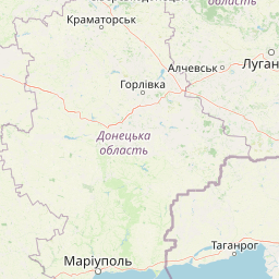
Why Holy Mountains National Nature Park stands out

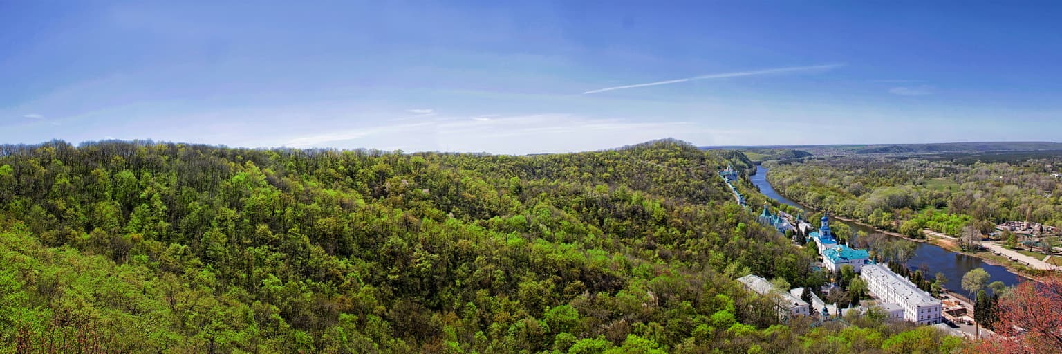
The Holy Mountains are best known for their extraordinary chalk cliffs that rise along the Donets River, a geological formation so significant that it was included in the "Seven Natural Wonders of Ukraine" competition. These chalk outcrops preserve relic plant species dating from the Cretaceous period, including the rare chalk pine that survived from pre-glacial times. The park is also famous for protecting one of the most biodiverse forest ecosystems in the Pontic-Caspian steppe region, with forests covering over 90% of the territory despite being located in a predominantly grassland biome. The Sviatohirsk Lavra monastery, perched on the rocky right bank of the Donets, adds profound cultural and religious significance to the natural landscape.

Wide view of snow-covered mountain peaks above a forested landscape with rocky outcrops under a partly cloudy sky
Snow-capped mountain peaks (Gorgany and Dovzhanka) visible in Holy Mountains National Nature Park with forested slopes in the foreground

Holy Mountains National Nature Park history and protected-area timeline

The history of protection for the Holy Mountains area spans more than a century. Naturalist V. Taliev first proposed creating a national park in this area in 1913, publishing the suggestion in the bulletins of the Kharkiv Society of Nature Lovers and again in his 1914 book "Protect Nature." This early proposal highlighted the area's exceptional natural value and the need for conservation. Following decades of various protected designations at the local level, the Holy Mountains National Nature Park was officially established on February 13, 1997, through Presidential Decree № 135/97. Prior to the national park designation, a state historical-cultural reserve was created on the park's territory in 1980, focused on preserving the Sviatohirsk Lavra complex and related archaeological sites. The park absorbed numerous pre-existing protected areas, including the Mayatska Datcha botanical preserve, the Sosna forest reserve, and various other natural monuments. In 2005, the Sviatohirsk Lavra was elevated to lavra status, the highest ranking for Orthodox monasteries in Ukraine. The park has faced significant challenges since 2022 due to the Russian invasion of Ukraine, with large portions of the protected area damaged by fires and military operations.

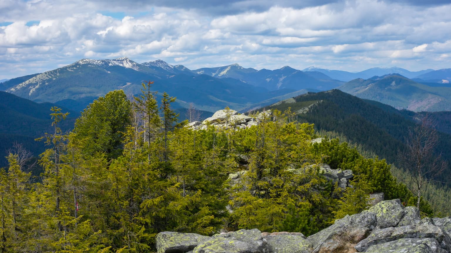
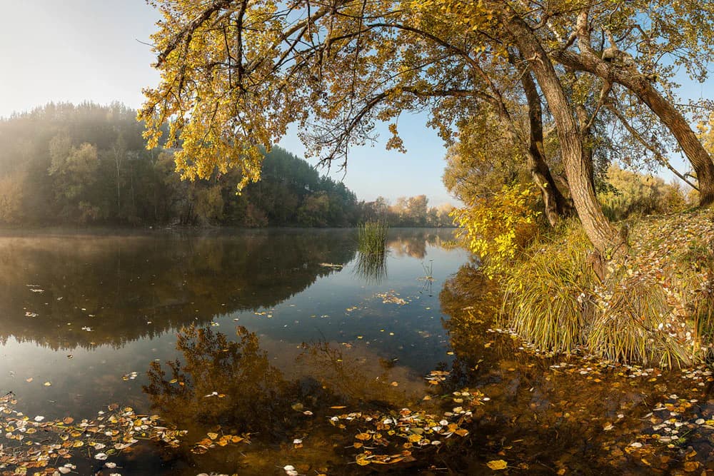
Holy Mountains National Nature Park landscape and geographic character

The landscape of Holy Mountains National Nature Park is defined by the dramatic interplay between the Donets River and the surrounding terrain. The right bank features chalk hills that rise sharply 120 to 130 meters above the river, their white limestone cliffs visible for kilometers and creating one of the most distinctive skylines in eastern Ukraine. These chalk outcrops, which gave the area its name, are among the northernmost exposures of this geological formation in the region. The left bank presents a contrasting scene of lower-lying flood terraces, where the river has deposited sediments over millennia, creating a network of wetlands, oxbow lakes, and small streams. The Donets itself is a significant river, with annual floods averaging 2.5 meters and peak floods of 5.8 meters occurring approximately every five years. The forest cover is extensive, with deciduous woodlands clothing both the slopes of the chalk hills and the river terraces, an unusual sight in the typically open steppe landscape. The combination of water, cliffs, and forest creates a landscape of considerable scenic beauty.

Calm river reflecting autumn trees and fallen leaves with forested hills in the background
Autumn river landscape reflecting trees and foliage in Holy Mountains National Nature Park

Holy Mountains National Nature Park ecosystems, habitats, and plant life

The ecological character of Holy Mountains National Nature Park is remarkable for its exceptional biodiversity within a relatively small area, particularly given its location in the Pontic-Caspian steppe region. The park's forests cover approximately 91% of the territory, a striking figure for an area theoretically situated in a grassland biome. This forest presence is made possible by the mountainous relief and consistent water availability from the Donets River and its tributaries. The deciduous forests on the left bank feature mature stands of oak, ash, lime, and maple, with oak comprising roughly one-third of the tree population. The first river terraces often support pine stands on sandy soils. Beyond the forests, the park contains willow-alder bogs covering 2.5% of the area and meadows accounting for 1.5%. The herbaceous vegetation tends toward steppe species, with the overall plant diversity reaching 943 recorded species, including 20 endemic species and many Cretaceous relict plants. The chalk pine found here represents a pre-glacial survivor, persisting from an era before the last ice age.

Dirt path alongside a misty river with trees and autumn foliage under early morning light
Sunrise over a misty river with autumn trees in Holy Mountains National Nature Park

Holy Mountains National Nature Park wildlife and species highlights

The wildlife population of Holy Mountains National Nature Park reflects the park's diverse habitats, with more than 250 animal species recorded within its boundaries. The park supports significant populations of predatory mammals including foxes, martens, and wolves, with foxes commonly denning within the protected area while also ranging into adjacent farmland. The bird population is particularly impressive, with over 200 species documented, making the park an important area for avian biodiversity in the region. Fish diversity includes 40 species, while the reptile population comprises 10 species and mammals total 48 species. Nine amphibian species have also been recorded. Of particular conservation significance, 50 animal species found in the park are listed in Ukraine's Red Book, indicating their protected status at the national level. The wetlands and river channels provide crucial habitat for waterfowl and migratory birds, while the forests support both resident species and seasonal visitors.

Panoramic landscape of Holy Mountains National Nature Park with dense green forests, a winding river, and distant hills under a clear blue sky
Panoramic view of Holy Mountains National Nature Park showing forested hills and a winding river

Holy Mountains National Nature Park conservation status and protection priorities

Holy Mountains National Nature Park serves as a critical conservation stronghold in eastern Ukraine, protecting a unique combination of geological, botanical, and cultural heritage. The park's designation as an IUCN Category II protected area reflects its dual role in nature conservation and sustainable recreation. The chalk mountain ecosystems harbor numerous relic and endemic species that survived from the Cretaceous period, making the area of significant scientific interest. The forest coverage, unusual for the steppe zone, demonstrates successful ecosystem preservation and provides habitat for species typically found in more northern latitudes. However, the park faces severe conservation challenges following the 2022 Russian invasion, with reports indicating that approximately 80% of the area under direct park management has been damaged or destroyed by fires and military activity. This represents a profound setback for decades of conservation work and highlights the vulnerability of protected areas during armed conflicts.

Holy Mountains National Nature Park cultural meaning and human context

The cultural significance of Holy Mountains National Nature Park extends far beyond its ecological values, with the area containing one of Ukraine's most important religious sites. The Sviatohirsk Lavra, officially the Holy Assumption Sviatohirsk Lavra, is an Orthodox monastery founded between the 13th and 16th centuries and situated on the rocky right bank of the Donets River. The monastery was granted lavra status in 2005, recognizing its spiritual and historical importance to Ukrainian Orthodoxy. The park contains 129 archaeological sites spanning from the Paleolithic period through the Middle Ages, as well as 73 historical monuments. A notable feature is the monument to Artem (Fedir Serhiiev), a Soviet revolutionary and founder of Donetsk, created by sculptor Ivan Kavaleridze, located alongside a World War II memorial. The park's territory includes the town of Sviatohirsk and portions of Sloviansk, making it one of the more densely populated protected areas in Ukraine, with roads, railways, and settlements within its boundaries.

Top sights and standout views in Holy Mountains National Nature Park

The Holy Mountains stand out as one of Ukraine's most visually distinctive protected areas, where white chalk cliffs rise abruptly above the forested river valley. The combination of the Sviatohirsk Lavra monastery perched atop these cliffs creates an unforgettable cultural landscape. The park's forest coverage is exceptional for the steppe zone, and the biodiversity includes species found nowhere else in Ukraine. The chalk pine stands represent living relics from the Cretaceous period, while the wetlands support internationally significant bird populations. The area has been recognized as one of Ukraine's natural treasures, with the chalk mountains ranking among the candidates for the "Seven Natural Wonders of Ukraine."

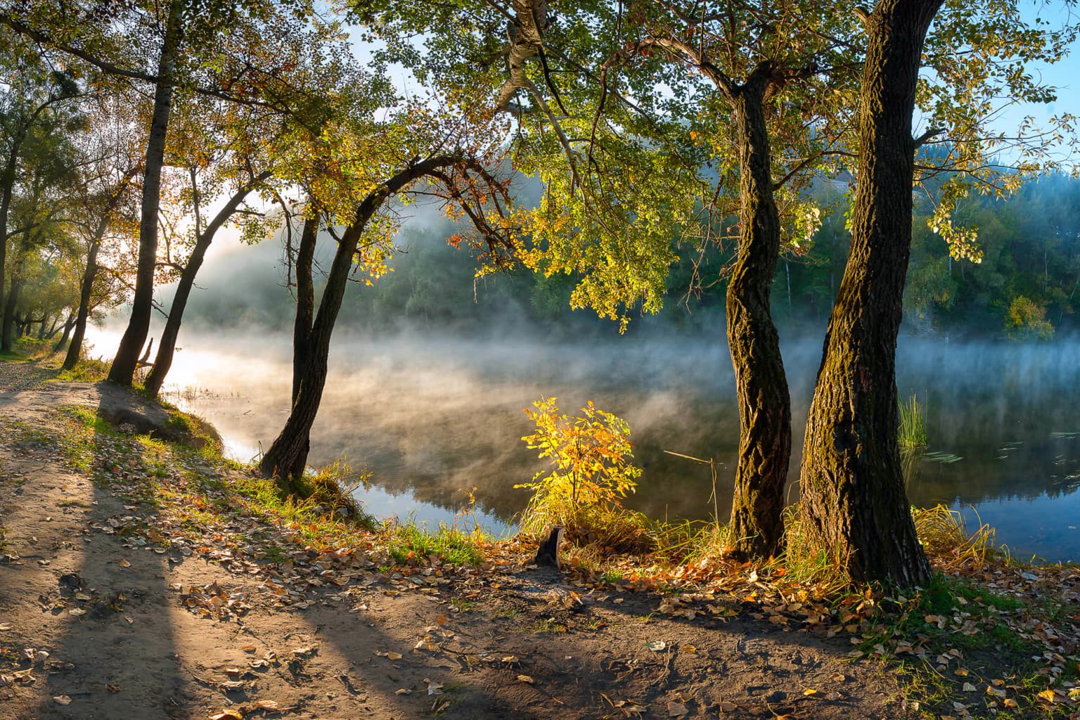
Best time to visit Holy Mountains National Nature Park

The park offers distinct experiences across seasons, with each time of year revealing different aspects of its character. Summer brings warm conditions ideal for hiking the forest trails and exploring the monastery complex, though this is also the peak visitor season. Autumn transforms the deciduous forests into vibrant displays of color, and the reduced water levels in the Donets reveal more of the riverbed and sandbars. Winter snow covers the white chalk cliffs, creating a striking contrast against the dark evergreen pines and deciduous trees stripped of their leaves. Spring coincides with the Donets flood season, when water levels rise dramatically and the wetlands fill, creating excellent conditions for birdwatching as migratory species return. The park's accessibility may be affected by the ongoing conflict in the region, and visitors should check current conditions before planning any trip.

Park location guide

Geography guide, regional context, and park location map for Holy Mountains National Nature Park

Holy Mountains National Nature Park park geography, regions, and map view in Ukraine
Understand where Holy Mountains National Nature Park sits in Ukraine through a broader geographic reading of the surrounding landscape, nearby location context, and its mapped position within the national park landscape.

How Holy Mountains National Nature Park fits into Ukraine

Ukraine is a sovereign nation in Eastern Europe, bordered by Russia, Belarus, Poland, Slovakia, Hungary, Romania, Moldova, and the Black Sea. It is the second-largest country in Europe by area. Kyiv is the capital and largest city, followed by Kharkiv, Odesa, and Dnipro. The official language is Ukrainian. Ukraine has a population of approximately 32.9 million and operates as a unitary semi-presidential republic.

Wider geography shaping Holy Mountains National Nature Park in Ukraine

Ukraine occupies 603,628 km² in Eastern Europe, making it the second-largest country in Europe. It shares borders with Russia, Belarus, Poland, Slovakia, Hungary, Romania, and Moldova. The country has a southern coastline along the Black Sea and Sea of Azov. The terrain includes plains, steppes, and the Carpathian Mountains in the west.

Map view of Holy Mountains National Nature Park

Use this park location map to pinpoint Holy Mountains National Nature Park in Ukraine, understand its exact geographic position, and read its mapped placement within the surrounding landscape more clearly.

Pigeon | © OpenStreetMap contributors

Location context for Holy Mountains National Nature Park

Donetsk Oblast

Explore the dramatic chalk cliffs, forested riverbanks, and distinct protected habitats of Holy Mountains National Nature Park.

Holy Mountains National Nature Park Photography: Visual Exploration of Ukraine's Unique Landscapes
Visually explore the distinctive chalk cliffs, extensive riverine forests, and unique steppe habitats that define Holy Mountains National Nature Park. These protected area images provide essential context for understanding the park's dramatic terrain and ecological significance within eastern Ukraine's landscape.

Wide view of snow-covered mountain peaks above a forested landscape with rocky outcrops under a partly cloudy sky

Aerial view of the Sviatohirsk Lavra monastery complex with blue domes situated on a forested hillside above the Donets River under a cloudy sky with sunbeams

Calm river reflecting autumn trees and fallen leaves with forested hills in the background

Dirt path alongside a misty river with trees and autumn foliage under early morning light

Panoramic landscape of Holy Mountains National Nature Park with dense green forests, a winding river, and distant hills under a clear blue sky

Panoramic landscape view featuring a fog-filled valley, forested hills on the left, and trees in the foreground under a partly cloudy sky

Park atlas

Compare the diverse protected landscapes and geographical features of Donetsk Oblast and surrounding regions.

Discover Nearby National Parks and Protected Areas Beyond Holy Mountains National Nature Park
After exploring Holy Mountains National Nature Park, you can browse other protected areas within Donetsk Oblast and the broader Eastern Ukraine region. This allows for geographical comparison of diverse landscapes, from riverine forests and chalk cliffs to steppe ecosystems, enhancing your understanding of regional conservation efforts.
Watercolor illustration of a river valley with hills, green fields, and distant mountains under a soft sky
National parkUkraine

Dvorichna National Nature Park: Protected Landscape and Geographic Atlas in Ukraine

Explore mapped boundaries and regional geography within Ukraine.

Understand the protected landscape identity of Dvorichna National Nature Park, a national park situated in Ukraine. This page provides detailed geographic context, focusing on mapped protected areas and the park's natural terrain. It serves as an atlas entry point to comprehend the park's placement within Eastern Europe and its significance as a conservation landscape.

Area
31.31 km²
Established
2009
IUCN
II
Relief
Highland
Watercolor illustration showing a valley with a winding river, green trees, and distant purple mountains under a light sky
National parkKharkiv Oblast

Homilsha Woods National Nature Park: National Park & Protected Landscape Atlas

Ancient oak woodlands and river valley geography in Kharkiv Oblast.

Delve into the protected natural heritage of Homilsha Woods National Nature Park, a significant national park situated in Ukraine's Kharkiv Oblast. This park preserves exceptional examples of ancient oak forests, some hundreds of years old, set within a complex geographic transition zone between steppe and forest ecosystems. Its diverse terrain, including hilly uplands and riverine plains, provides a compelling subject for mapped landscape discovery and understanding regional protected area distribution.

Area
143 km²
Established
2004
IUCN
II
Relief
Upland
Watercolor painting of a coastal scene with green hills, trees, and a body of water
National parkDonetsk Oblast

Meotyda National Nature Park: Coastal Wetlands and Bird Migration Hub in Donetsk Oblast

Explore protected park boundaries and unique Azov Sea ecosystems.

Meotyda National Nature Park protects a critical stretch of the Sea of Azov coastline, featuring diverse habitats such as coastal wetlands, estuaries, and steppe. Located in Donetsk Oblast, this national park is internationally recognized for its importance to migratory birds, supporting millions of waterfowl and over 100 nesting bird species annually. MoriAtlas offers an in-depth view of its geographic setting, mapped protected area, and its role within regional ecological corridors, providing essential context for understanding this significant Ukrainian natural landscape.

Area
207.21 km²
Established
2009
IUCN
II
Relief
Lowland
National parkKharkiv Oblast

Sloboda National Nature Park: National Park Protected Landscape in Kharkiv Oblast

Mapped Boundaries and Regional Geography Exploration

Investigate Sloboda National Nature Park, a recognized national park situated within Ukraine's Kharkiv Oblast. This page offers detailed insights into its protected landscape, focusing on its geographic setting and mapped terrain. Understand how this park contributes to the regional geography of Sloboda Ukraine and explore its mapped boundaries for a structured atlas discovery experience.

Area
52.44 km²
Established
2009
IUCN
II
Relief
Mixed relief
National parkSumy Oblast

Hetman National Nature Park: National Park Geography and Protected Landscape Atlas

Mapped protected area within Sumy Oblast, Ukraine.

Explore Hetman National Nature Park, a designated national park situated in Sumy Oblast, Ukraine. This page offers a detailed look at its geographic setting, mapped boundaries, and role as a protected landscape. Understand its place within the regional geography of northeastern Ukraine and utilize MoriAtlas for structured map-based discovery of this significant natural area.

Area
234 km²
Established
2009
IUCN
II
Relief
Lowland
Watercolor illustration of a landscape with rolling hills, a body of water, and greenery
National parkZaporizhzhia Oblast

Grand Meadow National Nature Park: National Park Protected Landscape and Regional Geography

Explore the mapped boundaries and natural terrain.

Grand Meadow National Nature Park represents a distinct protected landscape within Zaporizhzhia Oblast, Ukraine. As a national park, its designation signifies an area managed for conservation and geographic study. This entry on MoriAtlas details the park's physical presence, offering users the opportunity to explore its mapped terrain, understand its role in regional geography, and place it within the broader atlas of Ukrainian protected areas. It is ideal for users seeking concrete landscape context and precise geographic data.

Area
168 km²
Established
2006
IUCN
II
Relief
Lowland
National parkZaporizhzhia Oblast

Pryazovia National Nature Park: National Park Protected Landscape Atlas

Explore the mapped boundaries and regional geography of Pryazovia National Nature Park.

Pryazovia National Nature Park represents a key protected area within Zaporizhzhia Oblast, Ukraine. This MoriAtlas entry provides detailed atlas-style information, emphasizing the park's mapped boundaries and its integration into the regional geography. Understand the park's character as a protected natural landscape situated in the southeastern Ukrainian coastal zone near the Sea of Azov, offering valuable context for geographic exploration.

Area
781 km²
Established
2010
IUCN
II
Relief
Lowland
Watercolor depiction of a river flowing through wetlands with green vegetation, trees, and distant hills under a soft sky
National parkPoltava Oblast

Lower Sula National Nature Park: Protected Wetlands and River Floodplain Atlas Explorer

Mapped boundaries and geography of this Ukrainian national park.

Discover the detailed geography and protected landscape features of Lower Sula National Nature Park, located in Poltava Oblast, Ukraine. This page provides an atlas-level view of its critical wetland habitats, including marshes and shallow lakes, which are vital for waterfowl and fish spawning. Explore the park's unique position within the Sula River floodplain and its ecological significance as a national nature park, offering rich context for geographic study.

Area
186 km²
Established
2010
IUCN
II
Relief
Lowland

Common questions about visiting, size, designation, and location context for Holy Mountains National Nature Park

Holy Mountains National Nature Park FAQs for park facts, access, geography, and protected area context
Find quick answers about Holy Mountains National Nature Park, including protected-area facts, park geography, trail and visitor context, and how the park fits into its surrounding country and regional landscape.
MoriAtlas Explorer

Continue Your Protected Areas Search Across the Global Atlas

Deepen your exploration by continuing the structured search for national parks and protected areas worldwide. Utilize the comprehensive filtering capabilities to compare different conservation landscapes and refine your understanding of global park geography. Discover more about the distribution and characteristics of protected natural areas.

Global natural geography