Mori Atlas logo
National parkHomilsha Woods National Nature Park

Explore ancient oak forests and unique terrain across the Donets River valley in this vital protected area.

Homilsha Woods National Nature Park: National Park Protected Landscape in Kharkiv Oblast, Ukraine

(National Nature Park «Homilshanski Lisy»)

Homilsha Woods National Nature Park stands as a significant protected landscape within Ukraine's Kharkiv Oblast, safeguarding a critical forest-steppe transition zone. This national park encompasses roughly 14,300 hectares, characterized by ancient oak woodlands, pine forests on sandy terraces, and riverine wetlands along the Donets River. Its geographic setting features the hilly spurs of the Middle Russian Uplands contrasting with the flat East European Plain, offering a rich tapestry of mapped terrain and ecosystems for atlas exploration.

forest-steppeancient forestsoak woodlandswetlandsriver ecosystemsEastern Ukraine
Stylized illustration of a forested landscape featuring a waterfall, river, tall pine trees, and mountain cliffs under a pink sky with clouds

Homilsha Woods National Nature Park

National park

Park overview

Structured park overview, official facts, and landscape profile for Homilsha Woods National Nature Park

Homilsha Woods National Nature Park park facts, protected area profile, and essential visitor context
Review the core facts for Homilsha Woods National Nature Park, including designation, size, terrain, visitor scale, habitats, and operating context in one park-focused overview.

About Homilsha Woods National Nature Park

Homilsha Woods National Nature Park was established by presidential decree in September 2004 with the goal of preserving, restoring, and sustainably using the typical and unique forest-steppe natural complexes of the Donets River valley. The park occupies a picturesque corner of left-bank Ukraine in the valleys of the Siverskyi Donets and Homilsha rivers, approximately 45 kilometers from Kharkiv. The protected area encompasses a complex mosaic of forest, meadow, and wetland habitats that have developed on the river terraces and adjacent uplands. The forests of the park are among the best preserved in eastern Ukraine, with ancient oak stands representing a vanishing ecosystem type across the broader region. The park also contains remarkable archaeological and historical heritage, with numerous sites documenting human occupation from the Neolithic period through the era of Kyivan Rus and the Cossack period. The territory is functionally divided into a strict protected zone, regulated recreation zone, stationary recreation zone, and economic zone, with special "especially valuable natural areas" designated for enhanced protection.

Quick facts and research context for Homilsha Woods National Nature Park

Homilsha Woods National Nature Park spans 14,314 hectares in Kharkiv Oblast, Ukraine, established in 2004. The protected area occupies the middle reaches of the Donets River and Gomolshy River, featuring a mosaic of forest types within the forest-steppe zone. The region experiences a humid continental climate with warm summers and cold snowy winters, with average temperatures around 21.5 degrees Celsius in August. The park lies at the southern boundary of the Left-Bank forest-steppe, resulting in exceptional floristic diversity with nearly 1,000 vascular plant species, including 132 rare species. The area contains significant archaeological sites spanning from the Bronze Age to the era of Kyivan Rus.

Park context

Deeper park guide and search-rich context for Homilsha Woods National Nature Park

Homilsha Woods National Nature Park history, landscape, wildlife, and travel context
Explore Homilsha Woods National Nature Park through its history, landscape character, ecosystems, wildlife, conservation priorities, cultural context, and seasonal travel timing in a structured park guide built for atlas discovery and search intent.

Why Homilsha Woods National Nature Park stands out

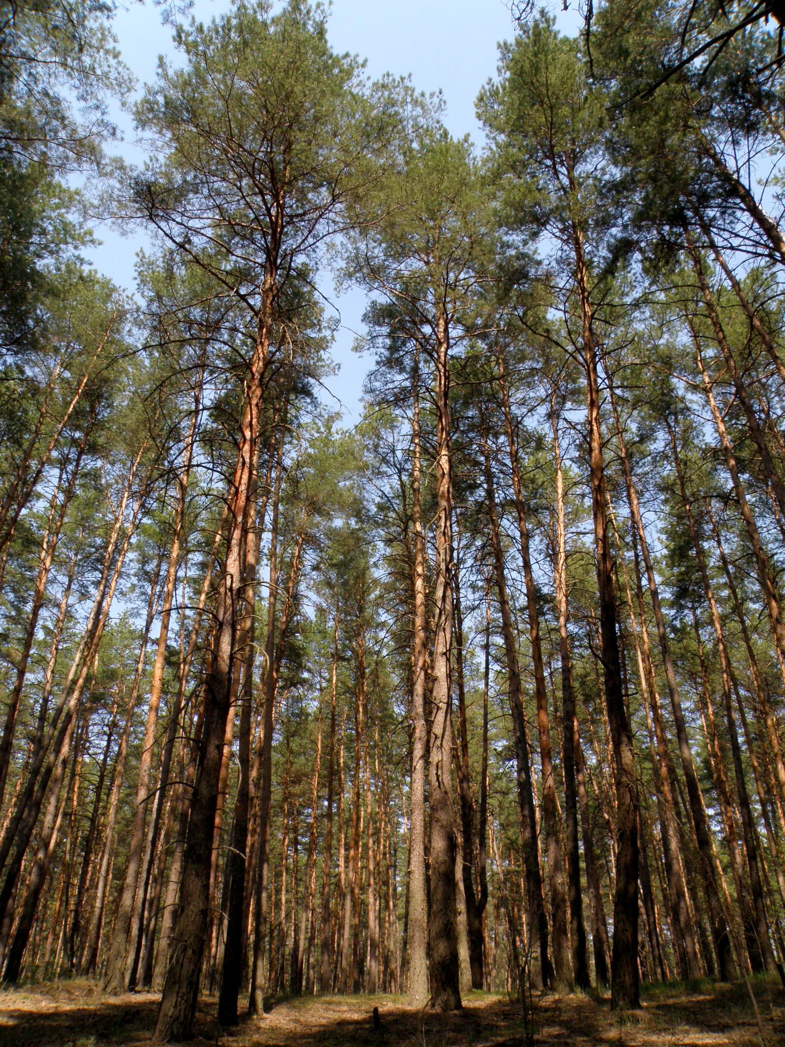
Homilsha Woods is best known for its ancient oak forests, some of the finest on Ukraine's left bank, with specimens reaching 600 years old. The park occupies a critical position in the forest-steppe transition zone, protecting representative examples of oak-hornbeam forests, pine forests on sandy terraces, and floodplain ecosystems. Its biodiversity is exceptional for the region, with over 850 plant species, 153 bird species, 53 mammal species, and more than 1,200 non-lichen-forming fungi documented within the boundaries. The park also preserves a chain of oxbow lakes and wetlands along the Donets River, supporting significant populations of waterfowl and wetland-dependent species.

Tall pine trees in a forest with a clear blue sky
Tall pine trees in Homilsha Woods National Nature Park

Homilsha Woods National Nature Park history and protected-area timeline

The protection history of Homilsha Woods dates back to the era of Peter the Great, who designated local territory as a "protected ship grove" to ensure a sustainable supply of timber for shipbuilding. Scientific interest in preserving this forest began in 1914, when researchers from Kharkiv University, led by Professor V.M. Arnoldi, proposed granting protected status to the area due to its value as a reserve of rare, relict, and endemic plant and animal species. In the early 20th century, portions of ancient forest were protected, and in 1926, the floodplain area in the Khomutky tract was declared a bird sanctuary. By 1932, the Homilshanska Lisova Dacha and the Khomutky floodplain forest were protected as republican-level nature monuments. In 1972, the Homilshanska Lisova Dacha landscape reserve covering 9,092 hectares was established, which formed the core upon which the national nature park was created in 2004. The park's creation fulfilled decades of scientific advocacy for the region's protection.

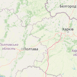
Homilsha Woods National Nature Park landscape and geographic character

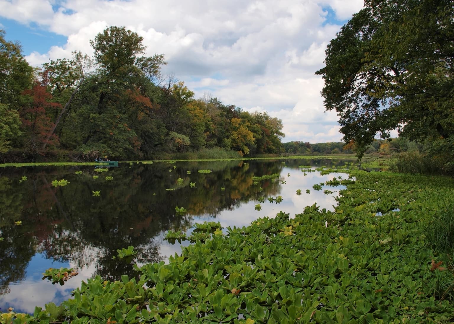
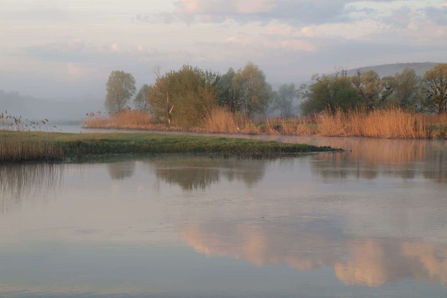
The park is composed of protected and recreational areas along both banks of the middle reaches of the Donets River and the Gomolshy River. The right bank features hilly spurs of the Middle Russian Uplands rising up to 100 meters above the river valley, while the left bank consists of the flat East European Plain. The terrain is characterized by hills and ravines, with steep cliffs along the river valleys exposing geological strata that document paleographical conditions from the Eocene epoch. Notable geomorphological features include the "Pravallia" multi-step landslide covered in steppe and shrub vegetation, and a landslide on the slopes of Monastyrska Mountain reaching 60 meters in height. The park contains numerous oxbow lakes and wetlands, including Bile Lake extending 1,122 meters with a maximum width of 297 meters, and the Kosach inlet representing an old channel of the Siverskyi Donets.

Forest-covered mountain ridges and distant peaks under a partly cloudy sky
Panoramic view of forested mountain ridges under a partly cloudy sky

Homilsha Woods National Nature Park ecosystems, habitats, and plant life

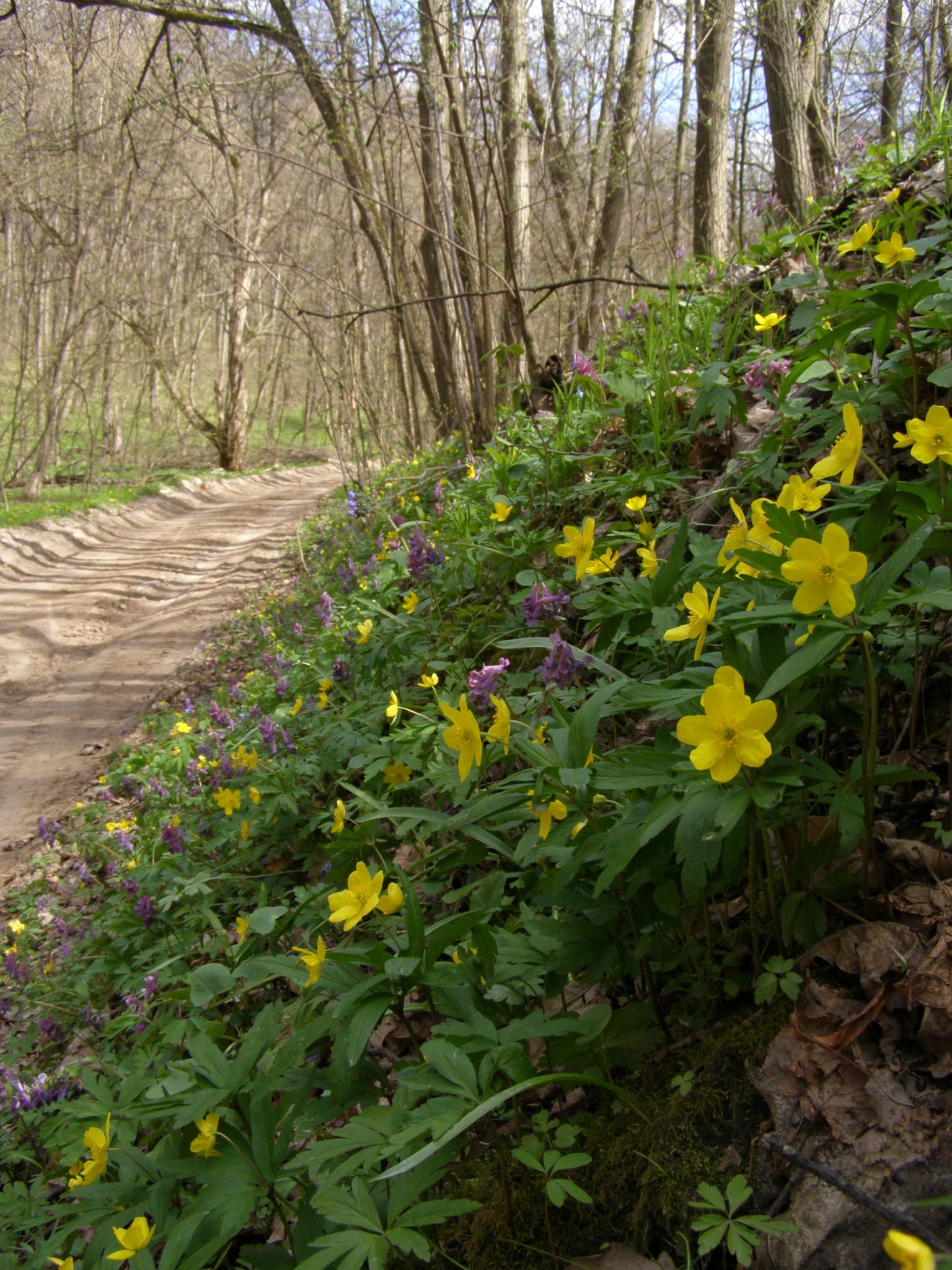
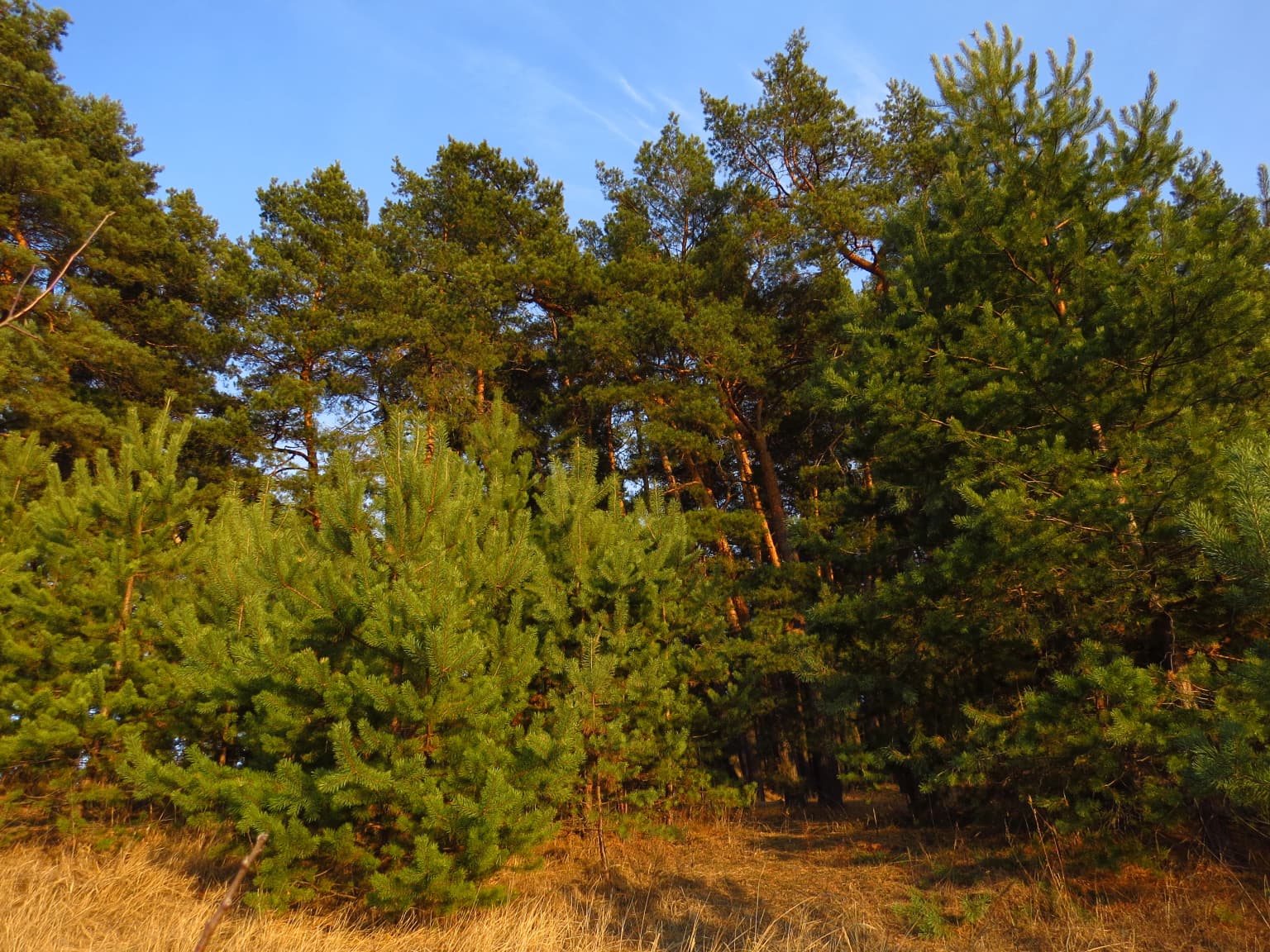
Homilsha Woods occupies the southern boundary of the Left-Bank forest-steppe, resulting in exceptional floristic diversity. The park contains approximately 1,000 species of vascular plants, with 132 species classified as rare. These include plants of oak forests (37 species), pine terrace species (34 species), floodplain meadow species (31 species), and steppe species (30 species). The forests are dominated by maple-ash-oak communities on the slopes of the right bank, while the sandy terraces of the left bank support pine forests and mixed pine-oak "subor" communities. Floodplain forests feature elm and maple, along with poplar stands, willow groves, and alder carrs. Approximately 500 hectares of forest are 130 to 150 years old, with individual oaks reaching 200 to 300 years, and the oldest specimens approaching 600 years. The park's soils represent nearly the entire spectrum of forest-steppe soils, with particular value being their occurrence under primary natural vegetation representing unaltered or minimally altered soil profiles.

A lake with floating green aquatic plants reflecting trees and a partly cloudy sky
A calm lake reflecting trees and sky, with Pistia plants floating on the water surface

Homilsha Woods National Nature Park wildlife and species highlights

The animal population of Homilsha Woods includes diverse zoogeographic groups, primarily species with broad ranges. The core of the animal community consists of representatives of the nemoral forest complex, with Mediterranean species at the northern limits of their distribution. The forests contain relict species of Atlantic, Tertiary, and glacial origin, while the bogs of the pine terrace support isolated taiga fauna elements, and sandy areas harbor psammophilous and thermophilic species of Mediterranean and even Central Asian origin. The park hosts 153 bird species, including rare European species such as the roller, bee-eater, and hoopoe. Floodplain meadows support the corncrake, a species listed on the IUCN Red List and European Red List. Large birds of prey nesting in the park include the lesser spotted eagle, white-tailed eagle, osprey, short-toed eagle, and imperial eagle. Mammal diversity includes 53 species, with notable species including the European mink, river otter, badger, and ten bat species. The park also documents 50 fish species and remarkable invertebrate diversity, including 40 insect species listed in the Red Book of Ukraine.

Dirt road in forest with yellow and purple wildflowers, trees in background.
Dirt road through forested area with wildflowers in Homilsha Woods National Nature Park.

Homilsha Woods National Nature Park conservation status and protection priorities

Homilsha Woods occupies a special place in Ukrainian nature conservation. The strict protection zone was strategically placed in the very heart of the park, creating natural barriers to human access while preserving core ecological areas. Additionally, special protective areas ranging from 10 to 120 hectares, designated as "especially valuable natural territories," were established in the economic and regulated recreation zones. These areas prohibit clear-cutting, selective logging, recreation infrastructure, and prescribed mowing is conducted in autumn rather than spring. As a result, 35 percent of the park (10.7 percent strict reserve and 24.3 percent especially valuable territories) operates under strict protection. Conservation outcomes have been significant, with the return of elk and formation of a regional population core, new bat colonies, doubled density of the smooth snake, restoration of post-breeding and migratory waterfowl congregations, and increased populations of red-listed bird species including the lesser spotted eagle (from 2 to 7 pairs) and black kite (from 3 to 5 pairs).

Homilsha Woods National Nature Park cultural meaning and human context

The territory of Homilsha Woods contains dozens of archaeological sites of European significance, including the Velikohomilske and Sukhohomilske fortified settlements. Archaeological remains include settlements, burial mounds, and other cultural monuments spanning from the Neolithic (sixth to third millennium BC) through the era of Kyivan Rus. The Great Homilsha fortified settlement, surrounded by earthworks with a burial mound complex containing over a thousand barrows from the Scythian period (sixth to third century BC), holds particular historical importance. The Suhohomilsky archaeological complex features medieval defensive walls, dwellings, and burial structures from the eighth to tenth centuries. The stone-walled settlement "Koropove" between Korobiv Khutir and Haidary represents a two-layer site with Scythian and Romny culture components. The ruins of the Saint Nicholas Monastery, founded in 1648 by Zaporizhzhia Cossacks as the last center of free Cossackdom in Ukraine, also survive within the park.

Calm river reflecting sky and clouds with grassy shore, reeds, and trees
Morning mist over the Dinets River in Homilsha Woods National Nature Park

Top sights and standout views in Homilsha Woods National Nature Park

The park offers five major hiking routes accessing both natural and cultural monuments, with shorter trails to historical and archaeological sites. Guided excursions are available, and educational programs along with scientific research projects are conducted by park management. Accommodation is available at marked points along the river, and swimming is permitted at designated areas. The region has developed as a green tourism destination with hotels and restaurants oriented toward European standards of environmental materials and energy-saving construction. The ecological routes include "Siversko-Donetski Krutoskhy" (Siverskyi Donets Steep Slopes), "Dubovyi Hai" (Oak Grove), and "Kozacha Hora" (Cossack Mountain). The ancient oak "Cossack Oak of Pynkrata Ryabukha" and the old Murava route with several 350-year-old oak giants represent living historical monuments within the forest.

A dense forest of pine trees with dry grass under a clear blue sky
Pine forest in Homilsha Woods National Nature Park

Best time to visit Homilsha Woods National Nature Park

The park can be visited year-round, though the most comfortable period for outdoor exploration is during the warm summer months from May through September, when average temperatures reach 21.5 degrees Celsius. Spring and early summer bring vibrant wildflower displays in the meadows and forest clearings, while autumn offers colorful foliage in the deciduous forests. Winter visits provide opportunities to experience the snow-covered landscape and observe winter-active wildlife, though some facilities may have limited availability. The frost-free period extends 155 to 160 days, making late spring through early autumn the optimal window for most visitor activities.

Park location guide

Geography guide, regional context, and park location map for Homilsha Woods National Nature Park

Homilsha Woods National Nature Park park geography, regions, and map view in Ukraine
Understand where Homilsha Woods National Nature Park sits in Ukraine through a broader geographic reading of the surrounding landscape, nearby location context, and its mapped position within the national park landscape.

How Homilsha Woods National Nature Park fits into Ukraine

Ukraine is a sovereign nation in Eastern Europe, bordered by Russia, Belarus, Poland, Slovakia, Hungary, Romania, Moldova, and the Black Sea. It is the second-largest country in Europe by area. Kyiv is the capital and largest city, followed by Kharkiv, Odesa, and Dnipro. The official language is Ukrainian. Ukraine has a population of approximately 32.9 million and operates as a unitary semi-presidential republic.

Wider geography shaping Homilsha Woods National Nature Park in Ukraine

Ukraine occupies 603,628 km² in Eastern Europe, making it the second-largest country in Europe. It shares borders with Russia, Belarus, Poland, Slovakia, Hungary, Romania, and Moldova. The country has a southern coastline along the Black Sea and Sea of Azov. The terrain includes plains, steppes, and the Carpathian Mountains in the west.

Map view of Homilsha Woods National Nature Park

Use this park location map to pinpoint Homilsha Woods National Nature Park in Ukraine, understand its exact geographic position, and read its mapped placement within the surrounding landscape more clearly.

Pigeon | © OpenStreetMap contributors

Location context for Homilsha Woods National Nature Park

Chuhuiv RaionKharkiv Oblast

Explore the diverse protected landscapes of Eastern Ukraine, revealing the park's distinct forest-steppe environment and riverine ecosystems.

Homilsha Woods National Nature Park: Visual Exploration of Forest-Steppe Landscapes and Ancient Oak Woodlands
Browse comprehensive photography of Homilsha Woods National Nature Park to visually understand its significant forest-steppe ecosystems, ancient oak stands, and Donets River valley. These images provide essential geographic context, detailing the hilly uplands, flat plains, wetlands, and diverse habitats that define this protected area's unique character.

Tall pine trees in a forest with a clear blue sky

A large mature oak tree with thick trunk and extensive branches, surrounded by green foliage and a wooden fence in a forested area

Forest-covered mountain ridges and distant peaks under a partly cloudy sky

A lake with floating green aquatic plants reflecting trees and a partly cloudy sky

Dirt road in forest with yellow and purple wildflowers, trees in background.

A single red Fritillaria flower with patterned petals, green stem, and blurred green meadow background under a partly cloudy sky

Calm river reflecting sky and clouds with grassy shore, reeds, and trees

A dense forest of pine trees with dry grass under a clear blue sky

Wide river with dense green forests on both banks and a small clearing with structures on the left bank

A calm river reflecting dense green forest and distant hills under a bright sky

Pistia water hyacinth floating on calm water in an old riverbed, with a wooden boat on the shore, surrounded by trees and vegetation

River with calm water reflecting trees and sky, showing natural debris blockage in wetland area with tall grasses and vegetation

Forest scene with a mix of green and bare trees, a path leading down a slope, and a river visible in the background

Multiple snakes coiled on a decaying tree stump surrounded by tall green grass

Park atlas

Trace the broader geographic context of protected landscapes, comparing national parks and natural reserves across Eastern Ukraine and Kharkiv Oblast.

Explore Other National Parks and Protected Areas Near Homilsha Woods National Nature Park
Explore additional national parks and protected areas near Homilsha Woods National Nature Park, including other significant forest-steppe ecosystems and river valley landscapes in Eastern Ukraine. Comparing these mapped park geographies offers a clearer understanding of regional conservation efforts and the diverse protected areas across Kharkiv Oblast.
National parkKharkiv Oblast

Sloboda National Nature Park: National Park Protected Landscape in Kharkiv Oblast

Mapped Boundaries and Regional Geography Exploration

Investigate Sloboda National Nature Park, a recognized national park situated within Ukraine's Kharkiv Oblast. This page offers detailed insights into its protected landscape, focusing on its geographic setting and mapped terrain. Understand how this park contributes to the regional geography of Sloboda Ukraine and explore its mapped boundaries for a structured atlas discovery experience.

Area
52.44 km²
Established
2009
IUCN
II
Relief
Mixed relief
Watercolor illustration of a river valley with hills, green fields, and distant mountains under a soft sky
National parkUkraine

Dvorichna National Nature Park: Protected Landscape and Geographic Atlas in Ukraine

Explore mapped boundaries and regional geography within Ukraine.

Understand the protected landscape identity of Dvorichna National Nature Park, a national park situated in Ukraine. This page provides detailed geographic context, focusing on mapped protected areas and the park's natural terrain. It serves as an atlas entry point to comprehend the park's placement within Eastern Europe and its significance as a conservation landscape.

Area
31.31 km²
Established
2009
IUCN
II
Relief
Highland
Watercolor illustration showing a river winding through a forested valley with rolling hills and distant mountains under a light sky
National parkDonetsk Oblast

Holy Mountains National Nature Park: Donetsk Oblast Protected Landscape

Mapped boundaries and regional geographic context.

This entry details Holy Mountains National Nature Park, a protected national park located in Donetsk Oblast, Ukraine. It serves as a key point for exploring the mapped protected areas and natural landscapes within the Donbas region. Understand the park's geographic significance and its place within the atlas of eastern Ukraine's diverse terrain and conservation efforts.

Area
406 km²
Established
1997
IUCN
II
Relief
Mixed relief
National parkSumy Oblast

Hetman National Nature Park: National Park Geography and Protected Landscape Atlas

Mapped protected area within Sumy Oblast, Ukraine.

Explore Hetman National Nature Park, a designated national park situated in Sumy Oblast, Ukraine. This page offers a detailed look at its geographic setting, mapped boundaries, and role as a protected landscape. Understand its place within the regional geography of northeastern Ukraine and utilize MoriAtlas for structured map-based discovery of this significant natural area.

Area
234 km²
Established
2009
IUCN
II
Relief
Lowland
Watercolor depiction of a river flowing through wetlands with green vegetation, trees, and distant hills under a soft sky
National parkPoltava Oblast

Lower Sula National Nature Park: Protected Wetlands and River Floodplain Atlas Explorer

Mapped boundaries and geography of this Ukrainian national park.

Discover the detailed geography and protected landscape features of Lower Sula National Nature Park, located in Poltava Oblast, Ukraine. This page provides an atlas-level view of its critical wetland habitats, including marshes and shallow lakes, which are vital for waterfowl and fish spawning. Explore the park's unique position within the Sula River floodplain and its ecological significance as a national nature park, offering rich context for geographic study.

Area
186 km²
Established
2010
IUCN
II
Relief
Lowland
Watercolor illustration of a landscape with rolling hills, a body of water, and greenery
National parkZaporizhzhia Oblast

Grand Meadow National Nature Park: National Park Protected Landscape and Regional Geography

Explore the mapped boundaries and natural terrain.

Grand Meadow National Nature Park represents a distinct protected landscape within Zaporizhzhia Oblast, Ukraine. As a national park, its designation signifies an area managed for conservation and geographic study. This entry on MoriAtlas details the park's physical presence, offering users the opportunity to explore its mapped terrain, understand its role in regional geography, and place it within the broader atlas of Ukrainian protected areas. It is ideal for users seeking concrete landscape context and precise geographic data.

Area
168 km²
Established
2006
IUCN
II
Relief
Lowland
National parkPoltava Oblast

Pyriatyn National Nature Park: Detailed Atlas View of Ukrainian River Valley Protected Landscapes

Explore Poltava Oblast's unique wetland and floodplain ecosystems.

Pyriatyn National Nature Park provides an exceptional case study of a complete river valley ecosystem within Ukraine's Poltava Oblast. This protected area showcases a distinct topographic sequence, transitioning from upland terraces to extensive floodplain wetlands and the meandering Udai River. Discover the park's significant role in conserving boreal plant species at their southern range limits and its importance as a mapped natural landscape for geographic atlas exploration.

Area
120 km²
Established
2009
IUCN
II
Relief
Lowland
Watercolor painting of a coastal scene with green hills, trees, and a body of water
National parkDonetsk Oblast

Meotyda National Nature Park: Coastal Wetlands and Bird Migration Hub in Donetsk Oblast

Explore protected park boundaries and unique Azov Sea ecosystems.

Meotyda National Nature Park protects a critical stretch of the Sea of Azov coastline, featuring diverse habitats such as coastal wetlands, estuaries, and steppe. Located in Donetsk Oblast, this national park is internationally recognized for its importance to migratory birds, supporting millions of waterfowl and over 100 nesting bird species annually. MoriAtlas offers an in-depth view of its geographic setting, mapped protected area, and its role within regional ecological corridors, providing essential context for understanding this significant Ukrainian natural landscape.

Area
207.21 km²
Established
2009
IUCN
II
Relief
Lowland

Common questions about visiting, size, designation, and location context for Homilsha Woods National Nature Park

Homilsha Woods National Nature Park FAQs for park facts, access, geography, and protected area context
Find quick answers about Homilsha Woods National Nature Park, including protected-area facts, park geography, trail and visitor context, and how the park fits into its surrounding country and regional landscape.
MoriAtlas Explorer

Continue Your Protected Areas Search Across the Global Atlas

Deepen your exploration by continuing the structured search for national parks and protected areas worldwide. Utilize the comprehensive filtering capabilities to compare different conservation landscapes and refine your understanding of global park geography. Discover more about the distribution and characteristics of protected natural areas.

Global natural geography