Mori Atlas logo
National parkSloboda National Nature Park

Discover the protected landscape boundaries and regional context of this Ukrainian national park.

Sloboda National Nature Park: A Designated National Park within Kharkiv Oblast's Geography

(Slobozhanskyi National Nature Park)

Sloboda National Nature Park represents a significant protected natural area within the eastern Ukrainian region of Kharkiv Oblast. As a designated national park, its protected landscape identity is integral to the mapped geography of the area. This page provides detailed atlas-style context, focusing on the park's boundaries and its place within the broader regional terrain, offering a unique lens for geographic discovery.

national parkswetlandsforest-steppeeastern Ukrainedeciduous forestsriver ecosystems

Sloboda National Nature Park

National park

Park overview

Structured park overview, official facts, and landscape profile for Sloboda National Nature Park

Sloboda National Nature Park park facts, protected area profile, and essential visitor context
Review the core facts for Sloboda National Nature Park, including designation, size, terrain, visitor scale, habitats, and operating context in one park-focused overview.

About Sloboda National Nature Park

Sloboda National Nature Park protects a distinctive forest-steppe landscape in eastern Ukraine where the Merla and Merchik Rivers converge within the East Poltava Highlands. The terrain features a complex topography of low river terraces with floodplains, meadows, and extensive marshland, transitioning to higher second terraces with forested hills and meadow-bog vegetation in depressions. This blend of wetland and upland habitats creates ecological diversity uncommon in the surrounding agricultural landscape. The park's establishment in 2009 reflects Ukraine's commitment to preserving representative examples of its natural heritage, with the site serving both conservation and environmental education functions. The wetland complex represents a critical ecological corridor and hydrological system, providing water regulation and habitat continuity for species adapted to this transition zone between steppe and forest biomes.

Quick facts and research context for Sloboda National Nature Park

Sloboda National Nature Park covers 5,244 hectares in eastern Ukraine's Kharkiv Oblast, established in 2009 as a protected forest-steppe ecosystem. The park sits at the confluence of the Merla and Merchik Rivers in the East Poltava Highlands, characterized by floodplain terraces, meadows, marshes, and rolling forest-steppe terrain. The humid continental climate features warm summers with four months averaging above 10°C. The park's forest cover is predominantly maple-lime association on the right river bank and pine plantations on the left, with alder and birch dominating bog-forest areas.

Park context

Deeper park guide and search-rich context for Sloboda National Nature Park

Sloboda National Nature Park history, landscape, wildlife, and travel context
Explore Sloboda National Nature Park through its history, landscape character, ecosystems, wildlife, conservation priorities, cultural context, and seasonal travel timing in a structured park guide built for atlas discovery and search intent.

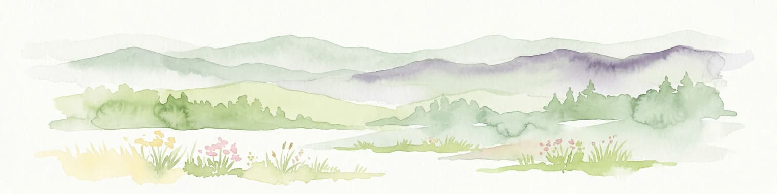
Why Sloboda National Nature Park stands out

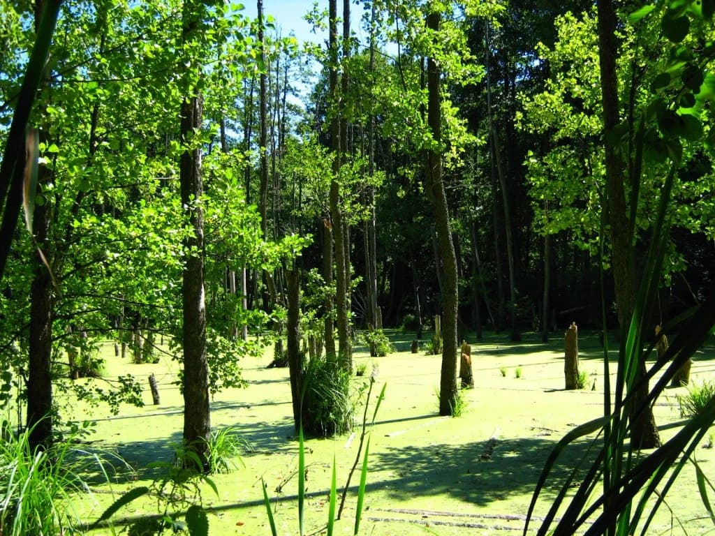
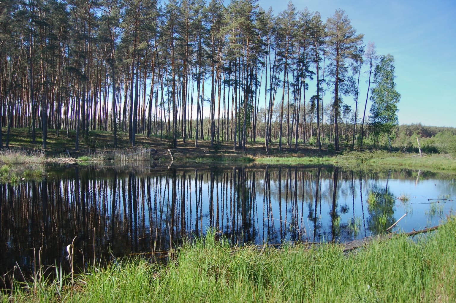
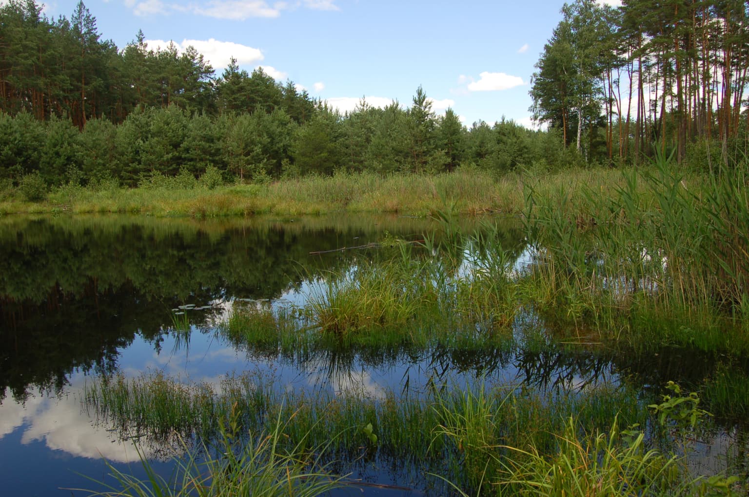
Sloboda National Nature Park is best known for its extensive wetland complex at the confluence of two rivers, creating a rich mosaic of marshes, swamps, and floodplain habitats within a forest-steppe setting. The park's maple-lime forest ecosystem on the Merla River's right bank represents a relatively intact example of mature deciduous woodland in this region. Its bog-forest communities of alder and birch provide critical habitat for diverse plant and animal species in an area where such wetland ecosystems are increasingly rare.

Sloboda National Nature Park history and protected-area timeline

Sloboda National Nature Park was established in 2009 as part of Ukraine's national park system, designated to protect representative examples of the forest-steppe ecosystem in the country's eastern region. The park was created under the administration of the Ministry of Ecology and Natural Resources of Ukraine, reflecting national policy to conserve natural areas of ecological, scientific, and educational significance. The protected area encompasses land that had previously existed in a relatively natural state amid the agricultural transformation of the surrounding Poltava Highlands region. The establishment of the park provided formal protection to the river confluence wetlands and associated forest communities that had survived as ecological islands in the cultivated landscape.

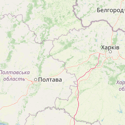
Sloboda National Nature Park landscape and geographic character

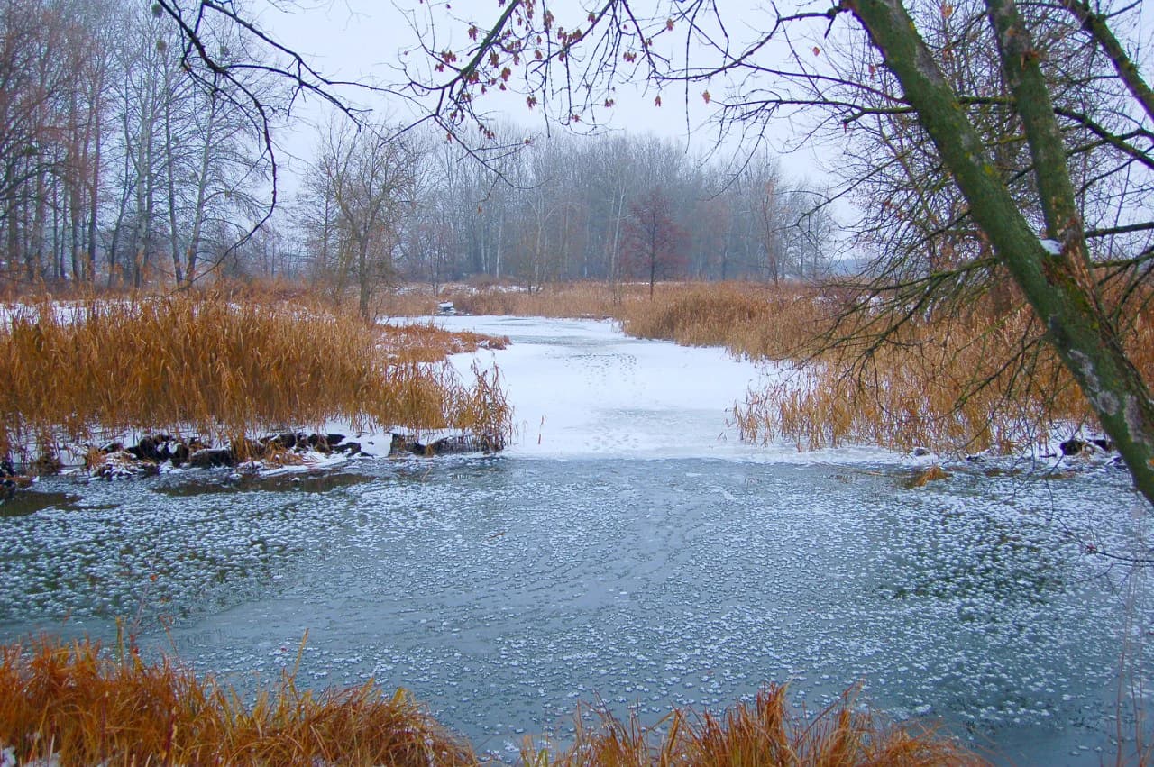
The physical landscape of Sloboda National Nature Park is defined by the valley system of the Merla and Merchik Rivers, where low floodplain terraces contain meadows, marshes, and swampy areas. The second terrace rises to rolling hills covered in forest-steppe vegetation, with deeper depressions supporting meadow-bog communities. The park's terrain creates a visual contrast between the open wetland flats along the rivers and the wooded slopes ascending to the upland plateau. The hydrological network of the two converging rivers and their associated wetlands forms the ecological backbone of the landscape, with water movement through marshes and boggy areas creating dynamic conditions that support specialized vegetation communities.

Sloboda National Nature Park ecosystems, habitats, and plant life

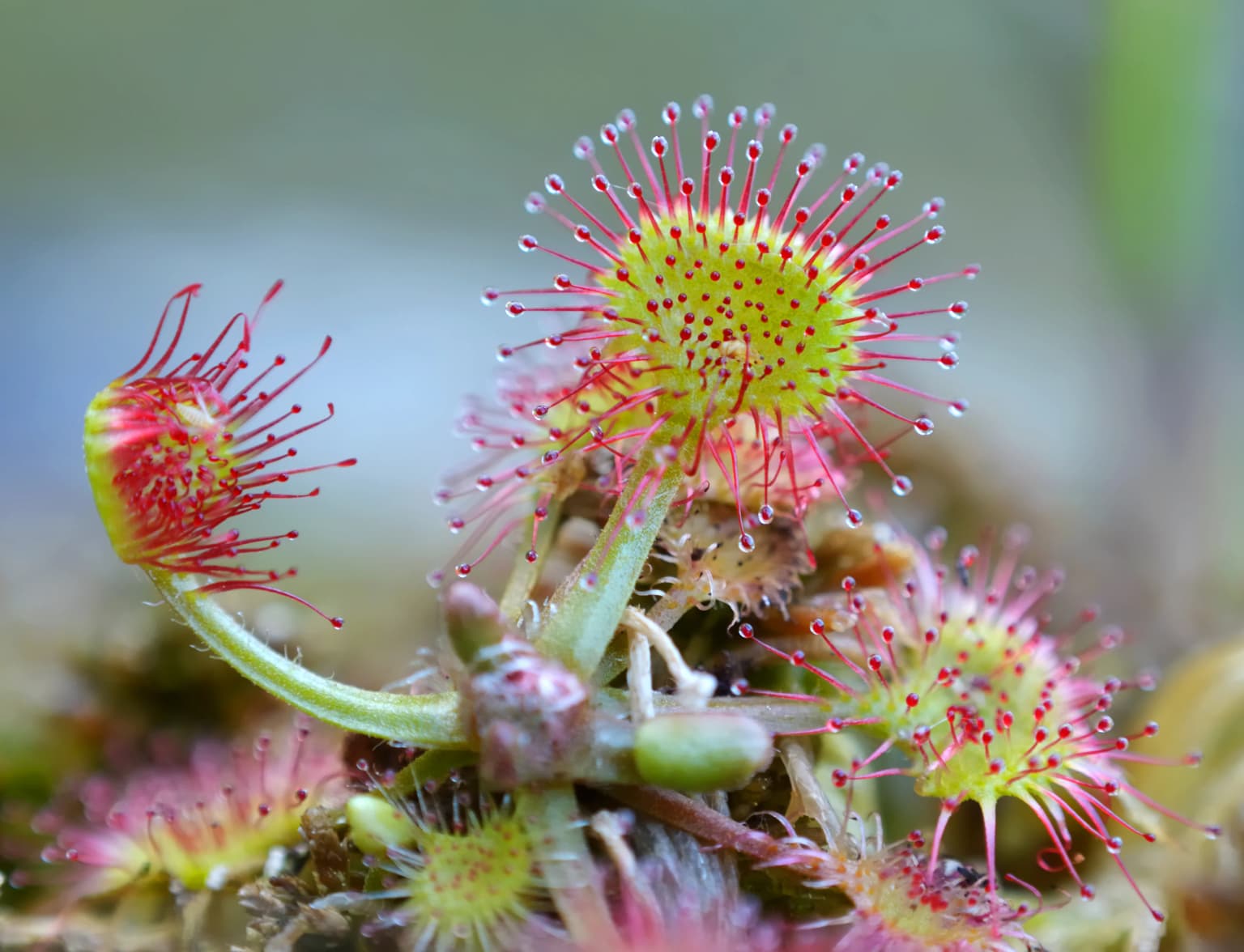
The ecological character of Sloboda National Nature Park centers on its forest-steppe and wetland ecosystems. Over 90 percent of the protected area is forested, with the natural maple-lime forest on the right bank of the Merla River representing the most ecologically significant woodland type. This deciduous forest association features mature trees in a structure that supports diverse understory and epiphytic communities. The left bank of the river features both natural woodland and planted pine stands, reflecting historical forest management. Bog-forest communities develop in the wetland depressions, where alder and birch dominate in response to persistently high soil moisture. The extensive marshes and swamps across the floodplain create habitat conditions that support flora and fauna adapted to wetland environments, contributing to the overall biodiversity of the park.

Sloboda National Nature Park wildlife and species highlights

The wetland and forest habitats of Sloboda National Nature Park support diverse wildlife communities characteristic of the forest-steppe zone. The marsh and swamp complexes provide crucial habitat for waterfowl, amphibians, and insects associated with wetland environments. The deciduous forests shelter mammal, bird, and invertebrate populations typical of mature woodland in this region of Ukraine. The ecological transition between wetland and upland forest creates habitat diversity that supports species assemblages from both environment types.

Sloboda National Nature Park conservation status and protection priorities

Sloboda National Nature Park serves as a protected area for the forest-steppe ecosystem of eastern Ukraine, conserving both the wetland complex at the river confluence and the surrounding forested landscapes. The protected status helps maintain ecological processes in an area where agricultural expansion has heavily modified the surrounding terrain. The park's wetlands provide important hydrological functions including water filtration, flood regulation, and habitat continuity for migratory species. As a Category II protected area, the park balances conservation objectives with sustainable public use, allowing controlled access for environmental education and nature-based recreation.

Sloboda National Nature Park cultural meaning and human context

The park occupies a region within the historical Sloboda Ukraine (Slobozhanshchyna) area of eastern Ukraine, an area historically characterized by a blend of Ukrainian and Russian cultural influences. The landscape name Sloboda reflects the historical administrative designation of the broader region. The protected area exists within a landscape that has been subject to agricultural use for centuries, though the specific river confluence area retained enough natural character to warrant protection. Local communities in the surrounding Bohodukhiv Raion maintain connections to the land through traditional land use practices, though the park itself is managed as a protected natural area.

Top sights and standout views in Sloboda National Nature Park

The park's defining features include the extensive marsh and wetland complex at the Merla and Merchik Rivers confluence, the mature maple-lime forest on the right river bank, and the ecological transition between floodplain wetlands and upland forest-steppe. The more than 90 percent forest cover provides a relatively wooded landscape uncommon in the agricultural region. The protected area offers ecological-educational and scientific-cognitive routes for visitors, with lodging, campsites, and picnic facilities available at designated centers.

Best time to visit Sloboda National Nature Park

The park can be visited throughout the warmer months from spring through autumn, when the full range of ecological-educational routes and recreational facilities are accessible. Summer brings the warmest conditions for exploring the wetland areas and forest trails, while autumn offers the opportunity to observe seasonal color changes in the deciduous forest. Winter provides a different character to the landscape, though visitor facilities operate on a reduced schedule. The timing of a visit may depend on interest in specific seasonal phenomena such as spring bird migration through the wetland corridors or summer aquatic ecosystem activity.

Park location guide

Geography guide, regional context, and park location map for Sloboda National Nature Park

Sloboda National Nature Park park geography, regions, and map view in Ukraine
Understand where Sloboda National Nature Park sits in Ukraine through a broader geographic reading of the surrounding landscape, nearby location context, and its mapped position within the national park landscape.

How Sloboda National Nature Park fits into Ukraine

Ukraine is a sovereign nation in Eastern Europe, bordered by Russia, Belarus, Poland, Slovakia, Hungary, Romania, Moldova, and the Black Sea. It is the second-largest country in Europe by area. Kyiv is the capital and largest city, followed by Kharkiv, Odesa, and Dnipro. The official language is Ukrainian. Ukraine has a population of approximately 32.9 million and operates as a unitary semi-presidential republic.

Wider geography shaping Sloboda National Nature Park in Ukraine

Ukraine occupies 603,628 km² in Eastern Europe, making it the second-largest country in Europe. It shares borders with Russia, Belarus, Poland, Slovakia, Hungary, Romania, and Moldova. The country has a southern coastline along the Black Sea and Sea of Azov. The terrain includes plains, steppes, and the Carpathian Mountains in the west.

Map view of Sloboda National Nature Park

Use this park location map to pinpoint Sloboda National Nature Park in Ukraine, understand its exact geographic position, and read its mapped placement within the surrounding landscape more clearly.

Pigeon | © OpenStreetMap contributors

Location context for Sloboda National Nature Park

Bohodukhiv RaionKharkiv Oblast
Park atlas

Trace the regional geography of protected landscapes, exploring the wetland and forest-steppe zones surrounding Sloboda National Nature Park.

Discover Other Protected Areas Near Sloboda National Nature Park, Eastern Ukraine
Explore other national parks and protected areas across eastern Ukraine, identifying comparable forest-steppe ecosystems, river valleys, and significant wetland complexes surrounding Sloboda National Nature Park. Compare these protected landscapes geographically, understanding how conservation efforts safeguard similar natural terrains and link the broader regional park networks.
National parkSumy Oblast

Hetman National Nature Park: National Park Geography and Protected Landscape Atlas

Mapped protected area within Sumy Oblast, Ukraine.

Explore Hetman National Nature Park, a designated national park situated in Sumy Oblast, Ukraine. This page offers a detailed look at its geographic setting, mapped boundaries, and role as a protected landscape. Understand its place within the regional geography of northeastern Ukraine and utilize MoriAtlas for structured map-based discovery of this significant natural area.

Area
234 km²
Established
2009
IUCN
II
Relief
Lowland
Watercolor illustration showing a valley with a winding river, green trees, and distant purple mountains under a light sky
National parkKharkiv Oblast

Homilsha Woods National Nature Park: National Park & Protected Landscape Atlas

Ancient oak woodlands and river valley geography in Kharkiv Oblast.

Delve into the protected natural heritage of Homilsha Woods National Nature Park, a significant national park situated in Ukraine's Kharkiv Oblast. This park preserves exceptional examples of ancient oak forests, some hundreds of years old, set within a complex geographic transition zone between steppe and forest ecosystems. Its diverse terrain, including hilly uplands and riverine plains, provides a compelling subject for mapped landscape discovery and understanding regional protected area distribution.

Area
143 km²
Established
2004
IUCN
II
Relief
Upland
Watercolor depiction of a river flowing through wetlands with green vegetation, trees, and distant hills under a soft sky
National parkPoltava Oblast

Lower Sula National Nature Park: Protected Wetlands and River Floodplain Atlas Explorer

Mapped boundaries and geography of this Ukrainian national park.

Discover the detailed geography and protected landscape features of Lower Sula National Nature Park, located in Poltava Oblast, Ukraine. This page provides an atlas-level view of its critical wetland habitats, including marshes and shallow lakes, which are vital for waterfowl and fish spawning. Explore the park's unique position within the Sula River floodplain and its ecological significance as a national nature park, offering rich context for geographic study.

Area
186 km²
Established
2010
IUCN
II
Relief
Lowland
Watercolor illustration of a river valley with hills, green fields, and distant mountains under a soft sky
National parkUkraine

Dvorichna National Nature Park: Protected Landscape and Geographic Atlas in Ukraine

Explore mapped boundaries and regional geography within Ukraine.

Understand the protected landscape identity of Dvorichna National Nature Park, a national park situated in Ukraine. This page provides detailed geographic context, focusing on mapped protected areas and the park's natural terrain. It serves as an atlas entry point to comprehend the park's placement within Eastern Europe and its significance as a conservation landscape.

Area
31.31 km²
Established
2009
IUCN
II
Relief
Highland
National parkPoltava Oblast

Pyriatyn National Nature Park: Detailed Atlas View of Ukrainian River Valley Protected Landscapes

Explore Poltava Oblast's unique wetland and floodplain ecosystems.

Pyriatyn National Nature Park provides an exceptional case study of a complete river valley ecosystem within Ukraine's Poltava Oblast. This protected area showcases a distinct topographic sequence, transitioning from upland terraces to extensive floodplain wetlands and the meandering Udai River. Discover the park's significant role in conserving boreal plant species at their southern range limits and its importance as a mapped natural landscape for geographic atlas exploration.

Area
120 km²
Established
2009
IUCN
II
Relief
Lowland
National parkUkraine

Ichnia National Nature Park: A Protected Landscape with Geographic Identity in Ukraine

Explore the mapped boundaries and regional natural context of this national park.

Ichnia National Nature Park represents a significant protected landscape within Ukraine, providing users with a focused entry point for geographic discovery. This page details its designation as a national park, highlighting its mapped features and regional setting. It serves as a foundational resource for understanding the park's specific landscape character and its contribution to the broader atlas of Ukraine's protected natural areas, offering detailed geographic context for further exploration.

Area
97 km²
Established
2004
IUCN
II
Relief
Lowland
Watercolor illustration showing a river winding through a forested valley with rolling hills and distant mountains under a light sky
National parkDonetsk Oblast

Holy Mountains National Nature Park: Donetsk Oblast Protected Landscape

Mapped boundaries and regional geographic context.

This entry details Holy Mountains National Nature Park, a protected national park located in Donetsk Oblast, Ukraine. It serves as a key point for exploring the mapped protected areas and natural landscapes within the Donbas region. Understand the park's geographic significance and its place within the atlas of eastern Ukraine's diverse terrain and conservation efforts.

Area
406 km²
Established
1997
IUCN
II
Relief
Mixed relief
National parkKyiv Oblast

Bile Ozero National Nature Park: Detailed National Park Atlas and Geography

Explore protected landscape boundaries in Kyiv Oblast.

Delve into Bile Ozero National Nature Park, a prominent national park situated in Kyiv Oblast, Ukraine. This entry provides a focused atlas-style exploration of the park's protected area status and its precise geographic positioning. Understand the mapped contours of this natural landscape and its regional context, essential for comprehensive geographic discovery on MoriAtlas.

Area
70.14 km²
Established
2009
IUCN
II
Scope
Terrestrial

Common questions about visiting, size, designation, and location context for Sloboda National Nature Park

Sloboda National Nature Park FAQs for park facts, access, geography, and protected area context
Find quick answers about Sloboda National Nature Park, including protected-area facts, park geography, trail and visitor context, and how the park fits into its surrounding country and regional landscape.
MoriAtlas Explorer

Continue Your Protected Areas Search Across the Global Atlas

Deepen your exploration by continuing the structured search for national parks and protected areas worldwide. Utilize the comprehensive filtering capabilities to compare different conservation landscapes and refine your understanding of global park geography. Discover more about the distribution and characteristics of protected natural areas.

Global natural geography