Mori Atlas logo
National parkPyriatyn National Nature Park

Discover the mapped river valley ecosystems and unique wetland habitats of this Ukrainian national park.

Pyriatyn National Nature Park: Protected Landscape and Geographic Context in Poltava Oblast

Pyriatyn National Nature Park represents a vital protected landscape within Poltava Oblast, Ukraine, safeguarding the intricate ecosystems of the Udai River valley. Established to conserve a unique mosaic of river corridors, floodplain wetlands, and forested terraces, this national park offers a crucial window into the natural geography of the East European forest steppe. Explore its distinct topographic sequence, from upland slopes to extensive reed beds, and understand its significance as a mapped natural area vital for regional biodiversity and atlas-based discovery.

wetlandsriver valleyforest-steppeUkraine national parksPoltava Oblastfloodplain ecosystems

Pyriatyn National Nature Park

National park

Park overview

Structured park overview, official facts, and landscape profile for Pyriatyn National Nature Park

Pyriatyn National Nature Park park facts, protected area profile, and essential visitor context
Review the core facts for Pyriatyn National Nature Park, including designation, size, terrain, visitor scale, habitats, and operating context in one park-focused overview.

About Pyriatyn National Nature Park

Pyriatyn National Nature Park occupies a strategic position in Ukraine's protected area network, safeguarding representative ecosystems of the Udai River valley in the north-central part of the country. The park's territory follows the Udai River as it flows from northwest to southeast, with clusters of protected land strung along the river corridor. The landscape is characteristic of river valleys on the East European Plain, combining forest-steppe elements on the steeper slopes with extensive wetlands on the lower terraces and floodplains.

The park was established in 2009 by decree of the President of Ukraine to preserve valuable natural and historical-cultural complexes. Its creation absorbed several previously designated protected areas, including the Deimanivsky landscape reserve, the Kukvinsky hydrological reserve, and the Berezovorudsky park. These earlier designations retain their protected status within the park's boundaries.

The park provides protection for a range of wetland types that are characteristic of river valleys in this region but have faced considerable pressure from agricultural conversion. The floodplain areas are dominated by reed communities, with both heavily flooded and marsh-type reed beds. Cattail and bulrush communities are widespread, while the open water bodies support diverse aquatic vegetation including various pondweed species and water crowfoot. The wetland complexes include both eutrophic and mesotrophic marshes, with the latter supporting rare sphagnum moss communities.

Quick facts and research context for Pyriatyn National Nature Park

Pyriatyn National Nature Park spans 12,028 hectares along the Udai River in Poltava Oblast, Ukraine. The park was established in 2009 and is managed by the Ministry of Ecology and Natural Resources. It protects river valley ecosystems characteristic of the East European forest steppe, including wetlands, reed beds, mesotrophic lakes, floodplain meadows, and forest-steppe habitats. The Udai River flows through the park for approximately 62 kilometers as a tributary of the Dnieper River system. The park includes several protected areas that predate its establishment, including the Deimanivsky landscape reserve, Kukvinsky hydrological reserve, and Berezovorudsky park.

Park context

Deeper park guide and search-rich context for Pyriatyn National Nature Park

Pyriatyn National Nature Park history, landscape, wildlife, and travel context
Explore Pyriatyn National Nature Park through its history, landscape character, ecosystems, wildlife, conservation priorities, cultural context, and seasonal travel timing in a structured park guide built for atlas discovery and search intent.

Why Pyriatyn National Nature Park stands out

The park is best known for its representation of complete river valley ecosystems along the Udai River, encompassing the full topographic sequence from the native riverbank (korinny bereh) through the sand terrace (borova terasa) to the floodplain (zaplava). Its wetlands are particularly significant, with extensive reed beds, emergent marsh communities, and floating aquatic vegetation. The park protects rare boreal plant species at their southern range limits, including sphagnum mosses and species typically found much further north. The area also supports notable bird populations, including a monitored white stork nesting site that has gained public attention through a dedicated YouTube channel.

Pyriatyn National Nature Park history and protected-area timeline

Pyriatyn National Nature Park was established on December 11, 2009, by presidential decree signed by President Viktor Yushchenko. The decree mandated the creation of the park to preserve valuable natural and historical-cultural complexes and objects that hold special conservation, recreational, historical-cultural, scientific, educational, and aesthetic value. The park was formed from state-owned lands totaling 12,028.42 hectares, including 5,555.14 hectares of reserve lands granted to the park for permanent use and 6,473.28 hectares incorporated into the park without appropriation.

The decree outlined specific requirements for the park's development, including the establishment of an administration, approval of park regulations within three months, preparation of land allocation materials during 2010-2011, and development of a comprehensive park management plan covering 2010-2012. The decree also addressed funding requirements for the park's ongoing operation.

Prior to the national park's establishment, the territory included several protected areas of local and national significance. The Deimanivsky landscape reserve and Kukvinsky hydrological reserve were designated as protected areas of national importance, while several local reserves (zakaznyky) focused on hydrological and zoological protection existed at the district level. The creation of the national park provided a unified protective framework for these previously separate designations.

Pyriatyn National Nature Park landscape and geographic character

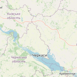
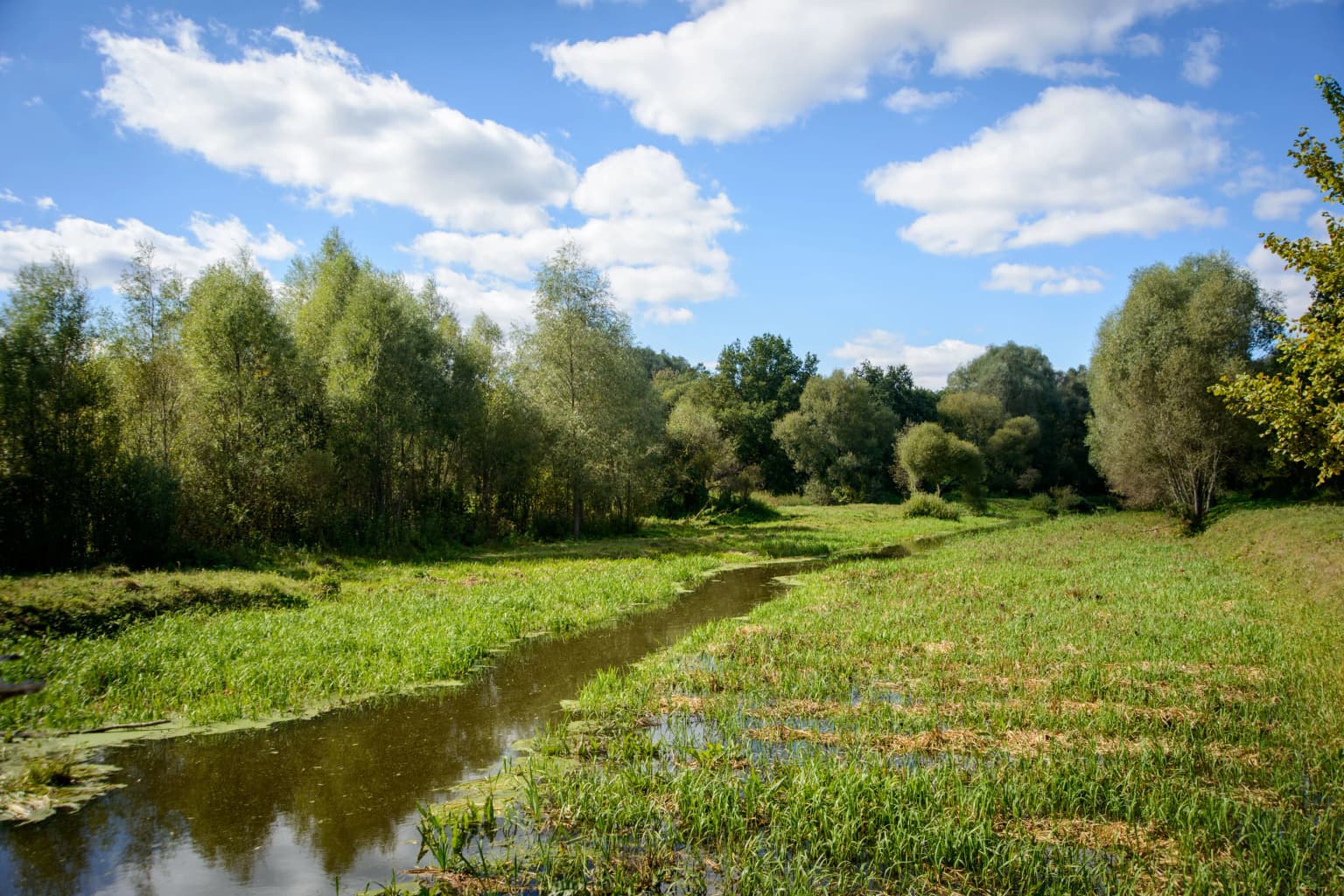
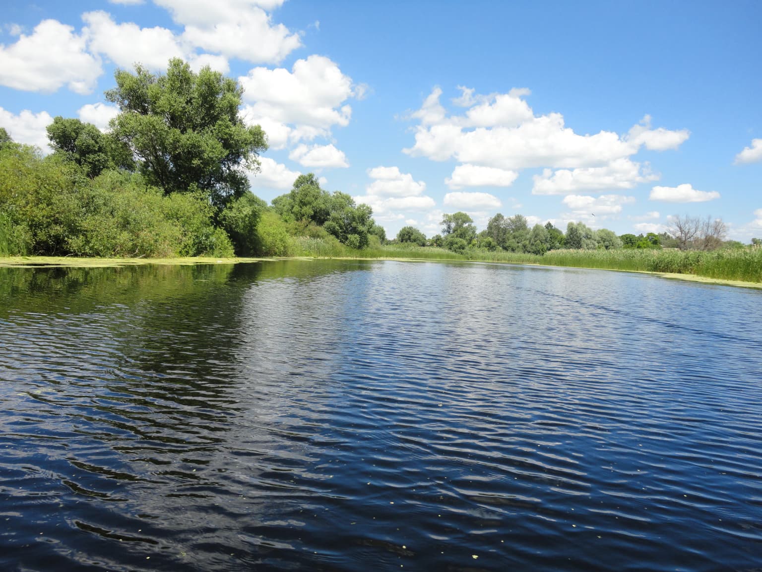
The park's landscape is defined by the Udai River valley, which flows through the protected area for approximately 62 kilometers. The river is a second-order tributary of the Dnieper, entering the Sula River before reaching the Dnieper system. The terrain exhibits the classic structure of river valleys on the East European Plain, with three main landscape zones represented within the park.

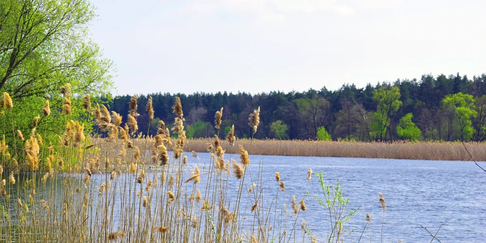
The native left bank (korinny bereh) forms the highest elevation, where loess-like loams underlie the terrain. This area supports meadow steppe communities and broadleaf deciduous forests. The sand terrace (borova terasa) occupies an intermediate position, with podzolic soils supporting pine plantations and mixed pine-oak forests. The floodplain (zaplava) represents the lowest elevation, dominated by wetlands, reed beds, and periodically flooded meadows.

The Udai River's floodplain is predominantly a reed marsh, covered by 0.1-0.5 meters of water or extremely saturated during most of the year. Flood duration varies from 10-15 days in the upper reaches to 2-4 months in the lower sections, with water depths sometimes reaching 1.0-1.25 meters. The river valley ranges from 3 to 8 kilometers in width, with slopes rising 30-50 meters above the floodplain.

Pyriatyn National Nature Park ecosystems, habitats, and plant life

The park's ecological character is defined by its position in the East European forest steppe ecoregion, a transition zone between the broadleaf forests of northern Ukraine and the grassland steppes to the south. This transitional position is reflected in the diversity of habitats preserved within the park, from river corridors through wetlands to forest-steppe slopes.

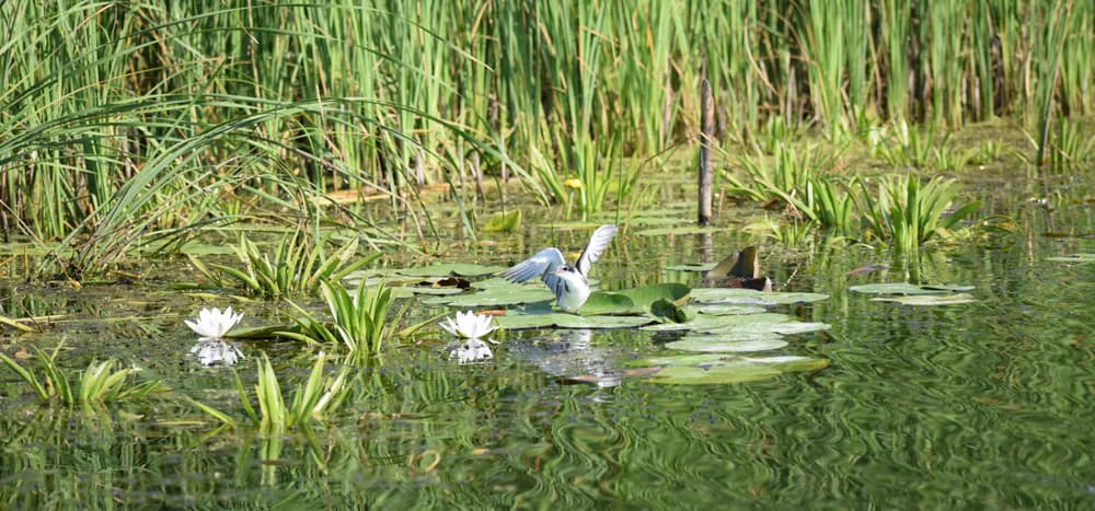
The vegetation cover includes various types of weakly transformed plant communities of both natural and artificial origin. The park supports significant areas of water vegetation, with the lowest relief areas containing aquatic and semi-aquatic plant communities widespread in modern floodplains. Common reed dominates the wetland areas, while communities of broad-leaved cattail, great bulrush, and lake sedge are also widespread. Open water bodies support pondweed communities including species such as fennel pondweed, shining pondweed, and various others.

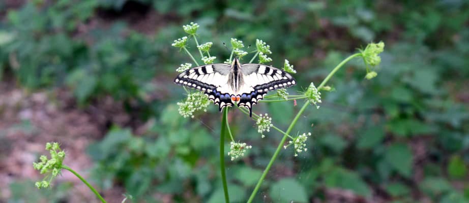
The flora includes over 700 species of higher vascular plants. The park protects numerous rare species listed in the Red Book of Ukraine, including various orchids such as the Early spider orchid, Marsh orchid, and Bird's-nest orchid, as well as species such as Lily of the valley, Spring snowflake, and Yellow star of Bethlehem. The boreal terrace forests support rare northern plant species at their southern range limits.

Pyriatyn National Nature Park wildlife and species highlights

The wildlife of Pyriatyn reflects the diversity of habitats within the river valley complex. The park supports significant bird populations associated with wetlands, forests, and open grasslands. Among the notable species are the Montagu's harrier, white stork (with a monitored nesting site), black stork, and various waders and waterfowl.

The protected area includes several red-listed species of conservation concern. Birds of prey such as the short-toed eagle and honey buzzard are present in the region. The European roller and grey shrike are among the characteristic bird species. Among mammals, the European polecat, weasel, and European hamster are recorded, along with the Eurasian beaver in the aquatic habitats.

The amphibian and reptile communities include common toad, moor frog, and common frog in the wetland areas, with dice snake and common viper in the surrounding habitats. The river and wetland systems support diverse fish communities characteristic of lowland river ecosystems in the region.

Pyriatyn National Nature Park conservation status and protection priorities

Pyriatyn National Nature Park serves an important conservation function in a region where river valley ecosystems have been extensively modified by agriculture. The park protects the full ecological spectrum of a river valley system, from upland forest-steppe to floodplain wetlands, maintaining ecological connectivity along the river corridor.

The protected status ensures preservation of rare plant communities, including wetland complexes that support boreal species at their southern range limits. The sphagnum peatland communities within the park represent particularly valuable conservation assets, supporting rare moss species that are unusual for the Poltava region. The aquatic vegetation communities, particularly those dominated by snow-white water lily, are listed in the Green Book of Ukraine.

The park's conservation value is enhanced by the integration of previously designated protected areas, including landscape and hydrological reserves that maintain specific ecological functions within the larger park framework. The ongoing scientific inventory work contributes to understanding of the park's biodiversity and supports adaptive management.

Pyriatyn National Nature Park cultural meaning and human context

The park is located near the town of Pyriatyn in what is historically part of the Lubenshchyna region of Poltava Oblast. The territory includes lands of the former Pyriatyn forestry enterprise, with the park encompassing areas around multiple villages including Hrabarivka, Davydivka, Berezova Rudka, Sasinivka, Hurbyntsi, Lyelyaky, Usivka, Keybalivka, Kaplyntsi, Kharkivtsi, Deymanivka, Vysoke, Velyka Krupa, Povstyn, and Oleksandrivka.

The area has a long human history, with the river valley providing resources and transport routes for local communities. The region is part of the traditional cultural landscape of central Ukraine, though the park itself focuses on natural ecosystem preservation. The park's name derives from the nearby town of Pyriatyn, which serves as the administrative center for the surrounding area.

Top sights and standout views in Pyriatyn National Nature Park

The park's defining feature is its comprehensive representation of a river valley ecosystem, protecting the complete topographic sequence from upland slopes through terrace forests to floodplain wetlands. The diversity of wetland types, from reed beds through floating aquatic communities to sphagnum peatlands, supports exceptional biodiversity. The presence of boreal plant species at their southern range limits makes the park particularly significant for understanding climate-driven range shifts. The monitored white stork nest provides a unique public connection to the park's wildlife, with round-the-clock observation of a nesting pair in the village of Lyelyaky.

Best time to visit Pyriatyn National Nature Park

The park can be visited throughout the year, with each season offering distinct experiences. Spring brings flooding of the floodplain, creating extensive wetland conditions that attract waterfowl and support dramatic displays of aquatic vegetation. Summer offers the most accessible conditions for hiking the ecological trails, with full foliage in the forest areas and active wildlife in the wetlands. Autumn provides color changes in the forest-steppe and terrace woodlands. Winter reveals the structure of the landscape when vegetation is minimal, though access to some wetland areas may be limited. The relatively new status of the park means infrastructure continues to develop, so visitors should check current conditions before traveling.

Park location guide

Geography guide, regional context, and park location map for Pyriatyn National Nature Park

Pyriatyn National Nature Park park geography, regions, and map view in Ukraine
Understand where Pyriatyn National Nature Park sits in Ukraine through a broader geographic reading of the surrounding landscape, nearby location context, and its mapped position within the national park landscape.

How Pyriatyn National Nature Park fits into Ukraine

Ukraine is a sovereign nation in Eastern Europe, bordered by Russia, Belarus, Poland, Slovakia, Hungary, Romania, Moldova, and the Black Sea. It is the second-largest country in Europe by area. Kyiv is the capital and largest city, followed by Kharkiv, Odesa, and Dnipro. The official language is Ukrainian. Ukraine has a population of approximately 32.9 million and operates as a unitary semi-presidential republic.

Wider geography shaping Pyriatyn National Nature Park in Ukraine

Ukraine occupies 603,628 km² in Eastern Europe, making it the second-largest country in Europe. It shares borders with Russia, Belarus, Poland, Slovakia, Hungary, Romania, and Moldova. The country has a southern coastline along the Black Sea and Sea of Azov. The terrain includes plains, steppes, and the Carpathian Mountains in the west.

Map view of Pyriatyn National Nature Park

Use this park location map to pinpoint Pyriatyn National Nature Park in Ukraine, understand its exact geographic position, and read its mapped placement within the surrounding landscape more clearly.

Pigeon | © OpenStreetMap contributors

Location context for Pyriatyn National Nature Park

Poltava Oblast
Park atlas

Trace the geographic spread of river valley ecosystems and connected protected landscapes across Poltava Oblast and central Ukraine.

Explore Other National Parks and Protected Areas Near Pyriatyn National Nature Park, Ukraine
Browse a curated selection of national parks and protected areas near Pyriatyn National Nature Park, encompassing diverse river valley, wetland, and forest-steppe landscapes across Ukraine. Comparing these protected landscapes allows for deeper atlas-style exploration of regional biodiversity, conservation zones, and mapped terrain beyond a single park's boundaries.
National parkUkraine

Ichnia National Nature Park: A Protected Landscape with Geographic Identity in Ukraine

Explore the mapped boundaries and regional natural context of this national park.

Ichnia National Nature Park represents a significant protected landscape within Ukraine, providing users with a focused entry point for geographic discovery. This page details its designation as a national park, highlighting its mapped features and regional setting. It serves as a foundational resource for understanding the park's specific landscape character and its contribution to the broader atlas of Ukraine's protected natural areas, offering detailed geographic context for further exploration.

Area
97 km²
Established
2004
IUCN
II
Relief
Lowland
National parkKyiv Oblast

Bile Ozero National Nature Park: Detailed National Park Atlas and Geography

Explore protected landscape boundaries in Kyiv Oblast.

Delve into Bile Ozero National Nature Park, a prominent national park situated in Kyiv Oblast, Ukraine. This entry provides a focused atlas-style exploration of the park's protected area status and its precise geographic positioning. Understand the mapped contours of this natural landscape and its regional context, essential for comprehensive geographic discovery on MoriAtlas.

Area
70.14 km²
Established
2009
IUCN
II
Scope
Terrestrial
Watercolor depiction of a river flowing through wetlands with green vegetation, trees, and distant hills under a soft sky
National parkPoltava Oblast

Lower Sula National Nature Park: Protected Wetlands and River Floodplain Atlas Explorer

Mapped boundaries and geography of this Ukrainian national park.

Discover the detailed geography and protected landscape features of Lower Sula National Nature Park, located in Poltava Oblast, Ukraine. This page provides an atlas-level view of its critical wetland habitats, including marshes and shallow lakes, which are vital for waterfowl and fish spawning. Explore the park's unique position within the Sula River floodplain and its ecological significance as a national nature park, offering rich context for geographic study.

Area
186 km²
Established
2010
IUCN
II
Relief
Lowland
Watercolor illustration of a river landscape with green hills, reeds, and water lilies
National park

Zalissia National Nature Park: Protected Forest Atlas and Regional Geography

Mapping Ukraine's temperate hardwood and pine forest ecosystems.

Delve into Zalissia National Nature Park, a significant protected landscape in Ukraine renowned for its vast temperate hardwood forests and ancient pine stands. This atlas entry details the park's mapped boundaries, its position within the Desna River floodplain, and the unique geographic context of its forest ecosystems. Understanding Zalissia National Nature Park offers insight into the conservation of northern Ukraine's natural heritage and its place in the broader regional geography.

Area
148 km²
Established
2009
IUCN
II
Relief
Lowland
National parkUkraine

Holosiiv National Nature Park: Ukraine's Protected Area and Mapped Landscape

Explore geographic boundaries and regional context.

Holosiiv National Nature Park represents a significant protected natural landscape within Ukraine. This detail page offers in-depth atlas exploration of the park's mapped boundaries and its integration into the country's regional geography. Understand the value of this protected area through structured geographic data and visual context, enabling a deeper appreciation of its unique landscape identity within the national park system.

Area
45.255 km²
Established
2007
IUCN
II
Relief
Lowland
National parkChernihiv Oblast

Mezyn National Nature Park: Protected Area with Paleolithic Heritage in Chernihiv Oblast

Explore ancient forests, river wetlands, and prehistoric landscapes.

Mezyn National Nature Park in Chernihiv Oblast, Ukraine, represents a significant protected area where natural landscapes meet profound archaeological discoveries. This national park encompasses diverse terrain, from the expansive Desna River floodplain dotted with oxbow lakes to ancient oak forests and rolling upland areas shaped by glacial activity. It is particularly noted for the Mezyn Paleolithic site, offering insights into Ice Age human life with remarkable artifacts and bone dwellings, making it a unique destination for atlas-driven discovery of protected lands and prehistoric geography.

Area
310 km²
Established
2004
IUCN
II
Relief
Lowland
National parkSumy Oblast

Hetman National Nature Park: National Park Geography and Protected Landscape Atlas

Mapped protected area within Sumy Oblast, Ukraine.

Explore Hetman National Nature Park, a designated national park situated in Sumy Oblast, Ukraine. This page offers a detailed look at its geographic setting, mapped boundaries, and role as a protected landscape. Understand its place within the regional geography of northeastern Ukraine and utilize MoriAtlas for structured map-based discovery of this significant natural area.

Area
234 km²
Established
2009
IUCN
II
Relief
Lowland
National parkKharkiv Oblast

Sloboda National Nature Park: National Park Protected Landscape in Kharkiv Oblast

Mapped Boundaries and Regional Geography Exploration

Investigate Sloboda National Nature Park, a recognized national park situated within Ukraine's Kharkiv Oblast. This page offers detailed insights into its protected landscape, focusing on its geographic setting and mapped terrain. Understand how this park contributes to the regional geography of Sloboda Ukraine and explore its mapped boundaries for a structured atlas discovery experience.

Area
52.44 km²
Established
2009
IUCN
II
Relief
Mixed relief

Common questions about visiting, size, designation, and location context for Pyriatyn National Nature Park

Pyriatyn National Nature Park FAQs for park facts, access, geography, and protected area context
Find quick answers about Pyriatyn National Nature Park, including protected-area facts, park geography, trail and visitor context, and how the park fits into its surrounding country and regional landscape.
MoriAtlas Explorer

Continue Your Protected Areas Search Across the Global Atlas

Deepen your exploration by continuing the structured search for national parks and protected areas worldwide. Utilize the comprehensive filtering capabilities to compare different conservation landscapes and refine your understanding of global park geography. Discover more about the distribution and characteristics of protected natural areas.

Global natural geography