Mori Atlas logo
National parkZalissia National Nature Park

Mapping the extent and terrain of this key national park in northern Ukraine.

Zalissia National Nature Park: A Protected Forest Landscape on Ukraine's Desna River

(National Nature Park Zalissia)

Zalissia National Nature Park represents a vital protected area within Ukraine's northern geography, situated on the left bank of the Desna River. This extensive national park spans approximately 14,836 hectares, primarily comprising temperate hardwood and significant old-growth pine forest ecosystems characteristic of the Central European mixed forests ecoregion. Established to preserve these valuable natural complexes, the park offers a unique landscape of forested river terraces and wetland habitats, providing a crucial context for understanding regional biodiversity and conservation efforts through detailed mapping and atlas exploration.

national parkprotected forestpine forestswetlandsCentral European mixed forestsriver terrace landscape
Digital illustration showing a waterfall in a mountainous landscape with pine trees, lily pads in a pond, and mountains with snow caps in the background

Zalissia National Nature Park

National park

Park overview

Structured park overview, official facts, and landscape profile for Zalissia National Nature Park

Zalissia National Nature Park park facts, protected area profile, and essential visitor context
Review the core facts for Zalissia National Nature Park, including designation, size, terrain, visitor scale, habitats, and operating context in one park-focused overview.

About Zalissia National Nature Park

Zalissia National Nature Park occupies a significant forested landscape in the Kyiv Oblast region of northern Ukraine, situated on the elevated left bank of the Desna River approximately 20 kilometers northeast of Ukraine's capital city. The park's creation in 2009 reflected Ukraine's broader commitment to expanding its network of protected areas and preserving representative examples of the country's natural heritage. The territory encompasses approximately 14,836 hectares, with the majority located within Brovary Raion and smaller portions extending into Chernihiv Oblast. The park's establishment was accompanied by ambitious plans for reorganization and development, including provisions for land allocation, boundary demarcation, and the formulation of a comprehensive management plan. However, the transition from the previous state administration structure to full national park operations has proceeded slowly, with the park continuing to function under dual management for state ceremonial purposes and environmental protection. The forested character of the park represents a continuation of the broader woodland landscape that historically covered much of this region of Ukraine, providing habitat for numerous species and serving as an important green space near the densely populated Kyiv metropolitan area.

Quick facts and research context for Zalissia National Nature Park

Zalissia National Nature Park covers approximately 14,836 hectares of forest land on the Desna River's left bank in Kyiv Oblast, Ukraine. The park was established in 2009 and falls under IUCN Category II protection. The landscape features the Desna River along its western boundary, with the park spanning roughly 10 kilometers east-west and 20 kilometers north-south across first and second river terraces. Pine forests dominate the ecosystem, comprising about 85% of the forested area, while oak and alder represent smaller but significant portions of the tree cover. The area experiences a humid continental climate with warm summers.

Park context

Deeper park guide and search-rich context for Zalissia National Nature Park

Zalissia National Nature Park history, landscape, wildlife, and travel context
Explore Zalissia National Nature Park through its history, landscape character, ecosystems, wildlife, conservation priorities, cultural context, and seasonal travel timing in a structured park guide built for atlas discovery and search intent.

Why Zalissia National Nature Park stands out

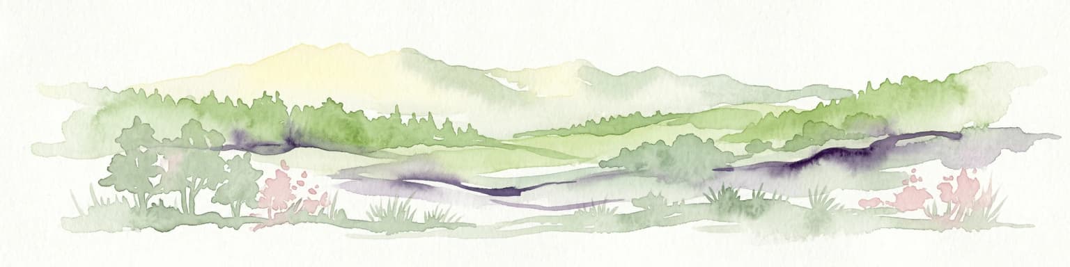
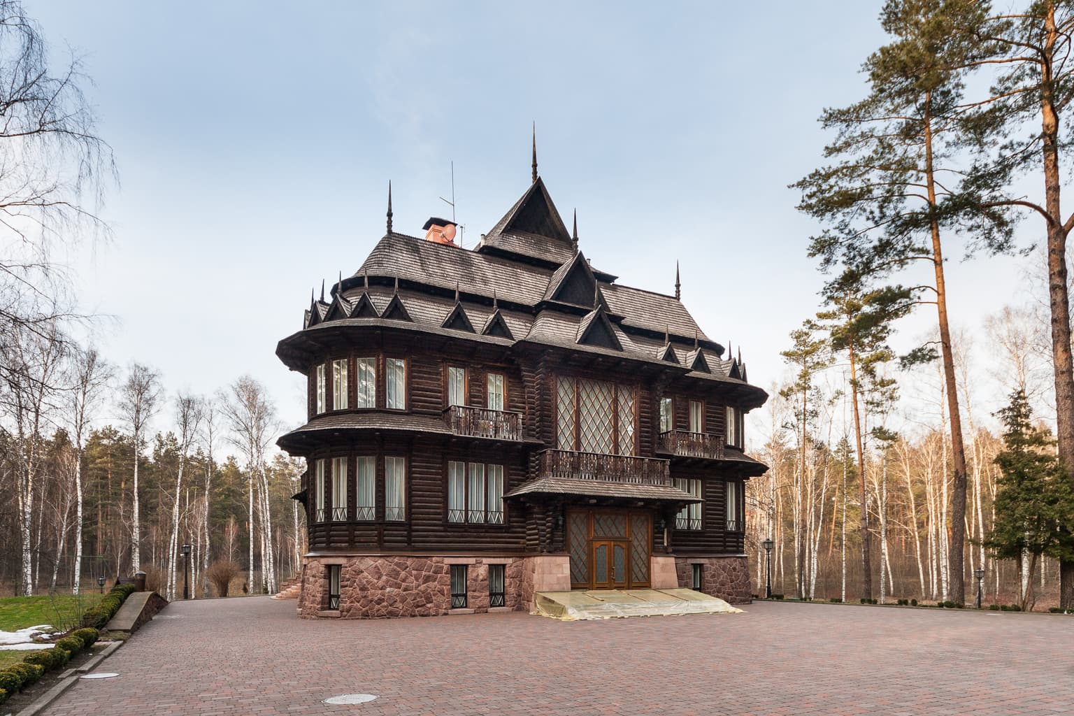
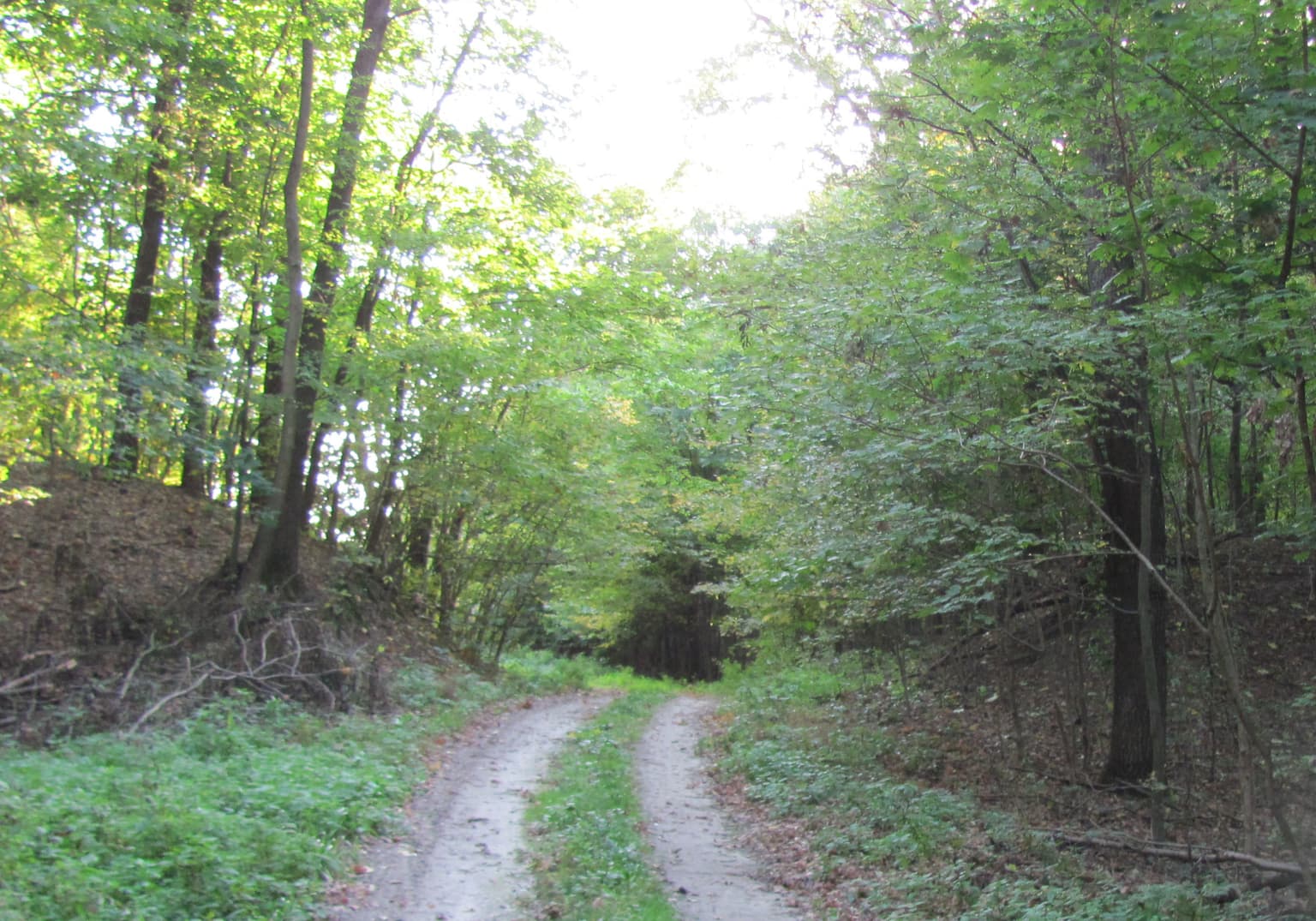
Zalissia is best known for its extensive pine forest ecosystem, which covers the majority of the protected area and includes approximately 1,700 hectares of pine forest over 100 years old. The park sits within the Central European mixed forests ecoregion, representing a well-preserved example of temperate hardwood forest habitat in northern Ukraine. Its location along the Desna River floodplain creates a distinctive landscape of river terraces and forested wetlands that support diverse plant and animal communities. The presence of the State Residence Zalissia, a government facility that also welcomes public visitors, adds a unique historical and institutional dimension to the park's character.

Stone staircase leading to a wooden house in a forest with birch trees and a lamppost
Stone staircase leading to a historic wooden residence surrounded by birch forest in Zalissia National Nature Park

Zalissia National Nature Park history and protected-area timeline

Zalissia National Nature Park was established on December 11, 2009, through a presidential decree issued by Viktor Yushchenko, the President of Ukraine at that time. The decree designated the territory for national park status with the explicit purpose of preserving, restoring, and enabling recreational use of typical and unique natural complexes possessing important conservation, scientific, aesthetic, recreational, and health value. The park was formed from lands previously administered by the State Organization "Residence Zalissia," which had maintained the area for state purposes including the reception of senior officials and foreign dignitaries. The presidential decree mandated that the Cabinet of Ministers of Ukraine take specific actions within six months, including reorganizing the State Organization into a national nature park, approving the park's regulations, and addressing land allocation matters. Subsequent provisions called for the development of a land management project in 2010 and an organizational management plan by 2011. Despite these directives, the necessary budget allocations were not included in Ukrainian state budgets from 2010 through 2017, significantly hampering the park's transition to full operational status as a traditional national park.

Zalissia National Nature Park landscape and geographic character

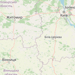
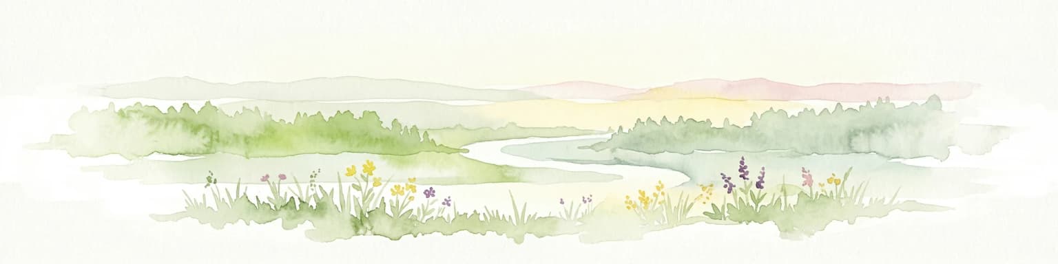
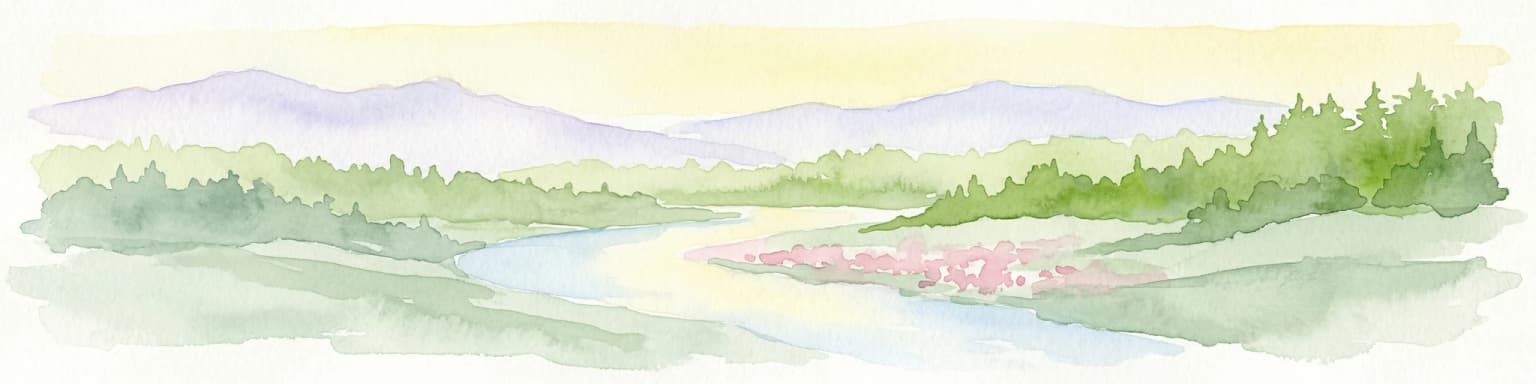
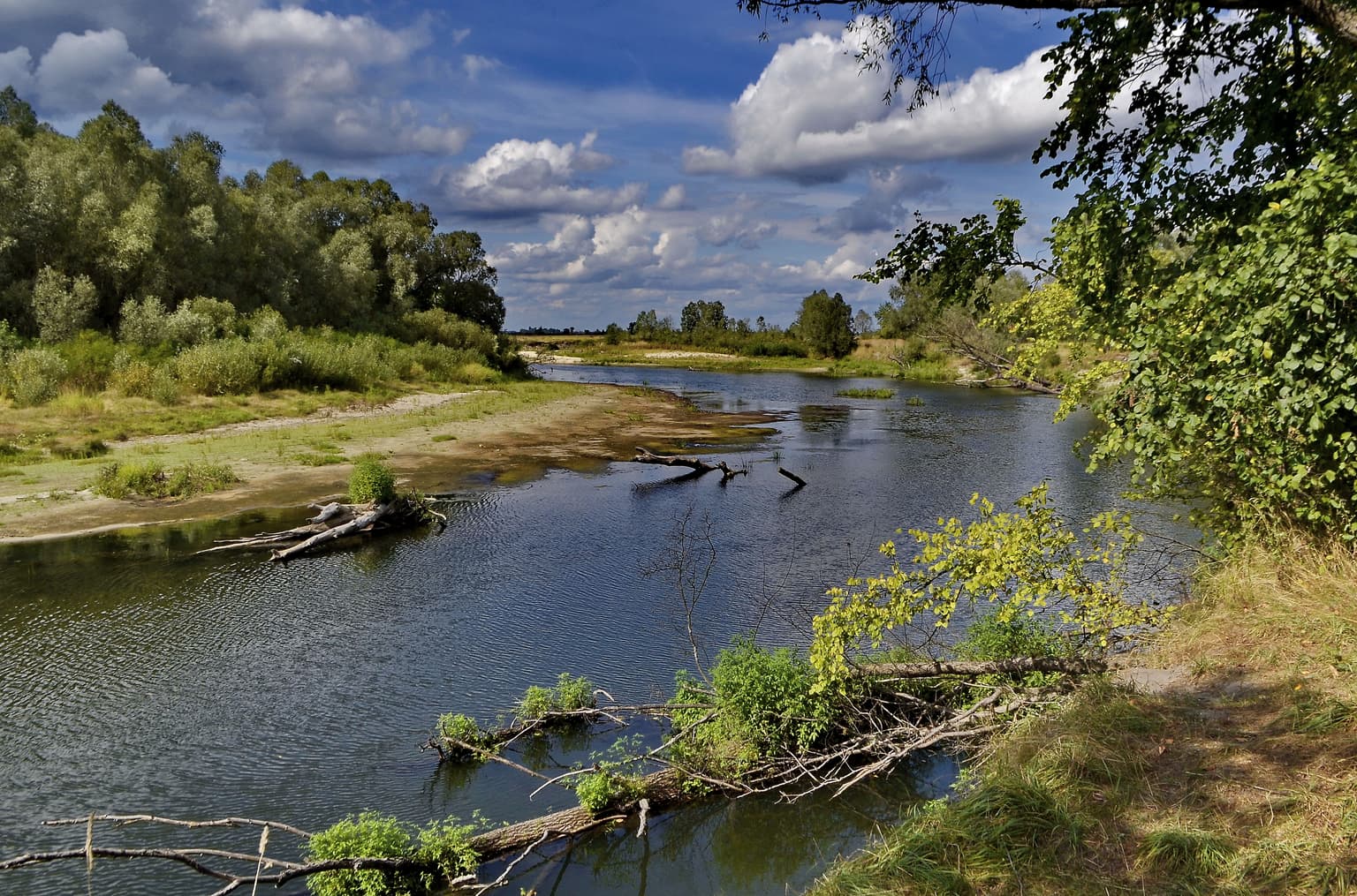
The landscape of Zalissia National Nature Park is defined by its position on the left bank of the Desna River, one of Ukraine's major rivers and a significant tributary of the Dnieper. The park occupies the first and second river terraces, creating a relatively flat to gently undulating terrain typical of river valley landscapes in northern Ukraine. The Desna River itself runs along the western boundary of the park, with the actual river channel positioned 5 to 10 kilometers from the park's edge. The park measures approximately 10 kilometers in width from west to east and extends about 20 kilometers in a north-south direction. The forest-dominated landscape creates an extensive woodland environment that contrasts with the agricultural and settled lands surrounding the protected area. The presence of wetland areas, including the Velekivske bog (a hydrological nature reserve of local significance), adds ecological diversity to the predominantly forested terrain.

A swamp landscape with water plants and trees under a partly cloudy sky
Landscape with a swamp in Zalissia National Nature Park, Brovary Raion, Ukraine.

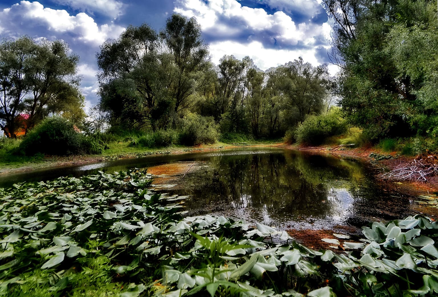
Zalissia National Nature Park ecosystems, habitats, and plant life

Zalissia National Nature Park is situated within the Central European mixed forests ecoregion, a temperate hardwood forest ecosystem that stretches across much of northeastern Europe from Germany to western Russia. The park's vegetation is overwhelmingly dominated by pine forests, which cover approximately 85% of the forested area. This strong pine dominance creates a distinctive woodland character typical of sandy soils and outwash plains in the region. Oak trees comprise about 7% of the forest cover, while alder accounts for approximately 5%, with other tree species making up the remaining 3%. A notable feature of the park is the presence of approximately 1,700 hectares of pine forest that are over 100 years old, representing relatively mature forest stands that provide important habitat structure. The climate classification is humid continental with warm summers (Köppen Dfb), characterized by significant seasonal temperature variation and a summer season of at least four months with average temperatures above 10°C but no month averaging above 22°C.

A wide river with calm water bordered by dense green forest and scattered tree trunks on the shore under a partly cloudy blue sky
River flowing through forested shoreline in Zalissia National Nature Park

Zalissia National Nature Park wildlife and species highlights

While the sources provide limited detailed information on specific wildlife species, the forest ecosystem of Zalissia National Nature Park supports typical fauna of the Central European mixed forests ecoregion. The mature pine forests, mixed deciduous components, and wetland areas provide habitat for various bird species, small mammals, and invertebrates characteristic of Ukrainian woodland environments. The park's accessibility for bird-watching activities, as noted in the public use information, indicates the presence of notable avian diversity. The protected status of the area helps preserve wildlife populations in a region that has seen significant agricultural and urban development around the Kyiv metropolitan area.

Large wooden mansion with stone foundation, steep roof, and decorative architectural details, surrounded by forest and paved driveway
State residence 'Zalissia' in Brovary Raion

Zalissia National Nature Park conservation status and protection priorities

Zalissia National Nature Park represents an important conservation designation within Ukraine's protected area network, classified under IUCN Category II as a national park. The park was established specifically to conserve typical and unique natural complexes of the Desna River basin region, protecting representative examples of the Central European mixed forests ecoregion in Ukraine. The inclusion of the Velekivske bog hydrological reserve within the park's boundaries demonstrates the protection of wetland habitats that serve important ecological functions including water regulation, carbon storage, and biodiversity support. Although the formal transition to full national park management has been delayed, the protected status provides a framework for ongoing conservation of the forest ecosystems, including the significant stands of mature pine forest that represent the park's most distinctive ecological feature.

Zalissia National Nature Park cultural meaning and human context

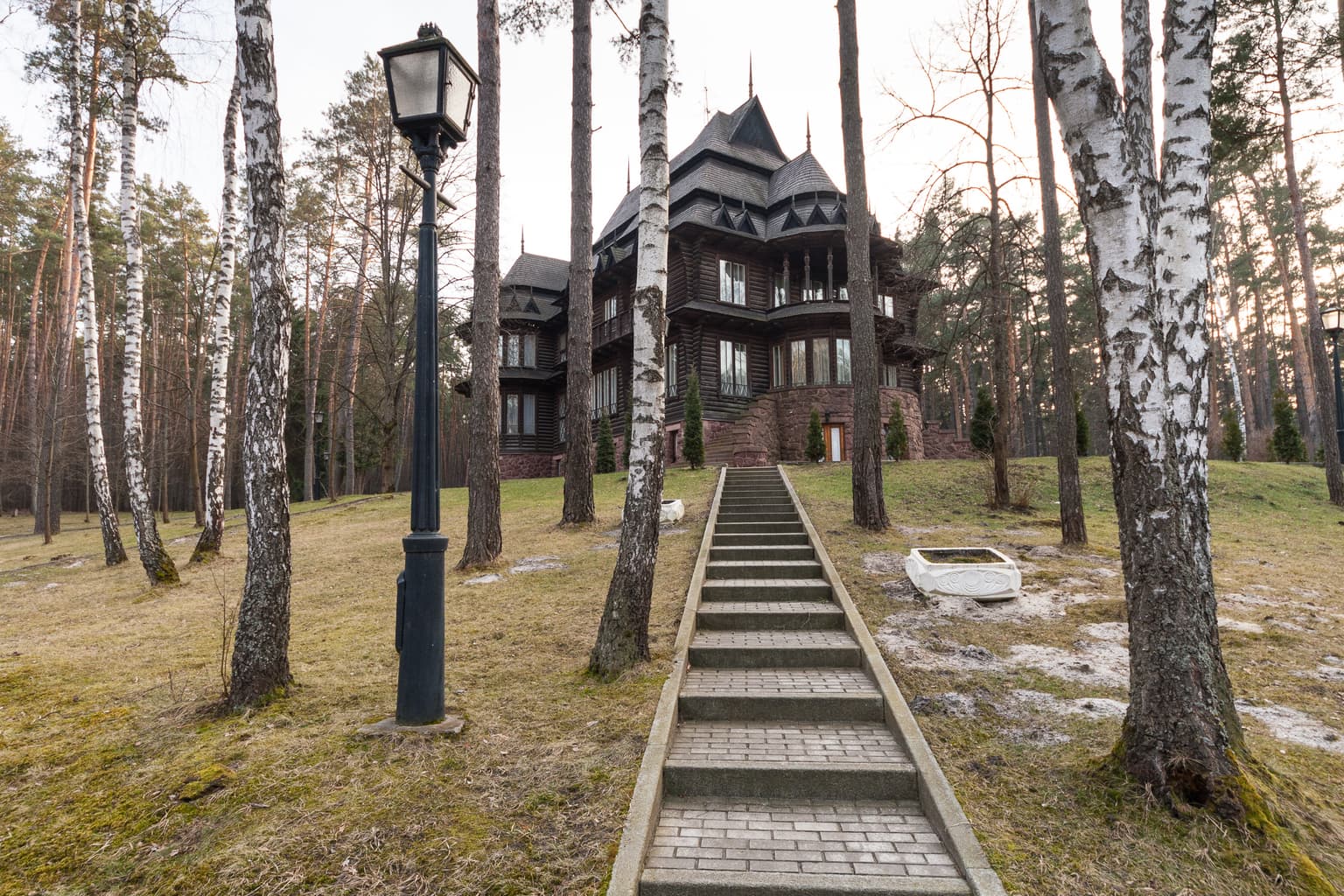
The territory of Zalissia National Nature Park carries historical significance beyond its ecological value. The area includes remains of ancient settlement earthworks near the village of Litochky, indicating human presence and activity in the region during earlier historical periods. The park's lands were associated with state administration and protocol functions through the "Residence Zalissia" facility, which served as a venue for hosting senior government officials, foreign heads of state, and international delegations. This governmental use established the park as a location of institutional importance within Ukraine's executive branch operations, even as environmental protection remains a core mandate of the designated national park status.

Dirt trail through dense green forest with earthen rampart structure on left side
Forest trail with ancient earthwork ramparts visible on the left side

Top sights and standout views in Zalissia National Nature Park

Zalissia National Nature Park offers a combination of natural and governmental features that distinguish it among Ukraine's protected areas. The extensive pine forest, particularly the significant old-growth stands exceeding 100 years of age, provides a relatively intact woodland environment near the Kyiv metropolitan region. The park's position along the Desna River and inclusion of wetland habitats adds ecological diversity to the forest-dominated landscape. The presence of Residence Zalissia, which remains open to the public and offers facilities for ecological excursions, horseback riding, and bird-watching, creates a unique opportunity for visitors to experience both the natural environment and the historical institutional character of the area.

Best time to visit Zalissia National Nature Park

The park can be visited throughout the year, with each season offering different experiences of the forest environment. The humid continental climate produces distinct seasons: spring and early summer bring active wildlife activity and lush vegetation growth, while autumn offers fall coloration in the deciduous forest components. Winter provides a different character to the landscape, though access arrangements should be confirmed in advance given the park's ongoing dual administrative function. The warm summer months (June through August) typically offer the most accessible conditions for outdoor activities such as bird-watching and horseback riding, which can be arranged through coordination with forestry department officials.

Park location guide

Geography guide, regional context, and park location map for Zalissia National Nature Park

Zalissia National Nature Park park geography, regions, and map view in Ukraine
Understand where Zalissia National Nature Park sits in Ukraine through a broader geographic reading of the surrounding landscape, nearby location context, and its mapped position within the national park landscape.

How Zalissia National Nature Park fits into Ukraine

Ukraine is a sovereign nation in Eastern Europe, bordered by Russia, Belarus, Poland, Slovakia, Hungary, Romania, Moldova, and the Black Sea. It is the second-largest country in Europe by area. Kyiv is the capital and largest city, followed by Kharkiv, Odesa, and Dnipro. The official language is Ukrainian. Ukraine has a population of approximately 32.9 million and operates as a unitary semi-presidential republic.

Wider geography shaping Zalissia National Nature Park in Ukraine

Ukraine occupies 603,628 km² in Eastern Europe, making it the second-largest country in Europe. It shares borders with Russia, Belarus, Poland, Slovakia, Hungary, Romania, and Moldova. The country has a southern coastline along the Black Sea and Sea of Azov. The terrain includes plains, steppes, and the Carpathian Mountains in the west.

Map view of Zalissia National Nature Park

Use this park location map to pinpoint Zalissia National Nature Park in Ukraine, understand its exact geographic position, and read its mapped placement within the surrounding landscape more clearly.

Pigeon | © OpenStreetMap contributors

Location context for Zalissia National Nature Park

Brovary RaionKyiv Oblast

Trace the distinct visual character of Zalissia, from its extensive pine forests to river terraces and wetland habitats.

Zalissia National Nature Park Photos: Visualizing Protected Landscapes, Scenery, and Habitats
Explore images of Zalissia National Nature Park to understand its temperate hardwood forest ecosystems, expansive pine stands, and crucial riverine wetland habitats. These visuals offer detailed insight into the protected area's unique landscape, showcasing its terrain, flora, and the distinct environmental character of this Ukrainian national park.

Stone staircase leading to a wooden house in a forest with birch trees and a lamppost

Mountain peaks with snow caps under a partly cloudy sky, surrounded by forested terrain and rocky outcrops

A swamp landscape with water plants and trees under a partly cloudy sky

A wide river with calm water bordered by dense green forest and scattered tree trunks on the shore under a partly cloudy blue sky

Large wooden mansion with stone foundation, steep roof, and decorative architectural details, surrounded by forest and paved driveway

Dirt road in a grassy field with scattered trees and a blue sky with clouds

Dirt trail through dense green forest with earthen rampart structure on left side

Park atlas

Browse Ukraine's conserved forest ecosystems and riverine landscapes, comparing regional protected areas and their geographic context.

Discover Nearby National Parks: Explore Protected Areas Near Zalissia National Nature Park
Explore other national parks and protected areas near Zalissia National Nature Park, tracing the geographic spread of forest ecosystems and riverine landscapes across northern Ukraine. Compare diverse protected zones, understand their regional context, and discover varied natural habitats safeguarding Ukraine's temperate mixed forests.
National parkUkraine

Holosiiv National Nature Park: Ukraine's Protected Area and Mapped Landscape

Explore geographic boundaries and regional context.

Holosiiv National Nature Park represents a significant protected natural landscape within Ukraine. This detail page offers in-depth atlas exploration of the park's mapped boundaries and its integration into the country's regional geography. Understand the value of this protected area through structured geographic data and visual context, enabling a deeper appreciation of its unique landscape identity within the national park system.

Area
45.255 km²
Established
2007
IUCN
II
Relief
Lowland
National parkKyiv Oblast

Bile Ozero National Nature Park: Detailed National Park Atlas and Geography

Explore protected landscape boundaries in Kyiv Oblast.

Delve into Bile Ozero National Nature Park, a prominent national park situated in Kyiv Oblast, Ukraine. This entry provides a focused atlas-style exploration of the park's protected area status and its precise geographic positioning. Understand the mapped contours of this natural landscape and its regional context, essential for comprehensive geographic discovery on MoriAtlas.

Area
70.14 km²
Established
2009
IUCN
II
Scope
Terrestrial
National parkUkraine

Ichnia National Nature Park: A Protected Landscape with Geographic Identity in Ukraine

Explore the mapped boundaries and regional natural context of this national park.

Ichnia National Nature Park represents a significant protected landscape within Ukraine, providing users with a focused entry point for geographic discovery. This page details its designation as a national park, highlighting its mapped features and regional setting. It serves as a foundational resource for understanding the park's specific landscape character and its contribution to the broader atlas of Ukraine's protected natural areas, offering detailed geographic context for further exploration.

Area
97 km²
Established
2004
IUCN
II
Relief
Lowland
National parkPoltava Oblast

Pyriatyn National Nature Park: Detailed Atlas View of Ukrainian River Valley Protected Landscapes

Explore Poltava Oblast's unique wetland and floodplain ecosystems.

Pyriatyn National Nature Park provides an exceptional case study of a complete river valley ecosystem within Ukraine's Poltava Oblast. This protected area showcases a distinct topographic sequence, transitioning from upland terraces to extensive floodplain wetlands and the meandering Udai River. Discover the park's significant role in conserving boreal plant species at their southern range limits and its importance as a mapped natural landscape for geographic atlas exploration.

Area
120 km²
Established
2009
IUCN
II
Relief
Lowland
National parkChernihiv Oblast

Mezyn National Nature Park: Protected Area with Paleolithic Heritage in Chernihiv Oblast

Explore ancient forests, river wetlands, and prehistoric landscapes.

Mezyn National Nature Park in Chernihiv Oblast, Ukraine, represents a significant protected area where natural landscapes meet profound archaeological discoveries. This national park encompasses diverse terrain, from the expansive Desna River floodplain dotted with oxbow lakes to ancient oak forests and rolling upland areas shaped by glacial activity. It is particularly noted for the Mezyn Paleolithic site, offering insights into Ice Age human life with remarkable artifacts and bone dwellings, making it a unique destination for atlas-driven discovery of protected lands and prehistoric geography.

Area
310 km²
Established
2004
IUCN
II
Relief
Lowland
Watercolor depiction of a river flowing through wetlands with green vegetation, trees, and distant hills under a soft sky
National parkPoltava Oblast

Lower Sula National Nature Park: Protected Wetlands and River Floodplain Atlas Explorer

Mapped boundaries and geography of this Ukrainian national park.

Discover the detailed geography and protected landscape features of Lower Sula National Nature Park, located in Poltava Oblast, Ukraine. This page provides an atlas-level view of its critical wetland habitats, including marshes and shallow lakes, which are vital for waterfowl and fish spawning. Explore the park's unique position within the Sula River floodplain and its ecological significance as a national nature park, offering rich context for geographic study.

Area
186 km²
Established
2010
IUCN
II
Relief
Lowland
National parkSumy Oblast

Desna, Stara Huta National Nature Park: Key Protected Area and Regional Geographic Context in Ukraine

Explore mapped landscapes of river floodplains and boreal forests.

This page details Desna, Stara Huta National Nature Park, a significant protected area within Ukraine's Sumy Oblast. It showcases a landscape defined by the Desna River floodplain, unique wetlands, and the southernmost extension of the Bryansk Forest. Users can explore its geographic identity, protected status, and its role in the atlas of Eastern European natural regions, focusing on landscape diversity and mapped boundaries.

Area
162 km²
Established
1999
IUCN
II
Relief
Lowland
Watercolor painting showing a lake surrounded by trees with distant hills under a colorful sky
National parkUkraine

Lower Polissia National Nature Park: Ukraine's Mapped Protected Wetland Landscape

National Park in Ukraine's Polissia region.

The Lower Polissia National Nature Park is a crucial protected area covering 8,762 hectares in western Ukraine. This park offers a detailed geographic profile, showcasing its extensive wetland habitats, forest complexes, and the Horyn, Viliia, and Hnylyi Rih river valleys. As a key component of the Polissia landscape zone, the park provides essential context for understanding the protected natural terrain and regional ecology of Eastern Europe through structured map exploration.

Area
87.62 km²
Established
2013
IUCN
II
Relief
Lowland

Common questions about visiting, size, designation, and location context for Zalissia National Nature Park

Zalissia National Nature Park FAQs for park facts, access, geography, and protected area context
Find quick answers about Zalissia National Nature Park, including protected-area facts, park geography, trail and visitor context, and how the park fits into its surrounding country and regional landscape.
MoriAtlas Explorer

Continue Your Protected Areas Search Across the Global Atlas

Deepen your exploration by continuing the structured search for national parks and protected areas worldwide. Utilize the comprehensive filtering capabilities to compare different conservation landscapes and refine your understanding of global park geography. Discover more about the distribution and characteristics of protected natural areas.

Global natural geography