Mori Atlas logo
Protected landscapePureora Forest Park

Mapping the protected landscapes, rugged mountain ranges, and historic conservation legacy of this North Island reserve.

Pureora Forest Park: Exploring the Ancient Podocarp Rainforests and Volcanic Terrain

Pureora Forest Park preserves one of the largest intact tracts of native forest on the North Island of New Zealand, spanning a rugged landscape between the Rangitoto and Hauhungaroa Ranges. The area encompasses ancient podocarp stands, including thousand-year-old rimu and totara, set against a backdrop of deep valleys and volcanic remnants. This geography offers deep insights into both biological growth and dramatic geological events, ranging from subterranean subfossil forests to the high peaks of Mount Pureora and Mount Titiraupenga.

rainforestpodocarp forestnative forestNorth Islandmountain rangesprotected area

Pureora Forest Park

Protected landscape

Park overview

Structured park overview, official facts, and landscape profile for Pureora Forest Park

Pureora Forest Park park facts, protected area profile, and essential visitor context

Review the core facts for Pureora Forest Park, including designation, size, terrain, visitor scale, habitats, and operating context in one park-focused overview.

About Pureora Forest Park

Pureora Forest Park sits at the heart of the North Island's central volcanic plateau, spanning the rugged ranges that rise between Lake Taupō and the limestone country around Te Kūiti. Bounded by the Rangitoto and Hauhungaroa Ranges, the park covers tens of thousands of hectares of forested hills, valleys, streams, small mires, and high peaks. Its position in the interior of the island gives it a cool, wet climate that has supported the development of some of New Zealand's most impressive temperate rainforest.

The vegetation of Pureora is a textbook example of New Zealand's ancient podocarp-broadleaf forests. On the lower and mid-elevation slopes, tall tawa and tree ferns form a dense canopy, while emergent giants such as rimu, kahikatea, mataī, miro, and tōtara rise well above this layer, reaching heights of 40 to 60 metres. Many of these veteran trees are over a thousand years old, belonging to plant lineages that stretch back to the era of the dinosaurs. At higher altitudes, the forest transitions to stands of kāmahi and Hall's tōtara, with sub-alpine herbfields taking over near the summits of Mount Pureora and Mount Titiraupenga.

Ecologically, the park is a stronghold for many of New Zealand's threatened native species. Birdlife is particularly rich, with the rare North Island kōkako among the most significant inhabitants, alongside kākā, kākāriki, kererū, and the North Island robin. The park also faces ongoing ecological pressure from introduced pests such as possums, rats, house mice, goats, deer, and pigs, several of which are actively managed to protect the native ecosystem.

Beyond its natural values, Pureora is significant for its modern cultural and conservation history. The 1978 tree-sit protests against logging in what were then exploitable state forests became a defining moment in New Zealand's environmental movement. The site of those protests, high platforms still standing in the canopy, is preserved within the park alongside relics of earlier timber extraction, including a 1940s steam hauler and a vintage Caterpillar tractor. Today the park serves as both a living temperate rainforest and an outdoor recreation destination, offering mountain biking, tramping, birdwatching, and a tangible connection to New Zealand's evolving relationship with its native forests.

Quick facts and research context for Pureora Forest Park

Pureora Forest Park is a 75,957-hectare protected area in the central North Island of New Zealand, administered by the Department of Conservation. It lies between Lake Taupō and Te Kūiti, mostly within the Waikato region with a southern extension into Manawatū-Whanganui.

Established in 1978 after public protests against logging, it is one of the largest intact native forest tracts remaining on the North Island. The park is bounded by the Rangitoto and Hauhungaroa Ranges, includes Mount Pureora (1,165 m) and Mount Titiraupenga (1,042 m), and contains ancient podocarp rainforest dating back to the dinosaur era.

Park context

Deeper park guide and search-rich context for Pureora Forest Park

Pureora Forest Park history, landscape, wildlife, and travel context

Explore Pureora Forest Park through its history, landscape character, ecosystems, wildlife, conservation priorities, cultural context, and seasonal travel timing in a structured park guide built for atlas discovery and search intent.

Why Pureora Forest Park stands out

Pureora Forest Park is best known for its ancient podocarp rainforest, with thousand-year-old rimu, kahikatea, mataī, miro, and tōtara towering over a dense understorey of tawa and tree ferns. It is widely cited as one of the finest rainforests in the world and represents one of the largest intact native forest blocks on the North Island. The park is also recognised for its pioneering role in New Zealand conservation history. Created in 1978 after dramatic tree-sit protests, it stands as a landmark case where grassroots environmental action led to permanent protection of native forest, the formation of the Native Forest Restoration Trust, and shaped national attitudes toward indigenous forest preservation.
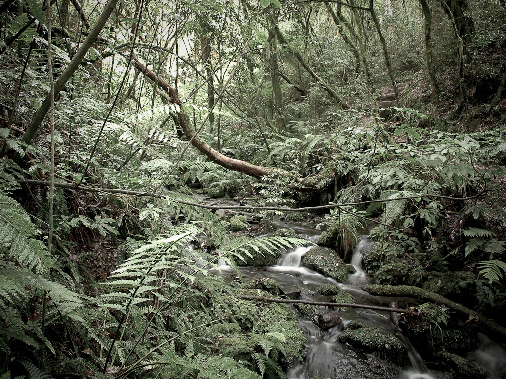
A small stream with long exposure water flow runs over mossy rocks through a dense temperate rainforest with numerous ferns and overhanging trees.
A small stream flowing through the dense, lush rainforest of Pureora Forest Park.

Pureora Forest Park history and protected-area timeline

Pureora Forest Park emerged from one of the defining moments of New Zealand's environmental history. In the late 1970s, conservation activists including Stephen King and Shirley Guildford led high-profile anti-logging protests within the forests that would become the park. Faced with industrial logging of native trees, they pioneered the technique of tree-sitting, erecting platforms high in the canopy and refusing to leave. These dramatic protests drew national attention and rallied public support for the protection of remaining tracts of native forest.

The outcome of these campaigns was transformative on three fronts. In 1978, the area was formally established as Pureora Forest Park, halting logging and creating one of the largest protected native forest reserves in the North Island. The New Zealand Government also moved to amend regulations to ensure that such operations could not resume in the park. In addition, the Native Forest Restoration Trust was created to manage reforestation of cleared pine areas back into native species. One such restored grove, developed with the dedicated efforts of Shirley Guildford, was named the 'Shirley Guildford Grove' in her memory in 1988, a year after her death.

The park's history also includes a remarkable palaeontological discovery. In 1983, a buried subfossil forest was identified within the park, consisting of trees that had been knocked over and covered by pumice following the eruption of the Taupō crater around AD 186. The trunks, including those of tānekaha, remain visible in the ground where they fell, offering a rare glimpse of the catastrophic volcanic events that have shaped the North Island's forests over centuries.

Pureora Forest Park landscape and geographic character

The landscape of Pureora Forest Park is defined by forested mountain ranges, deep valleys, and a network of streams, mires, and small lakes that drain the central North Island's volcanic interior. The park is flanked by the Rangitoto Range to the north and the Hauhungaroa Range to the south, with the territory between them forming a rugged block of hills and ridges. The two most prominent peaks are Mount Pureora at 1,165 metres and Mount Titiraupenga at 1,042 metres, while smaller summits such as Pukeokahu at 844 metres rise in the northwestern part of the park.

Between these ridges lie a series of notable valleys, including the Mangakahu Valley, the Tunawaea Valley to the southeast of Ōtorohanga, and the Maramataha Valley in the southwest. The Maramataha River runs through the latter and becomes impassable during periods of high water, illustrating the sometimes wild hydrological character of the terrain. Water features within the park include Waihora Lagoon and Waihora Stream, the Okahukura Stream, and the broader Waipa Mires, which can be seen from Select Loop Road.

A distinctive feature of the park's landscape is its buried subfossil forest, uncovered in 1983. When the Taupō volcano erupted around AD 186, pumice flows toppled and entombed entire stands of ancient trees; the aligned trunks of those trees can still be observed in the ground today. This combination of forested ranges, deep valleys, and volcanic history gives Pureora its unique character as a landscape shaped by both ancient biological growth and dramatic geological events.
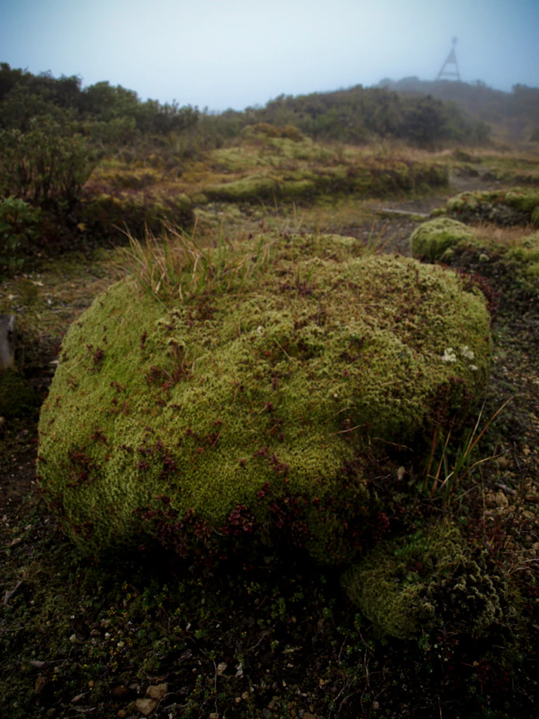
A large boulder covered in thick green moss sits in the foreground of a misty, hilly landscape with a small structure visible on the distant ridge.
A moss covered boulder in the misty highlands of Pureora Forest Park.

Pureora Forest Park ecosystems, habitats, and plant life

The ecology of Pureora Forest Park represents one of the best-preserved examples of New Zealand's temperate rainforest. The park's vegetation is structured in distinct tiers that change with altitude. Lower slopes are dominated by an understorey of tawa mixed with luxuriant tree ferns, rising into a tall canopy enriched by huge emergent podocarps. These include ancient specimens of kahikatea, mataī, miro, rimu, and tōtara, some towering 40 to 60 metres above the forest floor and reaching ages of around a thousand years or more.

Above this layer, at higher elevations, the forest shifts toward stands of kāmahi and Hall's tōtara. Near the summits, sub-alpine herb communities thrive in the cooler, more exposed conditions, while toetoe grasses flourish in certain open areas. The park also hosts the Pouakani Tōtara tree, recognised as New Zealand's tallest recorded tōtara, located just east of the Field Centre. Together, these plant communities form a living link to an ancient forest type that once covered much of the North Island.

The forest floor and waterways support a wide range of habitats for invertebrates and other organisms. Mount Pureora in particular is notable for rare insects such as Allocinopus sculpticollis, a striking example of the often-overlooked biodiversity present in the park. Wetland systems, including the Waipa Mires, and waterways like Waihora Lagoon add further ecological variety, supporting amphibians, invertebrates, and aquatic species. The mixture of podocarp giants, broadleaf forest, mires, and high-altitude herbfields makes Pureora an unusually complete representation of North Island forest ecosystems.
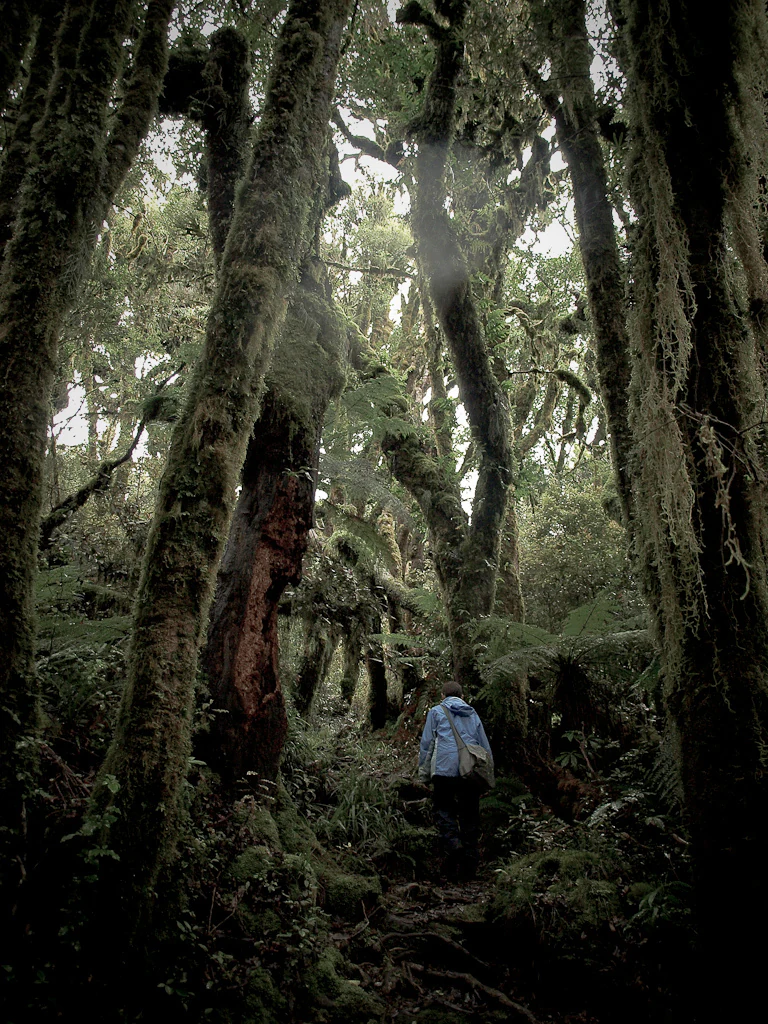
A lone person wearing a blue jacket walking on a narrow dirt path through an ancient, moss-covered rainforest with tall, twisted tree trunks and lush undergrowth.
A hiker walking through the dense, mossy native forest of Pureora Forest Park.

Pureora Forest Park wildlife and species highlights

Pureora Forest Park is recognised as one of the most important strongholds for indigenous North Island birdlife. Its tall canopy and relatively intact forest structure provide habitat for several threatened and characteristic species. Among the rarest is the North Island kōkako, a forest-dwelling bird associated with mature native forest, whose presence here reflects the park's high ecological quality. Other notable forest birds include the kākā, a noisy and characterful parrot; kākāriki, small bright-green parakeets; kererū, the large native pigeon also known as kūkū; and the North Island robin.

The park's wildlife is not limited to birds. Its invertebrate fauna is also significant, with rare endemic species such as _Allocinopus sculpticollis_ recorded on Mount Pureora. Streams, the Waihora Lagoon system, and the Waipa Mires contribute additional habitat for freshwater life and amphibians, further enhancing the park's biological richness.

Introduced animals also play a major role in shaping Pureora's ecology. At least eleven pest species coexist within the park's boundaries, including possums, rats, house mice, goats, pigs, and illegally released Sika deer. Of these, possums and goats are particular targets of ongoing management programmes because of their damaging impact on native vegetation and on nesting birds. The interplay between vulnerable native wildlife and persistent invasive species is one of the park's defining modern ecological challenges.

Pureora Forest Park conservation status and protection priorities

Pureora Forest Park holds an outsized place in New Zealand conservation history, both as a protected area and as the product of one of the country's most influential environmental campaigns. Covering tens of thousands of hectares of ancient podocarp and broadleaf forest, it represents one of the largest intact tracts of native forest remaining in the North Island and provides crucial continuous habitat for many species that have been largely lost elsewhere in lowland New Zealand.

The park's formation in 1978 marked a turning point in national forest policy, ending logging in what had been exploitable state forests and prompting regulatory changes to ensure that such operations could not resume. The campaign also led to the establishment of the Native Forest Restoration Trust, which has been responsible for replanting former pine plantations back into native forest species. The Shirley Guildford Grove stands as a tribute to this work, showcasing how degraded land can be restored to functioning native ecosystem.

Conservation management today focuses on the ongoing threat posed by introduced species. Possums, rats, mice, goats, pigs, and illegally liberated deer all require active control to safeguard the forest's regenerative capacity and the nesting success of its native birds. By combining long-term protection with practical restoration and pest management, Pureora exemplifies a comprehensive approach to conserving New Zealand's unique forest ecosystems, serving both as a refuge for rare native species and as a living laboratory for indigenous forest restoration.

Pureora Forest Park cultural meaning and human context

Pureora Forest Park carries a strong modern cultural identity rooted in New Zealand's environmental movement. The 1978 tree-sit protests at what is now the park were a defining moment of grassroots activism, blending ecological advocacy with direct action. The platforms constructed high in the canopy during those protests remain accessible today and serve as a tangible memorial to that era of conservation campaigning.

The park also preserves material traces of earlier settler-era forestry, including a 1940s steam hauler once used to transport logs for milling and a two-tonne Caterpillar tractor from the 1950s that was deployed to harvest tōtara for posts. These relics, set beside the recovering native forest, offer a layered story of changing relationships between people and the North Island's forests: from extraction, through protest and protection, to active restoration. The Shirley Guildford Grove and the broader work of the Native Forest Restoration Trust further embed the park in a living tradition of community-led conservation.

Top sights and standout views in Pureora Forest Park

Pureora Forest Park's standout qualities include its ancient podocarp giants, some exceeding a thousand years in age and reaching 40 to 60 metres in height, and the dense broadleaf rainforest of tawa and tree ferns beneath them. Its 1978 origin in tree-sit protests gives it a special place in New Zealand's environmental history, while restoration efforts such as the Shirley Guildford Grove highlight an ongoing commitment to rebuilding native forest.

Best time to visit Pureora Forest Park

Pureora's interior climate is cool and wet year-round, with mild summers and chilly winters that regularly bring frost and occasional snow to the higher peaks. Summer and early autumn generally offer the most pleasant conditions for tramping, mountain biking the Timber Trail, and exploring forest tracks, with longer daylight hours and warmer temperatures. Winter climbing of Mount Pureora and Mount Titiraupenga is best attempted by experienced visitors, while spring brings fresh growth and active birdlife, including more conspicuous kōkako and kākā activity in the canopy. Rainfall is significant throughout the year, so visitors should be prepared for changeable weather in any season.

Monthly climate preview

Long-term monthly temperature averages and precipitation patterns for Pureora Forest Park

Pureora Forest Park Climate Normals, Annual Temperature and Precipitation Rhythm

Historical climate normals trace the measured annual temperature and precipitation rhythm across twelve months at Pureora Forest Park. Detailed monthly breakdowns provide complete baseline data for analyzing long-term regional weather variations.
Annual mean12 °C
7 °C18 °C
Jan17°
Feb18°
Mar16°
Apr13°
May10°
Jun
Jul
Aug
Sep
Oct11°
Nov13°
Dec15°
Warmest month
February

17.8 °C

Coolest month
July

6.6 °C

Wettest month
June

3.8 mm/day

Driest month
January

2.3 mm/day

Park location guide

Geography guide, regional context, and park location map for Pureora Forest Park

Pureora Forest Park park geography, regions, and map view in New Zealand

Understand where Pureora Forest Park sits in New Zealand through a broader geographic reading of the surrounding landscape, nearby location context, and its mapped position within the national park landscape.

How Pureora Forest Park fits into New Zealand

New Zealand is an island nation in the southwestern Pacific Ocean comprising two main islands and numerous smaller islands. Located east of Australia across the Tasman Sea, it features varied topography with the Southern Alps running along the South Island and volcanic terrain on the North Island. The country was settled by Maori people between 1280 and 1350, followed by European exploration beginning in 1642, and became a Dominion in 1907 before gaining full independence in 1947.

Wider geography shaping Pureora Forest Park in New Zealand

New Zealand lies in the southwestern Pacific Ocean, east of Australia across the Tasman Sea. The country consists of two main islands, the North Island and South Island, plus over 600 smaller islands. The North Island features volcanic plateaus and hills while the South Island is dominated by the Southern Alps mountain range. The country has a long coastline and is surrounded by the Pacific Ocean.

Map view of Pureora Forest Park

Use this park location map to pinpoint Pureora Forest Park in New Zealand, understand its exact geographic position, and read its mapped placement within the surrounding landscape more clearly.

Pigeon | © OpenStreetMap contributors

Location context for Pureora Forest Park

Manawatū-WhanganuiWaikato
Recorded earthquake history

Review the Pureora Forest Park Seismic History and Recorded Earthquake Catalogue

Examine the historical record of seismic activity associated by proximity with the native forests and ranges of Pureora Forest Park. This MoriAtlas collection gathers event data to provide a clear, factual summary of recorded earthquakes surrounding the park territory.

Pureora Forest Park Earthquake History

Catalogued events

682 events

Strongest magnitude

Magnitude 6.3

Most recent event

Aug 17, 2026

This history includes earthquakes recorded inside the park or within 50 km of its borders

Visual reference for ancient podocarp rainforests and volcanic mountain terrain

Pureora Forest Park Photos and Landscape Scenery

Visual documentation reveals the dense canopy layers and rugged topography that define the reserve. Protected area photography captures ancient podocarp giants and volcanic terrain across the central ranges.

A small stream with long exposure water flow runs over mossy rocks through a dense temperate rainforest with numerous ferns and overhanging trees.

A dense, lush rainforest with tall, thin, moss-covered trees and thick green undergrowth including ferns in Pureora Forest Park.

A large boulder covered in thick green moss sits in the foreground of a misty, hilly landscape with a small structure visible on the distant ridge.

A lone person wearing a blue jacket walking on a narrow dirt path through an ancient, moss-covered rainforest with tall, twisted tree trunks and lush undergrowth.

Park atlas

Compare nearby national parks and connected protected landscapes across the central volcanic interior.

Parks Near Pureora Forest Park: Discover Protected Areas Across the Surrounding Region

Browsing other parks near Pureora Forest Park reveals a diverse network of protected rainforest reserves and volcanic terrain across the central North Island. Expanding the geographic view helps trace regional conservation corridors and compare adjacent natural habitats.
National parkNew Zealand
12 km away#1 closest

South

Tongariro National Park: New Zealand's Premier Volcanic National Park Atlas

Explore mapped terrain, active volcanoes, and unique dual World Heritage values.

Tongariro National Park, situated in New Zealand's North Island, is a globally significant protected area celebrated for its dramatic volcanic landscapes and profound cultural heritage. As the nation's oldest national park, it features three active volcanoes: Mount Ruapehu, Mount Ngauruhoe, and Mount Tongariro, set within a diverse terrain that includes forests, alpine zones, and the Rangipo Desert. Its dual World Heritage status underscores its importance for both natural attributes and its sacred cultural landscape, offering rich opportunities for geographic and atlas exploration.

Area
795.96 km²
Established
1887
IUCN
II
Relief
Mountain
National parkNew Zealand
25 km away#2 closest

South

Whanganui National Park: Protected Wilderness Landscape and Geographic Context

Explore the mapped boundaries and natural terrain of this national park.

Whanganui National Park offers a unique blend of natural wilderness and significant cultural history, centered on the Whanganui River valley. This protected area safeguards one of New Zealand's most extensive lowland forest ecosystems, providing vital habitat and showcasing a landscape deeply intertwined with Māori traditions and historical settlement. Understanding its geographical setting and mapped protected boundaries reveals its importance as a distinct national park.

Area
742 km²
Established
1986
IUCN
II
Relief
Lowland
A minimalist watercolor painting of rolling hills and grassy landscape under a white background.
Protected areaManawatu-Whanganui Region
28 km away#3 closest

South

Kaimanawa Forest Park: A Deep Dive into Protected Forest Terrain and Regional Mountain Geography

Remote backcountry wilderness within the Manawatu-Whanganui Region

Spanning the high country of the Rangitikei District, Kaimanawa Forest Park offers a vast, forested wilderness experience distinct from the surrounding volcanic cones. This atlas entry details the park's structural role as a protected conservation area, tracing its boundaries across rugged mountain ridges and deep valleys that define the heart of New Zealand's central North Island landscape.

Area
759.57 km²
Established
1969
Relief
Mountain
Climate
Temperate
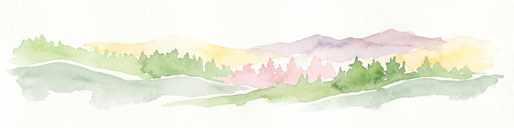
A wide, panoramic watercolor illustration showing layers of green rolling hills in the foreground, a line of green trees in the mid-ground, and soft purple and pink mountains in the background against a pale yellow sky.
Protected areaNew Zealand
About 42 km away#4 closest

Northwest

Pirongia Forest Park: Mapped Geography and Protected Landscapes in the Waikato Region

Volcanic summits and native podocarp forest boundaries

Gain a deeper understanding of Pirongia Forest Park through its complex volcanic geology and dense native vegetation. This resource outlines the park's fragmented ridges, limestone stream systems, and its role as a biogeographic bridge within the Waikato landscape of New Zealand.

Area
167.7 km²
Established
1971
Relief
Mountain
Climate
Temperate
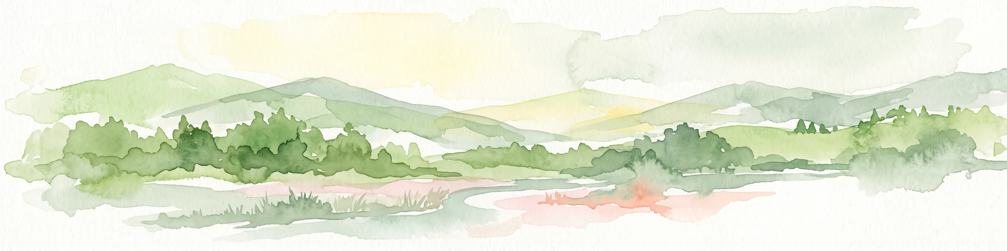
A watercolor painting showing soft, rolling green mountains and forest lines under a bright, light-filled sky.
Protected landscapeHawke's Bay
55 km away#5 closest

Southeast

Kaweka Forest Park: Protected Landscape and Mountain Geography in Hawke's Bay

High-altitude alpine terrain and forest reserve mapping

Kaweka Forest Park represents a massive block of protected country in the central North Island, defined by the Kaweka Range and its prominent 1,724-metre summit. The landscape shifts from managed pine plantations to rugged, dissected mountain ridges, offering a unique study in New Zealand's interior geography, native ecological restoration, and geothermal features like the Mangatutu Hot Springs.

Area
594.26 km²
Established
1972
Relief
Mountain
Climate
Temperate
Watercolor painting of a green landscape featuring rolling hills, forested slopes, and a body of water in the foreground against a light, misty background.
Marine protected areaNew Plymouth District
71 km away#6 closest

West

Parininihi Marine Reserve: A Detailed Atlas of New Zealand's Coastal Marine Protected Area

Mapping the ecological sanctuary and reef geography in the New Plymouth District.

Gain insights into the geography of Parininihi Marine Reserve, a protected marine environment north-east of New Plymouth. This record outlines the reserve's structural features, from the iconic White Cliffs coastline to the complex underwater canyons and pinnacles of the Pariokariwa Reef. Learn about the seafloor terrain and the ecological distribution of invertebrate colonies and fish populations that define this crucial New Zealand marine reserve.

Area
18 km²
Established
2006
Relief
Lowland
Climate
Temperate
Wildlife reserveWaikato
About 83 km away#7 closest

Northwest

Kārewa / Gannet Island Wildlife Reserve: Waikato Offshore Protected Landscape Mapping

Geological tuff ring remnant and significant seabird sanctuary

Kārewa / Gannet Island serves as a crucial wildlife sanctuary and volcanic marker on the Waikato coast. This ancient tuff ring fragment rises from the seafloor to host an extensive gannet breeding population, offering a concentrated study of offshore geological and biological isolation within New Zealand's protected area network.

Relief
Lowland
Climate
Temperate
Access
Remote access
Scope
Mixed
National parkNew Zealand
118 km away#8 closest

Southwest

Egmont National Park: New Zealand's Distinctive Volcanic National Park

Explore the mapped volcanic terrain and protected landscape of Mount Taranaki.

Egmont National Park represents a significant protected area within New Zealand's North Island, dominated by the iconic stratovolcano, Mount Taranaki. This national park is celebrated for its distinct circular protected boundary, a unique feature against the surrounding pastoral farmlands, and its dramatic volcanic landscape. Visitors can explore a range of natural habitats from dense temperate rainforests to alpine environments, all mapped within this significant conservation landmark.

Area
341.7 km²
Established
1900
IUCN
II
Visitors
400K annual

Common questions about visiting, size, designation, and location context for Pureora Forest Park

Pureora Forest Park FAQs for park facts, access, geography, and protected area context

Find quick answers about Pureora Forest Park, including protected-area facts, park geography, trail and visitor context, and how the park fits into its surrounding country and regional landscape.
MoriAtlas Explorer

Continue Your Protected Areas Search Across the Global Atlas

Deepen your exploration by continuing the structured search for national parks and protected areas worldwide. Utilize the comprehensive filtering capabilities to compare different conservation landscapes and refine your understanding of global park geography. Discover more about the distribution and characteristics of protected natural areas.

Global natural geography