
Mori Atlas logo
Nature reserveRéserve naturelle régionale de la Moselle sauvage

Mapping the extensive alluvial forests, gravel bars, and floodplain corridors of the Moselle river valley.

Réserve naturelle régionale de la Moselle sauvage: A Protected Mobile Riverbed Landscape in France

(Réserve naturelle régionale de la Moselle sauvage (RNR183))

The Réserve naturelle régionale de la Moselle sauvage protects twelve kilometers of a rare, free-flowing river corridor in the Grand Est region. This nature reserve sustains an intricate mosaic of riparian habitats, including expansive gravel bars, pebble beaches, oxbow arms, and the largest continuous stretch of alluvial forest in Lorraine. By preserving these dynamic hydrological features, the reserve maintains a critical natural buffer and aquifer recharge zone for the local river basin.

regional nature reserveriver reservemobile riverbedalluvial forestfloodplainriverine wetlands
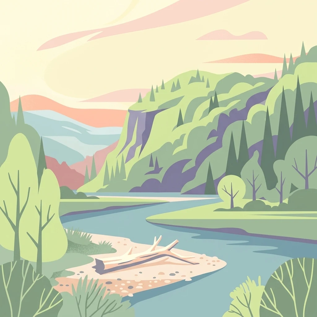
A flat vector-style illustration of a winding river flowing through a forested valley with a fallen log on a gravel bank in the foreground.

Réserve naturelle régionale de la Moselle sauvage

Nature reserve

Park overview

Structured park overview, official facts, and landscape profile for Réserve naturelle régionale de la Moselle sauvage

Réserve naturelle régionale de la Moselle sauvage park facts, protected area profile, and essential visitor context

Review the core facts for Réserve naturelle régionale de la Moselle sauvage, including designation, size, terrain, visitor scale, habitats, and operating context in one park-focused overview.

About Réserve naturelle régionale de la Moselle sauvage

The Réserve naturelle régionale de la Moselle sauvage is a French regional nature reserve dedicated to conserving a living, mobile river landscape in the heart of Lorraine. Created in 2006 under the authority of the Conseil régional de Lorraine, the reserve occupies roughly 381 hectares of floodplain and river corridor along about twelve kilometers of the Moselle, spanning the departments of Meurthe-et-Moselle and Vosges.

What distinguishes the site is that the Moselle still behaves as a naturally shifting river here, with a mobile bed that constantly reshapes gravel bars, islands, and channels. This dynamism produces an exceptional concentration of complementary habitats packed into a relatively narrow valley: dense alluvial forests dominated by softwoods and hardwoods, open gravel and pebble beaches, sandy outcrops and low cliffs known locally as reculées, wet meadows, former river arms, and patches of heathland.

The reserve is administered by the Conservatoire d'espaces naturels de Lorraine, which had already secured much of the floodplain through long-term agricultural leases between 1994 and 1998. The current classification extends the protection to seven communes and fully overlaps the Natura 2000 site Vallée de la Moselle from Châtel-sur-Moselle to Tonnoy. Together, these designations secure the valley as a key component of the regional ecological network of Grand Est and as an important reference site for understanding how a medium-sized European river can function when allowed to remain dynamic.

Quick facts and research context for Réserve naturelle régionale de la Moselle sauvage

The Réserve naturelle régionale de la Moselle sauvage covers about 381 hectares across seven communes in Meurthe-et-Moselle and Vosges: Bainville-aux-Miroirs, Bayon, Chamagne, Gripport, Mangonville, Socourt, and Virecourt. It was officially classified by the Conseil régional de Lorraine on 22 December 2006, following earlier land protection efforts by the Conservatoire d'espaces naturels de Lorraine between 1994 and 1998, when roughly 360 hectares were secured through long-term leases known as baux emphytéotiques. The reserve is administered by the Conservatoire d'espaces naturels de Lorraine, is classified as an IUCN Category IV area, and lies entirely within the Natura 2000 site Vallée de la Moselle. The protected area encompasses approximately 12 kilometers of the Moselle river, riparian woodlands, meadows, gravel banks, and former channels, with elevations ranging between roughly 240 and 260 meters.

Protection and recognition

Documented conservation status and protected area records for regional natural landscapes.

Protection Status and International Recognition for Réserve Naturelle Régionale de la Moselle Sauvage

Examine the official protection status, administrative designation history, and documented recognition data associated with Réserve naturelle régionale de la Moselle sauvage. Review verified records from international databases to understand the established conservation framework governing this protected natural landscape.

Protection details

WDPA ID
555514377
Park context

Deeper park guide and search-rich context for Réserve naturelle régionale de la Moselle sauvage

Réserve naturelle régionale de la Moselle sauvage history, landscape, wildlife, and travel context

Explore Réserve naturelle régionale de la Moselle sauvage through its history, landscape character, ecosystems, wildlife, conservation priorities, cultural context, and seasonal travel timing in a structured park guide built for atlas discovery and search intent.

Why Réserve naturelle régionale de la Moselle sauvage stands out

The reserve is best known for preserving a rare free-flowing, mobile-bed stretch of the Moselle river in Lorraine. This dynamic river system generates an unusually diverse mosaic of alluvial habitats: alluvial forests, gravel and pebble bars, ephemeral islands, sandy grasslands, oxbow channels, riparian meadows, and heaths. The protected valley holds the largest continuous area of alluvial forest in the Lorraine region, giving the site particular ecological importance. It is also recognized for its role in flood regulation and groundwater recharge, functioning as a natural buffer along the river.
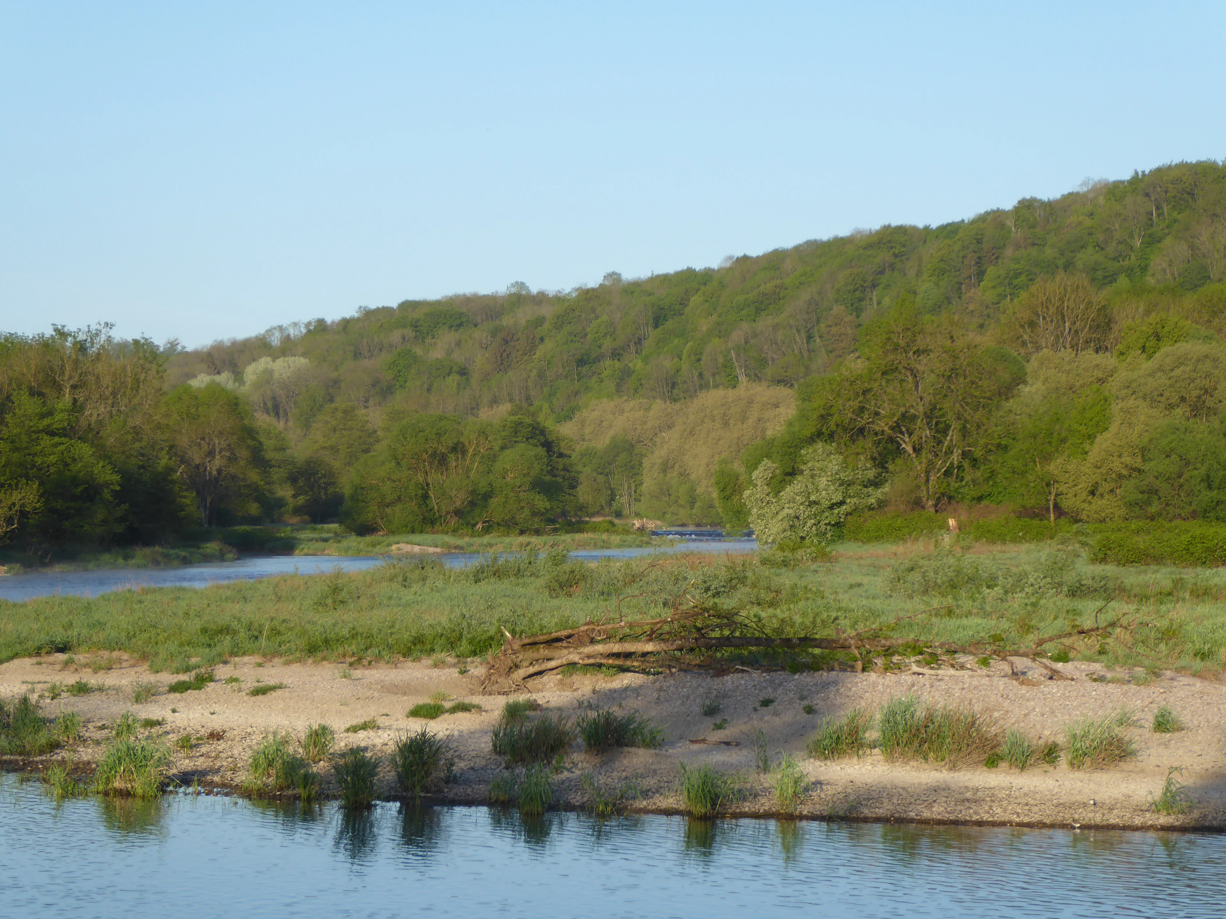
A wide, scenic view of the Moselle River with a gravel riverbank and dense green riparian forest along the banks.
The Moselle River flows through the Réserve naturelle régionale de la Moselle sauvage, showcasing a mobile riverbed and alluvial forest.

Réserve naturelle régionale de la Moselle sauvage history and protected-area timeline

Protection of the Moselle sauvage valley began well before the formal creation of the reserve. The site was first inventoried as a ZNIEFF in 1984, then recognized as a sensitive natural area in 1995, and classified as a priority wetland zone within the SDAGE Rhin-Meuse in 1996. Between 1994 and 1998, the Conservatoire d'espaces naturels de Lorraine secured roughly 360 hectares through long-term emphyteutic leases with the communes of Bainville-aux-Miroirs, Chamagne, Gripport, Mangonville, and Virecourt, financed through a European program supported by the French state, the AERM water agency, the Lorraine region, and the relevant departments.

The decisive moment came on 22 December 2006, when the Conseil régional de Lorraine formally classified the territory as a regional nature reserve for a renewable term of twelve years. A second deliberation on 19 December 2011 extended the reserve to two additional communes, Socourt and Bayon. The management plan was validated by the Conseil scientifique régional du patrimoine naturel on 20 January 2011. The reserve also became part of the larger Natura 2000 site Vallée de la Moselle, officially designated as a Special Protection Zone on 27 May 2009.

Réserve naturelle régionale de la Moselle sauvage landscape and geographic character

The landscape of the reserve is shaped by a single dominant feature: a stretch of the Moselle that still flows freely and reshapes its own bed. Over about twelve kilometers, the river creates an ever-changing pattern of gravel bars, pebbly islands, eroded banks, sandy outcrops, and cutoff channels. The valley floor sits between roughly 240 and 260 meters in elevation, and the active corridor is bordered by soft floodplain slopes.

Along the waterline, wide expanses of light-colored pebbles and gravels contrast with quieter backwaters and abandoned meanders known as bras morts. Behind the banks, the typical Lorraine floodplain sequence unfolds: dense riparian woodland giving way to meadows, heath patches, and low sandy bluffs. The overall impression is of a wide, open, and lightly humanized valley where the river clearly remains the principal sculptor of the terrain.

Réserve naturelle régionale de la Moselle sauvage ecosystems, habitats, and plant life

Because the river is still free to move, the reserve concentrates a remarkable variety of natural environments within a small territory. Alluvial forests cover much of the higher floodplain and represent the largest continuous block of this habitat type in Lorraine. At lower levels, mobile gravel beds, sandy banks, and exposed sediments host pioneer plant communities, while former channels and seasonally flooded depressions support wetland vegetation.

The botanical interest of the site includes rare or protected species such as the field scabious, the dropwort meadowsweet, and the green-winged orchid. Across the mosaic of habitats, the diversity of light, moisture, and substrate conditions creates niches for very different plant assemblages, which is one of the main reasons the valley is treated as a priority wetland within the regional water management plan.

Réserve naturelle régionale de la Moselle sauvage wildlife and species highlights

The reserve is particularly important for fauna linked to dynamic rivers and floodplains. The European beaver, reintroduced in 1984 at Tonnoy, is well established along this stretch of the Moselle and is one of the reserve's signature species. The river and its banks attract a rich birdlife, with more than a hundred species recorded, including the little ringed plover, the common kingfisher, the common sandpiper, and the sand martin. The osprey can also be observed during migration, passing through the wide, open river corridor. Overall, the combination of open water, gravel flats, woodland edge, and meadows supports a community typical of large, unregulated lowland rivers in temperate Europe.

Réserve naturelle régionale de la Moselle sauvage conservation status and protection priorities

The conservation value of the Moselle sauvage reserve lies in the rarity of what it protects: a still-mobile section of a medium-sized European river with its full suite of associated habitats. Such systems have largely disappeared from western Europe, where most major rivers have been channelized, dammed, or stabilized. By maintaining the natural dynamics of the Moselle, the reserve preserves a living reference for river ecology in the region, including the largest continuous alluvial forest in Lorraine.

Beyond biodiversity, the floodplain performs key hydrological functions: it absorbs and slows floodwaters, helps regulate the river's flow, and recharges alluvial aquifers that supply drinking water. Inclusion in the regional ZNIEFF, the SDAGE priority wetland list, and the Natura 2000 network of the Moselle valley reinforces the protection of these ecological and hydrological functions. The reserve is therefore both a biological refuge and a functional component of the regional landscape.

Réserve naturelle régionale de la Moselle sauvage cultural meaning and human context

The reserve sits in a rural Lorraine landscape historically shaped by the Moselle and by small farming communities clustered along the river. The protected territory spans seven communes, several of which, like Bainville-aux-Miroirs, Chamagne, and Bayon, have long traditions tied to the river's resources and floodplain agriculture. The presence of the Conservatoire d'espaces naturels de Lorraine, originally working through emphyteutic leases with local communes, reflects a strong tradition of cooperation between conservation bodies and rural municipalities in the region.

Top sights and standout views in Réserve naturelle régionale de la Moselle sauvage

A rare free-flowing stretch of the Moselle with a mobile riverbed; the largest continuous area of alluvial forest in Lorraine; a dense mosaic of gravel bars, pebble beaches, islands, oxbows, meadows, and heathland; a thriving beaver population originating from the 1984 reintroduction at Tonnoy; and an exceptional birdlife of more than a hundred species, including kingfisher, little ringed plover, common sandpiper, sand martin, and migrating osprey.

Best time to visit Réserve naturelle régionale de la Moselle sauvage

The valley can be enjoyed throughout much of the year, but the character of the visit changes significantly with the seasons. Spring brings rising water levels, active birdlife, and fresh growth in the meadows and alluvial forest, making it a strong period for observing migratory species and the early flowering of rare plants. Summer offers calm conditions, the full development of the riparian vegetation, and good visibility along the discovery trail that starts at the bridge of Bainville-aux-Miroirs. Autumn highlights the colors of the floodplain forests and the activity of beavers preparing for winter, while winter floods periodically reshape the gravel bars, renewing the dynamic character of the river.

Monthly climate preview

Long-term representative monthly temperature and precipitation patterns across the protected landscape

Réserve naturelle régionale de la Moselle sauvage Climate Normals and Annual Temperature Rhythm

Historical monitoring records from 1991 to 2000 outline the measured baseline of monthly temperature ranges and daily precipitation averages for Réserve naturelle régionale de la Moselle sauvage. Detailed twelve-month climate profiles provide deeper analytical context regarding temperature fluctuations and precipitation totals across the representative coordinate.
Annual mean10 °C
1 °C19 °C
Jan
Feb
Mar
Apr
May13°
Jun17°
Jul19°
Aug19°
Sep15°
Oct10°
Nov
Dec
Warmest month
July

19.4 °C

Coolest month
January

0.8 °C

Wettest month
December

2.5 mm/day

Driest month
April

1.6 mm/day

Park location guide

Geography guide, regional context, and park location map for Réserve naturelle régionale de la Moselle sauvage

Réserve naturelle régionale de la Moselle sauvage park geography, regions, and map view in France

Understand where Réserve naturelle régionale de la Moselle sauvage sits in France through a broader geographic reading of the surrounding landscape, nearby location context, and its mapped position within the national park landscape.

How Réserve naturelle régionale de la Moselle sauvage fits into France

France is a unitary semi-presidential republic and one of the world's largest economies. It borders Belgium, Luxembourg, Germany, Switzerland, Italy, Monaco, Andorra, and Spain, with a maritime border to the United Kingdom. The country is known for its cultural influence, art, cuisine, and political history spanning centuries.

Wider geography shaping Réserve naturelle régionale de la Moselle sauvage in France

France is located in Western Europe. Metropolitan France extends from the Rhine to the Atlantic Ocean and from the Mediterranean Sea to the English Channel and North Sea. The country borders Belgium, Luxembourg, Germany, Switzerland, Italy, Monaco, Andorra, Spain, and has a maritime border with the United Kingdom.

Map view of Réserve naturelle régionale de la Moselle sauvage

Use this park location map to pinpoint Réserve naturelle régionale de la Moselle sauvage in France, understand its exact geographic position, and read its mapped placement within the surrounding landscape more clearly.

Pigeon | © OpenStreetMap contributors

Location context for Réserve naturelle régionale de la Moselle sauvage

Grand Est

Photographic records of alluvial forests, gravel bars, and mobile river channels

Visual Exploration and Landscape Photography of Réserve naturelle régionale de la Moselle sauvage

Visual documentation of Réserve naturelle régionale de la Moselle sauvage reveals the shifting topography of a dynamic river corridor and its surrounding floodplain habitats. Photographic records illustrate the diverse mosaic of gravel bars, pebble beaches, and alluvial forests that define the protected natural landscape.

A wide, scenic view of the Moselle River with a gravel riverbank and dense green riparian forest along the banks.

A bird flies low over the surface of the Moselle river in the early morning, with a light mist clinging to the water and dense forest along the banks.

Park atlas

Explore surrounding regional reserves and connected river valley protected areas

Parks Near Réserve naturelle régionale de la Moselle sauvage

Browse protected areas and natural reserves located near Réserve naturelle régionale de la Moselle sauvage to compare regional landscapes. Discovering adjacent river corridors and floodplain habitats provides broader geographical context for northeastern France.
A minimalist watercolor painting showing rolling green hills and a gentle landscape under a light sky.
Nature reserveGrand Est
About 44 km away#1 closest

West

Réserve naturelle régionale des éboulis et pelouses calcaires de Pagny-la-Blanche-Côte et Champougny Landscape Overview

Geographic protected area in the Meuse department

Analyze the limestone scree and calcareous grassland habitats of this 49-hectare reserve. The site provides a focused look at the unique Jurassic-age formations and open-terrain conservation efforts managed within the Grand Est region, offering a clear map of its protected perimeter.

Area
0.493 km²
Established
2021
IUCN
IV
Nature reserveGrand Est
About 53 km away#2 closest

North

Réserve naturelle régionale de la côte de Delme: Protected Limestone Outlier and Grassland

Regional nature reserve in the Grand Est department of Moselle

Located in northeastern France, the Réserve naturelle régionale de la côte de Delme features a prominent Jurassic limestone hill known as a butte témoin. This protected area offers a rare glimpse into specialized calcareous grassland habitats, maintained through long-standing grazing traditions and dedicated conservation management across its diverse rocky slopes and open meadows.

Area
1.05 km²
Established
2007
IUCN
IV
Relief
Upland
A watercolor painting showing a soft, panoramic landscape of a peat bog or wetland with light green vegetation, scattered trees, and distant rolling hills on a white background.
Nature reserveGrand Est
About 62 km away#3 closest

Southeast

Réserve naturelle régionale de la tourbière des Charmes: Protected Mountain Peatland Geography

High Vosges mountain wetland and subalpine forest landscape

Located on the granite ridges of the Vosges mountains in the Grand Est region, this nature reserve preserves a vast, perched mountain peatland. Its distinct geographic character includes deep peat deposits and a habitat gradient transitioning from acidic wetland to mature fir and spruce forest, serving as a critical study area for specialized flora and cold-adapted wildlife.

Area
0.68 km²
Established
2008
IUCN
IV
Relief
Mountain
Nature reserveGrand Est
About 68 km away#4 closest

Southeast

Réserve naturelle nationale du Tanet-Gazon du Faing: Grand Est Protected Landscape Map

High-altitude heathlands and glacial granite ridges

The Réserve naturelle nationale du Tanet-Gazon du Faing protects a critical upland mosaic in the Vosges massif, defined by its subarctic-style flora, sprawling peat bogs, and rugged granite boulder fields. This high-elevation geography provides essential habitat for montane species and offers a clear example of post-glacial landscape development across the Grand Est region.

Area
5.05 km²
Established
1988
IUCN
IV
Relief
Mountain
A watercolor painting showing a wide panoramic view of green rolling hills and mountain ridges under a soft light.
Nature reserveGrand Est
About 71 km away#5 closest

Southeast

Réserve naturelle régionale des hautes-chaumes du Rothenbach: Protected Geography in the Vosges

A regional nature reserve in Grand Est, France.

This protected area provides a representative profile of the high Vosges mountains, spanning elevations from 900 to 1,300 metres. The terrain is characterized by an open mosaic of primary and secondary grasslands, known as chaumes, along with acidic heathlands and subalpine forests. Managed to preserve its fragile biodiversity, the site offers a deep look into the regional geography and the historical land use patterns that define the crests of Alsace.

Area
0.942 km²
Established
2008
IUCN
IV
Relief
Mountain
A watercolor painting showing a soft, panoramic view of a marshland with a winding stream, a small island of reeds, and distant trees on a pale background.
Nature reserveGrand Est
About 74 km away#6 closest

Northwest

Réserve naturelle régionale de Lachaussée: Geography, Wetlands, and Protected Map Data

Protected landscape and historic pond geography in the Meuse department

Focusing on the Étang de Lachaussée, this entry maps the protected boundaries and wetland terrain of a significant regional nature reserve in northeastern France. Observe the intersection of medieval engineering and contemporary ecological conservation through a detailed look at the pond, reedbeds, and surrounding mosaic of habitats that define the Woëvre plain landscape.

Area
6.072 km²
Established
2009
IUCN
IV
Relief
Lowland
A wide watercolor painting showing a body of water in the foreground, green trees along the banks, and rolling hills and mountains in soft pink, yellow, and green hues in the background.
Nature reserveFrance
About 80 km away#7 closest

South

Réserve naturelle régionale de la tourbière de la Grande Pile: Regional Nature Reserve

Protected peatland ecosystems and climate archive in eastern France

This regional nature reserve provides a compact study of peatland development and palaeo-environmental history. It preserves diverse wetland habitats at the edge of the Vosges saônoises, offering a rich environment for rare flora and dragonfly species within the wider Région des Mille étangs.

Area
0.593 km²
Established
2016
Relief
Lowland
Climate
Temperate
Nature reserveHaute-Saône
About 82 km away#8 closest

South

Réserve naturelle nationale de la grotte du Carroussel: Limestone Cave and Bat Reserve

Protected underground landscapes in the Haute-Saône region

Investigate the unique geographic setting of the Réserve naturelle nationale de la grotte du Carroussel. Located on a forested limestone plateau in the Val de Saône, this nature reserve serves as an essential maternity and hibernation site. Learn about its cave morphology, protected forest boundaries, and role within the regional ecological network.

Area
0.023 km²
Established
1990
IUCN
IV
Relief
Upland

Common questions about visiting, size, designation, and location context for Réserve naturelle régionale de la Moselle sauvage

Réserve naturelle régionale de la Moselle sauvage FAQs for park facts, access, geography, and protected area context

Find quick answers about Réserve naturelle régionale de la Moselle sauvage, including protected-area facts, park geography, trail and visitor context, and how the park fits into its surrounding country and regional landscape.
MoriAtlas Explorer

Continue Your Protected Areas Search Across the Global Atlas

Deepen your exploration by continuing the structured search for national parks and protected areas worldwide. Utilize the comprehensive filtering capabilities to compare different conservation landscapes and refine your understanding of global park geography. Discover more about the distribution and characteristics of protected natural areas.

Global natural geography