Mori Atlas logo
Nature reserveRéserve naturelle régionale du marais de la Grenouillère

Examining the ecological mosaic of the Ternoise river valley floor in Pas-de-Calais

Réserve naturelle régionale du marais de la Grenouillère: Protected Alluvial Wetland Atlas

(Réserve naturelle régionale du marais de la Grenouillère (RNR147))

The Réserve naturelle régionale du marais de la Grenouillère forms a vital alluvial wetland complex within the floodplain of the Ternoise river in Pas-de-Calais. This protected landscape preserves a rare mosaic of wet meadows, alder swamp woodland, and peat-forming habitats. By mapping its specific terrain and water-saturated zones, the atlas provides a clear view into this northern France refuge for hygrophilous plants and protected invertebrates.

wetlandalluvial floodplainmarshregional nature reservewet meadowalder swamp

Réserve naturelle régionale du marais de la Grenouillère

Nature reserve

Park overview

Structured park overview, official facts, and landscape profile for Réserve naturelle régionale du marais de la Grenouillère

Réserve naturelle régionale du marais de la Grenouillère park facts, protected area profile, and essential visitor context

Review the core facts for Réserve naturelle régionale du marais de la Grenouillère, including designation, size, terrain, visitor scale, habitats, and operating context in one park-focused overview.

About Réserve naturelle régionale du marais de la Grenouillère

The Réserve naturelle régionale du marais de la Grenouillère is a compact but ecologically dense protected area in the Ternoise river valley, in the center of the Pas-de-Calais department. Although it covers only around sixteen hectares, its location within an active alluvial floodplain gives it an outsized conservation role: it preserves a wetland landscape that has largely been lost elsewhere in the valley.

The reserve centers on a complex of woodland, wet meadows, and standing water set on a remarkably flat floodplain, with the highest and lowest points of the site only differing by a couple of meters. This low relief produces saturated soils, seasonal flooding, and the slow water conditions that allow both acidic peat-forming vegetation and relict alkaline low marshes to develop in close proximity. As a result, the reserve functions as a refuge for hygrophilous flora and fauna, an effective floodwater storage zone for the Ternoise, and a buffer against summer drought and heatwave stress downstream.

Protection of the site began in 2000, when it was classed as a voluntary nature reserve in recognition of its wetland interest. The stronger regional nature reserve designation followed in 2007, anchoring long-term management by the Conservatoire d'espaces naturels du Nord et du Pas-de-Calais. Today the reserve combines active habitat restoration, low-intensity grazing, public walking access, and environmental education programs that connect local communities to the marsh and its ecology.

Beyond its biological value, the site is embedded in a broader policy framework: it belongs to the Ternoise Natura 2000 site, contributes to the regional green and blue ecological network, and is taken into account by water management plans for the Canche basin under the European Water Framework Directive. This layered recognition underlines the Grenouillère marsh's role as a small but strategically placed wetland in the northern French countryside.

Quick facts and research context for Réserve naturelle régionale du marais de la Grenouillère

The Réserve naturelle régionale du marais de la Grenouillère is an IUCN Category IV (habitat or species management area) classed as a regional nature reserve under French law and managed by the Conservatoire d'espaces naturels du Nord et du Pas-de-Calais. It lies in the commune of Auchy-lès-Hesdin in the Pas-de-Calais department, within the alluvial floodplain of the Ternoise river in the Hauts-de-France region.

The protected site is a small wetland reserve occupying approximately sixteen hectares in the Atlantic biogeographic zone. It was first recognized as a voluntary nature reserve in 2000 and formally classified as a regional nature reserve in 2007, and is part of the Ternoise Natura 2000 site (FR3102001) as well as elements of the regional green and blue infrastructure network.

Protection and recognition

Documented terrestrial protection scope, 2007 designation year, and official database records

Protection Status and Designation History for Réserve naturelle régionale du marais de la Grenouillère

Terrestrial protection status, designation history, and management scope for Réserve naturelle régionale du marais de la Grenouillère appear alongside verified database records from 2007. Documented protection metrics and administrative attributes provide clear context for this protected natural area.

Protection details

Protection scope
Terrestrial
Designated year
2007
Transboundary protection
No
WDPA ID
555514380
Park context

Deeper park guide and search-rich context for Réserve naturelle régionale du marais de la Grenouillère

Réserve naturelle régionale du marais de la Grenouillère history, landscape, wildlife, and travel context

Explore Réserve naturelle régionale du marais de la Grenouillère through its history, landscape character, ecosystems, wildlife, conservation priorities, cultural context, and seasonal travel timing in a structured park guide built for atlas discovery and search intent.

Why Réserve naturelle régionale du marais de la Grenouillère stands out

The reserve is best known for preserving one of the most natural remaining wetland mosaics of the Ternoise valley, where wet meadows, tall herb mires, peat-forming areas, and alder swamp woodland coexist on a very gentle floodplain gradient. It is notable for the survival here of rare wetland plants for the region, including several wild orchids such as Dactylorhiza incarnata and Dactylorhiza praetermissa, bog cotton (Eriophorum polystachion) and buckbean (Menyanthes trifoliata). It is also recognized for its rich breeding bird community, a notable amphibian presence including fire salamander, and a stronghold population of the protected snail Vertigo moulinsiana, which was first observed alive in the marsh in 1999 and forms part of the site's Natura 2000 significance.

Réserve naturelle régionale du marais de la Grenouillère history and protected-area timeline

The Grenouillère marsh was historically used as common grazing land, or vaine pâture, by the inhabitants of Auchy-lès-Hesdin. This traditional open land use helped keep the wetland open and maintained its mosaic of wet meadows and ponds over centuries, while the surrounding community depended on the marsh for common pasture.

Modern protection began at the end of the twentieth century, as French conservation policy increasingly recognized the value of remaining wetland sites. In 2000 the marais was officially recognised as a réserve naturelle volontaire, a voluntary nature reserve, reflecting its interest as a wetland habitat at a time when much of the Ternoise floodplain had already been modified.

The site was then upgraded in 2007 when it was formally classified as a réserve naturelle régionale by the Nord-Pas-de-Calais regional council, strengthening its legal protection and entrusting its long-term management to the Conservatoire d'espaces naturels du Nord et du Pas-de-Calais. This regional designation marked the consolidation of the site as a permanent conservation area integrated within the regional green and blue ecological network and within the Ternoise Natura 2000 site FR3102001, which had been proposed to the European Commission in 2001.

Réserve naturelle régionale du marais de la Grenouillère landscape and geographic character

The reserve sits on an exceptionally flat stretch of the Ternoise floodplain, where elevation differences across the site are only a few meters. This gentle gradient, combined with the river's slow meandering dynamics, has shaped a marshy terrain where surface water lingers, soils remain saturated for long periods, and small pools and channels persist into the growing season.

Above this base, the physical landscape is structured as a mosaic of habitats rather than a single dominant landform. Wet meadows stretch across much of the area, punctuated by shallower depressions holding open water and relict alkaline low marshes, while taller herb communities rise along the edges where nutrient levels and water depth shift. A wooded fringe of alder swamp and riparian willows and ashes encloses parts of the site, softening the transition between the open marsh and the surrounding agricultural valley.

Seen from outside, the reserve reads as a lush green inset within the broader Ternoise valley, a patch of floodplain that retains its floods, textures, and quiet water surfaces, in contrast with the more intensified farmland that surrounds it.

Réserve naturelle régionale du marais de la Grenouillère ecosystems, habitats, and plant life

The site's ecological identity is built on the coexistence of several wetland habitat types within a small alluvial area. Acidic peat-forming zones blend with relict alkaline low marshes, while extensive wet meadows and tall forb communities, known as mégaphorbiaies, develop on the better-drained margins of the marsh.

Vegetation reflects this gradient clearly. Wet meadow communities include rush species such as Juncus inflexus and fleabane (Pulicaria dysenterica), together with meadow sweet-dominated tall herb stands and nettle-reed grass communities along more nutrient-enriched edges. Alder swamp woodland, dominated by Alnus glutinosa with willows and ashes, occupies the wettest sections and provides both structural contrast and a distinct habitat layer.

A flora inventory carried out by the conservatoire identified around 180 wild plant species in the reserve, equivalent to roughly a sixth of the regional flora. Notable species include marsh orchids such as the early marsh orchid (Dactylorhiza incarnata) and the southern marsh orchid (Dactylorhiza praetermissa), bog cotton (Eriophorum polystachion), buckbean (Menyanthes trifoliata), marsh valerian (Valeriana dioica), water horsetail (Equisetum fluviatile), and marsh bedstraw (Galium uliginosum). These form an unusually rich species assemblage for a site of this size in the region.

Réserve naturelle régionale du marais de la Grenouillère wildlife and species highlights

The reserve hosts a notably varied fauna for such a compact wetland. Bird surveys around 2008 recorded 27 bird species in the marsh, of which 22 were confirmed as breeding, including the sedge warbler, the common kingfisher, and the water rail, three species closely tied to wetland structure and quality.

Amphibians are well represented, with at least seven species recorded in the marais, including the fire salamander (Salamandra salamandra), a species in strong decline elsewhere in this part of Europe. The site also holds several species of dragonflies and damselflies, such as Vander Linden's damselfly, the azure damselfly, and the yellow-winged darter, together with characteristic wetland grasshoppers including the large marsh grasshopper (Stethophyma grossum). Butterflies are likewise diverse, with at least 14 day-flying species such as the small tortoiseshell, the tristan, the common blue, and the vine hawk-moth.

A particularly noteworthy faunal element is the wetland snail Vertigo moulinsiana, listed under Annex II of the European Habitats Directive. Live individuals of this species were first observed in the marsh in 1999; until then, the species was known in the region only from two empty shells found at Sangatte. The reserve today also hosts 43 recorded mollusc species, underscoring the invertebrate richness supported by the site's habitat diversity and the careful management regime.

Réserve naturelle régionale du marais de la Grenouillère conservation status and protection priorities

The reserve's conservation importance is rooted in its role as one of the last stretches of the Ternoise floodplain that has retained a high degree of naturalness in an otherwise heavily modified agricultural valley. By protecting a working mosaic of wet woodland, wet meadows, and open water, it preserves ecological processes such as seasonal flooding, peat formation, and habitat connectivity that have largely disappeared from the surrounding landscape.

It also delivers wider hydrological benefits. As part of a larger network of wet meadows along the Ternoise, the site functions as a flood expansion zone and helps limit flood peaks downstream while buffering the valley against summer drought and heatwave stress. The reserve is therefore not only a biodiversity refuge but also a functional component of the regional water system.

Management is led by the Conservatoire d'espaces naturels du Nord et du Pas-de-Calais and relies on restoration and conservation of the herb layer, supported by extensive grazing using cattle and horses to keep the vegetation open and dynamic. The site also lies within the Ternoise Natura 2000 site (FR3102001) and contributes to the regional green and blue ecological network, and is taken into account within the Canche river water management plan under the European Water Framework Directive. These overlapping frameworks give the small site a disproportionate role in regional conservation and water policy.

Main pressures identified include the eutrophication of the broader environment and the delayed impact of pesticides carried in from the surrounding catchment. Continuous management and monitoring of water quality, vegetation, and rare species remain central to maintaining the conservation gains achieved since 2000 and 2007.

Réserve naturelle régionale du marais de la Grenouillère cultural meaning and human context

The Grenouillère marsh carries a long tradition of common land use, having served for centuries as vaine pâture, or shared grazing ground, for the villagers of Auchy-lès-Hesdin. This customary agricultural relationship shaped the open character of the site well before any formal conservation designation existed, and it continues indirectly through the reintroduction of extensive grazing as a management tool.

The reserve's name also carries a more local folk memory: according to regional anecdote, the actress Adrienne Lecouvreur was reputedly buried in the marsh after the local church refused her access to the cemetery, lending the place a subtle layer of cultural-historical color beneath its present-day role as a wetland reserve.

In modern times, the site has taken on an educational role as well, with a long-standing partnership with the local Collège Jean Rostand, under which the reserve functions as an outdoor classroom for environmental education in the Ternoise valley.

Top sights and standout views in Réserve naturelle régionale du marais de la Grenouillère

Despite a footprint of only around sixteen hectares, the Réserve naturelle régionale du marais de la Grenouillère concentrates a remarkable variety of wetland habitat types: wet meadows, tall herb mires, alder swamp woodland, relict alkaline low marshes, and peat-forming zones, all within a very flat alluvial floodplain.

Its flora inventory of roughly 180 wild plant species, around a sixth of the regional flora, gives it an unusually high botanical density for its size, while its 27 recorded bird species, at least seven amphibian species, 43 mollusc species, and presence of protected invertebrates such as Vertigo moulinsiana make it a significant refuge for wetland fauna in the Ternoise basin.

Beyond biodiversity, the site functions as part of the Ternoise Natura 2000 network, contributes to flood regulation and drought buffering downstream, and serves as both a traditional grazing landscape and a living outdoor classroom for environmental education in Pas-de-Calais.

Best time to visit Réserve naturelle régionale du marais de la Grenouillère

Because the reserve is open to the public throughout the year, the experience varies largely with the seasons of a north European Atlantic floodplain. Late spring and early summer typically bring the richest display of marsh vegetation, with wild orchids, meadow sweet, and other tall herb communities at their peak, while the wet meadows are at their most lush and the breeding bird activity is most visible.

Autumn tends to emphasize the marsh's hydrological character, when rainfall returns water levels higher in the meadows and the alder swamp woodland acquires its characteristic ochre tones, while winter offers the most atmospheric views of open water, frost-touched sedges, and quieter birdlife.

Because the site is small, low, and often saturated, sturdy footwear is generally the most important practical consideration, rather than any particular seasonal restriction.
Monthly climate preview

Long-term representative temperature and precipitation patterns across the year

Réserve naturelle régionale du marais de la Grenouillère Climate Normals and Weather by Month

Historical climate records for Réserve naturelle régionale du marais de la Grenouillère trace measured monthly temperature ranges and daily precipitation averages from 1991 to 2020. Examining the complete twelve-month profile reveals detailed long-term environmental trends for this protected area coordinate.
Annual mean10 °C
4 °C17 °C
Jan
Feb
Mar
Apr
May12°
Jun15°
Jul17°
Aug17°
Sep15°
Oct11°
Nov
Dec
Warmest month
August

17.1 °C

Coolest month
January

3.6 °C

Wettest month
December

3 mm/day

Driest month
April

1.7 mm/day

Park location guide

Geography guide, regional context, and park location map for Réserve naturelle régionale du marais de la Grenouillère

Réserve naturelle régionale du marais de la Grenouillère park geography, regions, and map view in France

Understand where Réserve naturelle régionale du marais de la Grenouillère sits in France through a broader geographic reading of the surrounding landscape, nearby location context, and its mapped position within the national park landscape.

How Réserve naturelle régionale du marais de la Grenouillère fits into France

France is a unitary semi-presidential republic and one of the world's largest economies. It borders Belgium, Luxembourg, Germany, Switzerland, Italy, Monaco, Andorra, and Spain, with a maritime border to the United Kingdom. The country is known for its cultural influence, art, cuisine, and political history spanning centuries.

Wider geography shaping Réserve naturelle régionale du marais de la Grenouillère in France

France is located in Western Europe. Metropolitan France extends from the Rhine to the Atlantic Ocean and from the Mediterranean Sea to the English Channel and North Sea. The country borders Belgium, Luxembourg, Germany, Switzerland, Italy, Monaco, Andorra, Spain, and has a maritime border with the United Kingdom.

Map view of Réserve naturelle régionale du marais de la Grenouillère

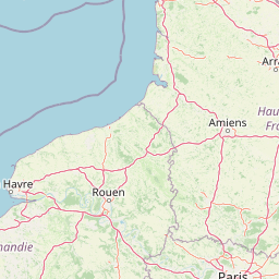
Use this park location map to pinpoint Réserve naturelle régionale du marais de la Grenouillère in France, understand its exact geographic position, and read its mapped placement within the surrounding landscape more clearly.

Pigeon | © OpenStreetMap contributors

Location context for Réserve naturelle régionale du marais de la Grenouillère

Hauts-de-FrancePas-de-Calais
Park atlas

Compare nearby regional nature reserves and wetland habitats across northern France

Parks Near Réserve naturelle régionale du marais de la Grenouillère and Surrounding Protected Landscapes

Browsing other protected areas near Réserve naturelle régionale du marais de la Grenouillère reveals a wider network of alluvial floodplains and river valley habitats. Comparing adjacent regional reserves helps place local wetland ecosystems into a broader geographic perspective.
A soft watercolor illustration of rolling hills with gentle green and yellow tones, dotted with clusters of green trees and hints of pink flowers on a white background.
Nature reservePas-de-Calais
About 18 km away#1 closest

South

Réserve naturelle régionale de la Pâture Mille Trous: Protected Chalk Grassland Geography

Authie valley landscape and calcareous plateau habitat

Located in the Pas-de-Calais department of northern France, this regional nature reserve preserves a rare chalk plateau and slope ecosystem. The area is marked by a distinctive field of historic lime-kiln depressions, creating a varied micro-topography. This protected landscape hosts an exceptionally diverse plant community, including numerous orchid species, within a compact mosaic of grassland and woodland edges overlooking the Authie valley.

Area
0.064 km²
Established
2007
IUCN
IV
Relief
Upland
Nature reserveHauts-de-France
About 18 km away#2 closest

South

Réserve naturelle régionale des Riez de Nœux-lès-Auxi Protected Landscape and Map Data

Geography of thermophilic limestone slopes in northern France

This site provides a detailed look at the Réserve naturelle régionale des Riez de Nœux-lès-Auxi, focusing on its role as the most thermophilic limestone slope in the former Nord-Pas-de-Calais region. Access structured data on the reserve's unique calcareous grassland mosaic, juniper stands, and the ravine forest habitat that characterizes this protected northern territory.

Area
0.083 km²
Established
1999
IUCN
IV
Relief
Upland
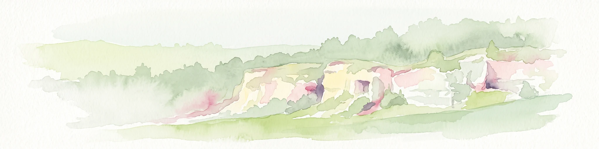
A soft watercolor painting of a grassy landscape with exposed limestone rock faces and green vegetation.
Nature reserveHauts-de-France
About 28 km away#3 closest

North

Réserve naturelle régionale des anciennes carrières de Cléty: Protected Geological Landscape

Regional nature reserve in the Hauts-de-France, France

A significant geological protected area in the Pas-de-Calais, this reserve features an exposed chalk quarry face that serves as a stratigraphic record for the Cretaceous period. The landscape hosts a rare intersection of geological heritage and diverse ecosystems, including orchids, butterflies, and bat colonies, within a compact footprint.

Area
0.02 km²
Established
2011
IUCN
IV
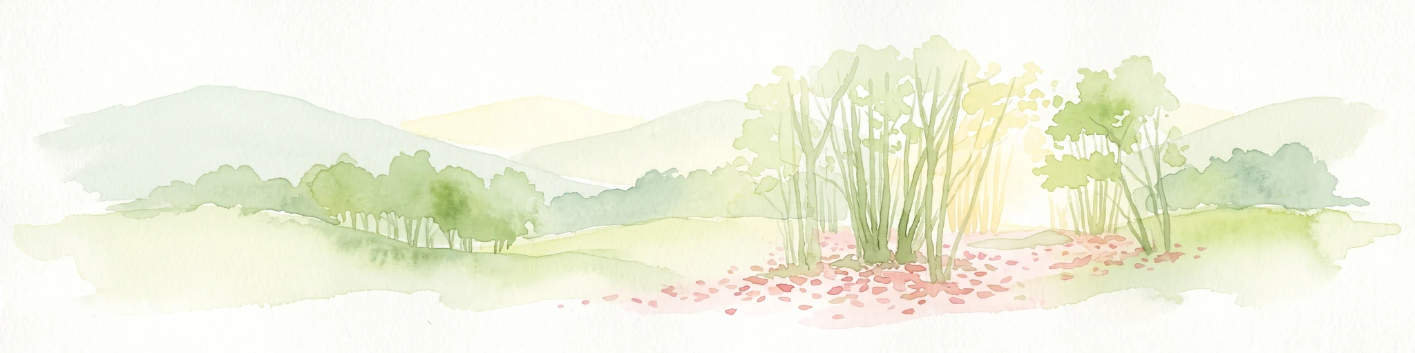
A soft watercolor illustration showing a landscape with sparse trees, a sunlit clearing, and rolling hills in the background, set against a plain white background.
Nature reserveHauts-de-France
About 33 km away#4 closest

West

Réserve naturelle régionale du bois des Agneux: Protected Nature Reserve Landscape

Wetland habitat and acidiphile woodland in Hauts-de-France

Examine the geography of Réserve naturelle régionale du bois des Agneux, a nature reserve in the Somme department of Hauts-de-France. This protected area stands out for its mosaic of acidiphile oak woodland, seasonal pools, and sandy micro-relief, serving as a critical refuge for specialized flora and fauna on the Picardy coast.

Area
0.256 km²
Established
2015
IUCN
IV
Relief
Lowland
Nature reserveHauts-de-France
About 34 km away#5 closest

Northeast

Réserve naturelle régionale du plateau des landes: Regional Nature Reserve Landscape Profile

Protected heathland geography in the Pas-de-Calais corridor.

Understand the ecological structure of the Réserve naturelle régionale du plateau des landes. This protected area features a unique crescent shape and mosaic of heathland sectors spread across several communes, offering a focused study of low-elevation inland conservation management in the heart of northern France.

Area
1.811 km²
Established
2009
IUCN
IV
A watercolor painting of a rolling rural landscape with bare trees, grassy hills, and distant purple and red hills against a pale sky.
Nature reserveHauts-de-France
About 35 km away#6 closest

Northwest

Réserve naturelle régionale du Molinet: Protected Calcareous Woodlands and Grassland Mosaic

Geographic and Habitat Analysis of a Pas-de-Calais Nature Reserve

Located in the Boulonnais landscape of northern France, this protected area serves as a vital refuge for calcareous flora. The reserve preserves a rare mosaic of limestone woodlands and grasslands, serving a dual role in both ecological conservation and water catchment protection within the Hauts-de-France administrative region.

Area
0.067 km²
Established
1987
IUCN
IV
Relief
Lowland
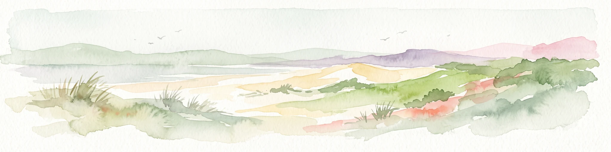
Watercolor painting of a coastal landscape with sand dunes, beach grasses, and distant hills under a light sky.
Nature reservePas-de-Calais
About 37 km away#7 closest

Northwest

Réserve naturelle nationale de la baie de Canche Protected Area Map and Geography

Coastal dune ecosystems and tidal estuary landscapes in Pas-de-Calais

This protected area offers a look into the geomorphology of the Canche estuary, where longshore drift, salt marshes, and rare chalk-cliff dune systems create a distinct environment. Understand the landscape context of this French national nature reserve, serving as a sanctuary for migratory bird populations and a site for active coastal research along the English Channel.

Area
5.05 km²
Established
1987
IUCN
IV
Relief
Lowland
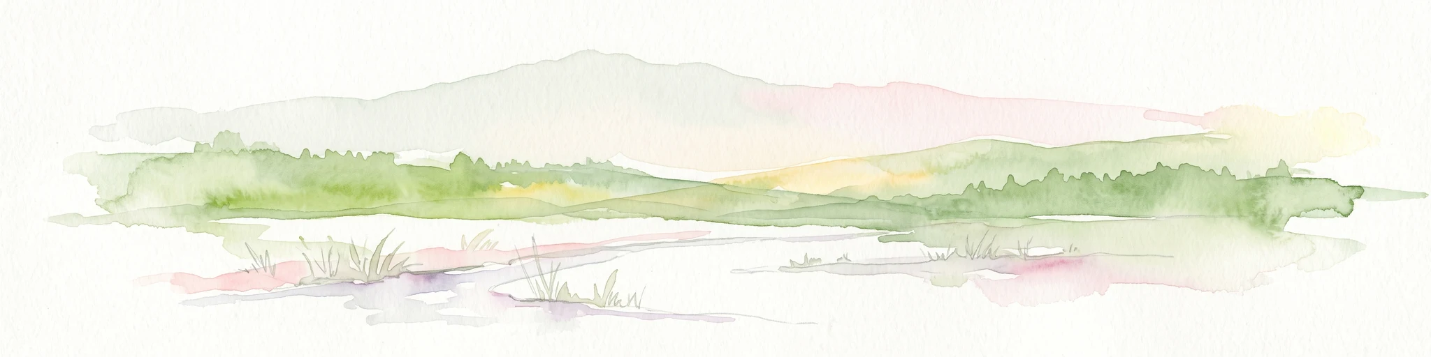
A soft watercolor illustration showing a low-lying landscape with gentle rolling hills, grassy foreground vegetation, and light, hazy atmospheric tones.
Nature reserveHauts-de-France
About 44 km away#8 closest

Northwest

Réserve naturelle régionale du marais de Condette: Wetland Geography and Protected Landscape

A vital ecological corridor within the Hauts-de-France region

Spanning 35 hectares, the Réserve naturelle régionale du marais de Condette protects a unique mosaic of marshland, peat-forming habitats, and forested massifs. This wetland reserve near the Opal Coast acts as an essential green infrastructure link, providing critical sanctuary for flora and fauna while maintaining hydrological balance in a heavily transformed northern French landscape.

Area
0.35 km²
Established
2009
IUCN
IV
Relief
Lowland

Common questions about visiting, size, designation, and location context for Réserve naturelle régionale du marais de la Grenouillère

Réserve naturelle régionale du marais de la Grenouillère FAQs for park facts, access, geography, and protected area context

Find quick answers about Réserve naturelle régionale du marais de la Grenouillère, including protected-area facts, park geography, trail and visitor context, and how the park fits into its surrounding country and regional landscape.
MoriAtlas Explorer

Continue Your Protected Areas Search Across the Global Atlas

Deepen your exploration by continuing the structured search for national parks and protected areas worldwide. Utilize the comprehensive filtering capabilities to compare different conservation landscapes and refine your understanding of global park geography. Discover more about the distribution and characteristics of protected natural areas.

Global natural geography