Mori Atlas logo
National parkShivapuri Nagarjun National Park

Discover the mapped boundaries and natural terrain of this key national park.

Shivapuri Nagarjun National Park: Protected Area and Geographic Context in Nepal

Shivapuri Nagarjun National Park represents a significant protected landscape within Nepal, offering insights into the nation's diverse geography. This atlas-focused page details the park's mapped boundaries and its role as a national park, providing essential context for understanding its place within the broader regional terrain of South Asia. Explore the geographic identity of Shivapuri Nagarjun National Park and its conservation landscape.

National ParkHimalayan ForestWatershed ProtectionBirdwatchingKathmandu ValleyMid-Hills Ecosystem

Shivapuri Nagarjun National Park

National park

Park overview

Structured park overview, official facts, and landscape profile for Shivapuri Nagarjun National Park

Shivapuri Nagarjun National Park park facts, protected area profile, and essential visitor context
Review the core facts for Shivapuri Nagarjun National Park, including designation, size, terrain, visitor scale, habitats, and operating context in one park-focused overview.

About Shivapuri Nagarjun National Park

Shivapuri Nagarjun National Park represents one of Nepal's most ecologically significant protected areas, established in 2002 as the ninth national park in the country and subsequently expanded in 2009 to incorporate the former Nagarjun Forest Reserve. The park occupies a strategic position on the northern fringe of the Kathmandu Valley, spanning across four districts and encompassing elevations from approximately 1,000 meters to the summit of Shivapuri Peak at 2,732 meters. This altitudinal range, combined with the park's location in the transitional zone between subtropical and temperate climatic systems, creates remarkably diverse habitat conditions within a relatively compact area. The protected area adjoins 23 Village Development Committees, making it a landscape-level conservation initiative that integrates multiple communities within its boundary. Beyond its ecological significance, the park provides critical ecosystem services to Nepal's capital city, with its forested watersheds supplying the majority of Kathmandu's daily water requirements. The park's accessibility from Kathmandu makes it an important destination for nature-based recreation, with popular hiking trails connecting the valley to Shivapuri Peak and various historical religious sites scattered throughout the forest.

Quick facts and research context for Shivapuri Nagarjun National Park

Shivapuri Nagarjun National Park spans 159 square kilometers in central Nepal, protecting the critical watershed that feeds the Kathmandu Valley. Established initially as a protected watershed and wildlife reserve in 1979, the area was gazetted as a national park in 2002 and expanded in 2009 to include the former Nagarjun Forest Reserve. The park encompasses elevations from approximately 1,000 meters to 2,732 meters at Shivapuri Peak, with terrain spanning subtropical broadleaf forests in lower valleys to temperate oak and rhododendron forests on higher slopes. The protected area supports significant biodiversity including Indian leopards, clouded leopards, Himalayan black bears, and 318 bird species. It is managed by Nepal's Department of National Parks and Wildlife Conservation.

Park context

Deeper park guide and search-rich context for Shivapuri Nagarjun National Park

Shivapuri Nagarjun National Park history, landscape, wildlife, and travel context
Explore Shivapuri Nagarjun National Park through its history, landscape character, ecosystems, wildlife, conservation priorities, cultural context, and seasonal travel timing in a structured park guide built for atlas discovery and search intent.

Why Shivapuri Nagarjun National Park stands out

Shivapuri Nagarjun National Park is best known as the vital watershed protection area for Kathmandu Valley, serving as the primary source of clean water for the capital city's hundreds of thousands of residents. The park protects some of the most accessible Himalayan forest ecosystems within reach of Kathmandu, with the iconic Shivapuri Peak standing at 2,732 meters as a prominent landmark visible from the valley below. The protected area is renowned for its exceptional bird diversity, with 318 species recorded including the Eurasian eagle-owl, slender-billed scimitar-babbler, and golden-throated barbet. Its position at the intersection of subtropical and temperate climate zones creates unique ecological conditions supporting both Himalayan subtropical broadleaf forests in the Schima-Castanopsis association and eastern Himalayan broadleaf forests with oak, laurel, and rhododendron communities.

Shivapuri Nagarjun National Park history and protected-area timeline

The area that now comprises Shivapuri Nagarjun National Park has served as a critical water catchment for Kathmandu Valley for centuries, but its formal protected status began in 1976 when the government established the area as a protected watershed and wildlife reserve recognizing its essential role in supplying the valley's water needs. In 2002, the protected area was formally gazetted as Shivapuri National Park, initially covering 144 square kilometers and representing Nepal's ninth national park. The park underwent a significant expansion in 2009 when the former Nagarjun Forest Reserve, covering 15 square kilometers, was incorporated into the protected area, bringing the total area to 159 square kilometers and adding the "Nagarjun" component to the park's name. This expansion reflected growing recognition of the importance of protecting contiguous forest ecosystems and watershed areas. Throughout its history, the park has maintained its dual function of biodiversity conservation and water resource protection, with management under Nepal's Department of National Parks and Wildlife Conservation.

Shivapuri Nagarjun National Park landscape and geographic character

The landscape of Shivapuri Nagarjun National Park is characterized by steep hill terrain rising from the Kathmandu Valley floor to the forested slopes of the central Himalayan mid-hills. The topography features numerous ridges, valleys, and stream corridors that channel water toward the valley below, creating a complex terrain of varying aspect and microclimate. The park encompasses Shivapuri Peak at 2,732 meters, which forms a prominent backdrop visible from Kathmandu and serves as a watershed divide between the Bagmati River system and other drainage basins. Southern-facing slopes feature drier conditions with chir pine stands on exposed ridges, while northern aspects support more lush broadleaf forests. The elevation range from approximately 1,000 to 2,732 meters creates distinct ecological zones, with lower valleys supporting subtropical vegetation and higher elevations transitioning to temperate forest communities. Stream corridors throughout the park feature distinctive riparian vegetation including alder, wild Himalayan cherry, Engelhardia, and ring-cupped oak associations.

Shivapuri Nagarjun National Park ecosystems, habitats, and plant life

The ecological character of Shivapuri Nagarjun National Park is defined by its position in the Himalayan mid-hills, where the intersection of subtropical and temperate climate zones creates remarkable habitat diversity within a relatively compact area. The park's vegetation follows distinct altitudinal patterns, with Himalayan subtropical broadleaf forests dominating the lower elevations between 1,000 and 1,800 meters, characterized by Schima-Castanopsis forest associations. At higher elevations, eastern Himalayan broadleaf forests feature broadleaf evergreen species from oak and laurel families, mixed with rhododendron on northern slopes. The park supports exceptional botanical diversity, with botanists recording 2,122 floral species including 449 vascular plant species and 16 endemic plants. The forest also supports 129 documented mushroom species, indicating healthy fungal communities. The protected area serves as a critical watershed, with annual precipitation of approximately 1,400 millimeters, most of which falls during the monsoon season from May through September, feeding the streams that supply Kathmandu Valley.

Shivapuri Nagarjun National Park wildlife and species highlights

Shivapuri Nagarjun National Park supports remarkable mammalian diversity despite its relatively small size, with surveys documenting numerous species including Indian leopard, clouded leopard, jungle cat, large Indian civet, golden jackal, and Himalayan black bear. The carnivore community also includes leopard cat, masked palm civet, crab-eating mongoose, and yellow-throated marten. Herbivores present include Himalayan goral, Indian muntjac, wild boar, and smaller mammals such as the Chinese pangolin and Indian pangolin. Primates are represented by rhesus monkey and Hanuman langur, while smaller mammals include Indian crested porcupine, Royle's pika, Indian hare, and various rodents. The park is particularly notable for bird diversity, with ornithologists recording 318 species including the Eurasian eagle-owl, slender-billed scimitar-babbler, white-gorgeted flycatcher, barred cuckoo-dove, and golden-throated barbet. Herpetofauna surveys have identified numerous reptile and amphibian species including monocled cobra, Himalayan keelback, various skinks, and amphibians such as the black-spined toad and long-legged cricket frog.

Shivapuri Nagarjun National Park conservation status and protection priorities

Shivapuri Nagarjun National Park represents an important conservation priority for Nepal due to its dual role in watershed protection and biodiversity preservation within the heavily populated Kathmandu Valley region. The park's designation as a protected watershed area in 1976 reflected recognition that the forested slopes above the valley are essential for maintaining water quality and quantity for the capital city's residents. The transition from watershed reserve to national park status in 2002 expanded conservation objectives to include explicit biodiversity protection, with subsequent surveys documenting significant mammal, bird, and reptile populations. The park's IUCN Category II designation reflects its primary function as a national park with ecosystem conservation and recreation as core objectives. Management by Nepal's Department of National Parks and Wildlife Conservation balances conservation with the park's important role as a recreation destination, with hiking trails providing accessible nature experiences while the protected watersheds continue supplying Kathmandu's water needs.

Shivapuri Nagarjun National Park cultural meaning and human context

The landscape of Shivapuri Nagarjun National Park holds significant cultural and religious value for local communities in the Kathmandu Valley region. The protected area contains numerous historical and religious sites that have attracted visitors for centuries, contributing to the park's importance beyond its ecological functions. The forested slopes surrounding the valley have traditionally been associated with religious practices and pilgrimage routes, with Shivapuri Peak itself holding spiritual significance. The park's extensive trail network connects these historical sites with rural villages that have maintained traditional land-use practices within the watershed area. The integration of 23 Village Development Committees within and adjacent to the park boundary reflects the historical relationship between local communities and the forested landscape, where sustainable use of forest resources has been practiced for generations.

Top sights and standout views in Shivapuri Nagarjun National Park

Shivapuri Nagarjun National Park offers visitors the opportunity to experience pristine Himalayan forest ecosystems within easy reach of Kathmandu, making it one of the most accessible mountainous protected areas in Nepal. The hike to Shivapuri Peak at 2,732 meters provides stunning panoramic views of the Kathmandu Valley and surrounding Himalayan ranges, while the diverse trail network traverses through varied forest types from subtropical broadleaf to temperate oak-rhododendron communities. The park's exceptional bird diversity makes it a rewarding destination for ornithologists and birdwatchers, with species such as the Eurasian eagle-owl and golden-throated barbet among the notable residents. The watershed protection function of the park means that trails often follow historic water sources and stream corridors, adding ecological interest to the hiking experience.

Best time to visit Shivapuri Nagarjun National Park

The optimal time to visit Shivapuri Nagarjun National Park spans from October through April, when the post-monsoon and winter seasons offer clear skies and comfortable temperatures for hiking. The monsoon season from May to September brings heavy rainfall that can make trails slippery and visibility limited, though the forest is at its lushest during this period. Winter temperatures between 2 and 17 degrees Celsius make higher elevation hikes invigorating but require appropriate preparation, while summer temperatures ranging from 19 to 30 degrees Celsius can make lower elevation walks warm but pleasant. The transition seasons of spring and autumn offer the most stable weather conditions and are particularly rewarding for wildlife viewing as animals are more active during moderate temperatures.
Park location guide

Geography guide, regional context, and park location map for Shivapuri Nagarjun National Park

Shivapuri Nagarjun National Park park geography, regions, and map view in Nepal
Understand where Shivapuri Nagarjun National Park sits in Nepal through a broader geographic reading of the surrounding landscape, nearby location context, and its mapped position within the national park landscape.

How Shivapuri Nagarjun National Park fits into Nepal

Nepal is a federal parliamentary republic in South Asia, landlocked between China and India. It spans the Himalayas and includes eight of the world's ten highest mountains. Kathmandu is the capital and largest city.

Wider geography shaping Shivapuri Nagarjun National Park in Nepal

Nepal is located in South Asia, landlocked between China to the north and India to the south, east, and west. The country occupies the Himalayan region in the north and extends into the Indo-Gangetic Plain in the south. Terrain includes the Terai lowlands, subalpine hills, and the Himalayas with peaks including Mount Everest.

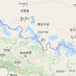
Map view of Shivapuri Nagarjun National Park

Use this park location map to pinpoint Shivapuri Nagarjun National Park in Nepal, understand its exact geographic position, and read its mapped placement within the surrounding landscape more clearly.

Pigeon | © OpenStreetMap contributors

Location context for Shivapuri Nagarjun National Park

Bagmati ProvinceKathmandu District
Park atlas

Map the surrounding protected landscapes and compare adjacent park geography in Nepal's mid-hills region.

Discover Nearby National Parks and Protected Areas Beyond Shivapuri Nagarjun National Park
Browse other national parks and protected areas located geographically near Shivapuri Nagarjun National Park, revealing connected conservation landscapes within Nepal's central mid-hills region. Gain a deeper understanding of regional park distribution, diverse Himalayan ecosystems, and the varied terrain surrounding the Kathmandu Valley.
A watercolor painting depicting a river flowing through a valley with mountains in the background and green forests
National parkNepal

Langtang National Park: Nepal's Pioneer Himalayan Protected Landscape and Alpine Atlas

Mapped glaciated terrain, sacred lakes, and towering peaks define this national park.

Langtang National Park, established as Nepal's first Himalayan national park, offers a unique window into high-altitude protected landscapes. Its geography is characterized by dramatic glaciated valleys, soaring mountain peaks including Langtang Lirung, and a rich diversity of alpine ecosystems. This page provides an atlas-centric view of the park's boundaries and its significance within the broader Himalayan conservation context.

Area
1,710 km²
Established
1976
IUCN
II
Relief
Mountain
National parkNepal

Chitwan National Park: Nepal's Designated National Park Landscape

Explore mapped boundaries and surrounding regional geography.

Chitwan National Park is a vital protected area offering critical insights into Nepal's natural geography. This entry provides detailed information on the park's specific landscape characteristics and its mapped boundaries, crucial for anyone interested in the atlas-level understanding of protected lands within South Asia. Discover the geographic context of this national park and its significance within the broader conservation framework of Nepal.

Area
952.63 km²
Established
1973
IUCN
II
Relief
Mixed relief
National parkNepal

Parsa National Park: Mapped Protected Landscape Within Nepal's Geography

Explore its national park status and geographic setting.

Parsa National Park represents a significant protected area within the geographic framework of Nepal. This page provides critical atlas context, detailing the park's mapped boundaries and its role as a national park. It serves as an essential resource for understanding the specific landscape features and regional geographic positioning of Parsa National Park, contributing to a structured view of protected lands across South Asia.

Area
627.39 km²
Established
2017
IUCN
II
Relief
Lowland
National parkWest Champaran District

Valmiki National Park: A Vital National Park and Protected Landscape in Bihar

Explore unique Sivalik terrain and mapped protected area boundaries

Valmiki National Park, located in the West Champaran District of Bihar, is a significant protected area renowned for its unique geography. Situated at the interface of the Himalayas and the Gangetic plains, the park showcases a varied terrain including ridges, gorges, dense forests, and extensive wetlands. As Bihar's only national park and a designated tiger reserve, it offers rich insights into conservation landscapes and regional biodiversity for atlas exploration.

Area
898.45 km²
Established
1990
IUCN
II
Relief
Mixed relief
National parkKoshi Province

Sagarmatha National Park: Mapped Protected Landscape and Geographic Identity in Koshi Province

Explore the protected area's regional geographic context.

Sagarmatha National Park serves as a distinct protected national park entity. This page facilitates an in-depth understanding of its mapped boundaries and its location within Koshi Province. Users can explore the park's specific landscape characteristics and its position within the broader regional geography, providing a foundation for atlas and map-driven discovery.

Area
1,148 km²
Established
1976
IUCN
II
Visitors
19K annual
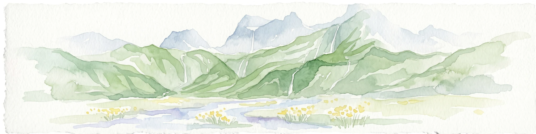
Watercolor illustration of mountain landscape with green slopes and blue peaks, showing a valley with yellow flowers in the foreground
National parkKoshi Province

Makalu Barun National Park: Protected Landscape and Regional Geography in Koshi Province

Explore the mapped boundaries of this national park.

Makalu Barun National Park is a designated national park providing critical protected landscape data for geographic discovery. Understand its position within Koshi Province and its specific mapped boundaries, offering insights into Nepal's protected areas. This entry is designed for users seeking detailed atlas information on the park's terrain and its role in regional conservation contexts.

Area
1,500 km²
Established
1992
IUCN
II
Relief
Mountain
National parkDarjeeling District

Singalila National Park: A High-Altitude Protected Landscape on the Eastern Himalayan Ridge

Explore mapped terrain and alpine park geography in Darjeeling District.

Singalila National Park represents a crucial protected natural landscape within the Eastern Himalayas, located in India's Darjeeling District. Defined by its dramatic ridgeline that ascends to over 4,000 meters, the park offers a unique alpine environment with stunning panoramic views. Its designation as a national park highlights its importance for conservation and its role in the regional geographic atlas. Discover the mapped boundaries and ecological context of this remarkable mountain wilderness, from its dense forests to its open alpine meadows.

Area
78.6 km²
Established
1986
IUCN
II
Relief
Mountain
National parkSikkim

Khangchendzonga National Park: National Park in Sikkim with Mapped Boundaries

Explore protected landscapes and regional geography.

Understand Khangchendzonga National Park as a key protected area within Sikkim, India. This entry provides focused atlas information on the park's geographic features, mapped boundaries, and its role as a national park, offering essential context for regional landscape discovery and exploration.

Area
1,784 km²
Established
1977
IUCN
II
Relief
Mountain

Common questions about visiting, size, designation, and location context for Shivapuri Nagarjun National Park

Shivapuri Nagarjun National Park FAQs for park facts, access, geography, and protected area context
Find quick answers about Shivapuri Nagarjun National Park, including protected-area facts, park geography, trail and visitor context, and how the park fits into its surrounding country and regional landscape.
MoriAtlas Explorer

Continue Your Protected Areas Search Across the Global Atlas

Deepen your exploration by continuing the structured search for national parks and protected areas worldwide. Utilize the comprehensive filtering capabilities to compare different conservation landscapes and refine your understanding of global park geography. Discover more about the distribution and characteristics of protected natural areas.

Global natural geography