
Why Sierra de Huautla stands out
Sierra de Huautla is best known for protecting one of the most extensive and ecologically significant remnants of tropical dry forest (selva baja caducifolia) in Mexico, an ecosystem defined by a short, open canopy that loses most of its leaves during a pronounced dry season. The reserve is also recognized for the Balsas screech owl (Megascops seductus), an endemic bird of limited distribution, and for its role as a UNESCO biosphere reserve. Its biodiversity profile, combined with the dramatic transition between the Trans-Mexican Volcanic Belt and the Balsas lowlands, makes its landscape and species composition unusual within Mexico's protected-area system.
Sierra de Huautla history and protected-area timeline
The landscape now protected as Sierra de Huautla has a long human history that long predates formal conservation. Pre-classical Mesoamerican cultures were present across what is now Morelos from around 1500 BCE, with sites such as Chalcatzingo to the east and later settlements at Atlihuayan and Chimalacatlán emerging within and around the range. By the later pre-Classic and Classic periods, communities such as Xochitepec, Tlacuatzingo, and Zacualpan were part of an interconnected network of settlements, while oral tradition records a confederation of villages in the Sierra de Huautla region headed by Tlaquiltenango, encompassing older towns like Amacuzac, Huautla, Nexpa, and Chimalacatlán.
Modern protection history began in the early 1990s. Recognizing the ecological value of the tropical dry forests, the state of Morelos designated a portion of the Sierra as an Ecological Conservation Area in 1993, covering roughly 313 square kilometers. The Mexican federal government then expanded and elevated the designation in 1999, when the area was officially decreed as the Sierra de Huautla Biosphere Reserve, extending its coverage to approximately 590 square kilometers. In 2006, UNESCO recognized the reserve as part of its international biosphere network, confirming its global conservation significance.
Throughout the late twentieth and early twenty-first centuries, the region has also experienced significant socioeconomic change. A historic silver mine in the area closed in the 1990s, and many local residents migrated to larger Mexican cities or to the United States in search of work. In response, the reserve's management strategy has emphasized local livelihood alternatives, including fruit cultivation, sustainable forestry, and ecotourism, alongside traditional agriculture and ranching. Contemporary management is structured around subprograms for protection, restoration, knowledge, culture, and administration, reflecting an integrated approach to conservation and community well-being.
Sierra de Huautla landscape and geographic character
The Sierra de Huautla is a rugged, predominantly east-west running range of hills and mountains that marks the southern edge of Morelos and extends visually across the political borders into Guerrero and Puebla. Elevation within the reserve ranges from approximately 700 meters in the lower foothills to peaks of 2,440 meters, producing rapid vertical changes over relatively short horizontal distances. The profile from Cerro Frío down to Tilzapotla, for instance, drops nearly 1,300 meters across about five kilometers, creating steep gradients that shape both microclimate and land use.
Geologically, the reserve spans two major physiographic provinces. The eastern and southern portions belong to the Trans-Mexican Volcanic Belt and feature a mixture of volcanic rocks and continental sediments, including Cretaceous-age limestones, sandstones, and shales that record ancient marine deposition. The western portion lies within the influence of the Sierra Madre del Sur, expressed as a labyrinth of low hills and small mesas with elevations between about 900 and 1,400 meters. Volcanic rocks dominate the surface, though intrusive dioritic and granodioritic bodies have produced contact metamorphism in parts of the reserve's northern reaches.
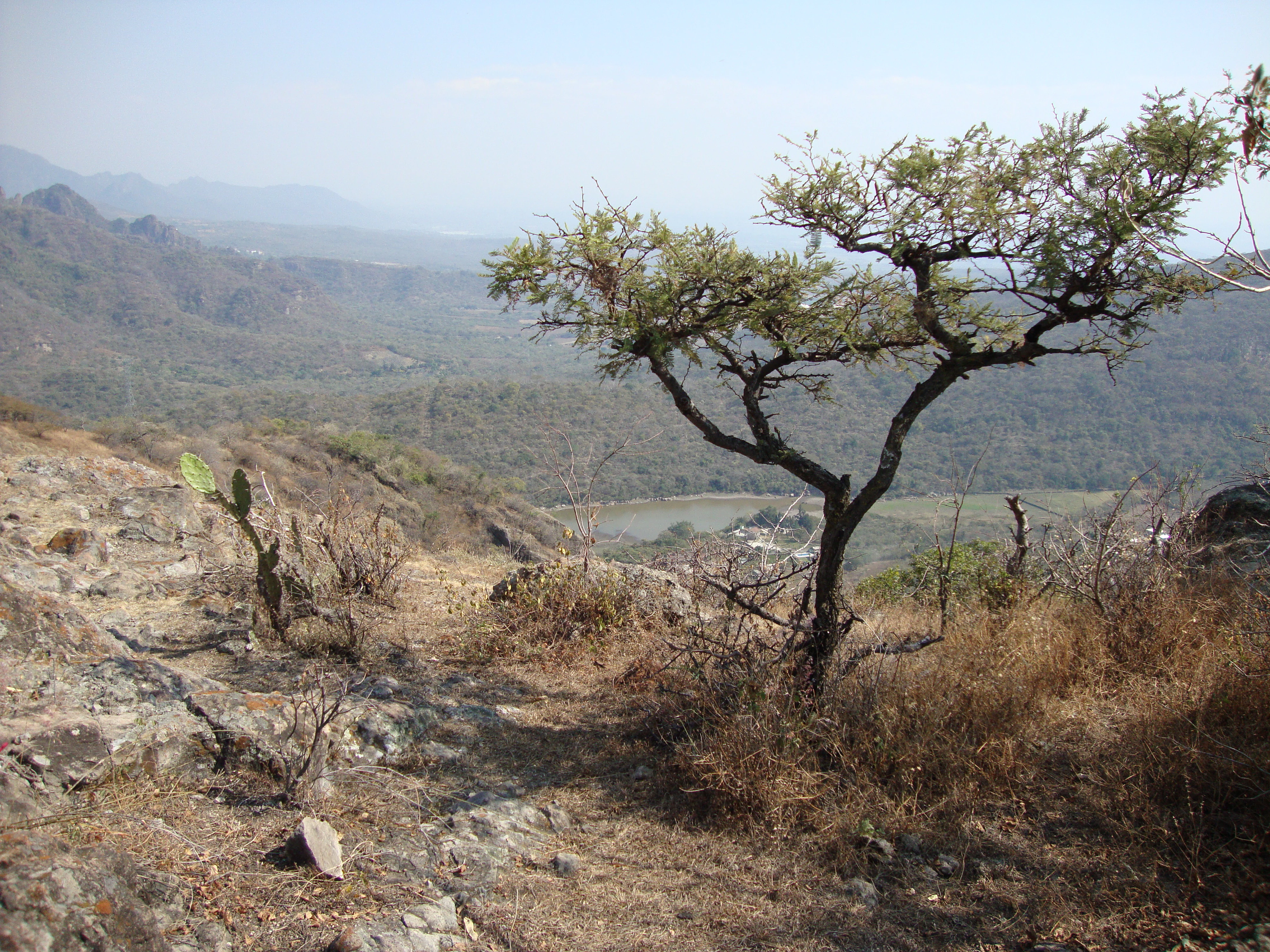
The most striking visual contrast within the landscape is between the dry, deciduous tropical forests of the lower slopes and the evergreen gallery forests lining the permanent streams. During the rainy season the hillsides flush green with a dense, low canopy, while in the dry months they shed most of their foliage and the rocky topography becomes fully visible. Ravines, seasonal arroyos, and small upland plateaus break up the slopes, with small reservoirs such as the Presa Emiliano Zapata near Tilzapotla storing runoff from Cerro Frío and supporting downstream irrigation. The result is a landscape of strong seasonal contrasts, sharp ecological transitions, and a tightly woven relationship between landforms, water, and vegetation.
Sierra de Huautla ecosystems, habitats, and plant life
Sierra de Huautla's ecological identity is defined by its tropical dry forest (selva baja caducifolia), a biome that covers most of the reserve and is one of the rarest and most threatened ecosystems in Mexico. The dry forest is characterized by a low, sparse canopy of trees that lose their leaves during the long dry season, revealing a landscape of contorted branches and rocky ground before the rains trigger rapid green-up between June and October. Dominant tree genera include Lysiloma, Conzattia, Bursera, Ceiba, Acacia, and Mimosa, with characteristic species such as Lysiloma acapulcense, Conzattia multiflora, Prosopis laevigata, and several Quercus species at higher elevations.
Along the permanent rivers and streams, evergreen gallery forests form a green corridor through the otherwise deciduous slopes, supporting very different plant and animal communities from the surrounding matrix. At the higher elevations, particularly in the northern parts of the reserve, oak and oak-pine woodlands create small patches of temperate-like forest. The result is a mosaic of habitats in close proximity, allowing species associated with dry forest, riparian corridors, and montane woodlands to coexist within a relatively small area.
The reserve also supports rich invertebrate communities, with initial estimates suggesting roughly 50 odonate species, 230 bee species, around 14 social wasp species, and more than 300 longhorn beetle species. This diversity reflects the structural complexity of the vegetation, the seasonal contrast between wet and dry periods, and the importance of the area as a refuge for tropical dry-forest specialists that have disappeared from much of central Mexico's transformed lowlands.
Sierra de Huautla wildlife and species highlights
Sierra de Huautla hosts a remarkable vertebrate community for a protected area of its size. The reserve records 71 mammal species, 208 bird species, 53 reptile species, and 18 amphibian species, along with 14 freshwater fish species and a strong presence of butterflies and other invertebrates. Among the mammals, the reserve retains a significant guild of mid-sized and large carnivores and felids, including puma, ocelot, margay, bobcat, and jaguarundi, with coati, ring-tailed cat, and white-tailed deer as more commonly encountered species.
Bat diversity is notable, with several Rhogeessa species and the Mexican long-tongued bat (Choeronycteris mexicana) recorded in the reserve, alongside the grayish mouse opossum (Tlacuatzin canescens canescens), one of Mexico's small marsupials. Reptiles include the black iguana (Ctenosaura pectinata) and the beaded lizard (Heloderma horridum), the latter being one of Mexico's venomous lizard species of conservation significance.
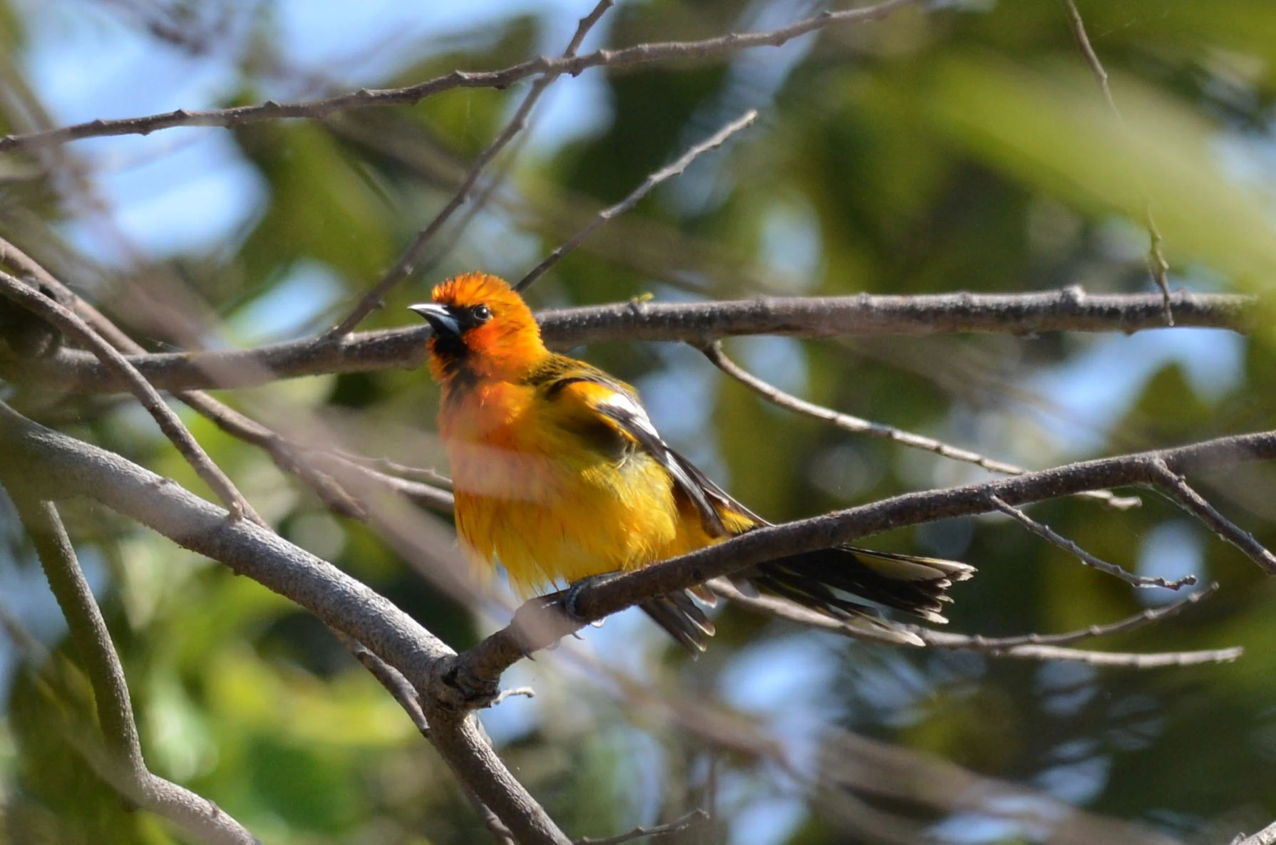
The reserve's birdlife is particularly important, blending tropical dry-forest species with montane pine-oak forest species. Among the raptors are the red-tailed hawk and the common black hawk, while owls include the ferruginous pygmy owl and the Balsas screech owl, the latter being a restricted-range endemic closely associated with the dry forests of the Balsas Basin and a major reason the reserve is recognized as an Important Bird Area. Iconic species also include the military macaw, the West Mexican chachalaca, the blue mockingbird, and a range of orioles, sparrows, woodpeckers, and hummingbirds, with ecological roles spanning seed dispersal, pollination, insect control, and predation.
Sierra de Huautla conservation status and protection priorities
Sierra de Huautla is a cornerstone site for the conservation of Mexico's tropical dry forests, an ecosystem that has suffered extensive loss elsewhere in the country. Its declaration as a biosphere reserve in 1999 built upon earlier state-level recognition as an Ecological Conservation Area in 1993, and the 2006 designation as a UNESCO biosphere reserve underscores the international significance of the dry forest ecosystems it protects. The reserve's biodiversity profile, including more than 2,400 recorded species and dozens of species in various categories of risk, gives it substantial conservation value beyond Mexico's borders.
Beyond its ecological role, the reserve is critical for watershed protection. The mountains of Cerro Frío and Huautla generate and regulate surface and groundwater resources that sustain both local communities and downstream users in Guerrero, with water from Cerro Frío supplying the Presa Emiliano Zapata and supporting irrigation in the Tilzapotla region. Most streams within the reserve are seasonal, but the Amacuzac and Cuautla rivers provide permanent flow and underpin riparian agriculture, even as they also carry pollution pressures from upstream urban and industrial sources.
Management of the reserve follows a structure of subprograms for protection, restoration, knowledge, culture, and administration, addressing threats such as overgrazing, deforestation for fuelwood, unregulated land conversion, and waste management in rural communities. Conservation efforts also seek to provide local economic alternatives, including sustainable fruit production and ecotourism, recognizing that the long-term integrity of the reserve depends on linking ecological protection with the well-being of the people who live within and around it.
Sierra de Huautla cultural meaning and human context
The Sierra de Huautla region carries a layered cultural heritage that stretches back to the earliest sedentary agricultural communities in central Mexico. Pre-Classic cultures established settlements across what is now Morelos from roughly 1500 BCE onward, including sites such as Chalcatzingo in the east and later communities at Atlihuayan and Chimalacatlán within the area later encompassed by the reserve. During the Classic period, towns such as Xochitepec, Tlacuatzingo, Miahuatlán, and Zacualpan contributed to a network of cultural, economic, and craft exchanges, sustaining livelihoods tied directly to the surrounding hills and rivers.
Oral tradition, recorded by chroniclers such as René Gama Beltrán for Tlaquiltenango, recalls a constellation of older settlements in the region, including Amacuzac, Huautla, Nexpa, Panchimalco, Quilamula, and Chimalacatlán. Through alliances among calpulli, these communities formed a confederation under the leadership of Tlaquiltenango, encompassing more than 300 villages and suggesting a long-standing regional identity tied to these mountains. This cultural pattern of shared landscape use and inter-village cooperation remains relevant to how conservation is negotiated in the reserve today.
Contemporary culture in the reserve remains closely tied to subsistence agriculture, livestock keeping, and small-scale forest use. Traditional farming on tlacololes (small terraced plots) and the gathering of fuelwood, resins, and bark continue as inherited practices, while the local population has also experienced significant change, including the closure of a historic silver mine in the 1990s and sustained migration toward larger Mexican cities and the United States. Initiatives to promote fruit cultivation and ecotourism reflect an effort to anchor new livelihoods in the same landscape that has supported these communities for generations.
Top sights and standout views in Sierra de Huautla
Sierra de Huautla stands out as one of Mexico's most important refuges for tropical dry forest, a globally significant but heavily threatened ecosystem characterized by dramatic seasonal cycling between leafless and fully leafed states. Its UNESCO biosphere status and recognition as an Important Bird Area underscore its role in international conservation networks.
The reserve's combination of rugged terrain, sharp altitudinal gradients, and a diverse mosaic of dry forest, gallery forest, and oak woodland supports an unusually rich fauna, including five wild cat species, the endemic Balsas screech owl, the military macaw, and the beaded lizard. Together, these features make Sierra de Huautla a strong example of how ecological value, watershed function, and deep cultural heritage can be managed within a single protected landscape.
Best time to visit Sierra de Huautla
Sierra de Huautla experiences a strongly seasonal tropical climate, with a marked wet season running roughly from June to early October and a pronounced dry season for the remainder of the year. The wettest months are typically July and September, often punctuated by brief mid-summer dry spells known locally as the canícula, while August can see reduced rainfall. Annual precipitation averages around 900 millimeters, and mean annual temperatures are around 24°C, with cooler conditions and more rainfall at higher elevations.
For visitors interested in seeing the dry forest at its most spectacular, the late dry season offers an open landscape of leafless trees and clear views across the rugged topography, alongside the highest temperatures. The early to middle wet season, by contrast, brings the canopy into full leaf, cooler conditions, more active wildlife, and the chance to witness flowering and fruiting cycles, though heavy afternoon storms are common. Birdwatching is particularly rewarding when migratory and breeding species are most active, while the rains transform seasonal streams and reveal the reserve's dramatic hydrology.