Mori Atlas logo
National parkSouthern Konnevesi National Park

Explore the geographic identity and protected area boundaries of this national park.

Southern Konnevesi National Park: Mapped Protected Landscape in Central Finland

(Etelä-Konneveden kansallispuisto)

Southern Konnevesi National Park represents a key protected landscape within Central Finland, a region characterized by its extensive lake district and rolling terrain. As a designated national park, it offers a specific geographic focus for atlas-based exploration, allowing users to understand its mapped boundaries and its place within the broader natural context of the Finnish Lakeland. This page serves as the primary entry point for discovering the park's unique environmental setting and its significance as a preserved natural area.

National ParksFinlandBoreal ForestsLake EnvironmentsIsland Archipelagos canoeing

Southern Konnevesi National Park

National park

Park overview

Structured park overview, official facts, and landscape profile for Southern Konnevesi National Park

Southern Konnevesi National Park park facts, protected area profile, and essential visitor context
Review the core facts for Southern Konnevesi National Park, including designation, size, terrain, visitor scale, habitats, and operating context in one park-focused overview.

About Southern Konnevesi National Park

Southern Konnevesi National Park protects one of Finland's most ecologically and scenically significant lake environments in the heart of the Finnish Lakeland. The park encompasses the southern archipelago of Lake Konnevesi, a large and deep lake system that forms part of the extensive Finnish lake district. The protected area includes both the scattered islands that characterize the southern part of the lake and a substantial mainland area along the eastern shoreline, creating a comprehensive保护 of the region's ecological integrity. The park's landscape bears the clear imprint of glacial activity, with smooth polished bedrock surfaces characteristic of the Fenno-Scandian shield mixed with more dramatic vertical cliff formations that rise above the lake surface. Visitors to the park experience a landscape where the vast openness of the lake meets the denser boreal forest, creating a distinctive contrast between open water and forested shores.

Quick facts and research context for Southern Konnevesi National Park

Southern Konnevesi National Park covers approximately 15 square kilometers of terrestrial and aquatic territory in central Finland. The park was established in 2014, making it one of Finland's newer national parks. It lies within the municipalities of Konnevesi and Rautalampi, situated between main road 69 to the south and highway 9 to the southeast. The park receives approximately 30,400 visitors annually, drawn to its canoeing and boating opportunities among the island maze, its fishing opportunities for wild brown trout, and its network of hiking trails through herb-rich forests to dramatic cliff viewpoints.

Park context

Deeper park guide and search-rich context for Southern Konnevesi National Park

Southern Konnevesi National Park history, landscape, wildlife, and travel context
Explore Southern Konnevesi National Park through its history, landscape character, ecosystems, wildlife, conservation priorities, cultural context, and seasonal travel timing in a structured park guide built for atlas discovery and search intent.

Why Southern Konnevesi National Park stands out

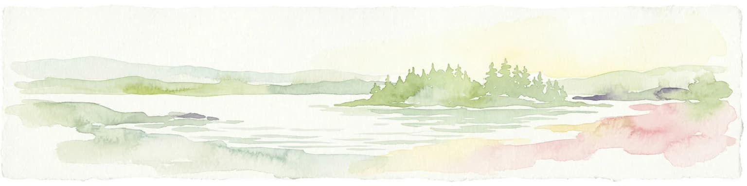
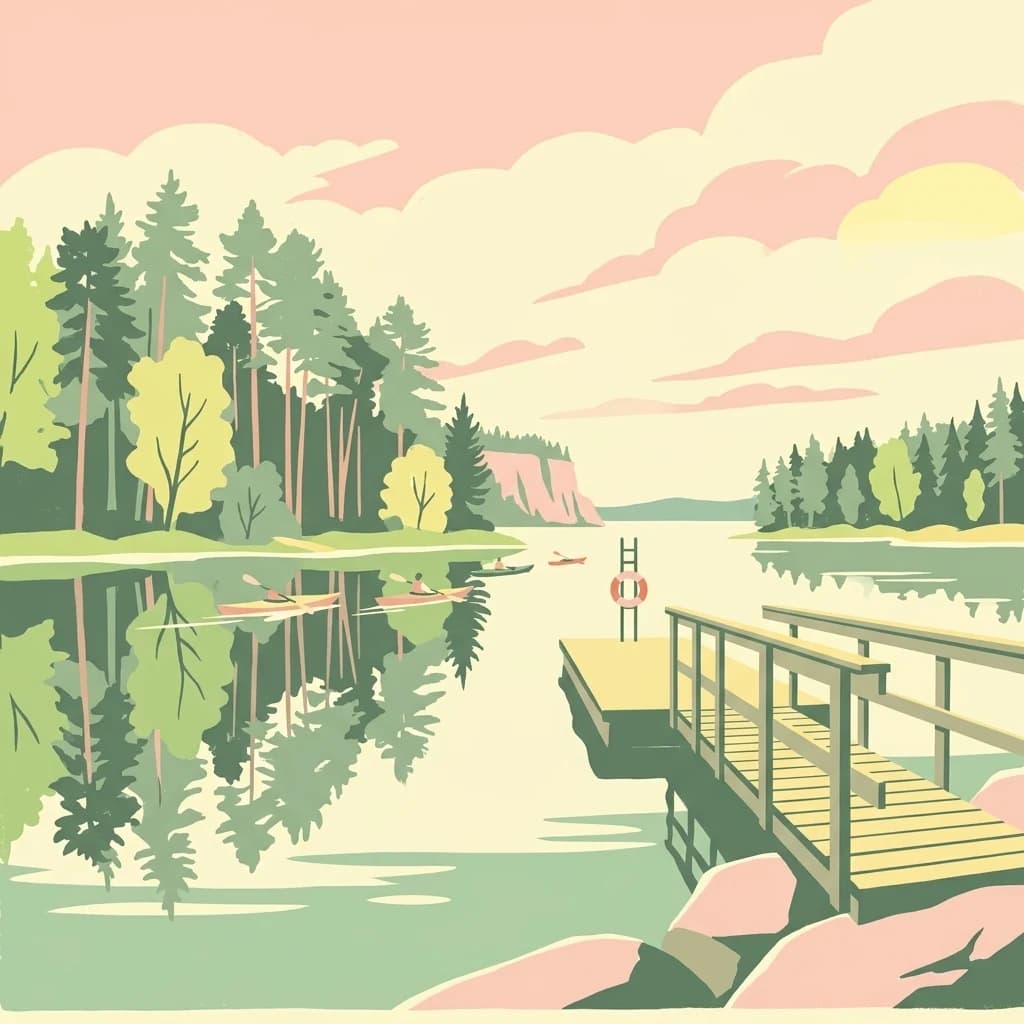
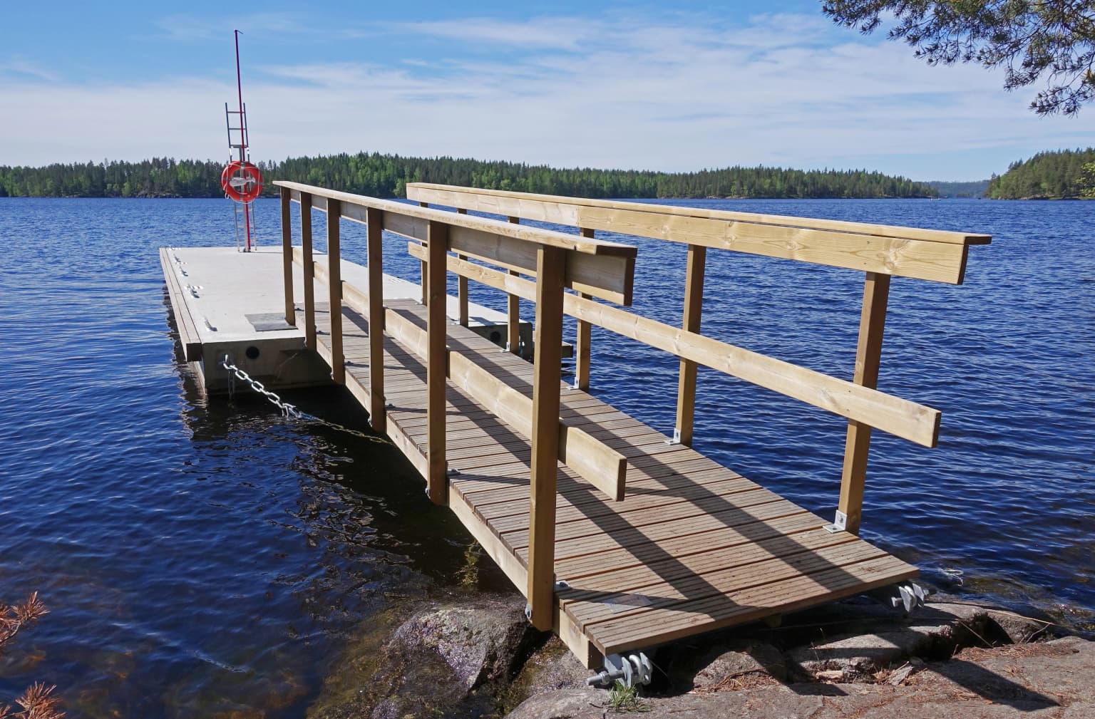
Southern Konnevesi is especially known for its dramatic island archipelago landscape of smooth glaciated bedrock islands interspersed with vertical rock walls and clear, deep lake waters. The park provides exceptional canoeing and paddling experiences through a maze of islands, where visitors can explore the wide open waters of Lake Konnevesi while encountering wild brown trout in the clear depths below. The park is also recognized for its significant research presence, as the University of Jyväskylä maintains a renowned research station at Konnevesi that has become internationally prominent in experimental ecology spanning both terrestrial and aquatic ecosystems.

Southern Konnevesi National Park history and protected-area timeline

Southern Konnevesi National Park was established in 2014 as part of Finland's ongoing commitment to expanding its network of protected areas. The park represents a relatively recent addition to Finland's national park system, created after careful assessment of the region's ecological significance and the need to protect the Lake Konnevesi environment from development pressures. The establishment of the park also built upon the scientific legacy of the Konnevesi Research Station operated by the University of Jyväskylä, which had long studied the terrestrial and aquatic ecosystems of the region and provided compelling scientific justification for formal protection. The park's creation reflects Finland's approach to identifying and preserving ecologically representative landscapes within its borders.

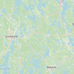
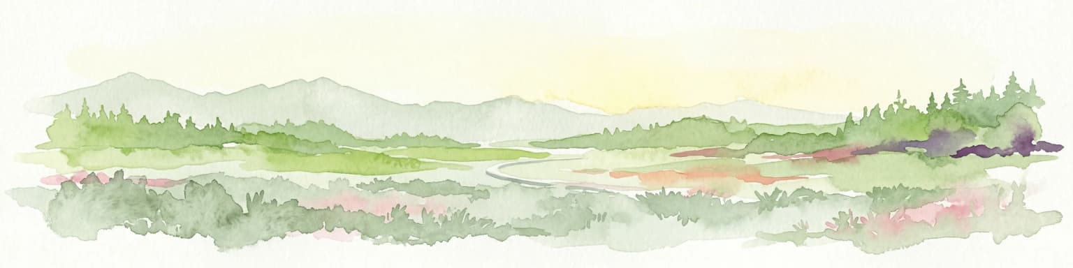
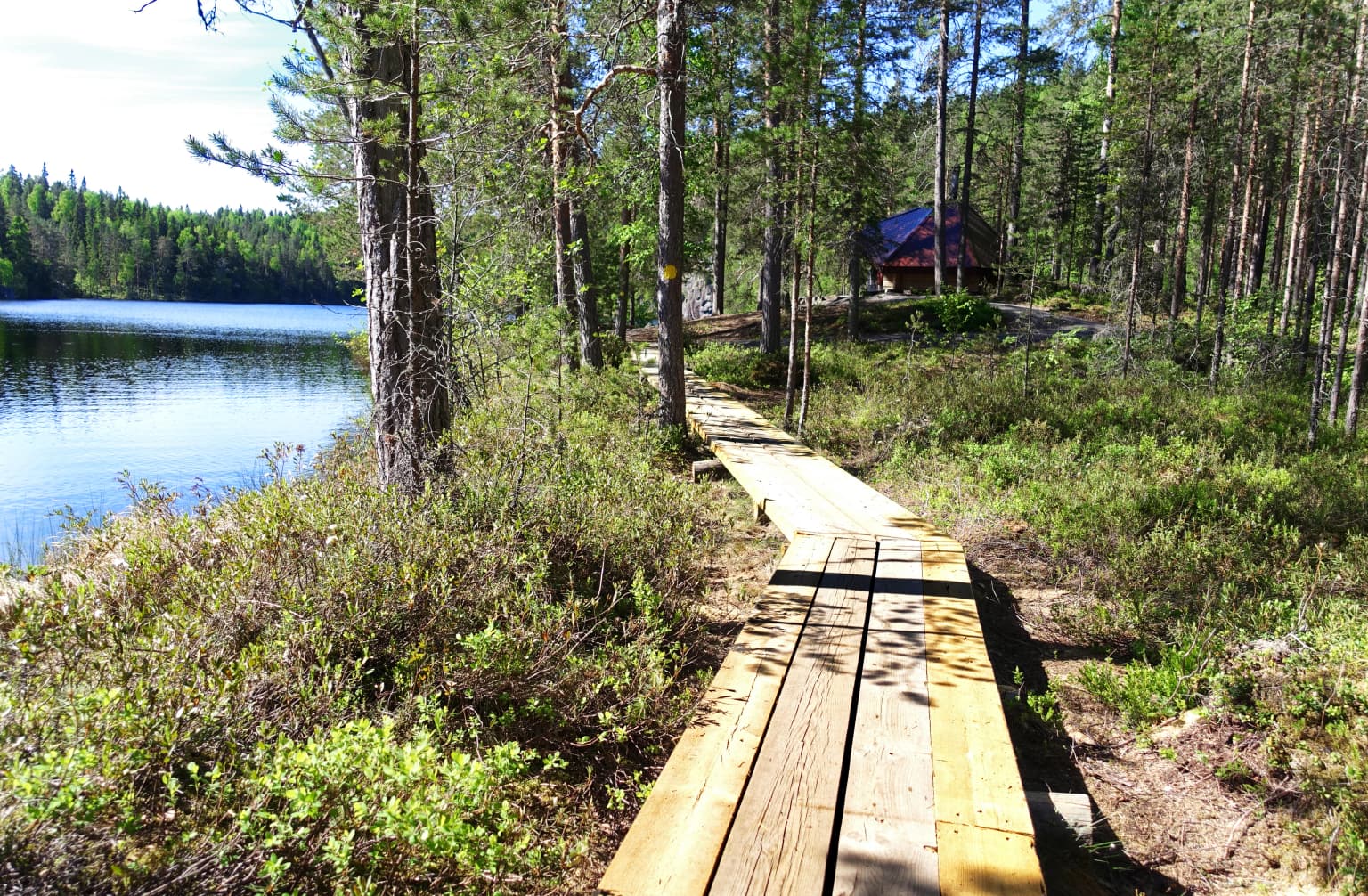
Southern Konnevesi National Park landscape and geographic character

The landscape of Southern Konnevesi National Park is defined by its position within the Finnish Lakeland, one of Europe's most extensive lake districts. The park protects a complex archipelago environment where hundreds of islands of varying sizes create a maze of waterways and sheltered bays. The bedrock throughout the park consists of ancient Precambrian rock formations that have been smoothed and polished by glacial action, resulting in the characteristic smooth glaciated rocks that define much of the island shoreline. Among the more gentle island surfaces, dramatic vertical rock walls rise abruptly from the water, providing dramatic focal points throughout the archipelago. The eastern mainland portion of the park transitions from lakeshore environments into mature boreal forest, creating a continuous ecological gradient from open water to upland forest.

Southern Konnevesi National Park ecosystems, habitats, and plant life

The nature of Southern Konnevesi reflects the boreal ecological zone that dominates much of Finland. The park's forests include herb-rich spruce and pine forests that grow on the islands and mainland areas, characterized by diverse ground vegetation typical of southern boreal forests. The lake itself supports a thriving aquatic ecosystem, with the clear, oxygen-rich waters providing habitat for wild brown trout and other fish species. The ecological complexity of the area, combining lake, island, and forest habitats, creates a diverse environment that supports numerous species. The research station at Konnevesi has conducted extensive studies on both the terrestrial and aquatic ecology of the region, making it one of the most scientifically studied areas in Finnish Lakeland.

Southern Konnevesi National Park wildlife and species highlights

Wildlife in Southern Konnevesi centers on the aquatic environments of Lake Konnevesi, where the clear deep waters support populations of wild brown trout that represent a significant draw for anglers visiting the park. The osprey is a particularly notable species in the area, with the park's dramatic cliffs providing ideal nesting habitat for this impressive bird of prey. Visitors hiking the park's trails may encounter typical boreal forest species in the wooded areas, while the open waters and islands support their own complement of birdlife. The combination of fishing opportunities, birdwatching possibilities, and the chance to observe wildlife in a relatively pristine boreal lake environment makes the park an attractive destination for nature enthusiasts.

Southern Konnevesi National Park conservation status and protection priorities

Southern Konnevesi National Park contributes to Finland's commitment to preserving representative samples of the country's diverse natural environments. The protection of Lake Konnevesi's southern archipelago ensures the preservation of a distinctive lake ecosystem that might otherwise face development pressure for cottage construction, forestry, or other activities. The park's establishment in 2014 reflects a deliberate strategy to protect areas that had retained their ecological integrity while also providing opportunities for sustainable nature-based recreation. The presence of the University of Jyväskylä research station has contributed to scientific understanding of the region's ecology, supporting ongoing conservation efforts through research and monitoring.

Southern Konnevesi National Park cultural meaning and human context

The Lake Konnevesi region has been inhabited and used by local communities for generations, with the municipalities of Konnevesi and Rautalampi maintaining strong connections to the lake environment. The landscape bears evidence of traditional land use patterns, though the national park designation has formalized protection of the core ecological values. The research station operated by the University of Jyväskylä has been a significant presence in the area for decades, contributing to both scientific knowledge and local identity. The park provides an interface between traditional Finnish lake culture and modern conservation values, offering visitors a glimpse into a landscape where human use and natural systems have coexisted over extended periods.

Top sights and standout views in Southern Konnevesi National Park

The primary highlight of Southern Konnevesi is its exceptional canoeing and boating opportunity, where visitors can paddle through a maze of islands amid smooth glaciated rocks and dramatic cliff walls while enjoying the wide open waters of a large Finnish lake. The park offers access to excellent fishing for wild brown trout in the clear lake depths. Hiking trails lead from herb-rich forests to high cliff viewpoints that provide sweeping vistas over the osprey-inhabited landscape. The presence of a major university research station adds intellectual depth to the visitor experience, connecting the protected area to decades of ecological research.

Best time to visit Southern Konnevesi National Park

The best time to visit Southern Konnevesi National Park depends on the activities sought, though the summer months of June through August offer the most reliable conditions for canoeing, paddling, and hiking. The long Finnish summer provides extended daylight hours and relatively mild temperatures suitable for outdoor exploration. Autumn brings changing colors to the boreal forests and can offer excellent wildlife viewing opportunities. Winter access is limited due to ice conditions, though the park's landscape transforms into a distinctly different experience during the cold season. The shoulder seasons of late spring and early autumn may offer fewer visitors while still providing favorable conditions for most park activities.

Park location guide

Geography guide, regional context, and park location map for Southern Konnevesi National Park

Southern Konnevesi National Park park geography, regions, and map view in Finland
Understand where Southern Konnevesi National Park sits in Finland through a broader geographic reading of the surrounding landscape, nearby location context, and its mapped position within the national park landscape.

How Southern Konnevesi National Park fits into Finland

Finland, officially the Republic of Finland, is a Nordic country in Northern Europe with a population of 5.6 million. It borders Sweden, Norway, and Russia, with the Gulf of Bothnia to the west and the Gulf of Finland to the south. The country gained independence from Russia in 1917 and is a unitary parliamentary republic. Its landscape is characterized by extensive boreal forests and over 180,000 lakes.

Wider geography shaping Southern Konnevesi National Park in Finland

Finland is located in Northern Europe, occupying a peninsula bordered by the Gulf of Bothnia to the west and the Gulf of Finland to the south. It shares land borders with Sweden to the northwest, Norway to the north, and Russia to the east. The terrain is predominantly flat with extensive forest coverage and numerous lakes.

Map view of Southern Konnevesi National Park

Use this park location map to pinpoint Southern Konnevesi National Park in Finland, understand its exact geographic position, and read its mapped placement within the surrounding landscape more clearly.

Pigeon | © OpenStreetMap contributors

Location context for Southern Konnevesi National Park

Central FinlandNorthern Savonia
Park atlas

Explore the Regional Park Geography of Finnish Lakeland and Compare Connected Protected Landscapes

Discover Other National Parks and Protected Areas Near Southern Konnevesi National Park
Continue your exploration of Southern Konnevesi National Park by discovering other national parks and protected areas across the Finnish Lakeland region, mapping their unique features and surrounding landscapes. Browse adjacent conservation sites to compare diverse boreal forests, clear lake environments, and intricate island archipelagos, gaining deeper insights into regional protected geography.
National parkCentral Finland

Pyhä-Häkki National Park: Central Finland's Ancient Forest Protected Landscape

Discover mapped boundaries, old-growth trees, and boreal peat bog ecosystems.

Pyhä-Häkki National Park is a crucial protected national park in Central Finland, safeguarding an exceptional expanse of old-growth forest and vital peat bog habitats. This protected landscape showcases ancient trees, some over 400 years old, and a unique boreal ecosystem largely untouched by human development. Explore its natural terrain, mapped park boundaries, and the ecological significance of this primeval forest environment through MoriAtlas's structured discovery platform.

Area
13 km²
Established
1956
IUCN
II
Visitors
17.9K annual
National parkCentral Finland

Leivonmäki National Park: Mapped Protected Landscape in Central Finland

Detailed geographic context for this Finnish national park.

Leivonmäki National Park offers a specific focus on a single protected landscape within the broader geography of Central Finland. This page provides users with detailed information centered on the park's mapped boundaries and its role as a national park. It is designed to be a foundational entry within the MoriAtlas discovery platform, helping users understand the park's geographic setting and its protected area status for informed exploration.

Area
29 km²
Established
2003
IUCN
II
Visitors
29.1K annual
Watercolor illustration showing a lake with islands and forested shores, distant hills, and soft pastel colors
National parkSouth Savo

Linnansaari National Park: South Savo's Protected Landscape and Geography

Explore the mapped boundaries of this Finnish national park.

Discover Linnansaari National Park, a distinct national park located in South Savo, Finland. This page provides detailed information focused on its protected landscape identity, mapped geography, and atlas context. Understand its significance as a conservation area and how its boundaries contribute to the regional natural landscape. Explore the geographic positioning of Linnansaari National Park within South Savo, offering insights for structured map-based discovery.

Area
38 km²
Established
1956
IUCN
II
Visitors
31.6K annual
National parkEtelä-Savo

Kolovesi National Park: Mapped Protected Landscape in Etelä-Savo, Finland

Explore its geographic identity and mapped park boundaries.

Kolovesi National Park is a significant protected area located in the Etelä-Savo region of Finland, characterized by its presence within the Finnish lake district. This detailed page provides an atlas-centric view, emphasizing the park's mapped geographic features and its status as a protected natural landscape. Users engaging with MoriAtlas can understand Kolovesi National Park's unique landscape context and its precise location within the regional geography of southeastern Finland.

Area
61 km²
Established
1990
IUCN
II
Visitors
17.2K annual
National parkFinland

Salamajärvi National Park: Explore Finland's Premier Mired Wilderness and Protected Landscape

Mapped boundaries and wetland ecosystems of this Finnish National Park.

Salamajärvi National Park is a critical protected area in Finland, celebrated for its unparalleled mire ecosystems, which represent some of the country's most extensive and intact peatland environments. The park's landscape is shaped by the Suomenselkä watershed, featuring a mosaic of old-growth forests, forest lakes, and rugged terrain, providing a vital sanctuary for forest reindeer. MoriAtlas details its geographic context and protected landscape features, offering users a structured way to explore its natural identity and mapped boundaries within Finland.

Area
62 km²
Established
1982
IUCN
II
Visitors
24.5K annual
National park

Isojärvi National Park: Finland's Protected Landscape with Dynamic Beaver-Shaped Terrain

Central Finland's boreal forest, ravines, and lake district geography.

Isojärvi National Park offers a unique atlas perspective on Central Finland's protected natural landscapes. This national park is characterized by a dynamic boreal environment, featuring steep hills, deep ravines, and varied topography shaped by both ancient geological processes and contemporary beaver activity. Discover the mapped boundaries of this protected area, its central role in the Finnish lake district's geography, and the distinctive wetland habitats created by beavers that enhance its ecological diversity. It serves as a key point for understanding regional landscape context and protected land exploration.

Area
19 km²
Established
1982
IUCN
II
Visitors
24.4K annual
National parkPäijät-Häme

Päijänne National Park: Mapped Island Archipelago in Finland's Päijät-Häme Region

Explore unique glacial geology and boreal island wilderness.

Päijänne National Park presents a compelling protected landscape for atlas discovery, focusing on its distinct archipelago character within Lake Päijänne, Southern Finland. This national park features numerous islands showcasing ancient geological formations, from rocky outcrops to sandy beach ridges and moraine formations. Its mapped terrain offers insights into glacial processes and the development of boreal island ecosystems. Navigate its unique island settings to understand the geographic context of this protected area in the Päijät-Häme region.

Area
14 km²
Established
1993
IUCN
II
Visitors
67K annual
Watercolor painting of a lake surrounded by forests with mountains in the background and a sunset sky
National parkFinland

Tiilikkajärvi National Park: Finland's Unique Protected Landscape with Sandy Shores and Eskers

Mapped geography of a distinctive Finnish national park.

Tiilikkajärvi National Park showcases a unique combination of natural features within Finland's protected lands. The park's core is the Tiilikkajärvi lake, almost entirely encircled by expansive sandy beaches and dramatic esker peninsulas. These glacial landforms create a striking visual contrast with the surrounding boreal forests and rare undrained aapa bogs. Explore the mapped landscape context and protected area identity of this significant Finnish natural environment.

Area
72 km²
Established
1982
IUCN
II
Visitors
26.1K annual

Common questions about visiting, size, designation, and location context for Southern Konnevesi National Park

Southern Konnevesi National Park FAQs for park facts, access, geography, and protected area context
Find quick answers about Southern Konnevesi National Park, including protected-area facts, park geography, trail and visitor context, and how the park fits into its surrounding country and regional landscape.
MoriAtlas Explorer

Continue Your Protected Areas Search Across the Global Atlas

Deepen your exploration by continuing the structured search for national parks and protected areas worldwide. Utilize the comprehensive filtering capabilities to compare different conservation landscapes and refine your understanding of global park geography. Discover more about the distribution and characteristics of protected natural areas.

Global natural geography