Mori Atlas logo
National parkIsojärvi National Park

Discover the dynamic boreal terrain, beaver-transformed wetlands, and geological formations of this Finnish national park.

Isojärvi National Park: A Mapped Protected Landscape in Central Finland's Regional Geography

(Isojärven kansallispuisto)

Isojärvi National Park represents a vital protected area within the geographic atlas of Central Finland. This national park, established in 1982, spans approximately 19 to 22 square kilometers of distinctive boreal forest landscape centered around Lake Isojärvi. Its terrain is defined by steep hills, deep ravine valleys, and varied topography, offering a rich context for map-based exploration and understanding of protected natural landscapes. The park's unique character is further shaped by beaver activity, creating dynamic wetland habitats that enrich its ecological profile within the Finnish lake district.

Boreal forestsLake districtBeaver activityNature trailsWetland habitatsGeological features

Isojärvi National Park

National park

Park overview

Structured park overview, official facts, and landscape profile for Isojärvi National Park

Isojärvi National Park park facts, protected area profile, and essential visitor context
Review the core facts for Isojärvi National Park, including designation, size, terrain, visitor scale, habitats, and operating context in one park-focused overview.

About Isojärvi National Park

Isojärvi National Park occupies a significant position in Finland's protected area network, representing the characteristic boreal forest and lake landscape of Central Finland. The park was established in 1982 to protect a landscape of exceptional geological and ecological diversity, characterized by its varied topography of steep hills and deep ravine valleys that contrast with the more typical gentle terrain of the Finnish lake district. The geological foundation dates back approximately 200 million years to when the earth's crust fractured in the region, creating the foundational ridges and valleys that glacial processes later modified and smoothed. The landscape centers on Lake Isojärvi, a dynamic water body whose level fluctuates seasonally, influencing the surrounding wetland and forest ecosystems. The park's vegetation reflects the broader boreal zone, with coniferous forests of Scots pine and Norway spruce forming the dominant cover, interspersed with bog communities in lower-lying areas. The Finnish name Isojärven kansallispuisto translates to Isojärvi National Park and reflects the park's identification with its central lake, which has historically shaped both the natural and human history of the area. The park offers extensive trail networks with over 30 kilometers of marked paths departing from Heretty and Kalalahti parking areas, providing visitors with opportunities to experience this varied landscape through routes ranging from 3.5 to 20 kilometers in length.

Quick facts and research context for Isojärvi National Park

Isojärvi National Park is situated in Central Finland's Pirkanmaa region near the town of Kuhmoinen, approximately 22 kilometers in area and established in 1982. The terrain features steep hills and deep ravine valleys formed through ancient crustal rifting and glacial activity, with the highest point being Vahtervuori at 218 meters. The park is managed by Metsähallitus and received approximately 24,400 visitors in 2024. The landscape is characterized by coniferous forests of Scots pine and Norway spruce, interspersed with bog habitats, and features the lake Isojärvi as its central water body. The Canadian beaver has become the park's unofficial emblem, with its dam-building activities creating unique wetland habitats within the forest.

Park context

Deeper park guide and search-rich context for Isojärvi National Park

Isojärvi National Park history, landscape, wildlife, and travel context
Explore Isojärvi National Park through its history, landscape character, ecosystems, wildlife, conservation priorities, cultural context, and seasonal travel timing in a structured park guide built for atlas discovery and search intent.

Why Isojärvi National Park stands out

Isojärvi National Park is best known for its dynamic boreal landscape shaped by beaver activity, where Canadian beavers have transformed portions of the forest into flooded wetland areas that enhance biodiversity through deadwood creation. The park's emblematic species, the Canadian beaver, has created extensive dam systems that periodically flood forest areas, generating ecologically valuable deadwood habitats that support fungi, insects, and other organisms. The landscape features a distinctive combination of steep forested hills, deep ravines, and the central lake Isojärvi, with vegetation dominated by Scots pine and Norway spruce forests. The park also preserves evidence of early human settlement and traditional land use, with historical farmsteads and forest workers' cabins providing cultural context to the natural environment.

Isojärvi National Park history and protected-area timeline

Isojärvi National Park was established in 1982 as part of Finland's expanding network of protected areas designed to preserve representative samples of the nation's diverse natural landscapes. Prior to national park designation, the area's forests had been subject to forestry operations since the late 19th century, with intensive logging activities beginning in the 1880s and accelerating significantly from the 1910s onward. Timber extraction served various purposes, including domestic commercial use and payment of post-war reparations following conflicts. Despite the extensive forestry history, some areas particularly those with difficult terrain or remote locations escaped clear-cutting and retain older forest character. The park's cultural landscape also preserves traces of earlier human habitation and land use, including the Heretty compound originally built in the 1940s as accommodation for forestry workers, the Huhtalan torppa (farmstead) dating from the 1700s, the Luutsaaren fish hut constructed in 1833 as a base for autumn fishing operations, and the Lortikka cabin built in 1956 as shelter for forest workers. Heretty has been restored to serve as the park's information center, connecting contemporary visitors to the site's working history while providing modern visitor services.

Isojärvi National Park landscape and geographic character

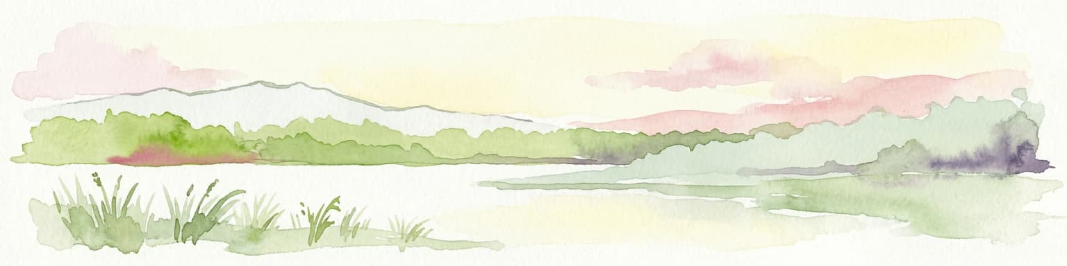
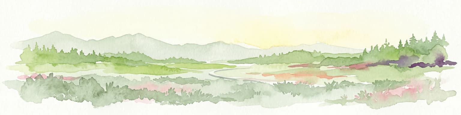
The landscape of Isojärvi National Park stands out within Central Finland for its topographic variety, featuring steep hillsides and deep ravine valleys that contrast sharply with the more subdued relief typical of the surrounding lake district. The park's average elevation ranges from 100 to 150 meters above sea level, with the highest point at Vahtervuori reaching 218 meters. These landforms originated approximately 200 million years ago during periods of crustal rifting that created the fundamental ridge and valley structure, subsequently modified by glacial processes during the last Ice Age, which deposited till and reshaped the terrain. The landscape centers on Lake Isojärvi, a substantial water body whose name translates to Great Lake and which gives the park its identity. The lake's water levels fluctuate seasonally, influencing the character of shoreline forests and adjacent wetlands. Beyond the central lake, the terrain descends into forested ravines, climbs to pine-covered ridges, and includes areas of bog vegetation in depressions where drainage is impeded. The combination of varied relief, coniferous forest cover, and water bodies creates a scenic landscape of considerable visual diversity within a relatively compact area.

Isojärvi National Park ecosystems, habitats, and plant life

The ecological character of Isojärvi National Park reflects the boreal forest ecosystem typical of Central Finland, with coniferous forests of Scots pine and Norway spruce dominating the vegetation cover. These forests, while significantly influenced by historical forestry operations, continue to provide habitat for characteristic boreal species. The park's nature has been shaped by the activities of the Canadian beaver, which has become the park's emblematic species following its introduction to Finland in the 1930s. Beaver dam-building activities create dynamic wetland conditions, periodically flooding sections of forest and killing trees through prolonged waterlogging. These flooded areas, while appearing destructive from a traditional forestry perspective, generate significant amounts of deadwood that supports remarkable biodiversity, particularly decomposer organisms such as fungi and wood-boring insects. The park's restoration efforts have included prescribed burning and the filling of drainage ditches in former peat extraction areas, contributing to the recovery of more natural ecological conditions. The landscape also includes bog communities in areas of poor drainage, adding habitat diversity to the predominantly forested terrain.

Isojärvi National Park wildlife and species highlights

The wildlife of Isojärvi National Park is emblematically represented by the Canadian beaver, which has shaped the park's ecological character through its extensive dam-building and tree-felling activities. These large rodents create flooded forest conditions that, while transforming the visual appearance of affected areas, generate important ecological benefits through the creation of deadwood and wetland habitats. The flooding kills trees, creating standing and fallen deadwood that supports communities of wood-decaying fungi and saproxylic insects, enhancing the overall biodiversity of the forest ecosystem. Bird species associated with the forest and wetland habitats are present throughout the park, though specific avian populations are not detailed in available sources. The combination of forest types, including the coniferous dominated areas, the beaver-created wetlands, and the bog margins, provides varied habitat conditions supporting diverse wildlife communities. The presence of deadwood, whether from natural tree mortality or beaver-induced forest flooding, is recognized as a critical factor supporting the park's biodiversity.

Isojärvi National Park conservation status and protection priorities

Isojärvi National Park serves important conservation functions within Finland's protected area network, preserving representative examples of the boreal forest and lake landscape characteristic of Central Finland. The park's establishment in 1982 provided formal protection for terrain features and ecosystems that had experienced limited industrial development compared to surrounding areas, though historical forestry had significantly modified the forest cover. Conservation values center on the boreal forest ecosystem, with its characteristic coniferous vegetation and associated wildlife communities. The park also contributes to wetland conservation through the beaver-maintained flooded areas, which create habitat conditions that would otherwise be rare in actively managed forest landscapes. Restoration activities within the park have included forest prescribed burning and the blocking of drainage ditches in former peat extraction areas, accelerating the recovery of more natural ecological conditions. The surrounding landscape includes state-owned multi-value forest areas with over 100 hectares of fully protected land, as well as several private nature reserves, creating a broader conservation context beyond the national park boundaries.

Isojärvi National Park cultural meaning and human context

The cultural landscape of Isojärvi National Park preserves evidence of human interaction with this boreal environment spanning several centuries. The area contains structures representing different periods of settlement and land use, including the Huhtalan torppa (traditional farmstead) established in the 1700s, representing the older pattern of small-scale agriculture and permanent settlement in the forest region. The Heretty compound, originally built in the 1940s as accommodation for forestry workers, reflects the period when the forest surrounding the present national park was subject to intensive timber extraction. The Luutsaaren fish hut, constructed in 1833, represents the seasonal fishing traditions associated with the lake, while the Lortikka cabin from 1956 documents the later era of organized forest management. These structures have been preserved and integrated into the visitor experience, with Heretty serving as the park's information center. Traditional land use practices continue through managed grazing at Luutsaaren heritage farm, where sheep are kept, and maintenance of meadows through mowing at Huhtalan heritage farm, connecting contemporary visitors to the historical pattern of human-modified landscapes that forms part of the park's character.

Top sights and standout views in Isojärvi National Park

Isojärvi National Park offers visitors a distinctive combination of varied boreal terrain, beaver-shaped landscapes, and preserved cultural heritage within a relatively compact wilderness area. The park's hallmark feature is its dynamic landscape shaped by Canadian beaver activity, where dam-building creates flooded forest areas that have become ecological hotspots supporting diverse deadwood-dependent species. The topographic variety of steep hills and deep ravines provides scenic contrast to the surrounding lake district's more gentle terrain, with views from Vahtervuori offering panoramic perspectives across the forested landscape. The extensive trail network of over 30 kilometers allows visitors to experience multiple facets of the park, from lakeside walks to ridge trails and ravine descents. The historical structures, particularly the restored Heretty information center and the traditional farmsteads at Huhtalan and Luutsaaren, provide cultural context that enriches the natural landscape experience.

Best time to visit Isojärvi National Park

Isojärvi National Park can be visited throughout the year, with each season offering distinct experiences of the boreal environment. Summer months bring full trail accessibility, with the forest in full leaf and the lake and wetlands supporting active wildlife activity. The marked trails, including both the red-signed nature trails and blue-signed ring routes, are fully accessible during the snow-free period, typically from May through October. Autumn brings the characteristic colors of boreal forest foliage and may coincide with the historic autumn fishing activities associated with the lake. Winter offers opportunities for cross-country skiing on prepared tracks, with the landscape transformed by snow cover and frozen wetlands providing a different perspective on the terrain. The fluctuating water levels of Lake Isojärvi influence the character of shoreline areas throughout the year, with spring snowmelt and autumn precipitation typically raising water levels.

Park location guide

Geography guide, regional context, and park location map for Isojärvi National Park

Isojärvi National Park park geography, regions, and map view in Finland
Understand where Isojärvi National Park sits in Finland through a broader geographic reading of the surrounding landscape, nearby location context, and its mapped position within the national park landscape.

How Isojärvi National Park fits into Finland

Finland, officially the Republic of Finland, is a Nordic country in Northern Europe with a population of 5.6 million. It borders Sweden, Norway, and Russia, with the Gulf of Bothnia to the west and the Gulf of Finland to the south. The country gained independence from Russia in 1917 and is a unitary parliamentary republic. Its landscape is characterized by extensive boreal forests and over 180,000 lakes.

Wider geography shaping Isojärvi National Park in Finland

Finland is located in Northern Europe, occupying a peninsula bordered by the Gulf of Bothnia to the west and the Gulf of Finland to the south. It shares land borders with Sweden to the northwest, Norway to the north, and Russia to the east. The terrain is predominantly flat with extensive forest coverage and numerous lakes.

Map view of Isojärvi National Park

Use this park location map to pinpoint Isojärvi National Park in Finland, understand its exact geographic position, and read its mapped placement within the surrounding landscape more clearly.

Pigeon | © OpenStreetMap contributors

Location context for Isojärvi National Park

Central Finland
Park atlas

Explore the geographic context and diverse protected landscapes surrounding Isojärvi National Park.

Explore Related National Parks and Protected Areas Adjacent to Isojärvi National Park
Explore national parks and protected areas situated near Isojärvi National Park, revealing regional patterns of boreal forests, lake district terrain, and other significant conservation landscapes. Compare unique geographic features, from steep hills and ravine valleys to beaver-shaped wetlands, tracing how these protected areas contribute to Central Finland's natural heritage.
National parkPäijät-Häme

Päijänne National Park: Mapped Island Archipelago in Finland's Päijät-Häme Region

Explore unique glacial geology and boreal island wilderness.

Päijänne National Park presents a compelling protected landscape for atlas discovery, focusing on its distinct archipelago character within Lake Päijänne, Southern Finland. This national park features numerous islands showcasing ancient geological formations, from rocky outcrops to sandy beach ridges and moraine formations. Its mapped terrain offers insights into glacial processes and the development of boreal island ecosystems. Navigate its unique island settings to understand the geographic context of this protected area in the Päijät-Häme region.

Area
14 km²
Established
1993
IUCN
II
Visitors
67K annual
National parkCentral Finland

Leivonmäki National Park: Mapped Protected Landscape in Central Finland

Detailed geographic context for this Finnish national park.

Leivonmäki National Park offers a specific focus on a single protected landscape within the broader geography of Central Finland. This page provides users with detailed information centered on the park's mapped boundaries and its role as a national park. It is designed to be a foundational entry within the MoriAtlas discovery platform, helping users understand the park's geographic setting and its protected area status for informed exploration.

Area
29 km²
Established
2003
IUCN
II
Visitors
29.1K annual
Watercolor painting depicting a landscape with hills, forests, and a river using muted colors
National parkPirkanmaa

Helvetinjärvi National Park: Protected Landscape and Geographic Context in Pirkanmaa

Mapped national park boundaries and regional natural terrain.

Delve into the details of Helvetinjärvi National Park, a protected area within the Pirkanmaa region of Finland. This atlas entry highlights the park's mapped geographic features and its identity as a national park. Understand the protected landscape and its place in the broader Finnish geography, offering structured insights for map-based discovery.

Area
49.8 km²
Established
1982
IUCN
II
Visitors
44K annual
Watercolor painting of a lake surrounded by trees with a colorful sky.
National parkFinland

Seitseminen National Park: Ancient Boreal Forests and Vast Mire Systems in Finland

Explore mapped terrain and protected wilderness landscapes.

Seitseminen National Park represents a significant protected area in western Finland, characterized by classic boreal forest ecosystems interspersed with extensive mire and bog landscapes. The park's geography includes the notable Seitsemisharju esker, contributing to its diverse terrain. As a sanctuary for ancient forests, including the historic Multiharju primeval forest, Seitseminen offers a unique focus for understanding Finnish protected wilderness and its mapped geographic features within the Nordic context.

Area
45.5 km²
Established
1982
IUCN
II
Visitors
42.3K annual
Watercolor illustration showing a landscape with mountains, a winding river, and patches of green vegetation and trees
National parkFinland

Repovesi National Park: Finland's Boreal Wilderness and Protected Landscape

Explore mapped terrain and regional geography.

Repovesi National Park represents a significant protected natural area in southeastern Finland, showcasing a landscape characterized by dense boreal forests, rolling hills, and numerous lakes. As one of Finland's most visited national parks, it offers a compelling example of conserved wilderness and natural terrain. This page details the park's protected landscape identity, its geographic setting within Finland, and the atlas-driven insights available for exploring its mapped boundaries and natural features.

Area
15 km²
Established
2003
IUCN
II
Visitors
100.9K annual
National parkCentral Finland

Southern Konnevesi National Park: National Park Protected Landscape Atlas

Mapped boundaries and regional geography within Central Finland.

Southern Konnevesi National Park is a vital protected area within Central Finland, distinguished by its national park status and its inclusion in the vast Finnish Lakeland. This entry provides a detailed geographic context for the park, emphasizing its mapped boundaries and its role within the region's natural landscape. Users can leverage this structured information for atlas-based discovery and to understand the park's specific environmental setting. Explore the terrain and protected land features that define this significant Finnish protected area.

Area
15 km²
Established
2014
Visitors
30.4K annual
Relief
Mixed relief
Watercolor painting showing a lake surrounded by vegetation with rolling hills in the background
National parkKanta-Häme

Liesjärvi National Park: Protected Landscape in Kanta-Häme's Finnish Lakeland

Explore its mapped geography and protected area context.

Liesjärvi National Park is a designated national park situated in the Kanta-Häme region, a landscape rich with the characteristic features of southern Finland's Finnish Lakeland. This page serves as a focused entry point for understanding the park's protected status, its unique geographic setting, and its contribution to the regional atlas of natural landscapes. By examining Liesjärvi National Park, users gain insight into the mapped terrain and conservation efforts that define this part of Finland, fostering a deeper appreciation for protected areas.

Area
22 km²
Established
1956
IUCN
II
Visitors
57.3K annual
National parkCentral Finland

Pyhä-Häkki National Park: Central Finland's Ancient Forest Protected Landscape

Discover mapped boundaries, old-growth trees, and boreal peat bog ecosystems.

Pyhä-Häkki National Park is a crucial protected national park in Central Finland, safeguarding an exceptional expanse of old-growth forest and vital peat bog habitats. This protected landscape showcases ancient trees, some over 400 years old, and a unique boreal ecosystem largely untouched by human development. Explore its natural terrain, mapped park boundaries, and the ecological significance of this primeval forest environment through MoriAtlas's structured discovery platform.

Area
13 km²
Established
1956
IUCN
II
Visitors
17.9K annual

Common questions about visiting, size, designation, and location context for Isojärvi National Park

Isojärvi National Park FAQs for park facts, access, geography, and protected area context
Find quick answers about Isojärvi National Park, including protected-area facts, park geography, trail and visitor context, and how the park fits into its surrounding country and regional landscape.
MoriAtlas Explorer

Continue Your Protected Areas Search Across the Global Atlas

Deepen your exploration by continuing the structured search for national parks and protected areas worldwide. Utilize the comprehensive filtering capabilities to compare different conservation landscapes and refine your understanding of global park geography. Discover more about the distribution and characteristics of protected natural areas.

Global natural geography