Mori Atlas logo
National parkPyhä-Häkki National Park

Discover the mapped boundaries and ecological continuity of one of southern Finland's last primeval forests.

Pyhä-Häkki National Park: Ancient Boreal Forest and Protected Landscape in Central Finland

(Pyhä-Häkin kansallispuisto)

Pyhä-Häkki National Park represents a vital protected area in Central Finland, preserving one of the most significant remaining tracts of old-growth forest in southern Finland. Its landscape is a prime example of boreal ecosystem continuity, featuring ancient Scots pine and Norway spruce trees that have stood for centuries. The park's protected boundaries encompass a unique mosaic of upland forests and extensive peat bogs, offering a rare glimpse into a natural environment that predates modern forestry and agricultural expansion.

Old-growth forestPeat bogsNorthern EuropeBoreal ecosystemNature conservationNatura 2000

Pyhä-Häkki National Park

National park

Park overview

Structured park overview, official facts, and landscape profile for Pyhä-Häkki National Park

Pyhä-Häkki National Park park facts, protected area profile, and essential visitor context
Review the core facts for Pyhä-Häkki National Park, including designation, size, terrain, visitor scale, habitats, and operating context in one park-focused overview.

About Pyhä-Häkki National Park

Pyhä-Häkki National Park occupies a landscape of exceptional ecological significance in Central Finland. The terrain forms part of the Suomenselkä watershed divide, with the area consisting of nearly equal proportions of forest and peat bog. The forest component comprises older, mostly dry to mesic heath forests dominated by Scots pine and Norway spruce, while the bog landscape includes open mires, spruce swamps, and pine bogs. The park's soils consist primarily of glacial till and peat, with the southern boundary marked by an esker system featuring parallel ridges and intervening kettle holes. Several small lakes dot the landscape, including Kotajärvi, Rahelampi, Riippilampi, and Säärilampi. The protection of this area was first proposed in the late 1930s, though World War II interrupted these plans, and the national park was ultimately established in 1956 with a significant expansion in 1982 when the Kotaneva area was incorporated.

Quick facts and research context for Pyhä-Häkki National Park

Pyhä-Häkki National Park is located in Central Finland within the Saarijärvi municipality. The park protects old-growth boreal forest on the watershed divide between the Kymijoki river system. Elevation ranges from 165 to 185 meters above sea level. The park is characterized by acidic pine forests on glacial till soils and extensive peat bogs. It is the largest remaining virgin forest area in southern Finland and supports exceptional biodiversity, particularly for wood-inhabiting fungi and cavity-nesting birds.

Park context

Deeper park guide and search-rich context for Pyhä-Häkki National Park

Pyhä-Häkki National Park history, landscape, wildlife, and travel context
Explore Pyhä-Häkki National Park through its history, landscape character, ecosystems, wildlife, conservation priorities, cultural context, and seasonal travel timing in a structured park guide built for atlas discovery and search intent.

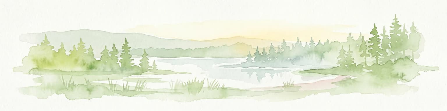
Why Pyhä-Häkki National Park stands out

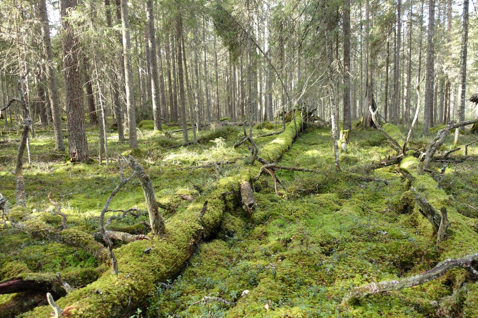
Pyhä-Häkki is renowned as the largest remaining old-growth forest area in southern Finland. The park protects ancient pine forests with trees often exceeding 250 years old, some surpassing 400 years. These moss-covered forests feature distinctive snag-covered trunks and kelo (dead standing trees) that bear witness to historical forest fires from the slash-and-burn cultivation era of the 1500s-1800s. The park also contains extensive peat bogs covering roughly half of its area, representing well-preserved examples of boreal wetland ecosystems.

Pyhä-Häkki National Park history and protected-area timeline

The history of Pyhä-Häkki's protection traces back to Finland's 18th-century land redistribution known as the isojako. The area proved unsuitable for agricultural assignment due to its lack of waterways for timber transport and its extensive bogs unsuitable for cultivation, leaving it as state-owned land. The first formal protection measures began in 1912 when the area was designated as a "säästömetsä" (reserve forest), effectively closed to all forestry and land use. Planning for national park status resumed in the late 1930s, but the outbreak of the Winter War and Continuation War interrupted these efforts. The park was finally established in 1956 and expanded in 1982 when the Kotaneva bog area was incorporated. The name Pyhä-Häkki derives from Mauno Häkkinen, who settled on the shores of Pyhäjärvi lake south of the park in 1554, giving the area its original name Pyhä-Häkkilä.

Pyhä-Häkki National Park landscape and geographic character

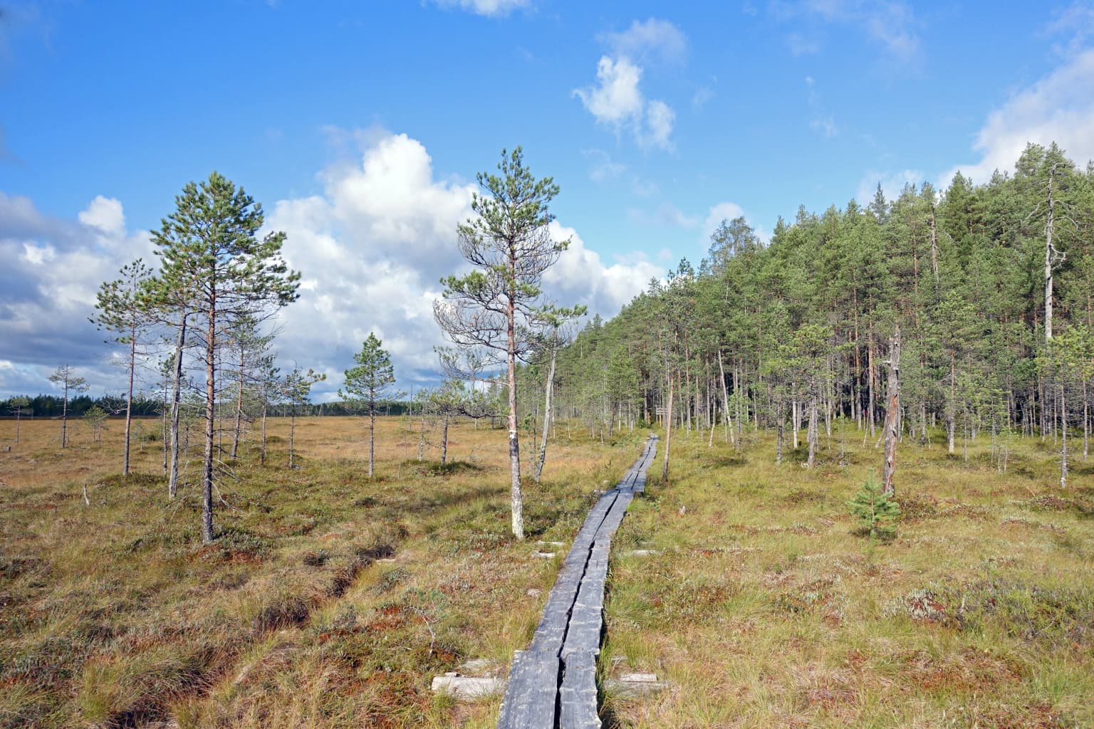
The physical landscape of Pyhä-Häkki National Park exemplifies the boreal wilderness character of Central Finland. The terrain is characterized by gently undulating till plains punctuated by numerous boulders and rocky exposures. The park lies on the Suomenselkä watershed divide, meaning water flows from here toward multiple river systems, ultimately joining the Kymijoki. The southern portion of the park is bordered by a distinctive esker formation consisting of several parallel ridges, some connected, with intervening kettle depressions. The area contains several small kettle lakes, and the overall elevation ranges from 165 to 185 meters above sea level. Roughly half the park consists of open and forested peat bogs, creating a mosaic of wet and dry habitats.

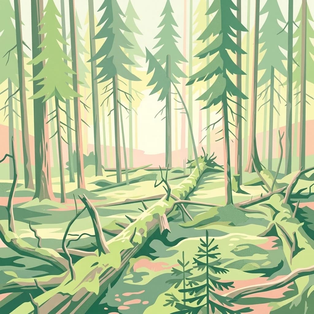
Pyhä-Häkki National Park ecosystems, habitats, and plant life

The ecological character of Pyhä-Häkki is defined by its old-growth forests and extensive peatland systems. The forest component features moss-covered pine stands with exceptionally old specimens—the oldest trees exceed 400 years, while many exceed 250 years. The distinctive "kelo" dead standing trees and thick-barked survivors of historical forest fires are characteristic features, with fire scars visible on numerous trunks despite the trees' survival. The bog vegetation is dominated by spruce in wet depressions and pine on drier hummocks, with common understory species including Labrador tea, cottongrass, and sphagnum mosses. The park supports over 70 species of bracket fungi, representing approximately one-third of Finland's total, highlighting the exceptional ecological value of the decaying wood habitat.

Pyhä-Häkki National Park wildlife and species highlights

Pyhä-Häkki's old-growth forests provide crucial habitat for cavity-nesting bird species. Woodpeckers are particularly well represented, with black woodpecker, great spotted woodplecker, and three-toed woodpecker among the notable species. Several owl species breed here, including Tengmalm's owl using black woodpecker cavities, pygmy owl in broken snags, and Eurasian pygmy owl occupying three-toed woodpecker holes. The bird fauna also includes numerous passerines such as titmice, treecreepers, goldcrest, and chaffinch. Grouse species including capercaillie, black grouse, and hazel grouse inhabit the forests, while open bogs support breeding cranes, snipe, and greenshank. Common mammals include red squirrel, root vole, water vole, and field mouse, though larger species like elk and bear prefer younger forest habitats.

Pyhä-Häkki National Park conservation status and protection priorities

Pyhä-Häkki National Park represents one of the most important conservation areas in southern Finland, protecting the largest remaining tract of virgin forest in this region. The old-growth forest ecosystem has been preserved largely because the area was considered unsuitable for agriculture and timber extraction due to its poor soils, extensive bogs, and lack of waterway access. The park is integrated into the Natura 2000 network as part of the Pyhä-Häkin alue, which extends to 21.3 square kilometers and continues into the municipality of Kannonkoski. The protection of such old-growth forest is particularly significant given the intensive forestry that has transformed most of Finland's southern landscapes, making this park a critical refuge for species dependent on ancient forest structures, dead wood, and uninterrupted ecological processes.

Pyhä-Häkki National Park cultural meaning and human context

The human history of the Pyhä-Häkki area reflects the challenging conditions that ultimately contributed to the land's preservation. During Finland's systematic land redistribution in the 18th century, this region was deemed worthless and remained unassigned because the forested till soils lacked waterways for timber transport and the extensive bogs were unsuitable for agriculture. The area thus remained as state-administered land. The name itself commemorates Mauno Häkkinen, who settled near the southern boundary of what is now the park in 1554, giving the locale its name. A former royal forest cottage built in 1854 at Poika-aho in the western part of the park stands as a historical structure from the era when the area was managed as crown forestland.

Top sights and standout views in Pyhä-Häkki National Park

Pyhä-Häkki stands as a living museum of Finland's original boreal forest, preserving ancient pine stands that predate modern forestry. The park's moss-draped trees, centuries-old snags, and extensive peat bogs create an evocative landscape of ecological continuity. Over 70 species of bracket fungi thrive here, one-third of Finland's total, reflecting exceptional biodiversity in decaying wood habitats. The park supports significant populations of woodpeckers and owls that require hollow trees for nesting. The network of wooden boardwalks allows visitors to traverse the bogs safely while minimizing impact on the sensitive wetland ecosystem.

Best time to visit Pyhä-Häkki National Park

The optimal season for visiting Pyhä-Häkki runs from May through October when the marked trails are accessible. Summer months offer full foliage and active wildlife, though the dense forest canopy limits wildlife viewing. The shoulder seasons of spring and autumn provide excellent conditions for birdwatching and experiencing the forest's seasonal transformations. Winter visits are possible but trails are not maintained, requiring appropriate winter equipment. The four marked loop trails range from 1.4 to 17 kilometers, offering options for different fitness levels and time constraints.

Park location guide

Geography guide, regional context, and park location map for Pyhä-Häkki National Park

Pyhä-Häkki National Park park geography, regions, and map view in Finland
Understand where Pyhä-Häkki National Park sits in Finland through a broader geographic reading of the surrounding landscape, nearby location context, and its mapped position within the national park landscape.

How Pyhä-Häkki National Park fits into Finland

Finland, officially the Republic of Finland, is a Nordic country in Northern Europe with a population of 5.6 million. It borders Sweden, Norway, and Russia, with the Gulf of Bothnia to the west and the Gulf of Finland to the south. The country gained independence from Russia in 1917 and is a unitary parliamentary republic. Its landscape is characterized by extensive boreal forests and over 180,000 lakes.

Wider geography shaping Pyhä-Häkki National Park in Finland

Finland is located in Northern Europe, occupying a peninsula bordered by the Gulf of Bothnia to the west and the Gulf of Finland to the south. It shares land borders with Sweden to the northwest, Norway to the north, and Russia to the east. The terrain is predominantly flat with extensive forest coverage and numerous lakes.

Map view of Pyhä-Häkki National Park

Use this park location map to pinpoint Pyhä-Häkki National Park in Finland, understand its exact geographic position, and read its mapped placement within the surrounding landscape more clearly.

Pigeon | © OpenStreetMap contributors

Location context for Pyhä-Häkki National Park

Central Finland
Park atlas

Explore the Surrounding Boreal Forest and Peat Bog Landscapes, Tracing Finland's Protected-Area Geography

Discover Other National Parks and Protected Areas Near Pyhä-Häkki in Central Finland
Browse national parks and protected areas geographically close to Pyhä-Häkki National Park, enabling comparative exploration of Central Finland's old-growth forests and extensive peat bogs. Trace interconnected boreal ecosystems and diverse conservation landscapes, gaining regional context for deeper atlas-style discovery of protected natural areas.
National parkFinland

Salamajärvi National Park: Explore Finland's Premier Mired Wilderness and Protected Landscape

Mapped boundaries and wetland ecosystems of this Finnish National Park.

Salamajärvi National Park is a critical protected area in Finland, celebrated for its unparalleled mire ecosystems, which represent some of the country's most extensive and intact peatland environments. The park's landscape is shaped by the Suomenselkä watershed, featuring a mosaic of old-growth forests, forest lakes, and rugged terrain, providing a vital sanctuary for forest reindeer. MoriAtlas details its geographic context and protected landscape features, offering users a structured way to explore its natural identity and mapped boundaries within Finland.

Area
62 km²
Established
1982
IUCN
II
Visitors
24.5K annual
National parkCentral Finland

Southern Konnevesi National Park: National Park Protected Landscape Atlas

Mapped boundaries and regional geography within Central Finland.

Southern Konnevesi National Park is a vital protected area within Central Finland, distinguished by its national park status and its inclusion in the vast Finnish Lakeland. This entry provides a detailed geographic context for the park, emphasizing its mapped boundaries and its role within the region's natural landscape. Users can leverage this structured information for atlas-based discovery and to understand the park's specific environmental setting. Explore the terrain and protected land features that define this significant Finnish protected area.

Area
15 km²
Established
2014
Visitors
30.4K annual
Relief
Mixed relief
National parkCentral Finland

Leivonmäki National Park: Mapped Protected Landscape in Central Finland

Detailed geographic context for this Finnish national park.

Leivonmäki National Park offers a specific focus on a single protected landscape within the broader geography of Central Finland. This page provides users with detailed information centered on the park's mapped boundaries and its role as a national park. It is designed to be a foundational entry within the MoriAtlas discovery platform, helping users understand the park's geographic setting and its protected area status for informed exploration.

Area
29 km²
Established
2003
IUCN
II
Visitors
29.1K annual
Watercolor painting depicting a landscape with hills, forests, and a river using muted colors
National parkPirkanmaa

Helvetinjärvi National Park: Protected Landscape and Geographic Context in Pirkanmaa

Mapped national park boundaries and regional natural terrain.

Delve into the details of Helvetinjärvi National Park, a protected area within the Pirkanmaa region of Finland. This atlas entry highlights the park's mapped geographic features and its identity as a national park. Understand the protected landscape and its place in the broader Finnish geography, offering structured insights for map-based discovery.

Area
49.8 km²
Established
1982
IUCN
II
Visitors
44K annual
National park

Isojärvi National Park: Finland's Protected Landscape with Dynamic Beaver-Shaped Terrain

Central Finland's boreal forest, ravines, and lake district geography.

Isojärvi National Park offers a unique atlas perspective on Central Finland's protected natural landscapes. This national park is characterized by a dynamic boreal environment, featuring steep hills, deep ravines, and varied topography shaped by both ancient geological processes and contemporary beaver activity. Discover the mapped boundaries of this protected area, its central role in the Finnish lake district's geography, and the distinctive wetland habitats created by beavers that enhance its ecological diversity. It serves as a key point for understanding regional landscape context and protected land exploration.

Area
19 km²
Established
1982
IUCN
II
Visitors
24.4K annual
Watercolor painting of a lake surrounded by trees with a colorful sky.
National parkFinland

Seitseminen National Park: Ancient Boreal Forests and Vast Mire Systems in Finland

Explore mapped terrain and protected wilderness landscapes.

Seitseminen National Park represents a significant protected area in western Finland, characterized by classic boreal forest ecosystems interspersed with extensive mire and bog landscapes. The park's geography includes the notable Seitsemisharju esker, contributing to its diverse terrain. As a sanctuary for ancient forests, including the historic Multiharju primeval forest, Seitseminen offers a unique focus for understanding Finnish protected wilderness and its mapped geographic features within the Nordic context.

Area
45.5 km²
Established
1982
IUCN
II
Visitors
42.3K annual
National parkPäijät-Häme

Päijänne National Park: Mapped Island Archipelago in Finland's Päijät-Häme Region

Explore unique glacial geology and boreal island wilderness.

Päijänne National Park presents a compelling protected landscape for atlas discovery, focusing on its distinct archipelago character within Lake Päijänne, Southern Finland. This national park features numerous islands showcasing ancient geological formations, from rocky outcrops to sandy beach ridges and moraine formations. Its mapped terrain offers insights into glacial processes and the development of boreal island ecosystems. Navigate its unique island settings to understand the geographic context of this protected area in the Päijät-Häme region.

Area
14 km²
Established
1993
IUCN
II
Visitors
67K annual
Watercolor painting of a lake surrounded by forests with mountains in the background and a sunset sky
National parkFinland

Tiilikkajärvi National Park: Finland's Unique Protected Landscape with Sandy Shores and Eskers

Mapped geography of a distinctive Finnish national park.

Tiilikkajärvi National Park showcases a unique combination of natural features within Finland's protected lands. The park's core is the Tiilikkajärvi lake, almost entirely encircled by expansive sandy beaches and dramatic esker peninsulas. These glacial landforms create a striking visual contrast with the surrounding boreal forests and rare undrained aapa bogs. Explore the mapped landscape context and protected area identity of this significant Finnish natural environment.

Area
72 km²
Established
1982
IUCN
II
Visitors
26.1K annual

Common questions about visiting, size, designation, and location context for Pyhä-Häkki National Park

Pyhä-Häkki National Park FAQs for park facts, access, geography, and protected area context
Find quick answers about Pyhä-Häkki National Park, including protected-area facts, park geography, trail and visitor context, and how the park fits into its surrounding country and regional landscape.
MoriAtlas Explorer

Continue Your Protected Areas Search Across the Global Atlas

Deepen your exploration by continuing the structured search for national parks and protected areas worldwide. Utilize the comprehensive filtering capabilities to compare different conservation landscapes and refine your understanding of global park geography. Discover more about the distribution and characteristics of protected natural areas.

Global natural geography