Mori Atlas logo
National parkTiilikkajärvi National Park

Mapping the unique geography of Tiilikkajärvi National Park, Finland's significant protected area.

Tiilikkajärvi National Park: Finland's Protected Landscape of Barren Lakes and Eskers

Tiilikkajärvi National Park represents a remarkable protected landscape in eastern Finland, distinguished by its strikingly barren Tiilikkajärvi lake, extensive sandy beaches, and dramatic glacial esker formations. This national park, now covering 72 square kilometers, is characterized by narrow peninsulas and unique lake shorelines shaped by ancient glacial activity. Discover the mapped boundaries and intricate regional geography of this important Finnish protected area.

National parksBogs and wetlandsLakesSandy beachesGlacial landformsEskers
Illustration of a lake bordered by pine forests with sandy shores and mountain peaks under a pastel sky

Tiilikkajärvi National Park

National park

Park overview

Structured park overview, official facts, and landscape profile for Tiilikkajärvi National Park

Tiilikkajärvi National Park park facts, protected area profile, and essential visitor context
Review the core facts for Tiilikkajärvi National Park, including designation, size, terrain, visitor scale, habitats, and operating context in one park-focused overview.

About Tiilikkajärvi National Park

Tiilikkajärvi National Park occupies a distinctive place in Finland's protected area network as a place where northern and southern natural characteristics converge. The park's landscape is dominated by the Tiilikkajärvi lake, an oligotrophic body of water with minimal aquatic vegetation due to its nutrient-poor, peat-stained waters. Surrounding the lake are extensive sandy beaches, a rarity among Finnish lakes, creating an almost Mediterranean atmosphere along certain shores. The glacial esker ridges known as Pohjoisniemi and Kalmoniemi stretch for several kilometers, at points narrowing to just a few meters wide, effectively partitioning the lake and providing hiking routes through pine forest with sweeping views over the water and adjacent bogs. Beyond the lake shore, the terrain transforms into vast aapa bogs, the largest being Hietasuo, Honkasuo, Alussuo, and Sarvisuo. These northern-style peatlands, characterized by open, treeless expanses with cottongrass tufts and bog rosemary, represent some of the last remaining undrained mires in southern Finland. The park's forests, while covering less than a third of the total area, are primarily nutrient-poor pine heath forests with occasional spruce groves in wetter depressions. Visitor infrastructure includes about 20 kilometers of marked hiking trails with duckboard sections across wet areas, with the main access from Sammakkotammi near the Rautavaara-Valtimo road.

Quick facts and research context for Tiilikkajärvi National Park

Tiilikkajärvi National Park lies in eastern Finland, spanning Rautavaara in North Savo and Sotkamo in Kainuu. The park covers 72 square kilometers, with approximately two-thirds consisting of pristine aapa bogs that represent some of the last undrained peatlands in southern Finland. The central Tiilikkajärvi lake is a nutrient-poor body of water with remarkably clear sandy beaches along its margins. Glacial esker formations, particularly Pohjoisniemi and Kalmoniemi, nearly split the lake in half and are covered with pine forest. The park is managed by Metsähallitus and received roughly 26,100 visitors in 2024.

Park context

Deeper park guide and search-rich context for Tiilikkajärvi National Park

Tiilikkajärvi National Park history, landscape, wildlife, and travel context
Explore Tiilikkajärvi National Park through its history, landscape character, ecosystems, wildlife, conservation priorities, cultural context, and seasonal travel timing in a structured park guide built for atlas discovery and search intent.

Why Tiilikkajärvi National Park stands out

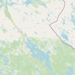
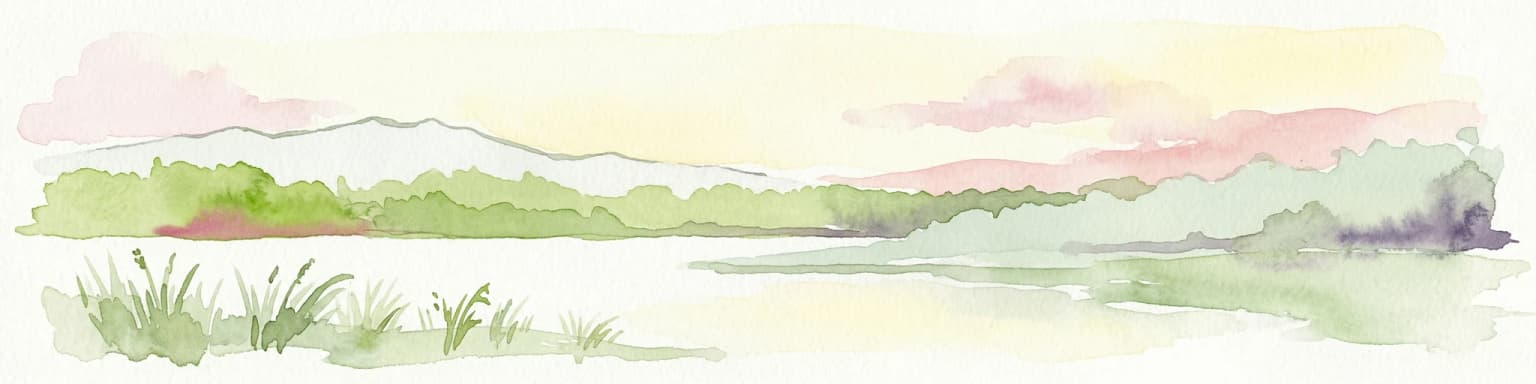
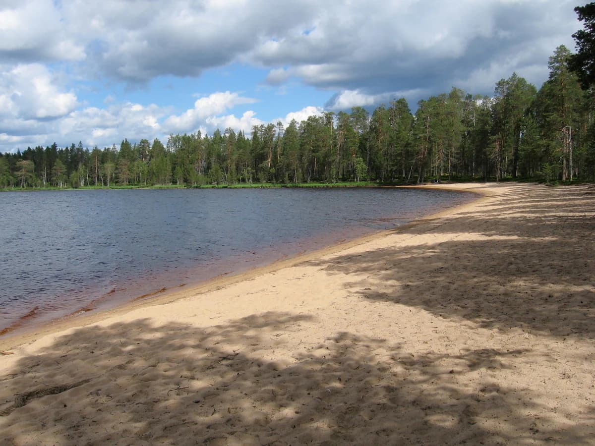
Tiilikkajärvi National Park is best known for its striking combination of barren sandy beaches and dramatic eskercapes that shape the Tiilikkajärvi lake. The Venäjänhiekka beach is frequently cited as the park's jewel, a long stretch of golden sand with historical significance tied to the 1595 Treaty of Teusina, which established the border between Sweden and Russia through this lake. The esker peninsulas, especially the narrow Kalmoniemi ridge, create panoramic hiking experiences with views over the lake and surrounding string bogs. The park also protects extensive undrained aapa bogs, increasingly rare in southern Finland, making it an important conservation area for northern bog ecosystems.

Sandy beach along a calm lake with forested shoreline under a partly cloudy sky
Venänhiekka sandy beach at Tiilikkajärvi National Park, Finland

Tiilikkajärvi National Park history and protected-area timeline

Tiilikkajärvi National Park was established in 1982 to protect the unique combination of lake, river, bog, and esker landscapes that characterize the area. The park was significantly expanded in 2023, more than doubling its area from the original 34 square kilometers to 72 square kilometers, making it the second-largest national park in southern Finland. The region carries historical significance tied to the Treaty of Teusina, signed in 1595, which established the border between Sweden and Russia along the Tiilikkajärvi lake. A border stone from this treaty, engraved with a crown and cross representing the two nations, remains in the northeastern part of the lake and serves as a popular visitor destination. The Tiilikanautio area within the park contains a restored torppa, orcroft, that was the birthplace of Olli Tiainen, a celebrated guerrilla leader during the Finnish War of 1808-1809. The surrounding area has evidence of lake ore processing, reflecting the region's historical significance as one of Rautavaara's best ore lakes. Logging operations and timber floating began in the area in the 1870s, with the Uiton kämppä cabin built in 1946 at the mouth of the Itkonjoki River to support these activities. Today this cabin serves as a rental hut for visitors.

Tiilikkajärvi National Park landscape and geographic character

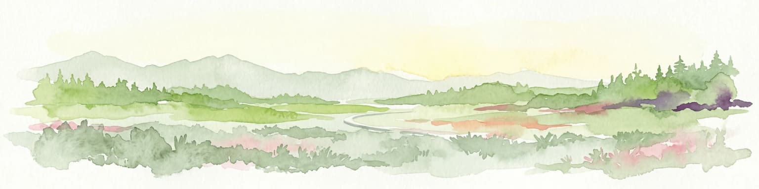
The physical landscape of Tiilikkajärvi National Park is defined by the interplay between the central lake and glacial formations. Tiilikkajärvi is a relatively shallow, nutrient-poor lake covering approximately 400 hectares, with a labyrinthine shape created by the esker capes that nearly divide it in two. The lake's most striking feature is the prevalence of light sandy beaches along virtually its entire shoreline, unusual among Finnish lakes. The esker ridges, particularly Pohjoisniemi and Kalmoniemi, are elongated glacial deposits that extend as narrow peninsulas into the lake. These formations are covered with pine forest and create dramatically different terrain from the surrounding wetlands. Beyond the lake and eskers, the landscape is dominated by extensive aapa bogs, which are northern-style mires characterized by flat, treeless expanses with string configurations pattern across the peat surface. The bogs transition into pine-dominated heath forests on slightly higher ground, while spruce occurs in wetter depressions. The overall terrain is flat to gently undulating, typical of boreal Finland, with the esker ridges providing the most prominent topographical variation.

Tiilikkajärvi National Park ecosystems, habitats, and plant life

The ecological character of Tiilikkajärvi National Park reflects its position at the junction of southern and northern Finnish natural zones. Approximately two-thirds of the park consists of aapa bogs, which represent some of the last remaining undrained peatlands in southern Finland. These northern-style mires differ from the more common southern bog types, featuring broader, more open expanses and distinct string patterns across the bog surface. The vegetation includes cottongrass, bog rosemary, and various wetland sedges. The lake's oligotrophic nature, resulting from its connection to nutrient-poor groundwater and peat-stained runoff, means very little aquatic vegetation grows in its waters. The forests, covering less than a third of the park, are predominantly pine-dominated heath forests on esker ridges and till-covered terrain, with spruce more common in wetter areas. The park is notable for the presence of silver birch growing on the edges of the bogs, adding visual variety to the otherwise dark pine-dominated forest. The transitional nature of the area, where boreal northern and more temperate southern elements meet, contributes to the ecological diversity of the landscape.

Tiilikkajärvi National Park wildlife and species highlights

Tiilikkajärvi National Park supports bird species characteristic of both forest and open bog habitats. In the coniferous forests, northern bird species including brambling and rustic bunting are common, while the Siberian jay adds a touch of boreal character. The open bogs are home to the yellow wagtail as the most common species, along with the Eurasian whimbrel which nests on the more vegetated bog margins. The barren Tiilikkajärvi lake provides habitat for the black-throated diver, while its sandy shores support breeding little ringed plovers. Other notable species include the lesser black-backed gull, capercaillie, willow grouse, bean goose, Eurasian golden plover, and in the summer of 1993, the pine grosbeak was recorded nesting in the area. The Canadian beaver inhabits the rivers flowing through the park, having colonized Finnish waterways following introduction in the 1930s. The surrounding forests provide habitat for larger game species, though the park is not known for significant mammal populations.

Tiilikkajärvi National Park conservation status and protection priorities

Tiilikkajärvi National Park serves important conservation functions in the Finnish protected area network. The park preserves extensive aapa bogs that represent some of the last remaining undrained peatlands in southern Finland, a habitat type that has been heavily impacted by drainage for forestry across the country. These northern-style mires store significant carbon and provide ecosystem services including water regulation and biodiversity maintenance. The park's location at the southern fringe of the aapa bog zone makes it particularly valuable for conserving this habitat type as climate change pushes northern species and ecosystems southward. The esker formations and the unique barren lake ecosystem with its sandy beaches are also protected, representing landscape features that are uncommon in the Finnish national park system. The 2023 expansion significantly increased the park's conservation value by incorporating additional bog and forest habitats, establishing it as the second-largest national park in southern Finland and strengthening its role in regional biodiversity conservation.

Tiilikkajärvi National Park cultural meaning and human context

The cultural landscape of Tiilikkajärvi National Park reflects centuries of human presence in eastern Finland. The area's historical significance centers on the 1595 Treaty of Teusina, which established the border between Sweden and Russia along the Tiilikkajärvi lake. The border stone from this treaty, engraved with a crown and cross to symbolize the two nations, remains visible in the northeastern part of the lake and serves as a tangible connection to the region's geopolitical history. The park also contains Tiilikanautio, where the restored torppa was the birthplace of Olli Tiainen, a celebrated guerrilla leader during the Finnish War of 1808-1809. Evidence of lake ore processing in the surrounding area indicates historical metalworking, and Tiilikkajärvi was historically known as one of Rautavaara's best ore lakes. Logging and timber floating operations in the area began in the 1870s, with the Uiton kämppä cabin built in 1946 to support these activities, now serving as visitor accommodation. The landscape thus reflects both older agricultural and resource-use traditions and more recent forestry history.

Top sights and standout views in Tiilikkajärvi National Park

The defining highlights of Tiilikkajärvi National Park center on its distinctive combination of sandy lake shores and dramatic esker landscapes. The Venäjänhiekka beach stands out as the park's most celebrated feature, a long stretch of golden sand along the Tiilikkajärvi lake with both natural beauty and historical significance tied to the 1595 Treaty of Teusina border. The esker peninsulas, particularly the narrow Kalmoniemi ridge, offer popular hiking routes with panoramic views over the lake and surrounding bogs. The extensive aapa bogs, among the last undrained peatlands in southern Finland, represent a increasingly rare habitat type. The border stone from 1595 provides a historical counterpoint to the natural landscapes. The park's size, ranking as the second-largest in southern Finland following the 2023 expansion, adds to its significance as a wilderness protection area.

Best time to visit Tiilikkajärvi National Park

Tiilikkajärvi National Park can be visited year-round, though the summer months of June through August offer the most comfortable conditions for hiking and beach activities. The long northern summer provides extended daylight hours, and the sandy beaches are most inviting during this period. The duckboard trails across the bogs are typically in good condition during the warmer months, though early summer can bring wet conditions. Autumn, particularly September and October, offers the opportunity to see the bogs and forests in vibrant fall colors, with fewer visitors than peak summer. Winter brings cross-country skiing opportunities on the frozen lake and groomed trails, though the flat terrain and bog exposure can make conditions challenging. The park's boreal setting means that spring arrives late, with May still seeing snow melt in shaded areas. The shoulder seasons of late spring and early autumn often provide excellent birdwatching opportunities as migratory species pass through the area.

Park location guide

Geography guide, regional context, and park location map for Tiilikkajärvi National Park

Tiilikkajärvi National Park park geography, regions, and map view in Finland
Understand where Tiilikkajärvi National Park sits in Finland through a broader geographic reading of the surrounding landscape, nearby location context, and its mapped position within the national park landscape.

How Tiilikkajärvi National Park fits into Finland

Finland, officially the Republic of Finland, is a Nordic country in Northern Europe with a population of 5.6 million. It borders Sweden, Norway, and Russia, with the Gulf of Bothnia to the west and the Gulf of Finland to the south. The country gained independence from Russia in 1917 and is a unitary parliamentary republic. Its landscape is characterized by extensive boreal forests and over 180,000 lakes.

Wider geography shaping Tiilikkajärvi National Park in Finland

Finland is located in Northern Europe, occupying a peninsula bordered by the Gulf of Bothnia to the west and the Gulf of Finland to the south. It shares land borders with Sweden to the northwest, Norway to the north, and Russia to the east. The terrain is predominantly flat with extensive forest coverage and numerous lakes.

Map view of Tiilikkajärvi National Park

Use this park location map to pinpoint Tiilikkajärvi National Park in Finland, understand its exact geographic position, and read its mapped placement within the surrounding landscape more clearly.

Pigeon | © OpenStreetMap contributors

Location context for Tiilikkajärvi National Park

KainuuNorth Savo

Discover the distinctive visual character of this eastern Finnish protected area, revealing its boreal forests, lake scenery, and extensive wetland habitats.

Tiilikkajärvi National Park Photos: Exploring Finland's Unique Sandy Beaches and Glacial Esker Landscapes
Visually explore Tiilikkajärvi National Park's striking landscape, featuring extensive sandy lake beaches, dramatic glacial esker capes, and rare undrained aapa bogs. These curated images provide essential insight into the park's unique terrain, helping users understand its significant boreal ecosystems and overall protected wilderness character.

Sandy beach along a calm lake with forested shoreline under a partly cloudy sky

A narrow wet path surrounded by tall green grass and trees in a forested area

Park atlas

Discover surrounding protected landscapes, unique bog ecosystems, and glacial landforms across Eastern Finland

Compare National Parks and Protected Areas Near Tiilikkajärvi National Park in Finland
Continue your exploration from Tiilikkajärvi National Park by browsing other national parks and protected areas throughout Eastern Finland. Compare their distinct geographic features, from sandy lake shores and esker ridges to extensive boreal forests and rare aapa bogs, for a deeper understanding of the region's diverse conservation landscapes.
National parkKainuu

Hiidenportti National Park: Kainuu Protected Area and Geographic Landscape Context

Explore mapped boundaries and regional geography in eastern Finland.

This MoriAtlas entry details Hiidenportti National Park, a designated national park situated in the Kainuu region of Finland. It serves as a vital hub for understanding the protected area's mapped landscape, its specific geographic characteristics, and its position within the regional atlas of eastern Finland's natural terrain. Dive into the structured details that define Hiidenportti National Park's protected identity and its contribution to the geographic understanding of the taiga-forested regions.

Area
45 km²
Established
1982
IUCN
II
Visitors
11.3K annual
Watercolor illustration of a landscape featuring green vegetation, rolling hills, and a body of water under a pastel sky
National parkNorth Karelia

Koli National Park: Protected National Park in North Karelia, Finland

Explore mapped landscape and regional geography.

Koli National Park represents a significant protected area within the eastern Finnish region of North Karelia. This page offers detailed geographic context and insight into the park's mapped landscape, essential for understanding its place within the broader atlas of Finland's natural terrain. Discover the protected boundaries and regional setting of this key national park.

Area
30 km²
Established
1991
IUCN
II
Visitors
249.8K annual
Watercolor illustration of a landscape with hills, a lake, trees, and a sunset
National parkNorthern Ostrobothnia

Rokua National Park: Mapping Finland's Glacial Heritage and Protected Landscapes

Discover unique geological formations and ancient boreal forests.

Rokua National Park in Northern Ostrobothnia offers a unparalleled glimpse into glacial history, designated as a UNESCO Global Geopark. Explore its mapped esker ridges, dramatic kettle holes like Syvyydenkaivo, and the ancient pine forests that thrive on its nutrient-poor soils. This protected landscape provides a rich context for understanding Quaternary geology and the development of northern Finnish natural environments, ideal for atlas-based geographic discovery.

Area
8.8 km²
Established
1956
IUCN
II
Visitors
50.7K annual
National parkNorth Karelia

Patvinsuo National Park: Protected Landscape Geography and Map Context

National park exploration in North Karelia, Finland.

Patvinsuo National Park stands as a vital protected area within North Karelia, Finland. This page serves as an atlas entry point, detailing the park's geographic scope, mapped boundaries, and its significance as a protected landscape. Users can explore the regional context and understand the natural terrain that characterizes this important Finnish national park, facilitating structured geographic discovery.

Area
105 km²
Established
1982
IUCN
II
Visitors
18.6K annual
National parkCentral Finland

Southern Konnevesi National Park: National Park Protected Landscape Atlas

Mapped boundaries and regional geography within Central Finland.

Southern Konnevesi National Park is a vital protected area within Central Finland, distinguished by its national park status and its inclusion in the vast Finnish Lakeland. This entry provides a detailed geographic context for the park, emphasizing its mapped boundaries and its role within the region's natural landscape. Users can leverage this structured information for atlas-based discovery and to understand the park's specific environmental setting. Explore the terrain and protected land features that define this significant Finnish protected area.

Area
15 km²
Established
2014
Visitors
30.4K annual
Relief
Mixed relief
National parkEtelä-Savo

Kolovesi National Park: Mapped Protected Landscape in Etelä-Savo, Finland

Explore its geographic identity and mapped park boundaries.

Kolovesi National Park is a significant protected area located in the Etelä-Savo region of Finland, characterized by its presence within the Finnish lake district. This detailed page provides an atlas-centric view, emphasizing the park's mapped geographic features and its status as a protected natural landscape. Users engaging with MoriAtlas can understand Kolovesi National Park's unique landscape context and its precise location within the regional geography of southeastern Finland.

Area
61 km²
Established
1990
IUCN
II
Visitors
17.2K annual
National parkCentral Finland

Pyhä-Häkki National Park: Central Finland's Ancient Forest Protected Landscape

Discover mapped boundaries, old-growth trees, and boreal peat bog ecosystems.

Pyhä-Häkki National Park is a crucial protected national park in Central Finland, safeguarding an exceptional expanse of old-growth forest and vital peat bog habitats. This protected landscape showcases ancient trees, some over 400 years old, and a unique boreal ecosystem largely untouched by human development. Explore its natural terrain, mapped park boundaries, and the ecological significance of this primeval forest environment through MoriAtlas's structured discovery platform.

Area
13 km²
Established
1956
IUCN
II
Visitors
17.9K annual
National parkRepublic of Karelia

Kalevalsky National Park: Rare Old-Growth Boreal Forest and Kalevala Epic Landscape

Mapped protected wilderness in the Republic of Karelia

Kalevalsky National Park is a significant protected area within the Republic of Karelia, Russia, safeguarding one of Europe's last remaining old-growth boreal pine forests. This vast national park protects a landscape characterized by numerous lakes, rivers, and marshes resting on ancient Baltic Shield bedrock, offering a clear representation of primeval taiga ecosystems. Its profound cultural ties to the Kalevala epic, Finland's national poem, make it a unique destination for exploring both natural and mythological geography. Understand the park's mapped boundaries and its place within the regional context.

Area
744 km²
Established
2007
IUCN
II
Relief
Lowland

Common questions about visiting, size, designation, and location context for Tiilikkajärvi National Park

Tiilikkajärvi National Park FAQs for park facts, access, geography, and protected area context
Find quick answers about Tiilikkajärvi National Park, including protected-area facts, park geography, trail and visitor context, and how the park fits into its surrounding country and regional landscape.
MoriAtlas Explorer

Continue Your Protected Areas Search Across the Global Atlas

Deepen your exploration by continuing the structured search for national parks and protected areas worldwide. Utilize the comprehensive filtering capabilities to compare different conservation landscapes and refine your understanding of global park geography. Discover more about the distribution and characteristics of protected natural areas.

Global natural geography