

Mori Atlas logo
Protected areaTasek Merimbun Heritage Park

Explore the mapped boundaries and natural landscape of this key protected area.

Tasek Merimbun Heritage Park: Protected Area Discovery and Geographic Context in Brunei

Tasek Merimbun Heritage Park stands as a significant protected area within Brunei, offering a unique lens through which to explore the nation's geographic identity. Situated on the island of Borneo, this protected landscape provides valuable context for understanding regional natural terrain and conservation efforts. Delve into the mapped boundaries and discover the intrinsic geographical character of Tasek Merimbun Heritage Park, contributing to a richer atlas of protected lands.

ASEAN Heritage ParkLakeWetlandBirdwatchingFreshwater LakeProtected Area

Tasek Merimbun Heritage Park

Protected area

Park overview

Structured park overview, official facts, and landscape profile for Tasek Merimbun Heritage Park

Tasek Merimbun Heritage Park park facts, protected area profile, and essential visitor context
Review the core facts for Tasek Merimbun Heritage Park, including designation, size, terrain, visitor scale, habitats, and operating context in one park-focused overview.

About Tasek Merimbun Heritage Park

Tasek Merimbun Heritage Park represents one of Brunei's most significant protected natural areas, centred around Merimbun Lake, the country's largest natural lake. Located in the Tutong District near Mukim Rambai, the park lies approximately 70 kilometres from Bandar Seri Begawan and 27 kilometres from Tutong Town. The S-shaped lake covers a maximum length of 500 metres and sits at surface elevation of 88 metres, bordered by approximately 7,800 hectares of protected forest and wetland ecosystems. The park was officially established as an ASEAN Heritage Park, making it the first of its kind in Brunei and a pioneering conservation site in Southeast Asia. The protected area serves multiple functions as a wildlife sanctuary, recreation centre, flora and fauna conservation area, and research site. Visitors can explore the lake by boat, accessing its two islands, while a wooden walkway leads to a small island featuring a picnic pavilion made from logs. Research facilities including chalets are available for scientists and researchers studying the park's unique ecology.

Quick facts and research context for Tasek Merimbun Heritage Park

Tasek Merimbun is Brunei's largest natural lake, spanning roughly 500 metres in length and surrounded by a 7,800-hectare protected park area in the Tutong District. The lake sits at an elevation of 88 metres and features two islands, Jurundung and Labi-Labi, which can be explored by boat. The park was designated as the first ASEAN Heritage Park on 29 November 1984, recognising its exceptional biodiversity and conservation value. It has also been identified by BirdLife International as an Important Bird Area due to its critical habitats for endangered species including Storm's storks. The park was officially inaugurated in May 2000 and serves as both a protected area and a destination for visitors seeking to experience Brunei's natural heritage.

Park context

Deeper park guide and search-rich context for Tasek Merimbun Heritage Park

Tasek Merimbun Heritage Park history, landscape, wildlife, and travel context
Explore Tasek Merimbun Heritage Park through its history, landscape character, ecosystems, wildlife, conservation priorities, cultural context, and seasonal travel timing in a structured park guide built for atlas discovery and search intent.

Why Tasek Merimbun Heritage Park stands out

Tasek Merimbun Heritage Park is best known for its dark tannin-stained lake waters, which create a striking visual characteristic unlike typical tropical lakes. The park serves as a critical sanctuary for endangered Storm's storks and has been recognised as an Important Bird Area by BirdLife International. It was the first area in Brunei to receive ASEAN Heritage Park status, establishing it as a landmark conservation site in the region. The lake supports two islands that visitors can explore by boat, and the surrounding forest harbours diverse mammal, bird, and reptile populations.

Tasek Merimbun Heritage Park history and protected-area timeline

The area surrounding Tasek Merimbun has been inhabited for several centuries by the Dorf Brunei people, with local tradition attributing the discovery of the lake to a hunter named Imbun. According to legend, Imbun was the son of a village head from Merangking Hilir in the Belait District who discovered the lake while hunting and recognised the area's abundance of food resources from both the surrounding forest and the lake itself. He settled there with his family, and other villagers subsequently joined him, establishing what is believed to be one of the earliest Dorf villages in the Tutong District. The park's conservation history began in 1967 when the first director of the Museums Department identified Tasek Merimbun as a valuable asset with potential as a wildlife sanctuary. A comprehensive survey conducted between 1983 and 1984 examined the area's biodiversity and socio-economic activities, leading to the significant discovery of a rare white-collared fruit bat. This finding proved instrumental in the park's designation as an ASEAN Heritage Park on 29 November 1984, making it the first such park in Brunei. The park was officially inaugurated at the Tasek Merimbun Heritage Park Exhibition Hall on 27 May 2000 by Datin Azizah Abdullah, representing the permanent secretary at the Ministry of Culture, Youth and Sports.

Tasek Merimbun Heritage Park landscape and geographic character

The landscape of Tasek Merimbun Heritage Park is defined by its central lake, a distinctive S-shaped body of water that serves as the largest natural lake in Brunei. The lake's dark-coloured waters result from tannins leached from decaying leaves and vegetation that fall into the lake, creating an tea-coloured appearance characteristic of peatland and swamp lake systems. The lake covers approximately 500 metres in length at surface elevation 88 metres above sea level and is bordered by extensive freshwater wetland habitats and tropical forest. Two islands, named Jurundung and Labi-Labi, sit within the lake, adding to the landscape's complexity and serving as refuges for wildlife. The surrounding 7,800-hectare park encompasses a mix of forest types and wetland environments that transition from the lake shores into broader catchment areas. The landscape provides visitors with opportunities to experience a tranquil tropical lake environment distinctly different from the coastal and mangrove ecosystems more commonly associated with Brunei.

Tasek Merimbun Heritage Park ecosystems, habitats, and plant life

The nature of Tasek Merimbun Heritage Park centres on its unique freshwater wetland and forest ecosystems that support significant biodiversity. The lake's tannin-rich waters create a specialised habitat supporting distinct aquatic communities, while the surrounding forest and wetland areas provide diverse ecological niches. The park has been designated by BirdLife International as an Important Bird Area, recognising the critical role its forest and freshwater wetland habitats play in supporting bird populations. These habitats are home to endangered Storm's storks, a species of particular conservation significance. The broader ecosystem supports rich fauna including birds, mammals, and reptiles, making the park a biodiversity hotspot within Brunei. The combination of lake, islands, forest, and wetland creates a mosaic of habitats that supports ecological processes and provides refuge for species in a region where such protected freshwater environments are relatively rare.

Tasek Merimbun Heritage Park wildlife and species highlights

Tasek Merimbun Heritage Park supports a rich diversity of wildlife across its lake, forest, and wetland habitats. The park is particularly notable for its birdlife, having been designated an Important Bird Area by BirdLife International due to its populations of endangered Storm's storks. The forest and freshwater wetland environments provide critical habitat for numerous bird species, while the surrounding terrestrial areas support diverse mammal and reptile communities. The discovery of the rare white-collared fruit bat during the 1983-1984 survey highlighted the park's significance for mammalian biodiversity. Visitors can observe wildlife through boat exploration of the lake and its islands, with opportunities to view birdlife and other animals in their natural environment. The combination of protected habitats and relatively undisturbed forest makes the park an important refuge for wildlife in Brunei.

Tasek Merimbun Heritage Park conservation status and protection priorities

Tasek Merimbun Heritage Park holds significant conservation importance as Brunei's first ASEAN Heritage Park, a designation received on 29 November 1984 following the discovery of rare species during biodiversity surveys. The park's recognition as an Important Bird Area by BirdLife International further underscores its conservation value, particularly for endangered species such as Storm's storks that depend on its forest and freshwater wetland habitats. The protected area was established not only as a wildlife sanctuary but also as a recreation centre, flora and fauna conservation area, and site for research and surveys. The discovery of the white-collared fruit bat during the initial survey period was a key factor in the park's designation, demonstrating how targeted research can inform and strengthen conservation outcomes. The park's multi-purpose approach combining protection, recreation, and research reflects a comprehensive vision for sustainable conservation of Brunei's natural heritage.

Tasek Merimbun Heritage Park cultural meaning and human context

Tasek Merimbun holds deep cultural significance for the Dorf Brunei people, who have lived in the area for several centuries. According to local tradition, the area was discovered by Imbun, a hunter who was the son of a village head from Merangking Hilir in the Belait District. While hunting, Imbun discovered the lake and recognised the area's abundance of food resources from both wildlife in the surrounding forest and fish in the lake. He chose to settle there with his family, and other villagers subsequently joined him, establishing what is believed to be one of the earliest Dorf communities in the Tutong District. The name Tasek Merimbun itself serves as a tribute to Imbun and has persisted through generations. An additional layer of cultural intrigue comes from an alternate origin story connecting the name to a Chinese merchant named Eng Boon, whose middle name is believed to have influenced the place name. On Pulau Jelundong, ruins of a sacred ancestral site were discovered, indicating the area's historical spiritual significance to early communities.

Top sights and standout views in Tasek Merimbun Heritage Park

Tasek Merimbun Heritage Park offers visitors a unique opportunity to experience Brunei's largest natural lake and explore a landscape shaped by tannins that give the water its distinctive dark colour. The park's status as the first ASEAN Heritage Park in Brunei marks its regional significance, while its Important Bird Area designation highlights critical habitat for endangered Storm's storks. Visitors can explore the lake by boat, visiting the two islands of Jurundung and Labi-Labi, with a wooden walkway providing access to one island featuring a peaceful picnic pavilion. The park accommodates researchers with chalet facilities, making it a destination for both recreation and scientific study. The combination of ecological importance, cultural heritage, and recreational opportunities makes Tasek Merimbun a distinctive protected area in Brunei.

Best time to visit Tasek Merimbun Heritage Park

Tasek Merimbun Heritage Park can be visited throughout the year, as Brunei maintains a tropical climate with relatively consistent conditions. The dry season from March to October typically offers more comfortable conditions for outdoor activities and boat exploration of the lake, though rain can occur at any time throughout the year. The park's evergreen forest and wetland environments maintain their character regardless of season, though visitor experiences may vary with weather conditions. Visitors planning trips should consider that the wetter months from November to February may bring increased rainfall, which could affect some activities while also contributing to the lushness of the surrounding forest environment.

Park location guide

Geography guide, regional context, and park location map for Tasek Merimbun Heritage Park

Tasek Merimbun Heritage Park park geography, regions, and map view in Brunei
Understand where Tasek Merimbun Heritage Park sits in Brunei through a broader geographic reading of the surrounding landscape, nearby location context, and its mapped position within the national park landscape.

How Tasek Merimbun Heritage Park fits into Brunei

Brunei is a sovereign nation on the northern coast of Borneo island in Southeast Asia. It is the only country entirely on Borneo and is completely surrounded by Malaysia's Sarawak state. The country operates as an Islamic absolute monarchy ruled by the Sultan, with Malay as the official language.

Wider geography shaping Tasek Merimbun Heritage Park in Brunei

Brunei is located on the northern coast of Borneo island in Southeast Asia, with coastline along the South China Sea. The country is completely surrounded by the Malaysian state of Sarawak, and its territory is bifurcated by the Sarawak district of Limbang. Total area is 5,765 km².

Map view of Tasek Merimbun Heritage Park

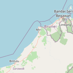
Use this park location map to pinpoint Tasek Merimbun Heritage Park in Brunei, understand its exact geographic position, and read its mapped placement within the surrounding landscape more clearly.

Pigeon | © OpenStreetMap contributors

Location context for Tasek Merimbun Heritage Park

Tutong District
Park atlas

Compare adjacent protected landscapes, wetland habitats, and conservation areas in the region.

Explore Protected Areas Near Tasek Merimbun Heritage Park and Its Surrounding Regional Geography
Browse a curated list of national parks and protected areas near Tasek Merimbun Heritage Park, mapping out diverse conservation landscapes and wetland ecosystems across the surrounding region. This geographic comparison helps users explore similar protected habitats and understand the broader ecological context beyond Brunei's largest natural lake.
Nature reserveBrunei

Luagan Lalak Forest Recreation Park Nature Reserve: Brunei's Pristine Freshwater Swamp Landscape

Explore mapped protected-area geography and unique wetland terrain.

Luagan Lalak Forest Recreation Park, a protected nature reserve in Brunei, preserves a rare and visually distinctive freshwater swamp ecosystem. Characterized by dark, tranquil waters and vast fields of purun grass, this natural wetland offers a unique landscape context and is a prime location for observing its rich biodiversity, especially its notable birdlife. The park's preservation as an intact swamp environment within a recreational area highlights its ecological importance for regional geography and protected-area mapping.

Area
2.7 km²
Established
1980
IUCN
II
Visitors
4.2K annual
Protected areaBrunei-Muara District

Bukit Shahbandar Forest Recreation Park: Protected Area with Ridge Landscape & Hiking Trails

Explore Brunei's unique recreational forest terrain and mapped natural features.

Bukit Shahbandar Forest Recreation Park is a notable protected area within the Brunei-Muara District, distinguished by its prominent grassy ridge and a network of challenging hiking trails that traverse its varied terrain. The park's landscape is characterized by rolling hills, including peaks that reach nearly 470 feet, offering strategic vantage points. As a recreational forest, it provides a distinct example of protected land use, blending modified natural vegetation with opportunities for outdoor activity and geographic discovery. Its unique topography and trail system offer a clear focus for atlas-based exploration.

Area
2.34 km²
Established
1998
IUCN
II
Visitors
35.5K annual
National parkSarawak

Gunung Buda National Park: Sarawak National Park Protected Landscape and Geography

Explore the mapped boundaries and regional context of this Malaysian national park.

Gunung Buda National Park is a significant protected area within Sarawak, Malaysia, contributing to the region's diverse geography. As a national park, it offers specific insights into mapped protected lands, providing a focal point for understanding Borneo's natural landscapes. This entry details its geographic identity and its role as a protected natural space, crucial for any atlas-driven exploration of East Malaysia's conservation areas.

Area
66.2 km²
Established
2001
IUCN
II
Relief
Mountain
Nature reserveTemburong District

Peradayan Forest Reserve Nature Reserve: Understanding its Protected Landscape and Geographic Setting

Explore mapped boundaries and the natural terrain of this Brunei reserve.

Peradayan Forest Reserve stands as a significant protected natural area within Brunei's Temburong District, an exclave characterized by vast tropical rainforests. This entry focuses on its identity as a nature reserve, providing key geographic context and details about its mapped boundaries. Understand its role within the regional landscape and how its protected status contributes to the conservation of Brunei's natural heritage, facilitating a deeper dive into atlas-style geographic exploration.

Area
26.5 km²
Relief
Upland
Climate
Tropical
Access
Moderate access
National parkBrunei

Ulu Temburong National Park: Brunei's Protected Rainforest Landscape and Geographic Context

Mapped natural terrain and conservation significance.

Ulu Temburong National Park represents Brunei's commitment to preserving its most ecologically significant tropical rainforests, covering approximately 550 square kilometers. This protected area is characterized by its remote location in the Temburong District and its diverse topography, ranging from lowland areas to mountainous ridges, all within a largely undisturbed natural setting. The park's mapped boundaries encompass a vital transboundary conservation landscape, making it a key site for understanding Borneo's unique ecosystems and forest protection policies through an atlas-driven exploration approach.

Area
488.59 km²
Established
1991
IUCN
II
Relief
Mixed relief
National parkMarudi District

Gunung Mulu National Park: A Protected National Park with Distinct Geographic Identity in Marudi District

Explore its mapped protected area and regional landscape.

Gunung Mulu National Park stands as a key protected area within Marudi District, Malaysia, offering critical insights into the region's natural geography. This national park entity provides a focal point for understanding mapped protected landscapes and their specific geographic characteristics. Users can explore the park's boundaries and its role within the wider atlas of Malaysian natural areas, gaining a solid foundation in its conservation geography.

Area
528.64 km²
Established
1974
IUCN
II
Relief
Mountain
National parkSarawak

Lambir Hills National Park: Sarawak's National Park Landscape and Geographic Discovery

Explore the mapped terrain and protected boundaries within Sarawak.

Investigate Lambir Hills National Park, a protected national park in Sarawak, Malaysia. This page provides essential geographic context and details its protected landscape identity. Understand its role within the Borneo region's atlas, offering users a deep dive into its mapped terrain and specific regional geography. Discover a key piece of Malaysia's natural protected areas with focused atlas-style information.

Area
69.52 km²
Established
1975
IUCN
II
Relief
Lowland
National parkSarawak

Loagan Bunut National Park: Protected Landscape in Sarawak, Malaysia

Explore the mapped geography and natural terrain of this national park.

This page offers a detailed atlas-style exploration of Loagan Bunut National Park, situated in Sarawak, Malaysia. Understand the park's designation as a national park and its place within the mapped geography of Borneo. It provides essential context for appreciating the protected landscape and its regional significance.

Area
100 km²
Established
1990
IUCN
II
Scope
Terrestrial

Common questions about visiting, size, designation, and location context for Tasek Merimbun Heritage Park

Tasek Merimbun Heritage Park FAQs for park facts, access, geography, and protected area context
Find quick answers about Tasek Merimbun Heritage Park, including protected-area facts, park geography, trail and visitor context, and how the park fits into its surrounding country and regional landscape.
MoriAtlas Explorer

Continue Your Protected Areas Search Across the Global Atlas

Deepen your exploration by continuing the structured search for national parks and protected areas worldwide. Utilize the comprehensive filtering capabilities to compare different conservation landscapes and refine your understanding of global park geography. Discover more about the distribution and characteristics of protected natural areas.

Global natural geography