
Mori Atlas logo
National parkWoliński Park Narodowy

Examine the mapped geography, glacial terrain, and marine boundaries of Poland's coastal sanctuary.

Woliński Park Narodowy: A Protected Coastal Landscape of Moraine Hills and River Deltas

Woliński Park Narodowy encompasses a diverse protected landscape on Wolin island, where glacial moraine hills, high Baltic cliffs, and the dynamic Swina River delta converge. This national park, the first in Poland to incorporate marine waters, displays a complex terrain ranging from dense beech forests to post-glacial lakes. Visitors can study the park's shifting coastal boundaries and its significance as a vital refuge for migratory bird populations.

coastal cliffsmoraine hillsBaltic coastmarine protected areabeech-pine forestspost-glacial lakes
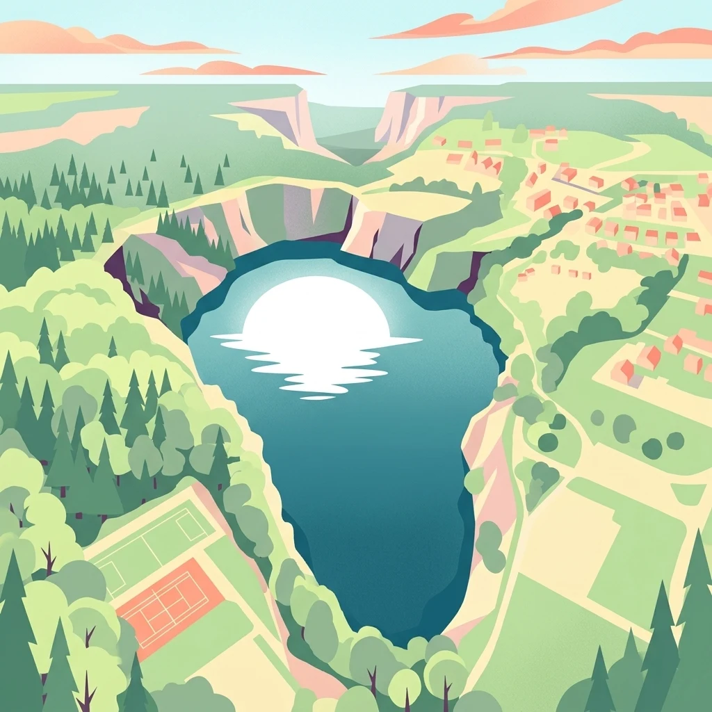
A flat, stylized illustration showing a body of water in the center, reflecting a large sun, surrounded by steep cliffs, pine forests, and a small town with tennis courts in the foreground.

Woliński Park Narodowy

National park

Park overview

Structured park overview, official facts, and landscape profile for Woliński National Park

Woliński National Park park facts, protected area profile, and essential visitor context

Review the core facts for Woliński National Park, including designation, size, terrain, visitor scale, habitats, and operating context in one park-focused overview.

About Woliński National Park

Woliński National Park protects a uniquely compact slice of northwestern Poland's coastal and island geography. Located on Wolin Island between the Pomeranian Bay and the Szczecin Lagoon, it offers an unusually dense combination of moraine uplands, high Baltic cliffs, glacial lakes, sandy outwash plains, and a still-active river delta. This diversity of landforms within a relatively small area gives the park both ecological richness and a strong visual identity.

The inland terrain is dominated by moraine hills that make up roughly three-quarters of the park. These forested uplands reach their highest point at Grzywacz hill, at just under 116 meters above sea level. Toward the east, the moraine hills give way to a post-glacial lake district featuring several natural lakes near Warnowo and Wisełka, as well as a few artificially created water bodies such as the famously turquoise Lake Turkusowe near Wapnica. In the south, near Karnocice, the landscape transitions into the flatter, sandy outwash plain known as the Wapnica-Karnocice sandr.

Along the coast, the park includes the long, steep Baltic cliffs of the Wolin range, which tower up to 95 meters above the sea and are subject to constant abrasion. To the south, the terrain merges into the branching delta of the Swina, a network of channels, marshy islands, and shifting shallows where the channel's bottom configuration changes every year. These contrasting landscapes combine forest, wetland, freshwater, marine, and coastal ecosystems within a single, easily accessible protected area.

The park also carries an important human and historical dimension. The hilltop settlement at Lubin, which preserves remains of an early medieval stronghold and what is believed to be one of Pomerania's oldest churches, sits within the park's borders. Nearby, the wartime V-3 bunker site near Zalesie preserves a unique piece of 20th-century military history. Combined with the landscape and biodiversity, this cultural layer contributes to the park's role as a destination for both nature-based and heritage-oriented visits.

Quick facts and research context for Woliński National Park

Woliński National Park was established on 15 March 1960 and is located on the central-western part of Wolin Island in northwestern Poland. Its area covers roughly 10,937 hectares, and in 1996 it became Poland's first national park with a marine component after Baltic Sea waters and parts of the Szczecin Lagoon were included.

The park encompasses remarkably varied terrain for a small protected area, including moraine hills rising above 115 meters, active sea cliffs reaching 95 meters in height, post-glacial lakes, and the shifting wetlands of the Swina River delta. These landscapes support a high concentration of protected and rare species and place the park within major European ecological networks for both habitats and birds.

Protection and recognition

Documented management scope and conservation recognition records

Woliński Park Narodowy Protection Status and Designated Area Framework

Woliński Park Narodowy maintains a documented protection status reflecting mixed management parameters and structured conservation frameworks. Official records assemble baseline designation details and international recognition parameters for analytical park evaluation.

Protection details

Protection scope
Mixed
Transboundary protection
No
Core area
5 km²
Buffer area
33.69 km²
Park context

Deeper park guide and search-rich context for Woliński National Park

Woliński National Park history, landscape, wildlife, and travel context

Explore Woliński National Park through its history, landscape character, ecosystems, wildlife, conservation priorities, cultural context, and seasonal travel timing in a structured park guide built for atlas discovery and search intent.

Why Woliński National Park stands out

Woliński National Park is most recognized for its dramatic combination of high coastal cliffs along the Baltic Sea, deep moraine hills, and the ecologically rich Swina River delta. The cliffs, which retreat about 80 centimeters per year due to abrasion, form one of the most striking natural sights on the Polish coast. The park is also widely known for its role in bird conservation. Wolin lies along a main migratory corridor along the Baltic coast, and the park has recorded more than 230 bird species. The delta of the Swina is recognized as a bird refuge of European importance, supporting waterbirds, raptors, and ongoing reintroduction efforts for the Eurasian eagle-owl. The white-tailed eagle, an emblematic species of the park, can be observed at the on-site wildlife enclosures.
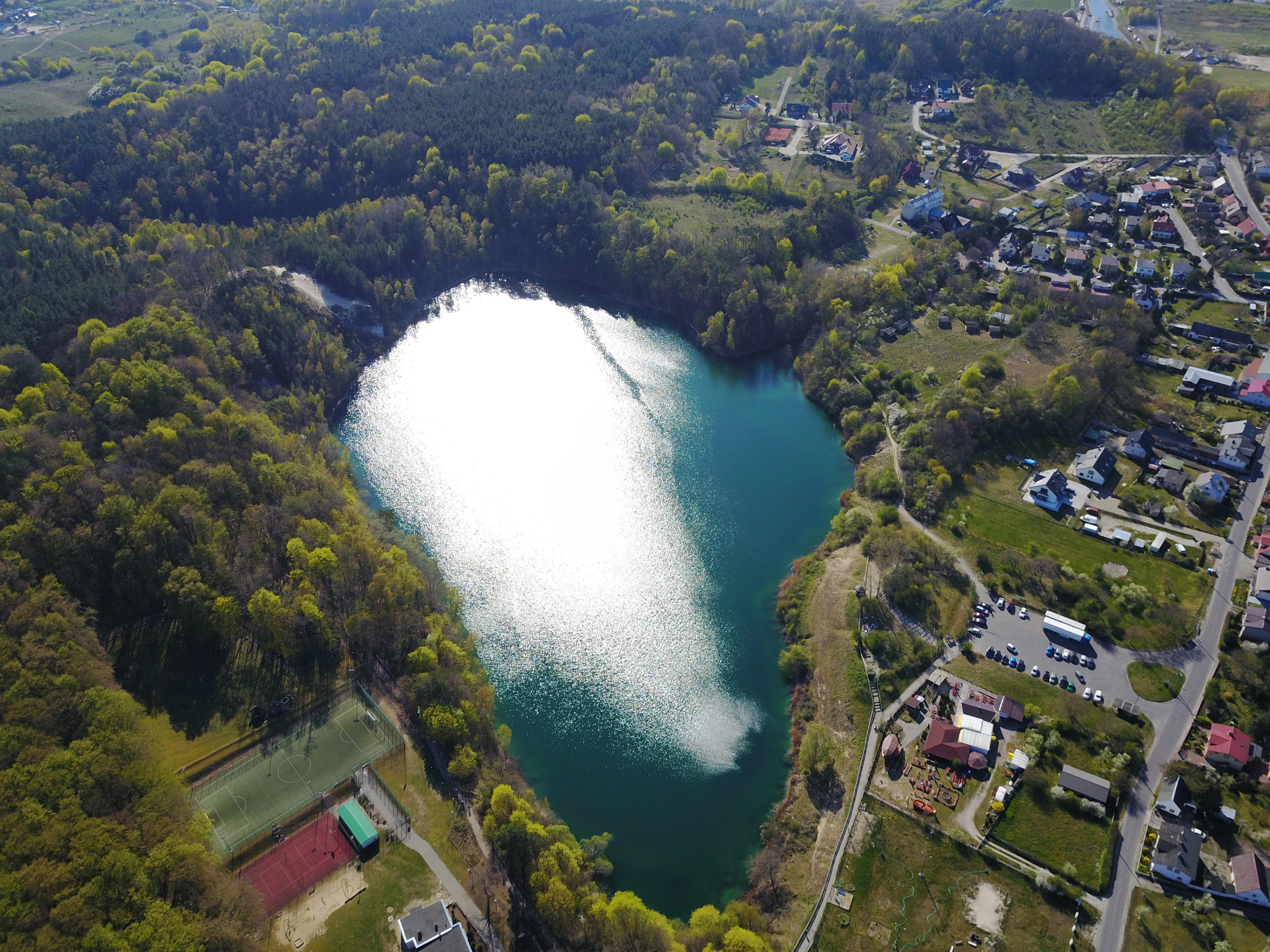
Aerial view of a bright turquoise lake surrounded by dense green forest and a small town area on the right bank.
Aerial view of Turkusowe Lake, characterized by its distinctive turquoise water, situated within Woliński Park Narodowy.

Woliński National Park history and protected-area timeline

The idea of protecting the natural values of Wolin Island took serious shape after the Second World War through the work of Mieczysław Tarchalski, a forester and former partisan commander. Tarchalski prepared the conceptual foundations, the documentation, and the draft regulation for creating a national park, and was expected to become its first director. However, political circumstances following the war prevented him from taking that role.

The park was officially established on 15 March 1960 and initially covered 4,844 hectares of primarily terrestrial terrain. Its first director, Leon Niedzielski, led the park through its formative years until 1972. The original footprint protected the inland moraine landscape and its forests, but the surrounding waters were recognized early on as integral to the area's ecological value.

A defining moment in the park's history came in 1996. By extending its boundaries to include Baltic Sea waters, waters of the Szczecin Lagoon, and the offshore archipelago of small islands, Woliński National Park became the first national park in Poland to formally include marine territory. This expansion transformed it into a protected area combining forest, lake, lagoon, and sea environments under a single management framework, and cemented its recognition as a national park of European importance for bird conservation.

Woliński National Park landscape and geographic character

The landscape of Woliński National Park is defined by the meeting of glacial history and active coastal processes. A continuous belt of frontal moraine hills, known as the Wolin Range and the Lubin-Wapnica Hills, dominates the central strip of the park. These hills rise to just under 116 meters at their highest point and form a forested ridge that separates the Baltic Sea coast from the calmer waters of the Szczecin Lagoon.

Along the Baltic side, the moraines drop into some of the highest active cliffs on the Polish coast, reaching around 95 meters in height. The sea continuously erodes the base of these cliffs, on average pulling the cliff edge back by about 80 centimeters per year. This dynamic coastal zone is one of the most visually expressive features of the park and a continuing subject of geological attention.

To the south and east, the terrain flattens into the broad delta of the Swina River, where numerous marshy islands, channels, and shallow banks shift their configuration from year to year. To the east, near Warnowo and Wisełka, a small post-glacial lake district displays natural lakes such as Warnowo Zachodnie, Warnowo Wschodnie, Czajcze, Domysłowskie, Zatorek, and Wisełka, together with artificial water bodies such as Lake Turkusowe. The Wapnica-Karnocice sandr, a flat sandy outwash plain, completes the picture with an open, dry contrast to the deeper forests elsewhere in the park.
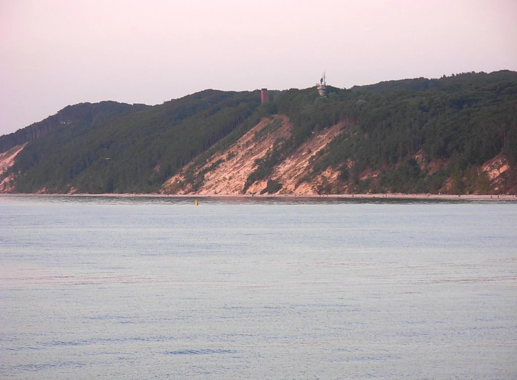
A distant view of a sandy cliff face rising above the Baltic Sea, topped by dense green forest and a small structure.
The coastal cliffs at Kawcza Gora in Woliński National Park.

Woliński National Park ecosystems, habitats, and plant life

Woliński National Park protects an unusually concentrated mosaic of habitats for an area of its size. Forest covers the great majority of the terrestrial surface, with pine as the dominant species occupying roughly 68 percent of the park's land area, followed by beech and oak. Several of the beech stands, particularly those with closed-canopy structures and rich undergrowth, are among the best-preserved in the region and resemble natural, near-primeval forests.

Along the coast, the slopes of the steep cliffs are draped with dense thickets of sea buckthorn, an emblem of these harsh maritime environments. The beaches themselves support specialized sand-loving plants, while the saline habitats of the Swina delta host a community of approximately 30 halophytic species. The Baltic seabed within the park is home to communities of green, brown, and red macroalgae, while the dunes and outwash plains harbor rare pine-associated flora and isolated populations of protected plants such as the royal fern and several orchid species.

Beyond forests and beaches, the park contains inland lakes, marshy meadows, islands of the Swina delta, and open expanses of the shallow Szczecin Lagoon and Pomeranian Bay. These varying conditions, from dry sand to freshwater lake edges, brackish lagoon shallows, and marine seabed, allow many distinct ecological communities to coexist within walking distance of one another.

Woliński National Park wildlife and species highlights

The wildlife profile of Woliński National Park is shaped strongly by its position along a major migratory corridor. The park has documented more than 230 bird species, including breeding populations of the white-tailed eagle, the aquatic warbler, the dunlin, and the red-breasted flycatcher. Its wetlands and shallow coastal waters serve as a critical resting and feeding area for waterbirds during both spring and autumn migrations, and the Swina delta is recognized as a bird refuge of European importance.

Among the park's larger and more charismatic fauna, the white-tailed eagle holds an iconic role and is featured in the park's own logo. A reintroduction program for the Eurasian eagle-owl is also underway. The surrounding Baltic waters are inhabited by grey seals and, although rarely seen, harbour porpoises, while the lagoon and rivers support diverse fish communities.

The park is also notable for its invertebrate fauna. Among insects, populations of the stag beetle and the great capricorn beetle are among the most significant, and scientists have described beetle and springtail species new to science from within the park's borders. Together, the birdlife, mammals, and invertebrates give the park a fauna that is unusually rich for such a compact protected area.

Woliński National Park conservation status and protection priorities

Woliński National Park plays a disproportionate role in Polish and European conservation. As the country's first marine national park, established with the 1996 inclusion of Baltic and Szczecin Lagoon waters, it set a precedent that has shaped subsequent coastal protection in Poland. Its wetland and coastal habitats host bird populations whose importance extends well beyond the national level, and the Swina delta is formally designated as a bird refuge of European significance.

Within the park, conservation is organized through a layered system. Seven strict protection areas safeguard the most sensitive zones, including six forest reserves named in honor of distinguished botanists and ecologists, and the Drożkowe Meadows reserve, which protects grassland and meadow habitats. The surrounding buffer zone reinforces protection across a broader landscape and incorporates complementary areas such as the Luniewo nature reserve near Warnowo.

The park is also integrated into the European Natura 2000 network, including both a special area of conservation covering the Oder estuary and Szczecin Lagoon, and a special protection area for birds covering Wolin and the neighboring island of Uznam. Active conservation projects within the park include ongoing efforts to restore the Eurasian eagle-owl as a breeding species in the area.

Woliński National Park cultural meaning and human context

Woliński National Park is rich in cultural and historical layers that complement its natural value. The most prominent is the early medieval stronghold at Lubin, on the highest point above the Szczecin Lagoon. The site dates from roughly the 10th to 12th centuries and contains the foundations of what is believed to be one of the oldest churches in Pomerania. Active archaeological work is carried out there in summer, and visitors can view exhibitions of early medieval ceramics. A remarkable find from the site was a hoard of more than a hundred Arabic dirhams from 951 AD, a small coin from which can be struck at the site as a souvenir.

The park also preserves a striking piece of 20th-century history. Near Zalesie, the remains of a wartime German V-3 launch bunker and its associated firing positions are preserved as the only such site in Poland, giving visitors a tangible glimpse of the military technology developed during the Second World War.

The cultural landscape of the park is further shaped by the surrounding towns and villages, including Międzyzdroje, which hosts the park's directorate and educational center, and small coastal communities such as Wapnica and Wisełka, where the rhythms of forest work, fishing, and seasonal tourism still influence daily life.

Top sights and standout views in Woliński National Park

Woliński National Park stands out for combining cliffs, moraine forests, post-glacial lakes, and a dynamic river delta within a single protected boundary. The white-tailed eagle, an emblem of the park since its founding, is also one of its strongest conservation symbols. Among European national parks, it holds a unique place as Poland's first marine national park and a recognized bird refuge.

Best time to visit Woliński National Park

Woliński National Park has a distinctly seasonal character. Late spring and early summer are favorable for birdwatching, when migratory species return to breed and the delta habitats are most active. The warmer months also offer the best conditions for reaching coastal viewpoints and lake areas, though the cliffs and beaches draw larger numbers of visitors in mid-summer.

Autumn is traditionally a strong season for observing migration, when the Swina delta and the shallow waters of the Pomeranian Bay and Szczecin Lagoon host large numbers of waterbirds. Winter brings quieter conditions and a starkly beautiful dune and cliff landscape, though some inland trails and viewpoints may be less accessible due to weather.

Overall, late spring through early autumn offers the richest combination of landscape, wildlife, and accessibility, while quieter shoulder seasons reward visitors interested primarily in bird migration and natural scenery.

Monthly climate preview

Long-term representative temperature and precipitation patterns across twelve months

Woliński Park Narodowy Climate Normals and Annual Weather by Month

Historical measurements from a representative coordinate establish the baseline annual temperature and precipitation rhythm across Woliński Park Narodowy. Detailed monthly breakdowns provide complete long-term climate normals for examining multi-month fluctuations.
Annual mean9 °C
1 °C19 °C
Jan
Feb
Mar
Apr
May12°
Jun16°
Jul19°
Aug19°
Sep15°
Oct10°
Nov
Dec
Warmest month
August

18.8 °C

Coolest month
January

0.7 °C

Wettest month
July

2.5 mm/day

Driest month
April

1.2 mm/day

Park location guide

Geography guide, regional context, and park location map for Woliński National Park

Woliński National Park park geography, regions, and map view in Poland

Understand where Woliński National Park sits in Poland through a broader geographic reading of the surrounding landscape, nearby location context, and its mapped position within the national park landscape.

How Woliński National Park fits into Poland

Poland, officially the Republic of Poland, is a Central European country spanning from the Baltic Sea in the north to the Carpathian Mountains in the south. It borders Germany, Czech Republic, Slovakia, Ukraine, Belarus, Lithuania, and Kaliningrad Oblast. The country has a temperate climate, diverse landscapes, and is known for its rich history, cultural heritage, and strong economic position within the EU.

Wider geography shaping Woliński National Park in Poland

Poland occupies 312,696 km2 in Central Europe, extending from the Baltic Sea coast in the north to the Sudetes and Carpathian Mountains in the south. It borders Germany to the west, Czech Republic and Slovakia to the south, Ukraine and Belarus to the east, and Lithuania and Kaliningrad Oblast to the northeast. The landscape includes lowland plains, uplands, and mountain ranges.

Map view of Woliński National Park

Use this park location map to pinpoint Woliński National Park in Poland, understand its exact geographic position, and read its mapped placement within the surrounding landscape more clearly.

Pigeon | © OpenStreetMap contributors

Location context for Woliński National Park

Zachodniopomorskie Voivodeship
Natural feature types

Browse the Geographic Index of Woliński Park Narodowy Natural Features

MoriAtlas offers a comprehensive look at the specific natural landmarks and water bodies across Woliński Park Narodowy. Start browsing the collection to understand the geological and hydrologic diversity of these protected Polish lands and their surrounding island geography.

Visualizing coastal cliffs, moraine hills, and protected marine habitats

Woliński Park Narodowy Photos and Landscape Scenery

Photographic archives reveal the dynamic terrain and varied environments spanning Woliński Park Narodowy. Visual records capture active Baltic sea cliffs, dense forest ridges, and wetland habitats across the protected zone.

Aerial view of a bright turquoise lake surrounded by dense green forest and a small town area on the right bank.

A multi-tiered wooden park sign displaying the text Woliński Park Narodowy, standing on a sandy beach with a forest-covered cliff and the sea visible in the background.

A distant view of a sandy cliff face rising above the Baltic Sea, topped by dense green forest and a small structure.

Park atlas

Compare adjacent coastal landscapes, moraine terrain, and regional park networks

Explore Other Parks Near Woliński Park Narodowy and Surrounding Protected Areas

Browsing other protected areas near Woliński Park Narodowy reveals broader ecological patterns across the Baltic coastline and regional river basins. Comparing adjacent natural habitats helps contextualize coastal cliffs, moraine forests, and wetland reserves within wider geographic formations.
A soft watercolor painting depicting a calm shoreline with rolling hills and trees in the distance.
Nature reservePoland
Park boundaries overlap#1 closest

Northeast

Ostoja na Zatoce Pomorskiej: Mapping the Pomeranian Bay Marine Nature Reserve

Extensive marine protected landscape in the Baltic Sea

Ostoja na Zatoce Pomorskiej encompasses over 243,000 hectares of the southern Baltic Sea, serving as a primary marine nature reserve for the Polish coast. The sanctuary is defined by complex underwater features such as shallow sandy banks, gravel plains, and the prominent Odrzańska Ławica, which collectively support essential migratory waterbird populations and protected aquatic species within the European ecological network.

Area
2,430.59 km²
Established
2009
Relief
Lowland
Scope
Marine
Protected areaZachodniopomorskie
Park boundaries overlap#2 closest

South

Ujście Odry i Zalew Szczeciński: Protected Area Geography and Estuarine Landscape Mapping

Coastal lagoons, riverine deltas, and island habitats in Zachodniopomorskie.

This extensive protected area offers a comprehensive view of the Oder estuary as it meets the Baltic Sea. The landscape comprises broad lagoons, branching river channels, and coastal islands that provide crucial habitat for migratory waterbirds and sustain a rare brackish water ecosystem. Use this geographic entry to analyze the boundaries, terrain, and interconnected waterways of this major Polish nature site.

Area
526.12 km²
Established
2008
Relief
Lowland
Scope
Mixed
Watercolor painting depicting mountains, rivers, and green terrain
National parkWest Pomeranian Voivodeship
Park boundaries overlap#3 closest

Southwest

Wolin National Park: Coastal Protected Landscape and Glacial Terrain in West Pomeranian Voivodeship

Explore Poland's first marine national park and its dynamic geography.

Wolin National Park offers a profound look into Poland's protected coastal geography. This national park in the West Pomeranian Voivodeship is distinguished by its high sea cliffs, inclusion of Baltic Sea and Szczecin Lagoon waters as Poland's first marine protected area, and a landscape sculpted by glacial moraines. Discover the park's complex delta systems, ancient forests, and the mapped terrain that supports significant bird migration, providing a rich focus for atlas exploration.

Area
109.37 km²
Established
1960
IUCN
II
Visitors
1.5M annual
Protected areaWest Pomeranian Voivodeship
9 km away#4 closest

East

Wybrzeże Trzebiatowskie Protected Area: Coastal Wetlands and Baltic Shoreline Map

A diverse wetland corridor in the West Pomeranian Voivodeship.

Wybrzeże Trzebiatowskie represents a significant stretch of the Baltic coastline, characterized by a narrow and elongated geographic profile. The protected landscape highlights a complex interplay of lagoon lakes, river floodplains, and classic dune systems, providing critical habitat within the broader West Pomeranian regional geography.

Area
317.576 km²
Established
2007
Relief
Lowland
Scope
Mixed
Protected areaZachodniopomorskie
10 km away#5 closest

South

Łąki Skoszewskie Protected Area: Geography, Mapped Terrain, and Wetland Landscapes

Coastal marshland and bird sanctuary in Zachodniopomorskie

Located along the Szczecin Lagoon, Łąki Skoszewskie consists of extensive wet meadows, alder carrs, and Scots pine forests. This protected area provides a detailed look at the hydrological networks and coastal transition zones that define the unique natural landscape of northwestern Poland.

Area
90.834 km²
Established
2004
Relief
Lowland
Climate
Temperate
A horizontal watercolor painting showing rolling green hills and a dense forest line against a pale, light-colored sky background.
Protected landscapeWest Pomeranian Voivodeship
11 km away#6 closest

Southeast

Puszcza Goleniowska Protected Landscape: Geographic Profile and Mapped Boundaries

A large-scale lowland forest complex in West Pomeranian Voivodeship.

Puszcza Goleniowska represents a critical protected woodland in Poland, spanning 630 square kilometers of post-glacial plains. This forest complex is characterized by its pine-dominated canopy, widespread bog and marshland habitats, and a series of rivers and lakes that form the backbone of its regional drainage. The area encompasses numerous nature reserves and Natura 2000 sites, offering a comprehensive look at the lowland ecological structure of the West Pomeranian Voivodeship.

Area
630 km²
Established
1349
Relief
Lowland
Climate
Temperate
Protected areaZachodniopomorskie
About 13 km away#7 closest

South

Park Natury Zalewu Szczecińskiego: Protected Coastal Landscape and Regional Geography Atlas

A pioneer in active Natura 2000 conservation and lagoon habitat preservation

Situated in the West Pomeranian region, Park Natury Zalewu Szczecińskiego covers a mosaic of coastal pastures, reed-bordered lagoons, and pine forests. This protected area stands out for its active management approach, integrating traditional grazing into a modern conservation model that sustains the biological integrity of the Szczecin Lagoon shorelines and adjacent woodland mosaics.

Area
40 km²
Established
2005
Relief
Lowland
Scope
Mixed
Watercolor painting of a coastal landscape with green grass in the foreground, a line of trees in the midground, and a soft pink horizon in the distance.
Protected landscapeMecklenburg-Vorpommern
About 21 km away#8 closest

West

Naturpark Insel Usedom: Geography and Protected Landscape Atlas

Coastal cliffs, lagoon systems, and diverse forest terrain in Mecklenburg-Vorpommern

Naturpark Insel Usedom encompasses the German side of Usedom Island, offering a condensed landscape that bridges the Baltic Sea with inland brackish lagoons. This protected area integrates sandy shorelines, steep moraine cliffs, and varied wetland habitats, making it an essential subject for understanding the ecological and geographic character of northeastern Germany.

Area
632 km²
Established
1999
Relief
Lowland
Climate
Temperate

Common questions about visiting, size, designation, and location context for Woliński National Park

Woliński National Park FAQs for park facts, access, geography, and protected area context

Find quick answers about Woliński National Park, including protected-area facts, park geography, trail and visitor context, and how the park fits into its surrounding country and regional landscape.
MoriAtlas Explorer

Continue Your Protected Areas Search Across the Global Atlas

Deepen your exploration by continuing the structured search for national parks and protected areas worldwide. Utilize the comprehensive filtering capabilities to compare different conservation landscapes and refine your understanding of global park geography. Discover more about the distribution and characteristics of protected natural areas.

Global natural geography